
In General
Getting Here
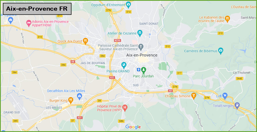
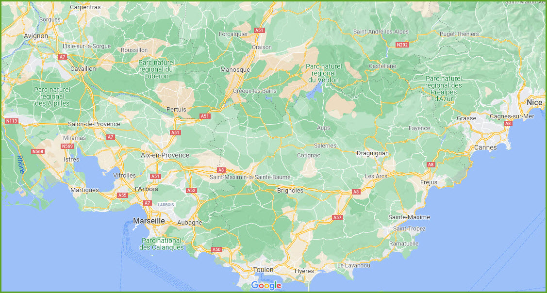
Map
Sights
Museums
Bridges
Signals
Floobydust
RAILROAD SIGNALS HOME
Location / Name:
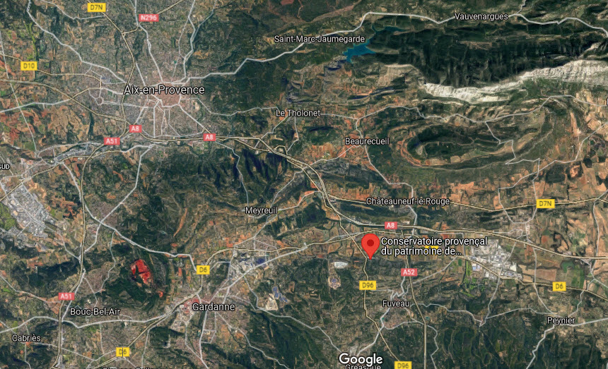
Aix en Provence, Provence-Alpes-Côte d'Azur, FR
What's Here:
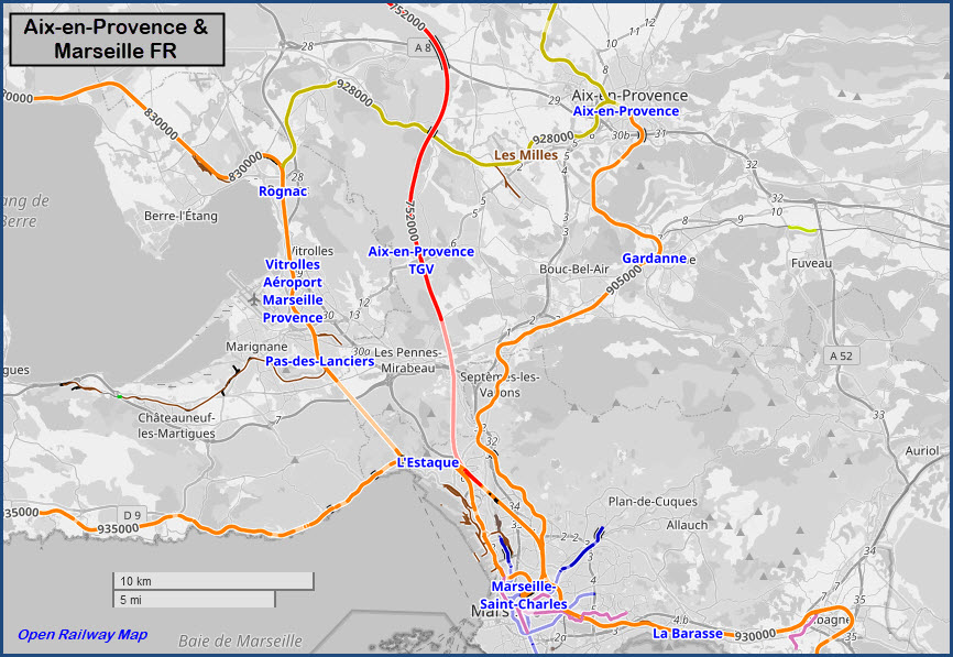
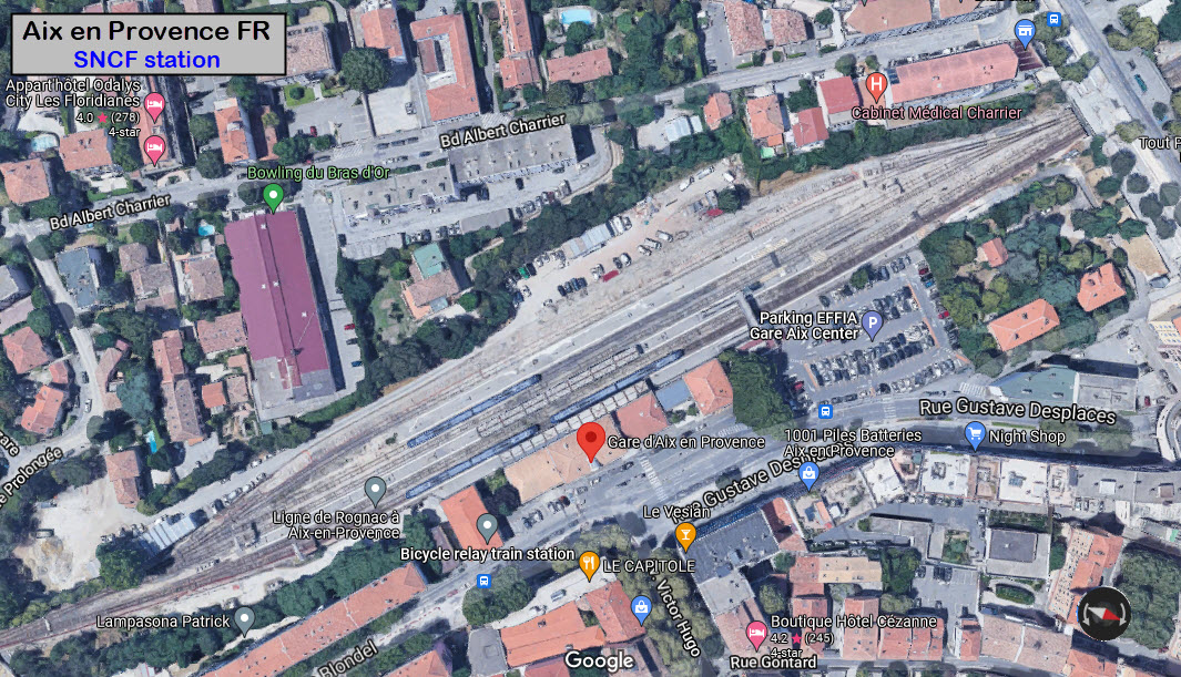
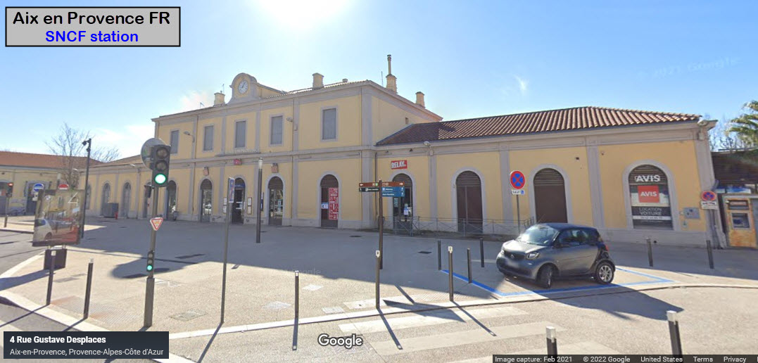
1 SNCF Station
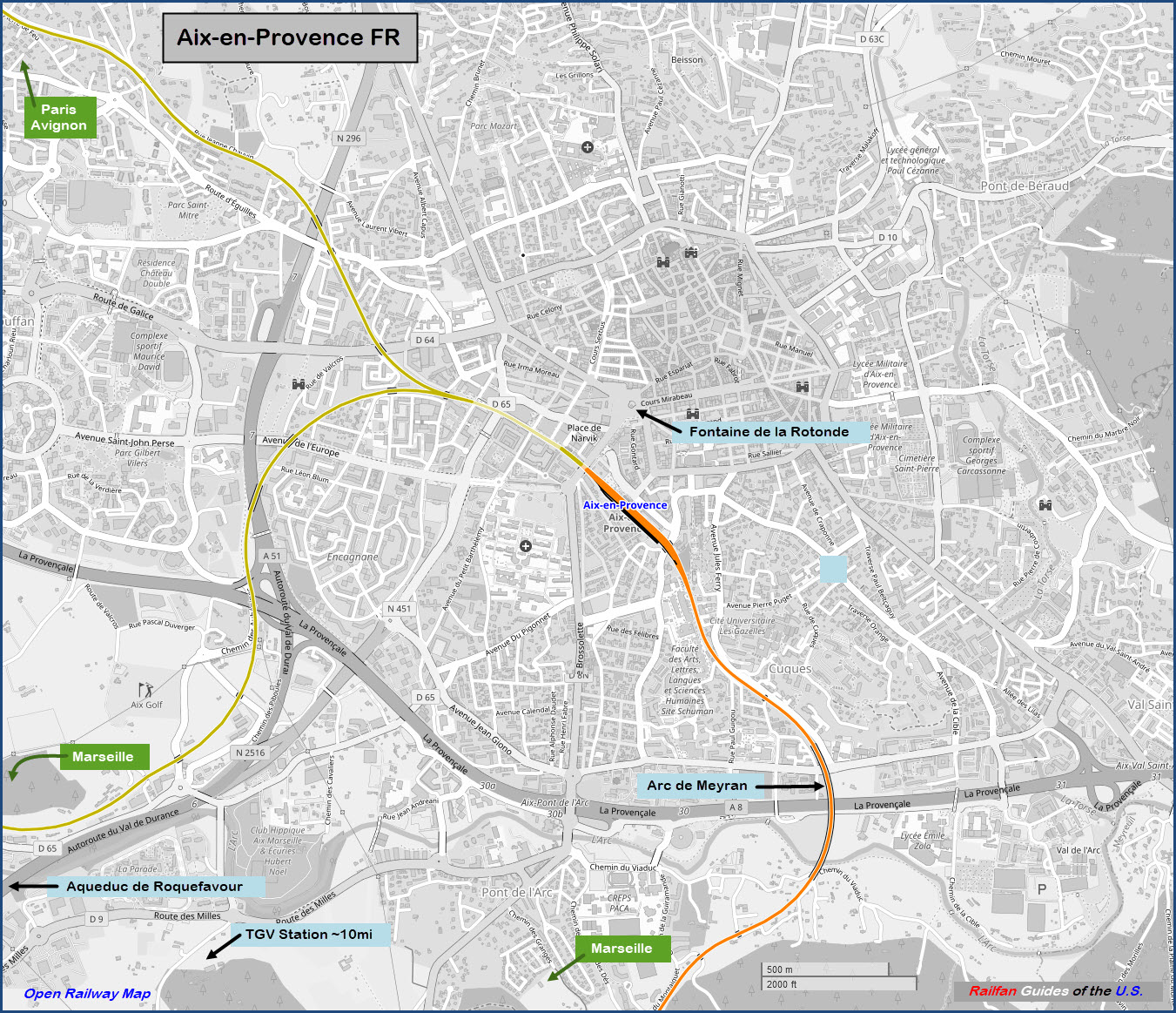
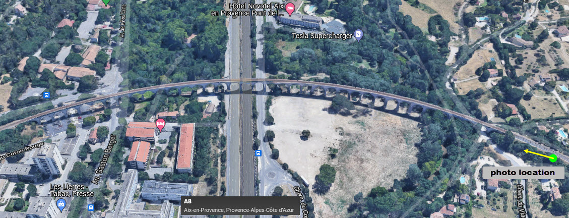
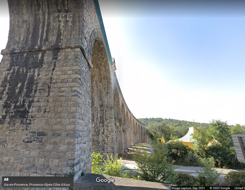
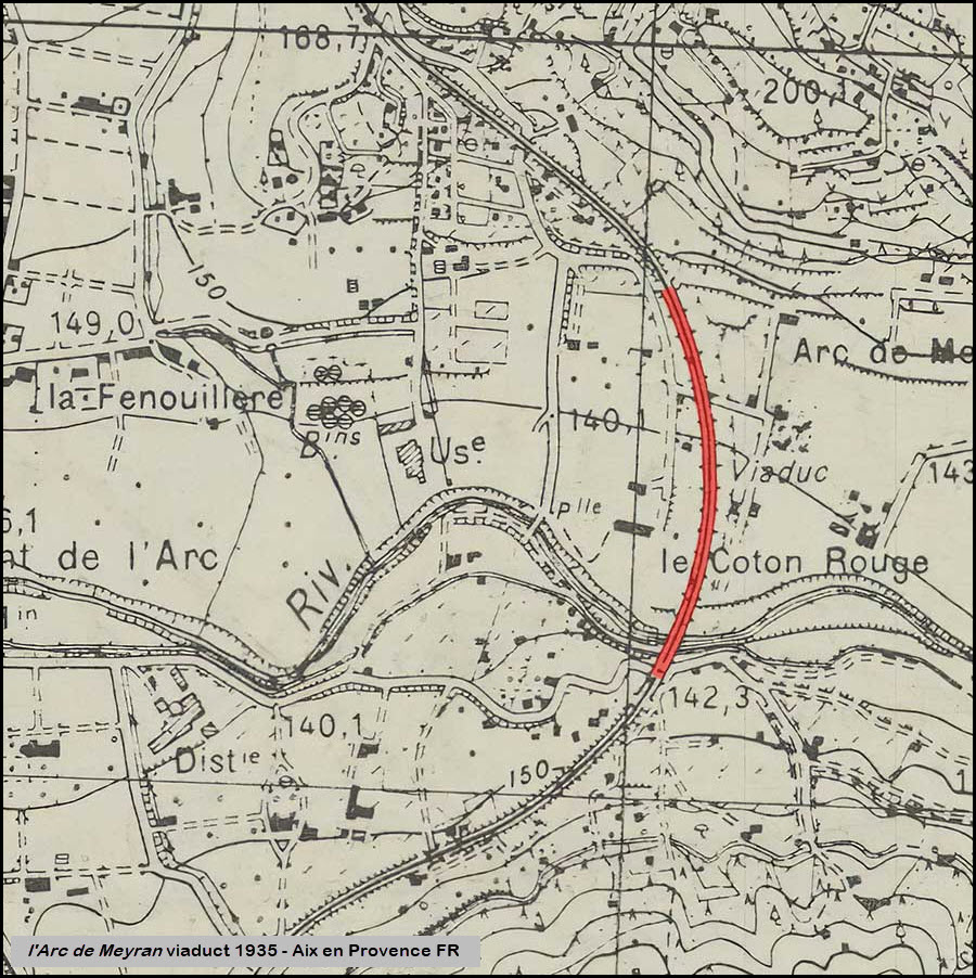
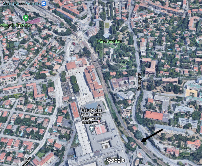
2 Le viaduc ferroviaire de l'Arc de Meyran
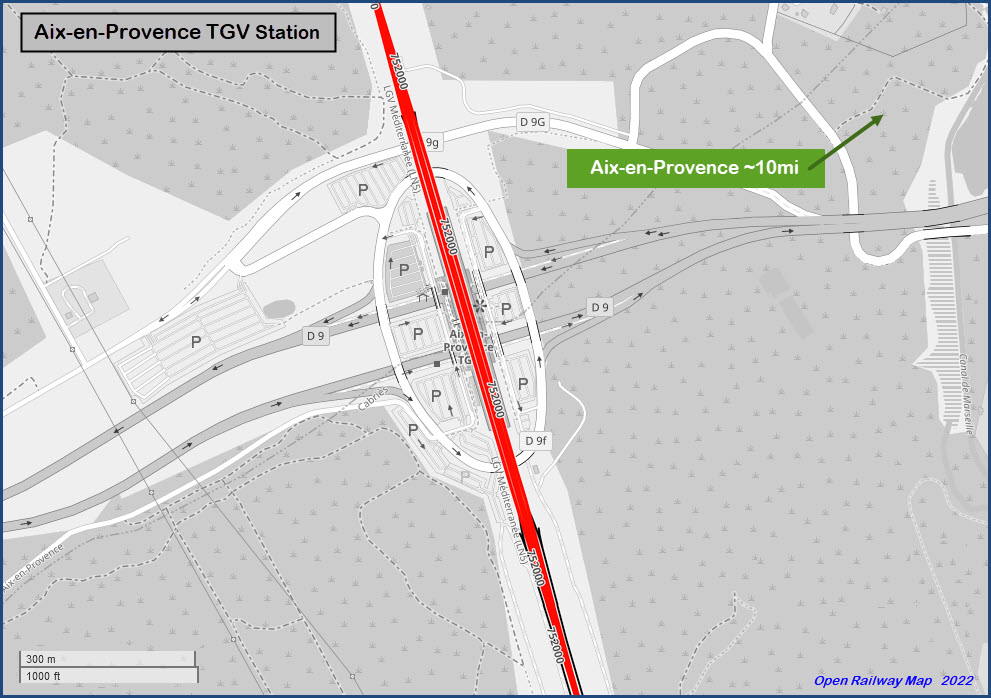
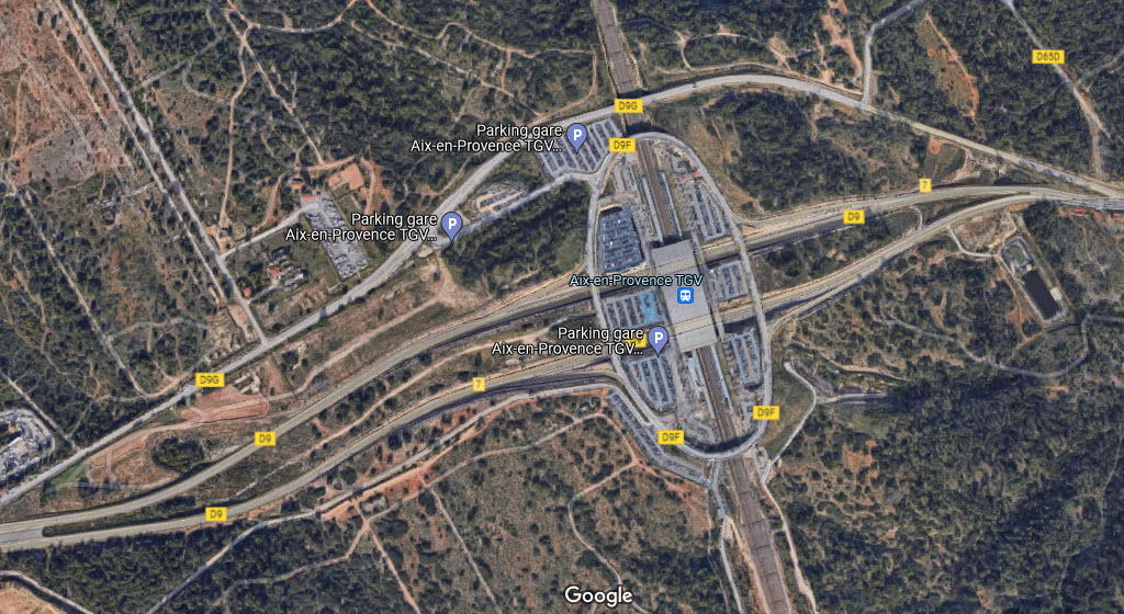
3 TGV station 10 miles (1.6km) southwest in l'Arbois
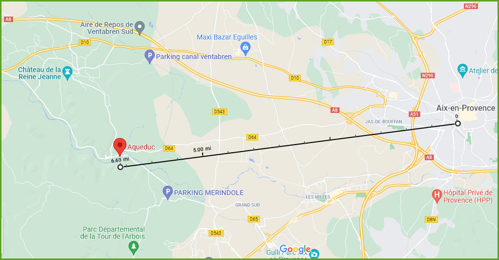
4 Aqueduc de Roquefavour (about 6mi west)
Data:
GPS Coordinates: as needed
Phone A/C: (+33) 4
ZIP: ?
Access by train/transit:
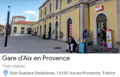
SNCF
The Scoop:
I'm doing a page for Aix because they have one of the coolest viaducts I have ever seen. If you are anywhere near Aix, you need to visit here and try to catch some pictures of it, or better yet, a train going over it.... It's impressive.
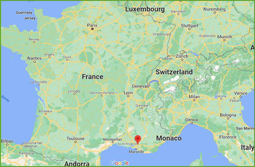
Aix-en-Provence is 400 miles southeast of Paris as the crow flies, and 15 miles from Marseilles and the southern coast of France.
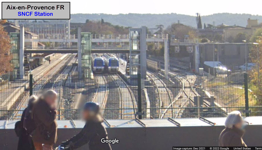
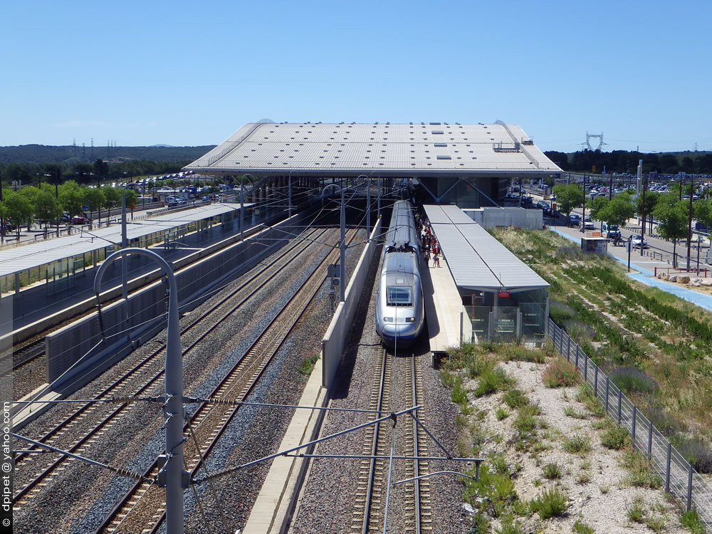
As far as the station in Aix goes, it looks like they have put in a parking lot next to the station since I was here. Back then, there was like no place to park, so I never stopped in. Now I could kick myself in the butt for not looking for a place to park :-(
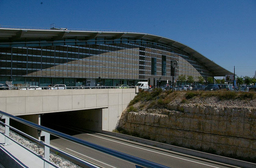
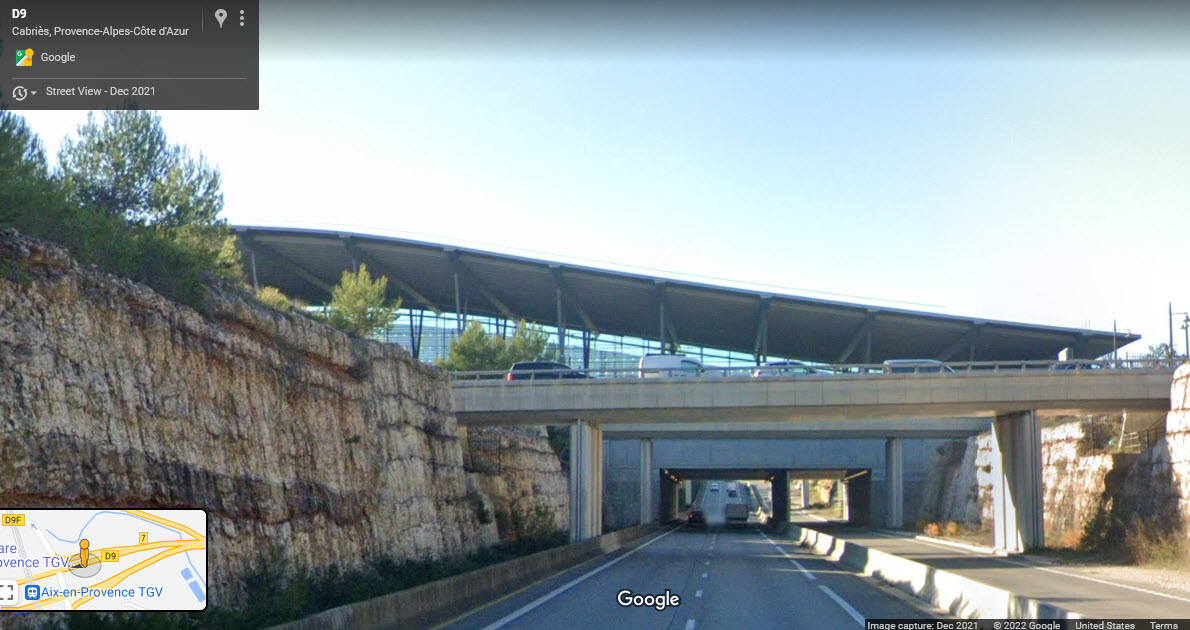
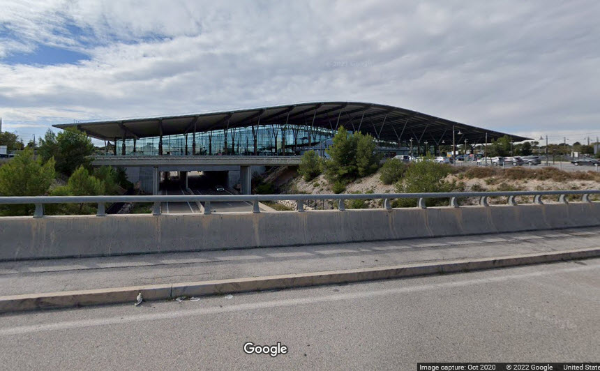
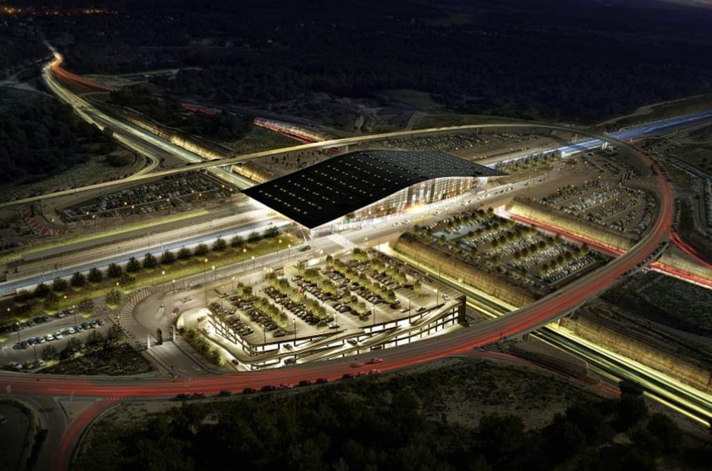
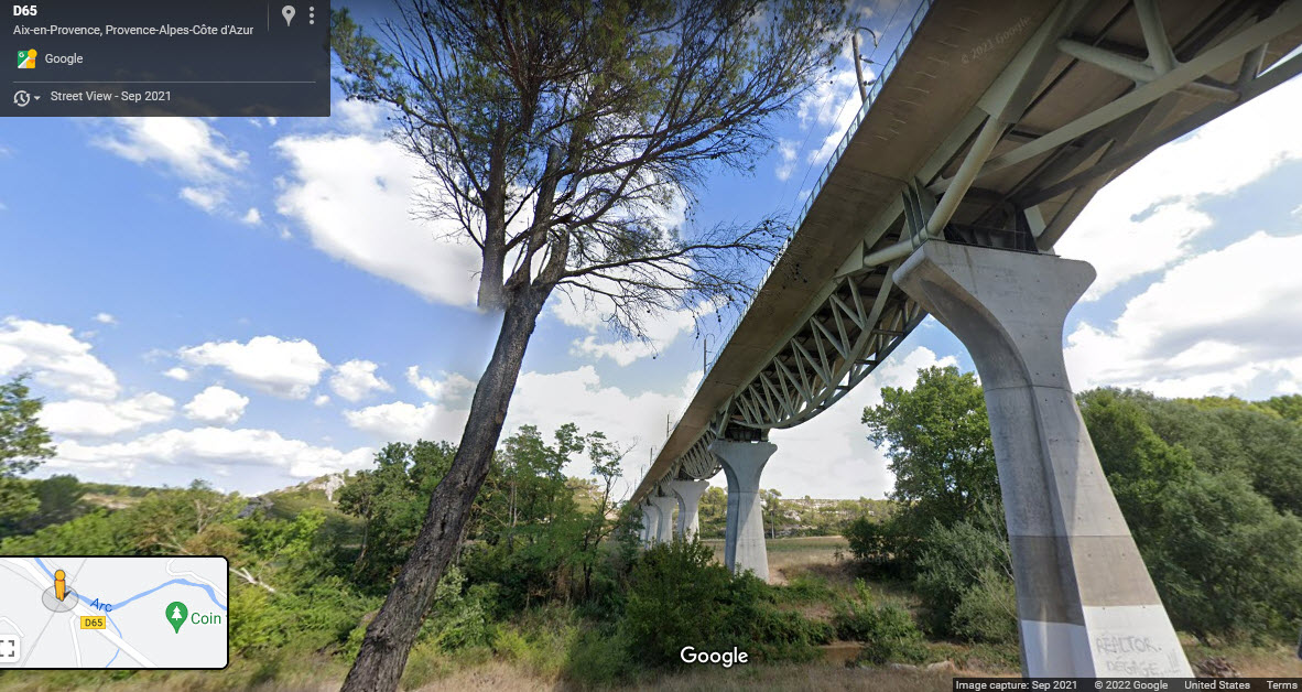
The TGV line passing west of Aix is a beautiful line, everything about it is GRAND. The station where it crosses D9 is simply superb! The bridge where it crosses D64 is beautiful. I wish Amtrak spent this kind of money :-)
Way back in 2002, I got to visit Aix en Provence for a few days while visiting a customer a little further south, Gemplus. Gemplus was one of the leading credit card manufacturers, and this was their main production facility. When the U.S. was still sucking their thumbs in terms of smart credit cards, Europe had already taken hold of them, and this was where they were made. Security was tighter than getting into NSA in Ft Meade MD!
Acknowledgements:
Google Maps
Wikipedia
Damien Pachot and the website below
Dominique Lenoir
Claude Gondran/Mejanes Library/Aix via aixendecouvertes.com
Fr.Latreille
Websites and other additional information sources of interest for the area:
https://www.aixendecouvertes.com/viaduc-arc-de-meyran/
https://en.wikipedia.org/wiki/Aix-en-Provence
https://www.museemusee.com/les-musees-de-france-par-thematique/ferroviaire-81.html
Highway A7 brings you "down" from Lyon ~177 mi (284 km)
Highway A51 brings you down from Grenoble ~131 mi (210 km)
Highway A61/A9 brings you in from the west, Toulouse is ~226 mi (364 km)
Highway A9//A54/A572 (at Nimes)//N113 (at Arles)//A7 (at Salon-de-Provence)//and A8 east (at Coudoux) brings you up from the border with Spain ~190 mi (306 km)
GPS Coordinates: 43.52289, 544533
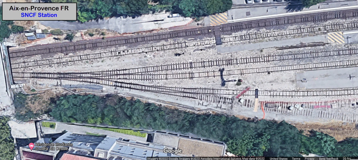
A single track line opens into seven tracks at the station..... it looks like it used to be five.
GPS Coordinates: 43.45503, 531728
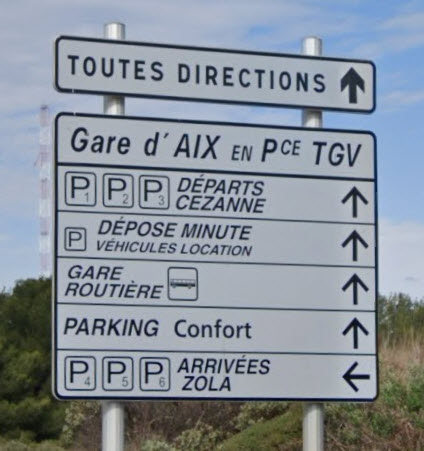
The station IS NOT in Aix, but about 10 miles (16 km) southwest of Aix on a TGV only right-of-way, that was being built when I was there in 2002. I wonder what D9 looked like before they built the station? If Amtrak spent the money on building "things" like this for their high speed trains, we could have real high speed trains! :-) I think they need more parking tho...
 Dominique Lenoir
GPS Coordinates: 43.51672, 5.31291
I know this is not a "train thing", but when you have the largest of it's kind in the world, and it is so close, it HAS to be mentioned. I came across this magnificent viaduct while following the railroad leaving Aix to the west in Google Maps.
From Wikipedia: The Roquefavour Aqueduct (French: Aqueduc de Roquefavour) is an aqueduct in Ventabren, near Aix-en-Provence, Bouches-du-Rhône, France. The aqueduct was first planned in 1565, but it was not realized until the 19th century. It was designed by Jean François Mayor de Montricher, built between 1841 and 1847, and is the largest stone aqueduct in the world. It was designated as a "monument historique" (national heritage site) in 2002.
Its construction took six years, from 1841 to 1847. It took 5,000 labourers, including 300 stone-cutters, and it cost 3,800,000 French francs. It is 83 metres high, 375 metres long, and the foundations are 9 to 10 metres deep. The aqueduct brings water (Canal de Marseille) from the Durance river to the Palais Longchamp in Marseille, all the way to La Ciotat. The water began to flow on 30 June 1847.
The aqueduct is located near Aix-en-Provence. It can be reached via the D64 road. It crosses the Arc river in Ventabren. end Wiki
As you can see, it is not far from the TGV line heading info Marseille.
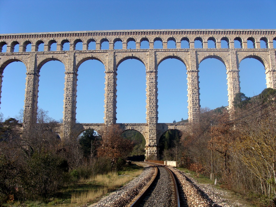 photo by Fr.Latreille, 2008, via Wikipedia
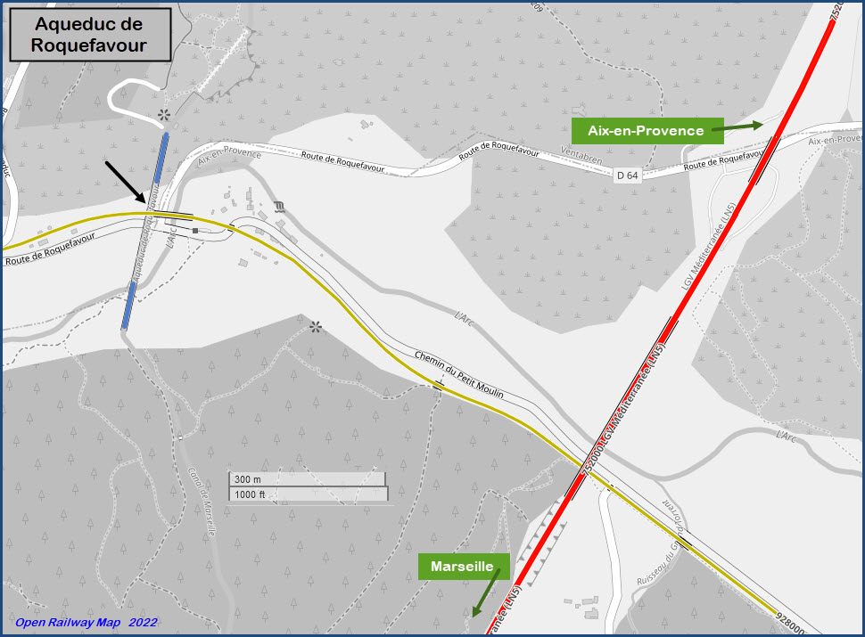
If you take D64 from Aix to get to the Aqueduct, you will pass under the TGV line heading to Marseille.... Graceful and beautiful!!!
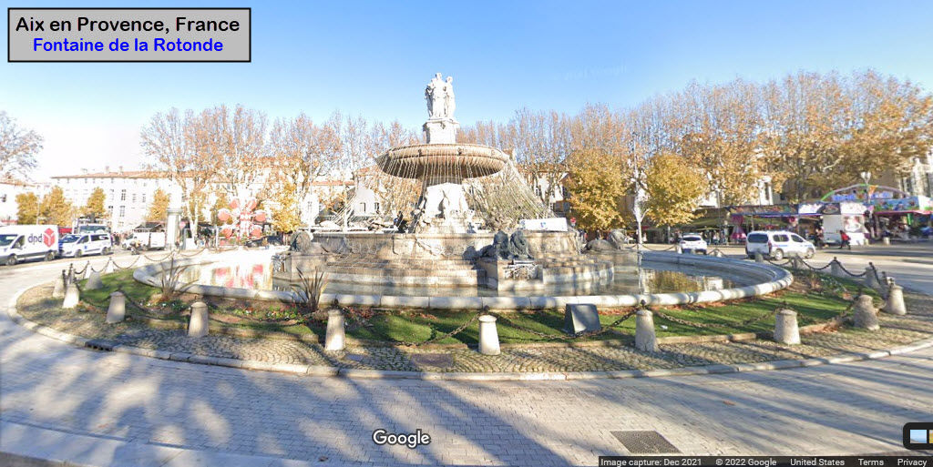
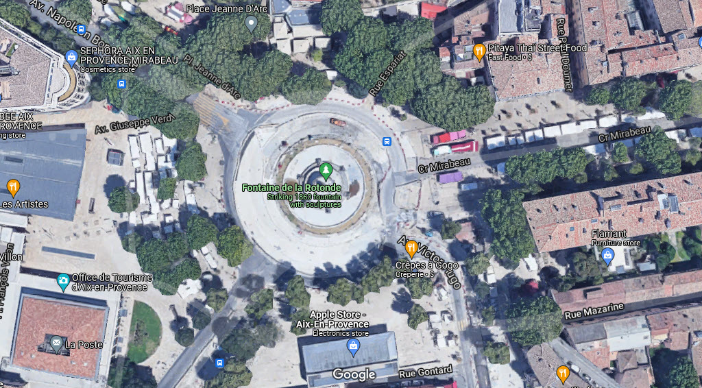
GPS Coordinates: 43.52630, 5.44542
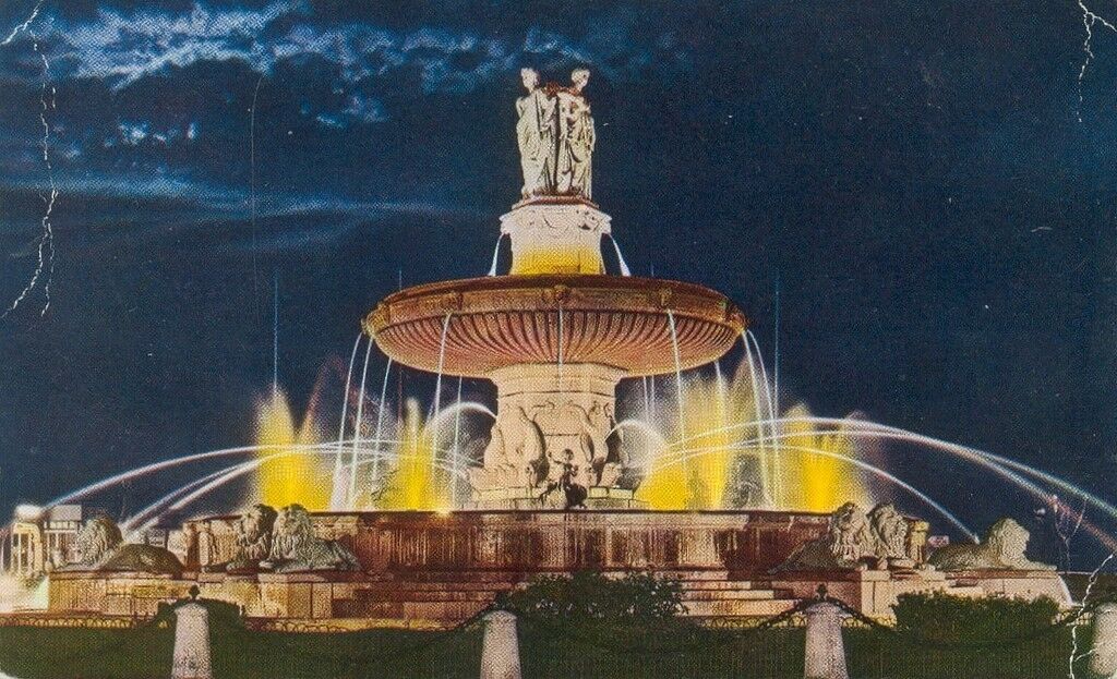
Place du Général de Gaulle, 13100 Aix-en-Provence, France.
Located in downtown Aix, a few blocks north of the train station. It's beautiful at night!
Elaborate fountain built in 1860 and topped with 3 statues representing justice, agriculture & art.
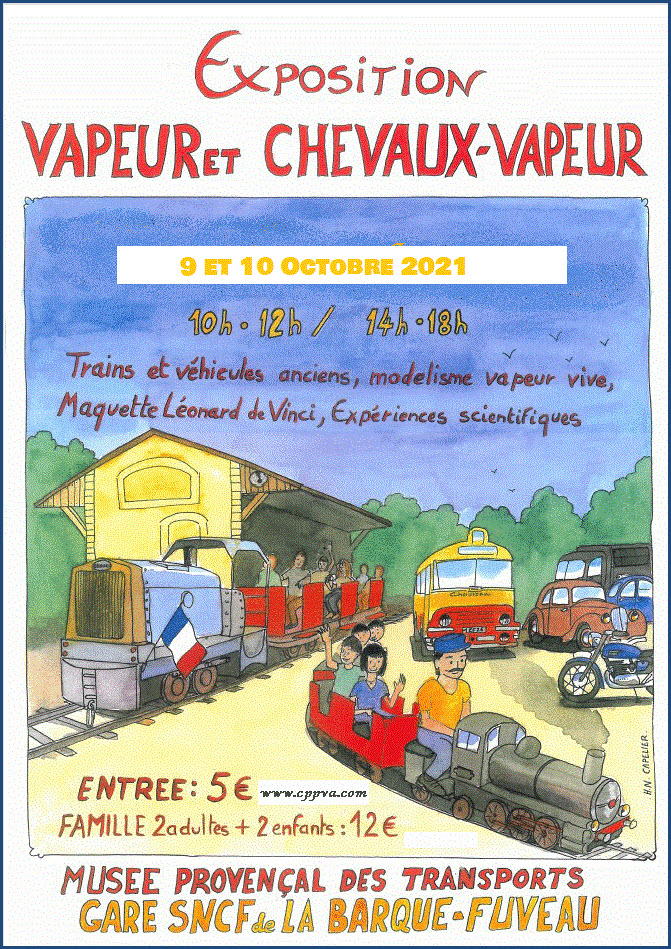
Le musée Provençal des Transports
GPS Coordinates: 43.479763, 5.538819
https://tourismeenfamille.com/item/musee-provencal-des-transports/
https://www.cppva.com/
https://www.facebook.com/CPPVA/
https://fr.wikipedia.org/wiki/Mus%C3%A9e_proven%C3%A7al_des_transports

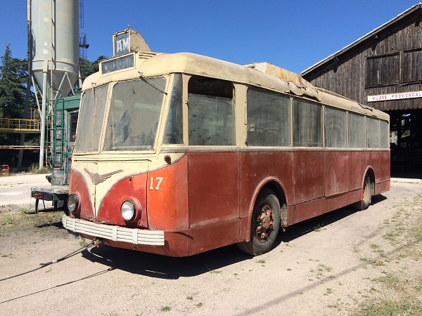
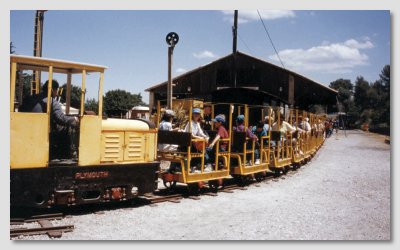
This museum was created in 1970 by Noël Malliary, at the edge (end, I'm guessing?) of the line from Carnoules to Gardanne at the location of the old goods hall of La Barque station. It contains a collection of Tramways from the city of Marseille, locomotives, and Trolleybuses from the region, including a single example of an intercity trolleybus formerly assigned to the Aix-Marseille route. It includes a collection of old railway equipment and traces their history. Waiting for you is a collection of over 20 locomotives, tractors, wagons and wagonets.
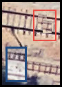
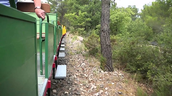
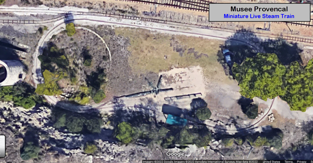
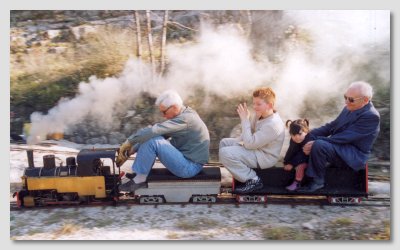
Best I can tell from using Google Translate, they also have two miniature trains you can ride. The first one is about 1.8km long, and the train is made up of equipment from coal and bauxite mines. The Little Train of Sainte Victoire allows you a ride of about 40 minutes in the countryside of Sainte Victoire. The second one, is a smaller gauge live steam train. I can't really tell, and there is no information whatsoever on their website except for their rulebook (as of 1/22), and few pictures! :-( Maybe someone that knows what the gauge of the two small railroads is, can shoot me an email. Judging from the Google satellite view, I'm guessing the Mining RR is 24" (red inset). The miniature Live Steam track looks to be multi-gauged, maybe 7-1/2", 5-1/4", and 3-3/4".
Be prepared to do some walking. The miniature live steam train ride is at the far east end of the property.
How to get here: Coming from Aix en Provence, take D7N and D96 east towards Aubagne, then, 500 m after the crossroads of La Barque, turn left just after the bridge under the railway. You could also take A8 (toll) and get off at ext 32, and then take D96 south.
Cost: 4 € per person, 12 € per family (2 adults/2 kids).
Hours: 10:00 to 18:00 with a 2 hour lunch break from noon to 2.
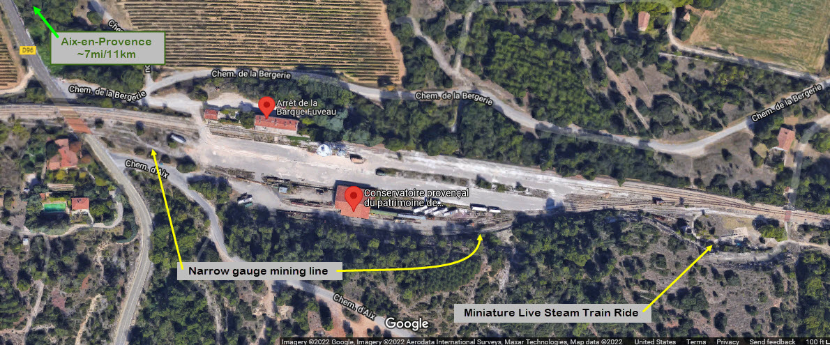
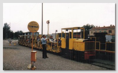
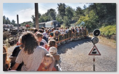
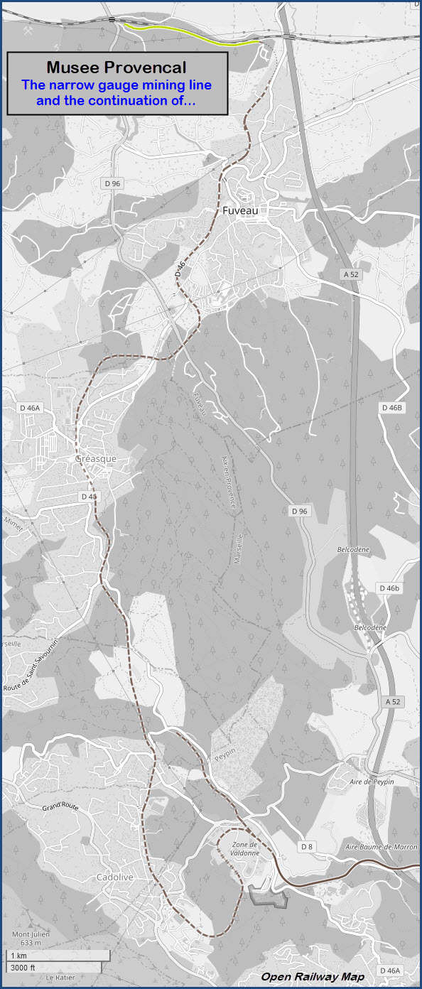
The Mining Railroad Ride
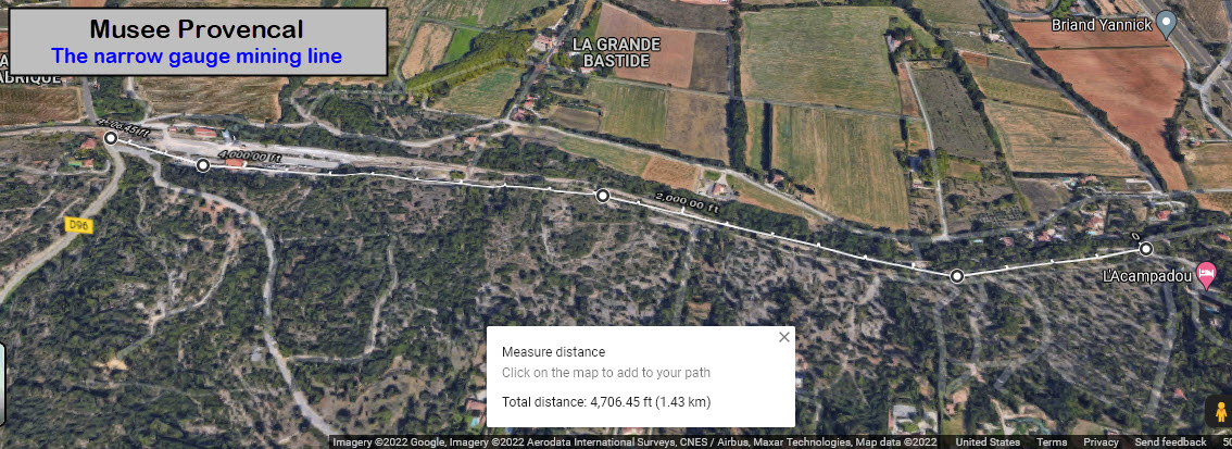
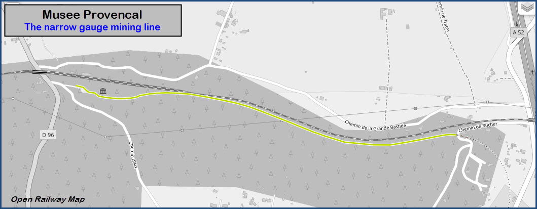
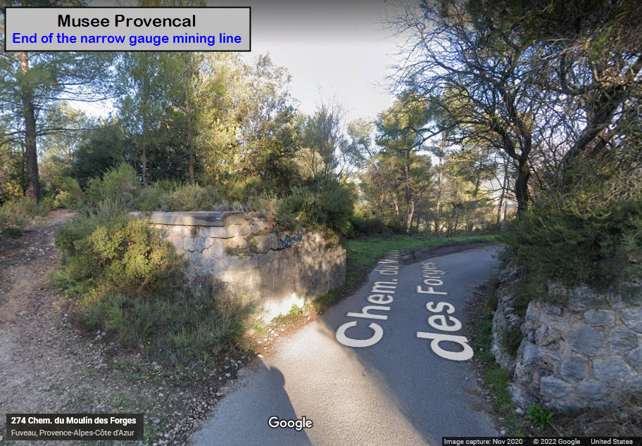
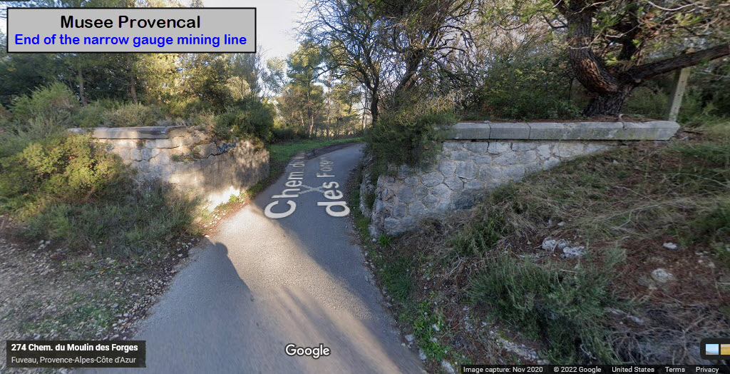
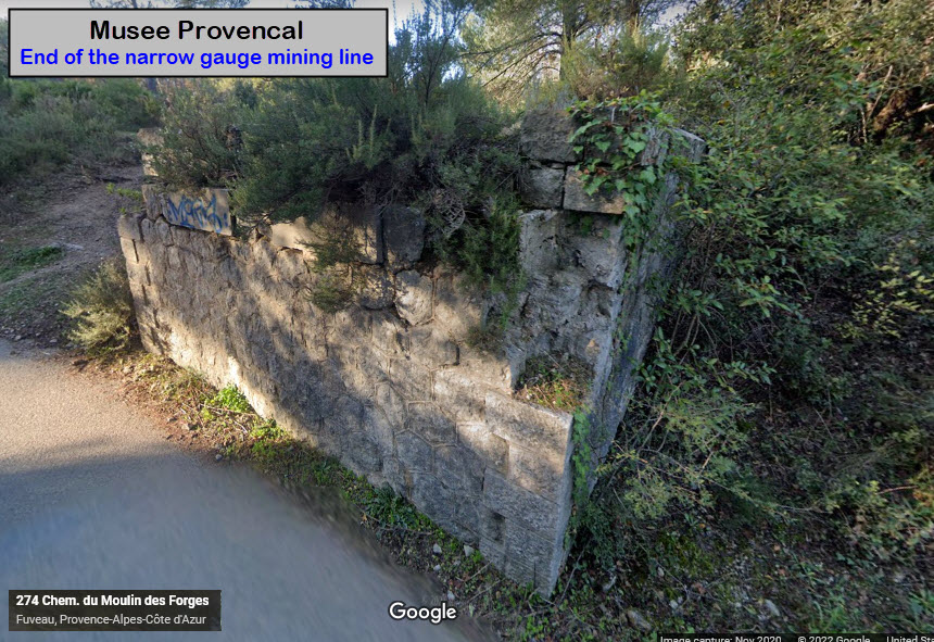
I can't really tell, but it looks like the "mining line" goes about 1.4km to the east, and comes to an end before a set of bridge abutments - which, it's hard to imagine a bridge this low to the ground, unless the road was filled in to make it level.... it would be interesting to see pictures from "before".
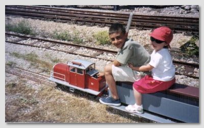
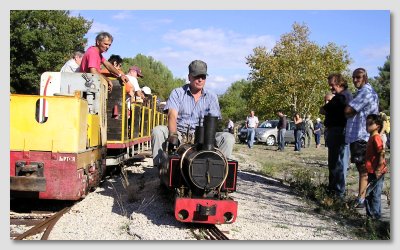
The following three pictures come from the CPPVA website
Courtesy Open Railway Map, we know where the Mining Line used to run:
The Miniature Live Steam Train

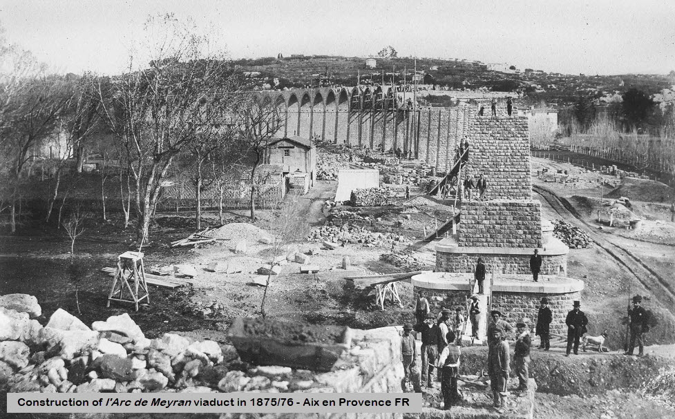
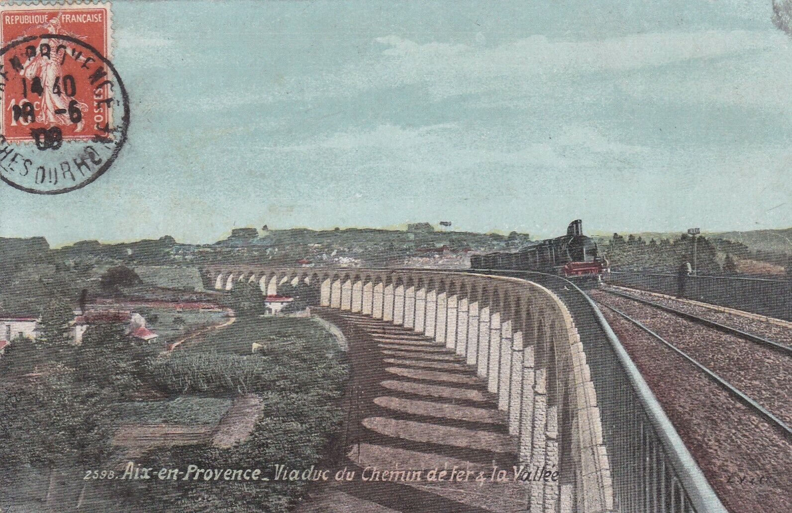
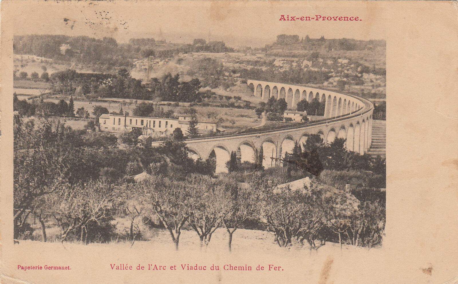
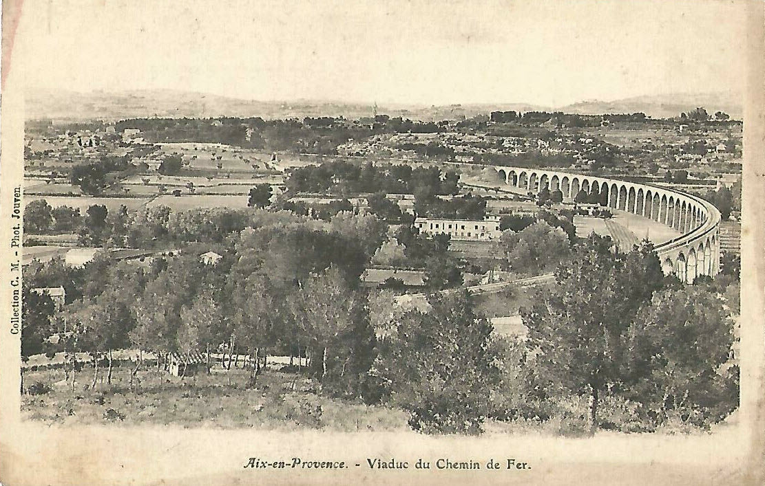
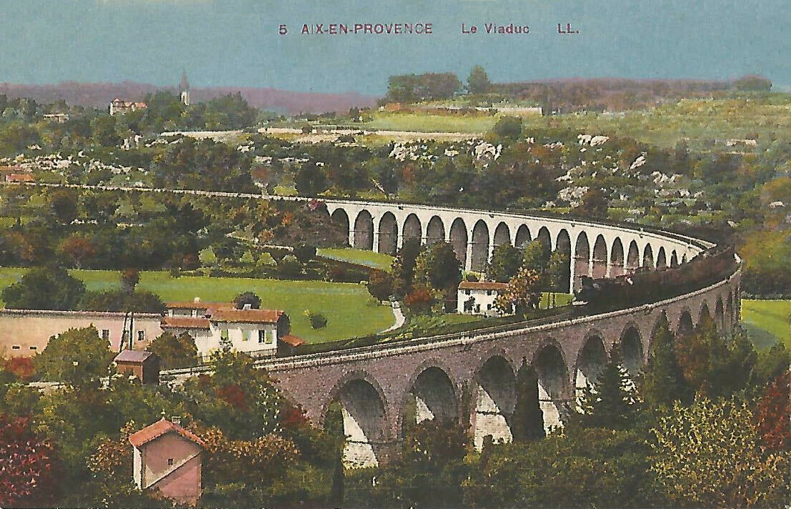
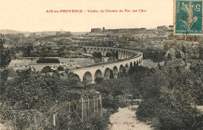
The viaduct was built in 1875/1876, and opened for service soon after.
Stats:
- The viaduct is 510 meters long (1,673 ft or 0.32mi)
- The viaduct has 38 arches
- The arches are about 20 meters high (66 ft)
- The arches are about 10 meters wide (33 ft)
- Depth of the foundations is 10 to 11 meters
- Number of tracks on the viaduct: 1
 Berkeley Library, Berkeley CA
Construction Photos
 Claude Gondran
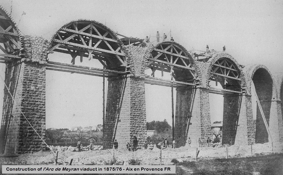 Claude Gondran
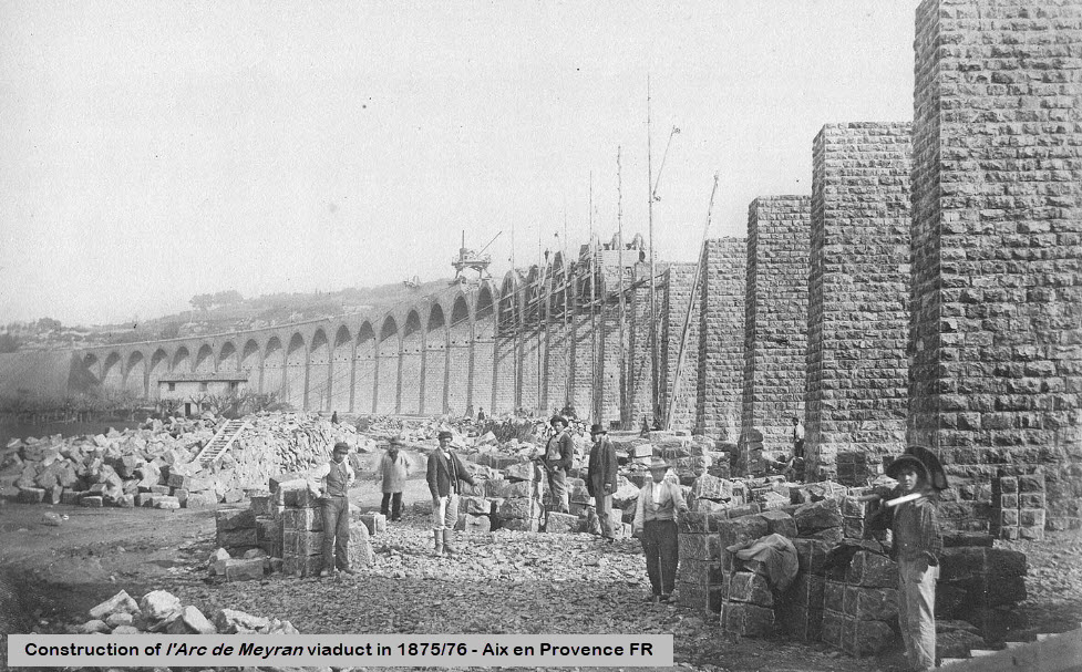 Claude Gondran
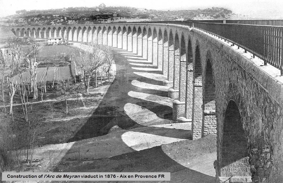 Claude Gondran
Postcards of the Viaduct
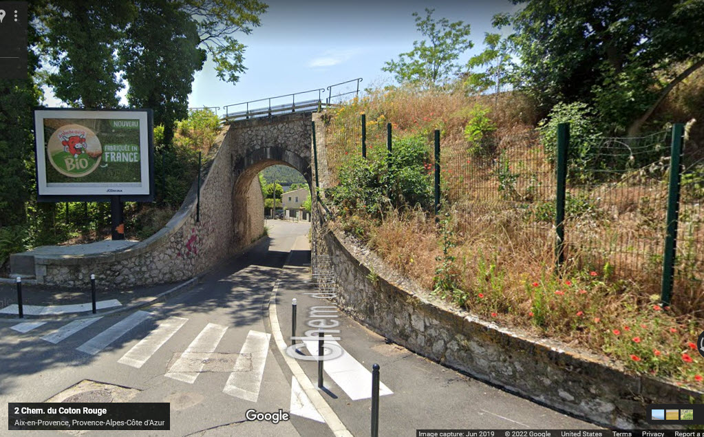
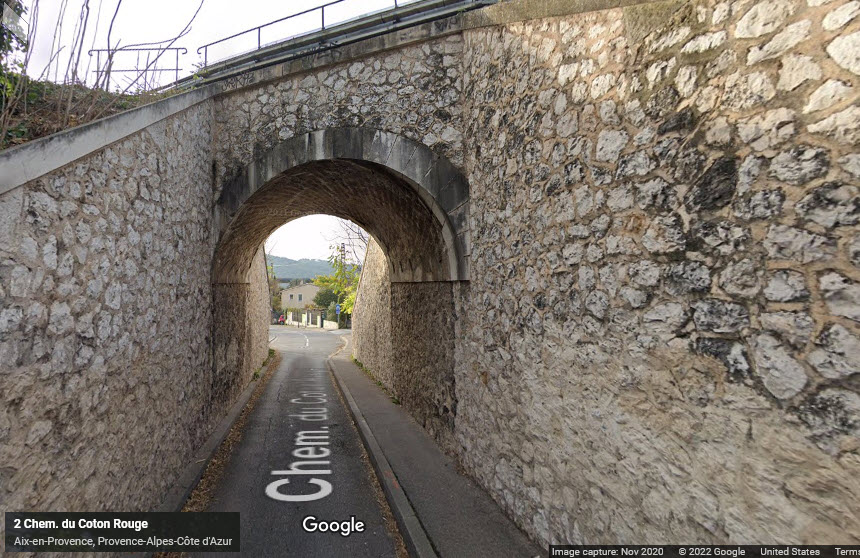
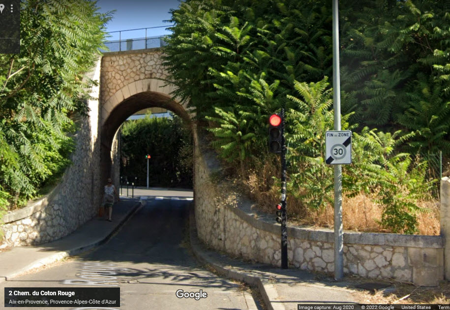
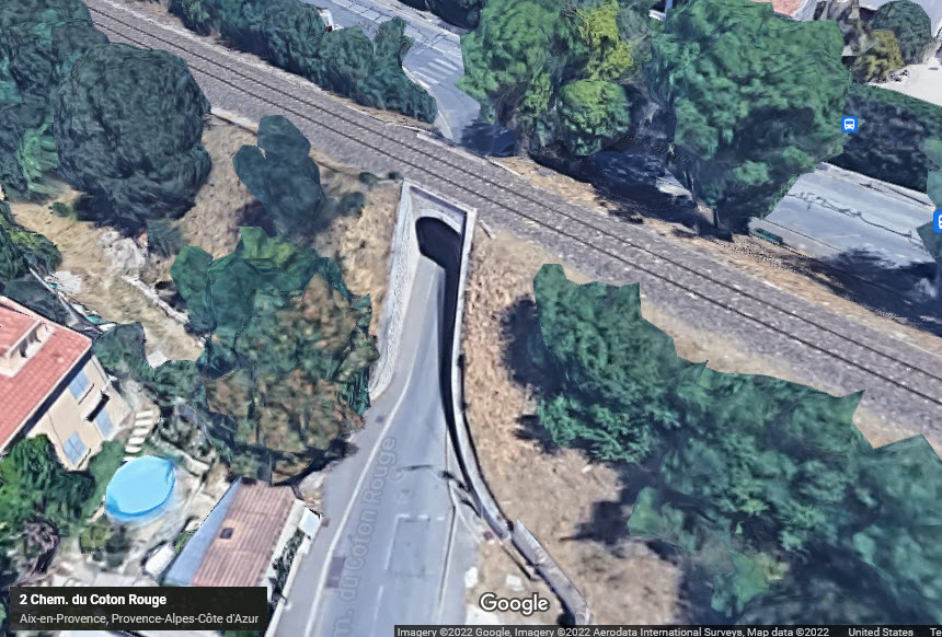
Cute little overpass, I wonder if a full size pick-up truck can squeeze thru there without going up on the sidewalk?
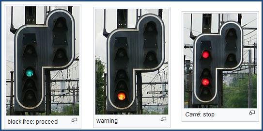
https://en.wikipedia.org/wiki/French_railway_signalling
The basic French signal indications:
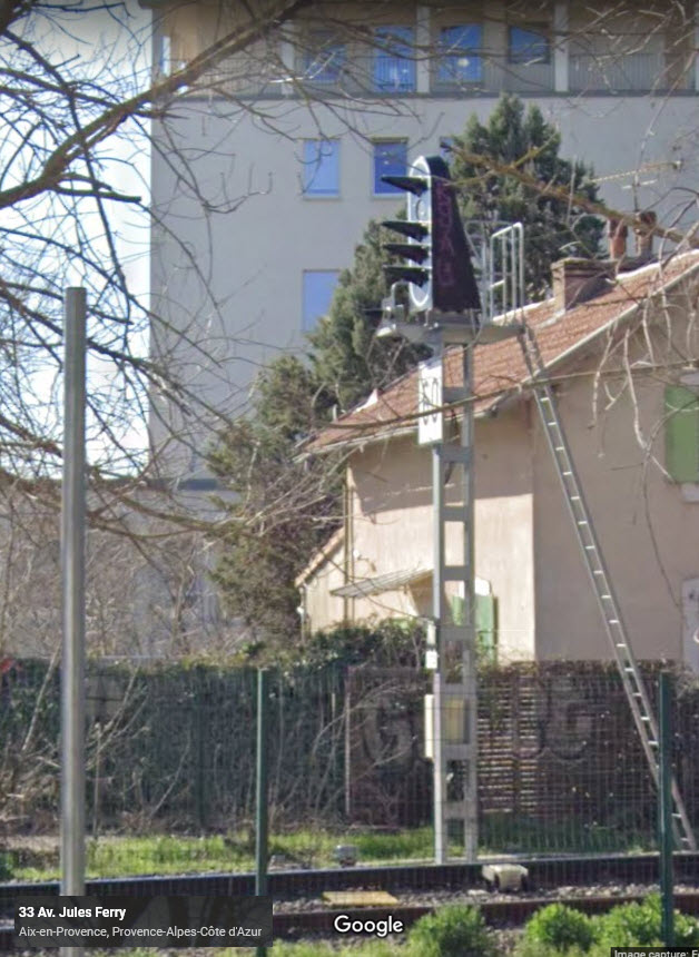
I didn't go looking for many signals on Google Streetview....
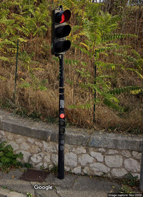
Standard Automobile Traffic Light Signal
They are everywhere.... The little signals are for cars that can't see the main signal, due to where they place the signals on the side of the street.
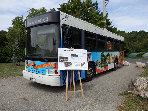
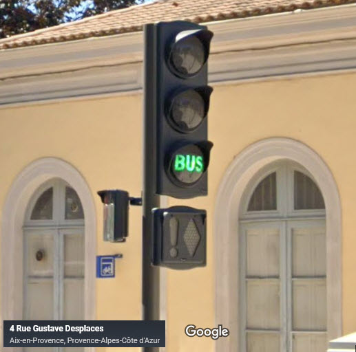
Bus Signal
This is in front of the train station:
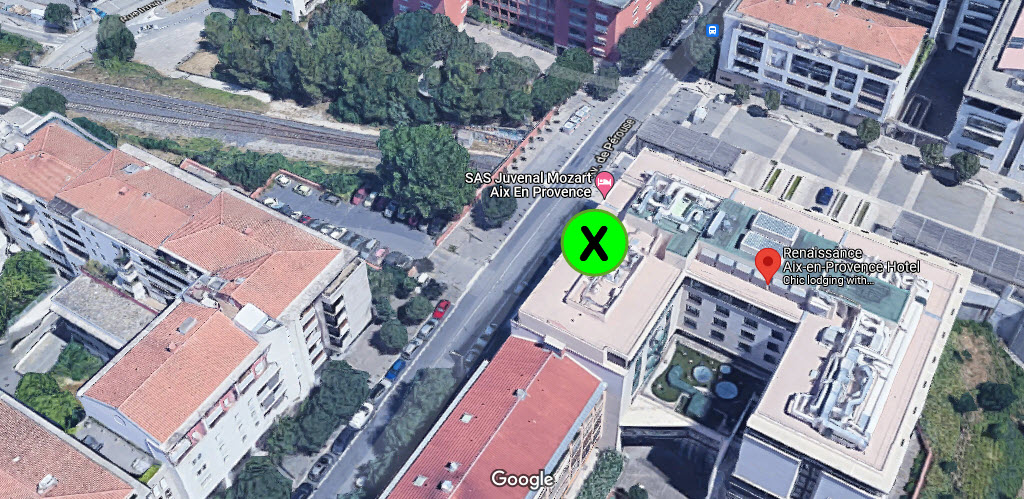
Train Watching Hotel
GPS Coordinates: 43.52607, 5.43789
Renaissance Aix-en-Provence Hotel // Hôtel Renaissance - Aix-en-Provence
Located at: 256 Av. de Pérouse, 13100 Aix-en-Provence, France
Ask for a room on the west side, on the top floor if you can get it. Looks like rooms are running ~$177 (in Jan22).
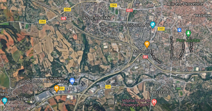
Oy!
I'm sure the French are not real happy about Google highlighting the Burger King and McDonalds on their maps like this, with all of the GREAT places to eat that are available!!! :-(
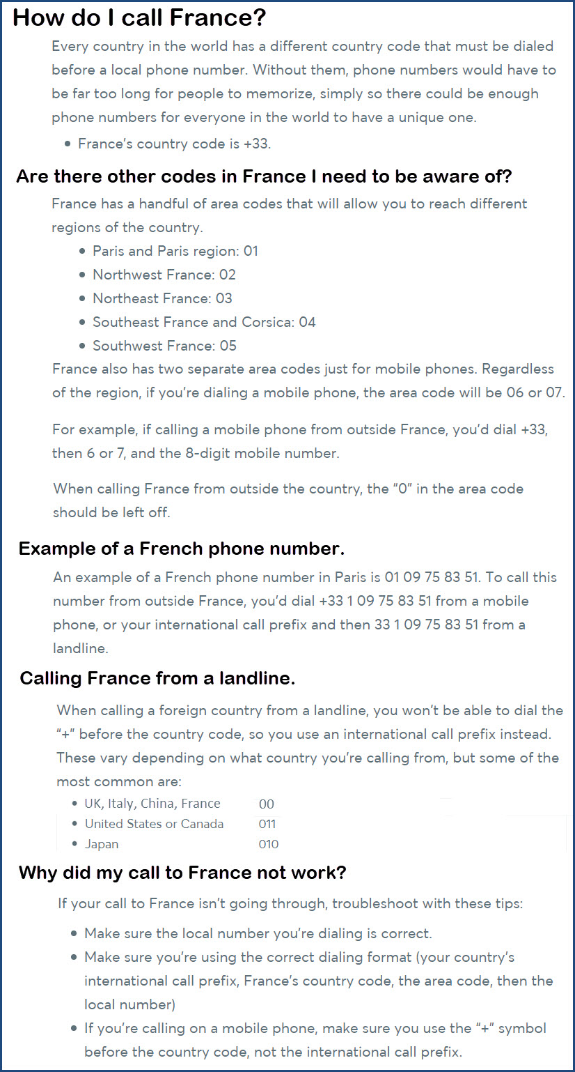
Phone calls to France
One of the things we ALL take for granted is calling someone. If you live in "the states", we have gotten used to the fact that most phone calls are now 10 digits, regardless of where you live.... gone are the days of 7 digit phone calls, this is due to the explosive growth of cellphones here and abroad. I could go one further, and tell you that when I was young, many towns only needed a 4 or 5 digit number to place local calls, if you were calling within the same exchange! :-)
Here is a guide I found to help you calling someone while in France:
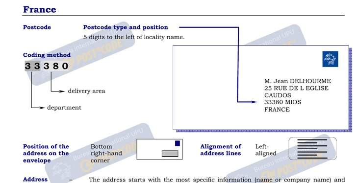
French Postal Codes
Looks like their "Zip Code" is placed in front of the town name....
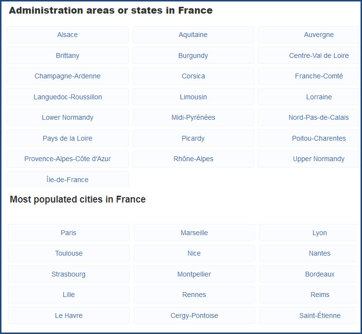
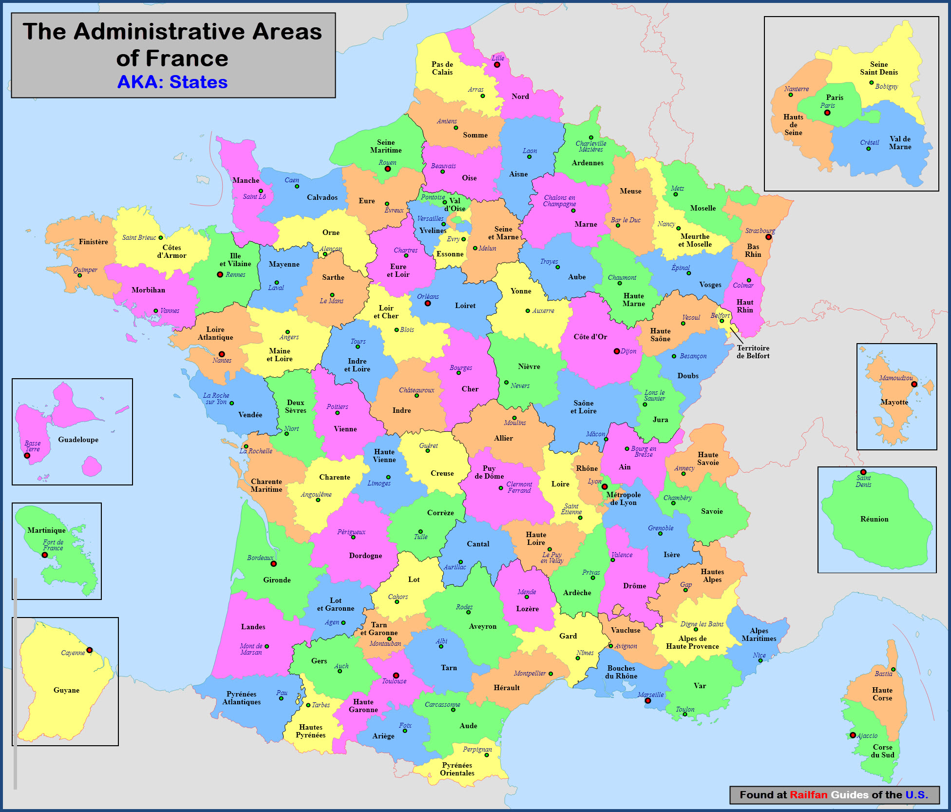
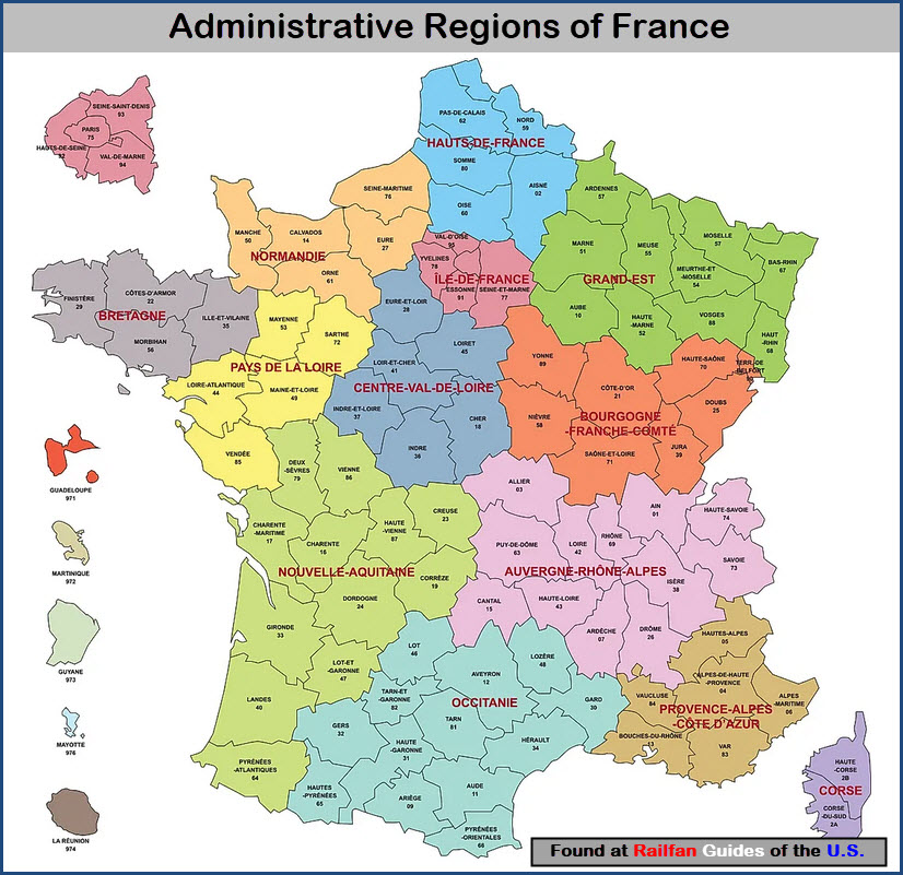
French Administration Areas, or "States"
Disclaimers:
I love trains, and I love signals. I am not an expert. My webpages reflect what I find on the topic of the page. This is something I have fun with while trying to help others.
Please Note: Since the main focus of my two websites is railroad signals, the railfan guides are oriented towards the signal fan being able to locate them. For those of you into the modeling aspect of our hobby, my indexa page has a list of almost everything railroad oriented I can think of to provide you with at least a few pictures to help you detail your pike.
If this is a railfan page, every effort has been made to make sure that the information contained on this map and in this railfan guide is correct. Once in a while, an error may creep in :-)
My philosophy: Pictures and maps are worth a thousand words, especially for railfanning. Text descriptions only get you so far, especially if you get lost or disoriented. Take along good maps.... a GPS is OK to get somewhere, but maps are still better if you get lost! I belong to AAA, which allows you to get local maps for free when you visit the local branches. ADC puts out a nice series of county maps for the Washington DC area, but their state maps do not have the railroads on them. If you can find em, I like the National Geographic map book of the U.S..... good, clear, and concise graphics, and they do a really good job of showing you where tourist type attractions are, although they too lack the railroads. Other notes about specific areas will show up on that page if known.
Aerial shots were taken from either Google or Bing Maps as noted. Screen captures are made with Snagit, a Techsmith product... a great tool if you have never used it!
By the way, floobydust is a term I picked up 30-40 years ago from a National Semiconductor data book, and means miscellaneous and/or other stuff.
Pictures and additional information is always needed if anyone feels inclined to take 'em, send 'em, and share 'em, or if you have something to add or correct.... credit is always given! Please be NICE!!! Contact info is here
Beware: If used as a source, ANYTHING from Wikipedia must be treated as being possibly inaccurate, wrong, or not true.
RAILFAN GUIDES HOME
RAILROAD SIGNALS HOME
NEW 1/15/2022, JAN17/18/20/23/2022
Last Modified 23-Jan-2022