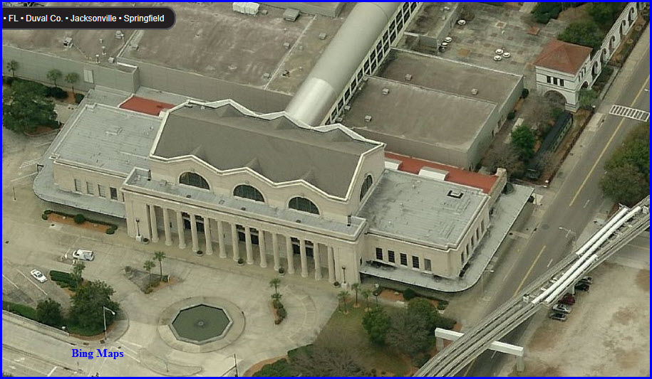
In the true sense of the word "union station" (yea, I
know, it's two words :-), the Jacksonville Union
Station was one of those grand places to visit during it's day.
When passenger operations closed there in 1974, it laid
dormant until Jacksonville built the
Prime F. Osborn III Convention Center in
1986, and the station was incorporated into the design.
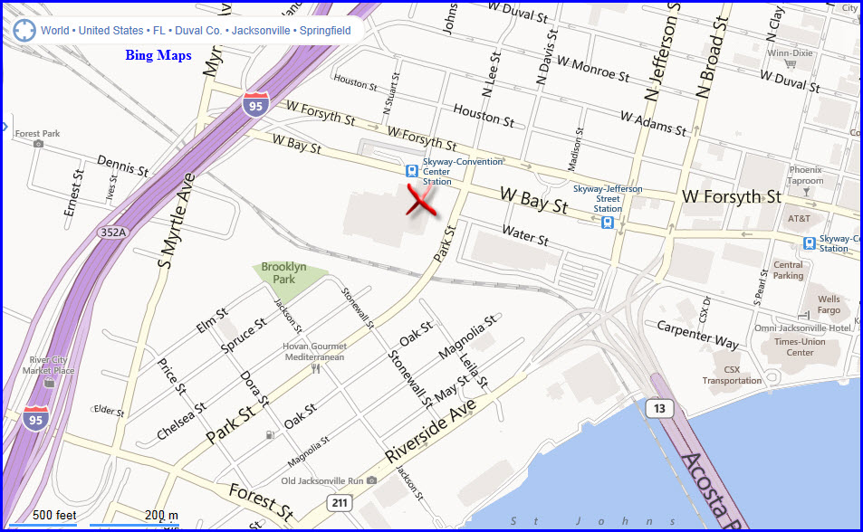
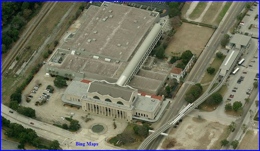
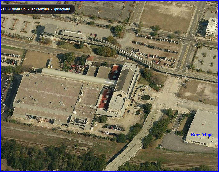
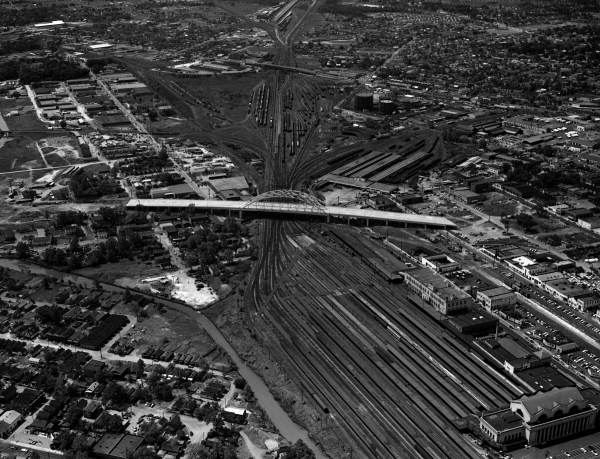
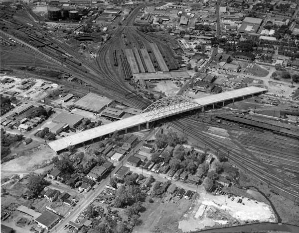
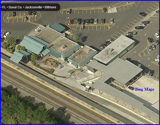
As can be seen in the aerial pictures below, the Skyway
has a station across the street, it is the terminus for the system on this
end.
Florida is kicking around the idea of re-opening the
station as the northern endpoint of commuter service on the Florida East
Coast... stay tuned.
If you are railfanning in the
northern Florida area, and into the southeast corner of Georgia, you may
want to visit Folkston GA, where the
Folkston Funnel" starts for trains heading into Florida. My guide
to Folkston is
here.
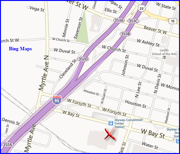
Find your way to I-95, and you have almost made it
there. There are exits which dump you off right at the Station.
For southbounders, take exit 353 (353A maybe?).
It puts you at a light with Church Street. Go straight thru the
intersection, this puts you on Cleveland St, which will then put you on the
one-way street, West Forsyth St. This takes you directly to the
comvention center/Station.
For NB I-95, take exit 352B (I think), which, it too,
puts you onto Forsyth.
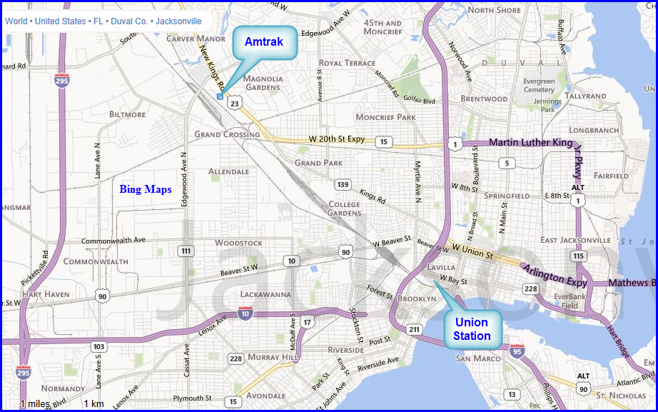
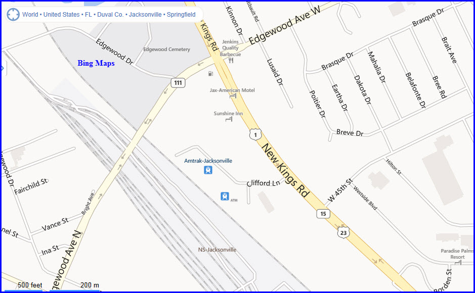
From Wikipedia: The Jacksonville Amtrak station
is a passenger train station in Jacksonville. It is served by Amtrak's
Silver Meteor,
Silver Star, and Thruway Motorcoach to Lakeland. The
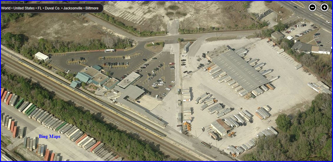
station lies next door to a freight facility with its own platform and is
also just east of Norfolk Southern's Simpson Yard.
Amtrak's Clifford
Lane facility has been in operation since 1974, when it replaced
the downtown Union Terminal.
Two other services once used this station, the
Palmetto and
Sunset Limited. In
2004 the Palmetto's route was
shortened to end in Savannah GA, and in 2005 the
Sunset Limited was shortened
to end in New Orleans, LA as a result of Hurricane Katrina.
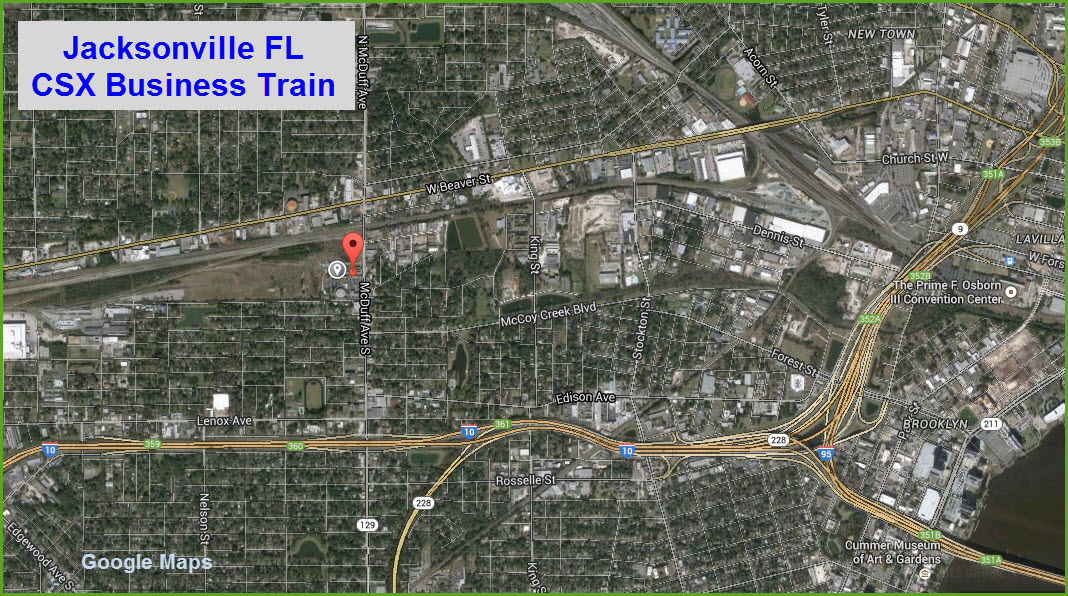
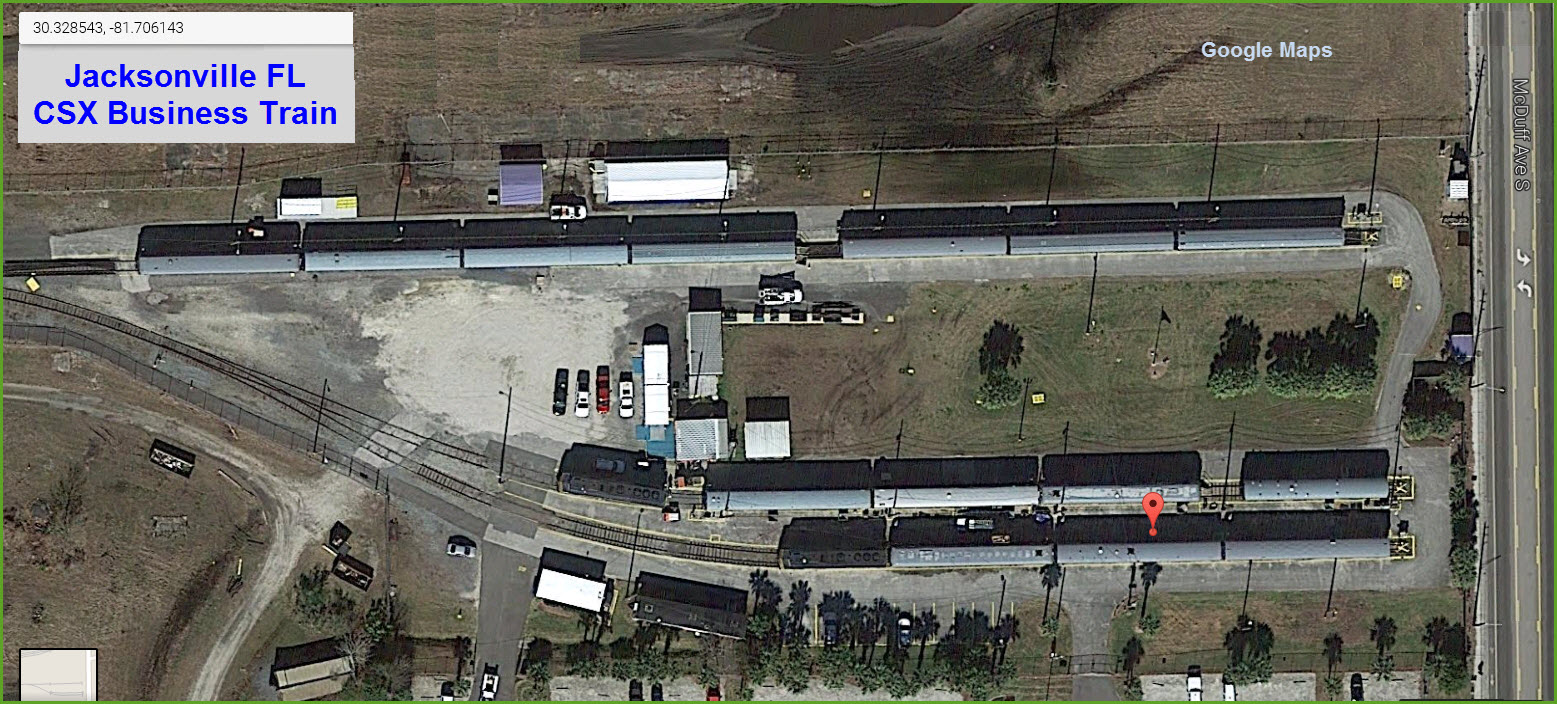
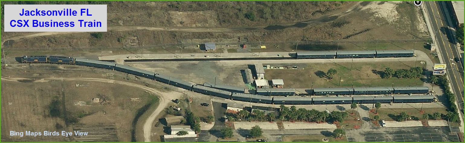
Thanks to Denver Todd for finding the
location of the business train. It doesn't look like it uses the old
Clinchfield F units anymore - I caught the train in Camden station in
Baltimore once around the 1990 time frame..... and a few years earlier
(~1981), in Erwin TN (home to the Clinchfield), I caught the engines while
they still said Clinchfield on the side!
The Google view shows 14 cars, while the Bing
view shows 17.
Union Station was used by Amtrak until 1974.
After that, it was incorporated into a convention center.
Union Station resides
in the LaVilla area of Jacksonville, which at the time of
construction, was a suburb of Jacksonville. For many
years, it was an important railroad hub. The first union
station in the area was built by the
Savannah, Florida and Western Railway (later part of
the Atlantic Coast Line Railroad) in 1883. The
Jacksonville, Tampa and Key West Railway
(also later part of the ACL) began to use it in 1884.
Other terminals
served the Florida Central and Peninsular Railroad (later part
of the Seaboard Air Line Railway), the Florida East Coast
Railway, and the Georgia Southern and Florida Railway.
The company was incorporated in 1894 by
Henry Flagler, who owned the Florida East Coast Railway.
Its first Union Depot opened on February 4, 1895, and was
completed on January 15, 1897. It came to be known as the
Flagler Depot.
The second Union Station opened in 1919 on
the site of the original one, and was last used on January 3,
1974 (Amtrak now stops several miles north). In 1982, a
public-private partnership was started, led by former CSX
chairman Prime F. Osborn III. The new convention center opened
on October 17, 1986.
It's not
clear in the Wikipedia article, what the original
company was, or was for, but they state the original company was
owned by five railroads, in the following
proportions
(This is one of the reasons a lot of people have a
problem with Wikipedia):
-- 25% Atlantic Coast Line Railroad (ACL)
-- 25% Florida East Coast Railway (FEC)
-- 25% Seaboard Air Line Railway (SAL)
-- 12.5% Southern Railway (SR)
-- 12.5% Georgia Southern and Florida Railway (later
merged into the Southern)
The ACL and SAL became the
Seaboard Coast Line in 1967, then the Seaboard
System in 1983, and then CSX in 1987.
The Southern merged with the Norfolk & Western Rwy
in 1990, and became the Norfolk Southern.
The FEC is still independent.
The Future?
The
Jacksonville Transportation Authority
has plans to convert the convention center back into a railroad terminal
with the re-opening of passenger travel down the Florida East Coast Railway
and eventually commuter rail. This plan will rebuild the passenger
platforms and restore the convention center back into a rail terminal.
The convention center is to stay at the location, with a convention center
and rail terminal complex.
Most of the above comes from Wikipedia, so please note
my standard Wikipedia disclaimer: Wikipedia, being what it is, an open
and uncontrolled source, may be at times unreliable in their content, reader
beware.
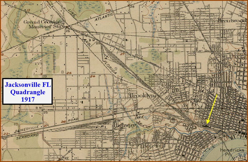
USGS Maps
This Snag is from the 1917 Jacksonville Quadrangle.
The arrow points to Union Station.
This and most of my historic USGS maps come from the University of Texas
website at:
http://www.lib.utexas.edu/maps/topo/topo_us.html
Disclaimers:
I love trains, and I love signals. I am not an
expert. My webpages reflect what I find on the topic of the page.
This is something I have fun with while trying to help others. My
webpages are an attempt at putting everything I can find of the subject in
one convenient place. There are plenty of other good websites to help
me in this effort, and they are listed in the links section on my indexa
page, or as needed on individual pages. Please do not write to me
about something that may be incorrect, and then hound the heck out of me if
I do not respond to you in the manner you would like. I operate on the
"Golden Rule Principle", and if you are not familiar with it, please
acquaint yourself with how to treat people by reading Mathew 7:12 (among
others, the principle exists in almost every religion). If you contact
me (like some do, hi Paul) and try to make it a "non-fun" thing and start
with the name calling, your name will go into my spambox list! :-)
Please Note:
Since the main focus of my two websites is railroad signals, the railfan guides
are oriented towards the signal fan being able to locate them. For those
of you into the modeling aspect of our hobby, my
indexa page has a list of
almost everything railroad oriented I can think of to provide you with at least a few pictures to
help you detail your pike.
If this is a railfan page, every effort has
been made to make sure that the information contained on this map and in this
railfan guide is correct. Once in a while, an error may creep in,
especially if restaurants or gas stations open, close, or change names.
Most of my maps are a result of personal observation after visiting these
locations. I have always felt that a picture is worth a thousand words",
and I feel annotated maps such as the ones I work up do the same justice for the
railfan over a simple text description of the area. Since the main focus
of my website is railroad signals, the railfan guides are oriented towards the
signal fan being able to locate them. Since most of us railheads don't have just
trains as a hobby, I have also tried to point out where other interesting sites
of the area are.... things like fire stations, neat bridges, or other
significant historical or geographical feature. While some may feel they
shouldn't be included, these other things tend to make MY trips a lot more
interesting.... stuff like where the C&O Canal has a bridge going over a river (the Monocacy Aqueduct) between Point of Rocks and Gaithersburg MD, it's way cool to
realize this bridge to support a water "road" over a river was built in the
1830's!!!
My philosophy: Pictures and maps are worth a
thousand words, especially for railfanning. Text descriptions only
get you so far, especially if you get lost or disoriented. Take
along good maps.... a GPS is OK to get somewhere, but maps are still
better if you get lost! I belong to AAA, which allows you to get
local maps for free when you visit the local branches. ADC puts
out a nice series of county maps for the Washington DC area, but their
state maps do not have the railroads on them. If you can find em,
I like the National Geographic map book of the U.S..... good, clear, and
concise graphics, and they do a really good job of showing you where
tourist type attractions are, although they too lack the railroads.
Other notes about specific areas will show up on that page if known.
Aerial shots were taken from
www.bing.com/maps. The screen
captures
from Bing are made with Snagit, a
Techsmith product... a great
tool if you have never used it!
Pictures and additional information is always needed if anyone feels
inclined to take 'em, send 'em, and share 'em, or if you have
something to add or correct.... credit is always given! Contact info
is here
Beware: If used as a source, ANYTHING from Wikipedia must be treated as
being possibly being inaccurate, wrong, or not true.