
In General
Getting Here
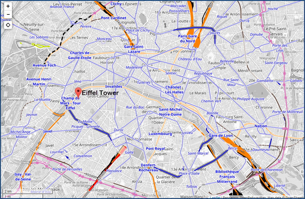
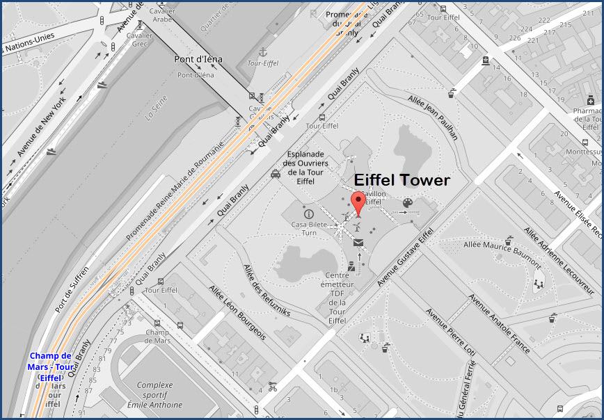
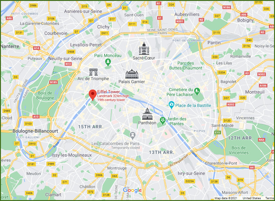
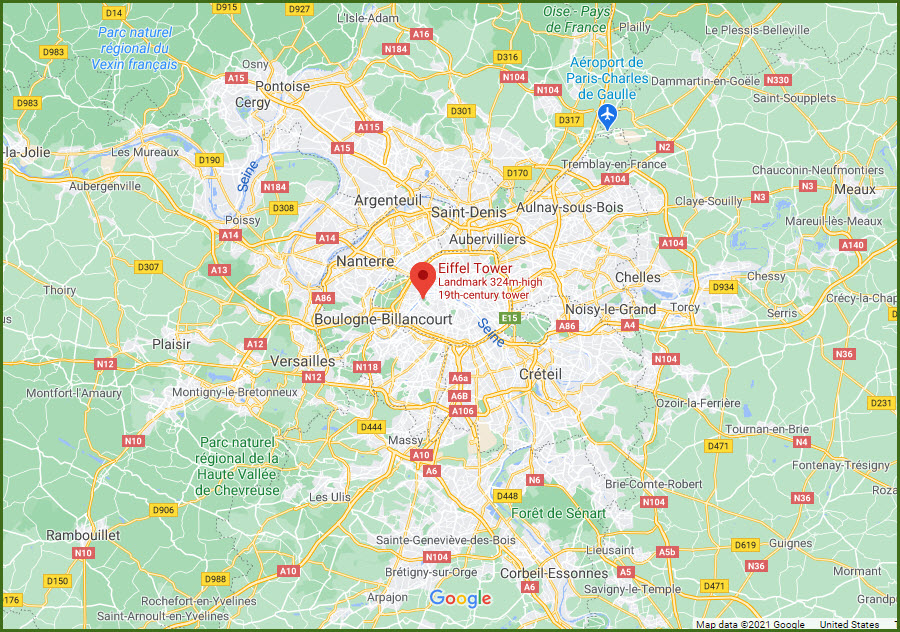
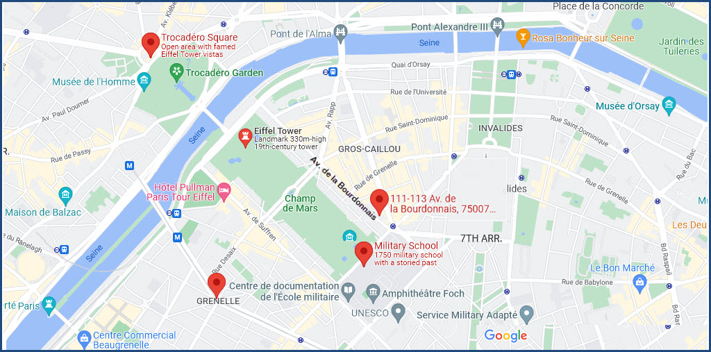
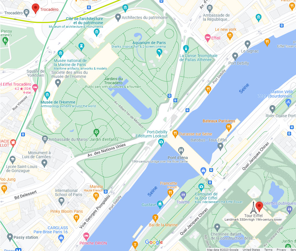
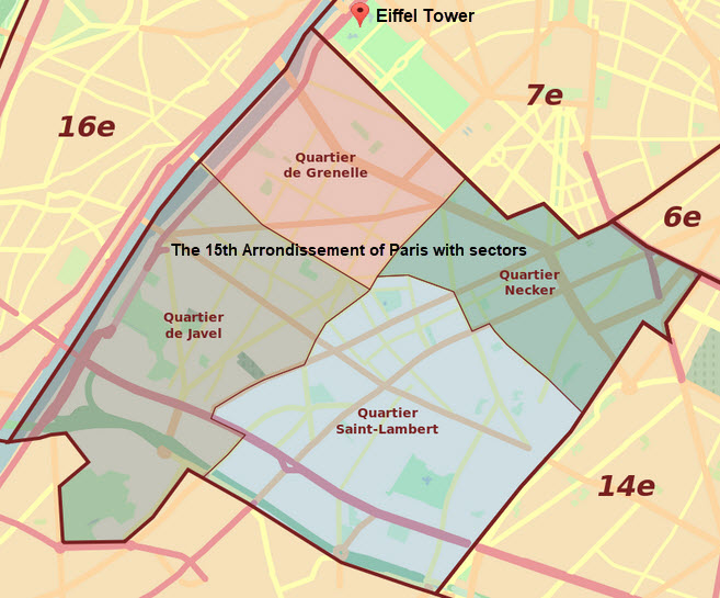
Map
Pictures
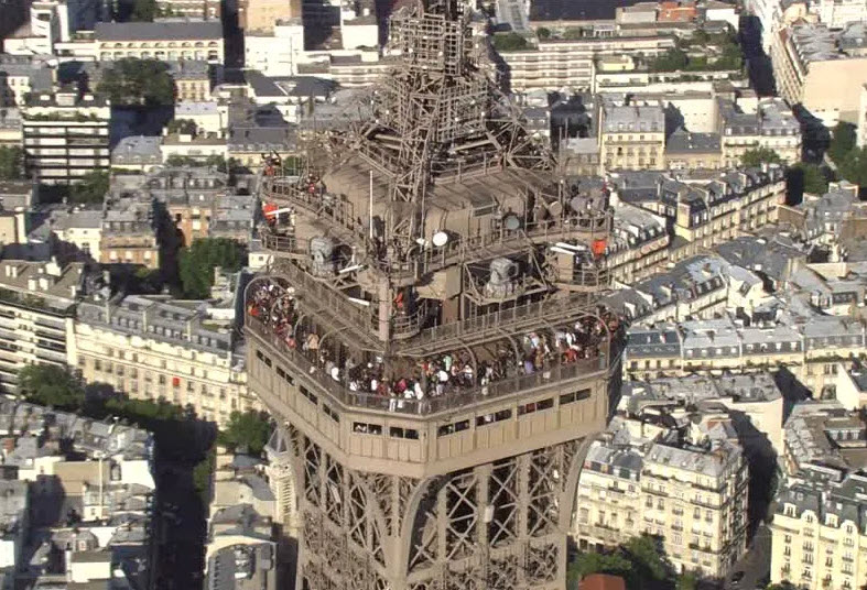
Day
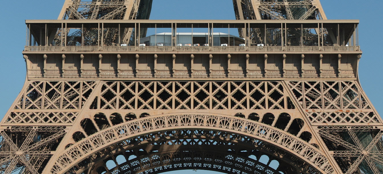
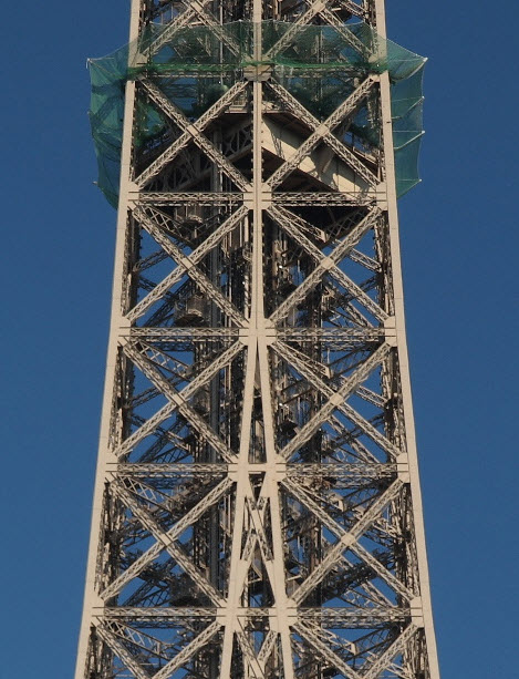
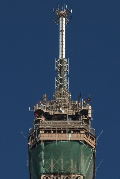
Detail
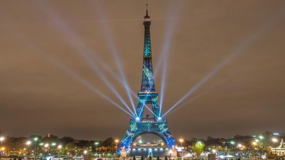
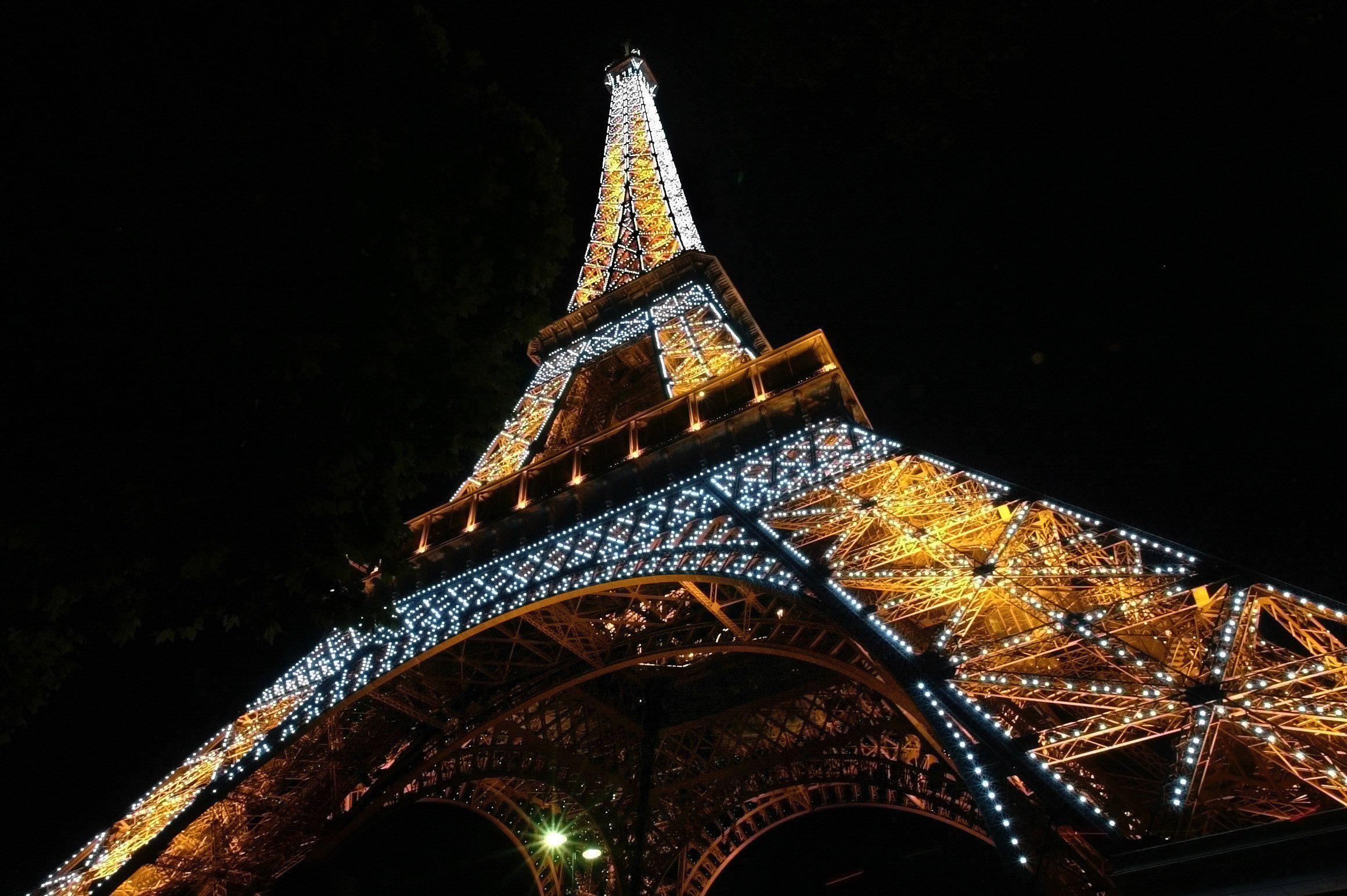
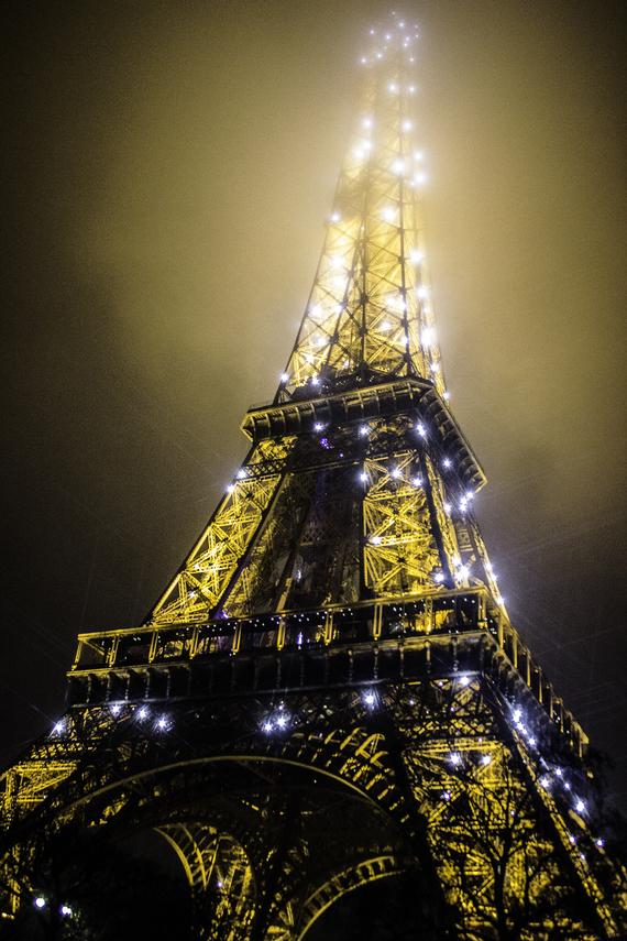
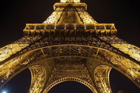
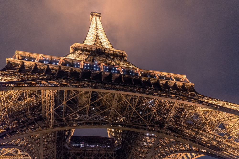
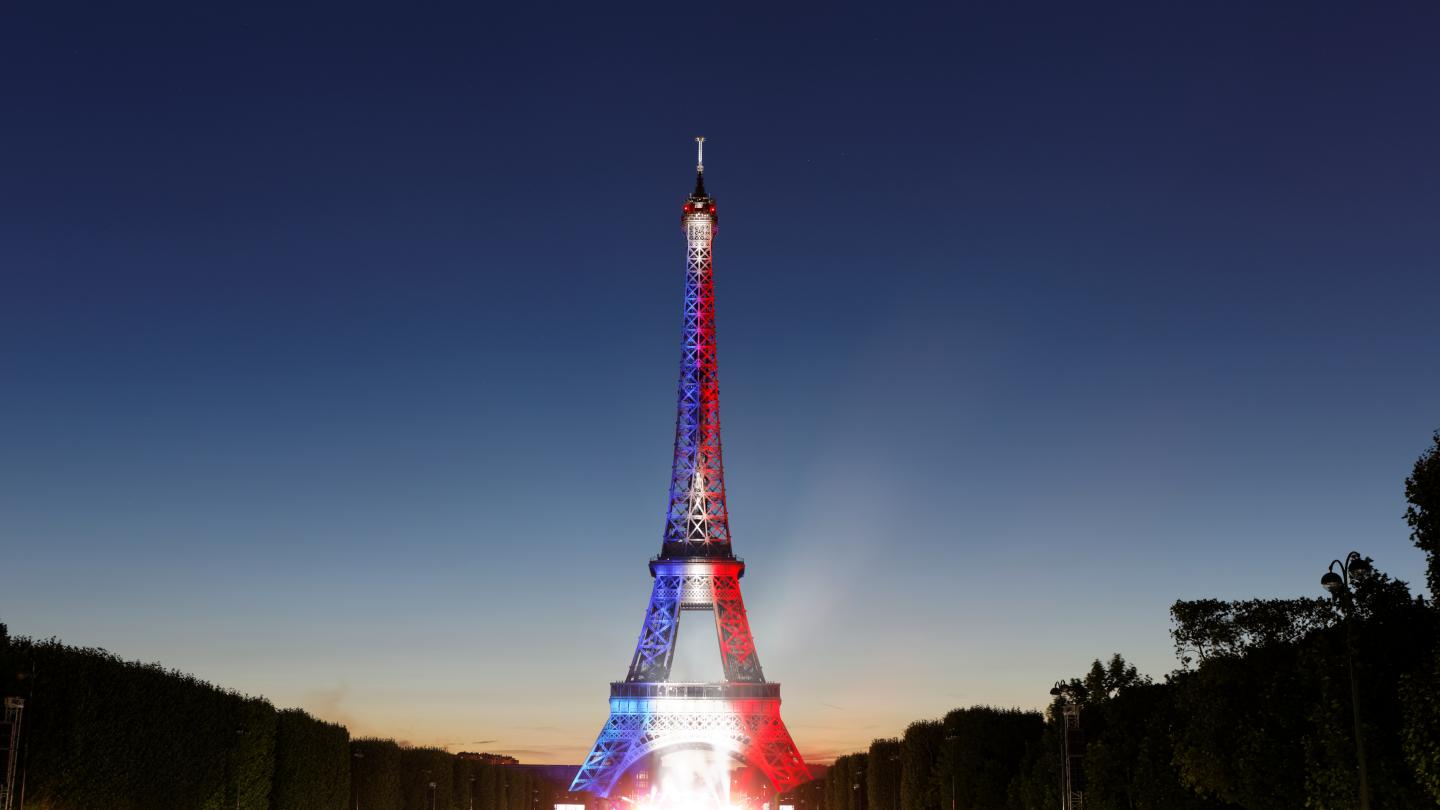
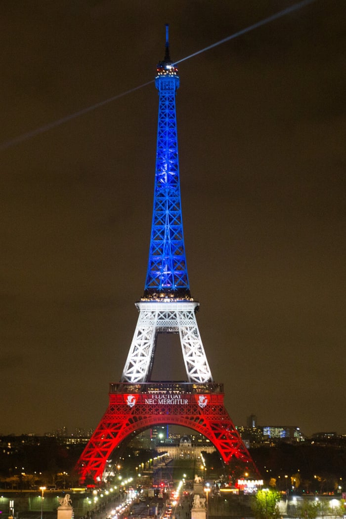
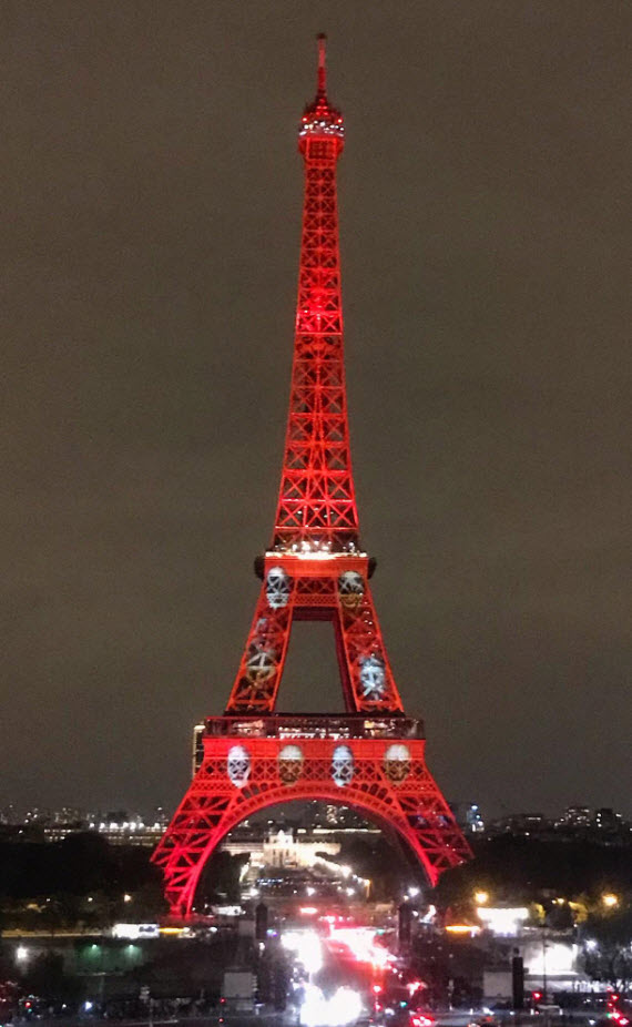
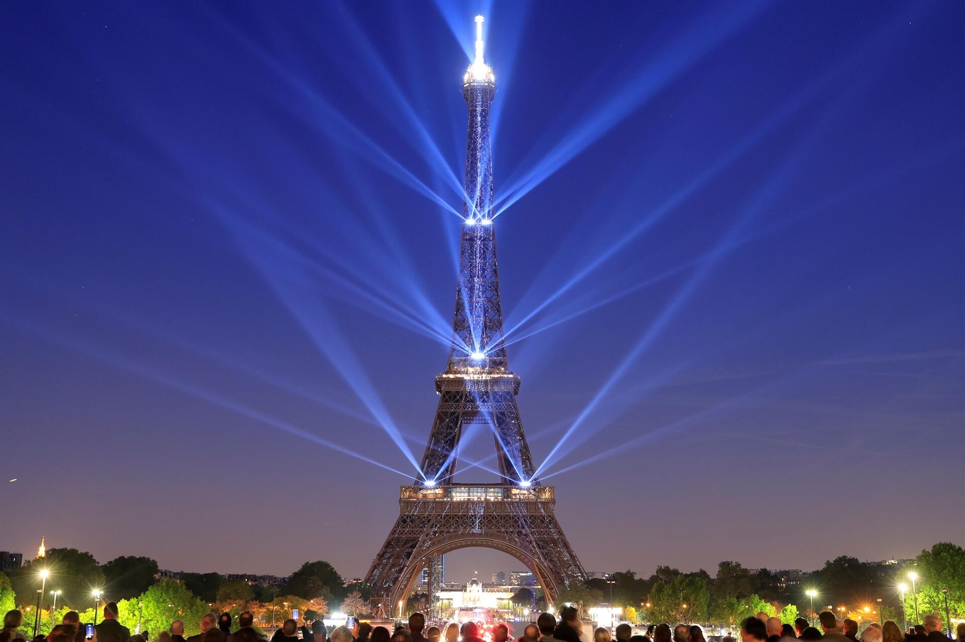
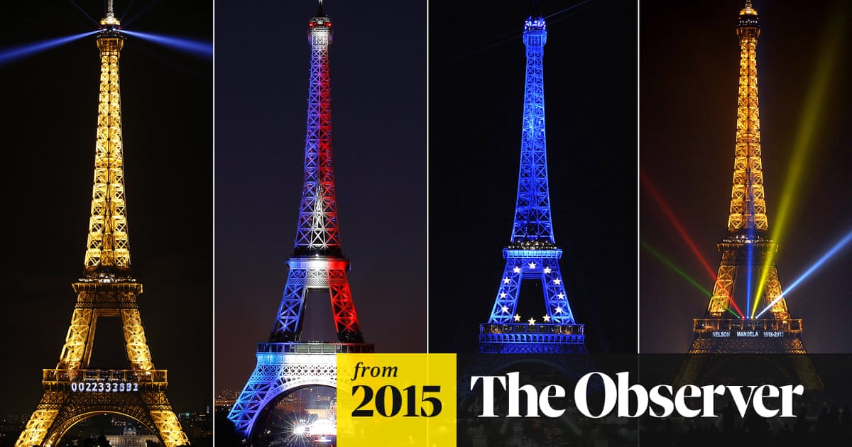
Night Time
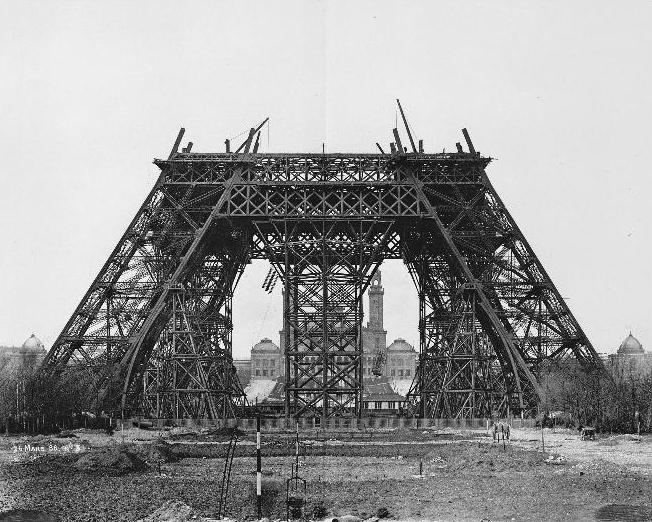
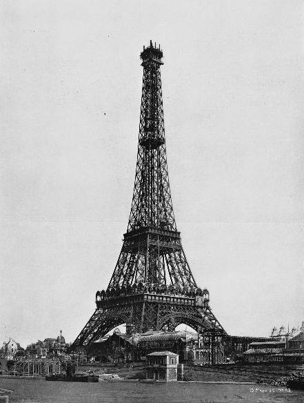
Construction
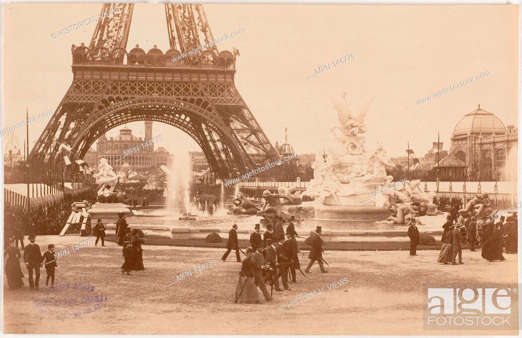
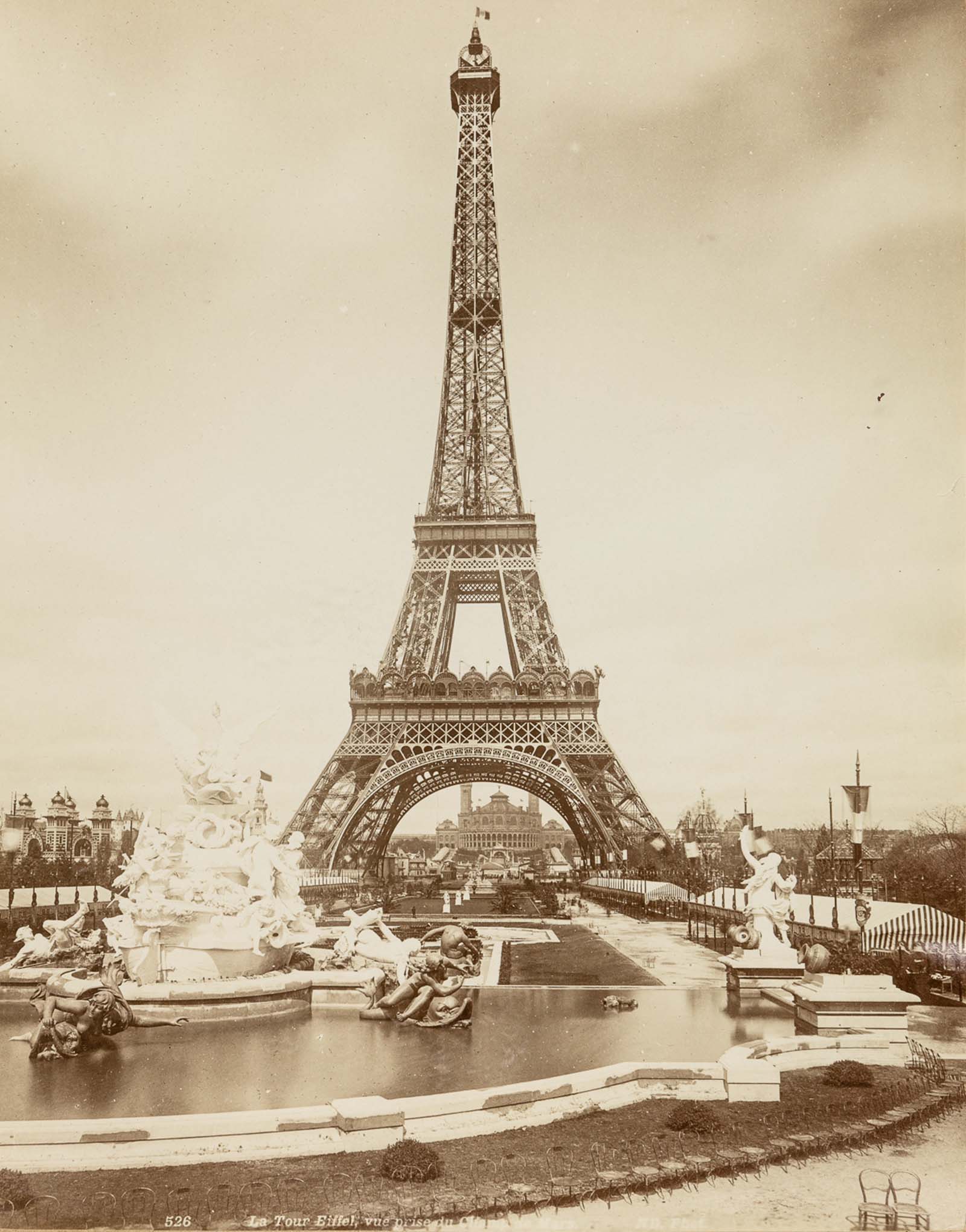
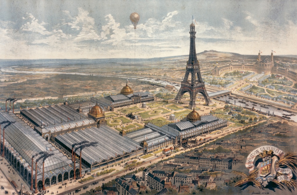
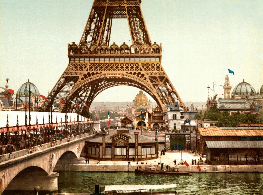
The 1889 Expo
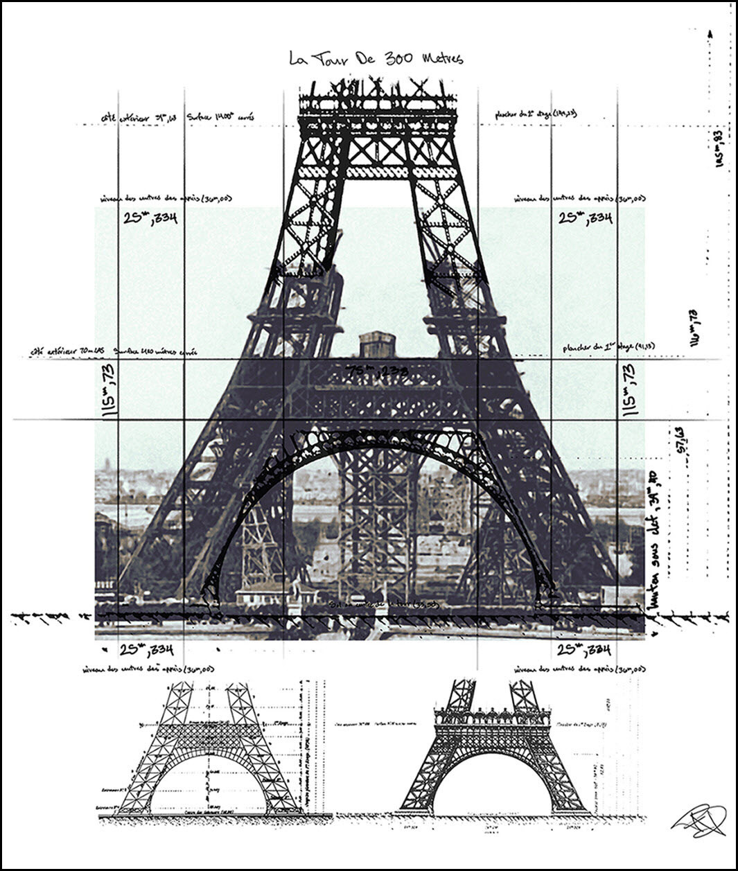
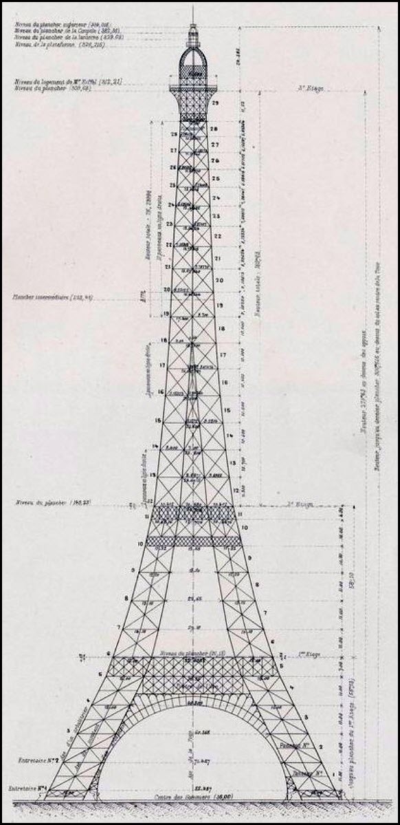
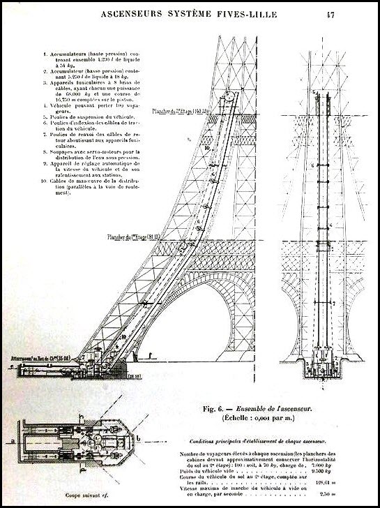
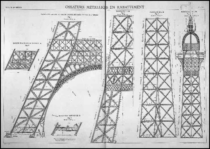
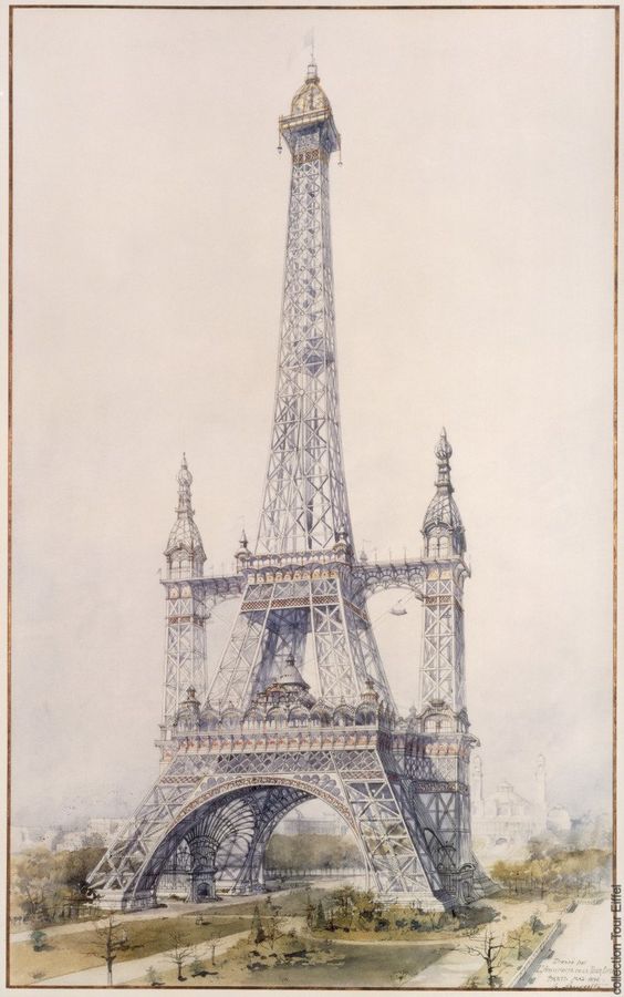
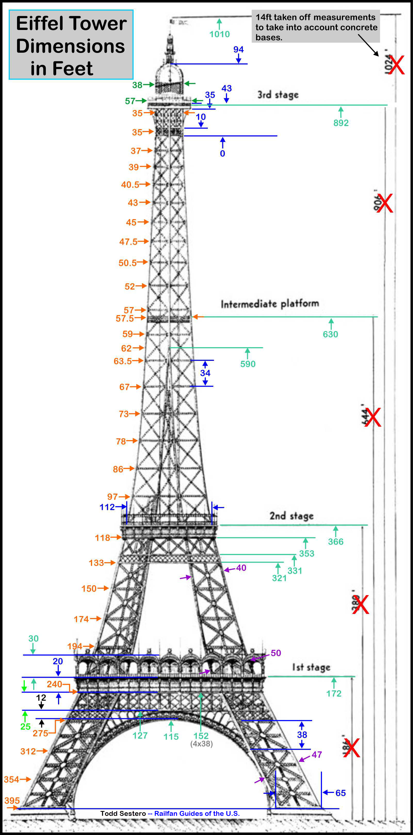
Drawings
The 72 Names
As Seen On TV
Google Info Shorts
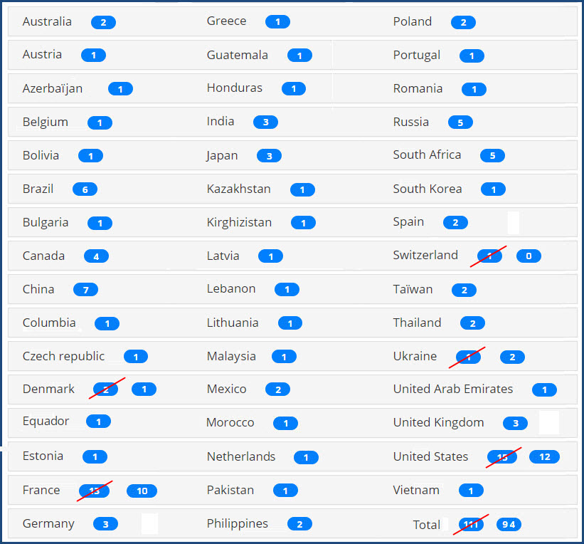
Replicas
Replica Index
Replicas: Countries A - H
Replicas: Countries I - R
Replicas: Countries S - Z
Models of the Tower
RAILROAD SIGNALS HOME
Location / Name:
Paris France
What's Here:
THE Eiffel Tower
Data:
GPS Coordinates: 48.85828, 2.29451
Phone A/C: +33 1 83 (I think)
Postal Code: 75007
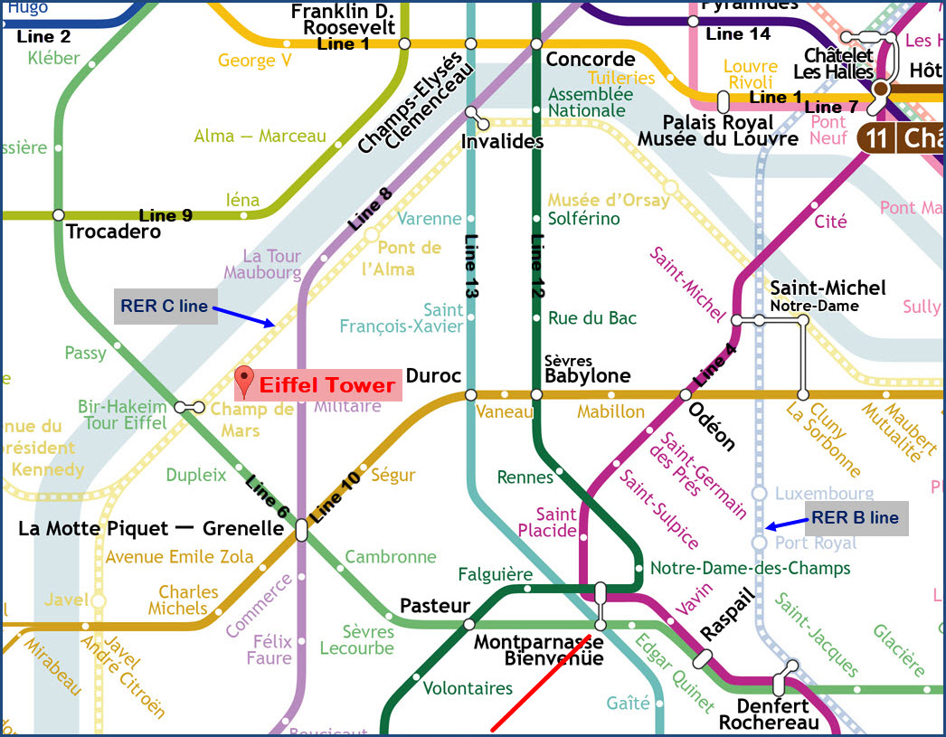
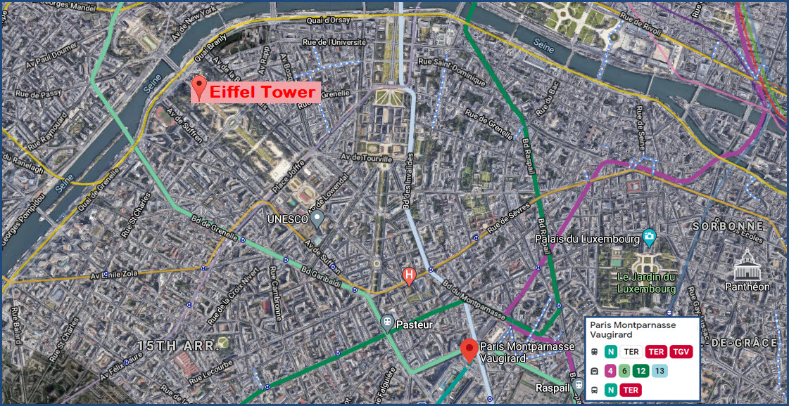
Access by train/transit:
SNCF -- Paris Montparnasse Vaugirard is the closest station/gare - then take the Line 6 Metro
Commuter Rail/RER -- the Champ de Mars-Tour Eiffel station of the C line is the closest
Metro -- the Bir-Hakeim station of Line 6 is the closest
The Scoop:
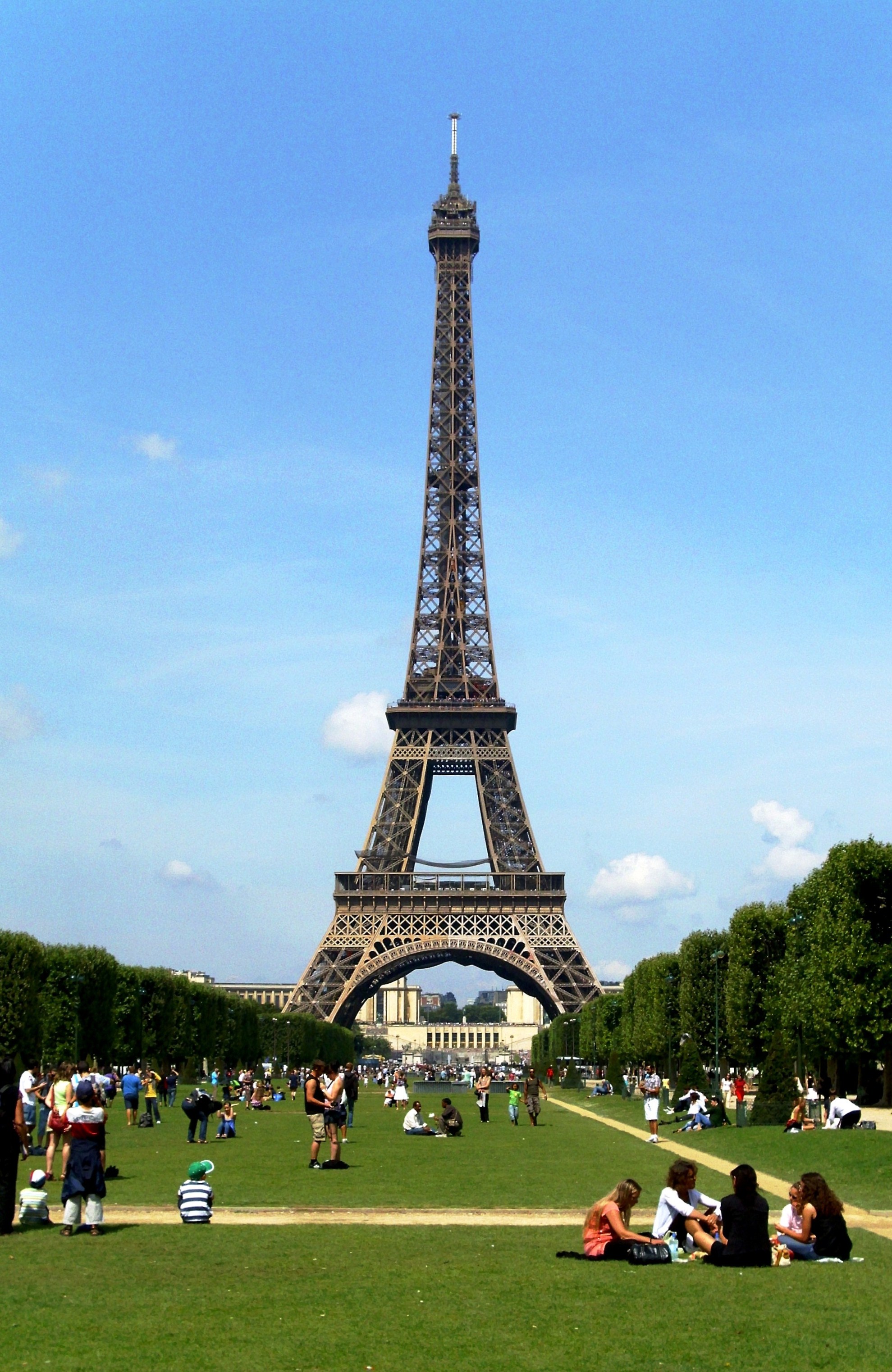
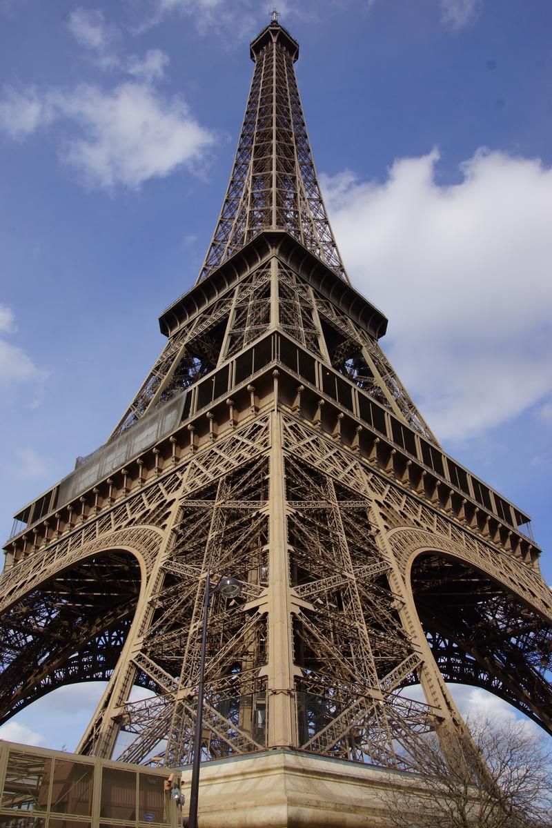
IMHO, The Eiffel Tower is (one of) if not the most beautiful structure designed by man.
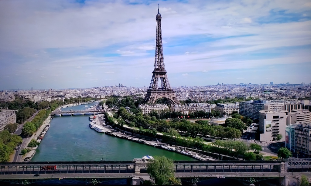
The Eiffel Tower is located in the Parc du Champ-de-Mars, which opened in 1780. The park extends from the École Militaire to the Eiffel Tower, and is a hotspot for national events. It can be accessed freely and offers the most beautiful view of the capital’s landmark monument.
There are well over 50 replicas of the Eiffel Tower around the world, some are accurate copies, while others take a little liberty in their interpretation. In whatever case, there are probably more copies of the Eiffel tower than any other man made structure.
Acknowledgements:
Denver Todd
Photographers as noted
Open Railway Map
Websites and other additional information sources of interest for the area:
https://www.unjourdeplusaparis.com/en/paris-reportage/exposition-universelle-1889 If I had a time machine, this is the first place I would want to go!
https://www.technocrazed.com/top-10-tallest-copies-of-the-eiffel-tower-in-the-world-photo-gallery
https://www.wimdu.com/blog/10-eiffel-tower-replicas-from-around-the-world
https://www.wonders-of-the-world.net/Eiffel-Tower/Copies-of-the-Eiffel-tower.php probably the best resource for Eiffel Tower replicas
https://en.wikipedia.org/wiki/Pet%C5%99%C3%ADn_Lookout_Tower
https://www.architecturaldigest.com/gallery/visit-eiffel-tower-replicas-located-outside-paris
https://www.unjourdeplusaparis.com/en/paris-insolite/repliques-tour-eiffel-dans-le-monde
https://www.wikiwand.com/en/Eiffel_Tower_replicas_and_derivatives
https://rarehistoricalphotos.com/eiffel-tower-construction/
https://www.toureiffel.paris/en/news/visit/what-time-does-eiffel-tower-light-and-sparkle
https://www.architecturaldigest.com/story/eiffel-tower-paris-secret-apartment
https://en.wikipedia.org/wiki/List_of_the_72_names_on_the_Eiffel_Tower
https://www.biography.com/scientist/gustave-eiffel
https://en-academic.com/dic.nsf/enwiki/639512 List of the 72 names on the Eiffel Tower
Traveling by Train around Paris
The national network of intercity trains is operated by France's equivalent of Amtrak, the SNCF. SNCF stands for Société Nationale des Chemins de Fer Français, and was formed in 1938. As of 2009, France had 3,054 train stations.
If you're coming from London by train, you will be on a train called the Eurostar. It runs between the Pancras International station in London to Gare du Nord in Paris. A standard train ticket from London to France starts around $74 (in 2022).
SNCF runs high speed trains called TGV's: Train à Grande Vitesse.
There are six major train stations in Paris serving SNCF's intercity trains:
-- Gare du Nord
-- Gare de l'Est
-- Gare de Lyon
-- Gare Saint-Lazare
-- Gare Montparnasse
-- Gare d'Austerlitz
And nearby, there is:
-- Gare de Bercy
-- Gare de Versailles Chantiers
Gare du Nord is Europe's busiest train station, with some 700,000 people passing through every day. It opened in 1864, and completed the following year.
For traveling around Paris, you have a number of alternatives: The subway system, regional commuter/express trains, and a tramway system.
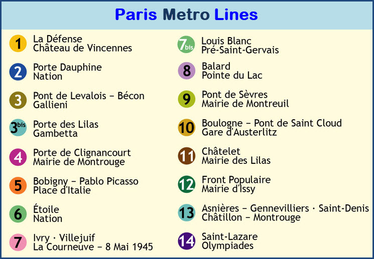
The Paris Metro -- The subway system of Paris is known as the Metro de Paris, the first line of which opened without ceremony on 19 July 1900, during the World's Fair (Exposition Universelle). Most cities outside of the U.S.A. call their subway system Metro systems (and some like the Baltimore system call it both, the Metro Subway :-). The Paris Metro system has 16 lines, 304 stations (another source says 380) with 64 transfers between lines, approx 700 cars, and around 170 miles of track. Additionally, it is one of the densest metro systems in the world, with 244 stations within the 86.9 km2 (34 sq mi) of the City of Paris. It's a standard gauge system using 750VDC for power via a third rail. Lines 1 and 14 are automated, with Line 4 scheduled to be automated by the fall of 2022. A single metro ticket costs €1.90. The Paris Visite travel pass allows you to use all of the public transport networks: the metro, tramway, bus, RER and SNCF Transilien networks. The Paris system is the second busiest in Europe behind the Moscow Metro, and the 10th busiest in the world. Besides the Métro, central Paris and its urban area are served by five RER lines (developed from the 1960s), ten tramway lines (developed from the 1990s) with an additional four under construction, eight Transilien suburban trains, as well as three VAL lines at Charles de Gaulle Airport and Orly Airport. A large expansion program is currently under construction with four new orbital Métro lines (15, 16, 17 and 18) around the Île-de-France region, outside Paris city limits. Other extensions currently under construction are on Line 4, Line 11, Line 12 and Line 14. Further plans exist for Line 1 and Line 10, as does a merger of Line 3bis and Line 7bis. Five Paris Métro Lines (1, 4, 6, 11 and 14) run on a rubber tire system developed by the RATP in the 1950s (the same system is used on the Montreal, Santiago, Mexico City and Lausanne metro systems).
The RER -- the RER is short for the Réseau Express Régional. It is a hybrid commuter rail and rapid transit system serving Paris and its suburbs. The RER combines the operations and roles of a local city-centre underground rail system and suburbs-to-city-centre commuter rail. The RER also complements the Paris Metro, giving Parisians and tourists a larger transport network in the centre of Paris. From Wikipedia: The RER contains 257 stations, 33 of which are within the city of Paris, and runs over 587 km (365 mi) of track, including 76.5 km (47.5 mi) underground. Each line passes through the city almost exclusively underground and on dedicated tracks. The RER is operated partly by RATP, the transport authority that operates most public transportation in Paris, and partly by SNCF, the national rail operator. In spite of this, the system uses a single fare structure and no transfer is needed between sections run by the two operators. RATP manages 65 RER stations, including all stations on Line A east of Nanterre-Préfecture and those on the branch to Saint-Germain-en-Laye. It also operates stations on Line B south of Gare du Nord. Other stations on the two lines and those on lines C, D and E are operated by SNCF. Of the RER stations operated by RATP, 9 have interchanges with Métro lines, and 9 allow transfer to SNCF's Transilien service. In the first phase of construction, the Vincennes and Saint-Germain lines became the ends of the east-west Line A, the central section of which was opened station by station between 1969 and 1977. On its completion, Line A was joined by the initial southern section of the north-south Line B. During this first phase, six new stations were built, three of which are entirely underground. The RER network came into being on 9 December 1977 with the joining of the eastern Nation-Boissy segment and the western Auber-Saint-Germain-en-Laye segment at Châtelet – Les Halles. The southern Ligne de Sceaux was simultaneously extended from Luxembourg to meet Line A at Châtelet – Les Halles, becoming the new Line B. The system of line letters was introduced to the public on this occasion, though it had been used internally by RATP and SNCF for some time.

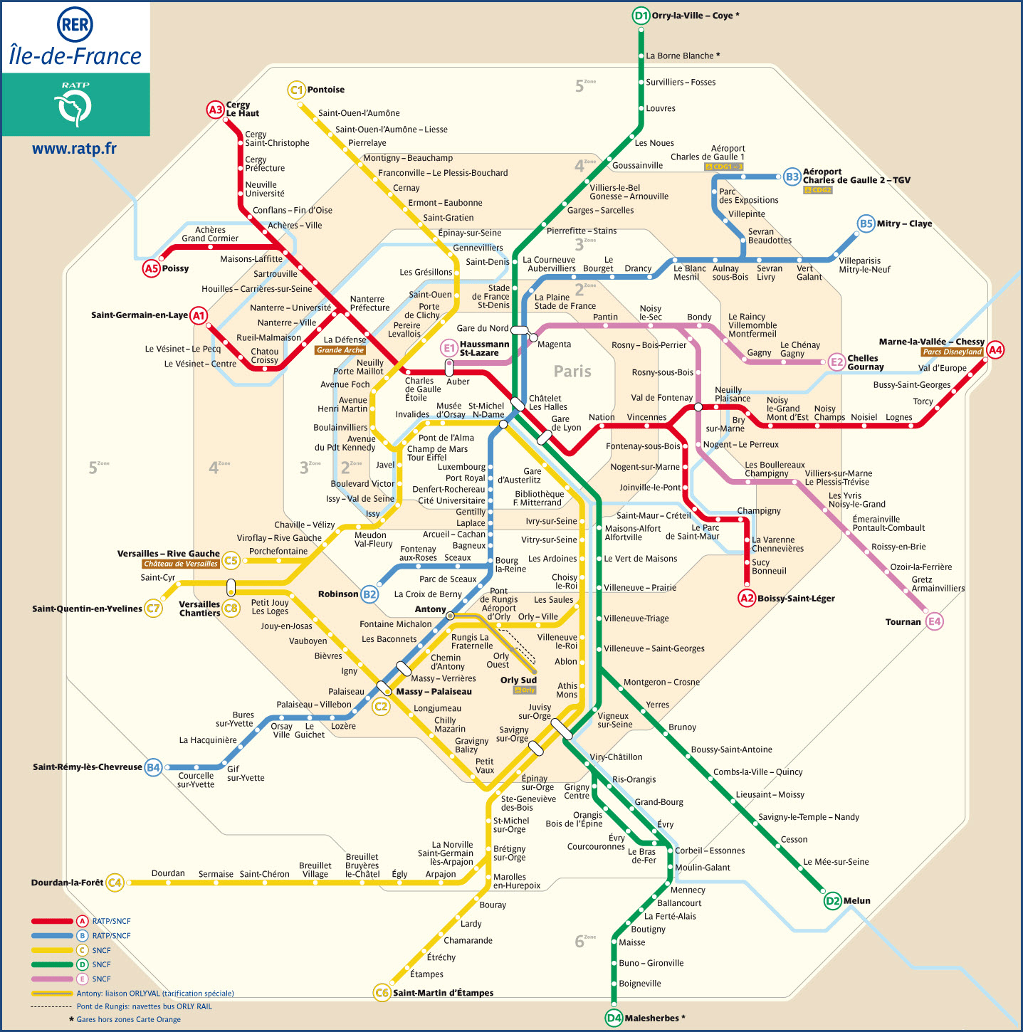

 Click the thumbnail for a map of all of the above services.
https://www.eurostar.com/us-en
https://upload.wikimedia.org/wikipedia/commons/2/2b/Carte_M%C3%A9tro_de_Paris.jpg
https://en.wikipedia.org/wiki/Paris_M%C3%A9tro
https://parisbytrain.com/paris-rer/
https://www.introducingparis.com/rer-train
https://en.wikipedia.org/wiki/R%C3%A9seau_Express_R%C3%A9gional
Here is a fairly comprehensive list of the replicas of the Eiffel Tower (adapted from the Wonders of the World page). As I travel the world tracking them down, the numbers will be adjusted accordingly.
My complete list of replicas is located HERE.
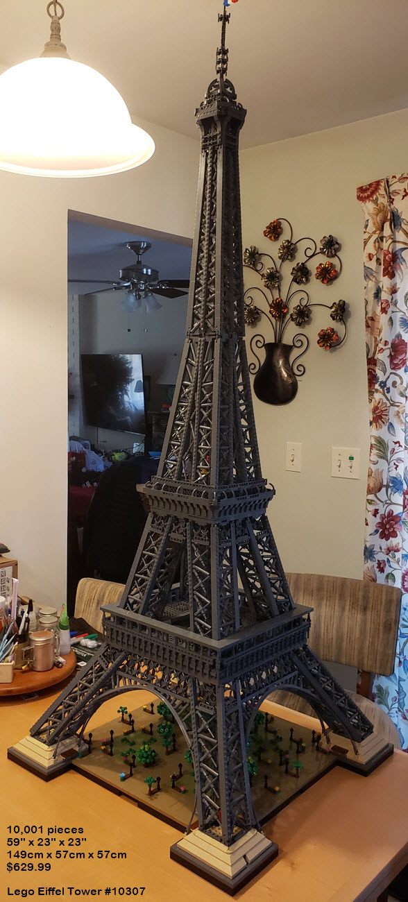
Lego has made a number of versions of the Eiffel Tower, increasing in size. Around Thanksgiving of 2022 (in the U.S.), they introduced their latest version, model 10307 - a 10,001 piece, 58 inch (149cm) tall version of it. It took around 40 hours to build.
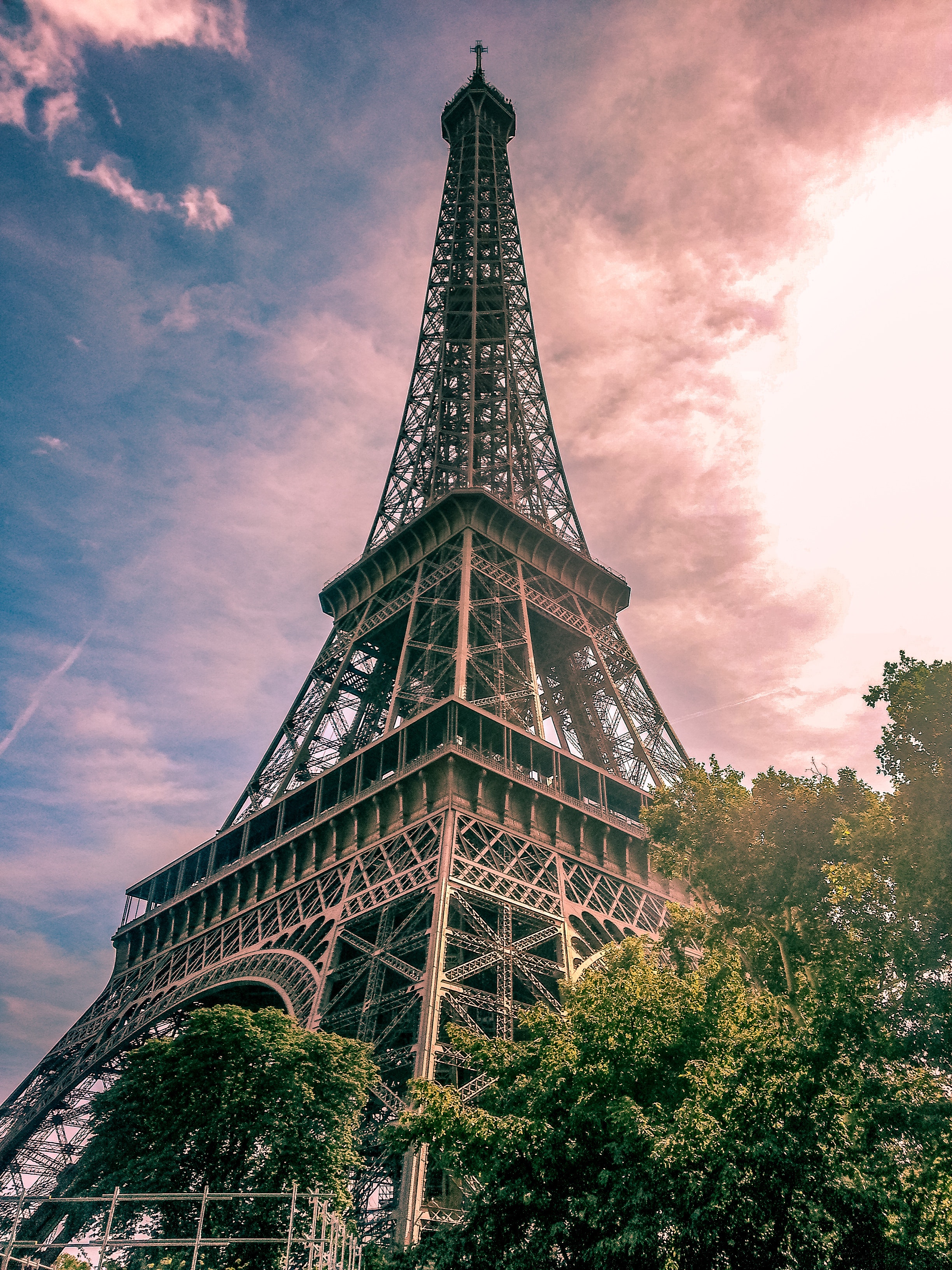
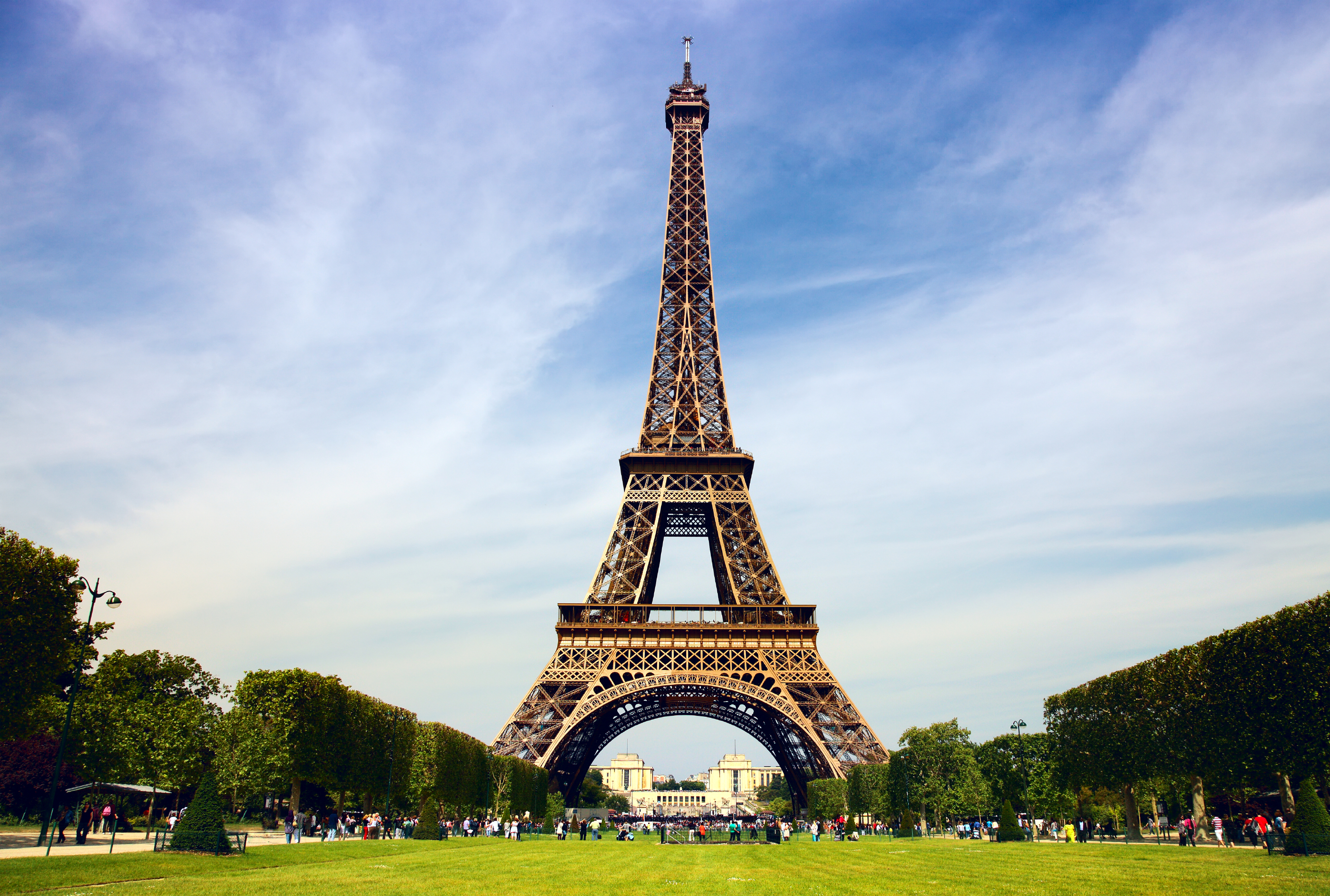
Pictures
Daytime Pix

Detail Pix

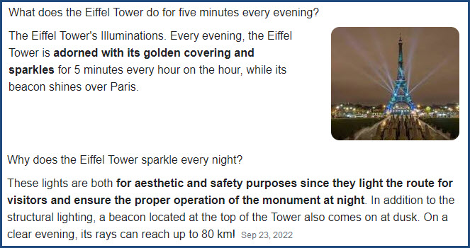
Nightime Pix
I believe I am breaking French law by posting these pictures..... Why? Because art is copyrighted in France, and the light shows are considered art.


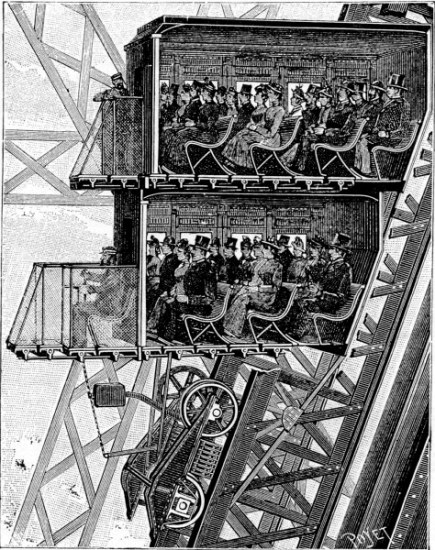
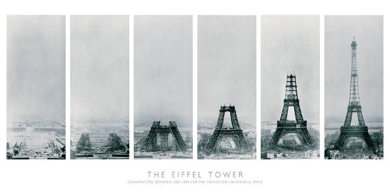
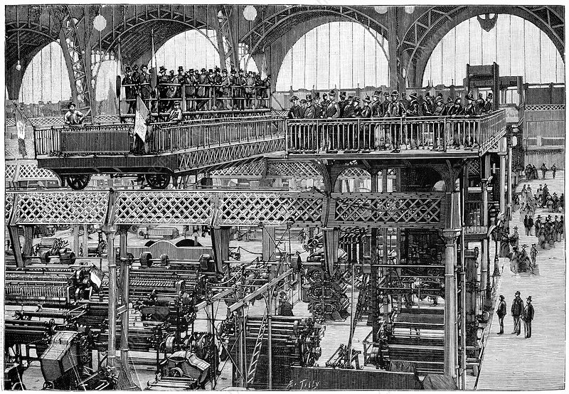
Construction Photos


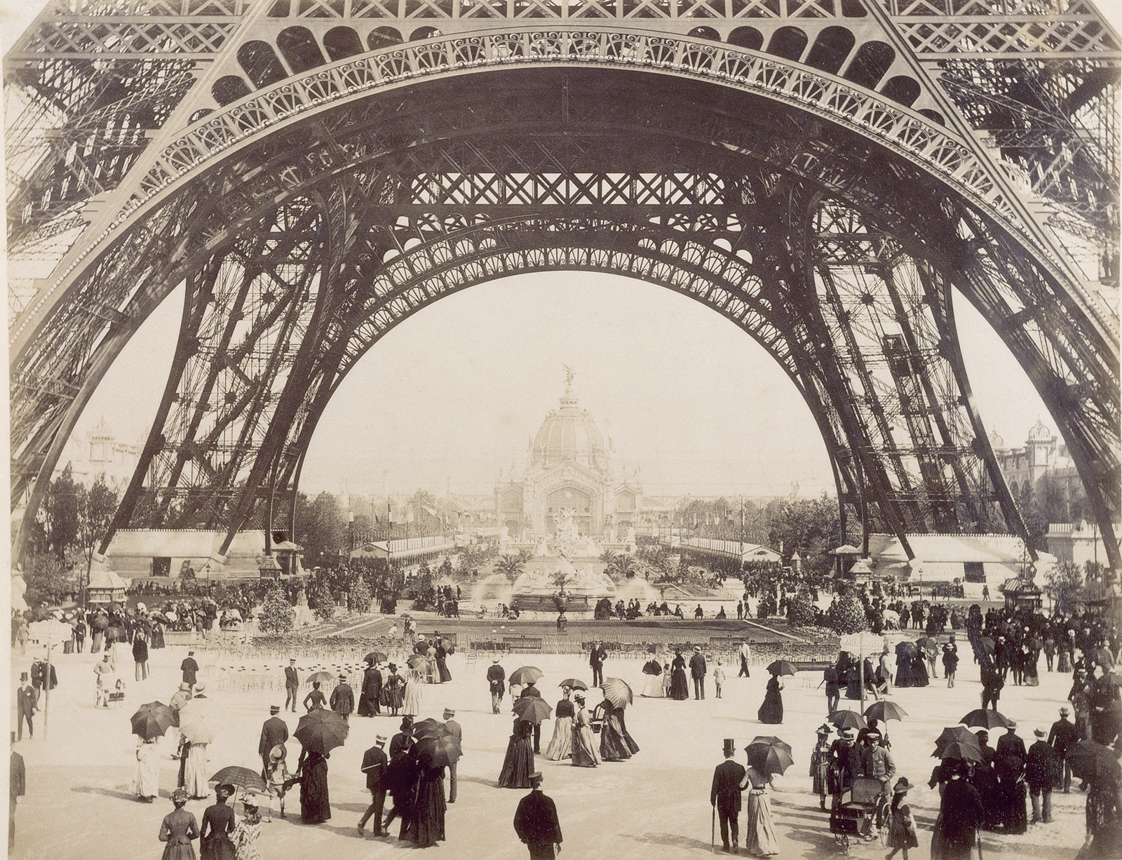
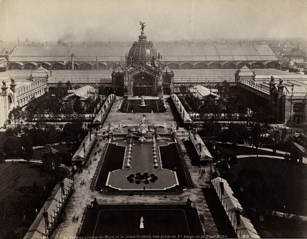
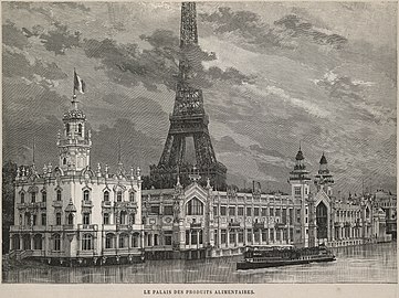
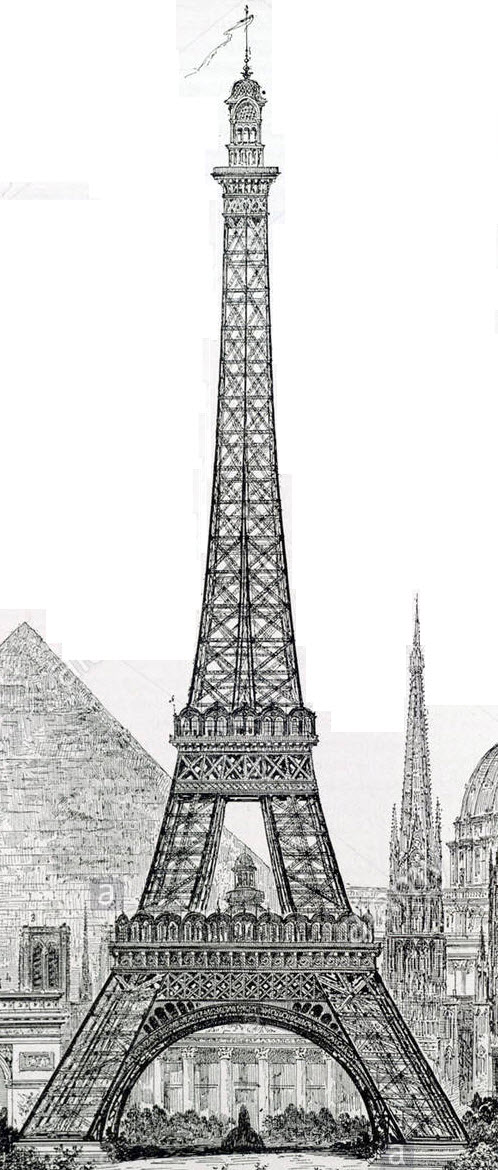
The 1889 Expo


 what it looked like before I cleaned it up
 What if? A nice steam-punk version :-) I love it!
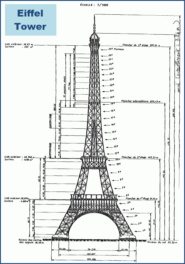
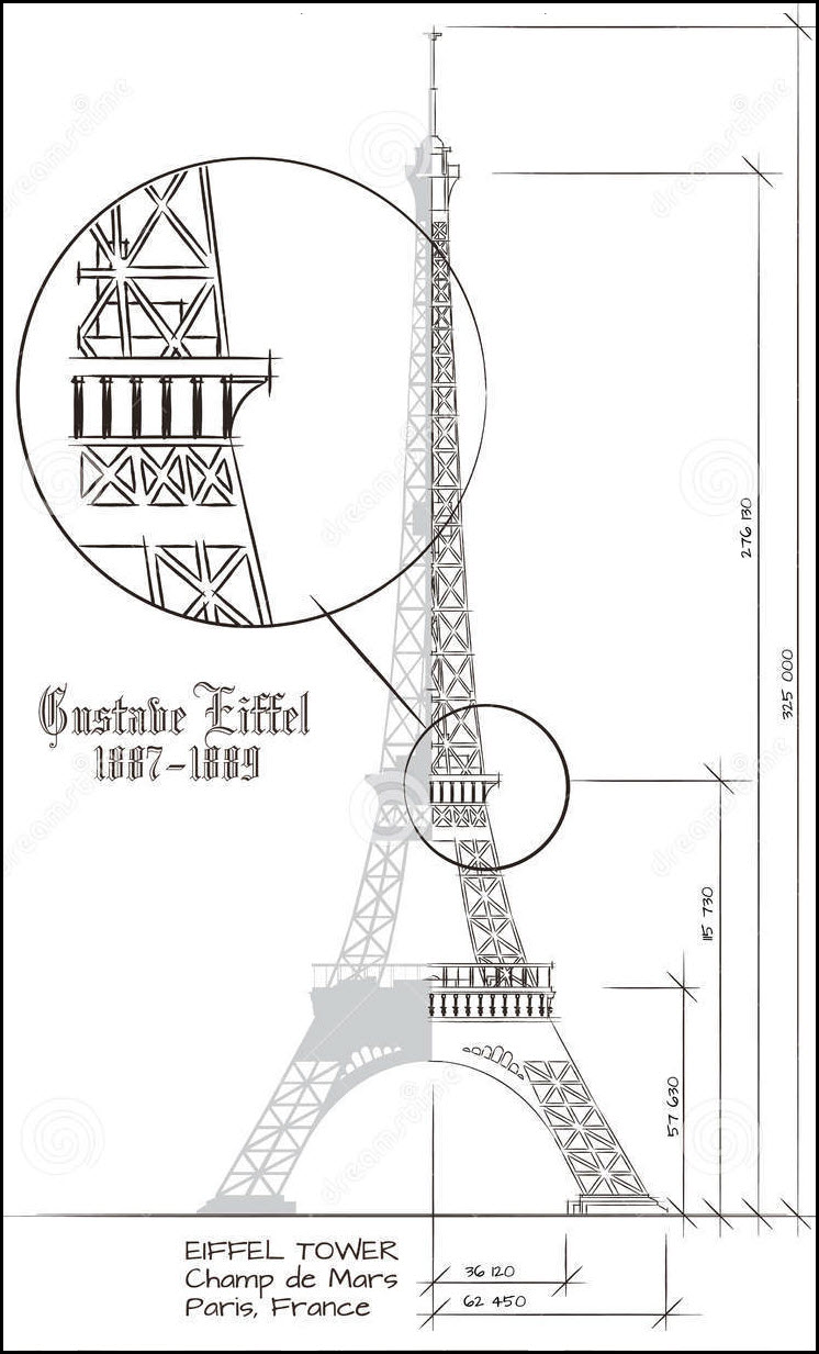
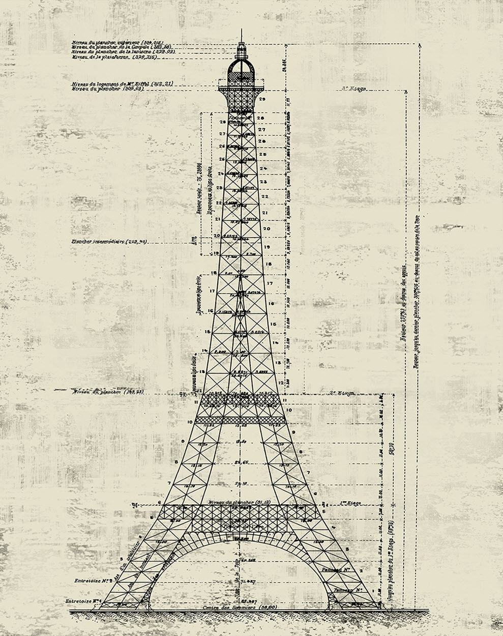
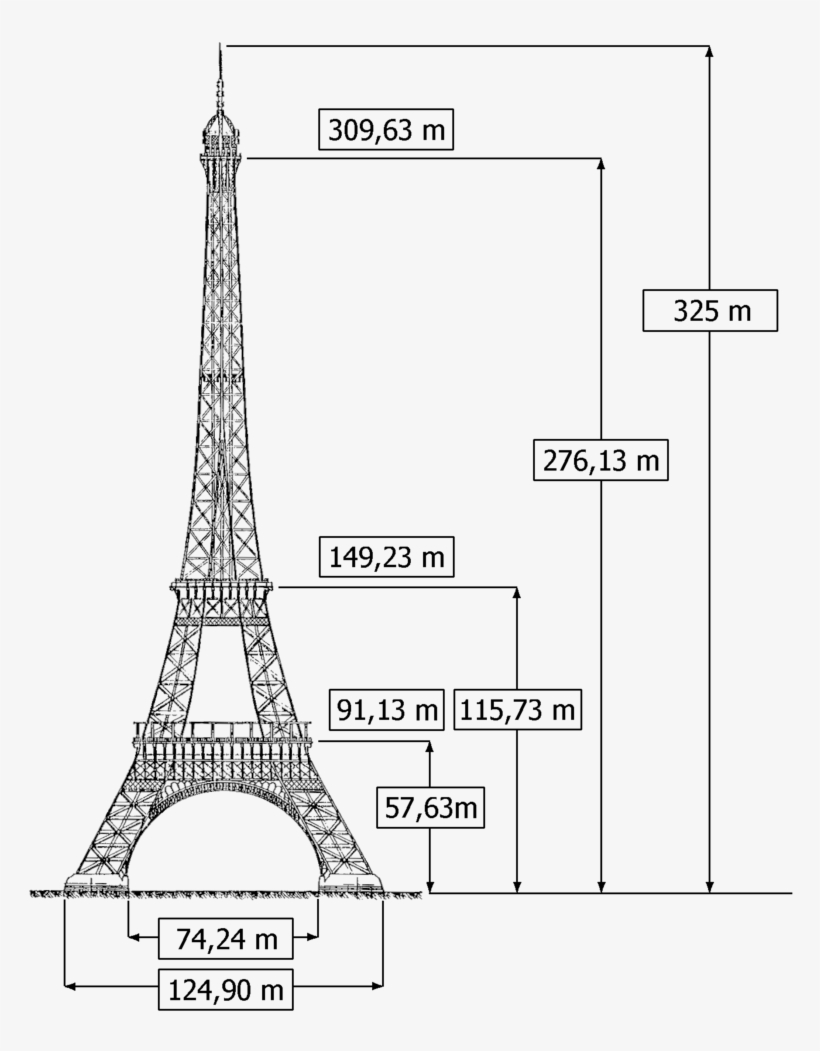
If you want to make your own copy of the Eiffel Tower, you can start off with the drawing below. I took one of the above drawings and imported it into Corel Draw, then scaled a ruler to the dimensions on the drawing until they matched, and used the result to measure everything with. They should be pretty accurate for the most part. Most of the above drawings have 129.4m (409.6ft) as the width of the base, but that is over the concrete footings - not the actual base of the tower.
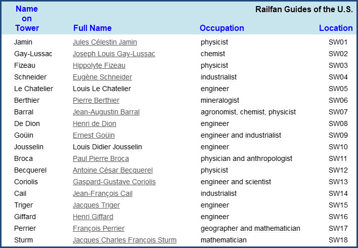
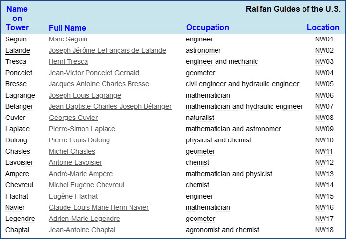
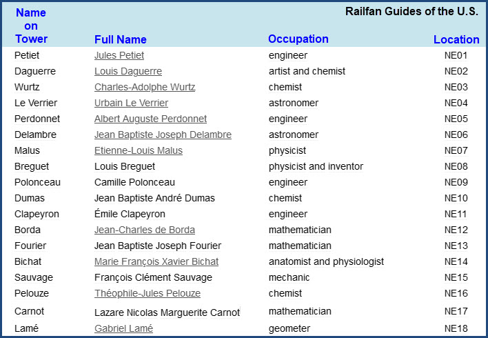
Names of the 72 Scientists, Engineers, and Mathematicians on the Eiffel Tower
The sides have been named after the parts of Paris that each side faces: the NE side is also known as the La Bourdonnais side; the NW side is also known as the Trocadéro side; the SE side is also known as the Military School side (École militaire en Francais); and the SW side is also known as the Grenelle side. Grenelle is an area just southwest of the Eiffel Tower. The Bourdonnais side is named after a French Naval officer of the early 1700's, and BTW, his grandson was considered "the best" chess player of the early 1800's! The Military School just SE of the Eiffel Tower is self explanatory. The Trocadéro side faces a beautiful park (in it's own right) on the other side of the Seine River, and contains: the Paris Aquarium, a beautiful garden, the Musée national de la Marine de Paris, the Musée national des Monuments Français, and the Palais de Chaillot among many other beautiful sites.


Location 1 is on the left as you view the names, 18 is all the way to the right.

As Seen On TV and Elsewhere :-)
As famous as the Eiffel Tower is, the media and advertisers like to use it as much as they can, here are some of the instances I have caught on TV.
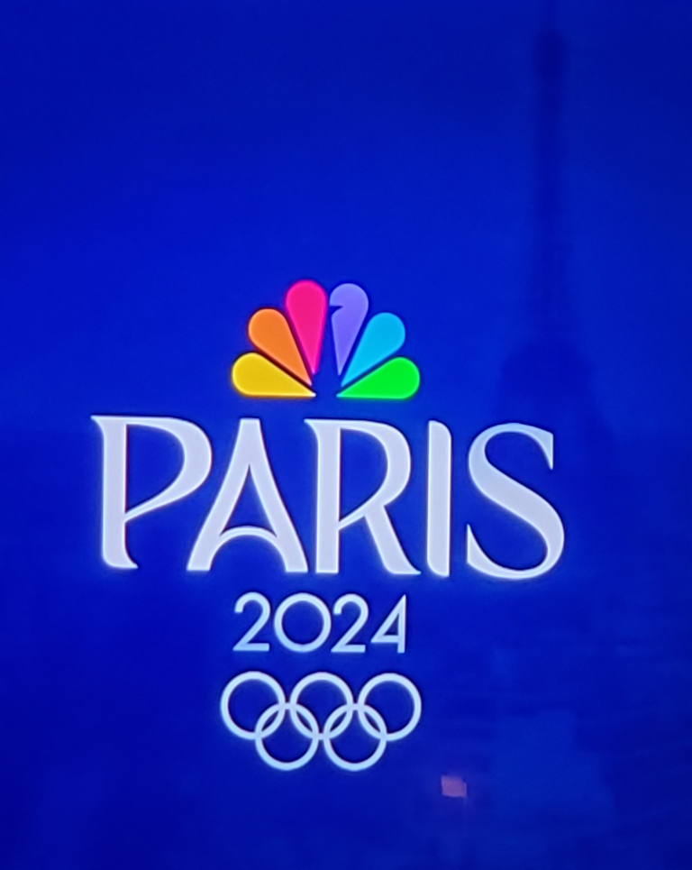
As of January 2023, NBC has already started advertising their coverage of the Olympics in Paris in 2024:

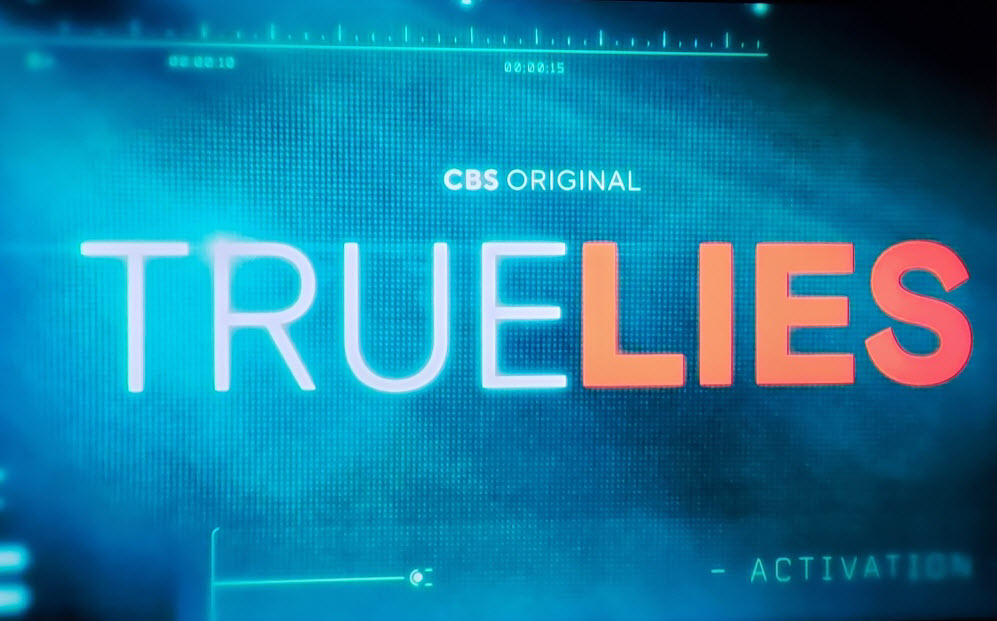
Starting in March 2023, CBS is debuting a new spy series based on the movie of the same name:

An ad (for something, didn't take notes) on ABC back in November 2022:

Back in November 2022, Lancôme was running this ad for their La Vie Est Belle parfume featuring Julia Roberts,
I believe they shot the scene with Julia during the five minutes of "sparkle" (seen on all U.S. networks):


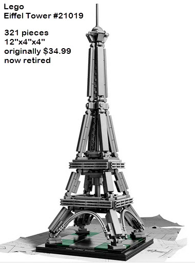
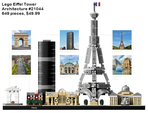
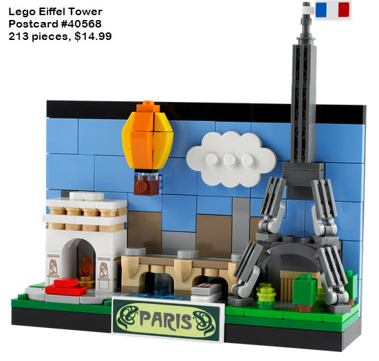
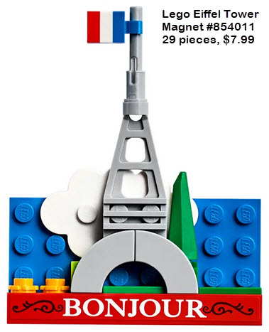
Lego Versions
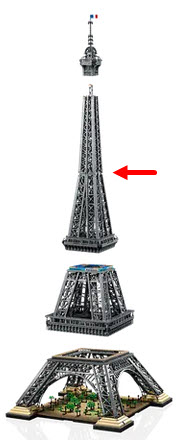
LEGO has made several versions of the Eiffel Tower. Their latest and largest came out at Thanksgiving time 2022. Model #10307 has 10,001 pieces and runs around $630,- it is 4-1/2 feet high, and separates into 5 pieces (The picture below shows it in 4 pieces, but the one section also separates at the red arrow). Be forewarned tho, if you're going to move it, treat it very GENTLY, because it will fall apart with no effort - DO NOT move it in one piece!!! Mine was short one piece, can you spot where it was supposed to go in the picture below? Took about a week to build.


Disclaimers:
New format 10/26/23: Please check out my disclaimer page for my standard dribble and contact info here
RAILFAN GUIDES HOME
RAILROAD SIGNALS HOME
NEW FEB06/2021, FEB07/08/2021, MAR10/21/2021, SEP18/2021, JAN28/29/30/31/2023, FEB03/2023, MAY13/16/2023, MAY09/2025
Last Modified 09-May-2025