RAILFAN GUIDES of the U.S.
Todd's Railfan Guide to
WASHINGTON DC
Train and Transit Things to See
In General
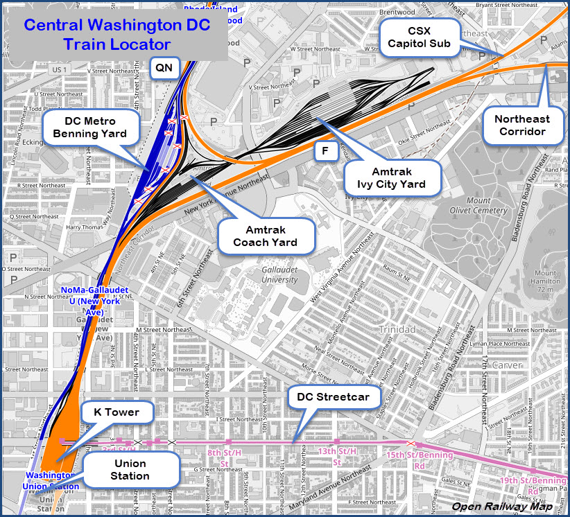
Map
Sights
Floobydust
RAILROAD SIGNALS HOME
As stated on the homepage, the DC area lacks (in numbers) things to take pictures of if you came into town strictly for seeing what's left of the "old" days.
You come to Washington DC for the backdrops and the combinations you cannot get elsewhere. For instance:
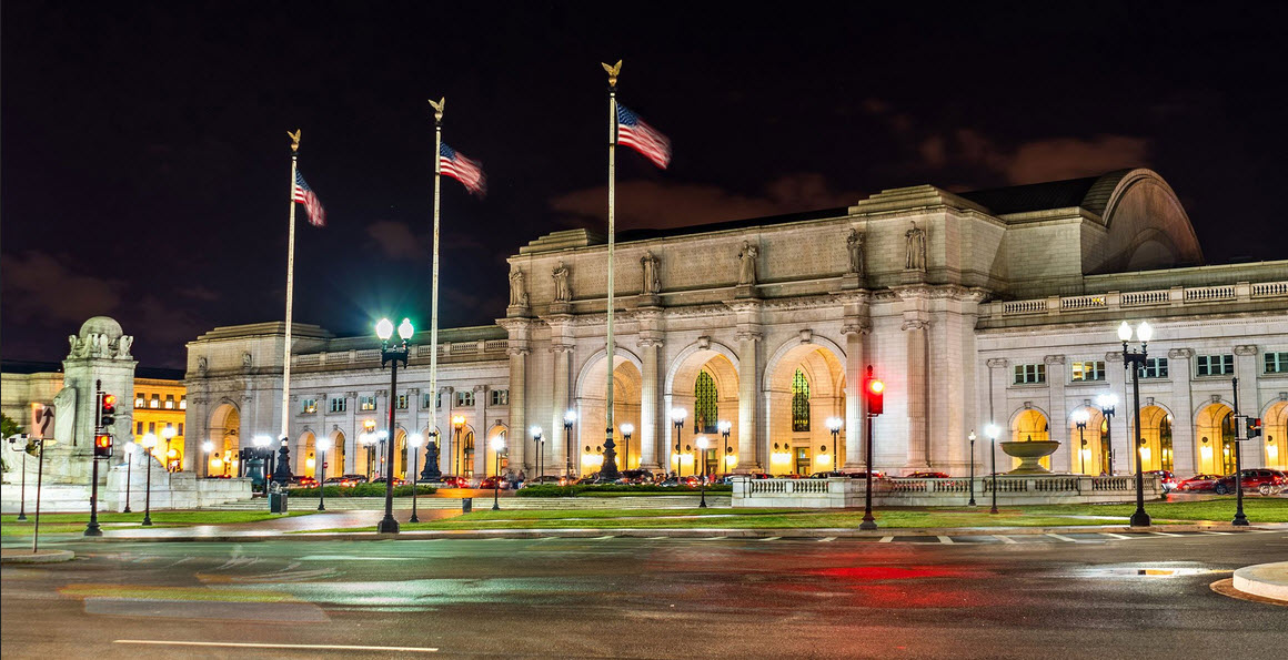
-- Looking down the throat of Union Station from New York Avenue, the combination of overhead wire, B&O dwarf CPL's, the Capitol building, MARC, VRE, and Amtrak.
-- A CPL signal made from Pennsy PL parts (off New York Avenue, behind the Howard Johnson hotel).
-- Amtrak, MARC, and the VRE in the same yard, and maybe some Metro cars thrown in too if you can catch all four together (off New York Avenue, again).
-- The "newest" streetcar system in the U.S. (for now), the DCstreetcar.
-- Trains and the Metro system crossing the Potomac River, on bridges right next to each other.
-- In service MARC trains and Amtrak trains coming into DC on parallel tracks, again, off New York Avenue.
-- There are a number of unique places to catch parallel action:
Alexandria VA (Metro and VRE/Amtrak/CSX)
Rockville MD (Metro and CSX/Amtrak)
New Carrolton MD (Metro and MARC/Amtrak)
Union Station (Metro and Amtrak/MARC/VRE) from the bike trail along the tracks
Washington DC is conveniently served by three airports: Dulles, National, and BWI, altho BWI is technically a Baltimore airport.
National is serviced by the DC Metro Blue & Yellow lines.
Metro service to Dulles was slated to begin in 2015 with the new Silver Line, but as of 2020, we are still waiting for the last part of the line to open, so we still don't have train service to the airport.
BWI is served with Amtrak and MARC trains, but isn't as convenient as getting to National airport for easy in/easy out. BWI has the advantage tho of a lot more flights!
Acknowledgements:
Jersey Mike
Websites and other additional information sources of interest for the area:
http://www.dcnrhs.org/learn/washington-d-c-railroad-history/timeline-of-washington-d-c-railroad-history?tmpl=%2Fsystem%2Fapp%2Ftemplates%2Fprint%2F&showPrintDialog=1
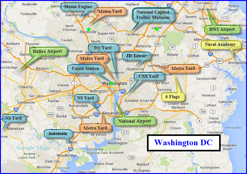
Green dots indicate where "vintage" depots still stand, the one in Rockville is not used as a station.
Stations/Depots
Railroad Yards
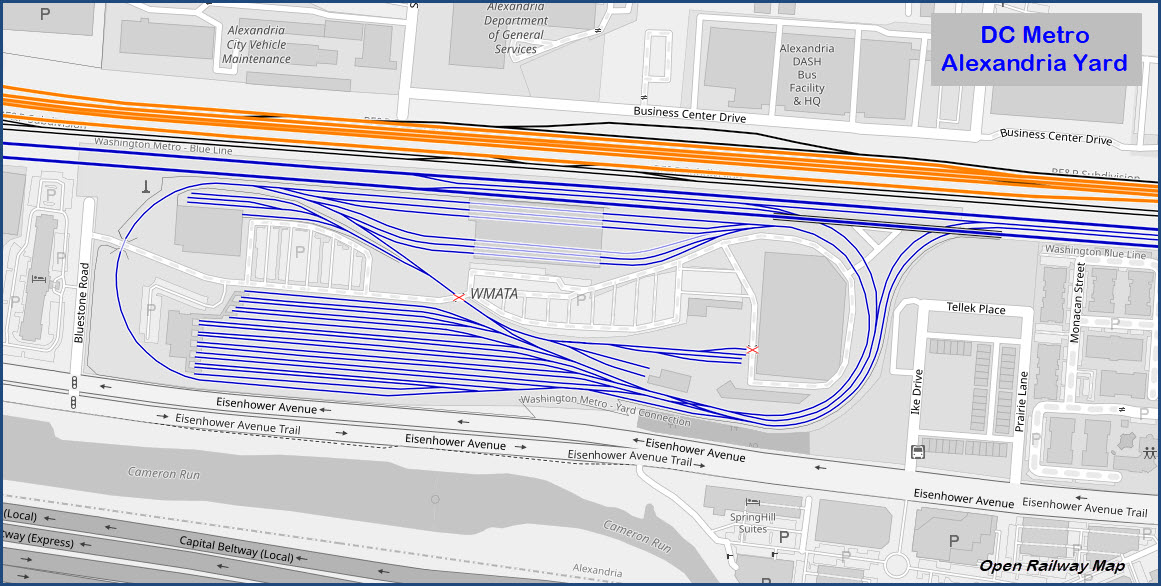
Metro Subway Yards
Towers
Metro Bus Yards
Washington's Union Station
https://www.railfanguides.us/dc/map1/index.htm
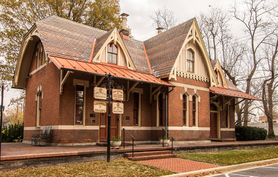
Rockville MD - ex-B&O Depot
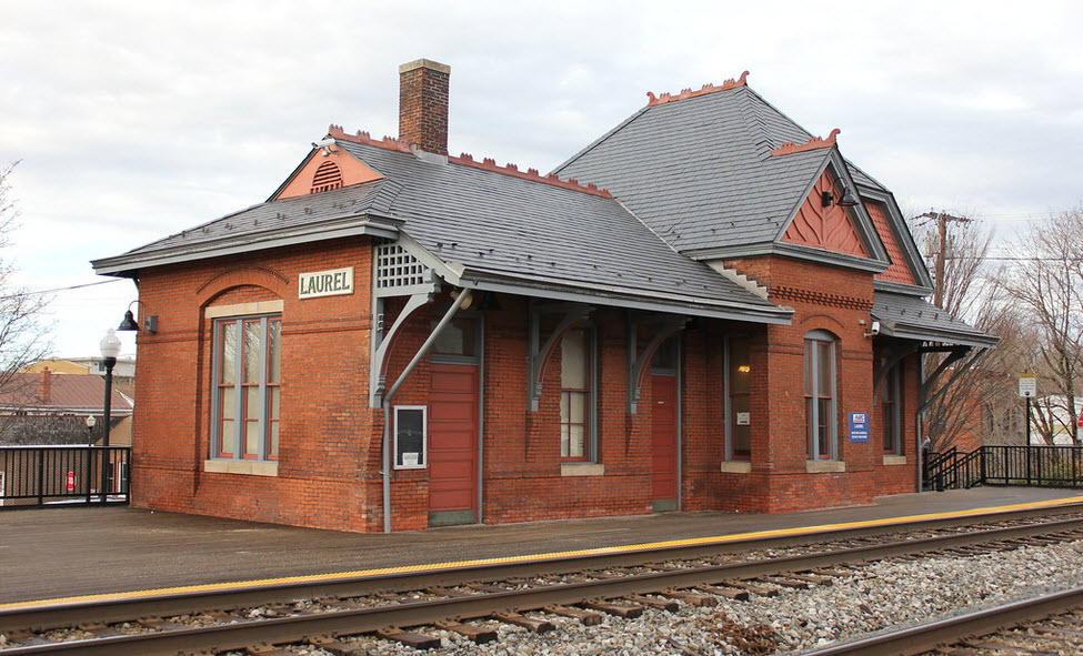
Laurel MD - ex B&O Depot
https://www.railfanguides.us/md/laurel/index.htm
CSX's Benning Yard
Norfolk Southern's Manassas Yard
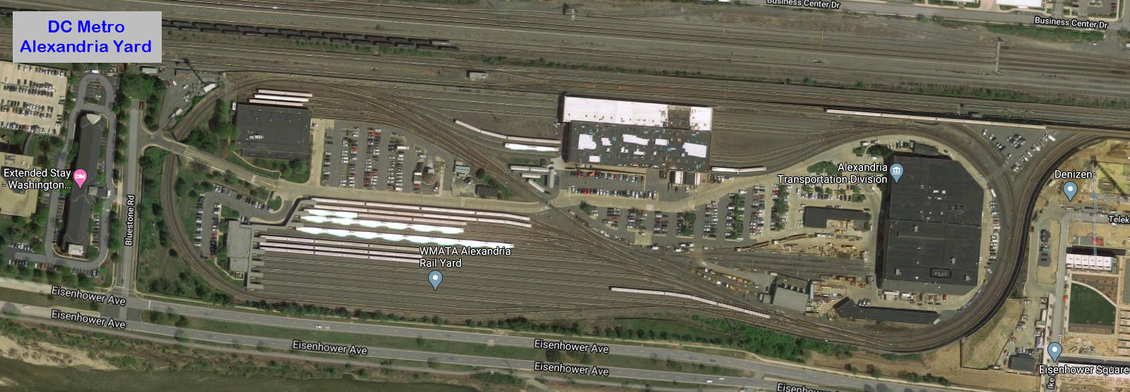
Norfolk Southern's Alexandria Yard
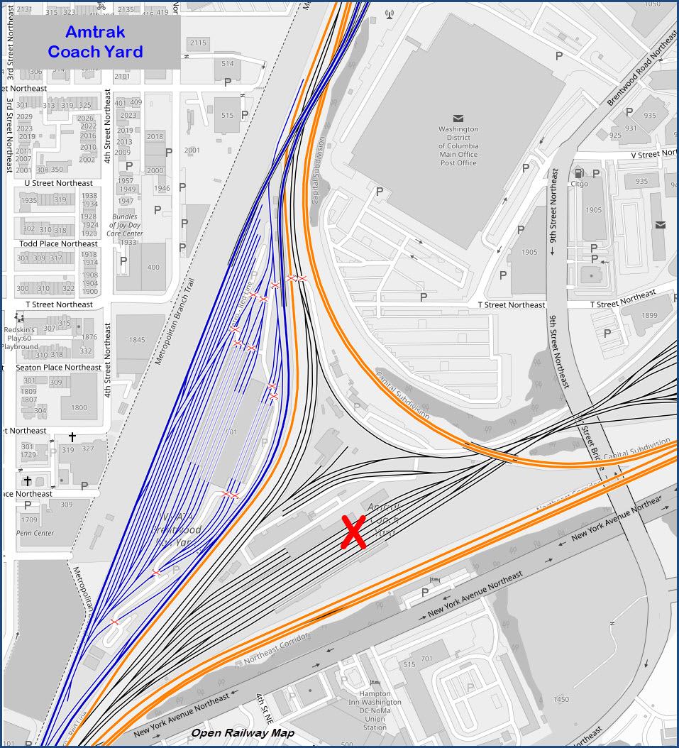
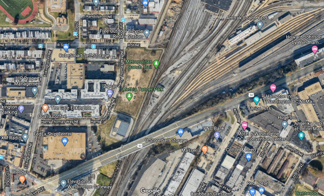
Amtrak Coach Yard
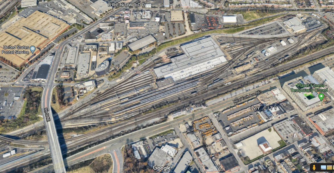
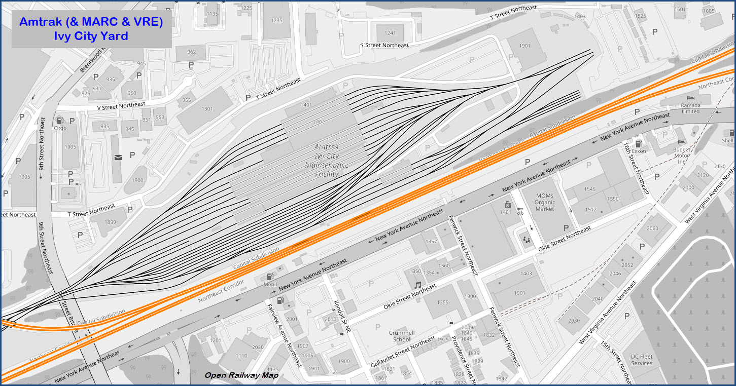
Amtrak's Ivy City Yard
https://www.railfanguides.us/dc/map2/index.htm
Alexandria
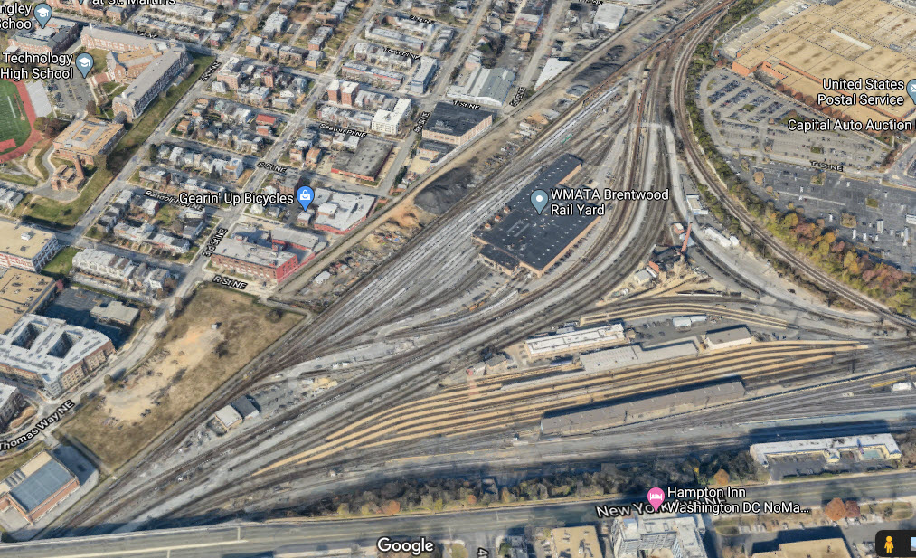
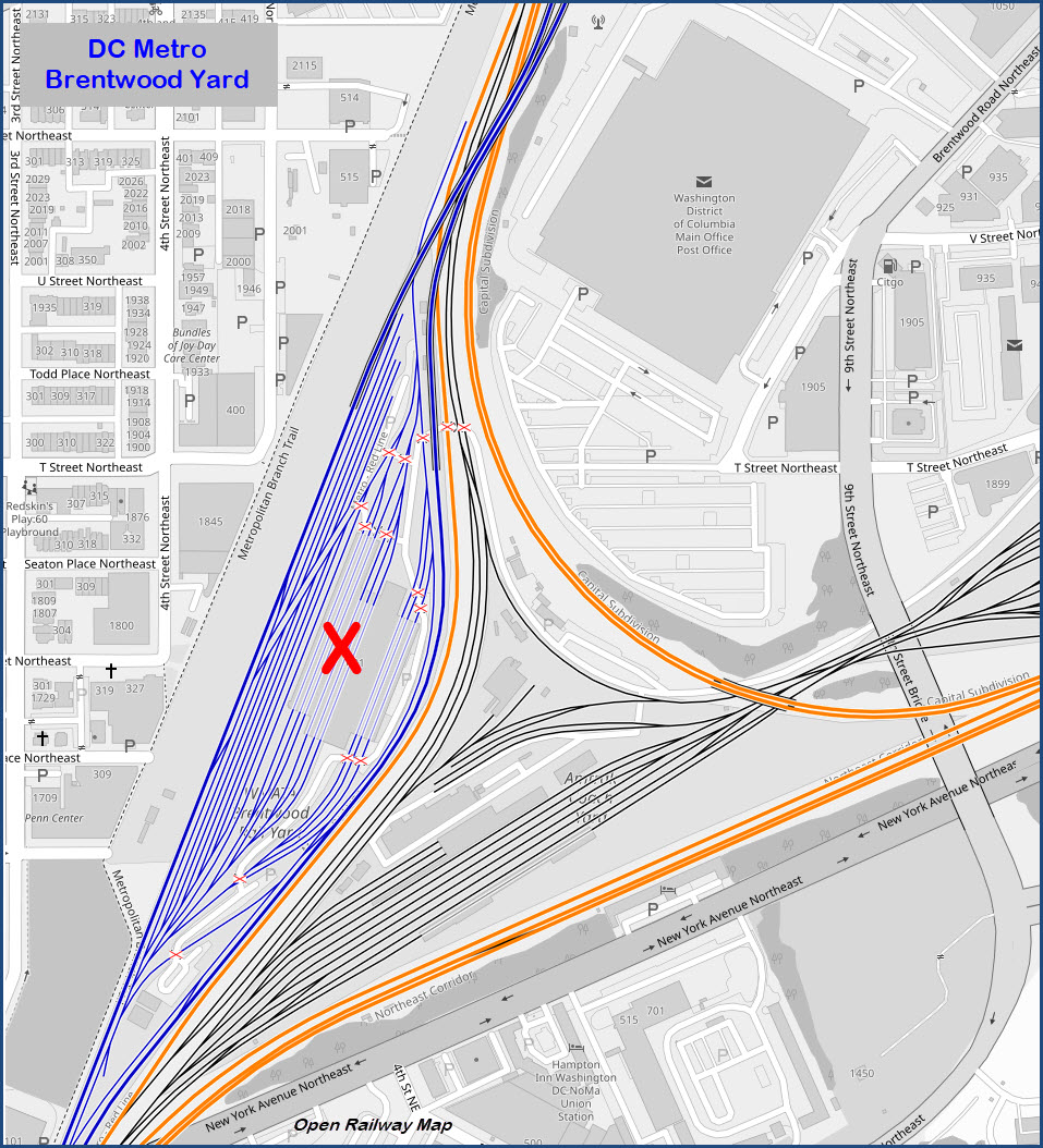
Brentwood
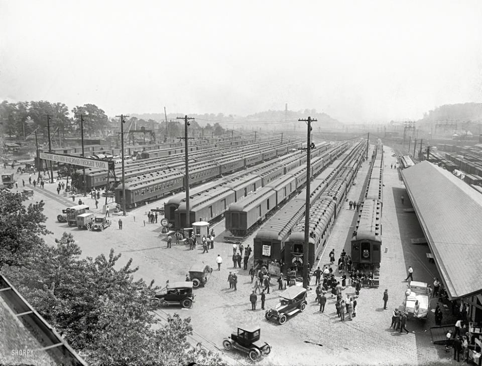
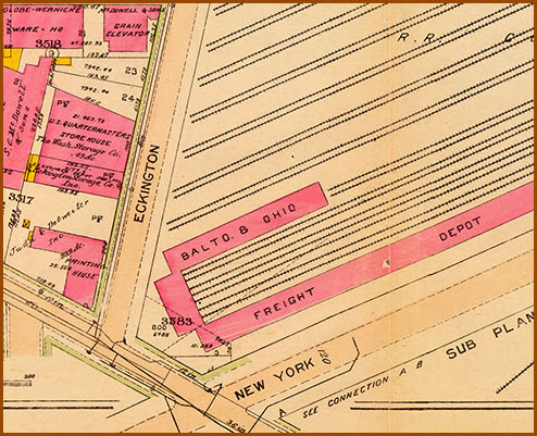
If I get my history right, the Brentwood facility was built on the grounds of the former B&O Eckington Coach Yard, in fact, back in the early 1900's, the yard was a huge freight yard.
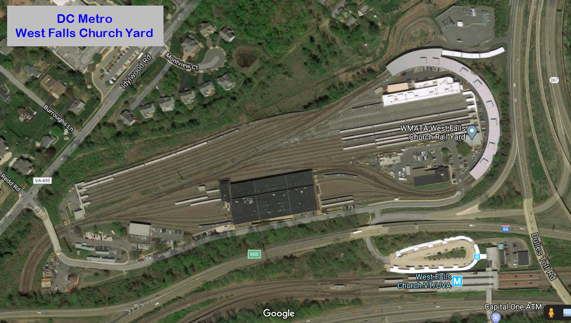
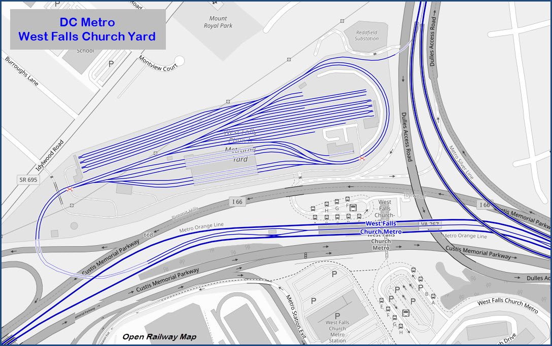
West Falls Church
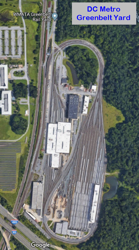
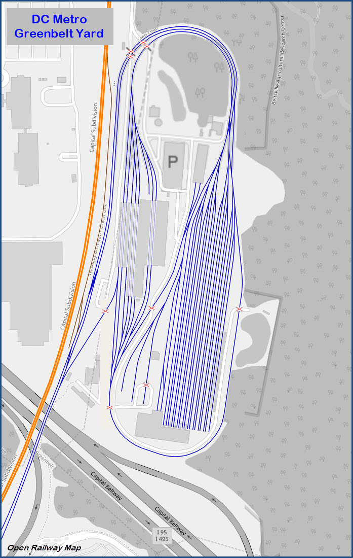
Greenbelt
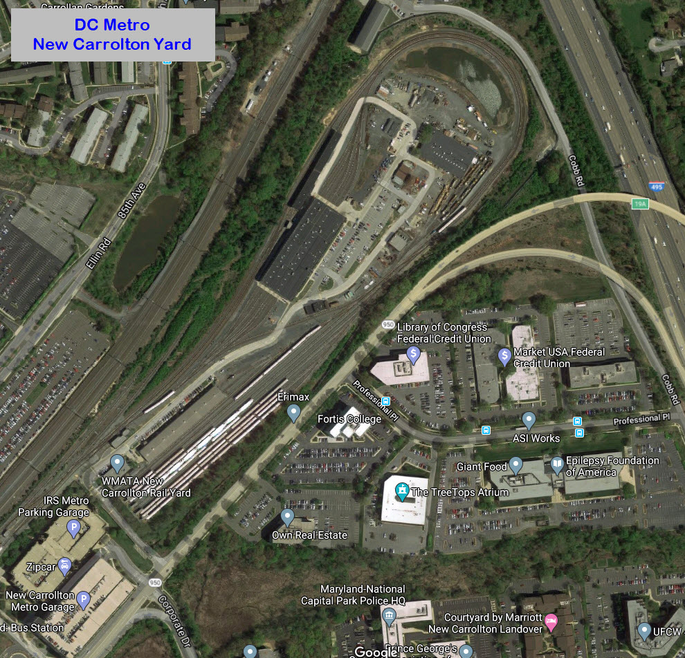
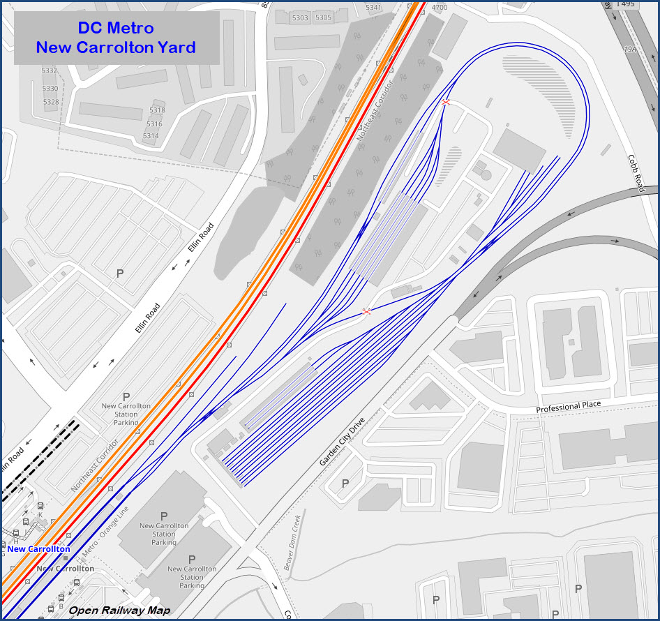
New Carrolton
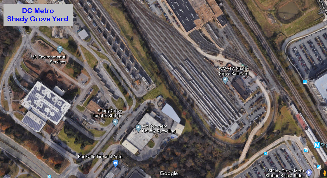
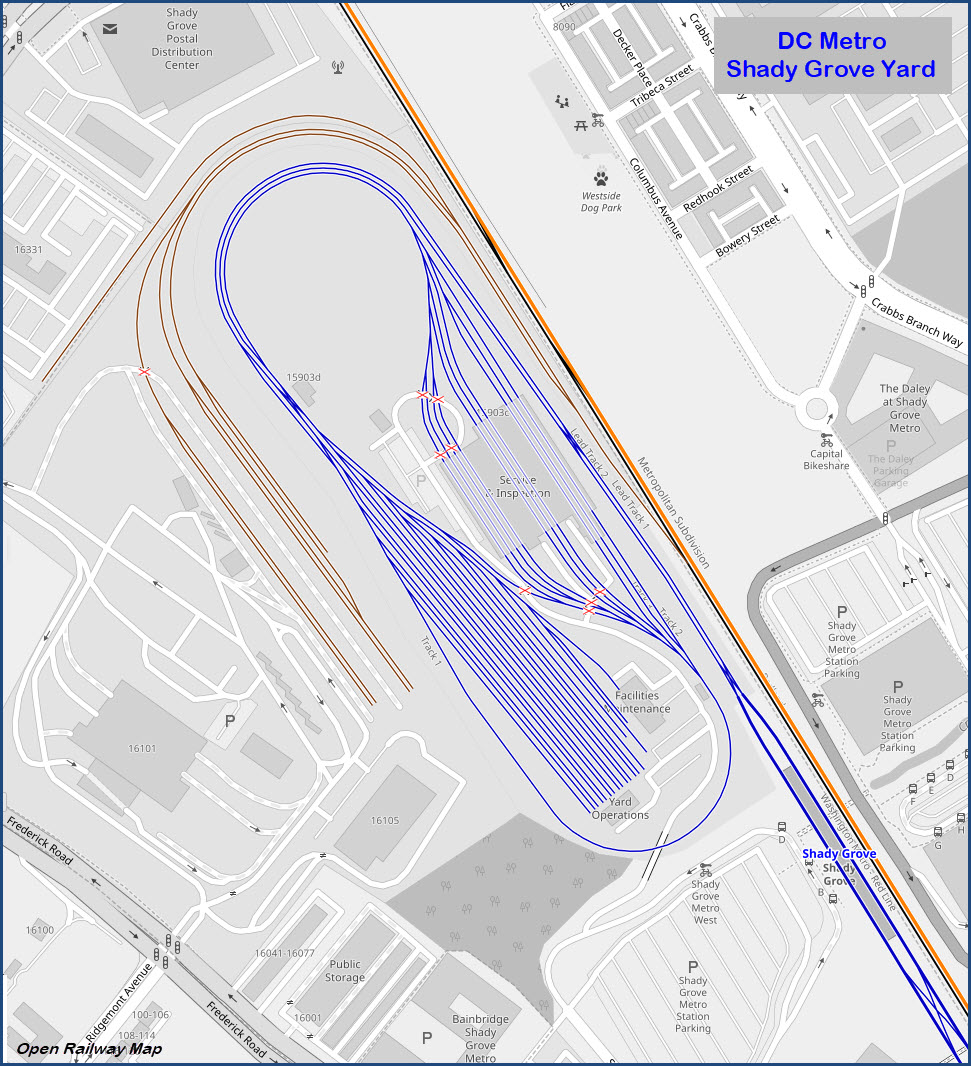
Shady Grove
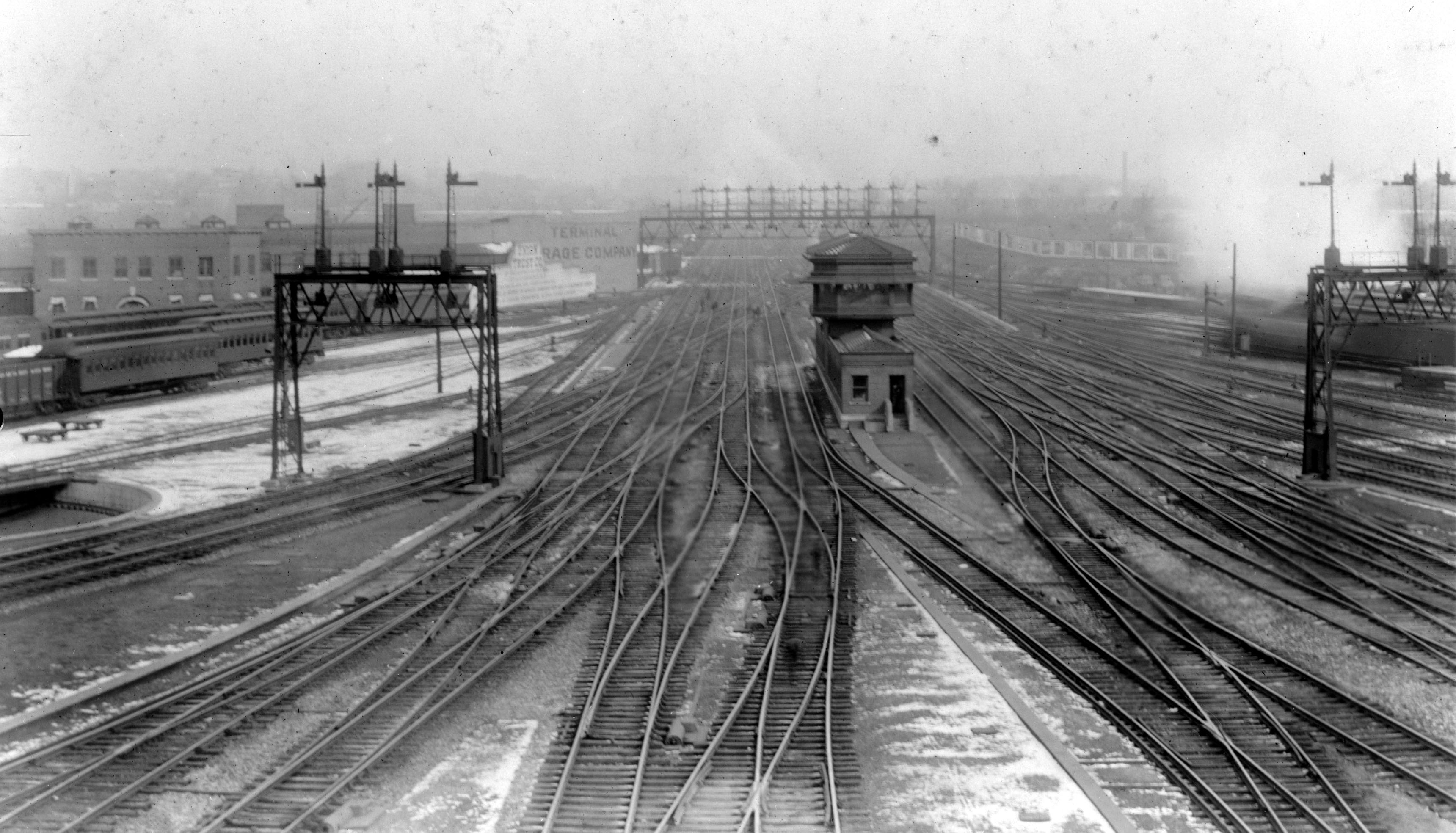
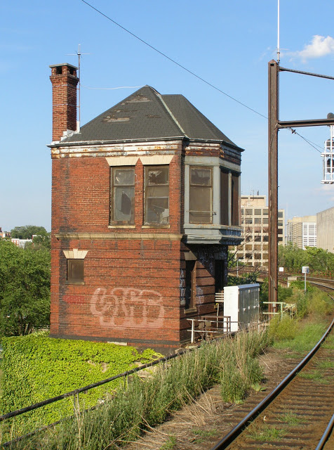
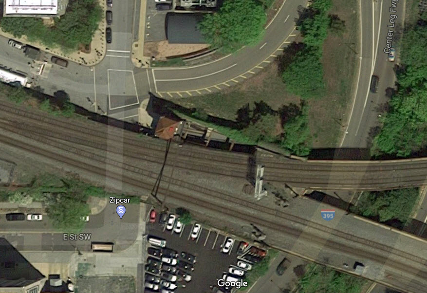
There are two towers remaining in the Washington DC area: K Tower in the middle of the vast interlocking for Union Station, and the old Pennsy Virginia Avenue Tower at the junction of the freight and passenger lines south of Union Station.
Union Station's K Tower
A shot of the tower and station throat before electrification and B&O CPL's were added to the scene.
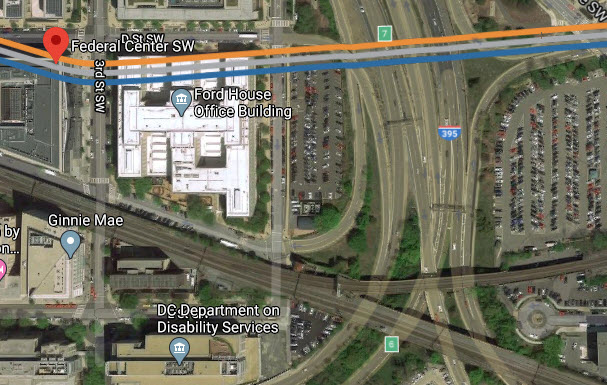
Ex Pennsy Virginia Ave Tower
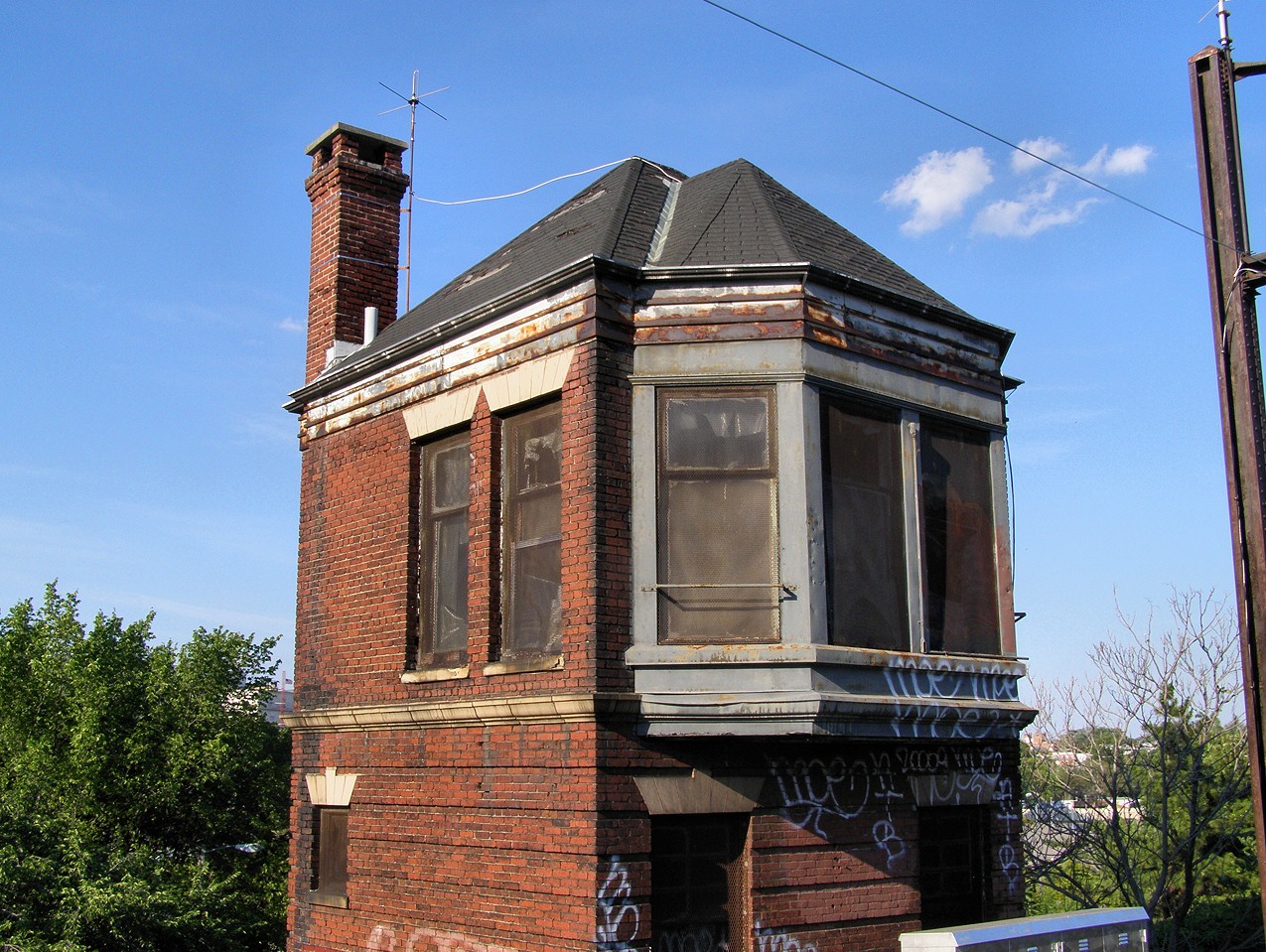
 Photos: Jersey Mike
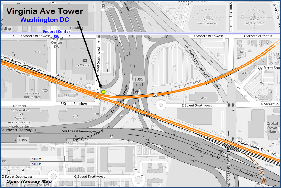
The closest DC Metro station is 2 blocks away where the Blue, Orange, and Silver lines stop at the Federal Center SW station.
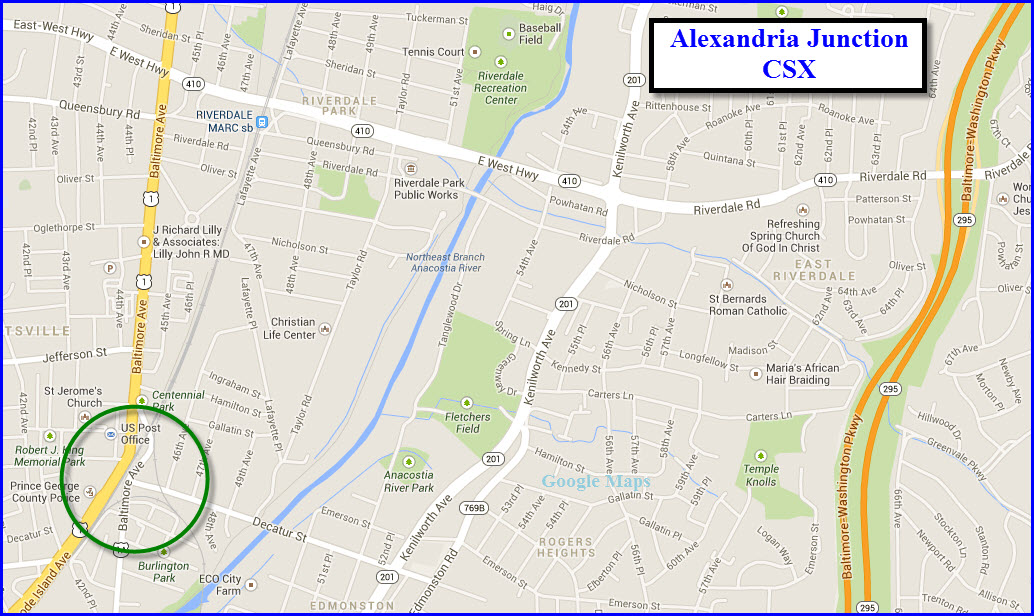
Alexandria Junction
Located on the NE side of DC, in the Maryland suburb of Hyattsville, is this former B&O, now CSX junction. Trains from Baltimore split here to go either west via the Brunswick line, or south via the bridge over the Potomac on the old RF&P line to Richmond. I have a separate page for it here. It is easy to get to, and sees moderate traffic, altho at the beginning of the week, you may sit around for while with nothing to do! During the weekday, and soon (Dec 2013), you also have MARC trains to shoot.
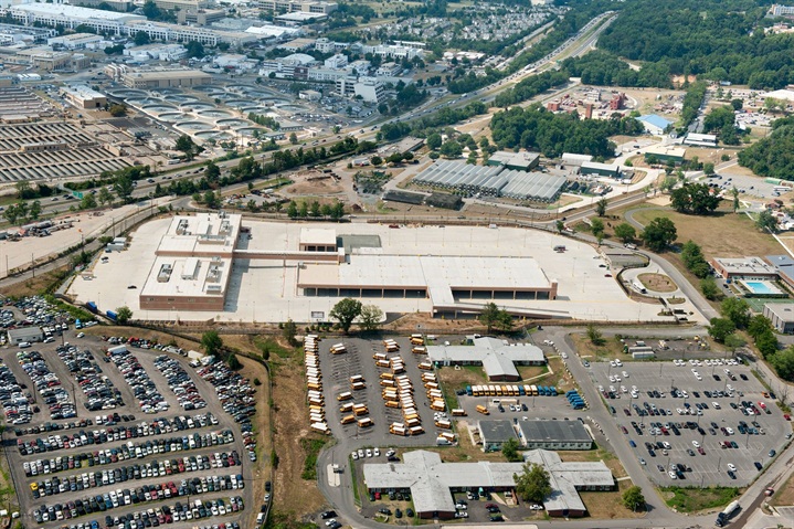
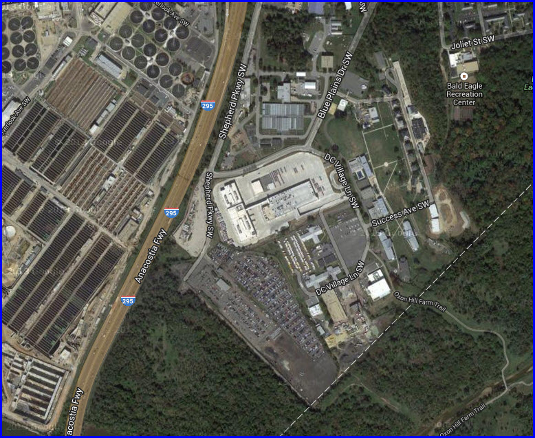
Shepherd Parkway
Washington
Metropolitan Area Transit Authority (Metro), local and federal
officials opened the new Shepherd Parkway Metrobus
Division, a modern, spacious and environmentally-friendly bus
facility in Southwest Washington, D.C. The new yard is located on the
east side of 295 as it zips past the Naval Research Labs, it was easy to
find with the sewage treatment fields in the picture!
The state-of-the-art facility sits on 16 acres of land with space for up to
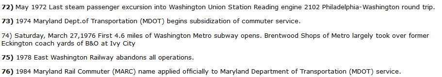
250 buses. Initially, it will house 114 Metrobuses that operate on 50 routes
mainly in Southeast and Southwest Washington, D.C., providing better bus
service for thousands of customers in the District of Columbia.
The Shepherd Parkway facility consists of a maintenance and administration
building, maintenance bays for repairs, inspections and servicing, bus wash,
fueling station, and parking and storage for up to 250 buses. A compressed
natural gas fueling station will be added next spring. Approximately 400
employees will work at the new Shepherd Parkway Metrobus Division.
Shepherd Parkway will be Metro’s first building with US Green Building
Council LEED Silver certification. While in its initial stages, Metro
committed to incorporating features to reduce energy and water consumption
from the design and construction phases through to the ways the facility
will be operated and maintained. Of note, Shepherd Parkway features a storm
water filtration system, white roof, drought-tolerant landscaping, low-flow
plumbing fixtures and lighting system with occupancy sensors. Additional
environmentally-friendly attributes include being within ¼-mile walking
distance from a bus stop, bicycle parking and priority parking spaces for
fuel efficient vehicles.
“Better maintenance on our vehicles, improved employee working conditions
and improved operating efficiency equals better service to the thousands of
people who ride Metrobuses in Southwest and Southeast Washington every day,”
said Metro GM and CEO Richard Sarles.
Shepherd Parkway replaces the former Southeastern
Metrobus Division, which was more than 70 years old when it
closed in March 2008 because of its proximity to Nationals Park. Metro broke
ground on the $97 million facility in September 2009, using proceeds from
the sale of the former Southeastern Metrobus garage and funds from the
Federal American Recovery and Reinvestment Act of 2009. More info
here
None for now.
Disclaimers:
I love trains, and I love signals. I am not an expert. My webpages reflect what I find on the topic of the page. This is something I have fun with while trying to help others.
Please Note: Since the main focus of my two websites is railroad signals, the railfan guides are oriented towards the signal fan being able to locate them. For those of you into the modeling aspect of our hobby, my indexa page has a list of almost everything railroad oriented I can think of to provide you with at least a few pictures to help you detail your pike.
If this is a railfan page, every effort has been made to make sure that the information contained on this map and in this railfan guide is correct. Once in a while, an error may creep in :-)
My philosophy: Pictures and maps are worth a thousand words, especially for railfanning. Text descriptions only get you so far, especially if you get lost or disoriented. Take along good maps.... a GPS is OK to get somewhere, but maps are still better if you get lost! I belong to AAA, which allows you to get local maps for free when you visit the local branches. ADC puts out a nice series of county maps for the Washington DC area, but their state maps do not have the railroads on them. If you can find em, I like the National Geographic map book of the U.S..... good, clear, and concise graphics, and they do a really good job of showing you where tourist type attractions are, although they too lack the railroads. Other notes about specific areas will show up on that page if known.
Aerial shots were taken from either Google or Bing Maps as noted. Screen captures are made with Snagit, a Techsmith product... a great tool if you have never used it!
By the way, floobydust is a term I picked up 30-40 years ago from a National Semiconductor data book, and means miscellaneous and/or other stuff.
Pictures and additional information is always needed if anyone feels inclined to take 'em, send 'em, and share 'em, or if you have something to add or correct.... credit is always given! Please be NICE!!! Contact info is here
Beware: If used as a source, ANYTHING from Wikipedia must be treated as being possibly being inaccurate, wrong, or not true.
RAILFAN GUIDES HOME
RAILROAD SIGNALS HOME
Last Modified 26-Mar-2020