
In General
Getting Here
Map
Sights
Pictures
Signals
Floobydust
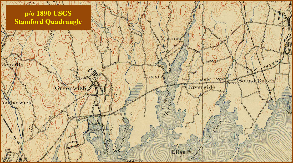
USGS Maps
RAILROAD SIGNALS HOME
Location / Name:
Cos Cob CT, Fairfield County
What's Here:
Former New Haven RR Generating Power Plant
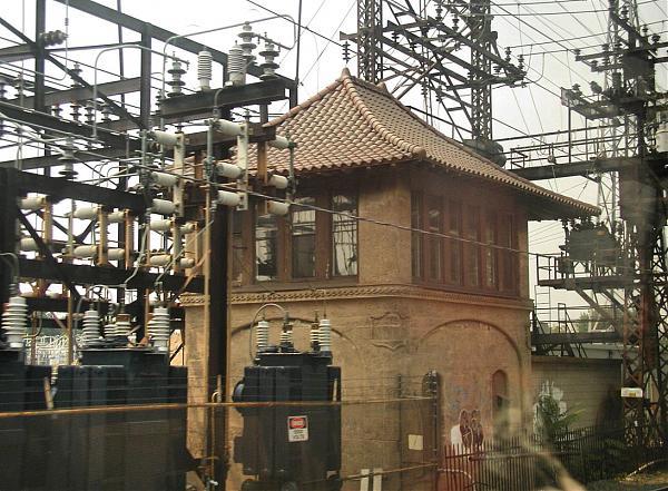
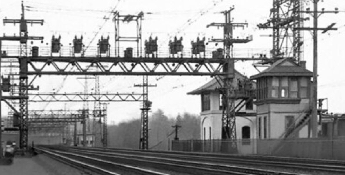
Former NH Cos Cob Power Control Station
Former NH Tower
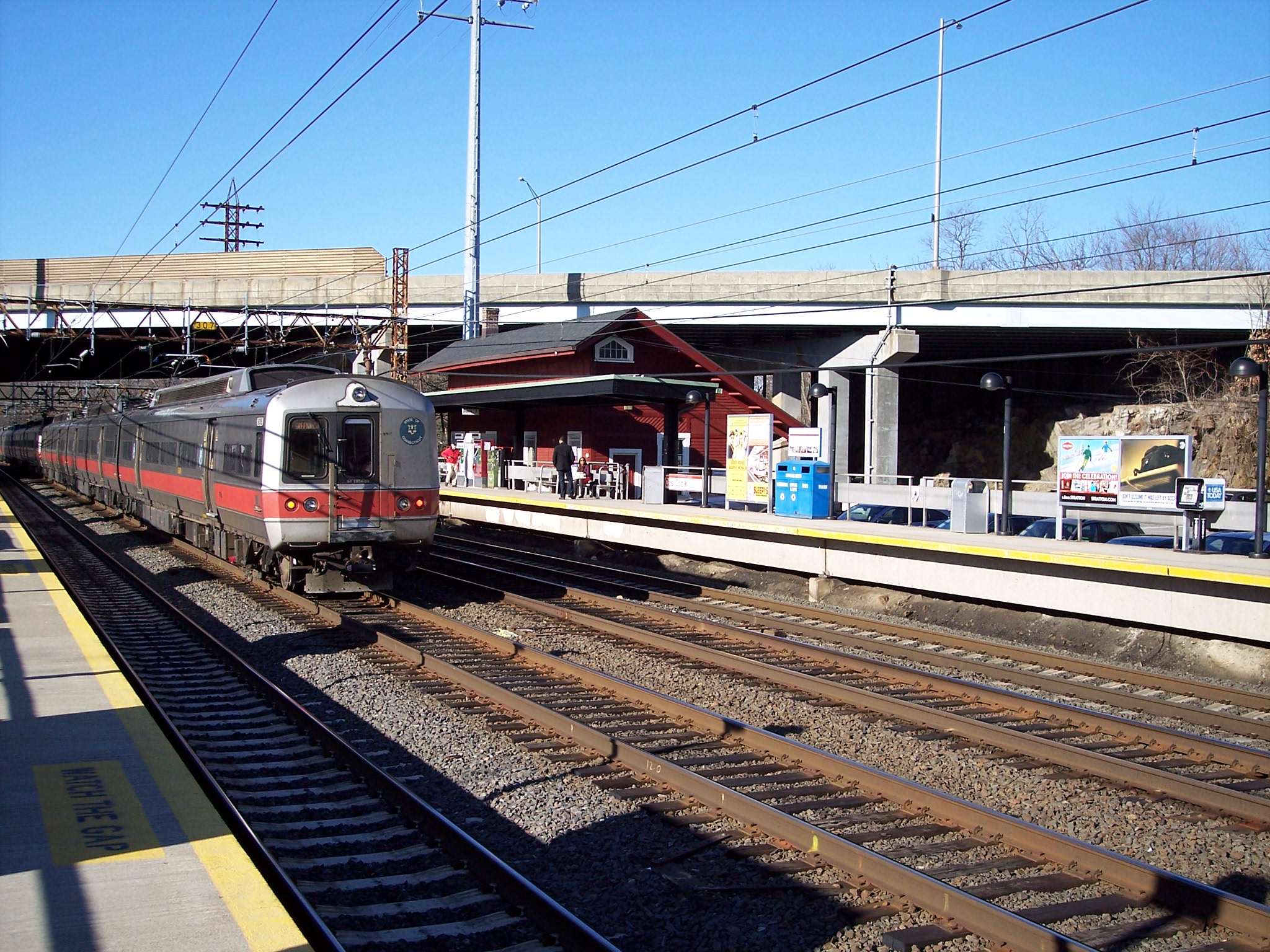
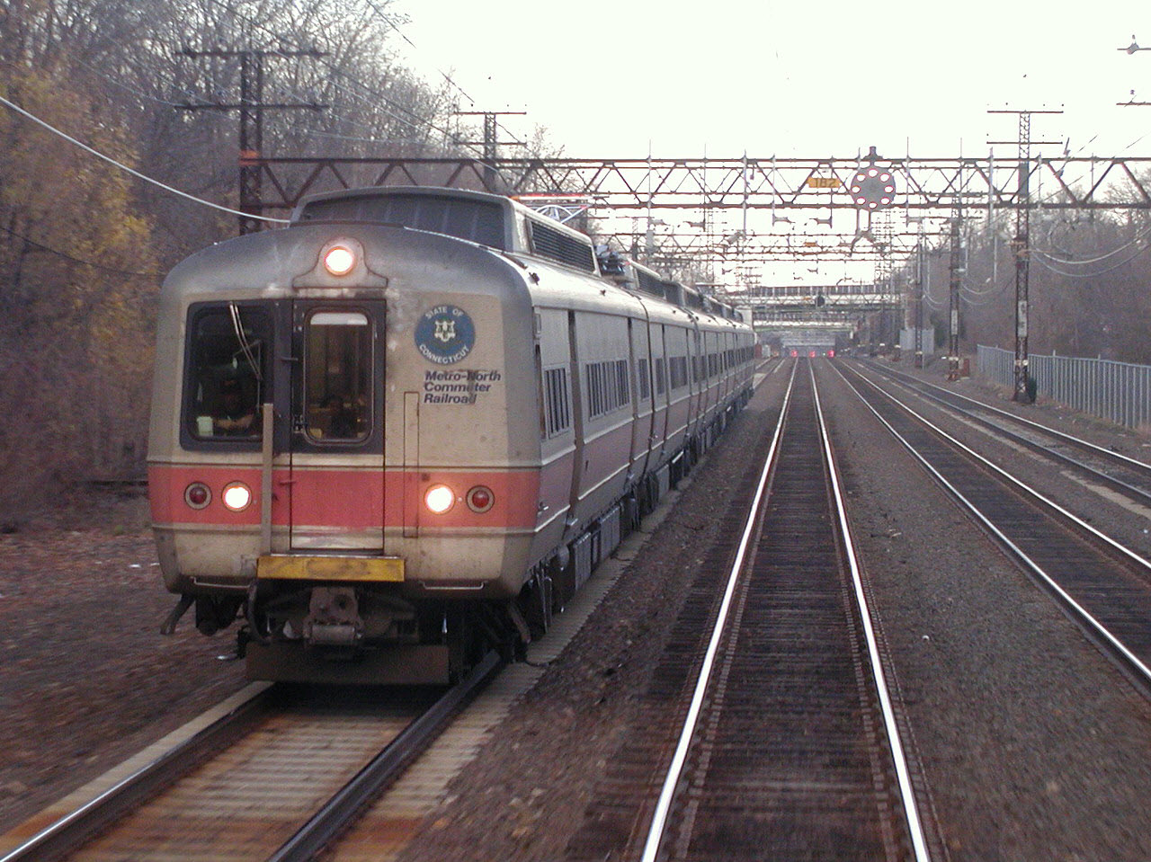
Metro-North Cos Cob Station
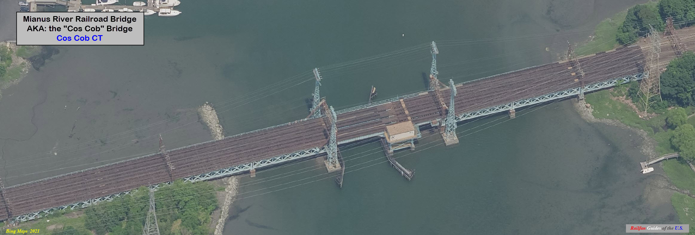
Cos Cob Bridge
Data:
GPS Coordinates: 41.02977, -73.59989 (at the station)
Phone A/C: 203
ZIP: 06830
Access by train/transit:
Metro-North Cos Cob Station
The Scoop:
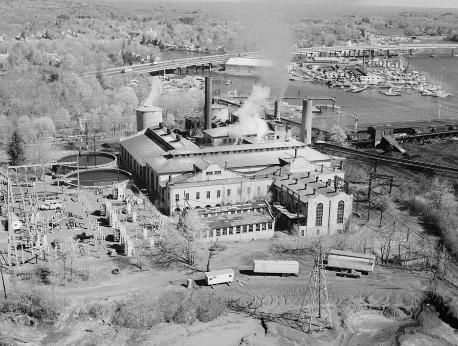
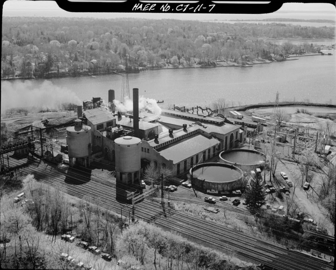
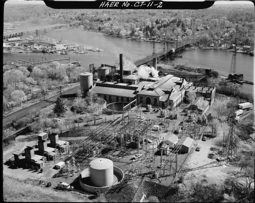
The Cos Cob Power Plant was the first power plant in the United States built specifically to supply mainline traction power to a major railroad. It operated at a frequency of 25 cycles, or Hertz as we now call it.
The power plant was constructed between 1905 and 1907, and supplied power to the New Haven RR, Penn Central RR, Conrail, Amtrak, and Metro North from 1907 to 1986, when power was converted to 60 cycles.
And how about that name??? The name "Cos Cob" is derived from the Coe Family. Way back in the day, in 1641, Robert Coe settled on a plantation in Stamford. A sea wall at that time was referred to as a "cob" -- and thus it became Coe's Cob, and eventually abbreviated to Cos Cob.
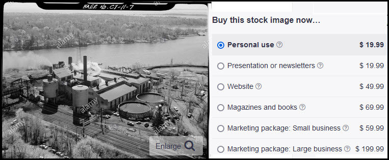
Pictures with the marking of HAER come from the U.S. Library of Congress.
Acknowledgements:
Jeff J, assisted with corrections
Library of Congress
Red Over Yellow Dot Com
prr4ever.blogspot.com/
Jersey Mike
Wikipedia
Google Maps
Bing Maps
Websites and other additional information sources of interest for the area:
https://en.wikipedia.org/wiki/Cos_Cob_station
https://en.wikipedia.org/wiki/Cos_Cob_Power_Station
https://en.wikipedia.org/wiki/Mianus_River_Railroad_Bridge
http://prr4ever.blogspot.com/2019/10/19-10-12-photos-metro-north-drawbridges.html
https://en.wikipedia.org/wiki/Cos_Cob,_Connecticut
http://as0.mta.info/mnr/stations/station_detail.cfm?key=220
http://prr4ever.blogspot.com/2002/11/
https://portal.ct.gov/-/media/Departments-and-Agencies/DPH/dph/environmental_health/eoha/ATSDR/coscobfactsheetpdf.pdf
https://archives.lib.uconn.edu/islandora/object/20002%3A860140100
https://www.loc.gov/resource/hhh.ct0568.photos/?sp=20
https://reference.insulators.info/publications/view/?id=10773
Getting here couldn't be any easier. It is just off exit 4 of I-95, the Connecticut Turnpike.
If you're going south on I-95, take a right onto Indian Field Road at the end of the exit ramp, and take an IMMEDIATE right turn onto Sound Shore Drive, it's almost like making a U-Turn. Go exactly a quarter of a mile, and the entrance to the station parking lot will be on the left, just before you go under I-95.
If you're going northbound on I-95, take a left at the end of the exit ramp onto Indian Field Rd, and cross I-95 to Sound Shore Drive.
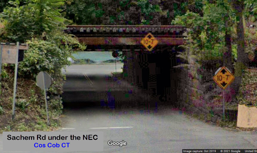
If you want to go to the side where the station is, go about halfway up Sound Shore Dr and hang a left onto Sachem Rd, which goes under the tracks. Take a right on the other side, and the station lot will be on your right shortly.

From Wikipedia: A 1903 New York State law prohibited the use of steam locomotives in New York City. The New Haven line of the New York, New Haven and Hartford Railroad ran commuter trains into the city, and electrification all the way to New Haven would avoid massive congestion and delays to commuter trains if locomotives were changed at the New York City limits or at Stamford, CT.
The "New Haven" chose AC electrification as proposed by Baldwin-Westinghouse, with locomotives which could operate on the third-rail DC system within city limits, and the AC system on the main line.
The plant was built by Westinghouse in 1907 in Mission Style, and was located where the Mianus River empties into the Cos Cob Harbor of Long Island Sound. The plant used coal-fired steam turbines, and the three-phase alternators supplied single-phase power at 11 kV 25 Hz directly to the catenary. They also supplied power to the New York Central's Port Morris generating station to compensate the NYC for power consumed by New Haven trains on the NYC's third-rail supplied line to the Grand Central Terminal within the city limits.
The power station was decommissioned in 1986-87.
The plant was listed on the National Register of Historic Places in 1990, but despite the listing and local and national debate, the plant was demolished in 2001. Part of the site is now a public park, and a plaque commemorating the plant is located at the nearby Cos Cob Railroad Station. (end Wiki)
From the Univ of CT: The Cos Cob Power Plant was conceived in 1903 as a result of the New York State legislature’s law that prohibited all steam locomotives from entering New York City after 1908 due to train wrecks in the Park Avenue Tunnel caused by low visibility from locomotive smoke and steam. The New York Central Railroad, which operated all railroad traffic between Woodlawn, New York, into New York City, decided to install a low-voltage direct current third-rail electrical system; thus after 1908 all locomotives coming into New York City's Grand Central Terminal (then under construction), would be forced to operate off third- rail.
Although the New York, New Haven & Hartford Railroad, better known as the New Haven Railroad, operated considerable low- voltage direct current trackage at this time, this system was considered inadequate for the operation of heavy trains over long distances at high speeds. The New Haven Railroad’s engineers, working with Westinghouse Electric and Manufacturing Company of Pennsylvania, decided to install high-voltage 11,000 volt overhead wires on the tracks from Woodlawn, New York, into Connecticut. These wires would be powered from the railroad's own power station, using single-phase alternating current (ac) electricity. This was done at a time when low-voltage direct current electrification was the rail standard of the day.
Construction of the power plant began in 1905 in Cos Cob, Connecticut, located in the town of Greenwich on the Mianus River. On 24 July 1907, the first New Haven Railroad electrified passenger train traveled from Grand Central Terminal to New Rochelle, New York. The initial electrification covered all four tracks to Stamford, Connecticut, and in 1913-1914 was extended to New Haven, Connecticut.
The New York Central Railroad's third-rail system from Woodlawn, New York, into Grand Central Terminal required the New Haven Railroad's locomotives to operate both off this system and on their own high-voltage overhead wire. This meant that these locomotives and multiple unit cars had to change over between these two systems while moving at track speed. With so much traffic it was considered unworkable to stop every train for the changeover.
The initial overhead catenary construction from Woodlawn to Stamford utilized two parallel messenger wires supporting a single trolley wire by vertical hangers, resulting in a triangular construction. The rigidity of this arrangement was found to be undesireable, so the 1913-1914 electrification extension to New Haven utilized a single messenger wire, as did other extensions. The system reached 673 track miles at its maximum.
The Cos Cob Power Plant was the first power plant built exclusively for a railroad and is considered an engineering achievement for its use of high-voltage alternating current (ac) for railroad electrification. The plant served the New Haven Railroad until the railroad's demise in 1969, and then served Penn Central, Conrail and Metro-North until it was closed in 1986. The Cos Cob Power Plant received landmark status from the American Society of Mechanical Engineers/Institute of Electrical and Electronics Engineers in 1982. (end UConn)
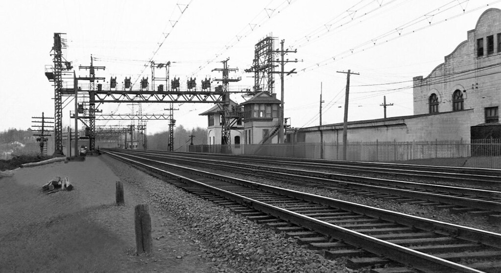
 from Wikipedia
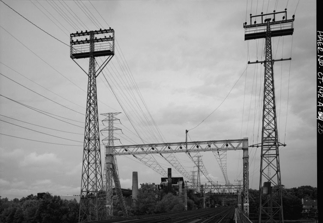
View of the catenary, feeder towers, and the Cos Cob Power Plant (center background), looking east from the south side of the Mianus River Bascule Bridge. Note that the catenary poles end at bridge 313. Trains are carried across the bascule bridge by their own momentum and pick up the catenary on the east side of the bridge. The feeder lines carry power across the river above the level of the opened bascule on the towers to the left and right. The right tower in HAER-142 is no longer there.
Not that I have anything against people making money, however, when a company pirates something available for free, and then charges you for it, I do begun to have a problem, witness the above picture available on the Library of Congress website for free, and below, the same photo for sale for the measly sum of up to 200 bucks!!! This is just plain wrong!!! If you have a problem with this, keep in mind that I make NO money from any of my website adventures, therefore you have no ads, and it costs me about $25 a month to host the two websites with website security.
GPS Coordinates: 41.02984, -73.60013
1 Cos Cob Avenue, Cos Cob, CT 06807-2736 (29.6 miles to Grand Central Terminal)
The basic New Haven structure remains, but got a new high-level platform in the 1980's. From Wikipedia: Built around 1894, the station house is a modest wood frame structure measuring about 50 by 20 feet (15.2 m × 6.1 m). It has a clapboarded exterior, and an asymmetrical gabled roof with a short face toward the track, caused by the loss of the original platform shelter. The interior retains most of its original finishes. It was listed on the National Register of Historic Places in 1989 as the Cos Cob Railroad Station. The station has two high-level side platforms each six cars long. The station has 567 parking spaces, 361 owned by the state. The Station Agent was eliminated on January 15, 1972.
The New York and New Haven RR was merged into the New York, New Haven and Hartford RR in 1872, and the station became part of that railroad. Beginning in 1907, the NYNH&H built the Cos Cob power plant as part of an effort to electrify the main line. As with all New Haven Line stations along the Northeast Corridor, the station became a Penn Central station upon acquisition by Penn Central in 1969, and eventually became part of the MTA's Metro-North in 1983. The station was added to the National Register of Historic Places in 1989.


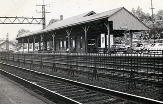 From the New Haven days
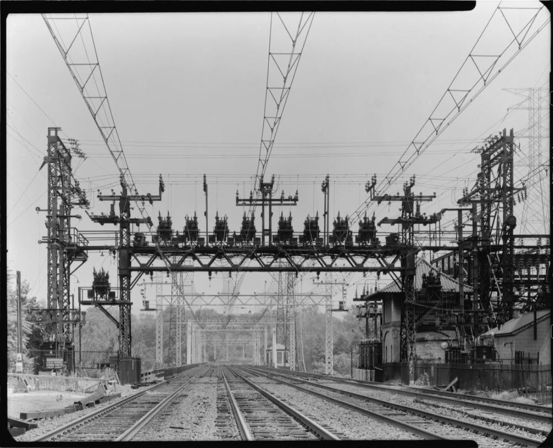
From red over yellow dot com: Passers-by often mistake the existing structure on the west end of the bridge for an interlocking tower, but it is actually the New Haven railroad's power dispatcher's office that controlled the entire 25Hz AC power network. The New Haven system of 1914 and modified over the years, uses an autotransformer architecture with 22/24Kv feeders supplying 11/12Kv overhead contact wires. Cos Cob was chosen as the site of the power dispatchers office because it was also the site of the power plant supplying the 25Hz electrification power.
Sitting next to the Power Dispatcher's Office is what maybe a tower, maybe not, not sure, cannot find any information on it. It's not for controlling the bridge, because the control room for that is on the bridge. Anyone know? Did we used to have a set of crossovers here - I doubt it, because about 4,100 feet south of here is a set of crossovers with a tower.
Below is from the picture seen above.
The
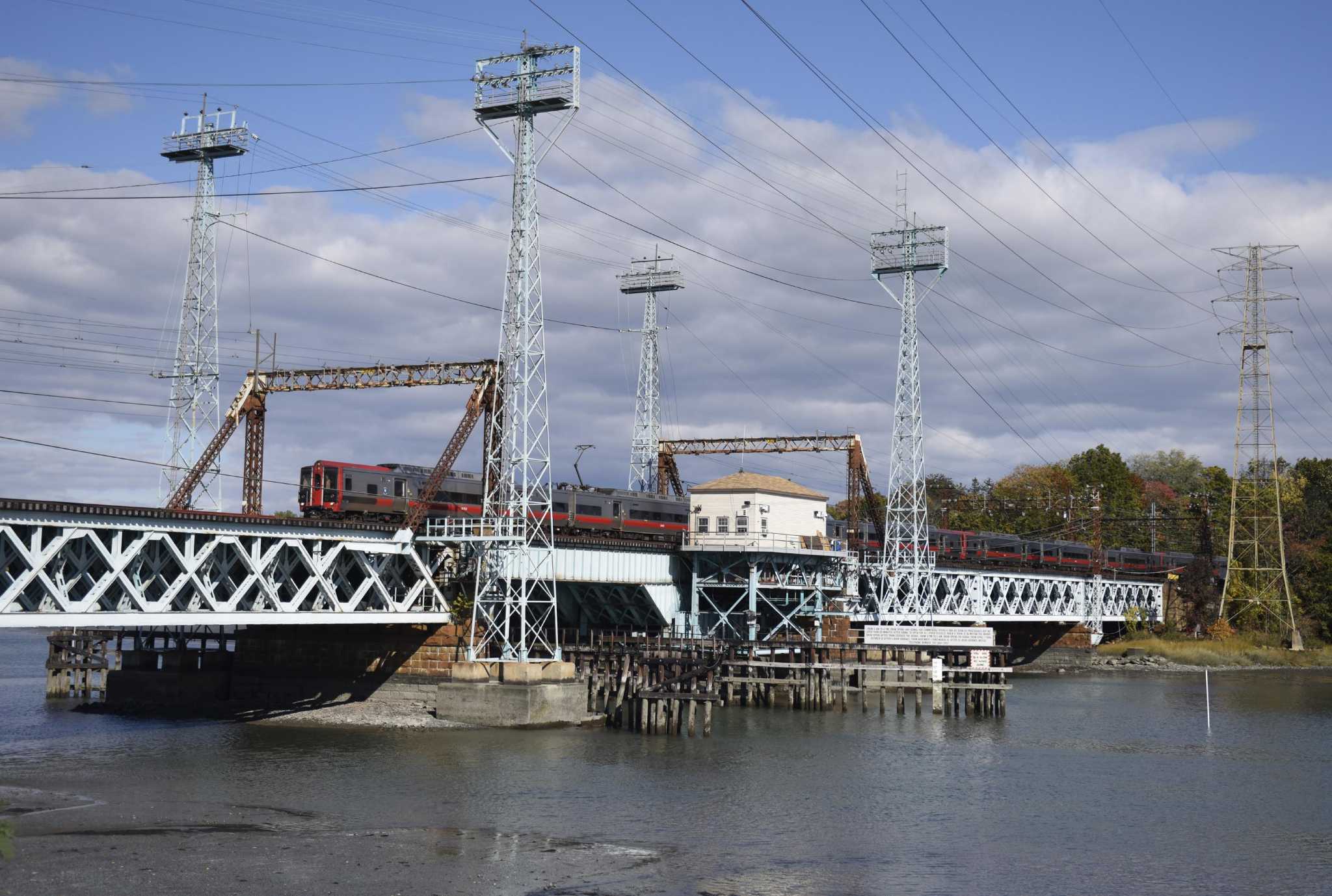
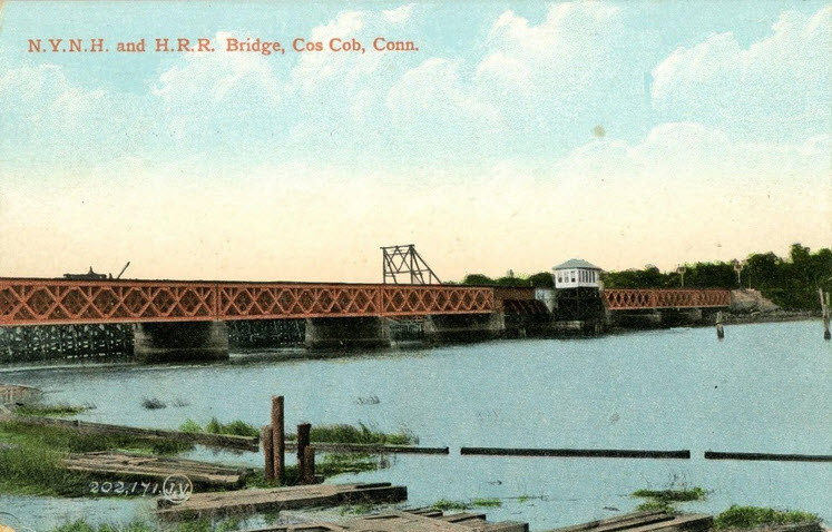
From Wikipedia: The "offical" name of the Cos Cob Bridge is the Mianus River Railroad Bridge. The bridge is a bascule bridge built in 1904 over the Mianus River, in Greenwich CT. It was put on the National Register of Historic Places in 1987. The bridge carries the Northeast Corridor, the busiest rail line in the United States, both in terms of ridership and service frequency. It is operated by the Metro-North Railroad, successor to Conrail, Penn Central, and the New York, New Haven and Hartford Railroad, which erected it, and is owned by the Connecticut Department of Transportation
It is a rolling lift type moveable bridge, built by the American Bridge Company, to replace a previous unsafe bridge on the site. It has a total length of 1,059 feet (323 m), divided into 11 spans. Seven of these are deck truss spans, while the others are deck girder spans, all set on stone abutments. The main movable span is 107 feet (33 m) long; four of the truss spans are 120 feet (37 m) in length. It is one of eight moveable bridges on the Northeast Corridor in Connecticut
 before the electric went in, maybe 1905ish?
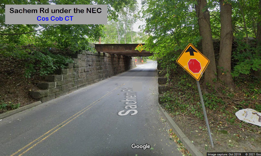
Gotta be some around, somewhere close.....
Rye NY
Not too far south of Cos Cob in New York is RYE. In Rye, we have a phase break in the overhead power due to Rye being on the ends of two power districts. The Pennsy had a unique signal for indicating a phase break, but not many are still left. There was one near Perryville MD, but it long since disappeared, and there is supposed to be one in Philadelphia on one of the old Reading lines.
 courtesy prr4ever
That New Haven Catenary
If you have ever seen it in person, or seen pictures of it, you will immediately know it can only come from the New Haven.
Here is a description of the catenary: The construction of the overhead trolley line is unquestionably the most novel feature of the New Haven Railroad equipment, at least from a constructive point of view. It was realized, when designing the system, that in view of the high speed of many of the trains, which frequently reaches from 70 to 75 miles an hour, it would be necessary to provide a trolley wire which would remain in true line and level, as distinguished from the loose and swaying wires of the ordinary trolley-car service. The system is built as follows: At about every 300 feet, the tracks are spanned by heavy latticed bridges erected upon massive concrete foundations. The bridges consist of two end posts and a deep latticed truss spanning the entire width of the tracks. The wires of the transmission line and signal service are strung upon the posts, and the four catenary trolleys are hung from the trusses. Each catenary consists of two half-inch steel "messenger" cables, which are cradled in the same way as the cables of a suspension bridge, and from these, and midway between them, is suspended a 3/8-inch copper trolley wire, the attachment being made by a series of triangles, which decrease from 6 feet on a side at the trusses to 6 inches at the center of each span. The triangles are formed of 3/8-inch galvanized pipe and they serve to hold the copper wire firmly in alignment and level. At intervals of two miles the place of the ordinary bridge is taken by a special tension bridge of much heavier construction — sufficiently heavy to enable it to take up the slack of the wires when adjustment of that kind is necessary. Up on the bridges, also is carried a set of section brake switches for cutting out the two mile section of the road which they serve.


Courtesy of the University of Texas Library, click here for their index page.
Disclaimers:
New format 10/26/23: Please check out my disclaimer page for my standard dribble and contact info here
RAILFAN GUIDES HOME
RAILROAD SIGNALS HOME
NEW JUL16/2021
Last Modified 26-Oct-2023