
RAILFAN GUIDES of the U.S.

Todd's
Transit Guide to the
RTD Light Rail System
Denver CO
In General
Map
Station by Station
RAILFAN GUIDES HOME
RAILROAD SIGNALS HOME
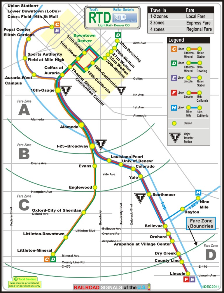
The light rail system in Denver is operated by the Regional Transportation District (RTD). The system has 39.4 miles of track, and has 36 stations.
The system has five lines: C, D, E, F, and H, and follow the lettering of their zone structure, A, B, C, and D. Local service is within two zones, express service is within three, and regional service is four zones. There was a 9mi long "G" line which went from Lincoln to Nine Mile - it was discontinued in 2009.
The first 5.3mi light rail section to open was part of what is now the D line, and opened Friday, October 7th, 1994. An 8.7mi long extension was opened to Mineral Ave in Littleton. The 1.8mi long Platte Valley extension to the Denver Union Station opened in December of 2000. The 19 mile long Southeast Corridor project opened in November of 2006.
On August 11th, 2011, ground was broken for the East Rail Line to the Denver International Airport, and the Gold Line to Arvada and Wheat Ridge. Scheduled opening date is 2016.
The final car of an order for 55 Siemens LRV's was delivered to the RTD on October 5th, 2011. This brings the total number of LRV's to 172. The new cars will be moved in and out of service until the new west line opens in 2013. The new cars are 81.4 feet long, 12.4 feet high, 8.7 ft wide, they are 89,560 lbs empty, they can seat a total of 64 people, with a total car capacity of 185, can do 55mph, and are designed for a service life of 30 years and/or 2 million miles. (from a PDF on the RTD website).
I have some slides of the system as it existed back in 1999-2000 when I came thru Denver on business, we'll get them on here as time permits.
For the rest of my guide below, I have departed from my usual format of just listing the stations, because the Denver system has many stations served by anywhere from just one line to all of the lines. At the beginning of each header is the lines the station serves. It's messy, but how else can it be done.
the D Line tail
Downtown and the loop
West around the circle to
Union Station
the Central Section
serving all of the Lines
Down the C and D Line
Down the E, F and H Line
East on the H Line
South on the E and F Line

An older map showing the now discontinued G line
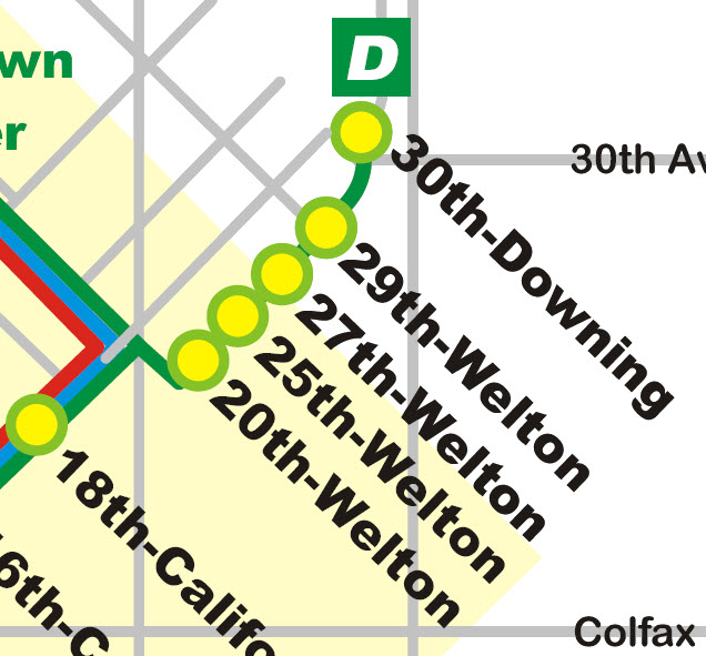
D - 30th - Downing
D - 29th - Welton
D - 27th - Welton
D - 25th - Welton
D - 24th - Welton
Here at 24th Street, the tracks converge into a single line for the rest of the trip to the end at 30th Street, where they provide two tracks for trains laying over till the next one arrives.
D - 20th - Welton
At 20th and Welton, the tracks cross the road, and you have a nice curve where it transitions from Welton onto 19th Street.
Aerial pictures in the CBD (central business district) are usually haphazard because of the tall buildings as can be seen in most of the following downtown shots.
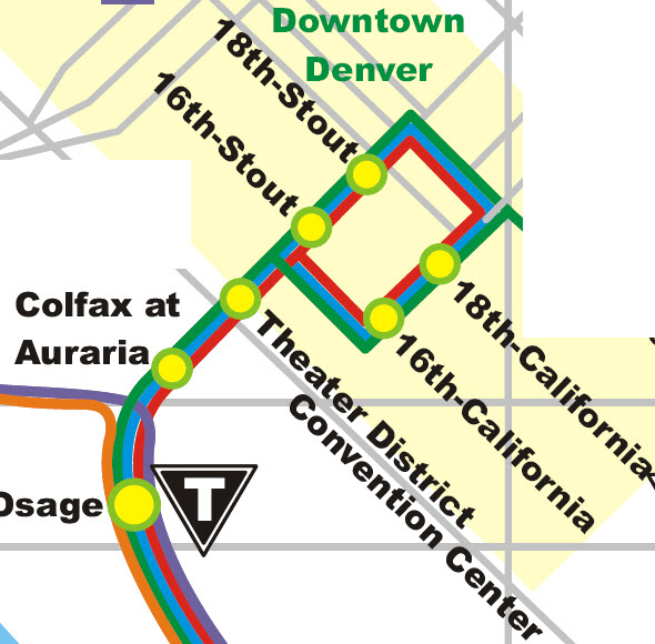
D/F/H - 18th - California
D/F/H - 16th - California
If you feel so inclined to staying there, that's a Hyatt Hotel on the left.

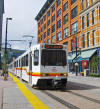 A picture taken at
16th/California, from Wikipedia by
vxla (of Chicago), who has more pictures on
Flickr.
D/F/H - 18th - Stout
D/F/H - 16th - Stout
D/F/H - Theatre District - Convention Center
The light rail goes under, or "through" the Colorado Convention Center. The Convention Center is one of the largest and nicely styled ones I have seen, and the area around it and the Colfax station should provide for some really nice shots!
D/F/H - Colfax at Auraria
West around the circle to Union Station
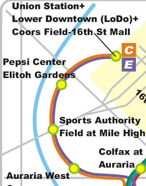
C/E - Union Station
C/E - Pepsi Center - Elitch Gardens
There are three tracks at this station, as seen in the photo.
C/E - Sports Authority Field at Mile High (Formerly Mile High Stadium and later Invesco Field)
C/E - Auraria West Campus
the Central Section serving all of the lines
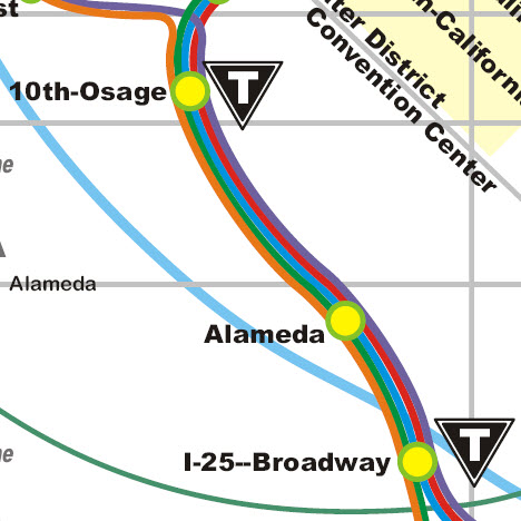
C/D/E/F/H - 10th-Osage
The shops and 10th-Osage is across from a Union Pacific yard... you can spend a fair amount of time around here.
C/D/E/F/H - Shops
C/D/E/F/H - Alameda
C/D/E/F/H - I-25/Broadway and the C/D - E/F/H Division Point
The lines split on the south side of the I-25/Broadway stop. The C and D lines go south and then SW, following BNSF's line. The E, F, and H lines go up and over Broadway to follow I-25 to the southeast.
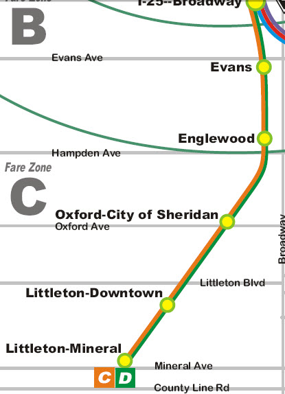
C/D - Evans
C/D - the Shops
C/D - Englewood
C/D - Oxford - City of Sheridan
C/D - Flyover at Union Ave
C/D - Littleton - Downtown
C/D - Littleton - Mineral
This is the end of the line for the C and D lines. I'm kind of surprised that when the RTD built the system, they didn't make the bridge going over Mineral Ave double-tracked, just in case they ever want to expand. On the south side of Mineral, there is a two track storage area.
 Another picture taken by
vxla at Mineral
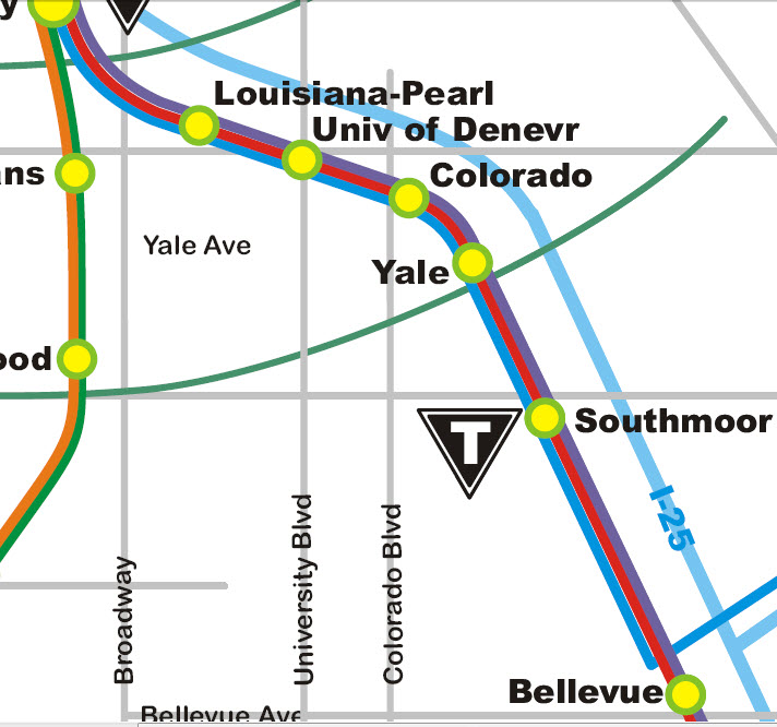
E/F/H - Louisiana-Pearl
E/F/H - University of Denver
They went to a lot of trouble putting in the light rail between here and Colorado... look at the highway flyovers and the way they put the tracks below grade.
E/F/H - Colorado
The right-of-way fro the Colorado station veers away from the interstate, and is also well below grade so it can pass under Colorado and Buchtel Blvds.
E/F/H - Yale

 The crossovers are north of the station
E/F/H - Southmoor
E/F/H - Southmoor Pocket Track
E/F/H Division Point and Wye
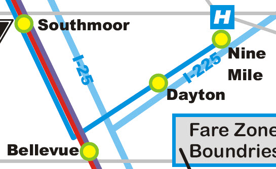
This is a full wye, because in the beginning, the G line came up from Lincoln and then headed west to Nine Mile. The wye also puts the right-of-way in the middle of I-255 :-(
The G line was discontinued on May 3rd, 2009, and should resume once the FasTrack I-255 Corridor project is finished.
H - Dayton
H - Nine Mile
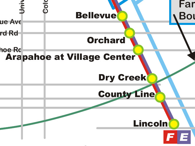
The E and F line runs down the west side of I-25 and is grade separated, AKA, it's on its own right-of-way.
E/F - Belleview
The parking lot is off Quebec from Bellevue

 The right SnagIt is a pre-completion photo available when you
zoom out a little bit on Bing
E/F - Orchard

 Crossovers are north of the station
E/F - Arapahoe at Village Center

 Crossovers are north of the station
E/F - Dry Creek

 Crossovers are south of the station
E/F - County Line
Parking for the County Line station is located on the east side of the interstate, and access to the station is via a walkway over the highway. The station is adjacent to the Park Meadows Mall.
E/F - Lincoln
North of the station is a single crossover, and south of the station, before the end of the line storage tracks, is a double crossover.
New 10?28/2011
last Modified:
15 Sep 2013