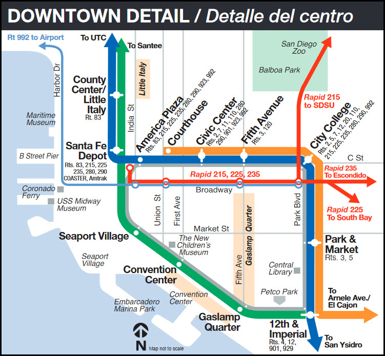
Access by train/transit:
Amtrak and the Coaster can be caught at:
- The Santa Fe Depot station on the Blue Line,
- One stop away from the Orange and Blue line's America Plaza station,
- The Old Town Transit Center (TC) station, end terminus of the Blue and Green lines.
The Scoop:
San Diego probably boosts more transit service than it does hardcore
train stuff for the railfan. It actually boosts a pretty good
variety of steel wheeled things for the railfan if you're into
transit: The San Diego Trolley, Coaster, and a vintage trolley system.....
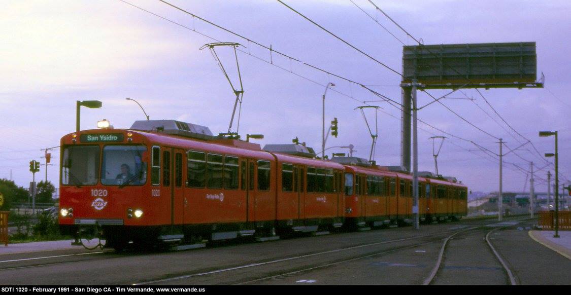
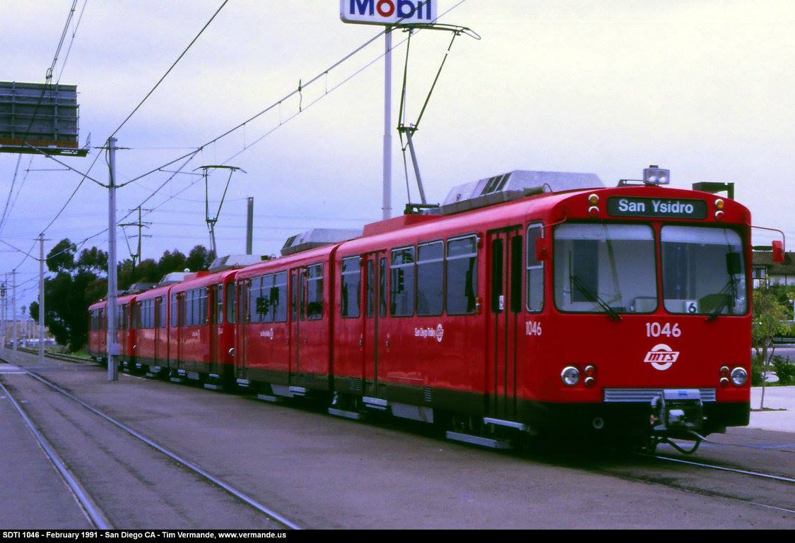
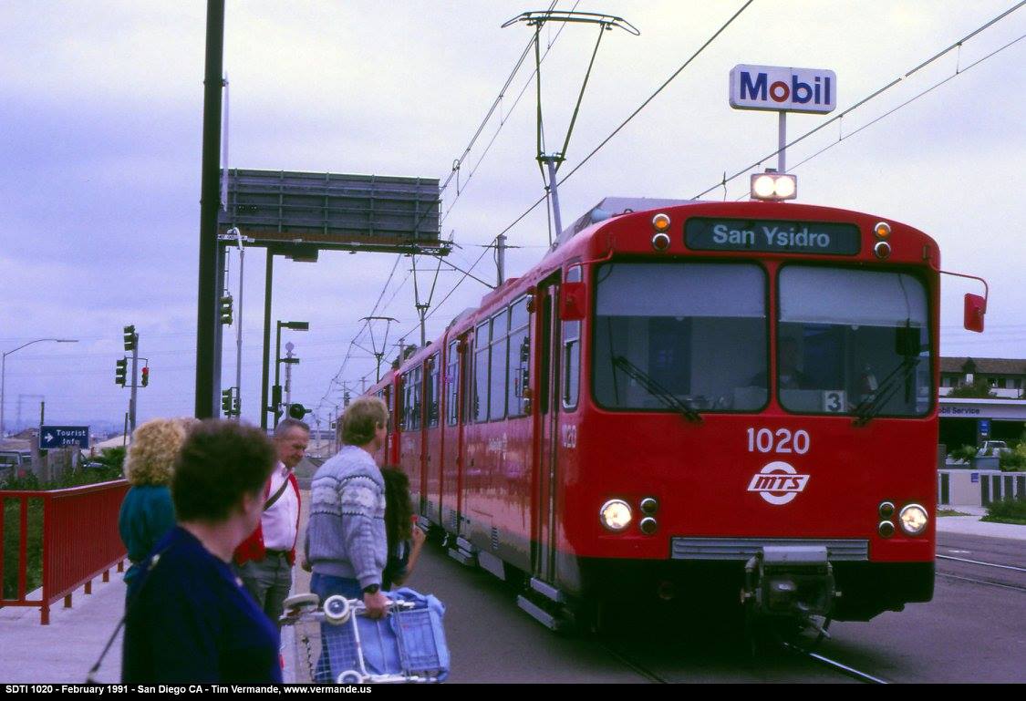
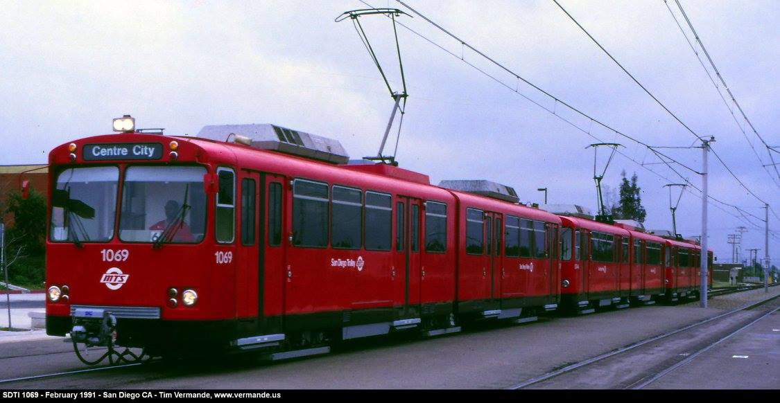
The most well known of the rail services in San Diego is probably the
San Diego Trolley - well known for their bright
red trolley cars. The system is operated by the Metropolitan Transportation
System, or simply, MTS.
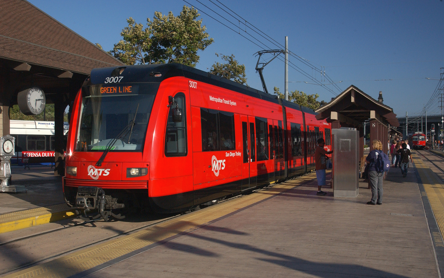
A new S70 trolley #3007 at Old Town, photo by Brett Shoaf, photo from the MTS website.
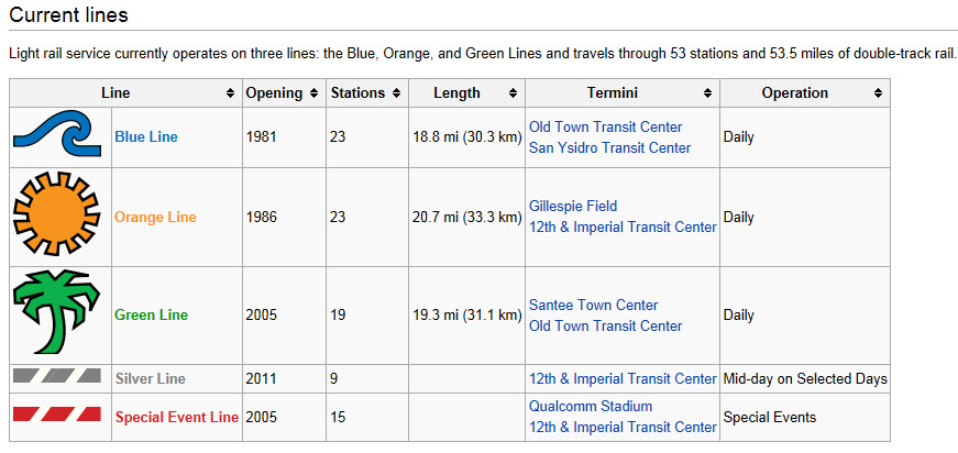
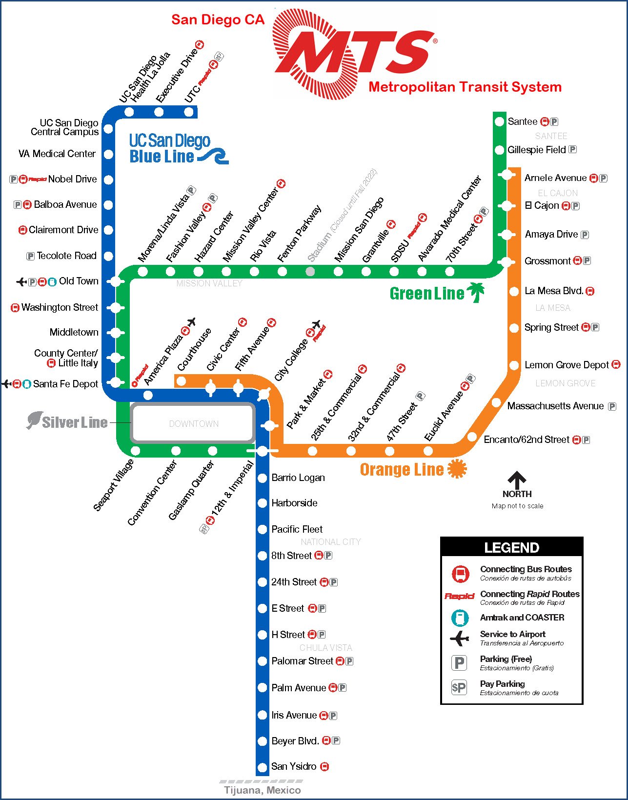
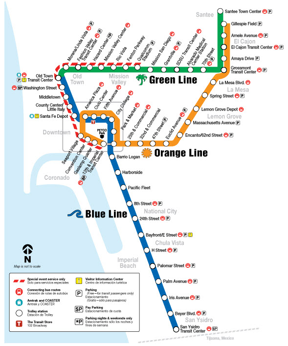
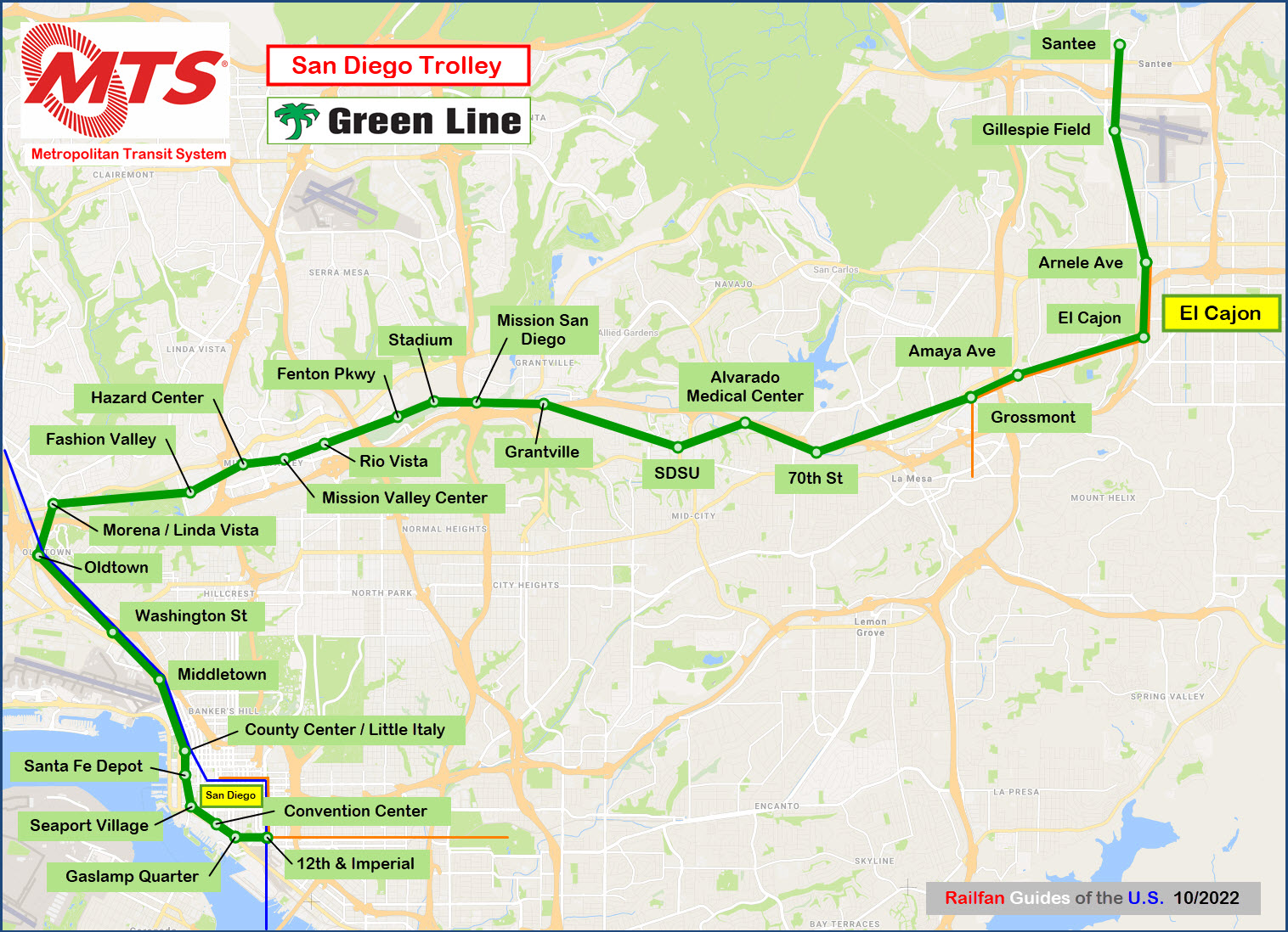
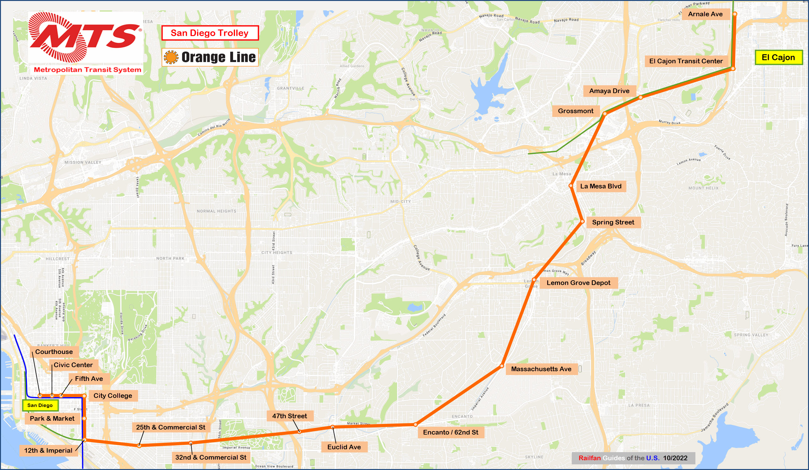
The San Diego system currently operates three lines,
Blue, Green, and Orange. The Blue line was the first of these to open July
26th, 1981, making it one of the older light rail lines to be put into service.
The system has 53 stations.
The Orange line was opened in 1986, and the Green line opened in 2005.
The three lines are supplemented by the Silver line, which
runs on Holidays and Weekends, and the Special Event line, which operates when
they are having something going on at Qualcomm Stadium. Service to the
stadium was initiated in 2005 and has 15 stops. Silver line service was
started in 2011, and includes ten stops on it's route on the downtown loop.
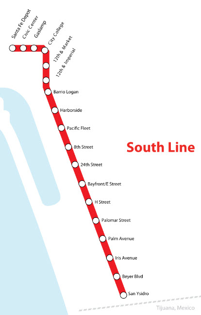
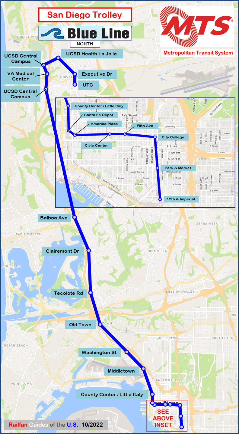
The original section was known as the South
Line, and went from the Santa Fe Depot
down to the border. It is now the Blue line.
The Blue Line operates over track owned by the San Diego
and Imperial Valley Railroad Company, which connects with BNSF in San Diego, the
UP to the east in Plaster City (off I-8), and Ferromex in San Ysidro/Tijuana.
The original cars of the Trolley were Siemens' U-2's, which
are now 30 years old. Eleven of them have already been sold to a startup
system in Argentina. In 1995, they took delivery of 52 SD-100's from
Siemens. Starting in September of 2011, the UTA started receiving new
Siemens' S70 LRV's. They also have one PCC car on the property.
BTW, the font MTS uses for the line names is
Acknowledgements:
Tim Vermande
Brett Shoaf and the MTS website
Google Maps
Open Railway Map
Bing Maps
Wikipedia
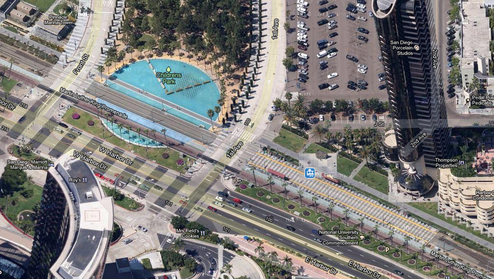
The Gaslamp Quarter station... cool pool too!
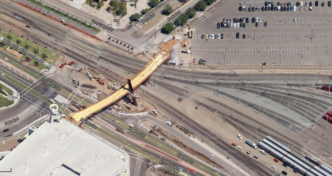
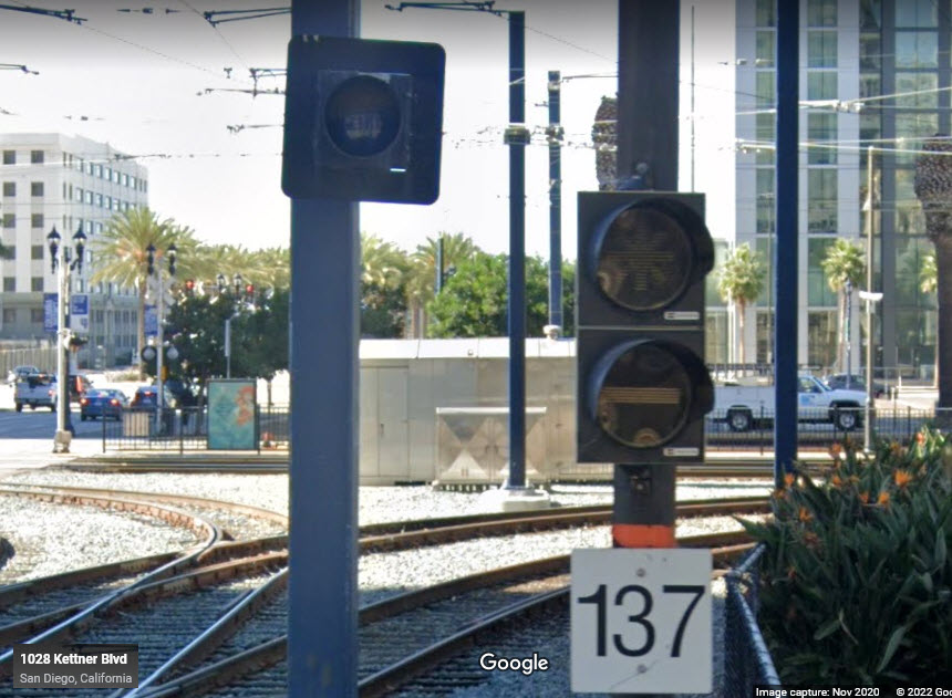
Notice the crossovers in preparation for the L/R yard, and the interchange to the railroad.
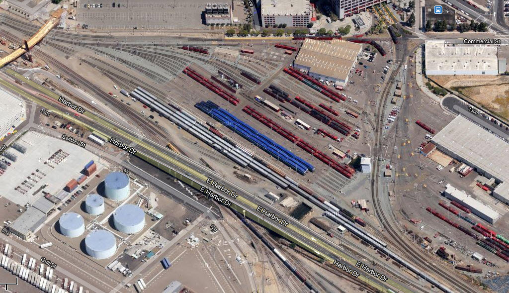
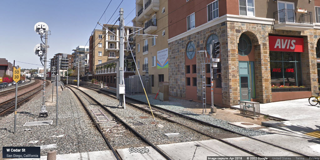
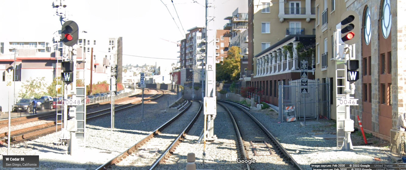
The north end of the yard area for both the Coater and the San Diego Trolley.
L/R shops and storage area for the Coaster.
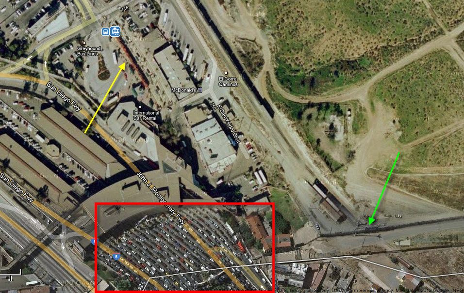
San Ysidro and
Tijuana. The Last light rail station on the
Blue line, at the border with Mexico, is pointed to by the yellow arrow.
Through rail service into Mexico is at the green arrow. And if you don't
have to drive into Mexico, don't, as I would not want to wait for all those cars
at the border crossing in the red box. When my wife and I did the tourist
thing into Tijuana, we took one of the "dollar" busses from the light rail
station in and avoided the rush.
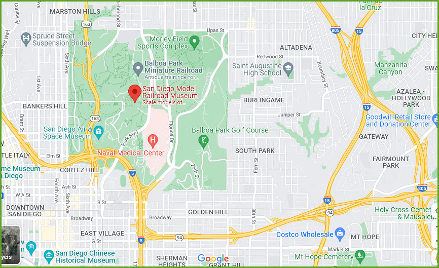
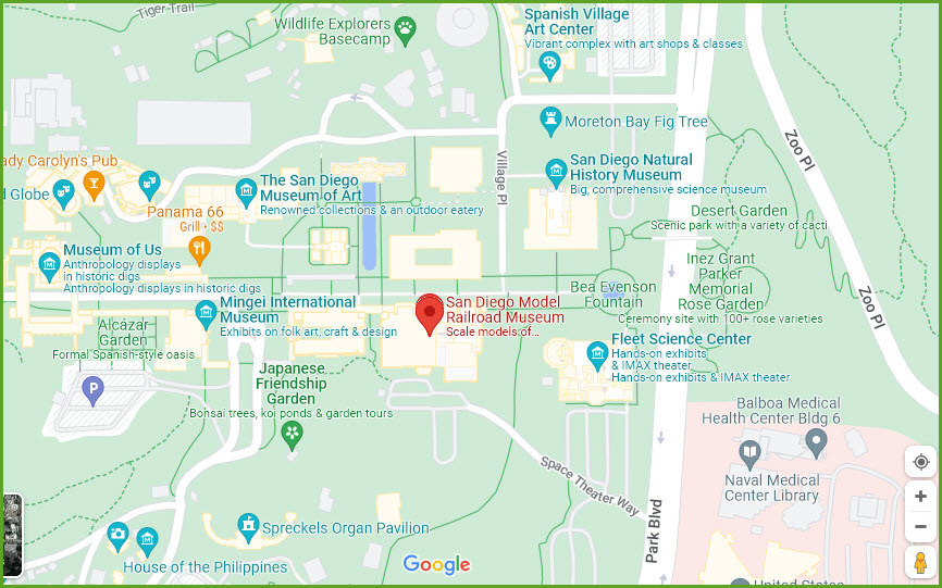
The San Diego Model Railroad Museum is located in Balboa Park, inside the
Casa de Balboa Building on the lower level. They share a parking lot with the
Fleet Science Center. Major cross street is Park Blvd and Space Theater Way.
Disclaimers:
I love trains, and I love signals. I am not an expert. My webpages reflect what I find on the topic of the page. This is something I have fun with while
trying to help others.
Please Note: Since the main focus of my two websites is railroad signals, the railfan guides are oriented towards the signal fan being able to locate them.
For those of you into the modeling aspect of our hobby, my
indexa page has a list of almost everything railroad oriented
I can think of to provide you with at least a few pictures to help you detail your pike.
If this is a railfan page, every effort has been made to make sure that the information contained on this map and in this railfan guide is correct. Once in a while,
an error may creep in :-)
My philosophy: Pictures and maps are worth a thousand words, especially for railfanning. Text descriptions only get you so far, especially if you get lost or
disoriented. Take along good maps.... a GPS is OK to get somewhere, but maps are still better if you get lost! I belong to AAA, which allows you to get
local maps for free when you visit the local branches. ADC puts out a nice series of county maps for the Washington DC area, but their state maps do not have the
railroads on them. If you can find em, I like the National Geographic map book of the U.S..... good, clear, and concise graphics, and they do a really good job
of showing you where tourist type attractions are, although they too lack the railroads. Other notes about specific areas will show up on that page if known.
Aerial shots were taken from either Google or Bing Maps as noted. Screen captures are made
with Snagit, a Techsmith product... a great tool if you have never used it!
By the way, floobydust is a term I picked up 30-40 years ago from a National Semiconductor data book, and means miscellaneous
and/or other stuff.
Pictures and additional information is always needed if anyone feels inclined to take 'em, send 'em, and share 'em, or if you have something to add or correct.... credit
is always given! Please be NICE!!! Contact info is here
Beware: If used as a source, ANYTHING from Wikipedia must be treated as being possibly inaccurate, wrong, or not true.