
In General
Getting Here
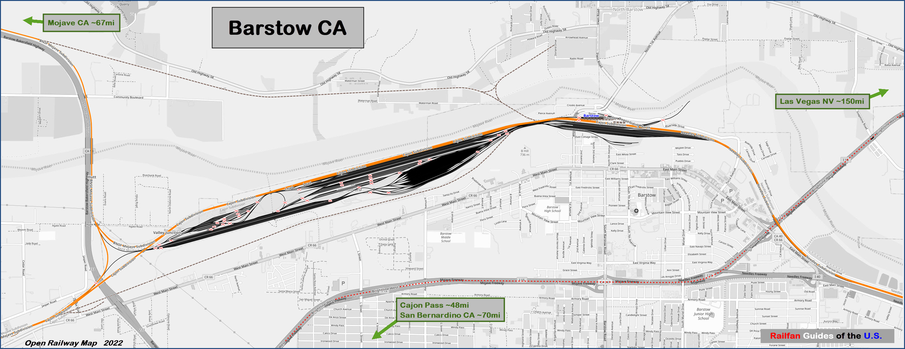
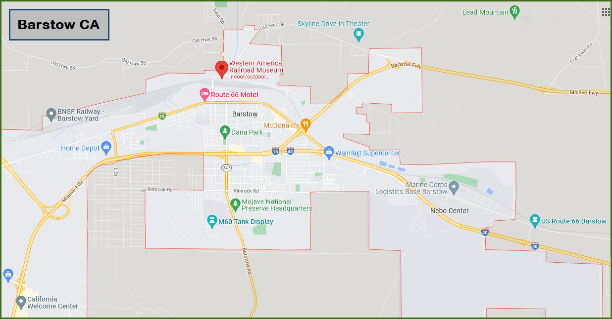
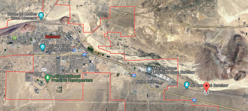
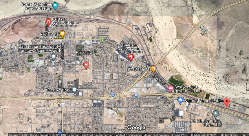
Map
Sights
Pictures
Bridges
Signals
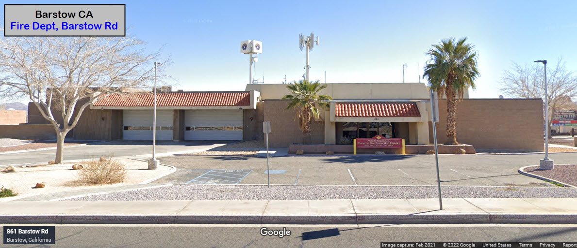
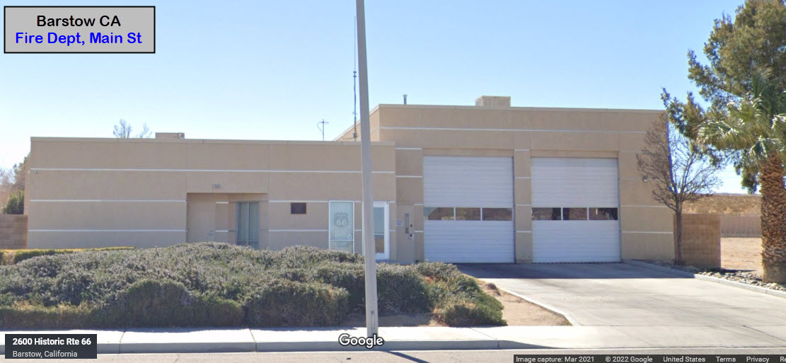
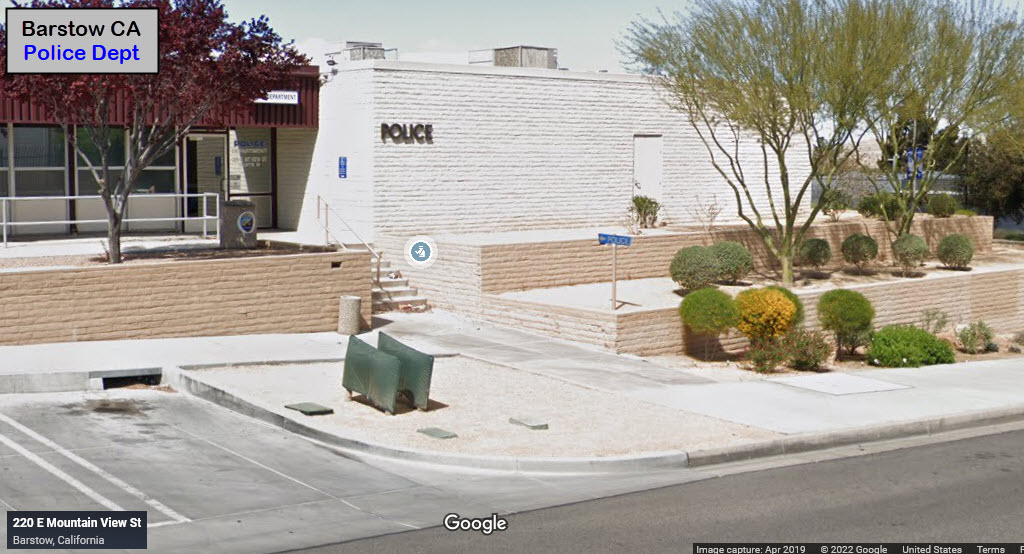
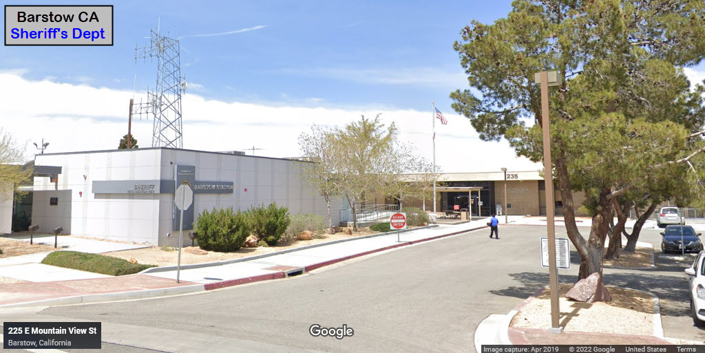
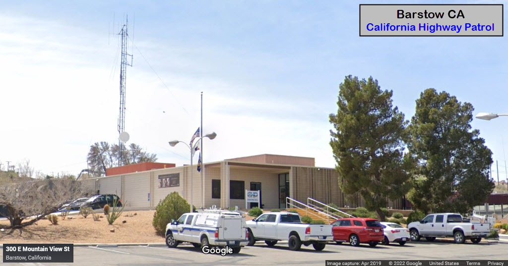
Fire & Police
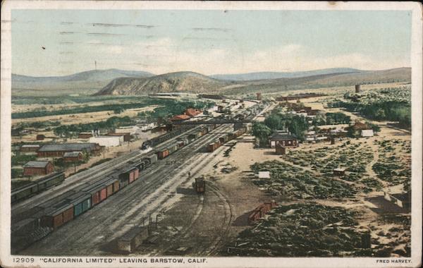
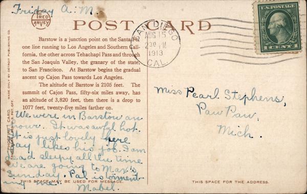
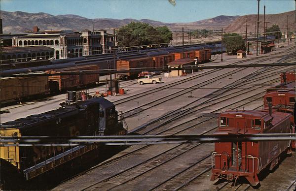
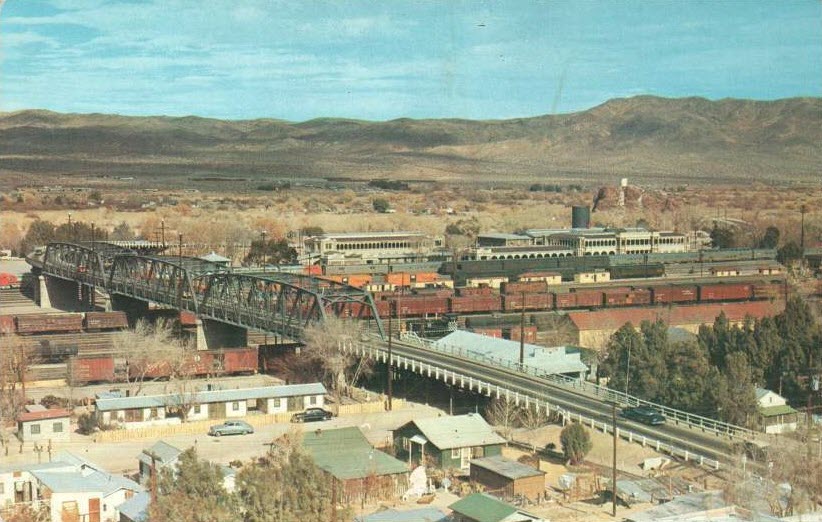
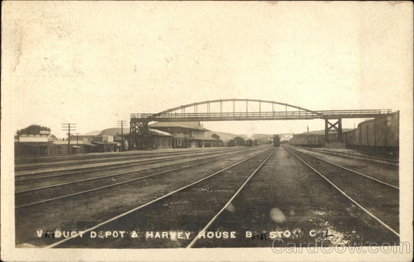
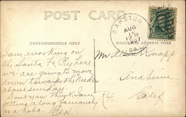
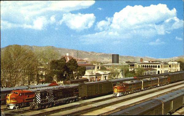
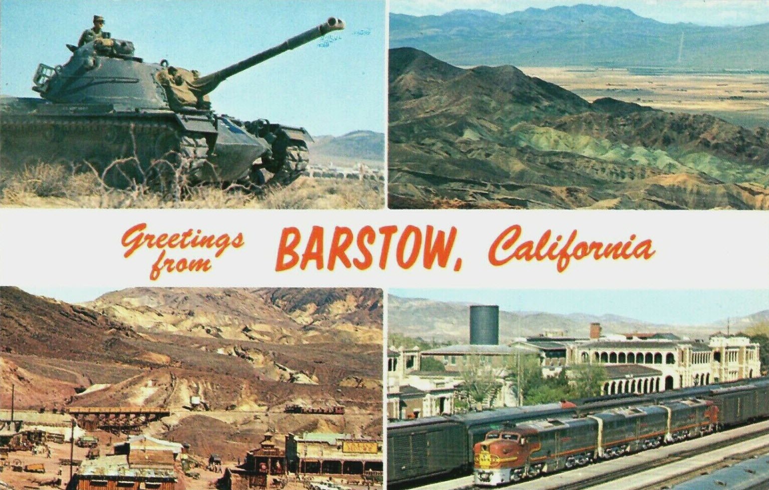
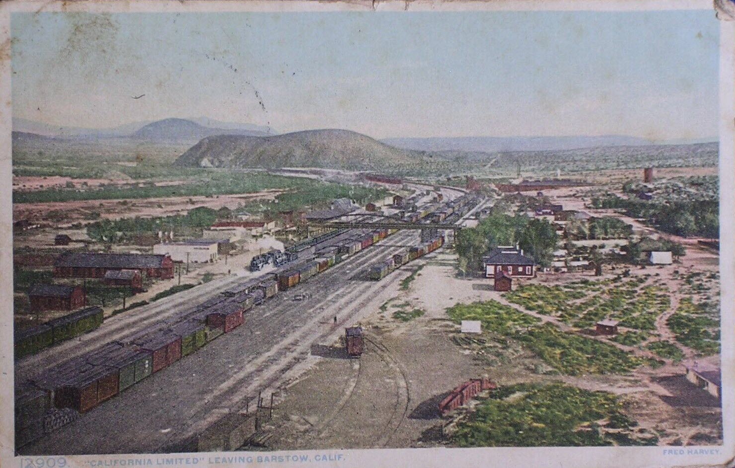
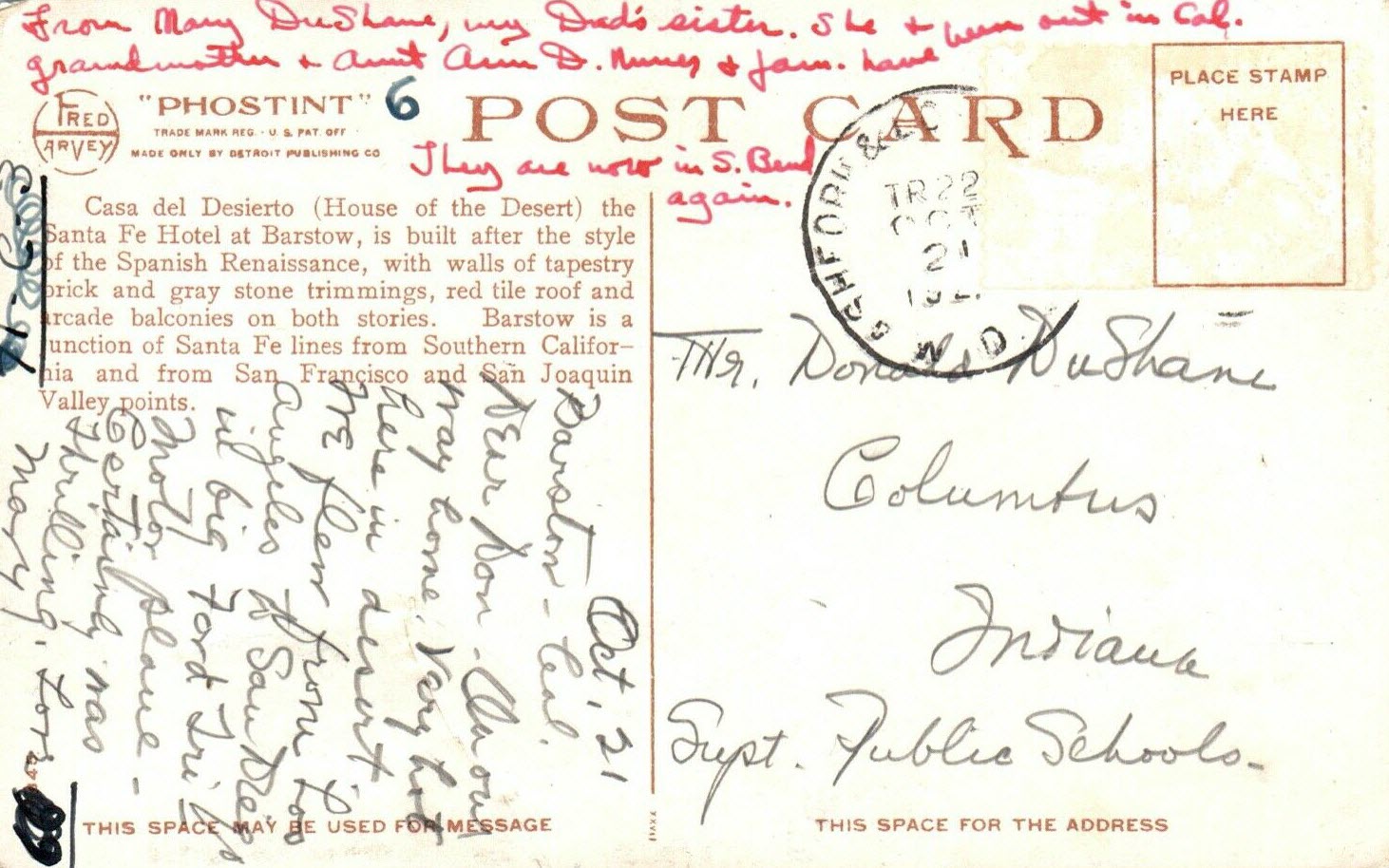
Postcards
Floobydust
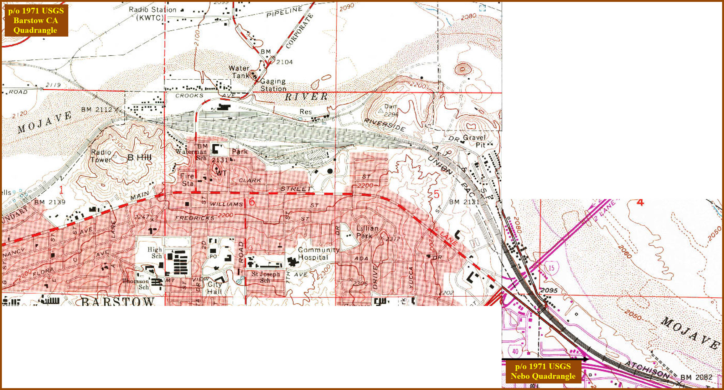
USGS Maps
RAILROAD SIGNALS HOME
Location / Name:
Barstow CA, San Bernardino County
What's Here:
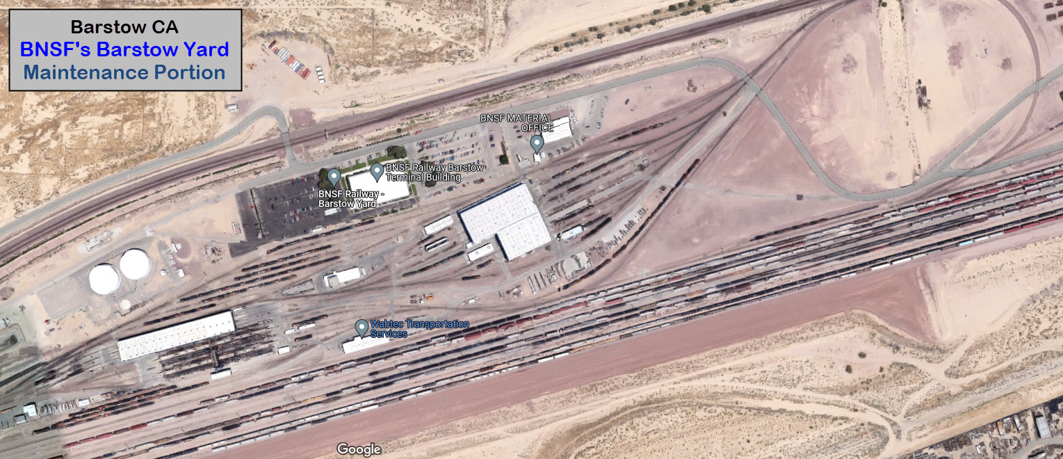
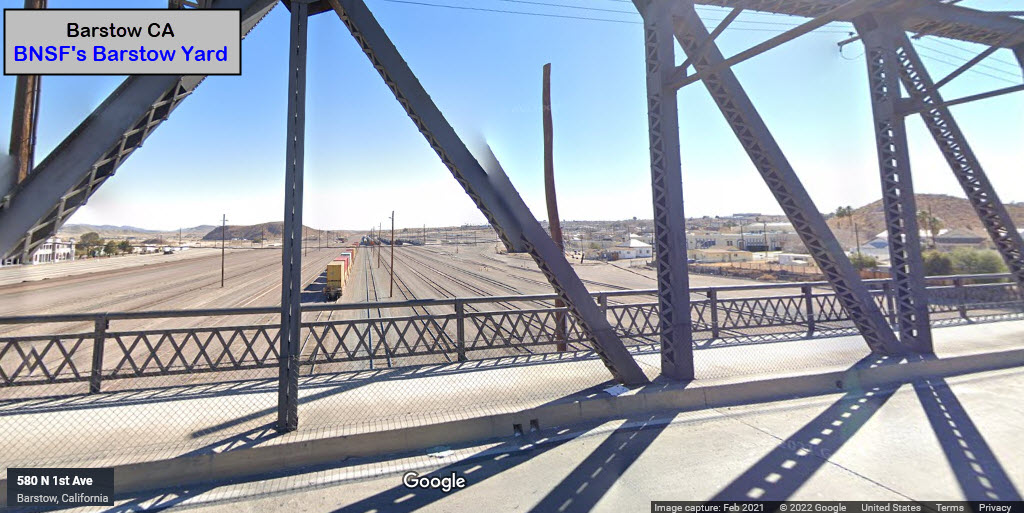
BNSF Barstow Yard
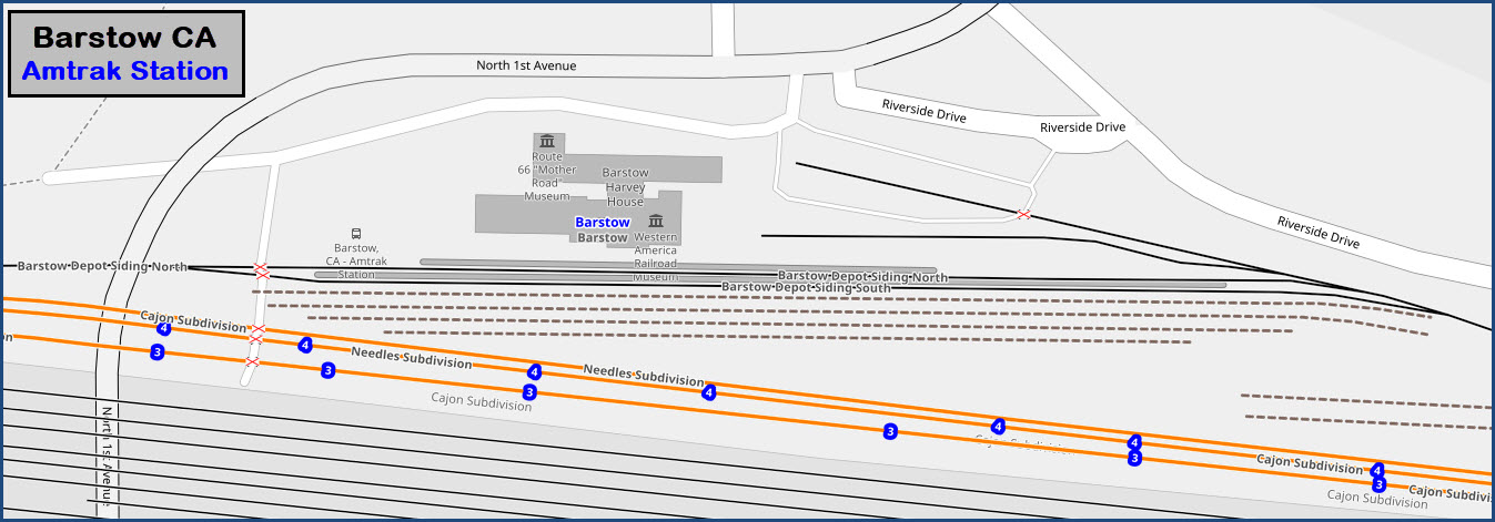
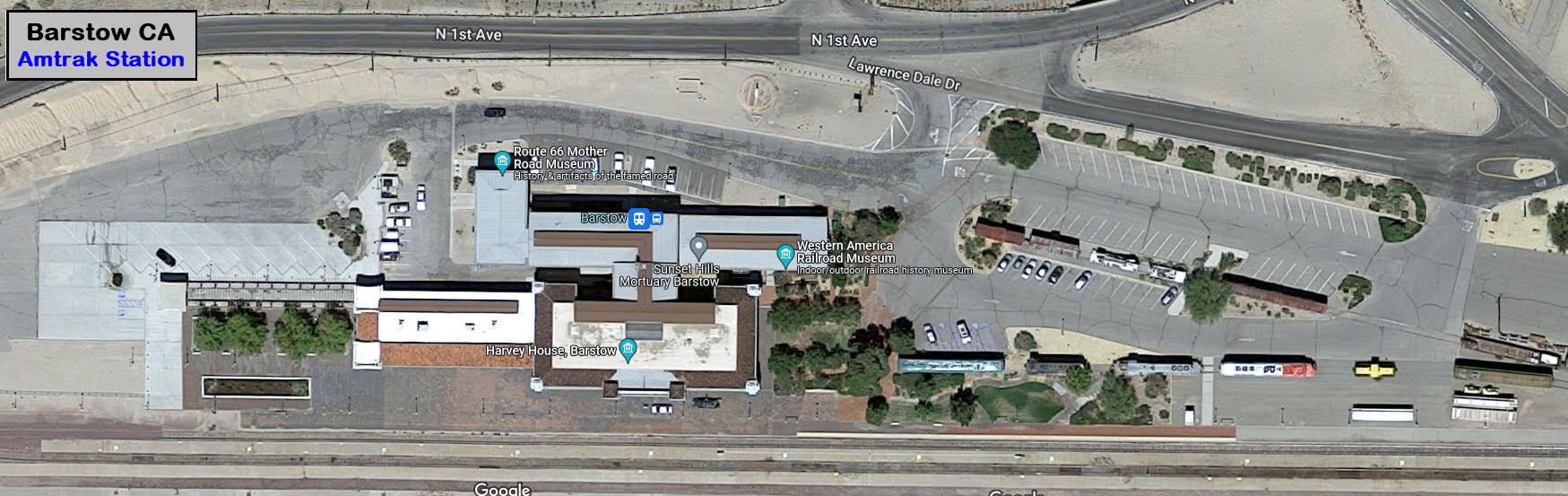
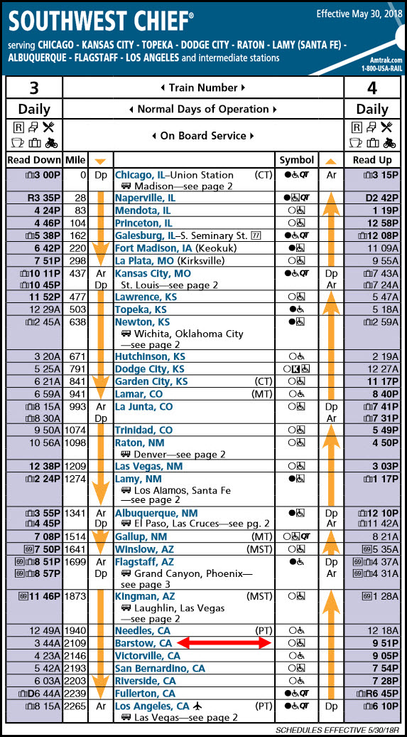
Amtrak Station
Western America RR Museum
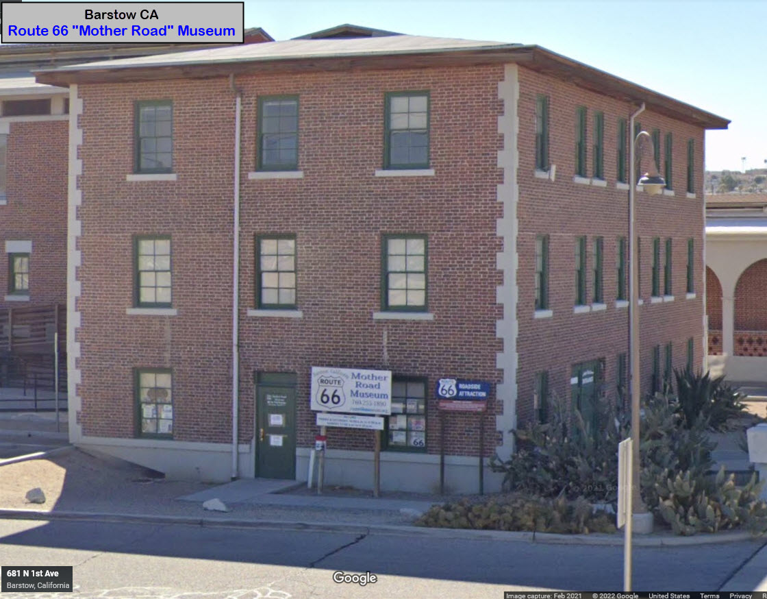
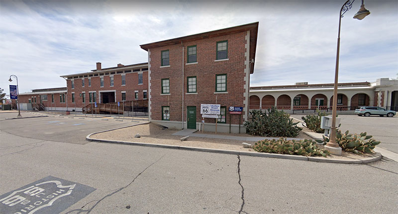
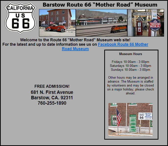
Route 66 "Mother Road" Museum
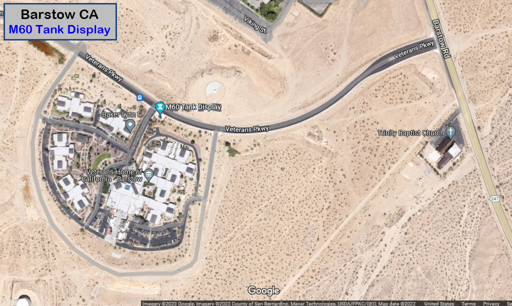
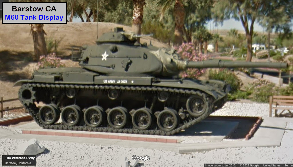
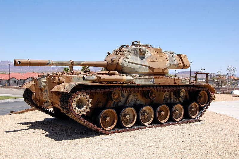
M60 Tank Display
the Desert Lighthouse (in nearby Hinkley)
Data:
GPS Coordinates: as needed
Phone A/C: 760
ZIP: 92311
Population: 25,415 / 2020 census
Access by train/transit:
Amtrak
The Scoop:
What a great place to stop at, especially if you're traveling between Las Vegas and Los Angeles.
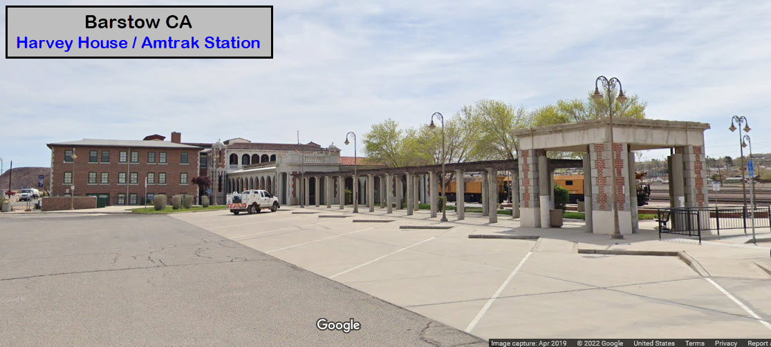
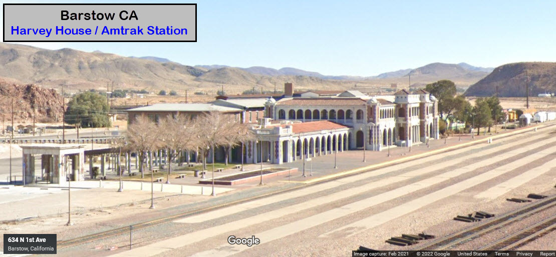
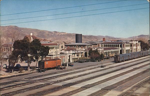
The former ATSF Harvey House station, now houses the Amtrak station, the Western America RR Museum, the Route 66 Mother Road Museum, and local government agencies.
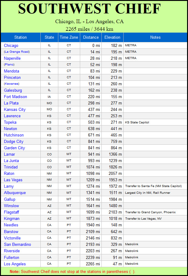
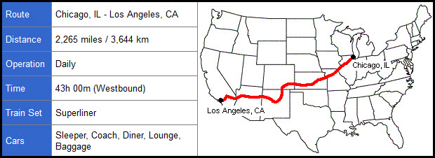
Amtrak's Southwest Chief stops in Barstow, which runs between Chicago and Los Angeles, but, trains are not scheduled in daylight hours :-(
BNSF has a substantial yard, which I first visited in 1970, when they had a long line of "alligator" ALCO's on a scrap line sitting next to the road.
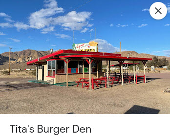
In addition, there is an M60 tank on display, a desert lighthouse in neighboring Hinkley, a drive-in theatre with two screens, plenty of natural sights in the desert to take in, and the original Del Taco stand in neighboring Nebo, altho it is technically Tita"s Burger Den.
Militarily, Barstow has the Marine Corps Logistics Base Barstow -- a United States Marine Corps supply and maintenance installation located in the Mojave Desert east of Barstow. Additionally, the Army's Fort Irwin is located in the western Mojave Desert midway between Las Vegas and Los Angeles, approximately 37 miles northeast of Barstow. From militarybase.com: Marine Corps Logistics Base Barstow is located in the immediate proximity – only 6 kilometers – of the city with the same name, in the southern part of California. The installation is run by the United States Marine Corps. It is better known among the officials for the Logistics Bases’ Maintenance Center. There are only two such facilities in the United States of America and this is one of them. The other one is in Albany, Georgia. The two bases are almost identical in build, mission and objectives. The location is extremely useful for the base, since it is at the intersection of three different highways, close to the most important rail traffic hub and near an airport. It is also the largest and most important single employer in the area.
So let's get busy!.....
Acknowledgements:
Denver Todd
Buck Burns
Doug Wertman
Christy Haines-Thrasher
Card Cow dot com
Google Maps
Bing Maps
Open Railway Map
Wikipedia
Websites and other additional information sources of interest for the area:
https://vanlifewanderer.com/2022/03/24/barstow-ca/ excellent guide to sights around Barstow
https://en.wikipedia.org/wiki/Desert_Lighthouse
https://en.wikipedia.org/wiki/Barstow_Harvey_House
https://www.greatamericanstations.com/stations/barstow-ca-bar/
https://www.route66ca.org/western-america-railroad-museum/
https://en.wikipedia.org/wiki/Western_America_Railroad_Museum
https://www.radiomuseum.org/museum/usa/western-america-railroad-museum-warm-barstow/
http://www.route66museum.org/
https://en.wikipedia.org/wiki/Calico,_California
https://www.calicoattractions.com/
https://militarybases.com/california/fort-irwin/
https://militarybases.com/california/mclb-barstow/
Exit 183 off of I-15 looks like your best bet to get to the railroad museum and the Amtrak station. Then take Barstow Rd north almost a mile. Take a left when you can't go any further at National Trails Highway. Take a left onto NTH, and then a right onto N 1st Ave (3 blocks), which will take you to the station.
GPS Coordinates: 34.90487, -117.02473
685 North 1st Ave, Barstow CA 92311
Station code: BAR
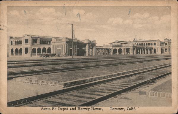
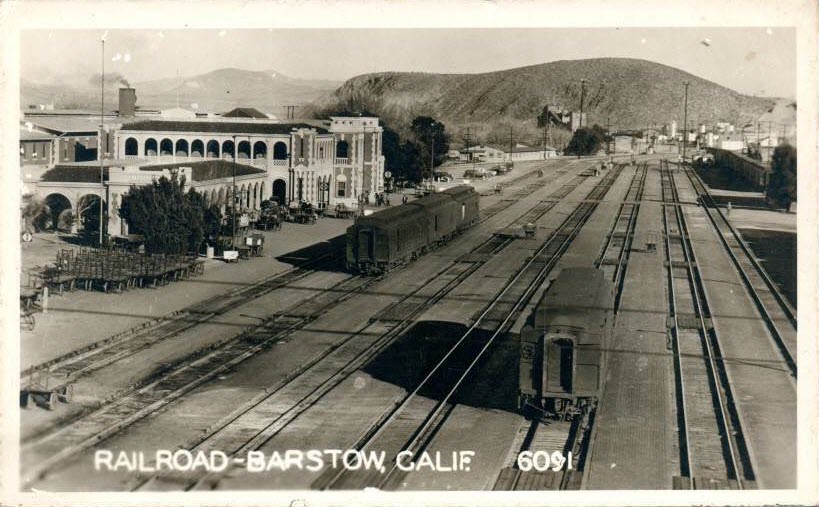
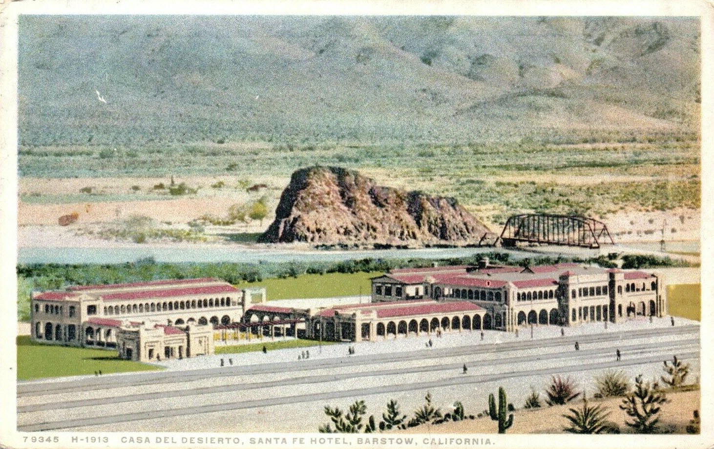
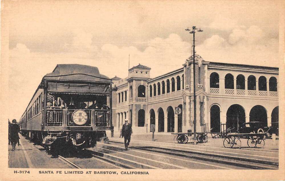
From Wikipedia: the Barstow Harvey House, also known as Harvey House Railroad Depot and Barstow station, is a historic building in Barstow, California. Originally built in 1911 as Casa del Desierto, a Harvey House hotel and Santa Fe Railroad depot, it currently serves as an Amtrak station and government building housing city offices, the Barstow Chamber of Commerce and Visitor Center, and two museums.
The Casa del Desierto station and hotel was built in 1911 by the Atchison, Topeka and Santa Fe Railway to replace an earlier one built in 1885 that burned in 1908. The Santa Fe closed the station in 1973. It became derelict until bought by the City of Barstow, and rebuilt following heavy damage in a 1992 earthquake. Francis W. Wilson is the architect credited by the Historic American Buildings Survey of the National Park Service. end Wiki
GPS Coordinates: 34.90491, -117.02443
685 N 1st Ave, Barstow CA 92311
760-256-9276
Opens on the weekends starting with Friday
Nostalgic museum showcasing historic train cars & memorabilia of the Pacific Southwest railways. The main part of the museum is in the Harvey House station building with Amtrak and the Mother Road Museum.
From Wikipedia: The Western America Railroad Museum is a railroad museum located in Barstow CA. The museum collects, preserves and shares the history of railroading in the Pacific Southwest. It is located on the east side of the Harvey House Railroad Depot and is operated by a non-profit organization.
It houses displays inside the depot and has indoor displays of railroad artifacts, artwork, timetables, uniforms, tools and various other types of railroad items.
There are also outdoor displays of rolling stock, locomotives and general railroad operating equipment. The museum also houses Atchison, Topeka and Santa Fe Railway #1460, also known as the “Beep”, and Union Pacific EMD SD40-2 #9950. end Wiki
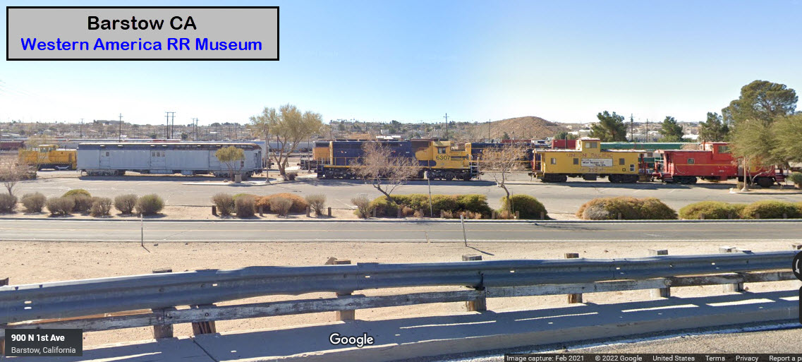
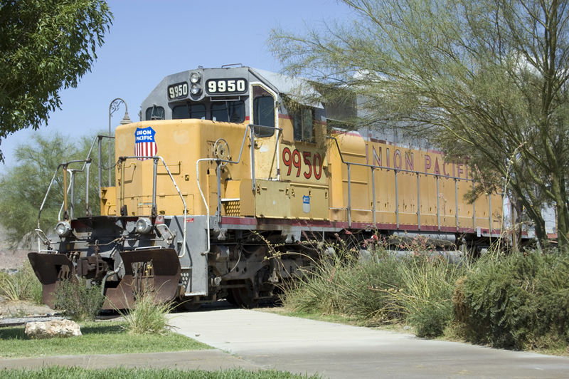 photo by Doug Wertman
GPS Coordinates: 34.89709, -117.05373 (hump tower of larger yard)
The main yard is 3.1 miles long, the eastern part of the yard is 1.5 miles long, giving the yard of total length of 4.6 miles!
There is a wye at the western end, maintenance shops, an EB receiving yard with a hump on the far side of it, a loop on the eastern side of the locomotive maintenance facility among a whole host of other "things". In the map section above is the layout of the yard.
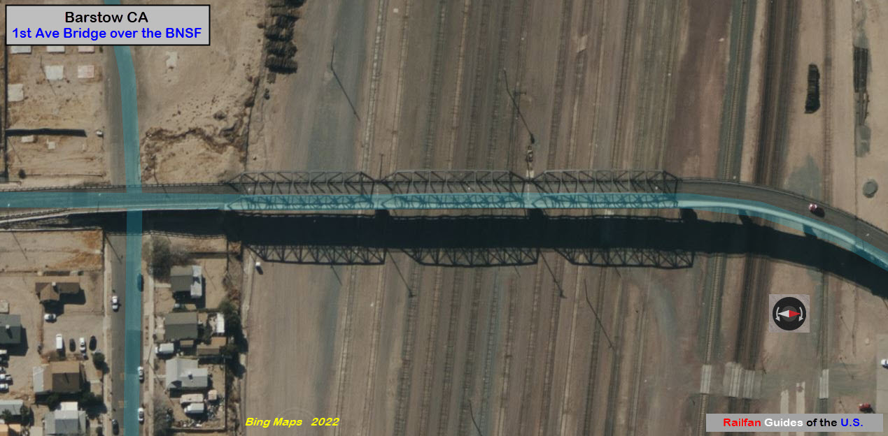
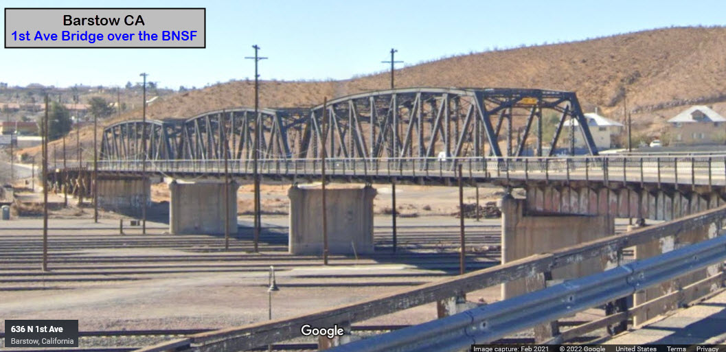
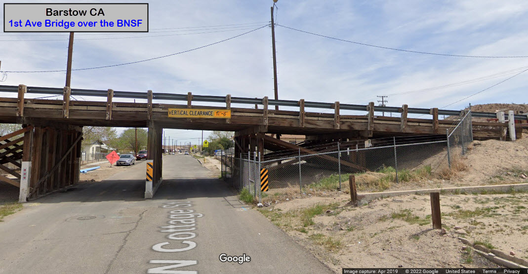
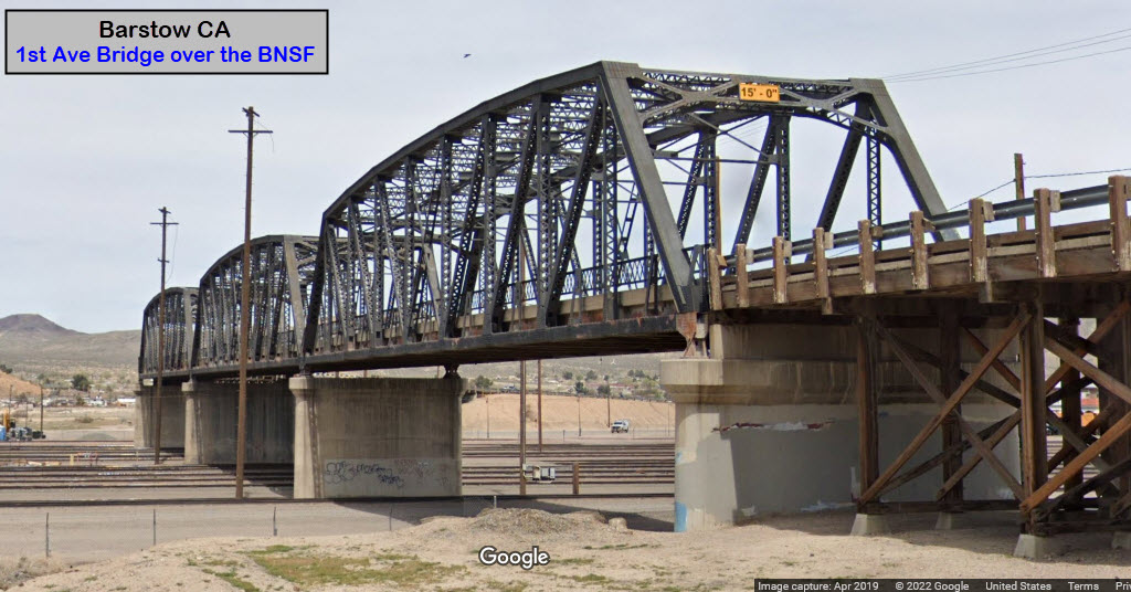
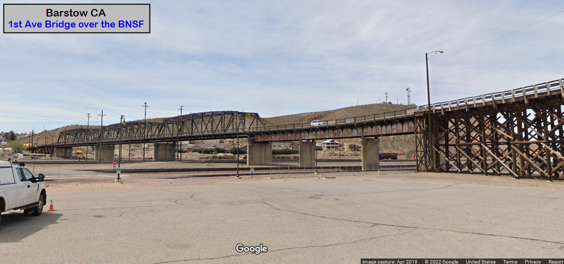
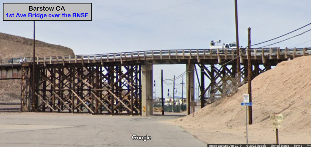
There is only one road crossing the yard, and it crosses the "eastern yard": North 1st Avenue. There is a sidewalk on the eastern side of the bridge.
GPS Coordinates: 34.86791, -117.02641
GPS Coordinates: 34.90494, -117.02505
The Route 66 "Mother Road" Museum was dedicated on July 4, 2000 in the historic Casa del Desierto, Harvey House, in Barstow, California. The Museum displays a collection of historic photographs and artifacts related to Route 66 and the Mojave Desert Communities. Displays include development of the United States Route 66 from early pioneer trails, railroads, automotive history, businesses and sites.
Visitors making this roadside attraction a day destination or staying in the area longer can learn more about what to experience while on the Mojave Desert or on Route 66 from many handouts, books and knowledgeable docents. Because of greater interest, our technical resources and preservation efforts are building to offer better assistance.
On May 1, 2003 Hampton Inn Hotels designated the Harvey House Route 66 Mother Road Museum as a "Roadside Attraction" by officially posting a sign, one of "66" along the Route's 2,448 miles.
During the heyday of rail passenger service in the Western United States, Barstow boasted a splendid rail depot/restaurant/hotel complex called the "Casa del Desierto", House of the Desert. Completed in 1911, the Casa del Desierto was the fourth "Harvey House" built by the Atchinson, Topeka, and the Santa Fe Railway Company along its right-of-way and operated by the Fred Harvey Company. These Harvey Houses established an unparalleled standard of food service to the traveler, and entered the lore of American railroading and the West. (from their website)
GPS Coordinates: 34.94513, -116.86294
Calico was abandoned in the mid-1890s. Ten years previously it had hit its peak as a silver mining town. Today, Calico Ghost Town Regional Park stands as a testament to the old west. In the 1950s, developer Walter Knott (who had just created Knott’s Berry Farm) purchased the land and kept the five original buildings in town while building false façades for the rest. Not everything is abandoned tho, as there are small business' set up in some of the buildings.
It's about 10 miles NE of the train station. Directions: Exit 191 from I-15 if you're coming from the west and go north on Ghost Town Road. Or, exit 194 if you're coming from the east, and go north on Calico Road, They will meet up just south of the town, but Ghost Town Road continues on north to the town.
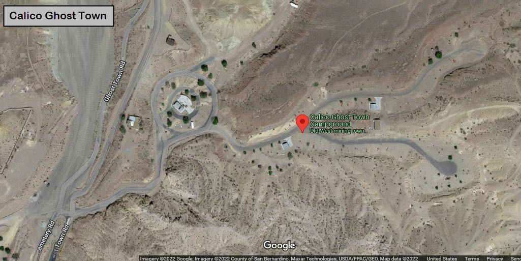
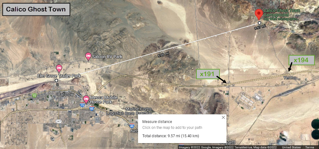
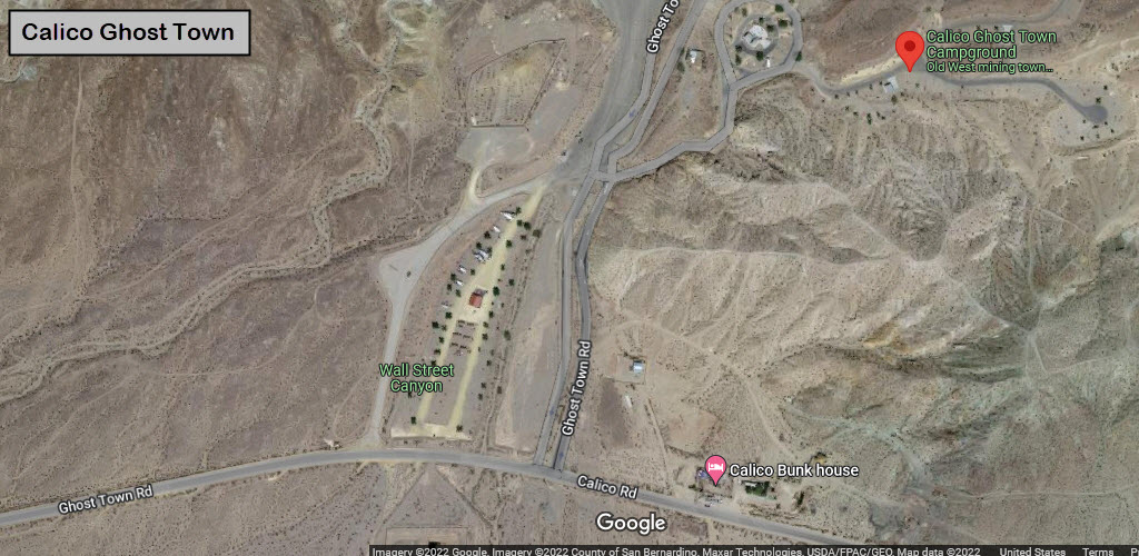
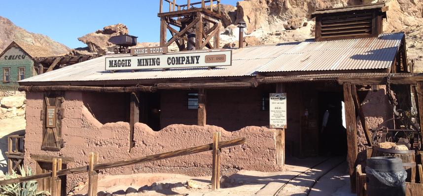
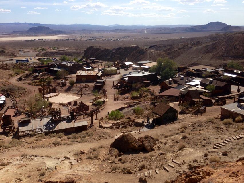 photo by Nicely, via Wikipedia
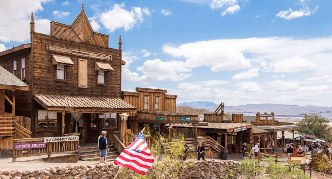
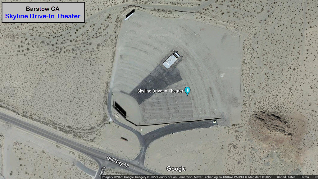
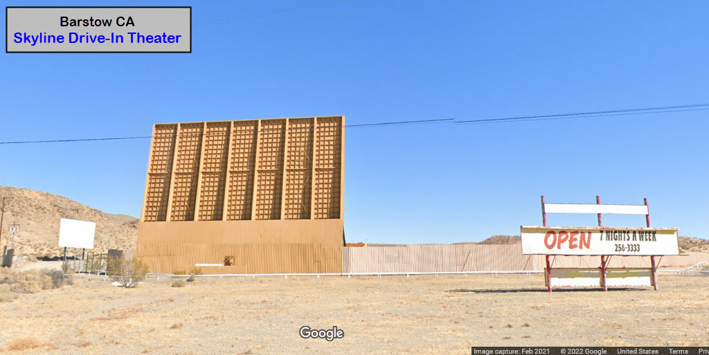
GPS Coordinates: 34.91280, -116.98387
Not that drive-in theaters are all that rare, this one apparently has a nice overlooking view of Barstow lit up at night!
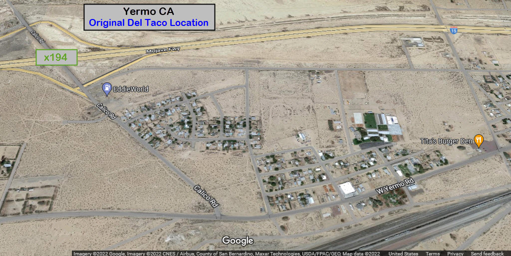
GPS Coordinates: 34.90513, -116.82128
38434 W Yermo Rd, Yermo CA 92398
760-905-8205
It's about 11-1/2 miles due east from the train station in Barstow.
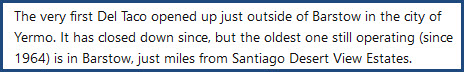 It is now Tita's Burger Den.
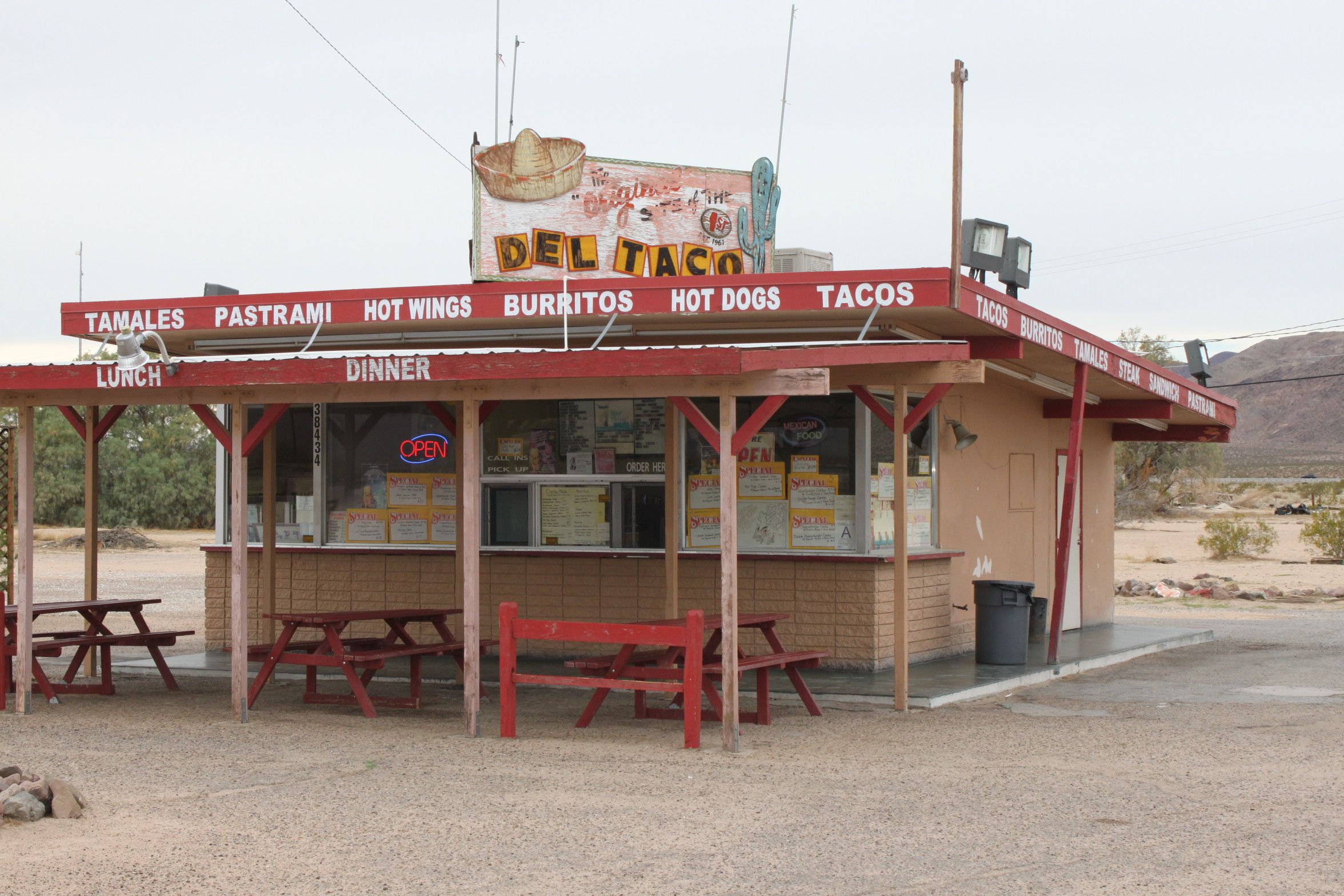 photo
by Christy Haines-Thrasher via Pinterest
photo
by Christy Haines-Thrasher via Pinterest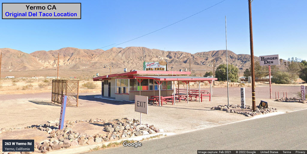
GPS Coordinates: 34.95742, -117.21278
Built in 2017 by artist Daniel Hawkins, this wayward construction stands over 50 feet tall and is fully functioning. The light creates "a beacon in a sea of sand". The lighthouse was built over a ten year period thanks to local contractors. To visit the lighthouse, you need to drive down Brook Canyon Road outside of the town of Hinkley and then hike a half mile.
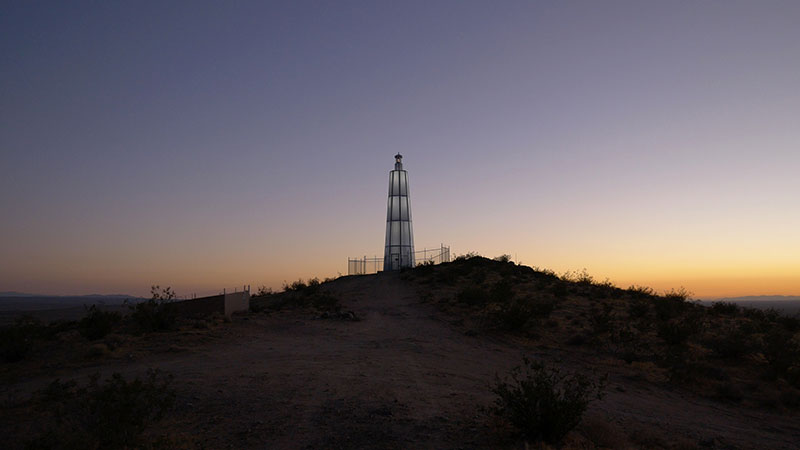 Buck Burns, via Wikipedia
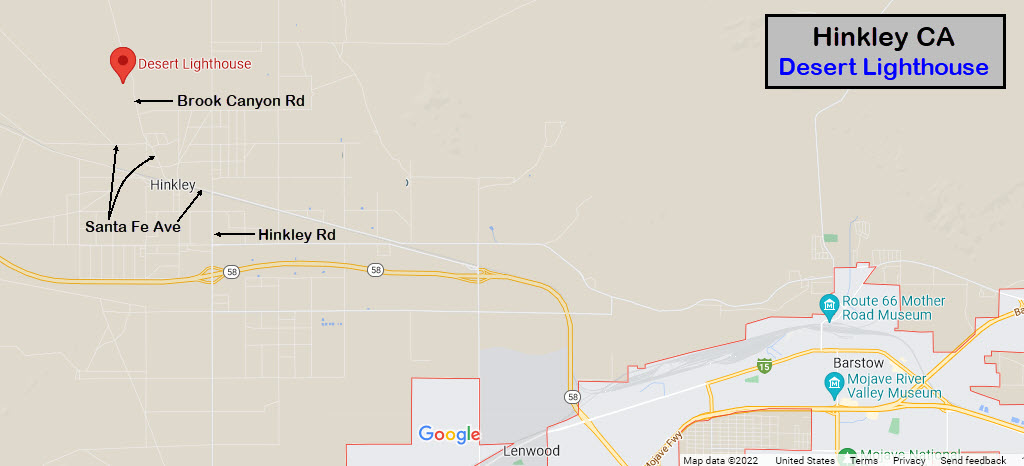
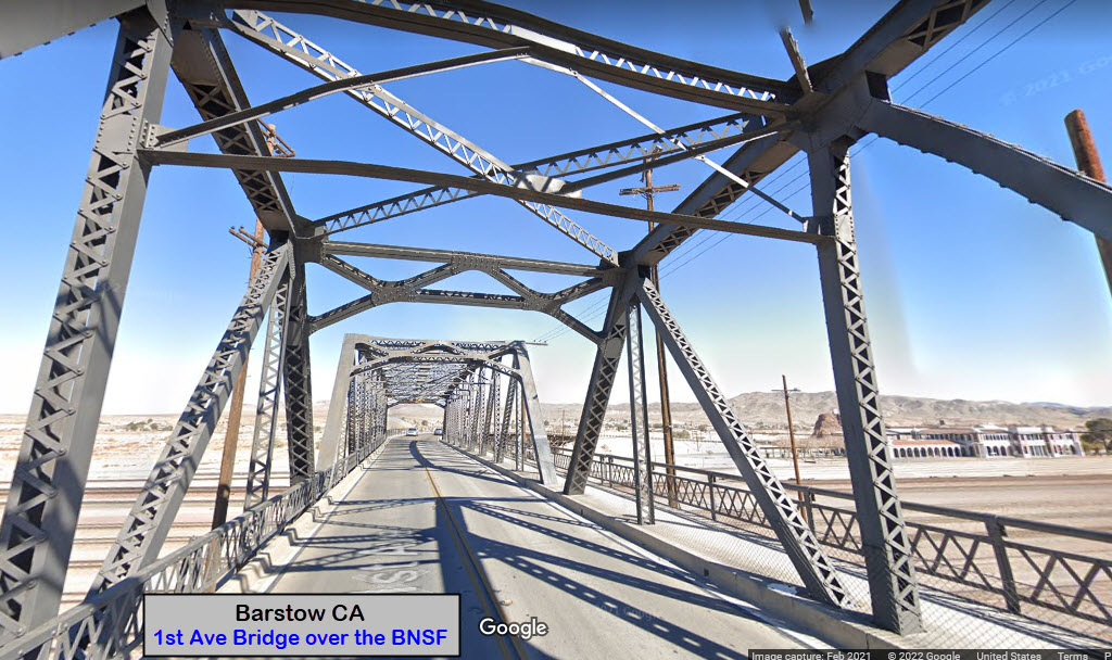
The
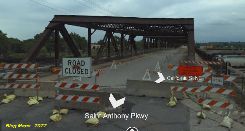
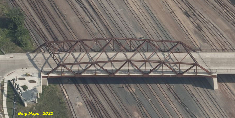
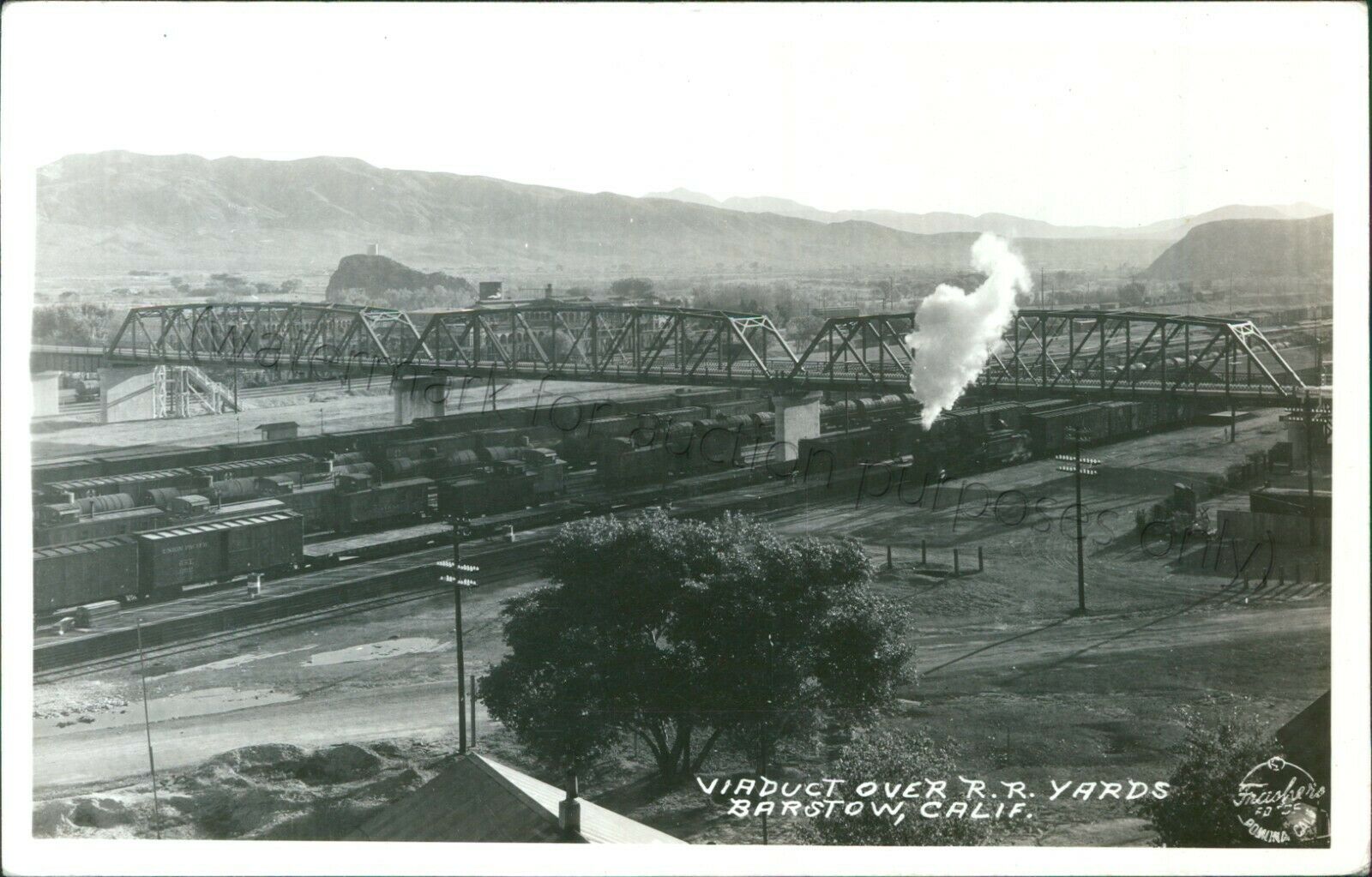
None seen other than "rain culverts".... With that said, let's dive into cool 1st Avenue bridge that crosses the BNSF, which, if we imagine (and it doesn't take much), this could just as easily be a railroad bridge! If you are at all familiar with Minneapolis, you'll remember there used to be a very similar bridge crossing Northtown Yard at the south end, at Saint Anthony Parkway.
GPS Coordinates: 34.90342, -117.02720


And for comparison purposes, a couple oft the bridge at Northtown (not exact, I just said -close-).....
GPS Coordinates: 34.86650, -116.91634
Located on the main line east of town on Route 66, about 6.7 miles SE of the station.
GPS Coordinates: 34.88364, -116.97990
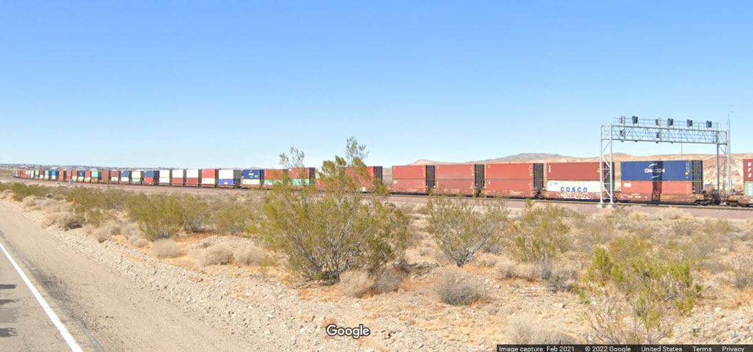
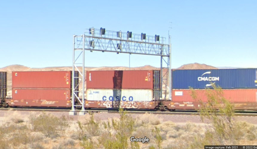
Perfect timing, for once, with signals in the shot no less! :-) Just east of a Walmart....
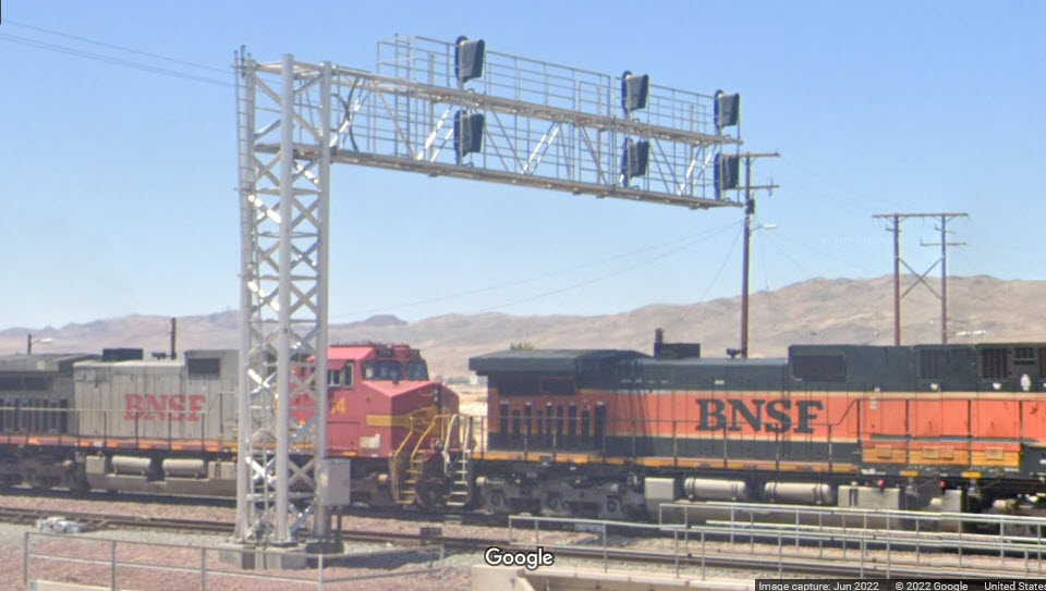
GPS Coordinates: 34.90294, -117.01237
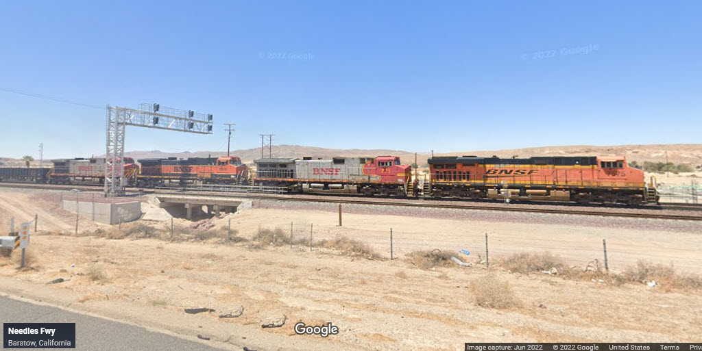
At the east end of the yard on the mainline, just down the road from the station.
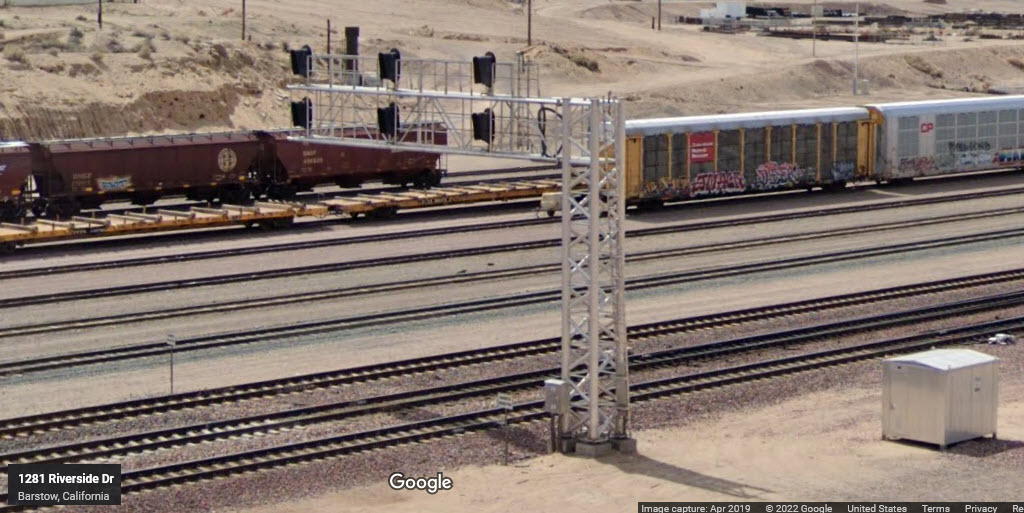

GPS Coordinates: 34.88858, -117.02240
861 Barstow Rd, Barstow CA 92311
760-256-2254
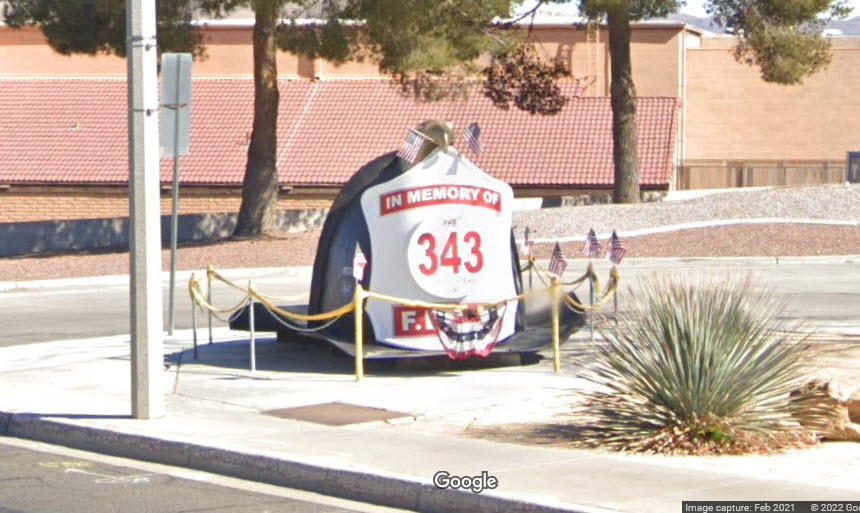
GPS Coordinates: 34.88590, -117.07795
2600 Main St, Barstow CA 92311
I guess, in some fashion, we're lucky that all of the law enforcement bureaus offices are within such a short distance from each other....

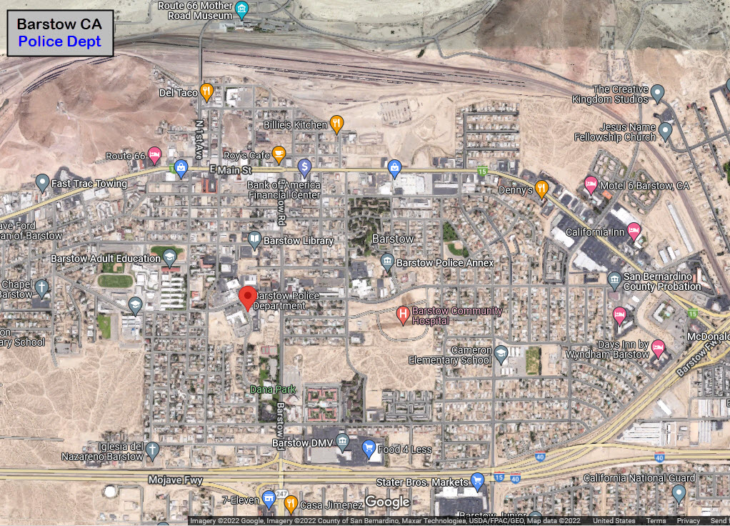
GPS Coordinates: 34.89271, -11702495
220 E Mountain View St # B, Barstow CA 92311
760-256-2211
GPS Coordinates: 34.89347, -117.02539
225 E Mountain View St, Barstow CA 92311
GPS Coordinates: 34.89347, -117.02539
300 E Mountain View St, Barstow CA 92311
760-255-5900
About half of these came from Card Cow, and the other half were found on EBay.


None for now......
Courtesy of the USGS, click here for their index page.
Disclaimers:
I love trains, and I love signals. I am not an expert. My webpages reflect what I find on the topic of the page. This is something I have fun with while trying to help others.
Please Note: Since the main focus of my two websites is railroad signals, the railfan guides are oriented towards the signal fan being able to locate them. For those of you into the modeling aspect of our hobby, my indexa page has a list of almost everything railroad oriented I can think of to provide you with at least a few pictures to help you detail your pike.
If this is a railfan page, every effort has been made to make sure that the information contained on this map and in this railfan guide is correct. Once in a while, an error may creep in :-)
My philosophy: Pictures and maps are worth a thousand words, especially for railfanning. Text descriptions only get you so far, especially if you get lost or disoriented. Take along good maps.... a GPS is OK to get somewhere, but maps are still better if you get lost! I belong to AAA, which allows you to get local maps for free when you visit the local branches. ADC puts out a nice series of county maps for the Washington DC area, but their state maps do not have the railroads on them. If you can find em, I like the National Geographic map book of the U.S..... good, clear, and concise graphics, and they do a really good job of showing you where tourist type attractions are, although they too lack the railroads. Other notes about specific areas will show up on that page if known.
Aerial shots were taken from either Google or Bing Maps as noted. Screen captures are made with Snagit, a Techsmith product... a great tool if you have never used it!
By the way, floobydust is a term I picked up 30-40 years ago from a National Semiconductor data book, and means miscellaneous and/or other stuff.
Pictures and additional information is always needed if anyone feels inclined to take 'em, send 'em, and share 'em, or if you have something to add or correct.... credit is always given! Please be NICE!!! Contact info is here
Beware: If used as a source, ANYTHING from Wikipedia must be treated as being possibly inaccurate, wrong, or not true.
RAILFAN GUIDES HOME
RAILROAD SIGNALS HOME
NEW 07/25/2022, JUL26/27/28/29/2022
Last Modified 29-Jul-2022