In General
Getting Here
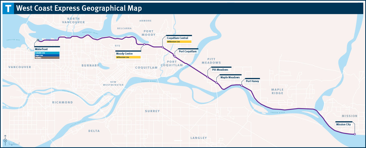
Maps
Station by Station
Pictures
Signals
Floobydust
RAILROAD SIGNALS HOME
Location / Name:
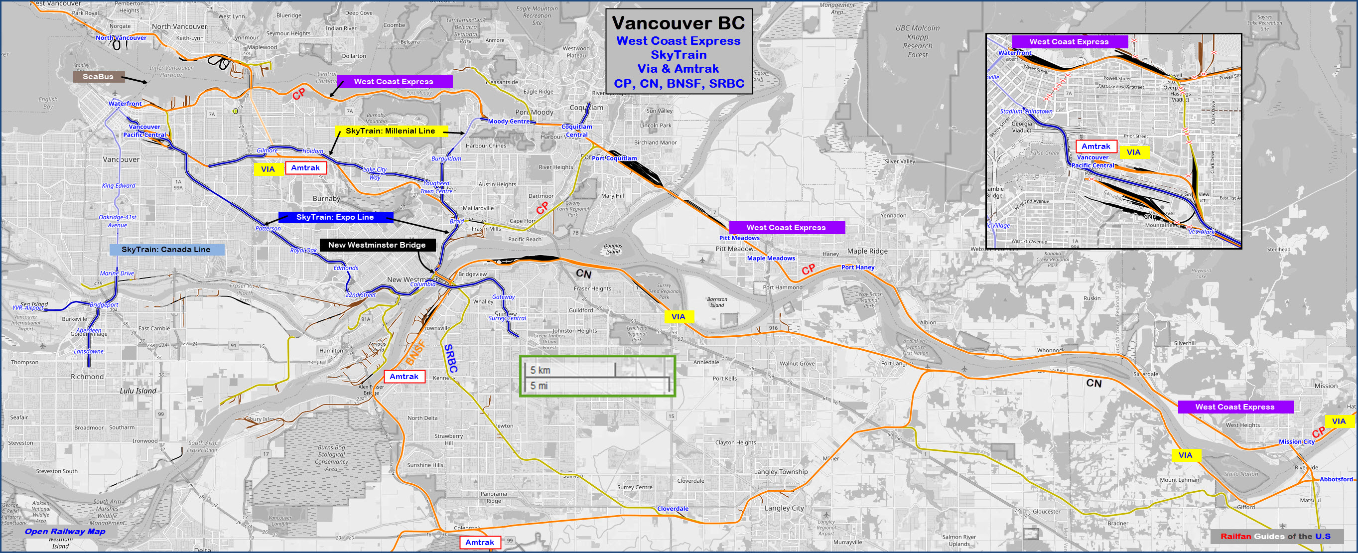
Vancouver BC
What's Here:
West Coast Express (Regional Commuter Rail)
Skytrain Rapid Transit System
Via
Amtrak
CP Rail
Canadian National
BNSF
Southern Railway of British Columbia
Waterfront Station (West Coast Express, SeaBus, Skytrain/2 lines)
Pacific Central Station (Via and Amtrak)
Data:
GPS Coordinates: as needed
Phone A/C: 604, specifically: 604-953-3333
ZIP: V6A 4C7 (at the Pacific Central Station)
Access by train/transit:
SkyTrain and SeaBus at the Waterfront station
Via and Amtrak after a 4 station ride on the SkyTrain Expo line
The Scoop:
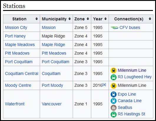
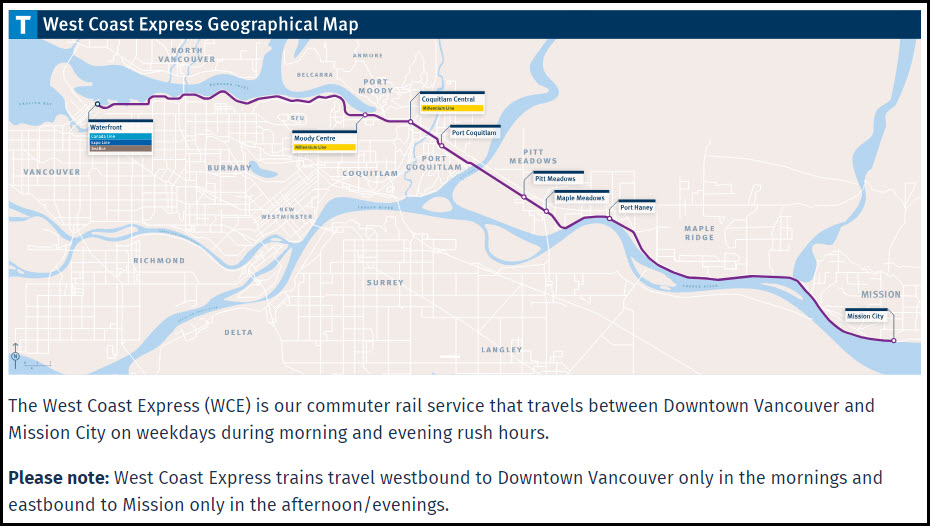
West Coast Express (WCE) has been serving the lower mainland since November 1, 1995 and provides more than 2.8 million trips per year. Every weekday more than 11,000 customers get on and off WCE at one of eight stations going to/from downtown Vancouver and Mission.
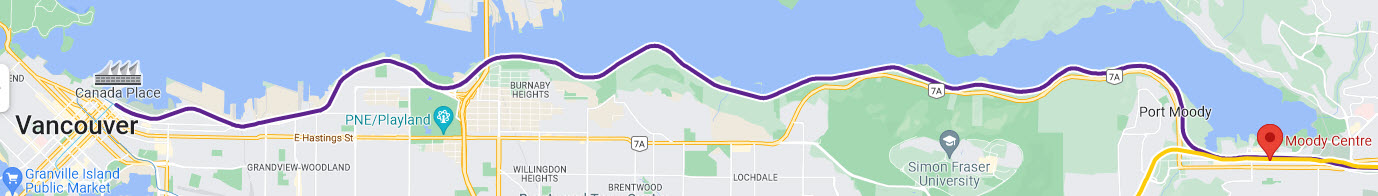
Trains terminate/originate from the Waterfront Station in downtown Vancouver, making a direct connection to Via or Amtrak not possible without taking a ride on SkyTrain's EXPO line (a four station ride).
Whether you need to catch up on work, or catch a few Z’s – WCE makes your commute as comfortable as possible. Every car is equipped with a washroom and our trains and stations are fully accessible. We can accommodate wheelchairs and scooters onboard our trains. Bikes are welcome onboard. Most WCE stations have Park & Ride lots where you can pay at the machine, use the TransLink Park&Go App.
The West Coast Express runs along the Canadian Pacific RR tracks from Mission to Vancouver along a 69km (42.9mi) route. A one way trip takes approximately 1 hour, 13 minutes, not including station breaks.
Note that the West Side Express is an inbound only commuter service during the AM hours, and an outbound to the "suburbs" type service in the PM hours. There are no "reverse movement" trains.
From the Waterfront station to its first stop at Moody Centre, it follows the southern shore of the Vancouver Harbour. If you're riding the train, you have a nice waterfront view around Bates & Montrose Parks and
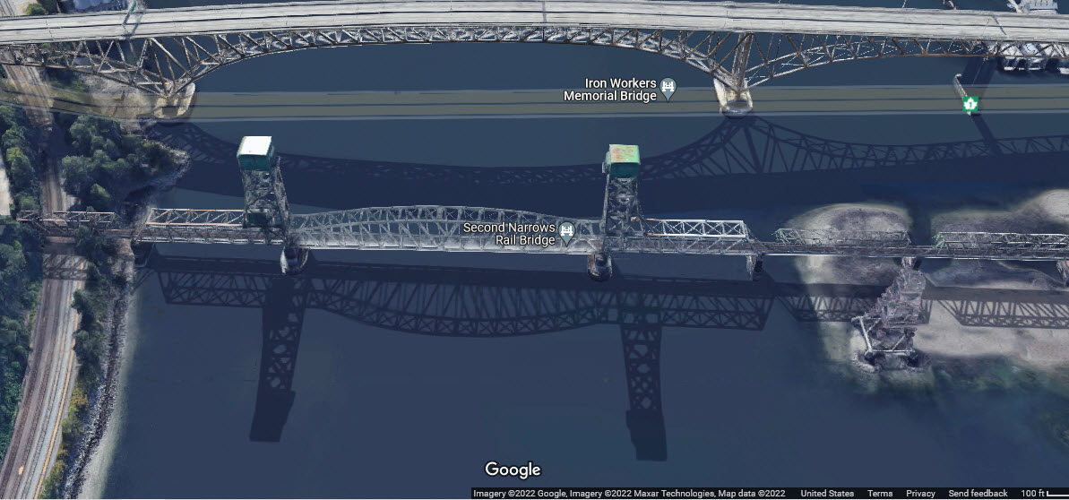
Next to the Trans-Canada Highway bridge over the harbour, is the Second Narrows Rail Bridge, a lift bridge that no longer carries any traffic because it doesn't connect to anything on it's south end.
Half of the West Coast Express stations have a transit connection:
Details / Specifics:
Acknowledgements:
Martin Parsons
Rick Horne
Jeffrey Ngai
Express691
Sonia Peterson
Mark Forseille
K200YVR
Denver Todd
Google Maps
Open Railway Map
Websites and other additional information sources of interest for the area:
https://en.wikipedia.org/wiki/West_Coast_Express
https://www.translink.ca/About-Us/Corporate-Overview/Operating-Companies/WCE.aspx
https://cptdb.ca/wiki/index.php/West_Coast_Express_906
https://canada.fandom.com/wiki/West_Coast_Express
https://www.abbynews.com/news/translink-ready-if-west-coast-express-affected-by-cp-rail-union-job-action/
https://en.wikipedia.org/wiki/Canadian_(train)
https://dailyhive.com/vancouver/west-coast-express-trains-upgrade-funding-translink
Since this line is a "long one", it is probably best to use your GPS or a really good map.
![]()
Station by Station
Waterfront Station
Moody Centre Station
Port Coquitlan Station
-- Canadian Pacific Yard --
-- Pitt River Swing Bridge --
-- Intermodal Facility --
Pitt Meadows Station
Maple Meadows Station
Port Haney Station
Mission City Station
-- Port Moody Historic Depot --
-- Historic Mission City Depot --
NON-STATIONS denoted with double set of dashes --
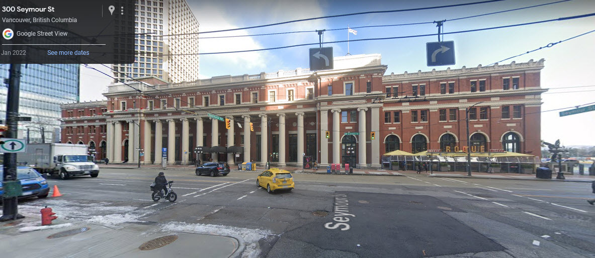
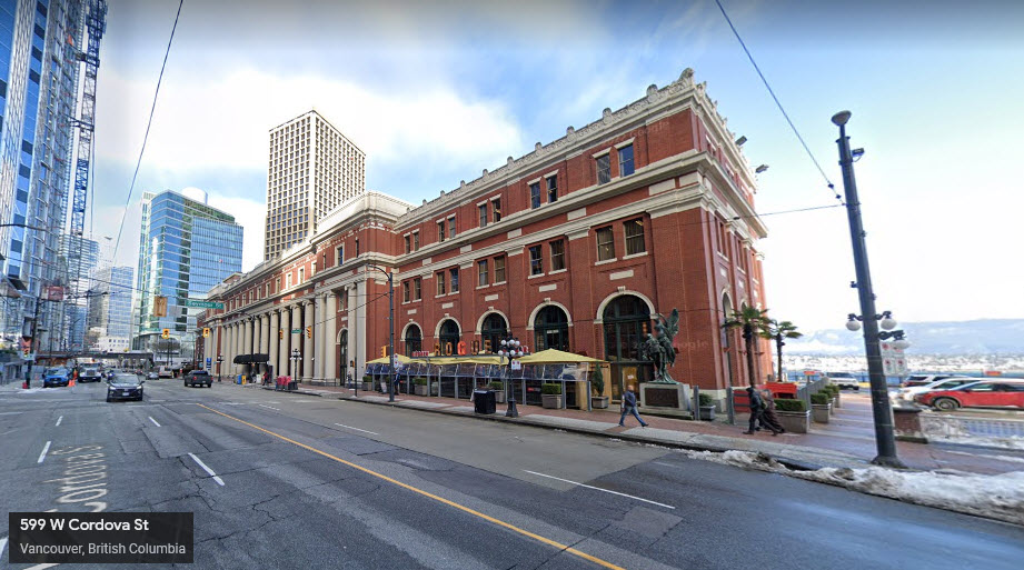
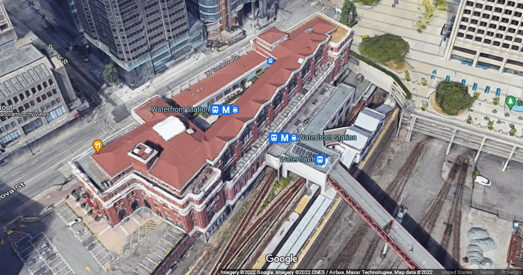
Waterfront Station / Vancouver BC
GPS Coordinates: 49.28612, -123.11171
601 W Cordova St, Vancouver BC, V6B 1G1
https://en.wikipedia.org/wiki/Waterfront_station_(Vancouver)
From Wikipedia: Waterfront station was built by the Canadian Pacific Railway (CPR) and opened on August 1, 1914. It was the Pacific terminus for the CPR's transcontinental passenger trains to Montreal, Quebec, and Toronto, Ontario. The current station is the third CPR station. The previous CPR station was located one block west, at the foot of Granville and, unlike the current classical-styled Waterfront station, was built in "railway gothic" like the CPR's many railway hotels.
In 1978, when Via Rail took over the passenger operations of the CPR and the Canadian National Railway, it continued using both railways' stations in Vancouver, but a year later, Via consolidated its Vancouver operations at Pacific Central Station, the CN station near False Creek, and ceased using the CPR station. The last scheduled Via passenger train to use Waterfront station departed on October 27, 1979.
Waterfront station's transformation into a public intermodal transit facility began in 1977. That year, the SeaBus began operating out of a purpose-built floating pier that was connected to the main terminal building via an overhead walkway above the CPR tracks. The CPR's passenger platform and some of its tracks were torn up in the early 1980s to make way for the guideway of the original SkyTrain line (Expo Line), which opened on December 11, 1985. During Expo 86, SkyTrain operated special shuttle trains between Waterfront station and Stadium–Chinatown station (then named Stadium station), connecting the Canadian Pavilion at Canada Place to the main Expo site along False Creek.
In 1995, platforms were built adjacent to the SkyTrain station for the West Coast Express, which uses the existing CPR tracks. The platforms for the West Coast Express were built in the same location as the old CPR platforms.
In 2002, Millennium Line trains began to share tracks with the Expo Line at Waterfront station. The lines continued to share tracks until late 2016, when an Expo Line branch to Production Way–University station was created in replacement of the Millennium Line service between VCC–Clark and Waterfront stations.
In 2009, the Canada Line opened with separate platforms which are accessible via the main station building, but require leaving the fare-paid zone when transferring between other modes. Waterfront station serves as a common terminus point for both the Expo Line and the Canada Line. end Wiki
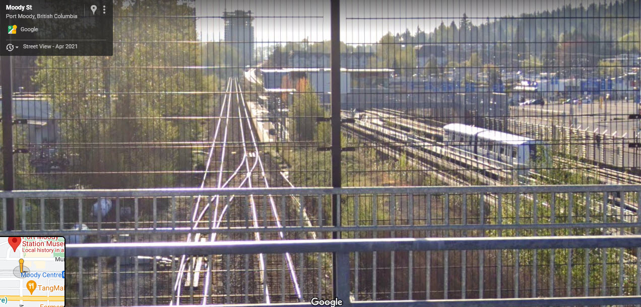
Moody Centre Station / Port Moody BC
GPS Coordinates: 49.27812, -122.84715
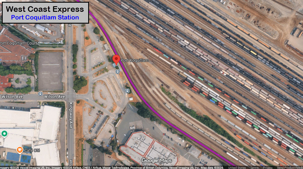
Port Coquitlan Station / Port Coquitlan BC
GPS Coordinates: 49.27392, -122.80007
A HUGE Canadian Pacific Railyard, on the west shore of the Pitt River.
The Millennium Line, which has paralleled the WCE from downtown, turns north on it's own "routing".
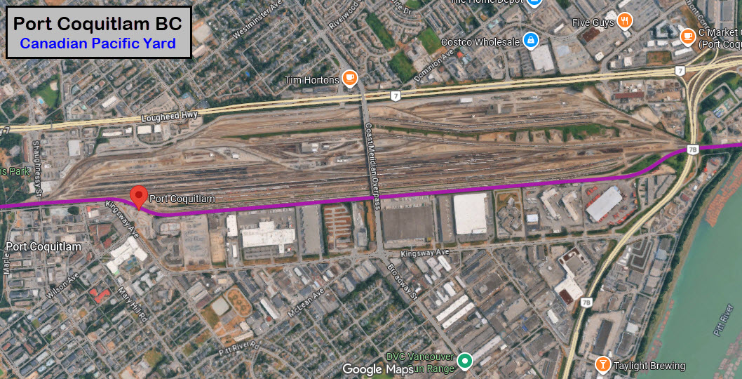
Canadian Pacific Yard
Huge yard which the West Coast Express runs along the south side of.
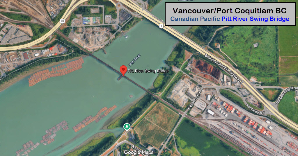
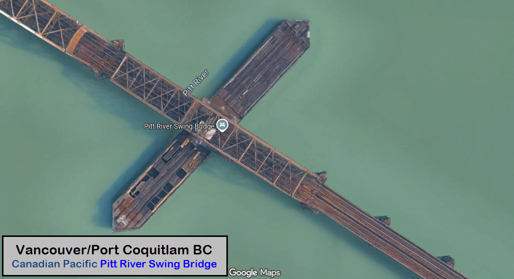
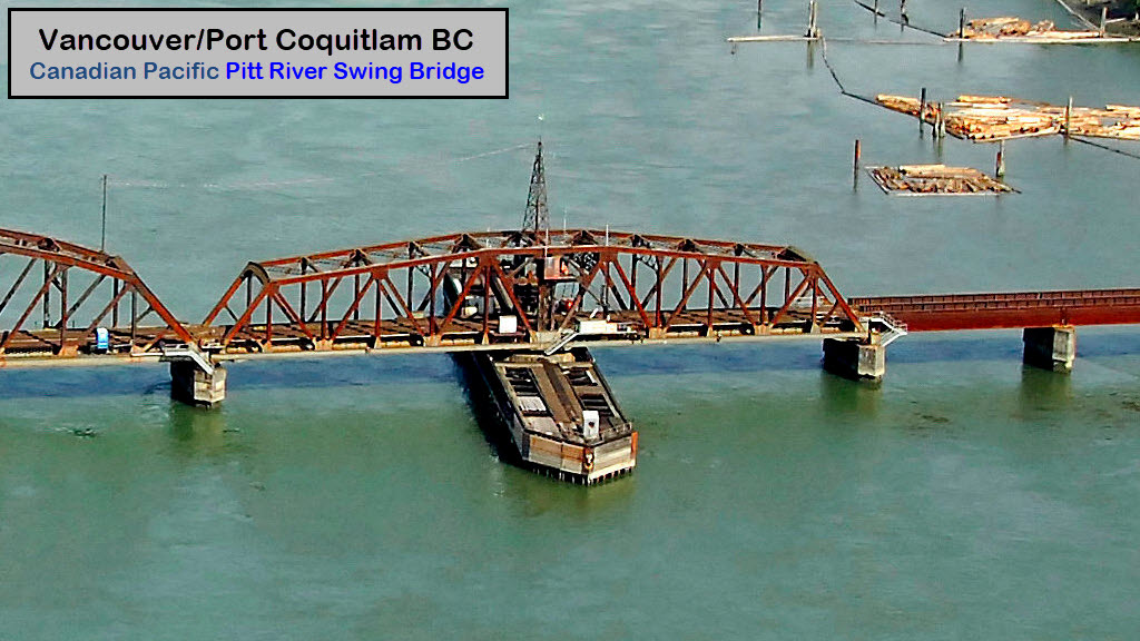
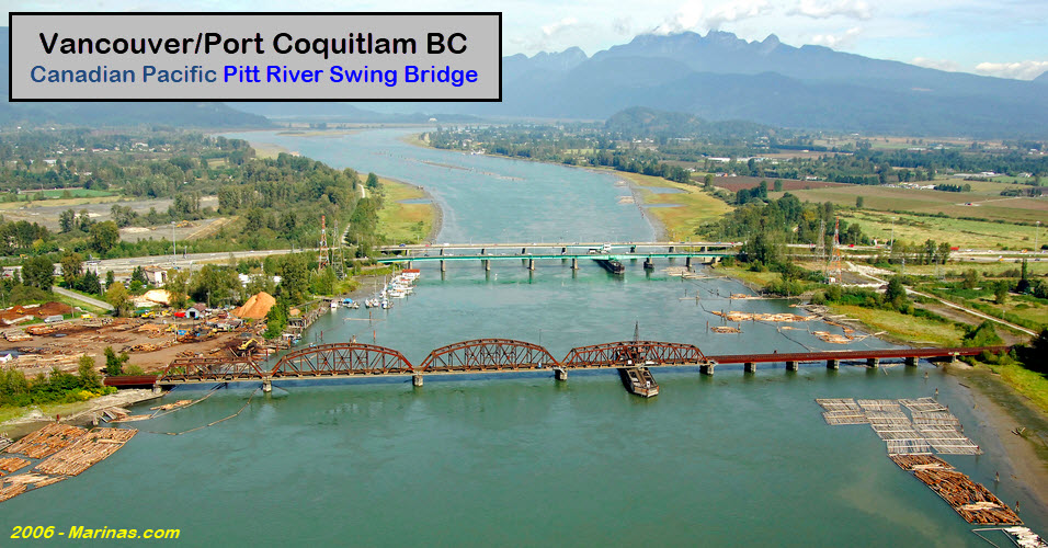
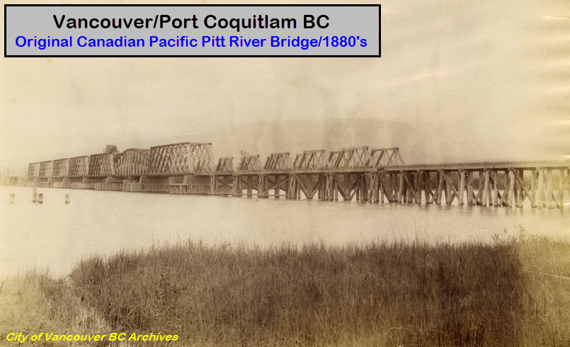
Canadian Pacific Pitt River Swing Bridge
GPS Coordinates: 49.24510, -122.73366
https://en.wikipedia.org/wiki/Pitt_River_Swing_Bridge
https://marinas.com/view/bridge/dmu131_Pitt_River_Canadian_Pacific_Railway_Bridge_Port_Colquitlam_BC_Canada
From Wikipedia: The Pitt River CPR Bridge is a railroad swing bridge that crosses the Pitt River between Port Coquitlam and Pitt Meadows in British Columbia, Canada. The bridge is owned and operated by Canadian Pacific Kansas City (CPKC), formerly Canadian Pacific Railway (CPR). Besides freight traffic, the bridge also hosts West Coast Express commuter trains.
The bridge has a total length of about 530 metres (1,750 ft), and it opens for marine traffic by rotating a 84-metre long (276 ft) swing span that weighs 590 tonnes (650 short tons). In addition to the swing span, there are eight short plate girder spans, two 78-metre (257 ft) fixed truss spans, and one 55-metre (182 ft) fixed truss span.[12] The truss of the swing span was recycled from the former single-track CPR bridge over the Red River in Winnipeg, Manitoba. The fixed truss spans are on the west side of the river, the swing truss span is in the middle, and the plate girder spans are on the east side of the river.[12][8] The maximum depth of the river below the bridge was about 21 metres (70 ft).
As of 2024, the bridge averages about 45 daily train crossings, and it opens about 15 times per day. The bridge requires about 8 minutes to open or close the swing span. When opened, the Port Coquitlam side of the opened bridge has a channel width of 30 metres (98 ft) at a control depth of 6.1 metres (20 ft), while the Pitt Meadows side has a channel width of 21 metres (69 ft) and a control depth of 3.3 metres (11 ft). -END WIKI-
Vancouver/Pitt Meadows BC - Canadian Pacific Intermodal Facility
Another yard that the West Coast Express skirts the south side of, on the eastern shore of the Pitt River.
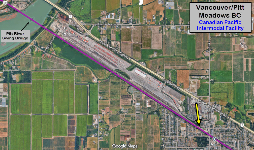
From Harris Road, you can see the yard lead and signal controlling access to this yard from the main.
Pitt Meadows Station / Pitt Meadows BC
GPS Coordinates: 49.22577, -122.68831
12280 Harris Road, Pitt Meadows BC
https://cptdb.ca/wiki/index.php/TransLink_Pitt_Meadows_Station
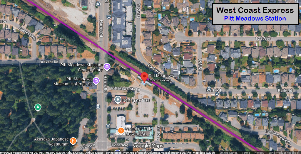
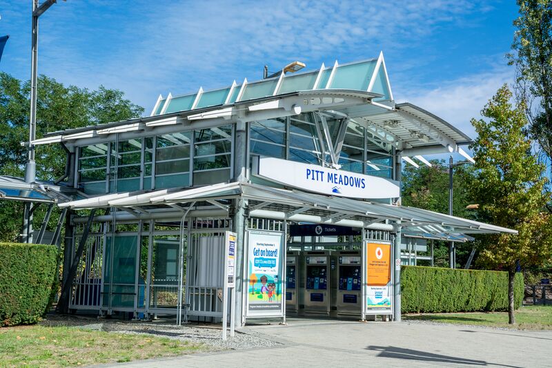 photo by Express691, 12NOV2021
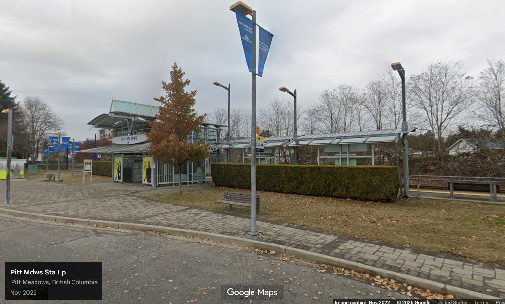
Maple Meadows Station / Maple Ridge BC
GPS Coordinates: 49.21653, -122.66617
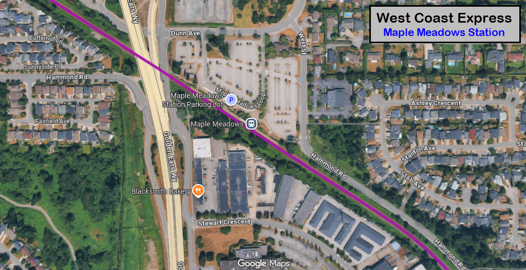
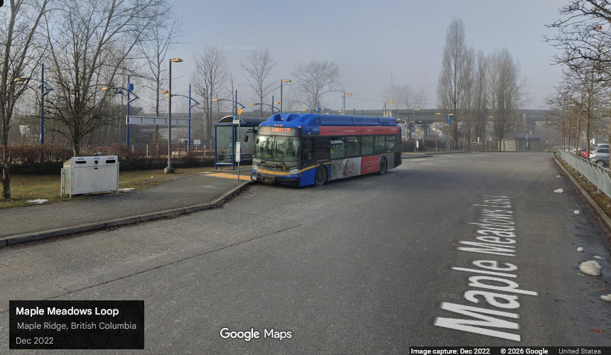
 unknown location shot.....
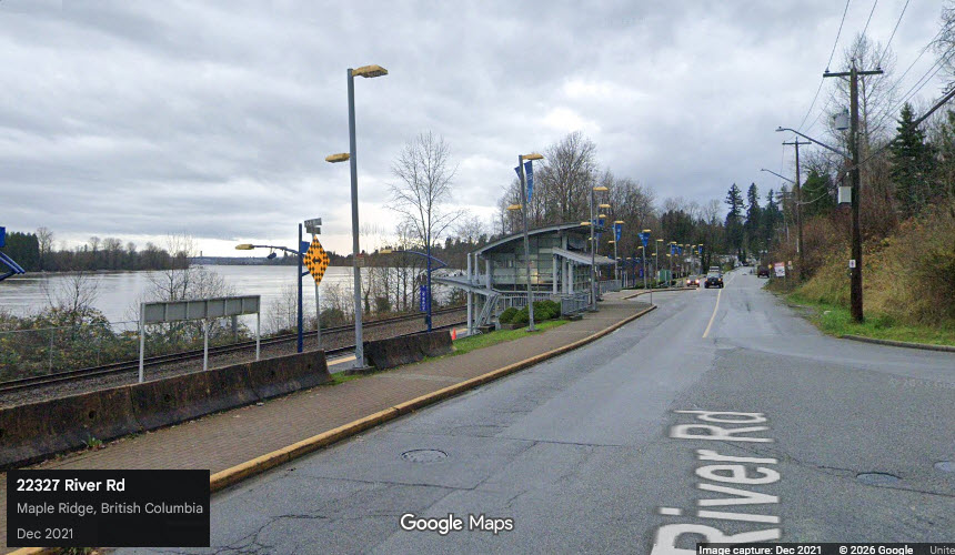
Port Haney Station / Maple Ridge BC
GPS Coordinates: 49.21223, -122.60528
22300 River Road, Maple Ridge, BC
https://cptdb.ca/wiki/index.php/TransLink_Port_Haney_Station
Station has a beautiful view of the Fraser River!
From Ms. Peterson's Flickr page: Port Haney Station - Port Haney, Maple Ridge, BC Canada -- The Port Haney station is a commuter rail station served by the West Coast Express line which connects Vancouver and Mission in British Columbia, Canada. The station is located on the north side of the Canadian Pacific Railway (CPR) tracks in Maple Ridge, just off River Road and 223rd Street. The station opened in 1995, when the West Coast Express began operating. All services are operated by TransLink.
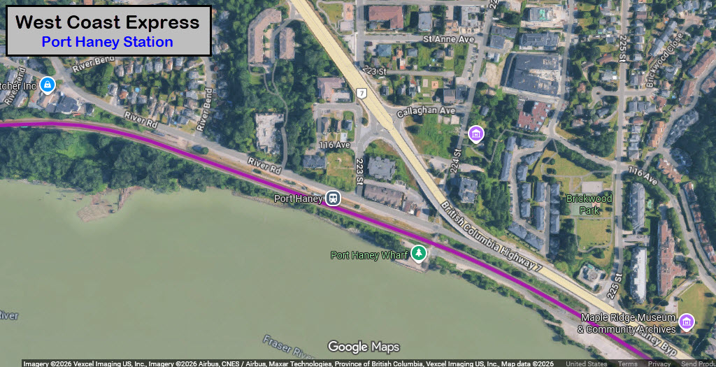
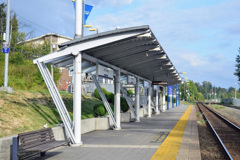 photo by K200YVR
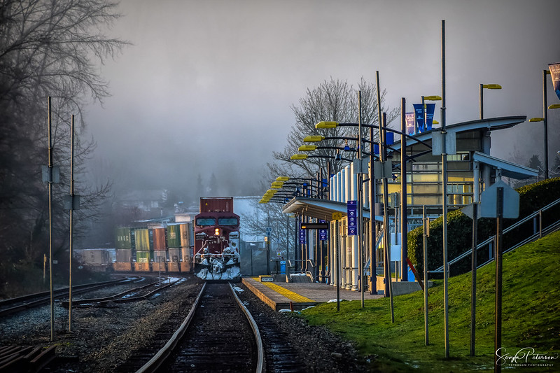
photo by Sonia Peterson, I run the risk of her emailing me and telling me to take it down since she says it's a licensable pix, but enjoy it for now -- nice shot BTW!
For more of her work: https://www.flickr.com/photos/spetersongallery/27788362249
Mission City Station / Mission BC
GPS Coordinates: 49.13380, -122.30369
33200 N. Railway Avenue, Mission BC
https://cptdb.ca/wiki/index.php/TransLink_Mission_City_Station
See pictures of the original depot below.
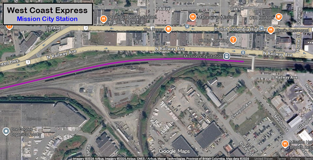
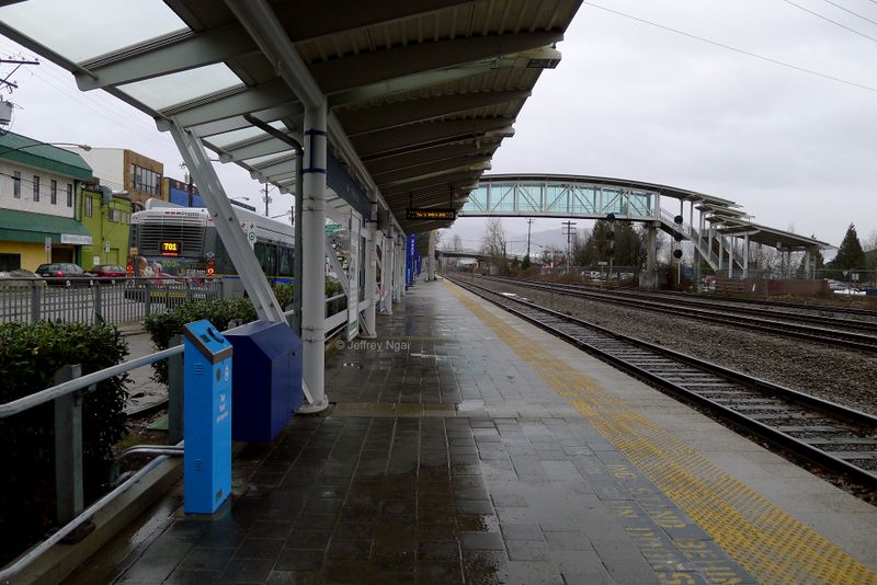 photo by Jeffrey Ngai, 13DEC2017
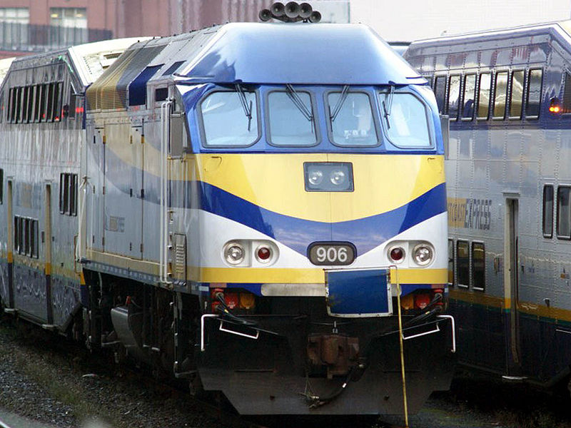
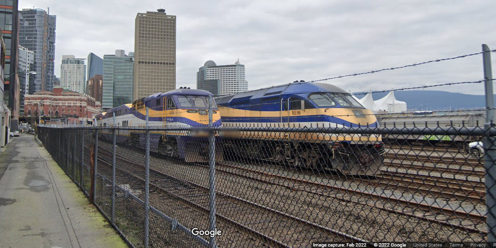
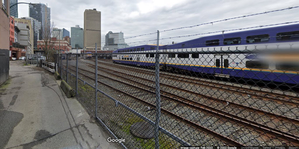
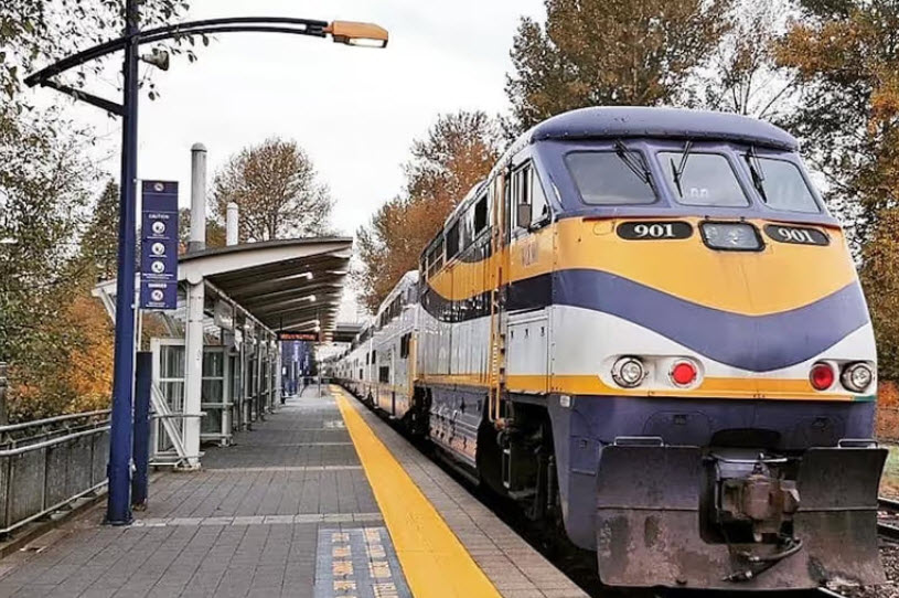
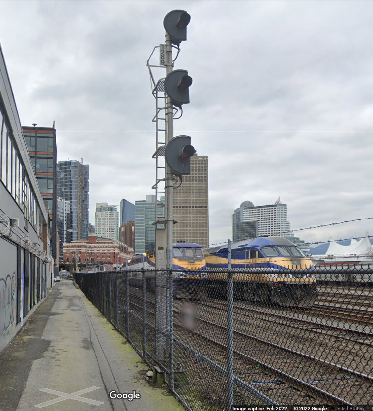
West Coast Express MPI-built MP36PH-3C 906 at Vancouver's Waterfront Station, 2NOV2007, photo by Martin Parsons
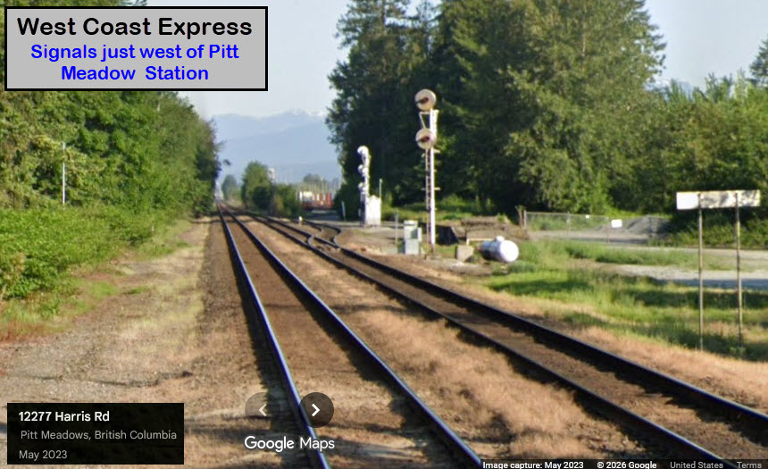
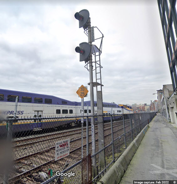
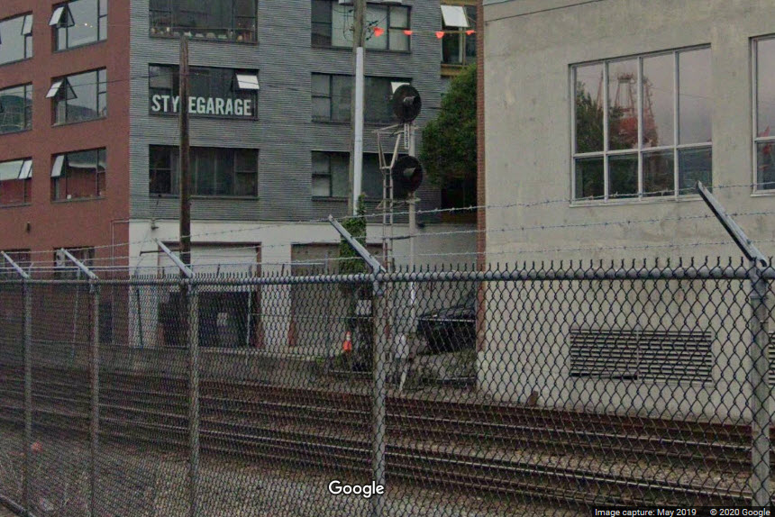
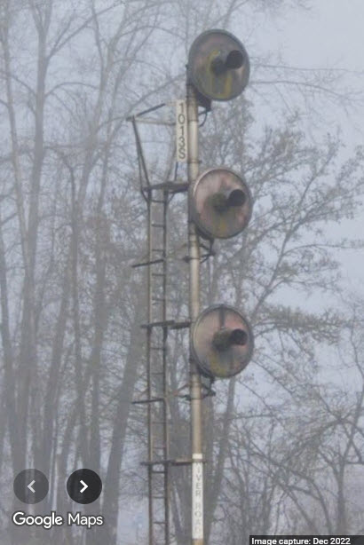
Looks like most, if not all of the signals on the line are GRS searchlight signals.
Notice in the Waterfront station area, the backgrounds have been trimmed because of close clearances.
GPS Coordinates: 49.28474, -123.10823
GPS Coordinates:
GPS Coordinates:
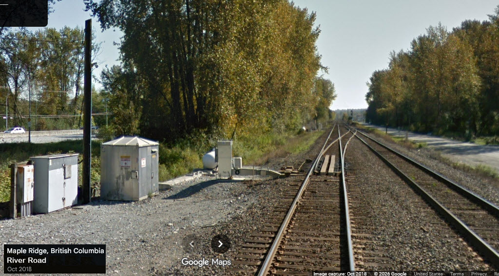
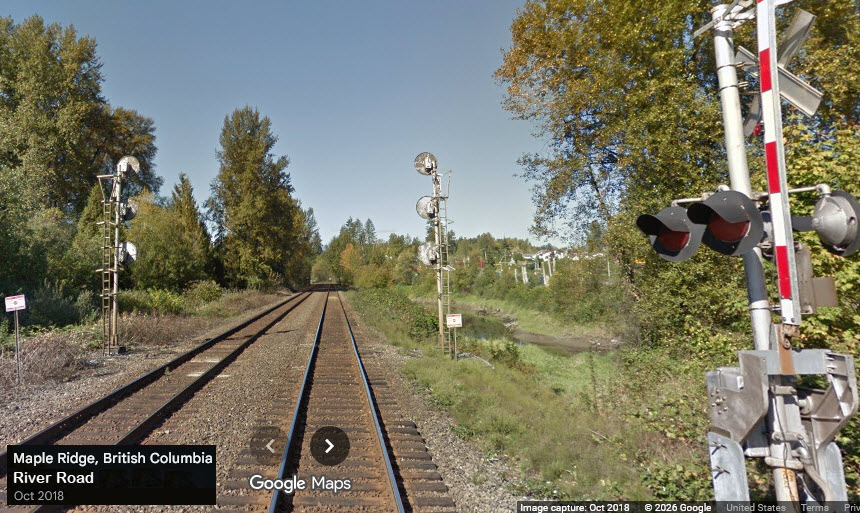
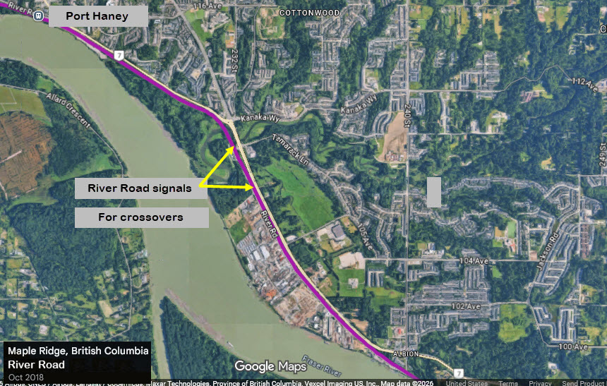
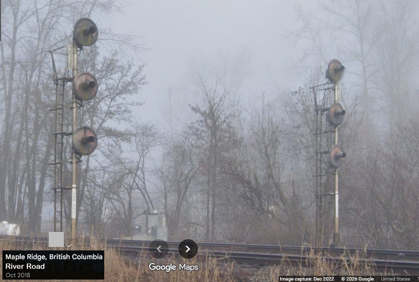
GPS Coordinates: 49.20076, -122.57942
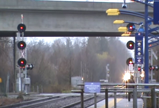
Beautiful picture spot if you want pictures framed by a dual set of signals, at both ends of the crossovers.
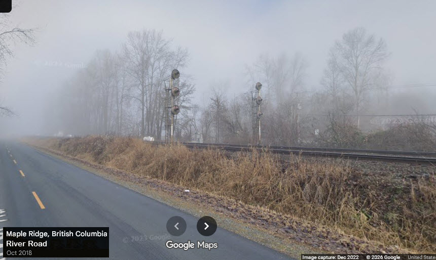
The Google Streetview cameras caught them on a foggy morning!
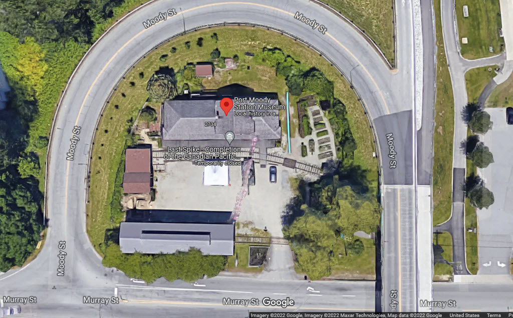
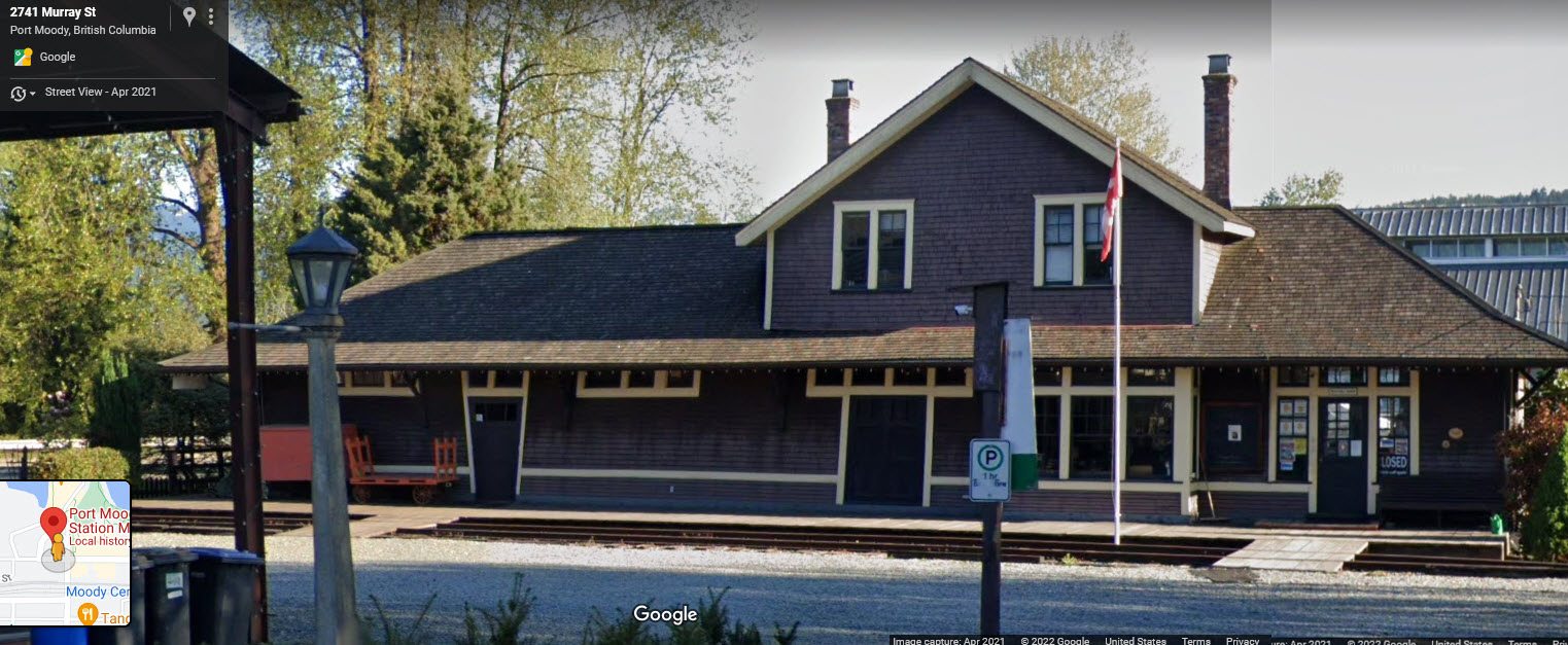
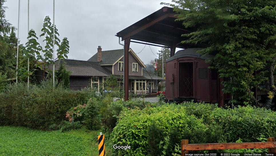
CP Rail's Port Moody Station
Built circa 1907 and in use until 1971. Purchased in 1978 by the Port Moody Heritage Society and moved to a new location on Murray Street.
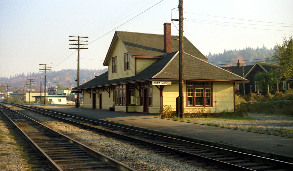 1967, Rick Horne via Flicker
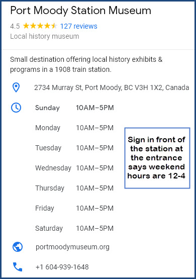
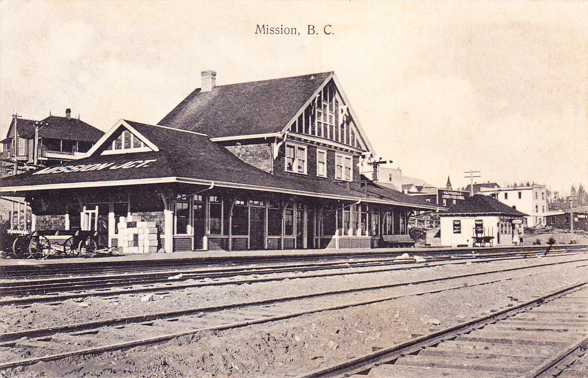
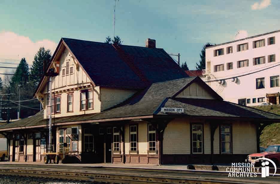
Mission Junction / Mission City Station
History from the FB Page https://www.facebook.com/photo.php?fbid=3432250490173344&set=a.767583605161156&id=100057285706869:
Mission Community Archives: BLAST FROM THE PAST – Picture This! Mission’s CPR Station, 1989
Constructed in 1909 by BC Mills, Timber and Trading, the former CPR station on Railway Avenue shown here in 1989 played an important role in the development of the community, serving as a major transportation centre that literally put Mission on the map. As many as 30 trains a day stopped at the station, including passenger trains from Montreal, St. Paul, Seattle, Agassiz and Vancouver.
A year after this [color] photo was taken, the Canadian Pacific Railway closed the station and slated it for demolition even though the building was structurally sound. However, in 1991, the former station was saved through the federal government’s Heritage Railway Stations Protection Act.
Damaged by fire in 1993, the Kinsmen Club of Mission acquired the old station for purposes of restoring and re-purposing it. However, on January 25th, 1999 the iconic building burned down due to arson. (SOURCE: Heritage Places | Mission, BC Website)
The posted photograph was taken by local photographer Noel Hall (1930-2017) who called his business “Picture This!”
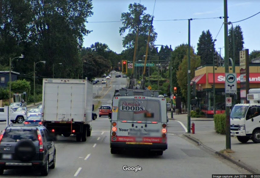
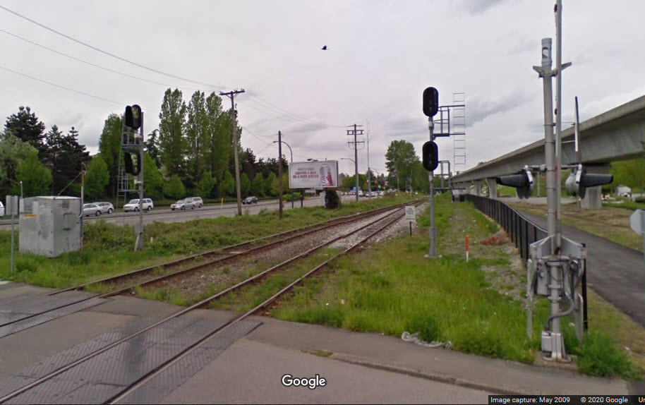
Trackless Trolley on Renfrew St, just after crossing the CPR tracks.
This is close to the Renfrew Millennium Line station, about 4.2km (2.6mi) from the Pacific Central Station:
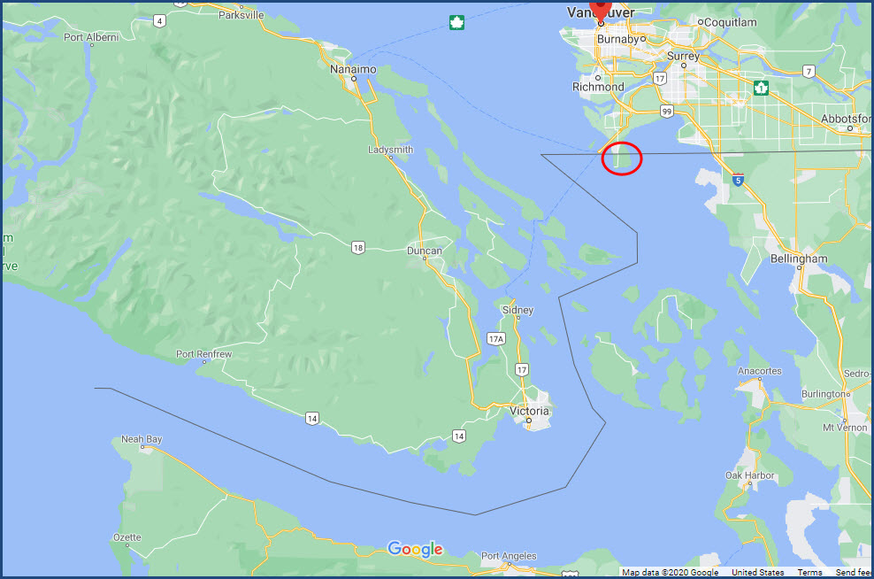
Mystery........
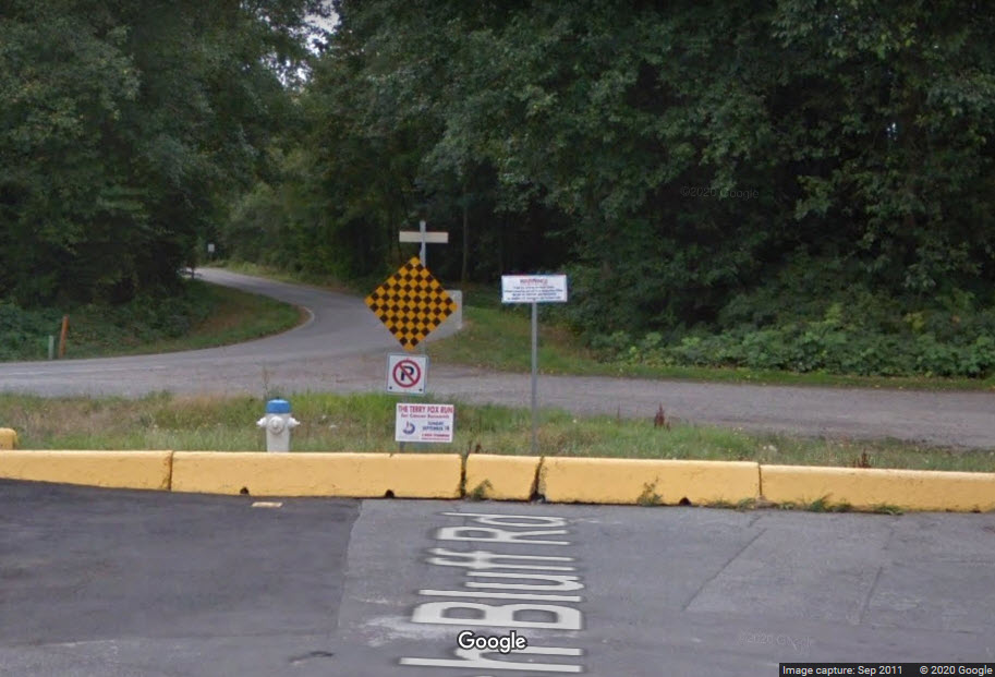
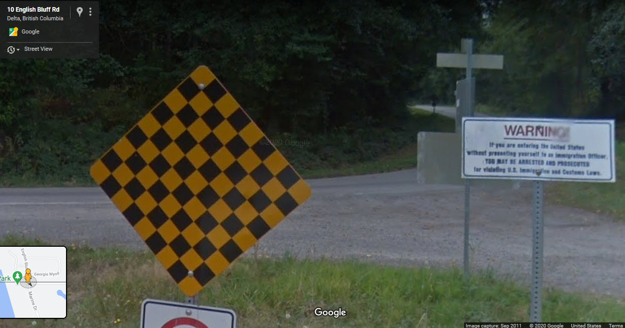
Why, when the U.S./Canada border was drawn up, did they leave the tip of the peninsula as part of the United States? They sure went to a lot of trouble to zig-zag thru the other islands to divide things up, so why didn't they do the same for this area????? There is no way to get to the U.S. except for going thru customs and driving thru Canada, and now that the two countries have gotten on "unfriendly" terms, requiring a passport to cross the border, it must be a freakin pain-in-the-ass experience!!! And before telephone companies went electronic, I betcha they just loved having a separate section of number 5 crossbars just for the few phones that were in the states, and they still probably charged it as an international call even if you were calling someone in a house just across the street, but in Canada. I dunno, I think we should give it to Canada and call it a day! :-) :-)
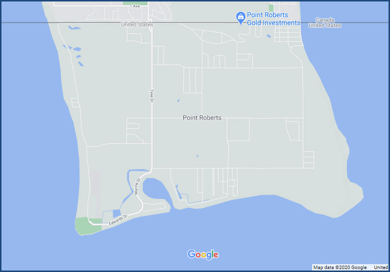
This is at the west end of the peninsula, the streetview is from 2011, so there is probably a fence there now with razor wire on it!
Here are a few signal locations I happened to comes across while looking for other things.....
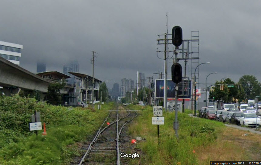
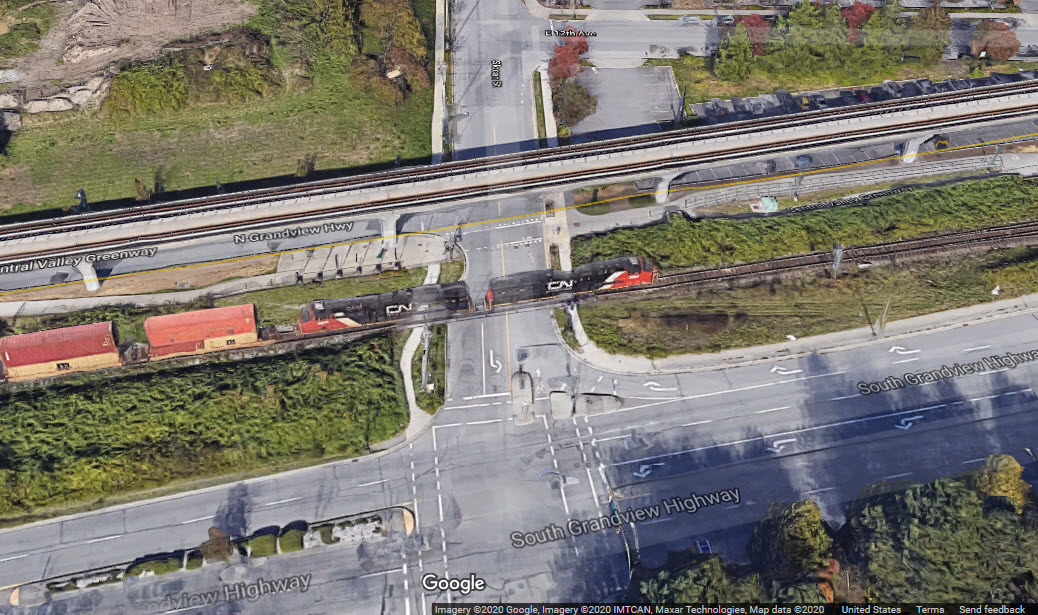
Kaslo St / CN Freight Line
The tracks here go to single track to continue on into downtown. For a while, it parallels the Millennium Line.
Disclaimers:
New format 10/26/23: Please check out my disclaimer page for my standard dribble and contact info here
RAILFAN GUIDES HOME
RAILROAD SIGNALS HOME
NEW SEP26/2020, MAR26/2022, DEC11/2022, MAY16/17/2026
Last Modified 17-May-2026