![]()
In General
Getting Here
Map
Articles
Pictures
Before the Wall Fell
Signals
USGS Maps
RAILROAD SIGNALS HOME
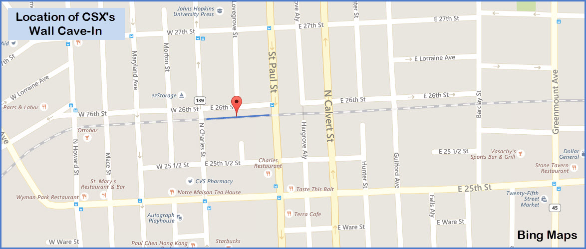
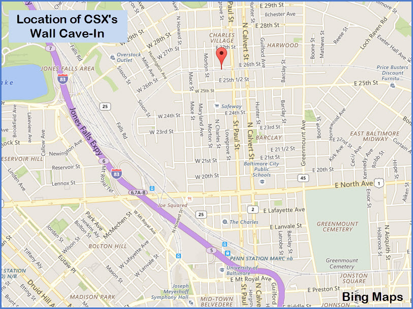
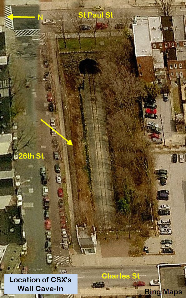
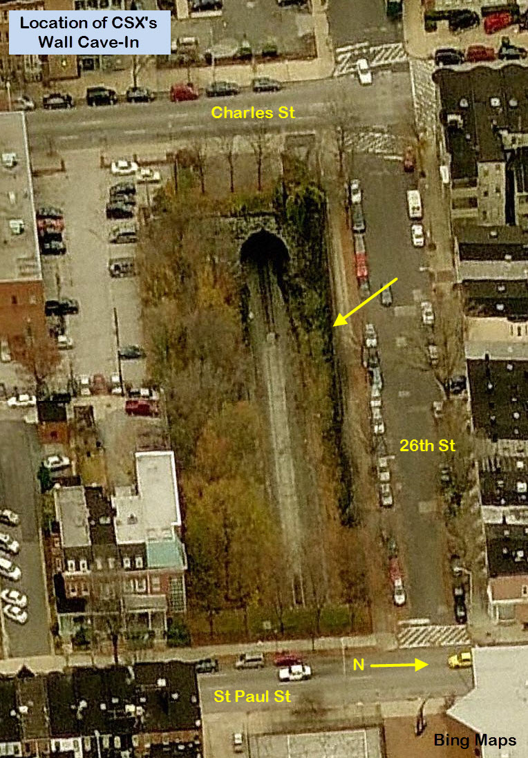
Location / Name:
26th St in Baltimore City MD, adjacent to Charles St
What's Here:
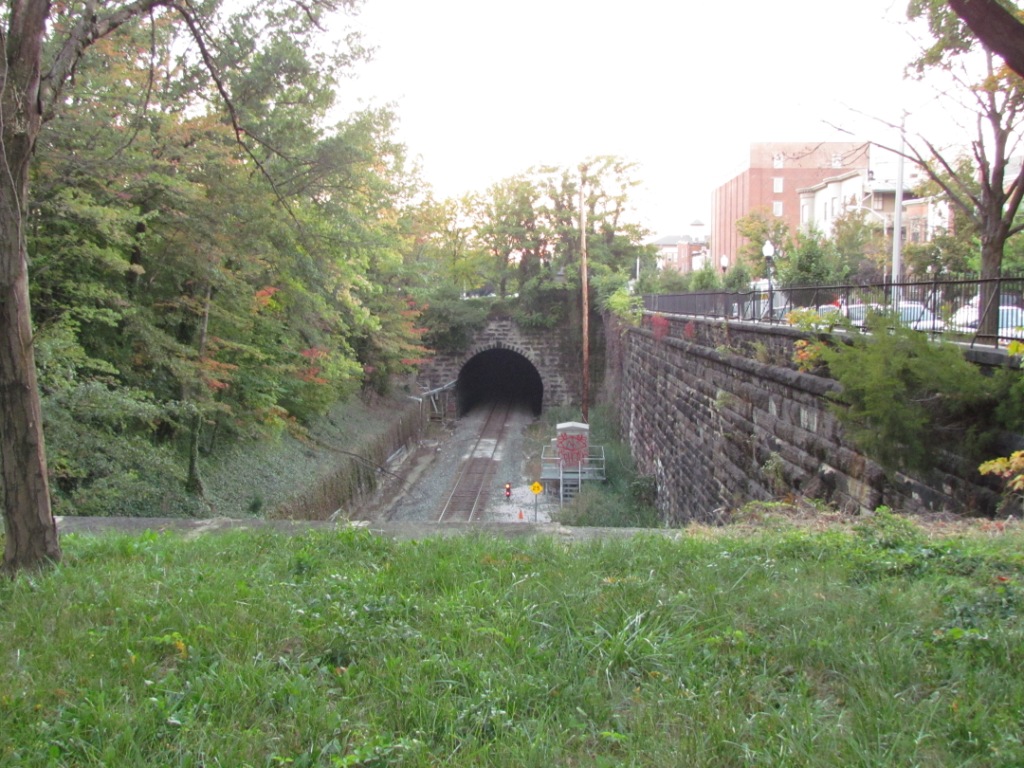
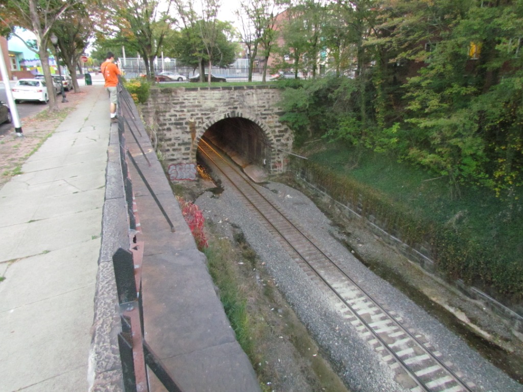
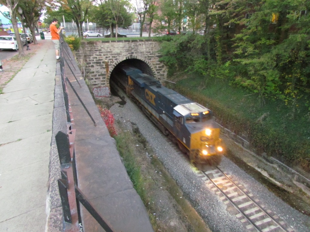
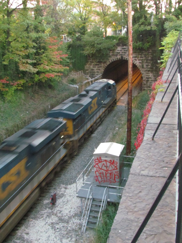
CSX's E/W Mainline through Baltimore
And the Retaining Wall that Collapsed
Data:
GPS Coordinates: 39.319240, -76.616345
Phone A/C: 410 & 443
ZIP: 21218
Access by train/transit:
None
The Scoop:
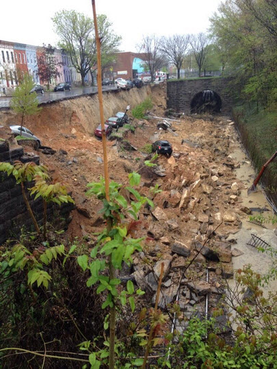
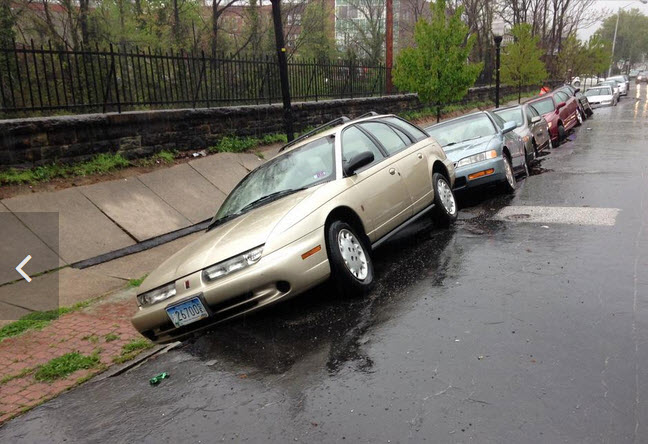
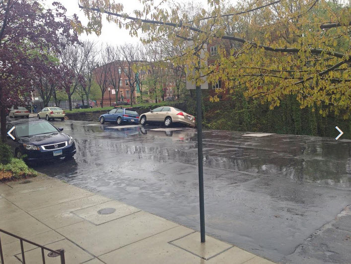
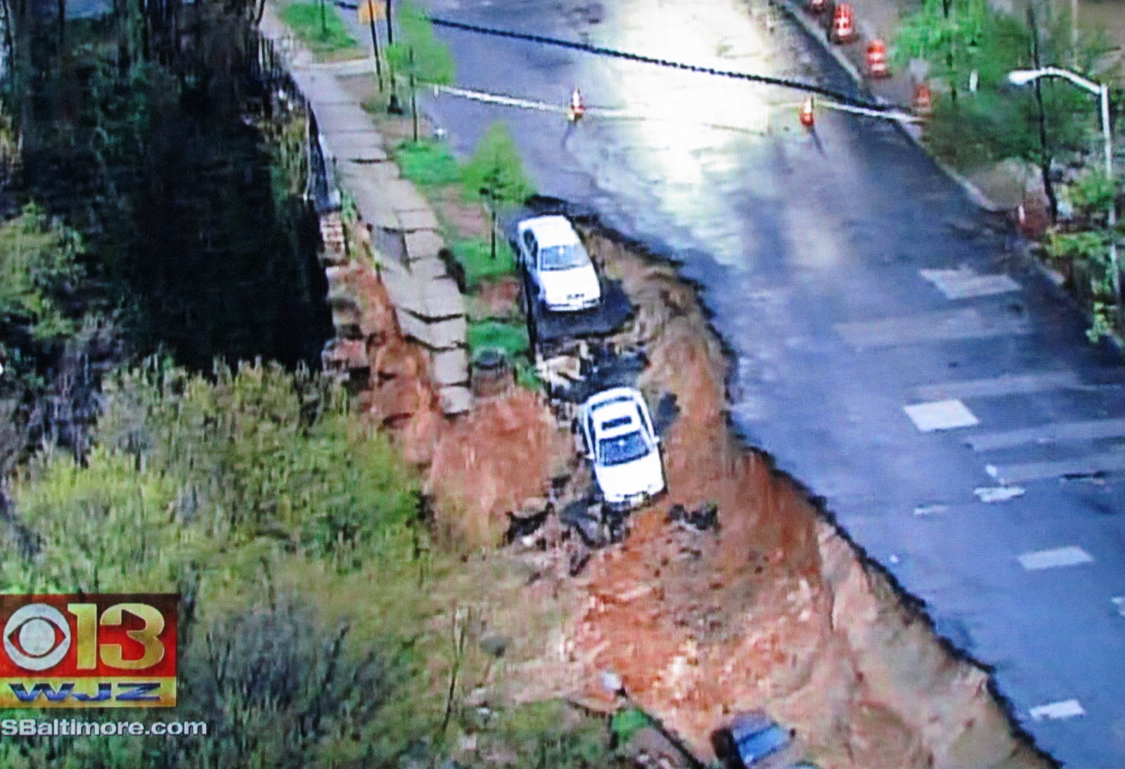
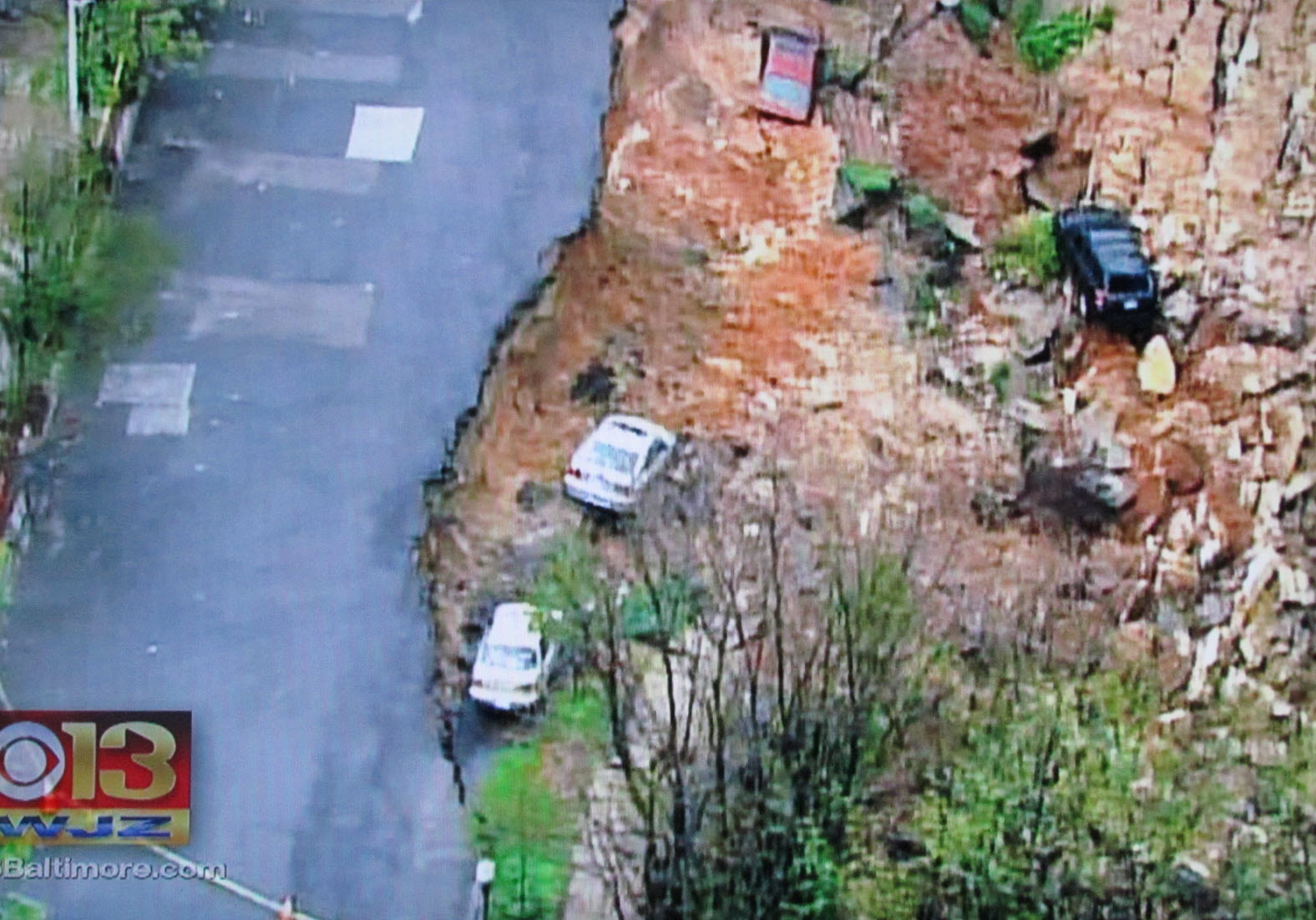
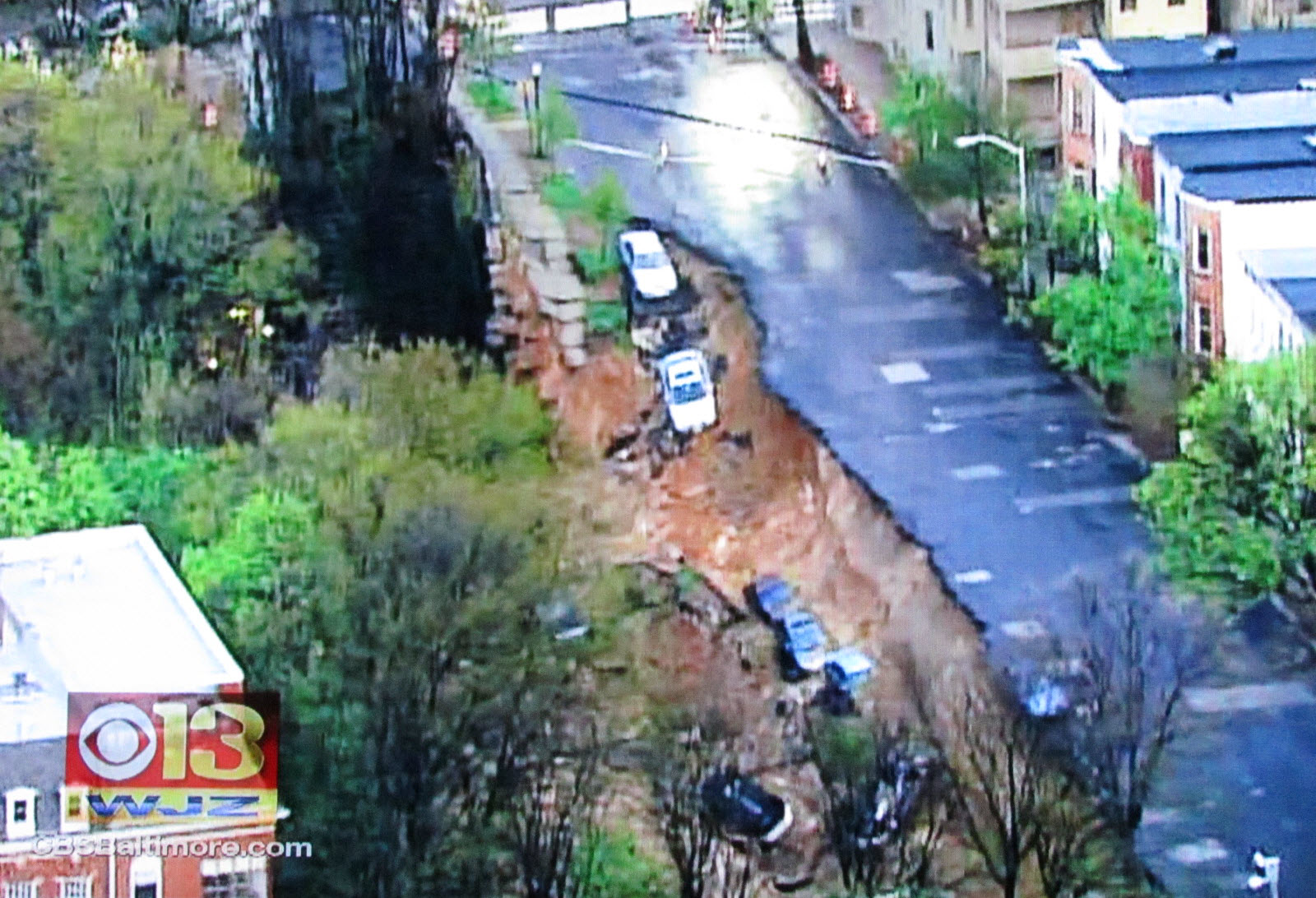
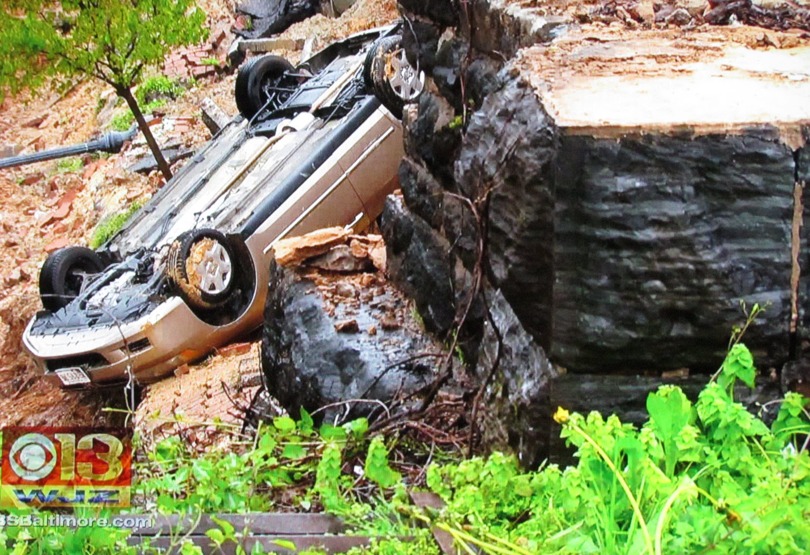
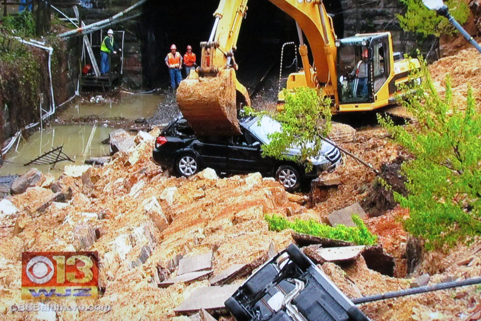
On April 30th, 2014, we had been getting all sorts of rain, in near record amounts over short periods. This 100+ year old retaining wall finally gave up the ghost, and gave in to the pressure of all that water and collasped.
On many occasions, I have parked in the same exact spot where the cars went over the side while visiting a train buddy who use to live half a block away from the site.
Acknowledgements:
The various news sources as noted below in the clips
Channel 13 WJZ TV
Channel 2 WMAR TV
Additional reading:
https://en.wikipedia.org/wiki/Baltimore_Belt_Line
If you are coming from downtown Baltimore, take Charles St north to 26th Street and take a right, the wall will be on your right.
From out in the county, north, like Towson or coming down I-83 from PA, come down I-83 and take the 28th Street exit east. Go to Calvert Street and take a right, 26th Street is in 2 blocks, hang a right.
Coming down I-95 from NY, NJ, PA, or DE, take the Beltway I-695 west and then take I-83 south when you get to Towson. Then take the 28th Street exit. You could alternatively take the Ft. McHenry Tunnel to I-395 and come up the south as below, but that costs you 5 bucks.
From west (I-70 ) or coming up I-95 from DC or VA, take the Beltway to I-95 (if not already on it), and head to I-395 going into downtown Baltimore. Take a right at Conway (the first light), and then an immediate left onto Charles Street and head north.
I believe the two screens shots above are from before the wall collapse
 Minutes before the wall collapsed
Minutes after the wall collapsed
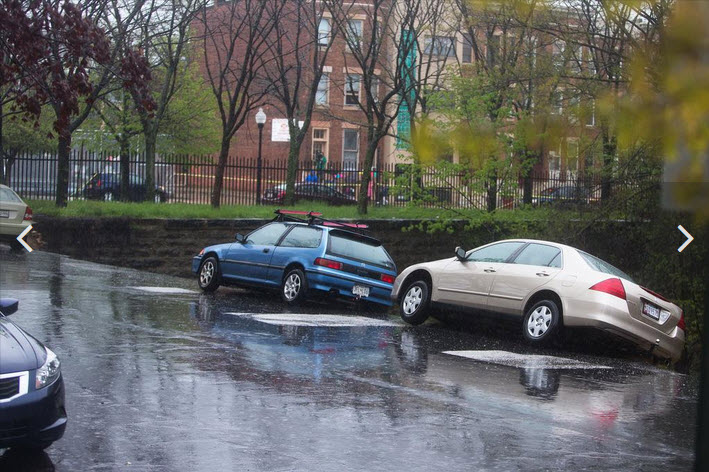
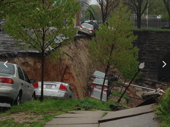
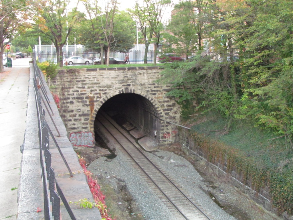
Pictures From April 30th, 2014
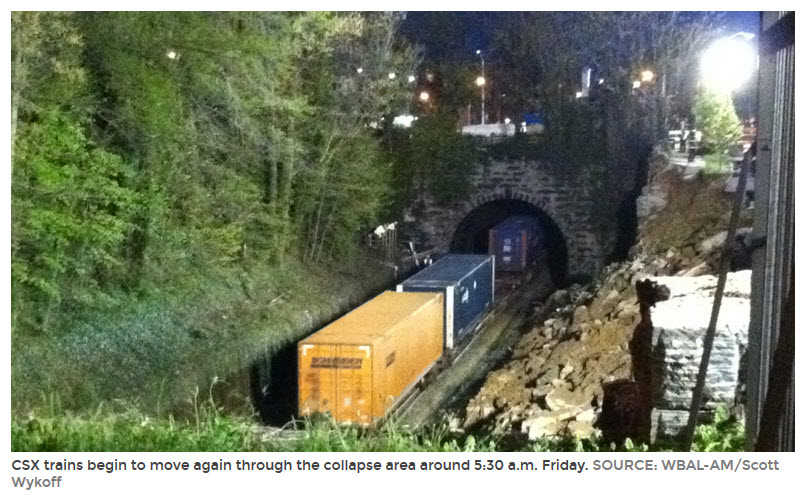
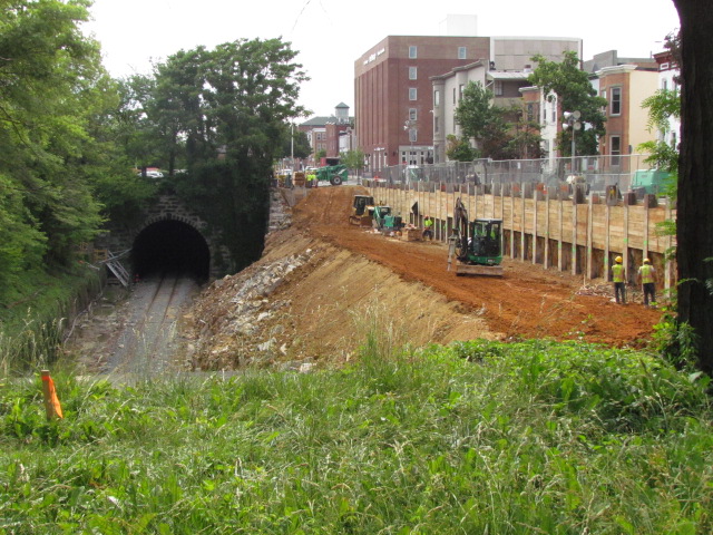
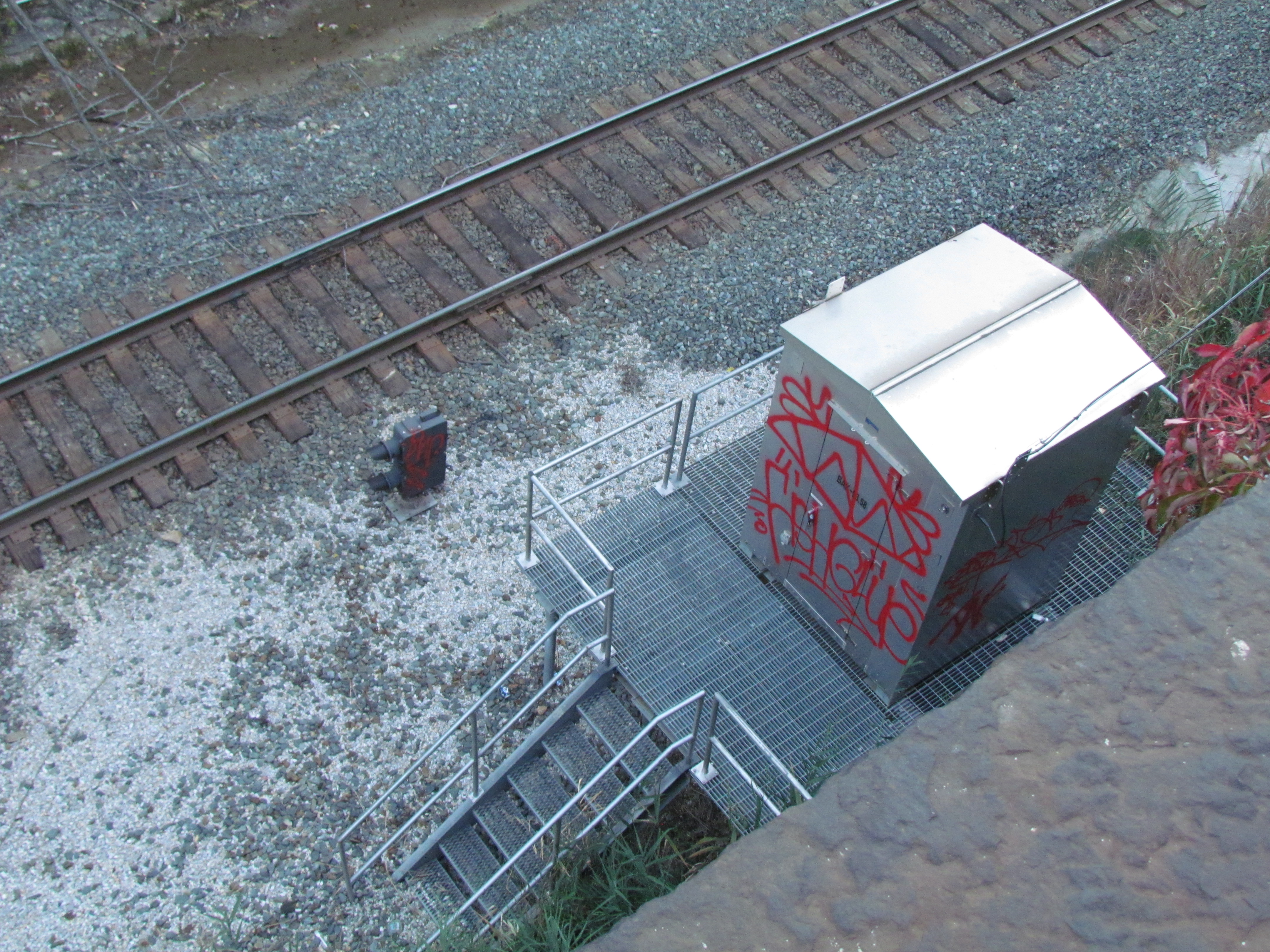
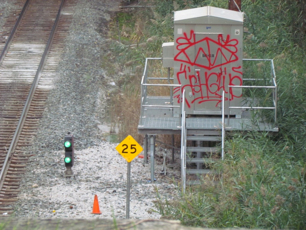
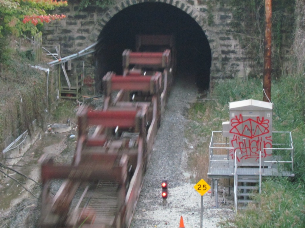
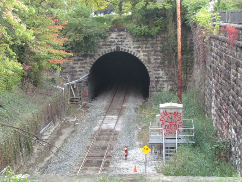
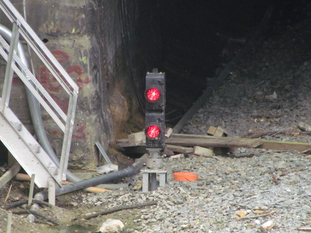
A couple of pictures off the TV for DC (left) and in northern Baltimore City along the Jones Falls, which is a major creek that flows behind my house, and under the Light Rail (former Pennsy tracks) in Riderwood. CSX was quick to get an excavator in there to clear the tracks. I heard, but cannot confirm, that the owners of the cars did not get insurance for their cars because it was an act of God. There had been a dwarf CPL signal at the entrance to the tunnel, but it got destroyed by the landslide and was replaced by a Unilens signal to the left side of the track. Trains were running again about 5 days later.
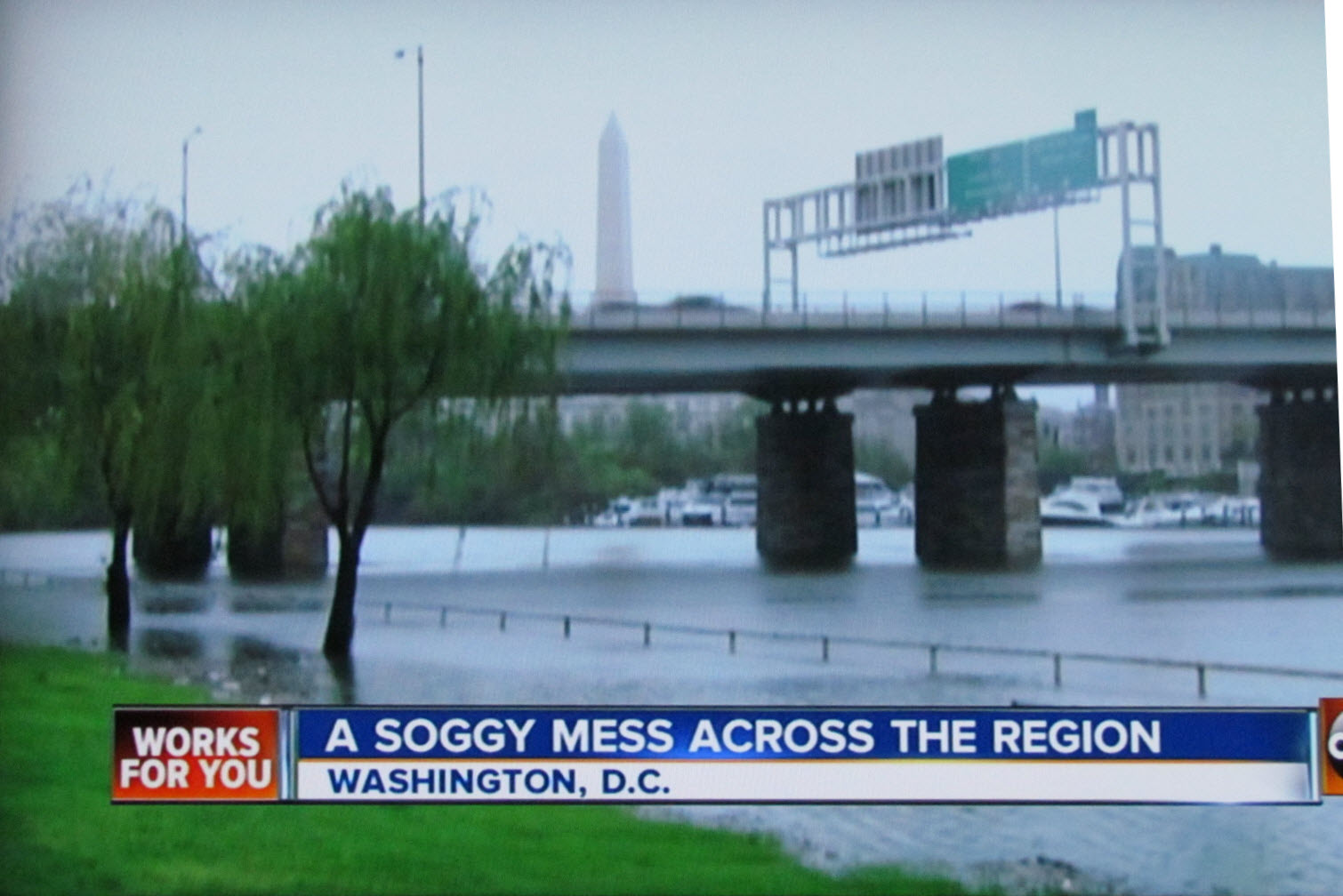
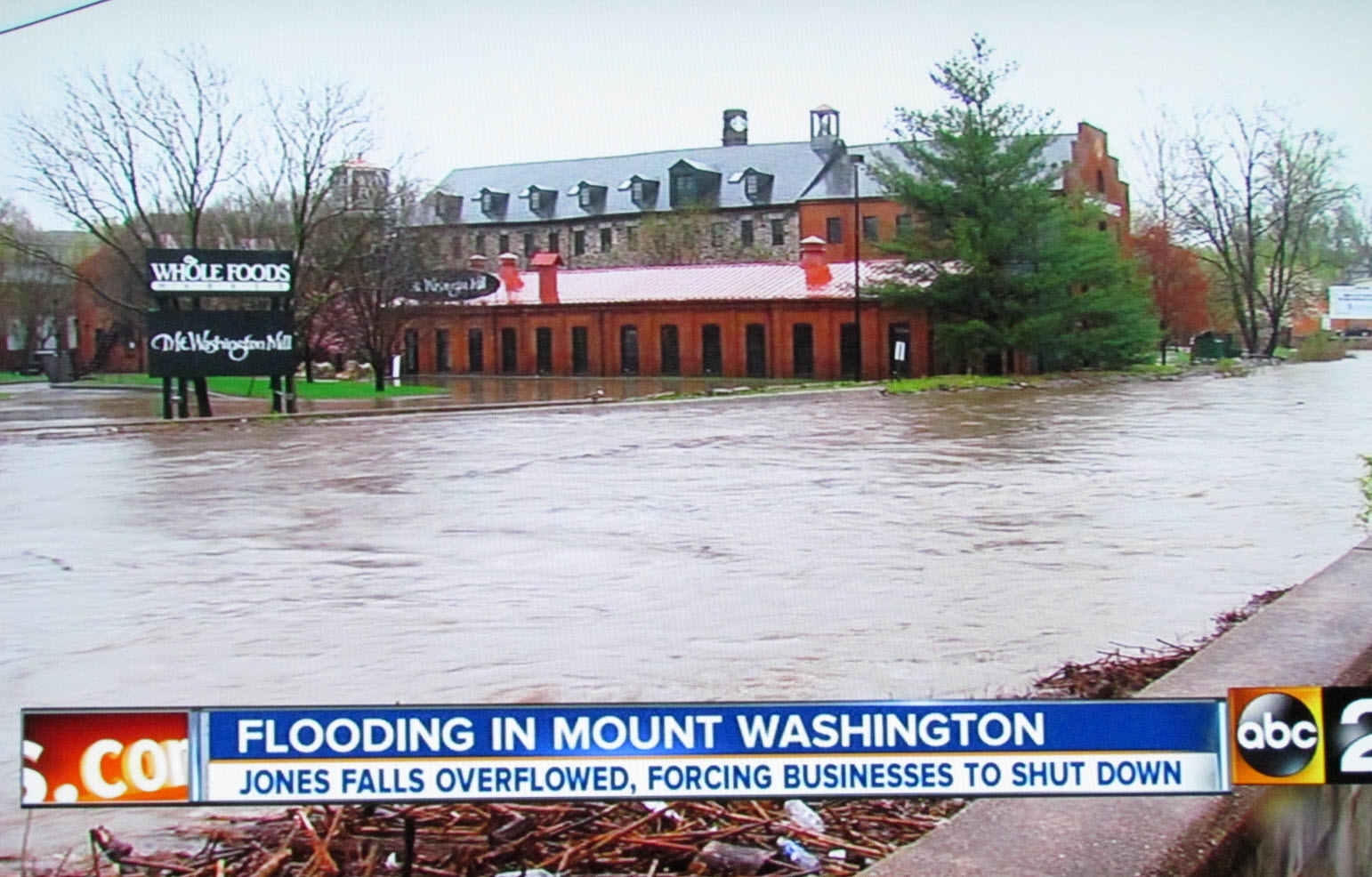
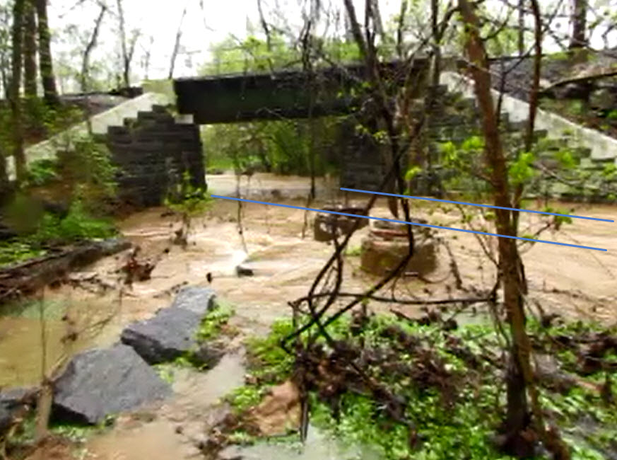
The picture below is of the same creek, the Jones Falls, when it is normally a small thing about 15 feet across and a foot deep (the blue lines). On this day, it swelled to about 50 feet across, and about 6 feet deep before trying to go thru the narrows at the former Pennsy RR bridge. The picture above in Mt Washington is about 4 miles downstream, after the stream that follows the old Northern Central Green Spring branch joins this branch.
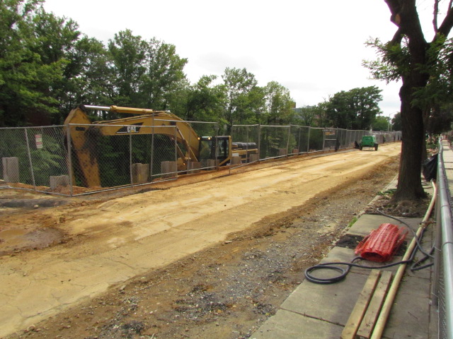
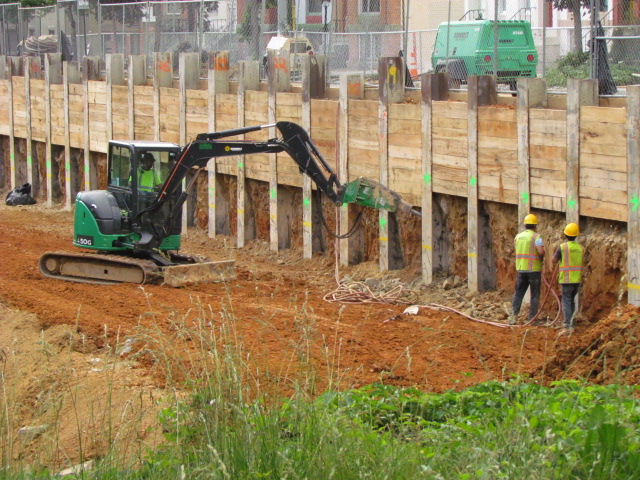
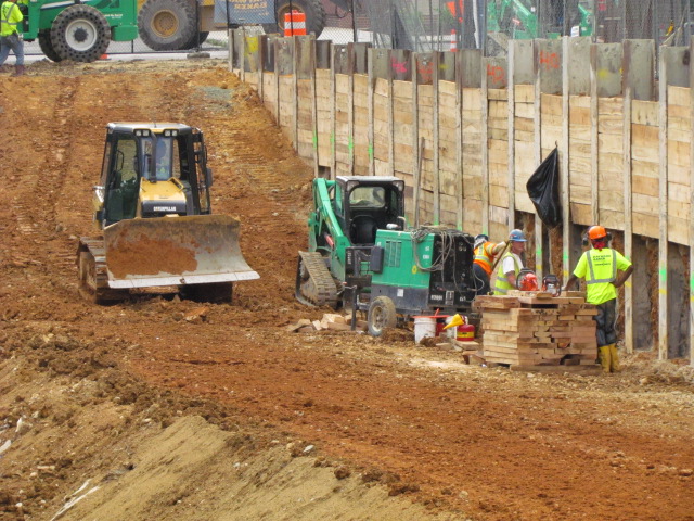
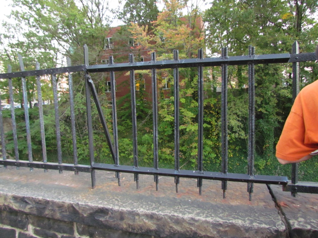
Pictures From A Year Later on June 11th, 2015
Courtesy of the University of Texas Library, click
here for
their index page. Disclaimers: I love trains, and I love signals. I am not an
expert. I do these pages because I love spending my time doing them -
although I do a reasonable amount of research to make sure the information
presented is accurate! :-) :-) Please Note:
Since the main focus of my two websites is railroad signals, the railfan guides
are oriented towards the signal fan being able to locate them. For those
of you into the modeling aspect of our hobby, my
indexa page has a list of
almost everything railroad oriented I can think of to provide you with at least a few pictures to
help you detail your pike. If this is a railfan page, every effort has
been made to make sure that the information contained on this map and in this
railfan guide is correct. Once in a while, an error may creep in,
oooooooops, oh well! :-)
My philosophy: Pictures and maps are worth a
thousand words, especially for railfanning. Text descriptions only
get you so far, especially if you get lost or disoriented. Take
along good maps.... a GPS is OK to get somewhere, but maps are still
better if you get lost! I belong to AAA, which allows you to get
local maps for free when you visit the local branches. ADC puts
out a nice series of county maps for the Washington DC area, but their
state maps do not have the railroads on them. If you can find em,
I like the National Geographic map book of the U.S..... good, clear, and
concise graphics, and they do a really good job of showing you where
tourist type attractions are, although they too lack the railroads.
Other notes about specific areas will show up on that page if known. Beware: If used as a source, ANYTHING from Wikipedia must be treated as
being possibly being inaccurate, wrong, or not true.
RAILFAN GUIDES HOME
NEW
02/01/2017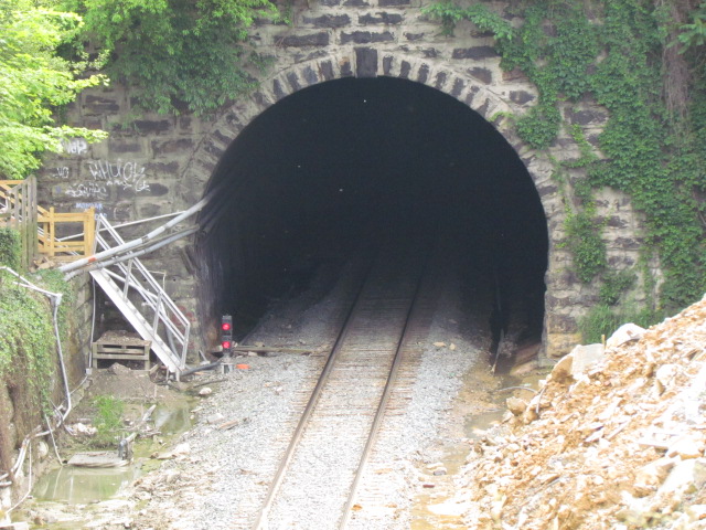
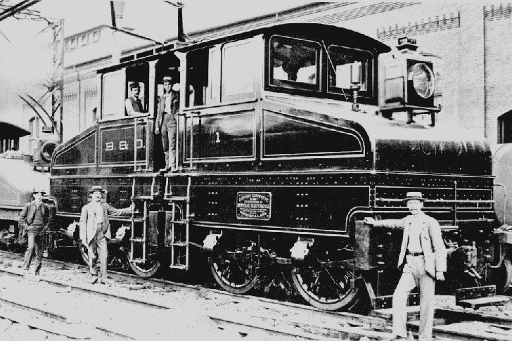
While looking for information about the Belt Line, I came across these photos from 1901 of the electric service that the B&O used to pull NB freights thru the Howard Street tunnels with.
Freights were pulled up to Huntingdon St, Passenger trains were released at Mt Royal. It was the first mainline electrification in the United States.
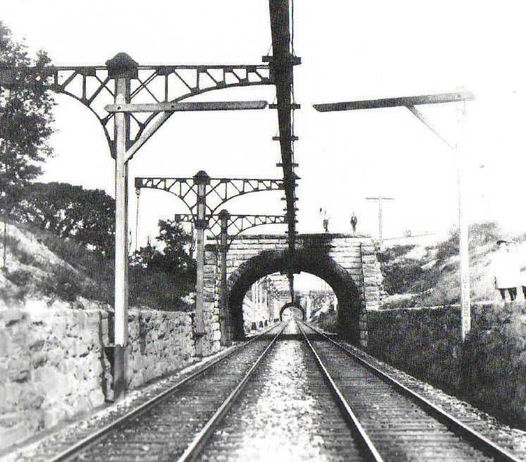
In "the old days", the entrance to the two track section before getting
to Mt Royal was protected by a CPL signal, a Color Position Light signal.
These were the signals designed by the B&O in the early part of the 1900's,
and only showed up on the B&O and associated railroads, like the SIRT on
Staten Island NY.
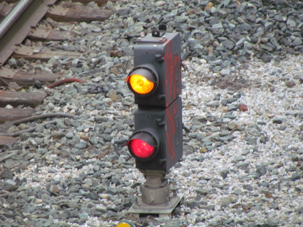
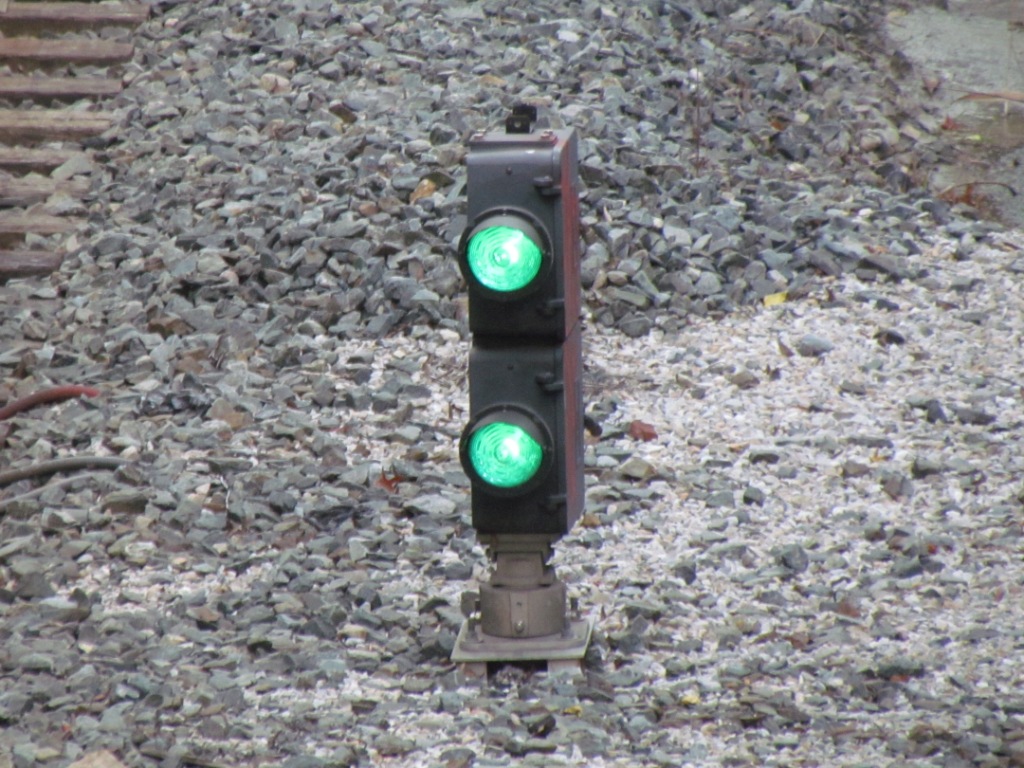
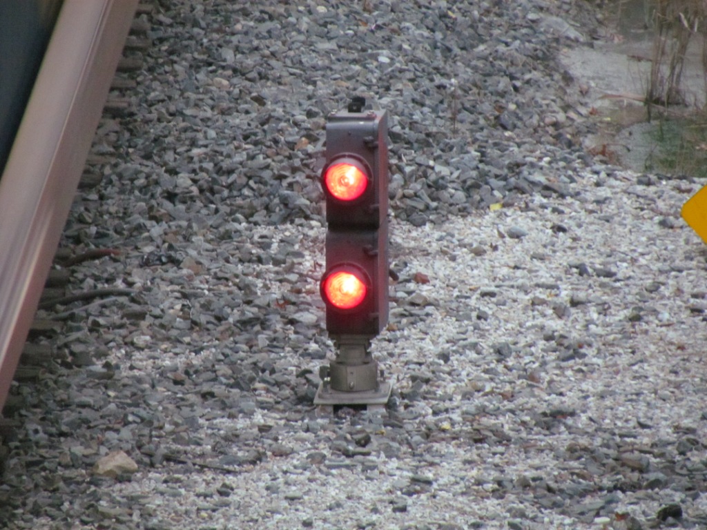
They have since been replaced by a type of signal called a UNILENS signal.
There are separate light bulbs inside the housing for each aspect, but they
all come out thru one opening in the housing, sort of like a searchlight
signal, but with no moving parts.
After the wall fell, they moved the signal over to the left of the tunnel
entrance.
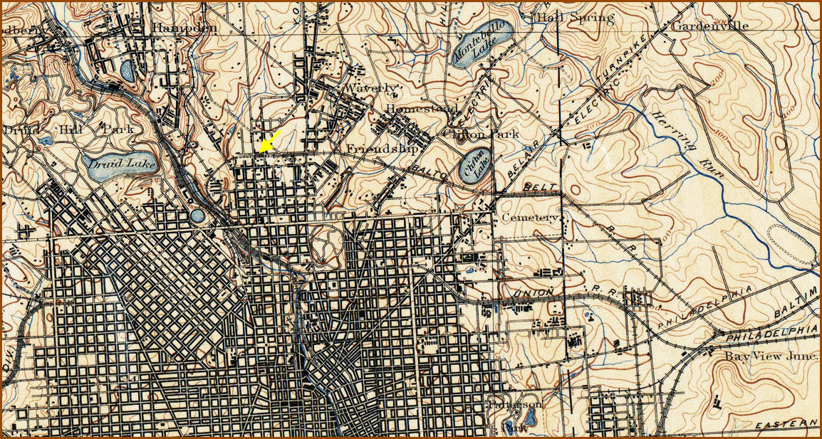 1898
Quadrangle
1898
Quadrangle
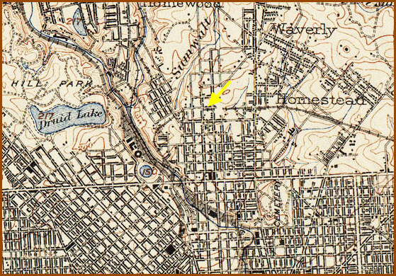 1902
Quadrangle
1902
Quadrangle
BTW, floobydust is
a term I picked up 30-40 years ago from a National Semiconductor data
book, and means miscellaneous and/or other stuff.
Pictures and additional information is always needed if anyone feels
inclined to take 'em, send 'em, and share 'em, or if you have
something to add or correct.... credit is always given! BE NICE!!! Contact info
is here
RAILROAD SIGNALS HOME
Last Modified
15-Jul-2019