This map is available here
RAILFAN GUIDES of the U.S.
Todd's Railfan
Guide to
BALTIMORE MD
West of Baltimore City
Mostly Baltimore County, some Howard and Anne Arundel County
In General
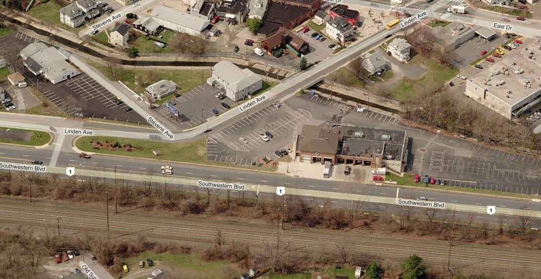
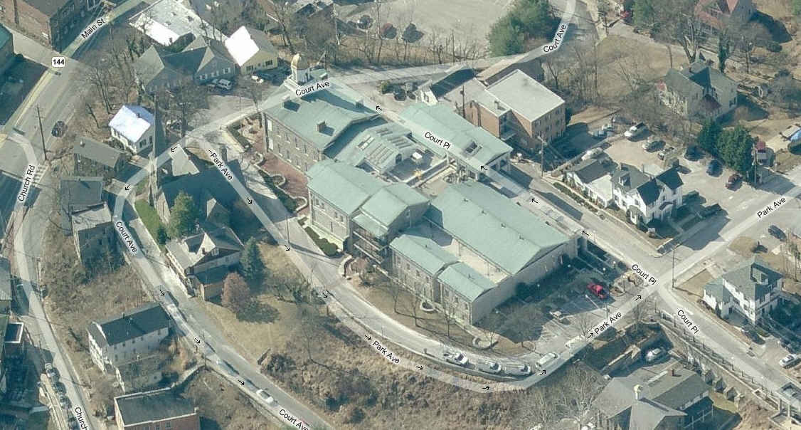
Map
Sights
Light Rail Stations
MARC Stations
Fire and Police
Signals
Floobydust
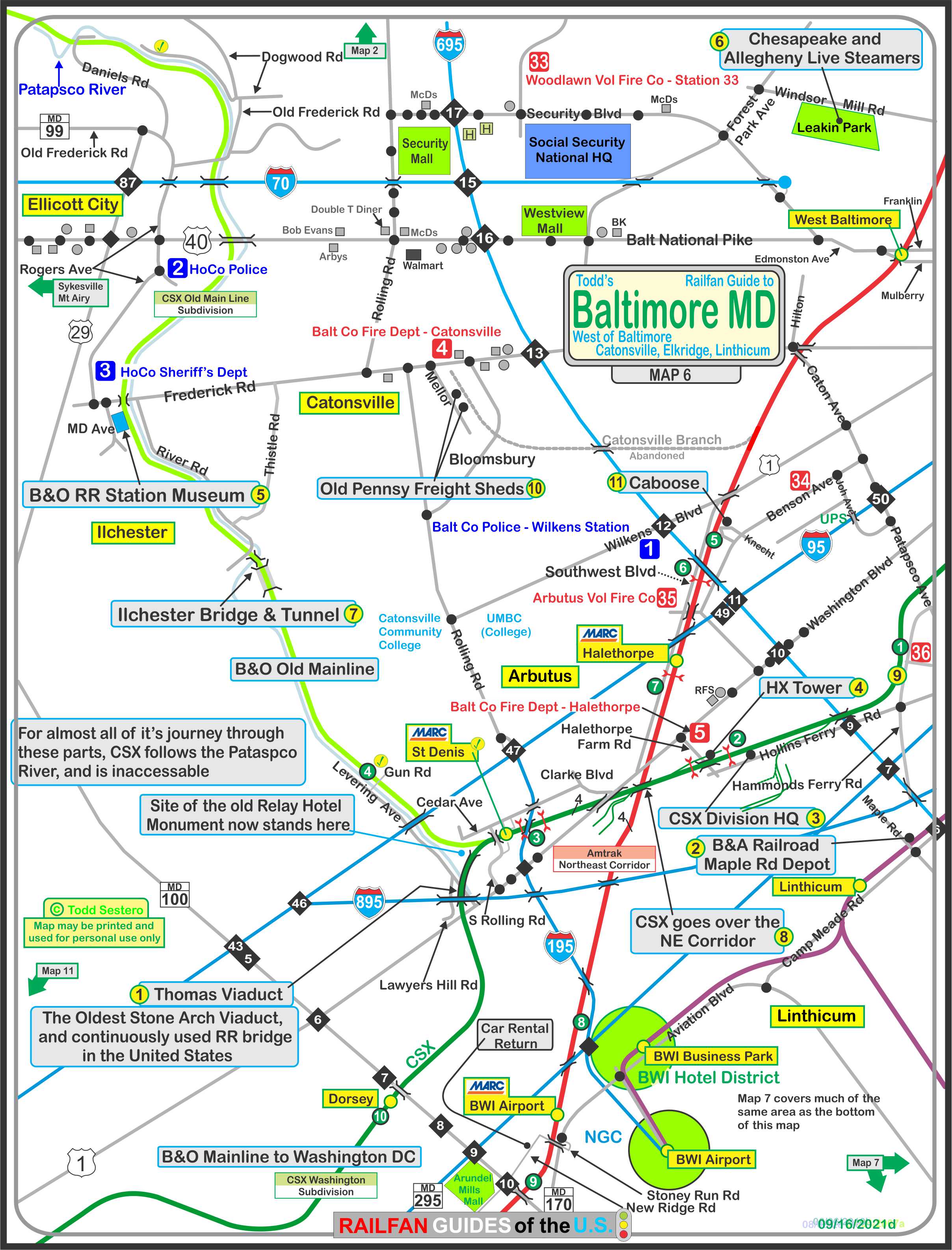
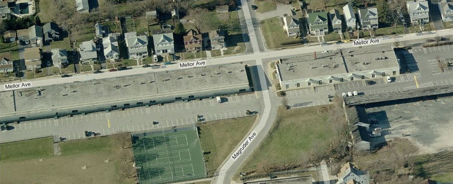
The map below shows the area south and west of Baltimore City, mostly in Baltimore County, and a little bit in Anne Arundel County (around BWI Airport). It has a lot going on, a lot to see...... it contains a lot of stuff to keep you busy, and you could easily spend a day in this quadrant alone.
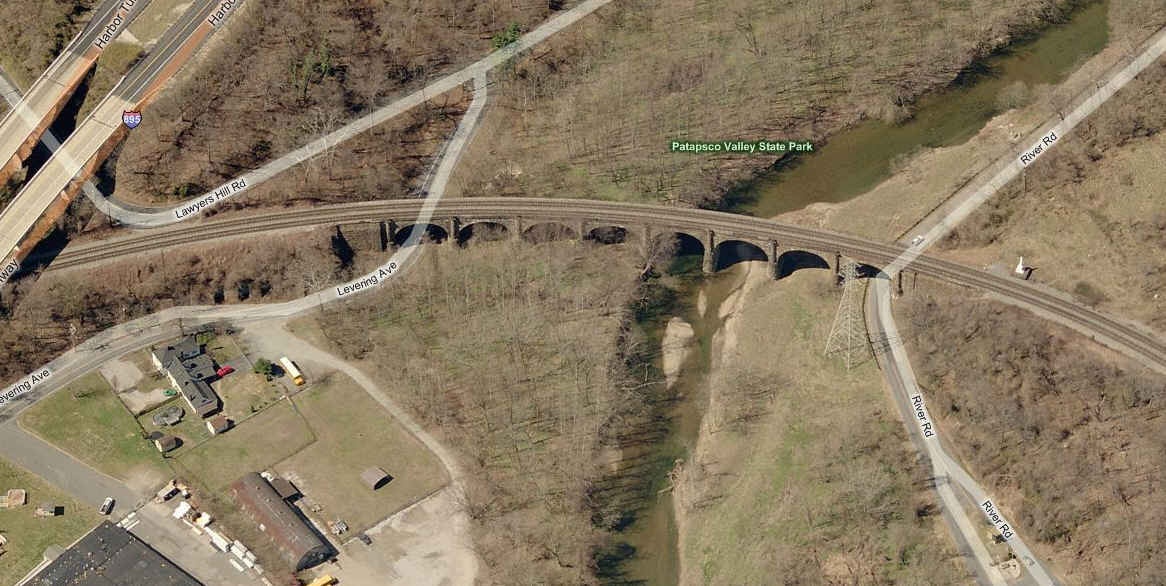
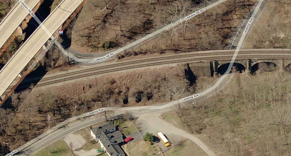
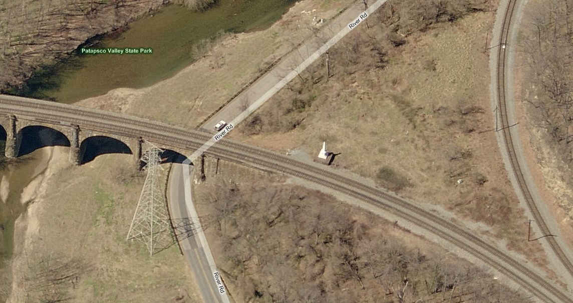
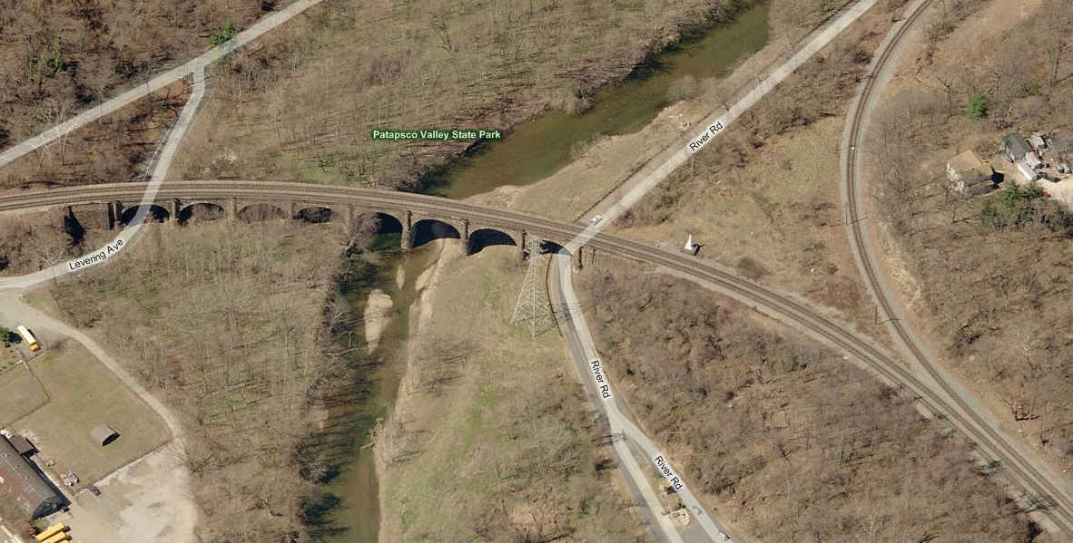
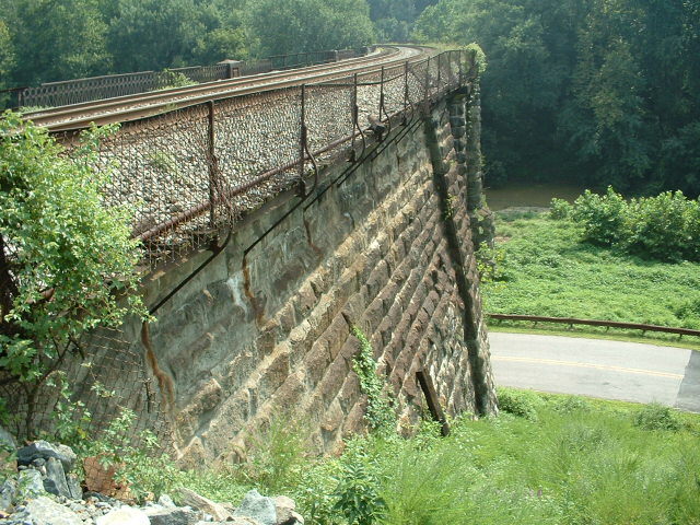
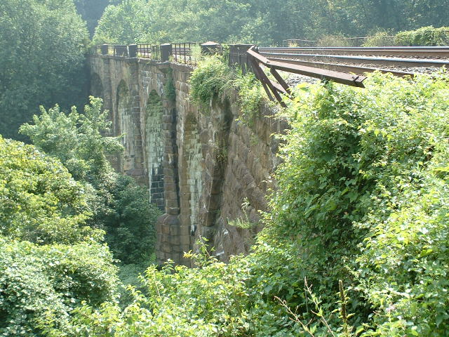
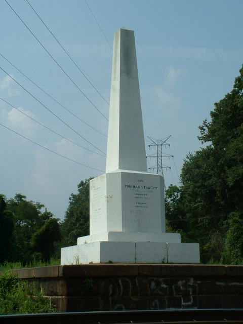
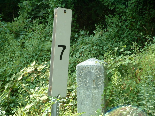
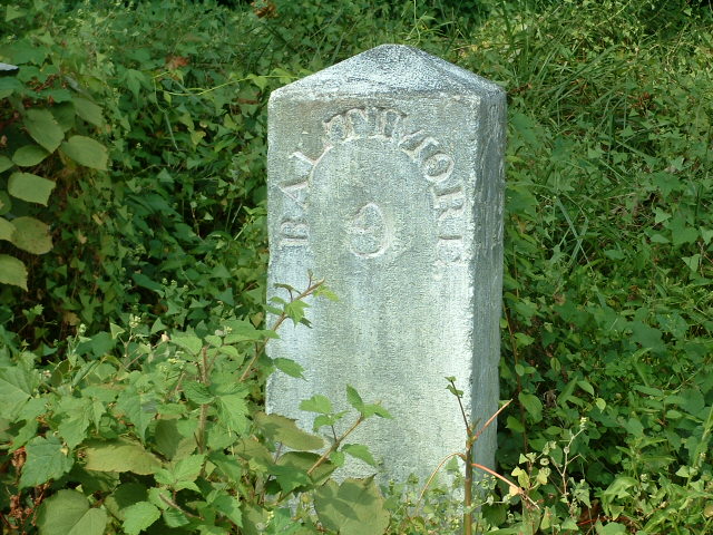
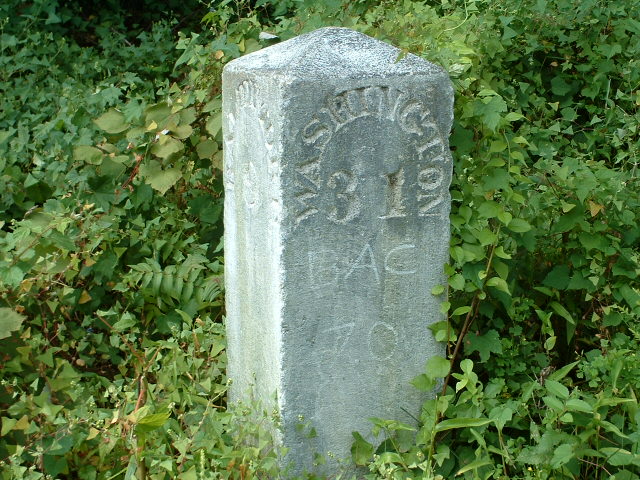
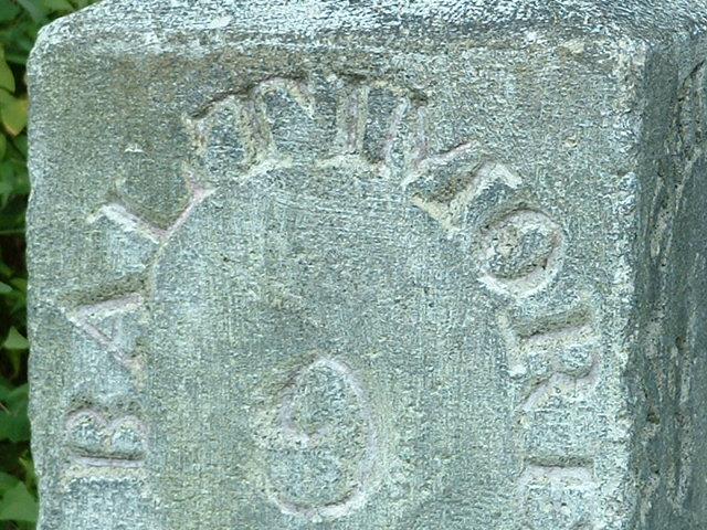
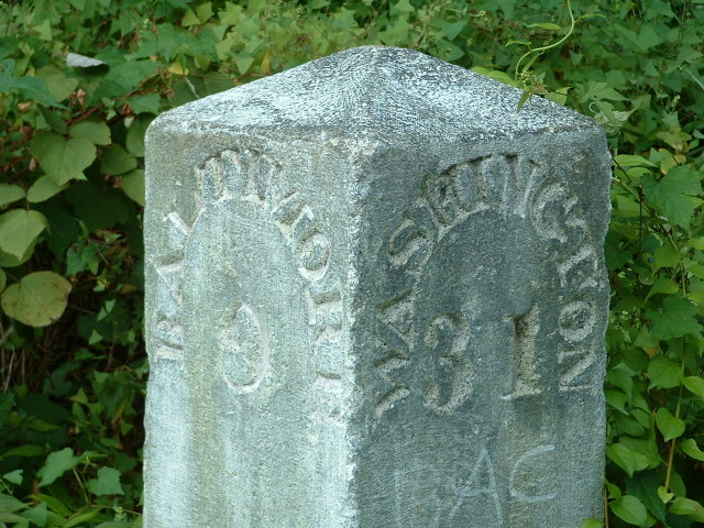
Probably the most notable structure on the map is the famous Thomas Viaduct is in Elkridge, the oldest stone arch bridge of it's type in the U.S. Good pictures can be had from both ends, so you don't have to worry at what time of the day you get there, altho CSX hasn't done as good a job at keeping the growth down as the B&O did. Unfortunately, the marble mileposts by the Old Main Line split were removed ~2008, by whom, no one seems to know - an unfortunate loss.
The CALS live steams guys are around twice a month, check their website for info. Great stuff!!!
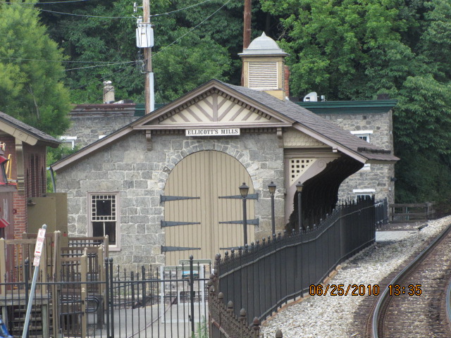
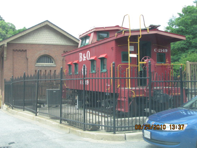
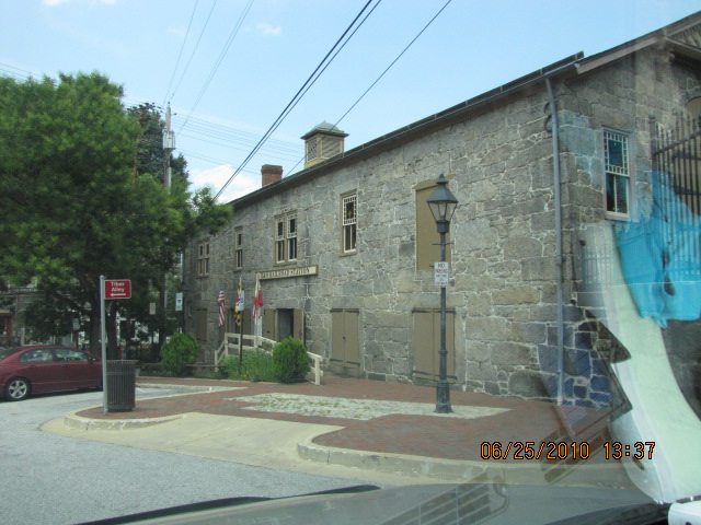
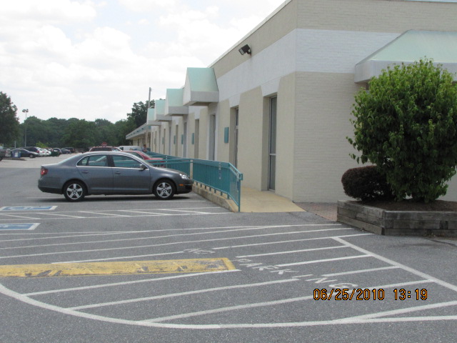
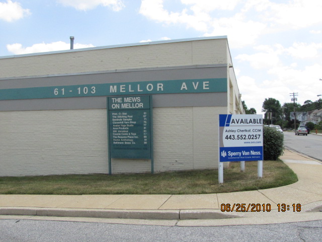
Altho a small museum, the B&O Railroad Station Museum has artifacts and information on the first railroad of the United States, and a model railroad - there's also plenty of eating and shopping to do while in Ellicott City, a definite plus if your wife isn't into trains!
The BWI station is a good spot for corridor pictures, but I hate the parking since they put up the megaplex garage and charge for parking (it used to be free). Halethorpe is also a good spot, and there is a nearby overpass for "looking down" pictures. If you scout around Southwest Blvd, you can also find a few places to go in between the trees for corridor shots, something you don't find too often cause they usually make it difficult to access the R-O-W for safety reasons. Between roughly 11;30am and 1pm, there seems to be a lot of activity.
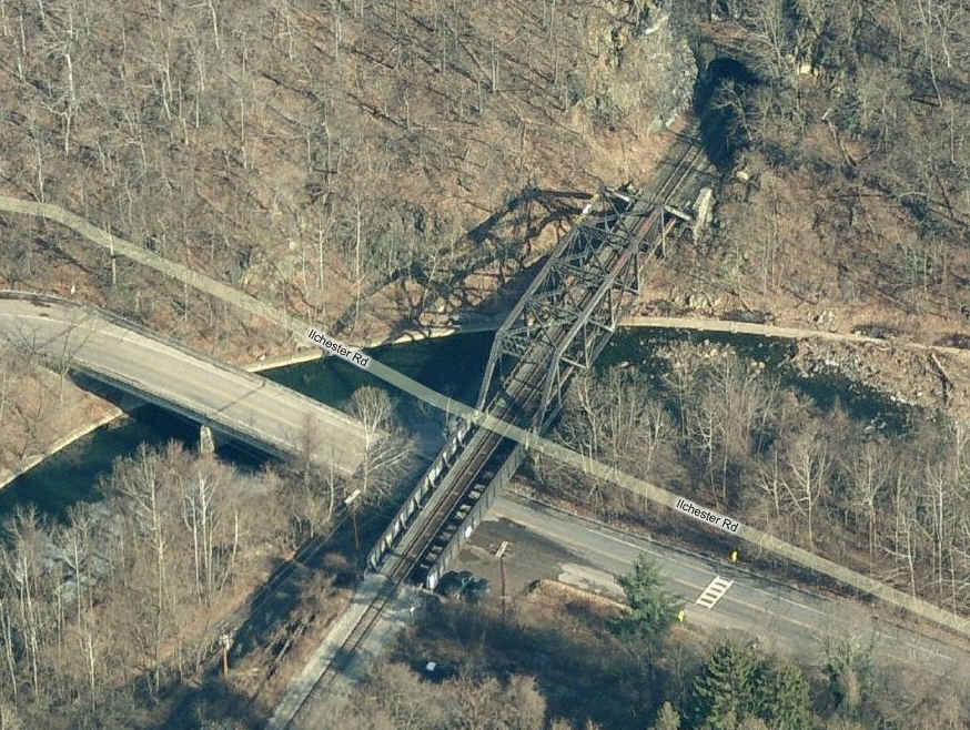
You also have the B&O Old Main Line, the first railroad line in the U.S. going to Ellicott Mills (now Ellicott City). The Old Main Line offers a lot of good photo ops, just refer to a good map of the area, and bring along a fair amount of patience, but your rewards will be great! One of my favorite spots is the bridge and tunnel in Ilchester, best for westbound freights, so you can catch 'em coming out of the tunnel.
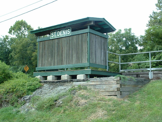
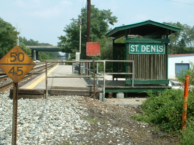
Mornings can be a good time at St Denis, I caught 5 trains in about an hour there around 8am, three MARC commuters, and two freights for the Old Main Line.
There are no yards on this map, altho you have CSX's West Yard just off the right edge of the map (off Patapsco and Gable Aves). The CSX line still has it's CPL's in place, north of St. Denis.
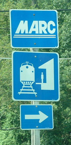
Also on this map, you have the southern end of the Light Rail system, but no Metro. There are a couple of MARC stops on the map, two on the Penn Line (on the NE Corridor - Halethorpe and BWI), and one on the CSX's Camden Line (St. Denis).
Note: even though the B&O's tracks went north and south, the B&O referred to the directions as East (north) and West (south). I use the north and south terms mostly, only because it is easier to reference to the maps.
A lot of the pictures I use are taken on signal hunting trips with Michael Watnoski, as we scour Baltimore and the Delmarva area for those elusive CPL's and PL's.
It's difficult to get all of the little street names on the map without cluttering it up, so make sure you take along a good map of the Baltimore area. ADC puts out a good book map of the area, DeLorme's is so-so, I would go with ADC's - they've been doing the area for around 30 years and know the area well. Thomas also has an excellent map book out on Baltimore, slightly more expensive tho. If you belong to AAA, they have a pretty good map, even tho they now put everything on one map (they used to have 3 or 4 for the area, and if you can find someone that wants to let loose with the set, GRAB IT!).
As far as food and other services go...... A few of my favorite restaurants in this quadrant are the Double-T off exit 16, and G&M's and Snyders off exit 8 - they all have lines getting into them during the popular hours, attesting to the quality of their food (especially G&M's if you want some of the best crabcakes in Baltimore).
Interstate 895 sucks for commuting around, since it is not one of those roads you can get on n off of like the reminder of the highways around Baltimore. This stems from the fact that it was a tollroad in the beginning, and for some reason, Maryland has been happy to keep it as a very limited access highway.
Color coding follows the keys on the map:Map
This map is available here
Thomas Viaduct
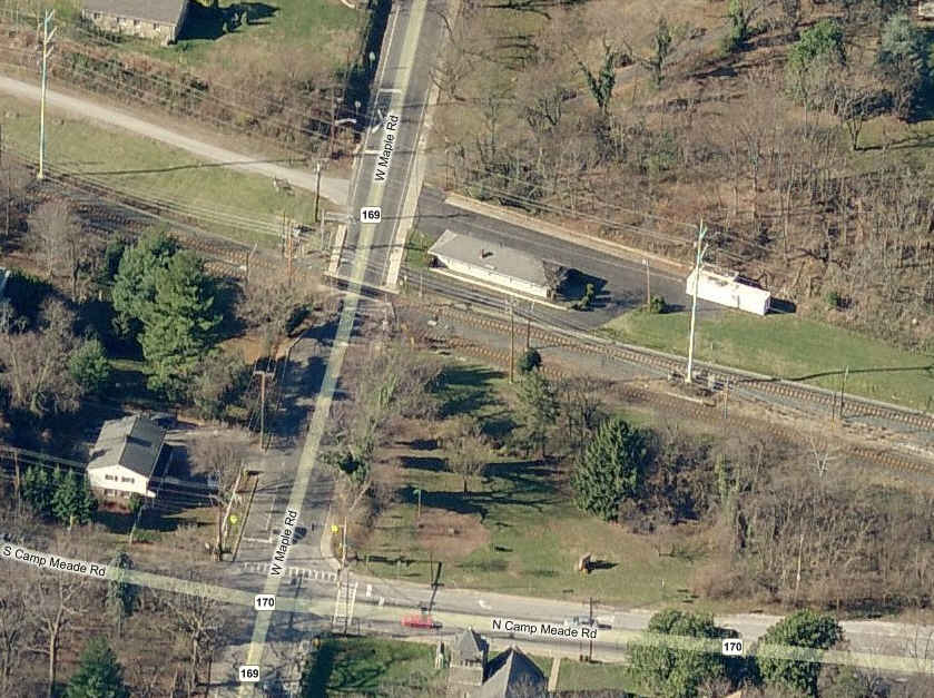
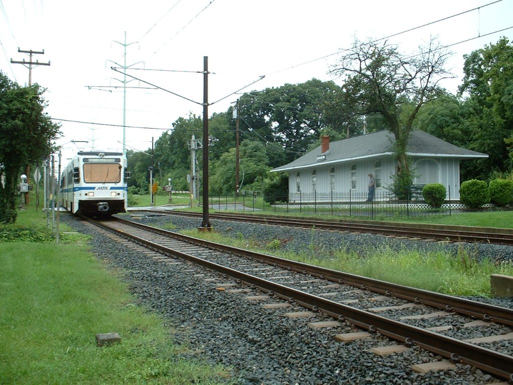
ex B&A Maple Road
Depot
CSX Baltimore Division HQ
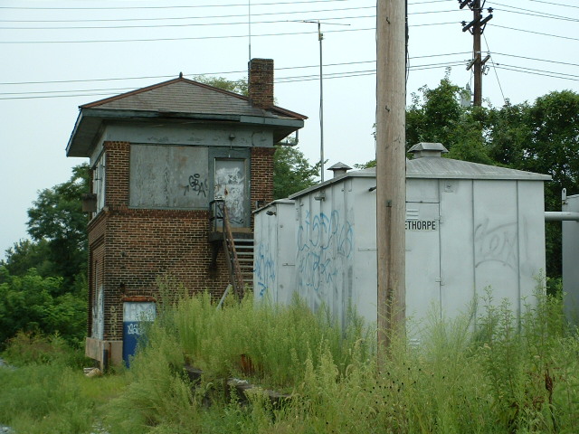
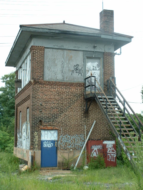
ex B&O HX Tower
B&O RR Station Museum
Chesapeake &
Allegheny Steam Preservation Society
Ilchester Bridge and Tunnel
CSX Crosses The NE Corridor
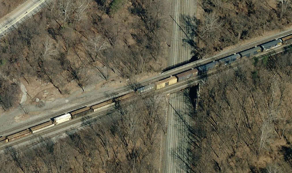
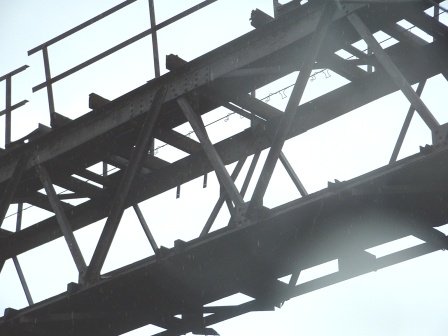
When Thomas Viaduct was first built, the designers held their breath as a small engine of the time went over it for the first time.... if they could just be around today to see 6000HP behemoth's go over it now!
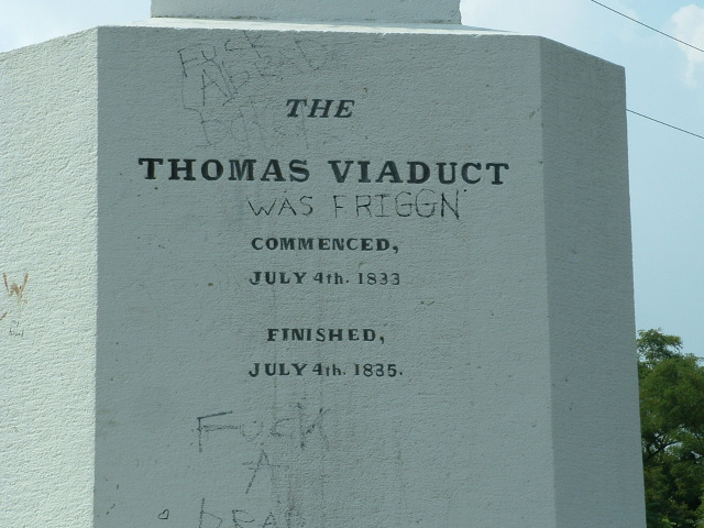
Thomas Viaduct was the first stone masonry arch bridge on a curve built in the United States. Construction started July 4th, 1833, and was completed on July 4th, 1835. The bridge was named for Philip E. Thomas, first president of the B&O RR.
The bridge is 612 feet long, the average arch span is 58 feet (of which there are eight of them), the average height of the arches is 59 feet, the width of the bridge is 26'-4". It cost $142,236 in 1830's money, which today, would equate to roughly $2.7mil in today's money.
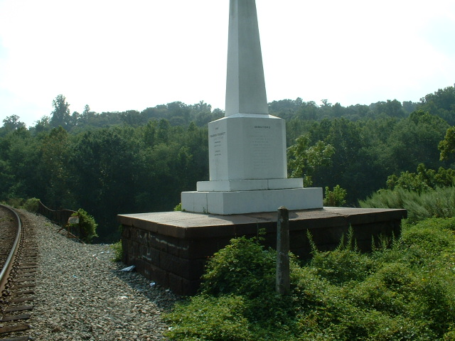
Below in the thumbnails... the Monument erected for the Viaduct and the Relay Hotel that used to sit where the monument is, and a really nice marble mile marker (there were two of them here, one on both sides of the tracks), which disappeared in the 2007 time frame :-(.

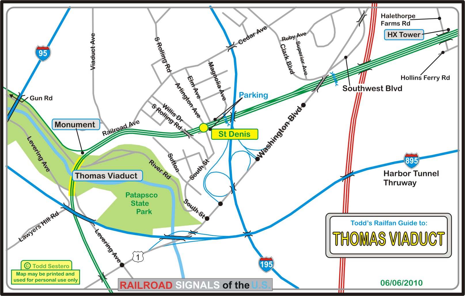
The Thomas Viaduct map is available in PDF format
here
![]() ex Baltimore and Annapolis RR - Maple Road Depot
ex Baltimore and Annapolis RR - Maple Road Depot


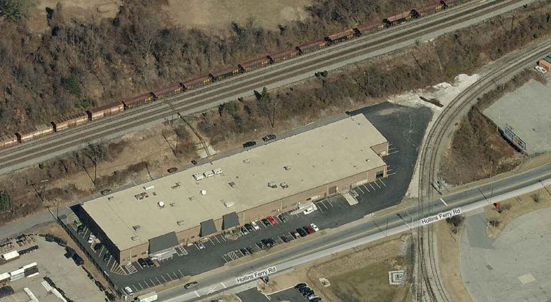
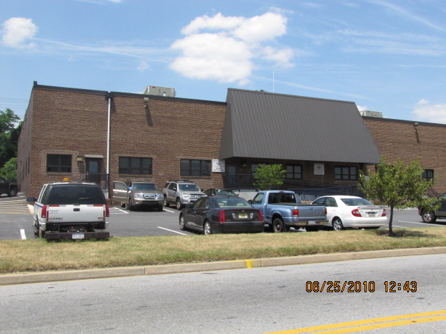
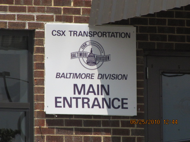
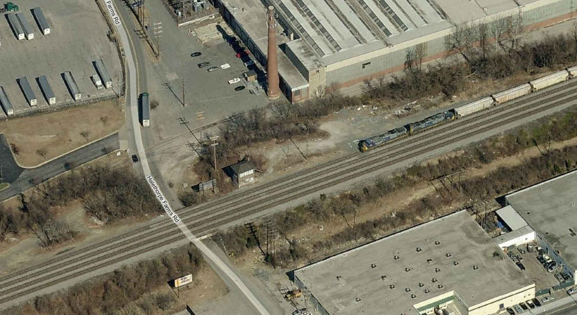
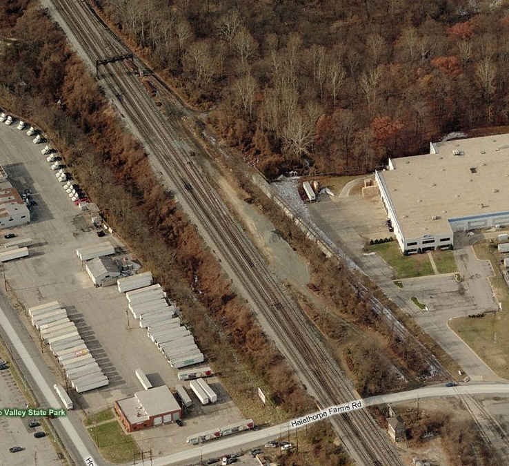
![]() CSX Baltimore Division
Headquarters
CSX Baltimore Division
Headquarters
The CSX Baltimore Terminal Service Center (BTSC)
in the CANCO building at the corner of Halethorpe Farms Rd and Hollins Ferry Rd
closed when dispatch operations were centralized in Jacksonville, FL. CSX
returned its local dispatch operations to Baltimore on June 21, 2008 when it
opened its new Baltimore Dispatch Center in the former Carling Brewery plant on
the southwest side of the Baltimore Beltway. (From
Wikimapia).

 Just down the street, and then onto the Beltway going north,
you pass under the CSX on this bridge.
Just down the street, and then onto the Beltway going north,
you pass under the CSX on this bridge.
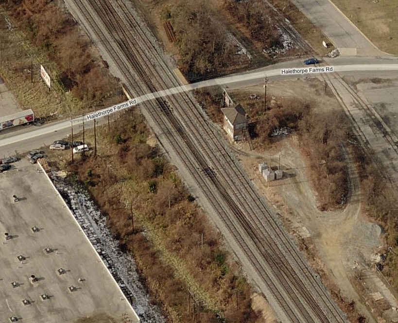
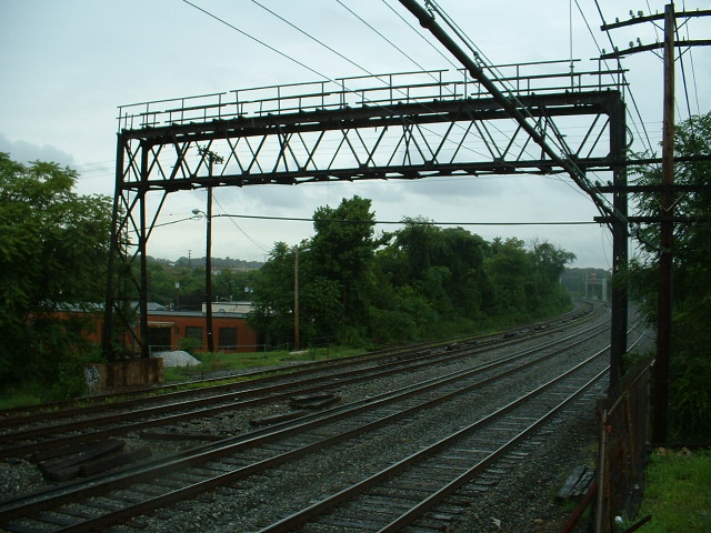
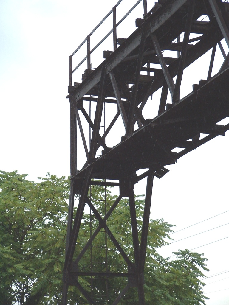
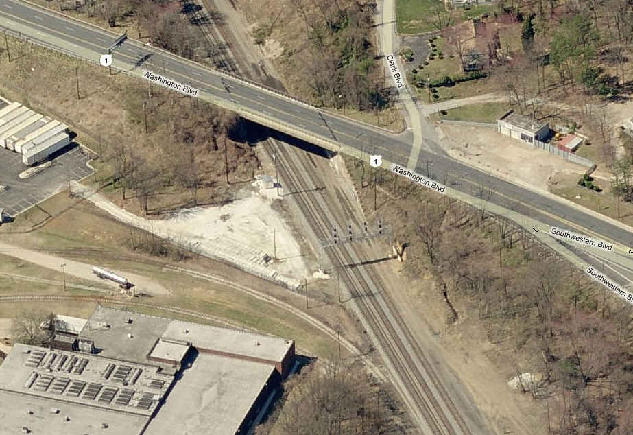
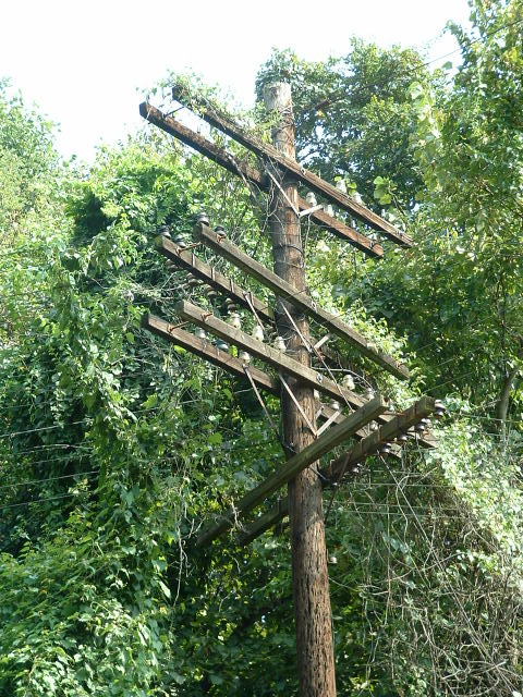
HX Tower is the last surviving tower on the Old Main Line (and one of two in the whole Balt/DC area - the other is BX down in Curtis Bay). It was built in 1917, and operations out of it ceased on October 1st, 1985. The tower is now used once in a while by the signal guys, although the CPL signal bridges disappeared around 2008 when they re-did the interlocking here and put in colorlight signals.
The tower marks the beginning of the Old Main Line, which runs 59 miles west to Point of Rocks. Back in the old B&O days, the B&O Railroad Museum would run the Tom Thumb from the museum to Ellicott City, and HX was a favorite spot to watch it from.
 All of the shots are from Bing except for the one on the
right, which is from Google.
All of the shots are from Bing except for the one on the
right, which is from Google.
The two thumbs on the left are from several years ago before CSX changed the
interlocking and did away with the two CPL bridges seen in those two pictures.
The two new color light signals bridges further west, adjacent to US Route 1,
are their replacements.
For the time being, these two shots on the left can still be seen on the birds eye view of bing.com/maps (west, I believe), but don't wait too long, as they will update the pictures someday, and they will be gone.
![]() B&O RR Station Museum / Ellicott
City (aka, Ellicott Mills)
B&O RR Station Museum / Ellicott
City (aka, Ellicott Mills)
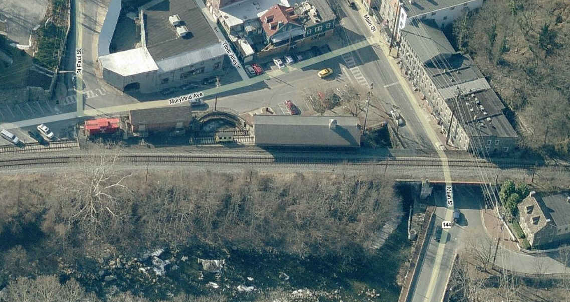

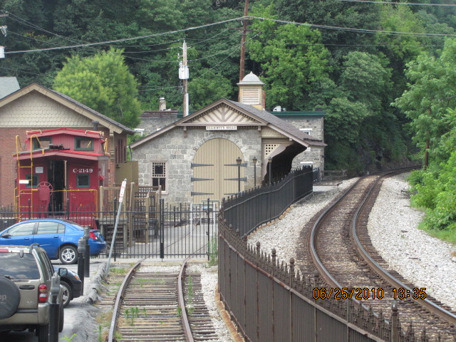


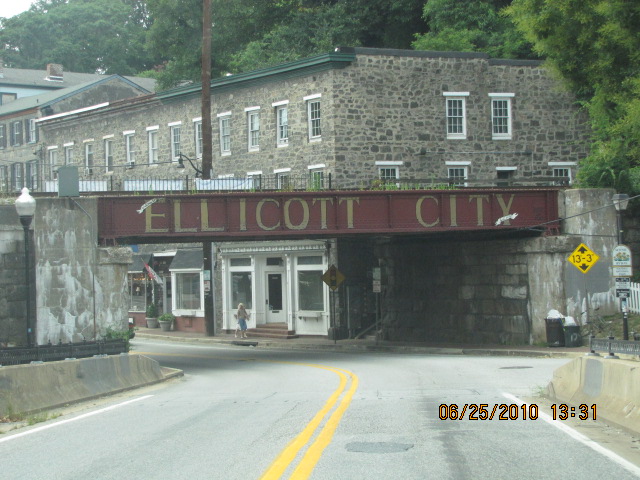 When coming from the Beltway, on Frederick Road, you will pass
under this bridge upon entering Ellicott City.
When coming from the Beltway, on Frederick Road, you will pass
under this bridge upon entering Ellicott City.
CSX had a derailment here on Tuesday, August 21st, 2012. A few pix of the derailment are below.
![]() Chesapeake and Allegheny
Live Steamers
Chesapeake and Allegheny
Live Steamers
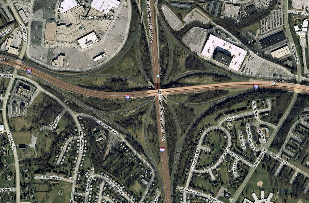
This group is associated with the Chesapeake and Allegheny Steam Preservation Society. They have a place in Leakin Park, which is just off Security Blvd, as you head towards Baltimore from the Baltimore Beltway exit 17 (remember, we're on the west side of Baltimore), and go past the Social Security Administration complex. Rides are free, but donations are always gratefully accepted. If coming in from the west, take I70, past the Beltway, till it ends, this will dump you off on Security Blvd, head west and hang a right at the first traffic light, which is Forest Park Ave, then hang a right at the next light on to Windsor Mill... the park will be on your right.
The club has 3200 feet of double tracked 7-1/2" gauge track (1/8 or 1.5/1.6" to the foot scale), and about 2700 feet of 3-3/4" gauge track (1" scale).
They have public run days on the 2nd Sunday of the month, and a club run day on the 4th Sunday, weather permitting; April to November, 11 to 3:30.
For more info, visit: http://calslivesteam.org/


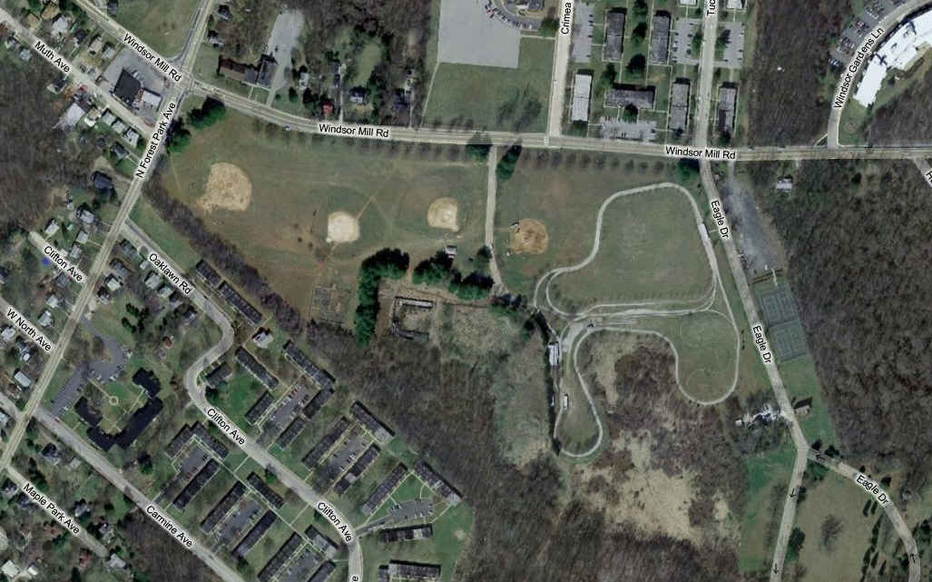
A cool spot for pictures, although lighting and sight lines are difficult.
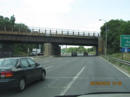
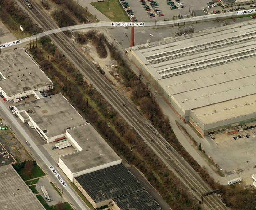
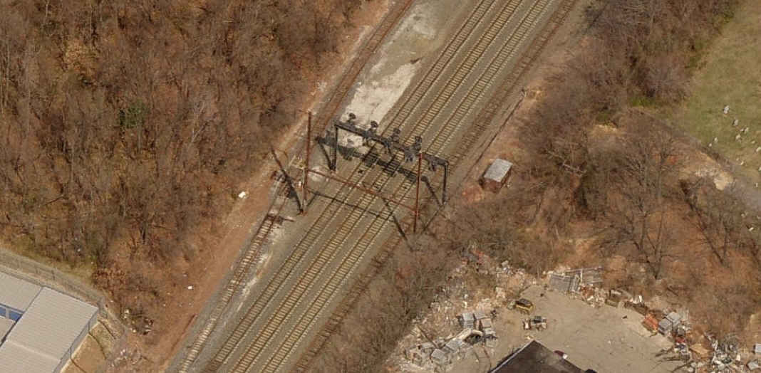
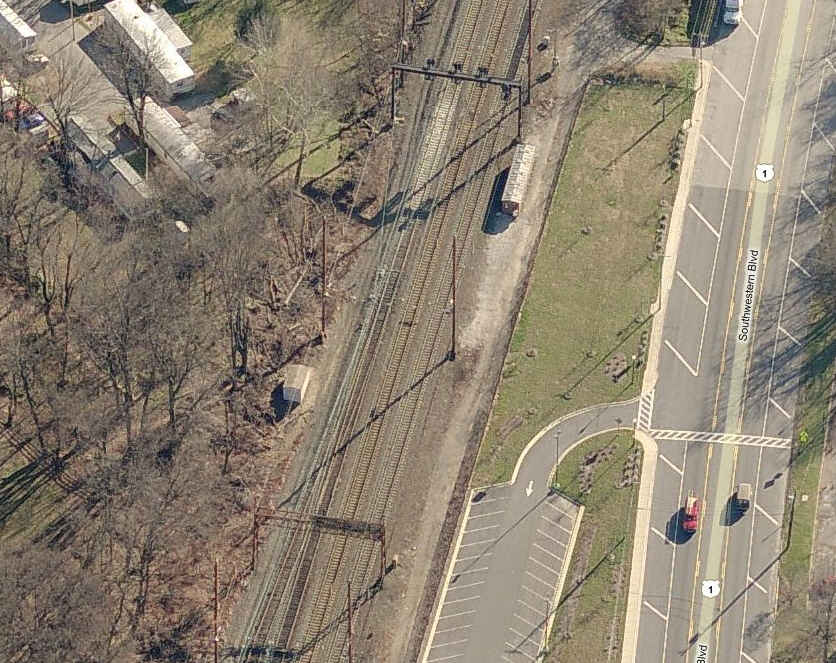
![]() CSX Crosses the North East Corridor.
CSX Crosses the North East Corridor.
CSX crosses the old Pennsy tracks in a 3x4 configuration (used to be 4x4), unfortunately, access is almost impossible. Just south of the Halethorpe MARC station, and RT 1.

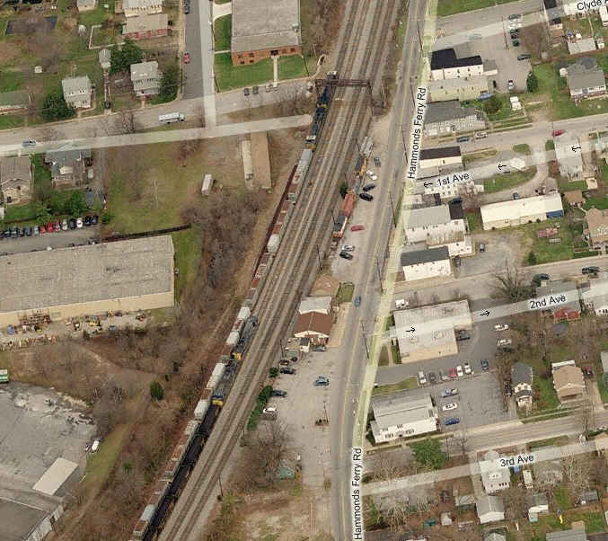
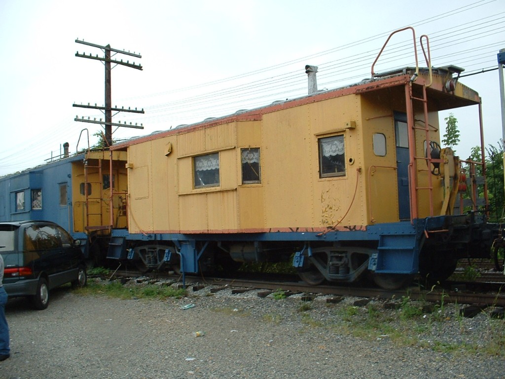
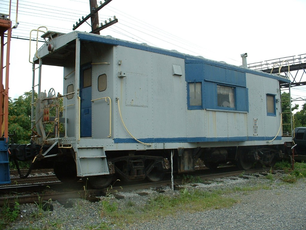
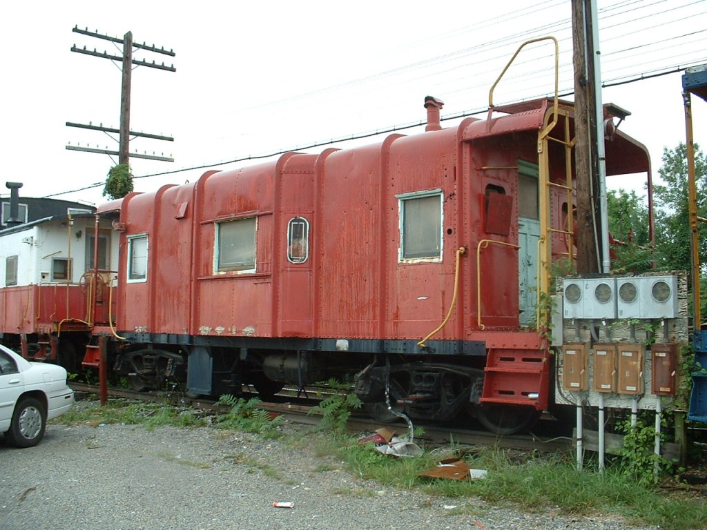
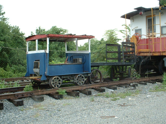
![]() Cabooses in Landsdowne
Cabooses in Landsdowne
There used to be 5 cabooses along Hammond Ferry Rd in Landsdowne. At one time there were a number of shops occupying the cabooses, but they eventually went somewhere else, and they fell into disrepair. About two years ago, they started disappearing. The restaurant next to where they used to be has good food, altho they do not have an outside eating area :-( For the time being, these shots can still be seen on the birds eye view of bing.com/maps, but don't wait too long, as they will update the pictures someday, and they will be gone.
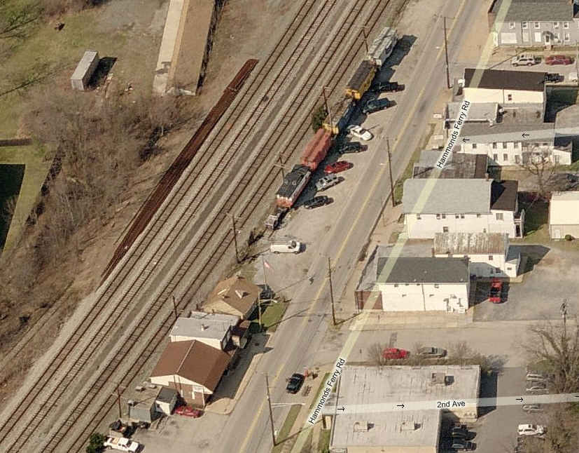
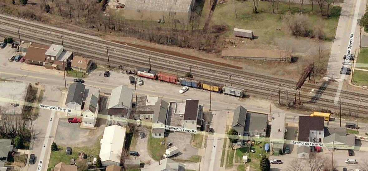
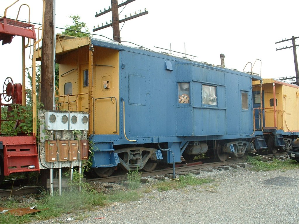
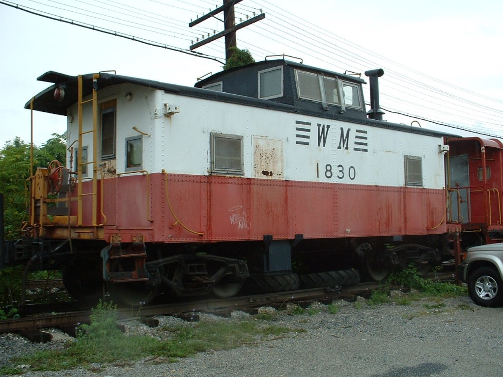
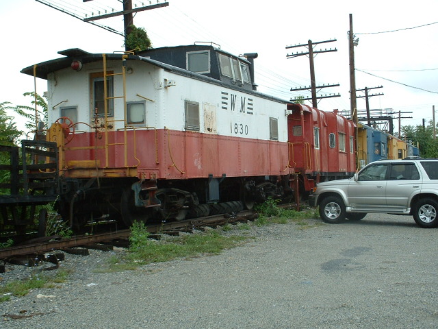
 In 2005.
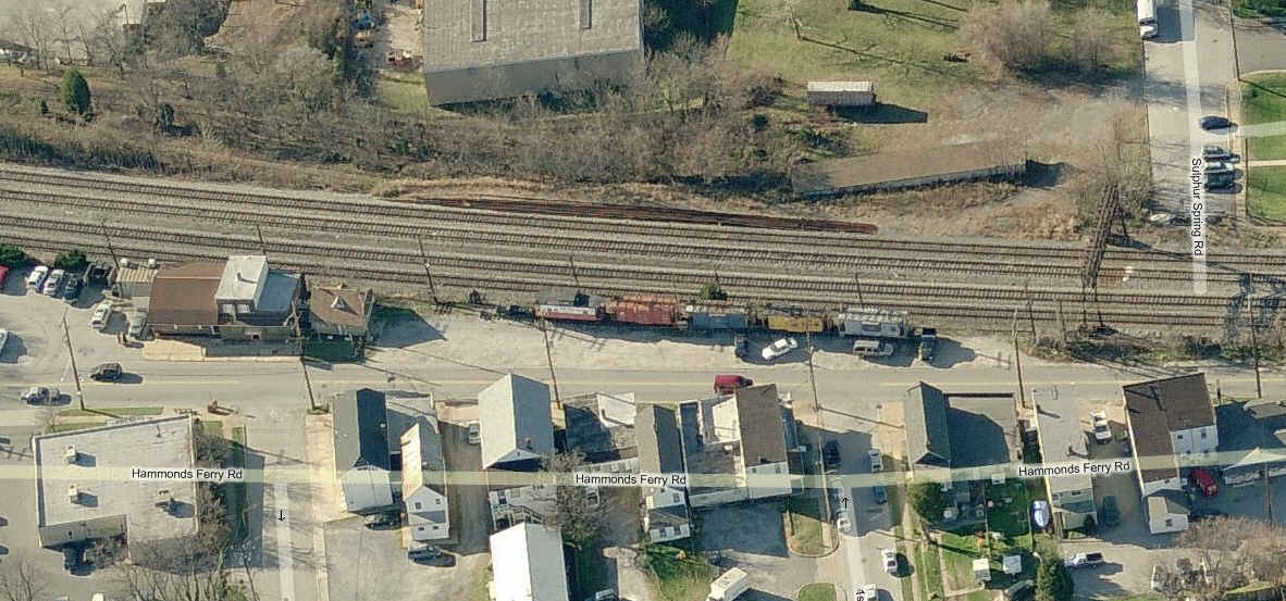
 This was all that was left when I went by in 2009.

 2010 - In the year since, they have put in curbs and made a small
park where the cabooses used to be.
2010 - In the year since, they have put in curbs and made a small
park where the cabooses used to be.
![]() Old ex Pennsy Freight Sheds / Catonsville
Old ex Pennsy Freight Sheds / Catonsville

![]() Lone Caboose on Knecht Ave, off Benson Ave
Lone Caboose on Knecht Ave, off Benson Ave
Up until the early 80's, Knecht Ave was one of the few grade crossings left on the North East Corridor. Back then, I used to work for Westinghouse which (luckily) had a facility on Knecht Ave, and I would spend many of my lunchtimes sitting at the crossing for waiting to take pictures. A siding which used to service a business, now sees duty as a storage siding, as winessed by the equipment I caught there the other day... in addition to the caboose which has been there for about 25 years.

Linthicum
BWI Business Park
BWI Airport
MARC St Denis
Station
MARC
Halethorpe Station
MARC BWI
Station
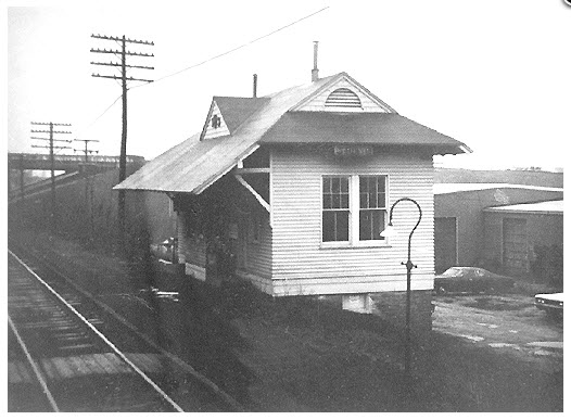
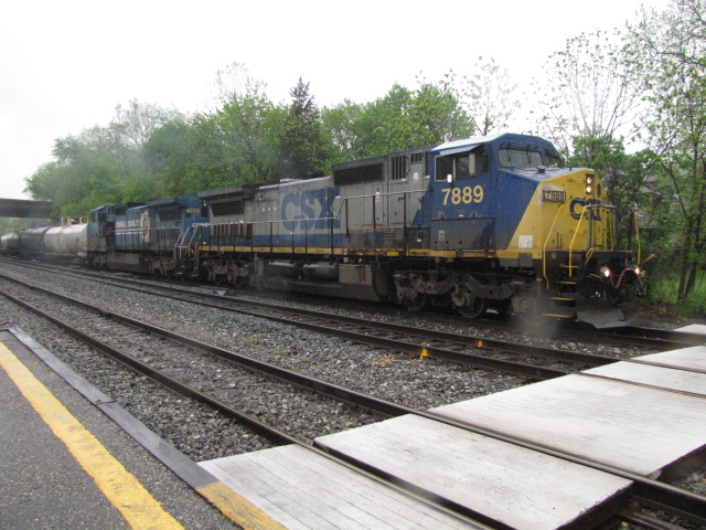
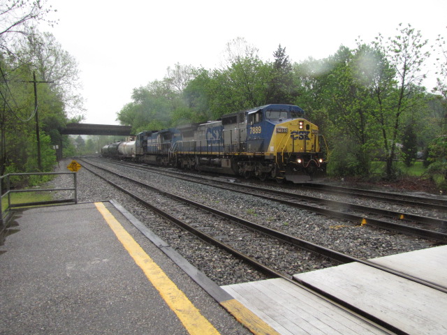
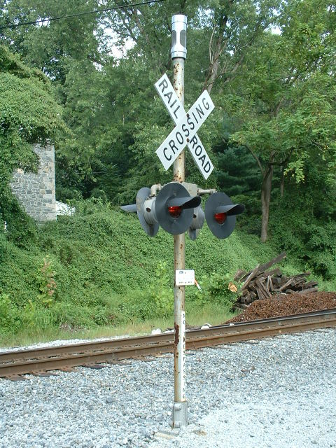
St Denis MARC Station - Camden Line
The St. Denis station dates back to the old
B&O days. The current "station" (if you can call it that), was put in
place when MARC started it's commuter service back in the MDOT days. When
I first went to college in 1969, I would come over here to "study" and watch
trains - there was a real depot here then (well - kinda, sorta :-). The
B&W picture below is the only one I have come across of it, and it was taken by
my best friend John's father, Leonard Buxton - one of the greatest railfans of
all time!!!
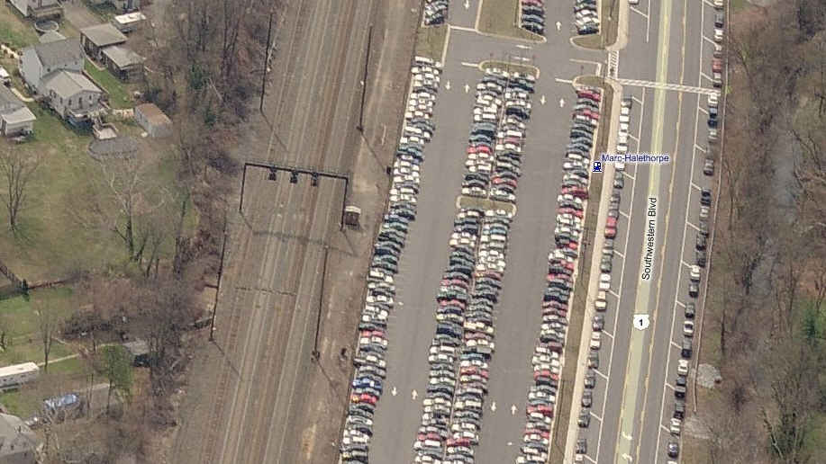
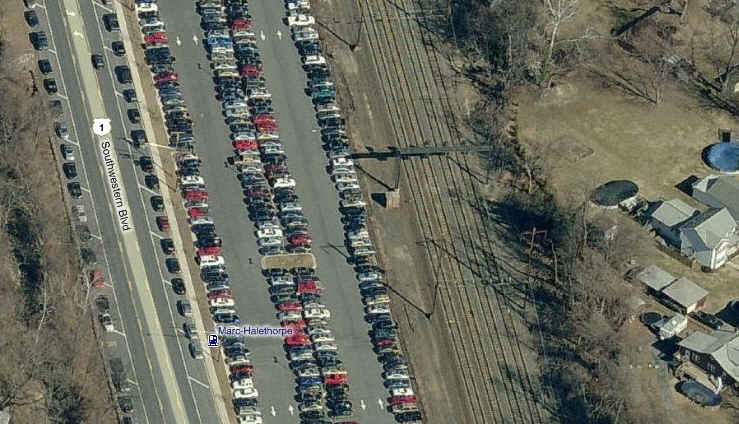
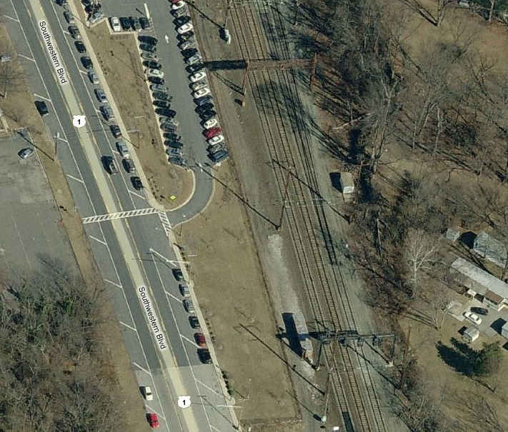
Halethorpe MARC Station - Penn Line, on the NE Corridor
This MARC station has a fair bit of parking, but in order to find a spot, you need to get there no later than 8am. The tracks here are straight, both north and south. Francis Ave goes over the station, and the stairways to go from track level to bridge level offer a nice vantage point for SB's coming out of Baltimore.
MARC recently rebuilt the Halethorpe station with high level platforms in 2010.
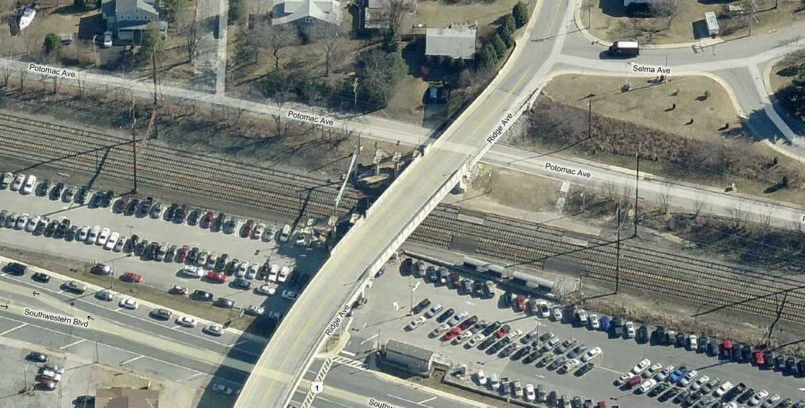
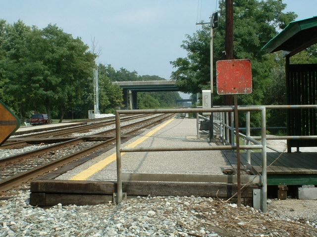
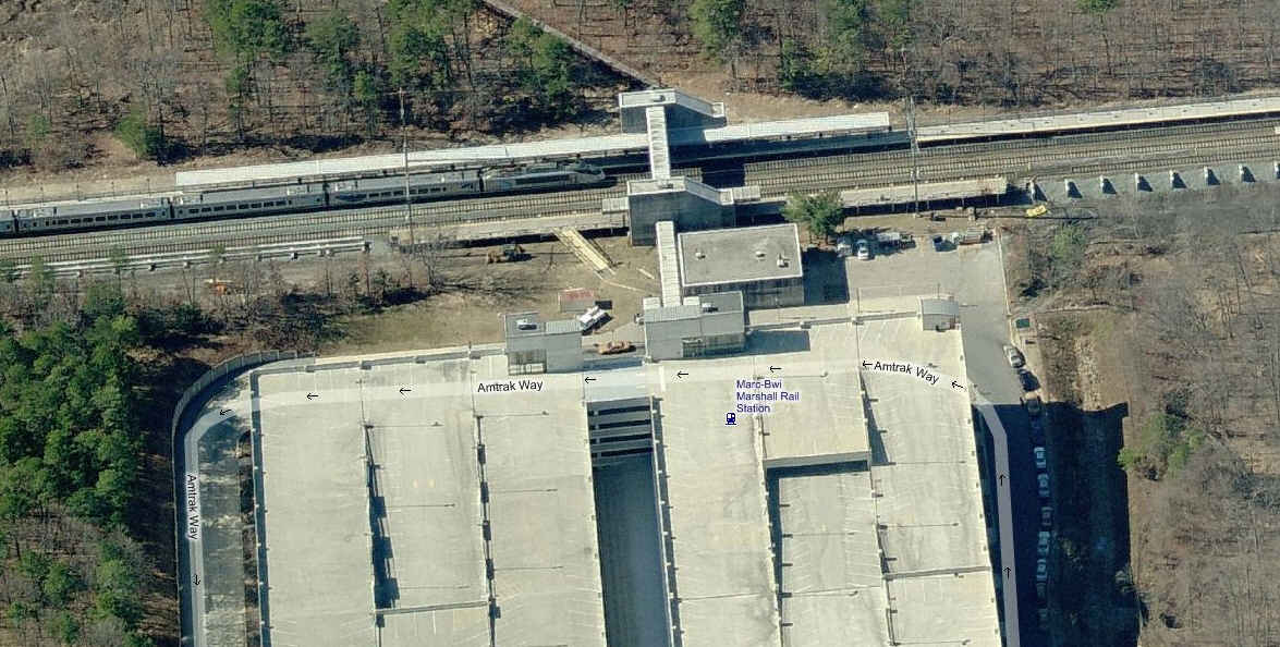
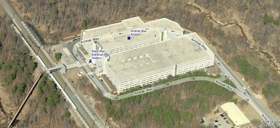
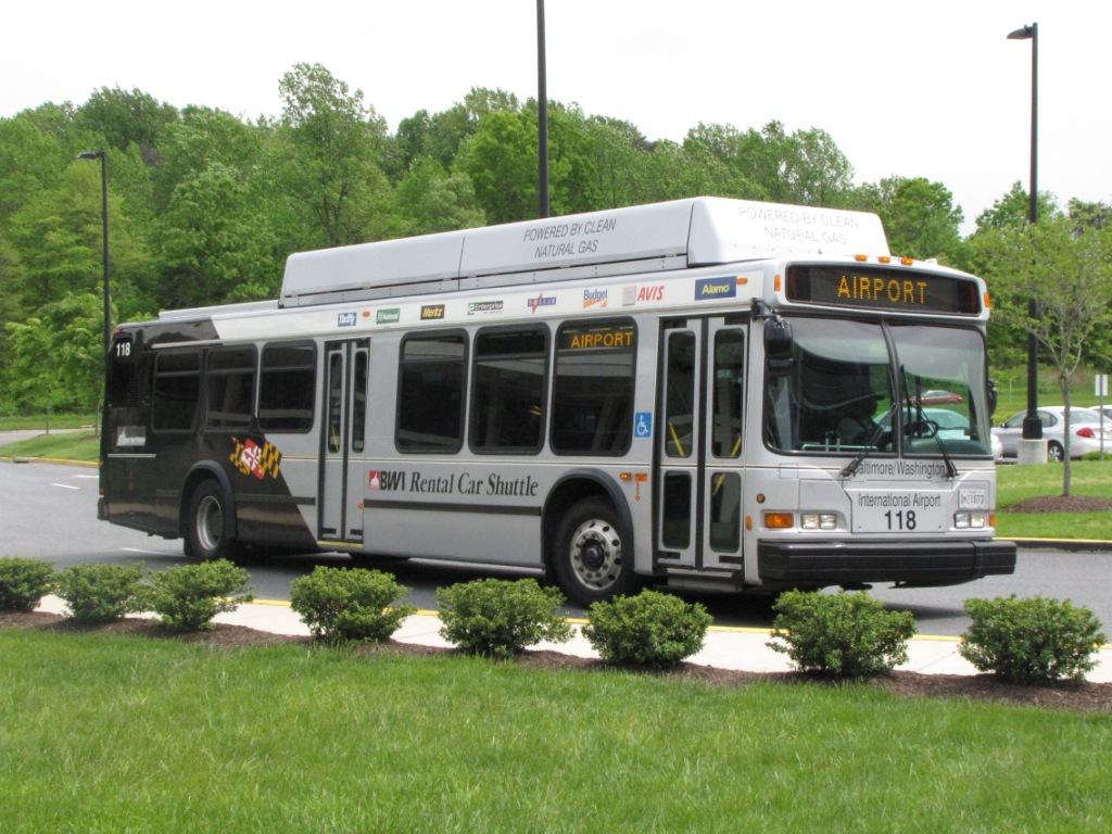
MARC BWI Station - Penn Line, on the NE Corridor
Amtrak's southern most station in the Baltimore area. Parking is OK, but was much better (and free) before they built the huge parking structure. Lunchtime is pretty good for train watching (11am-1pm).


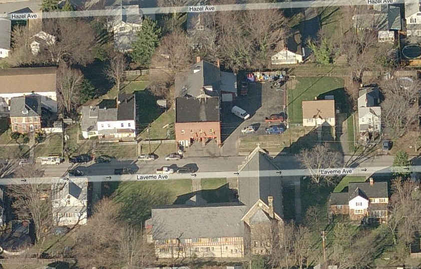
For a complete list of Baltimore County Fire Stations: http://www.baltimorecountymd.gov/Agencies/fire/stationinfo/index.html
![]() Woodlawn Volunteer Fire Co, Station 33
Woodlawn Volunteer Fire Co, Station 33

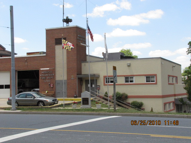
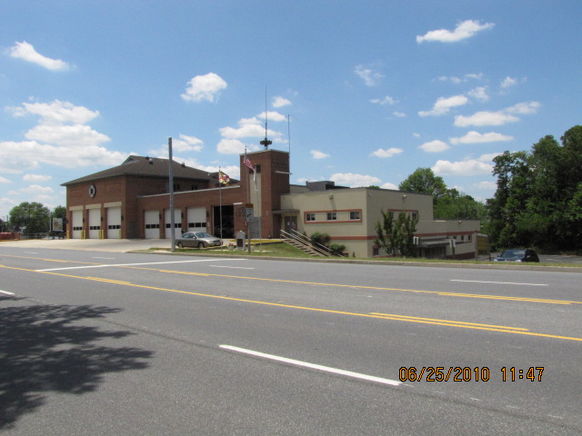
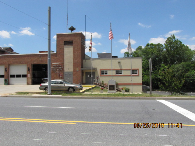
![]() Arbutus Volunteer Fire Co, Station 35
Arbutus Volunteer Fire Co, Station 35
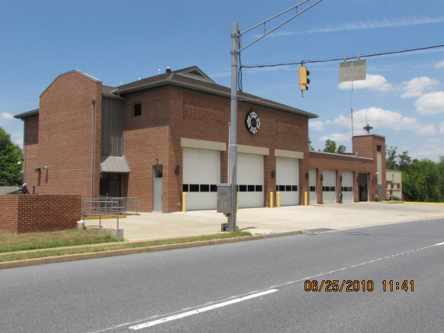
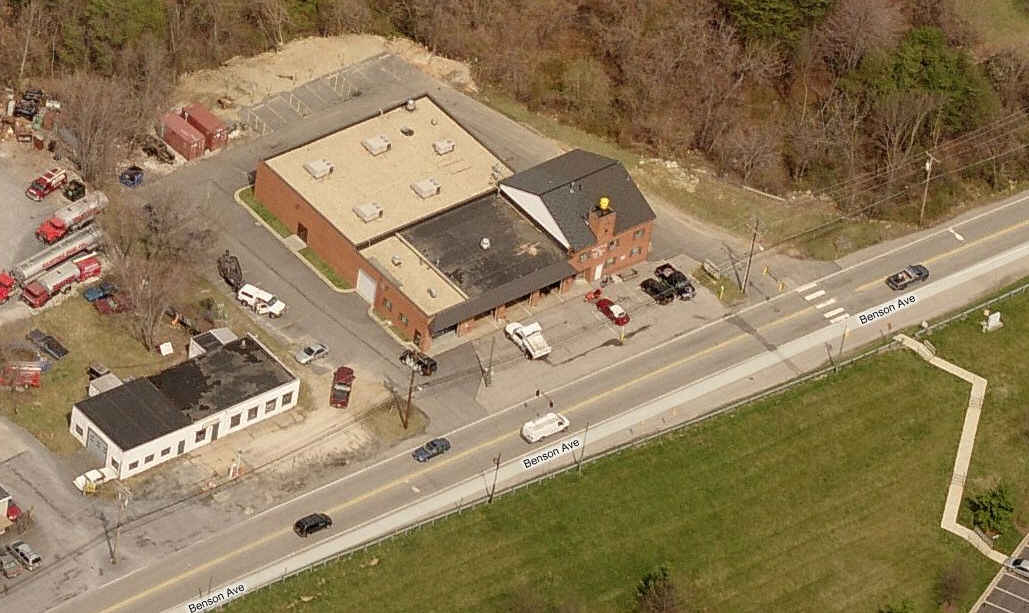
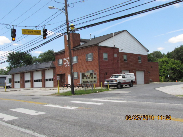
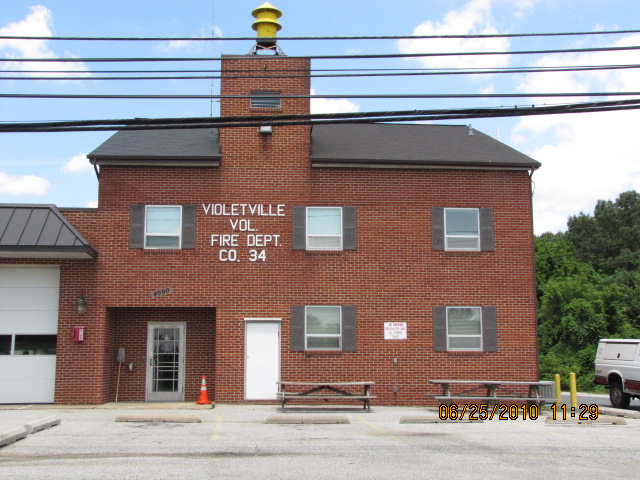
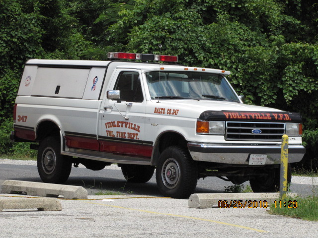
![]() Violetville Volunteer Fire Co, Station 34
Violetville Volunteer Fire Co, Station 34


![]() Baltimore County Fire Station 4 - Catonsville
Baltimore County Fire Station 4 - Catonsville

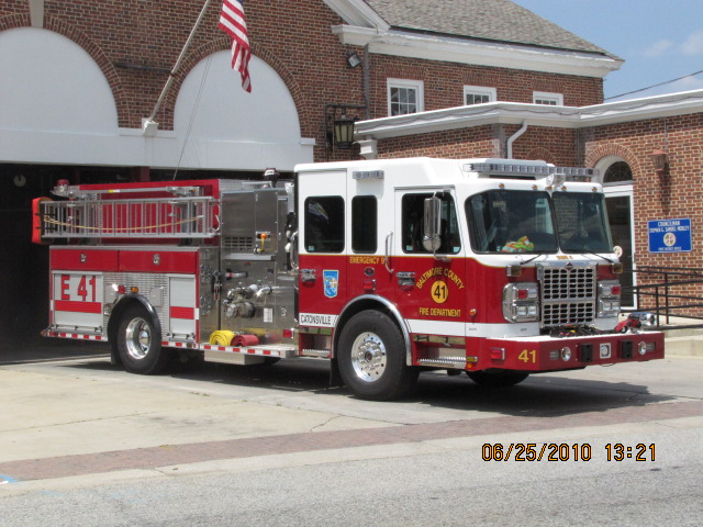
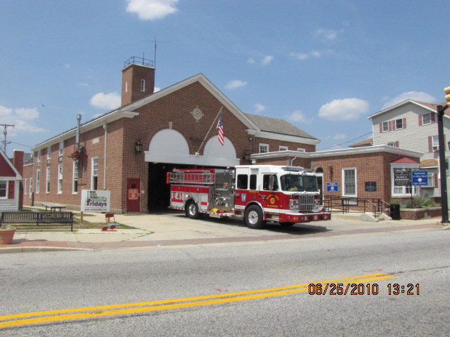
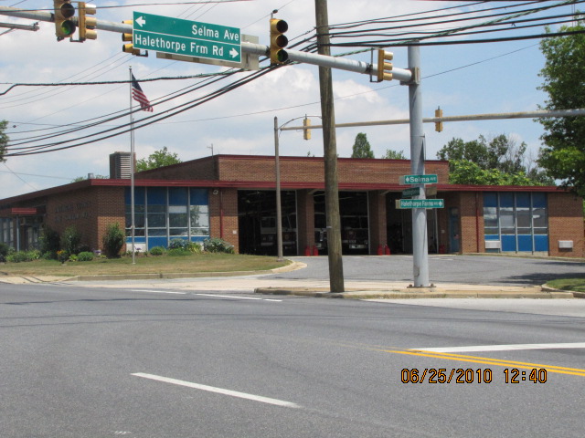
![]() Baltimore County Fire Station 5 - Halethorpe
Baltimore County Fire Station 5 - Halethorpe

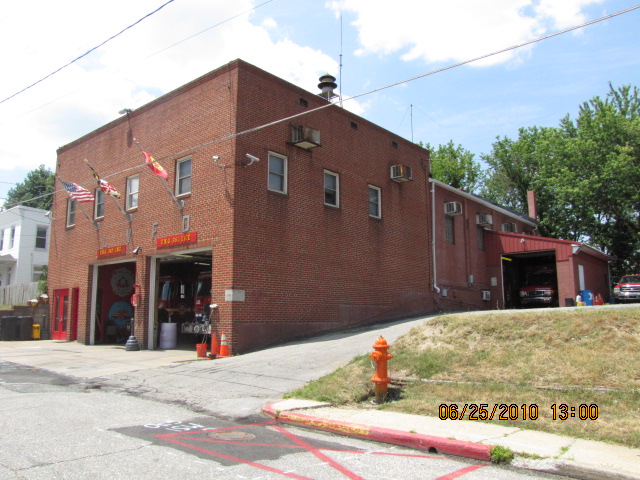
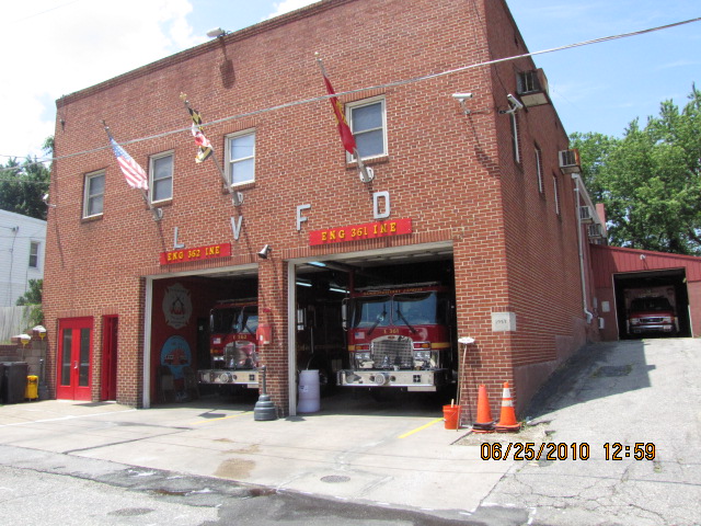
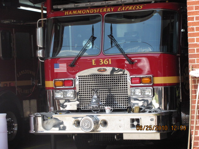
![]() Landsdowne Volunteer Fire Co, Station 36
Landsdowne Volunteer Fire Co, Station 36


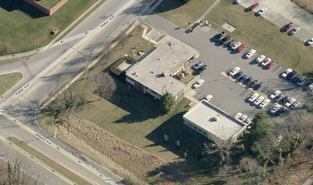
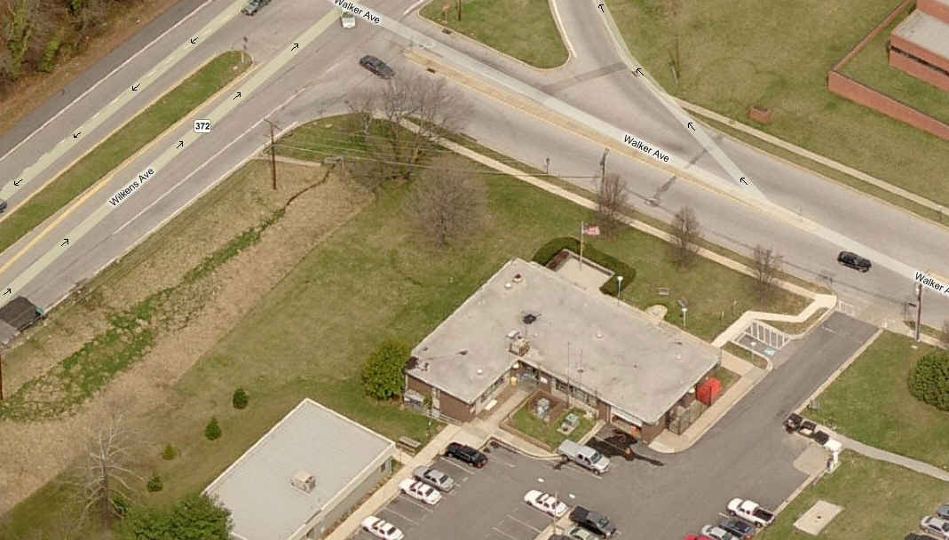
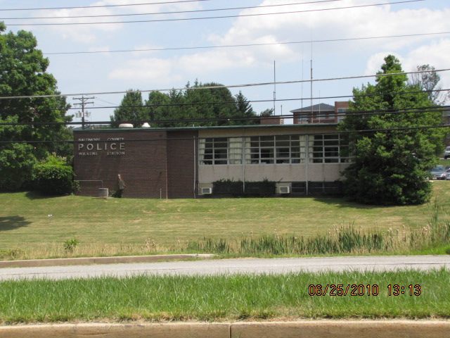
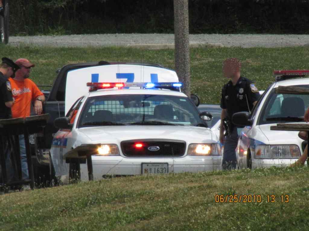
![]() Baltimore County Police Station - Wilkens
Baltimore County Police Station - Wilkens
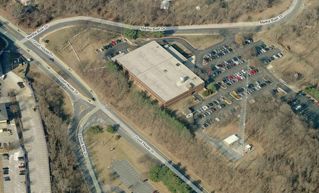
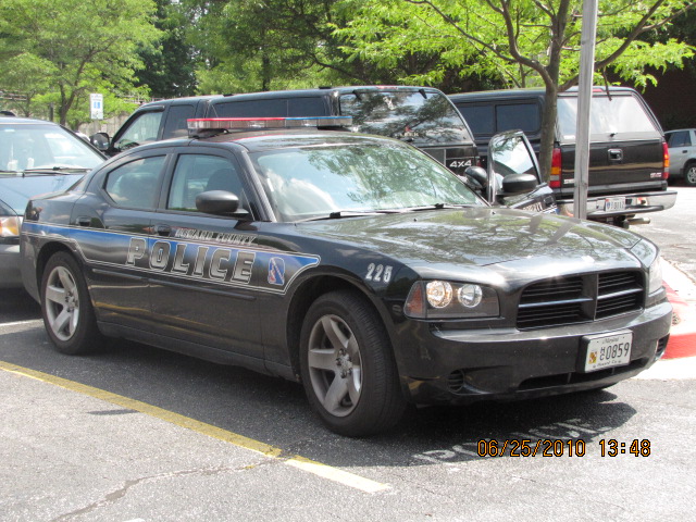
![]() Howard County Police Station / Headquarters
Howard County Police Station / Headquarters
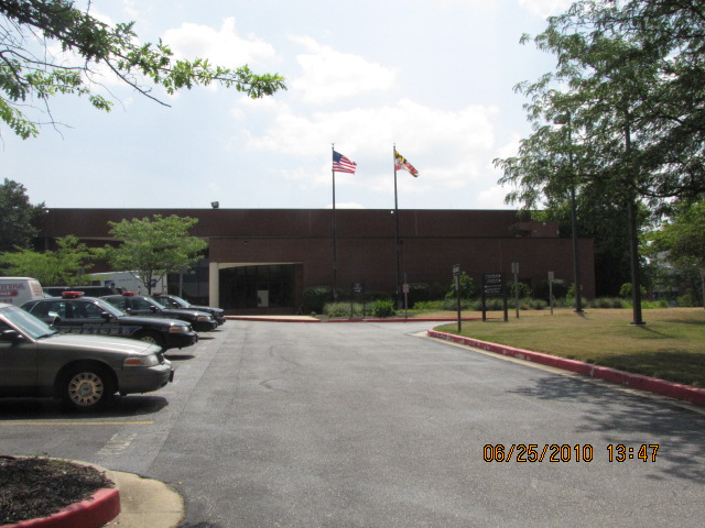
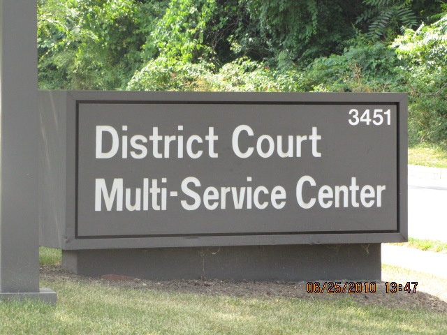


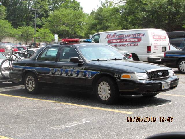
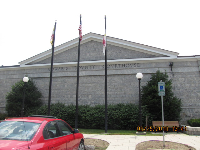
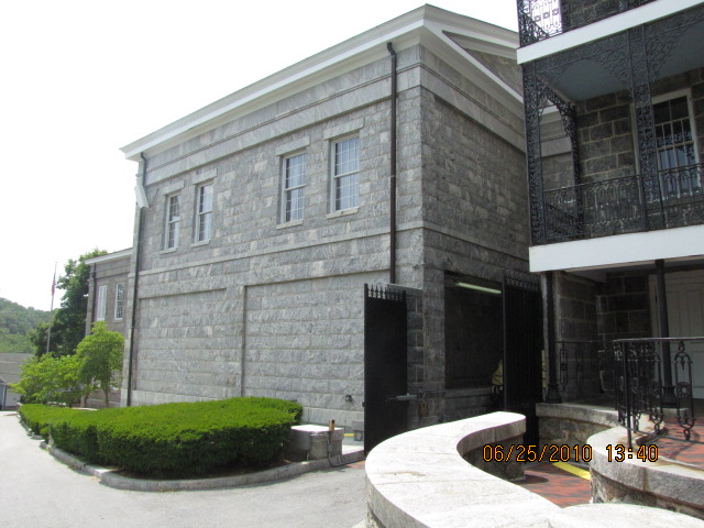
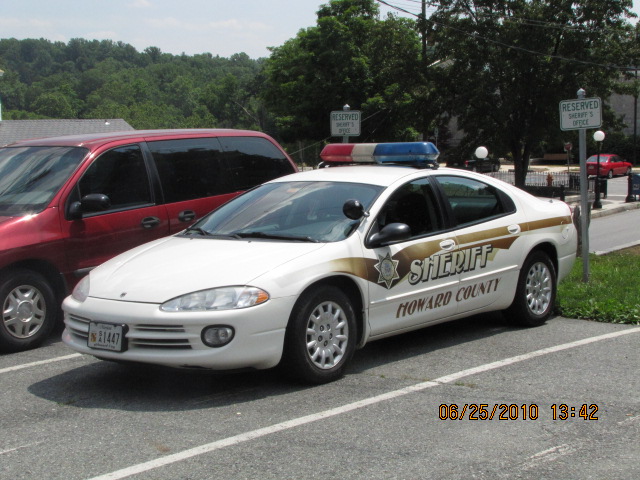
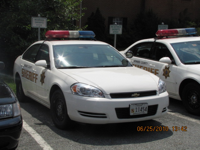
![]() Howard County Sheriff's Department / Court
House
Howard County Sheriff's Department / Court
House


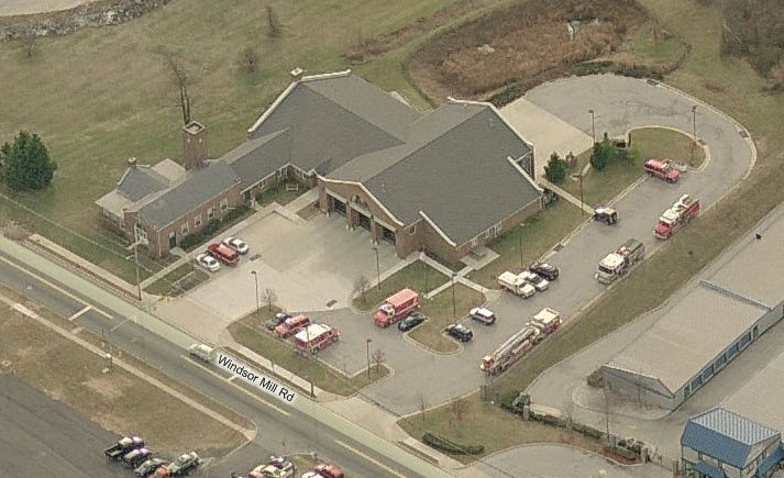
![]() Baltimore County Fire Station 3 - Woodlawn
Baltimore County Fire Station 3 - Woodlawn
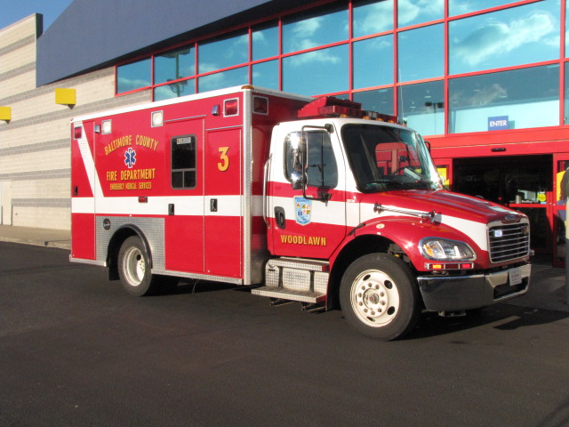
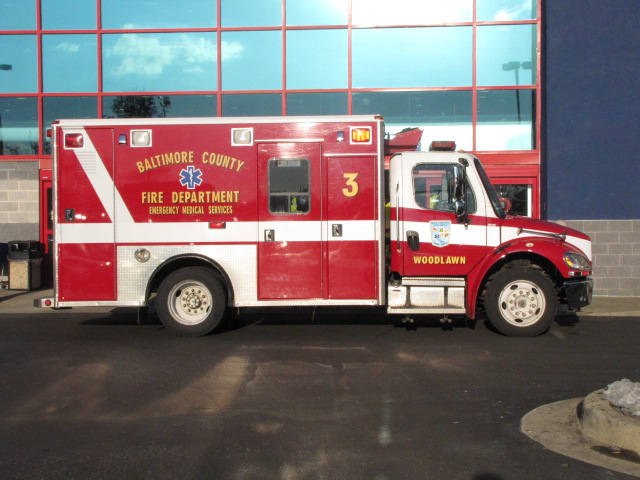 Woodlawn's Ambo 3 in front of Best Buys on Security,
12/28/2009
Woodlawn's Ambo 3 in front of Best Buys on Security,
12/28/2009
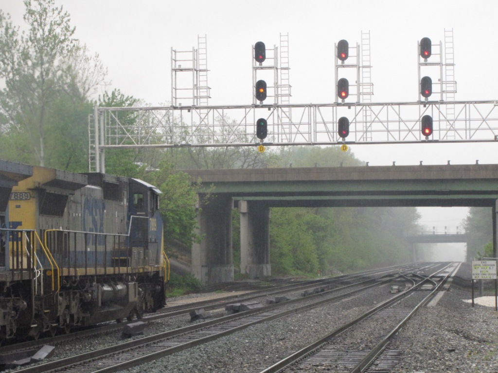
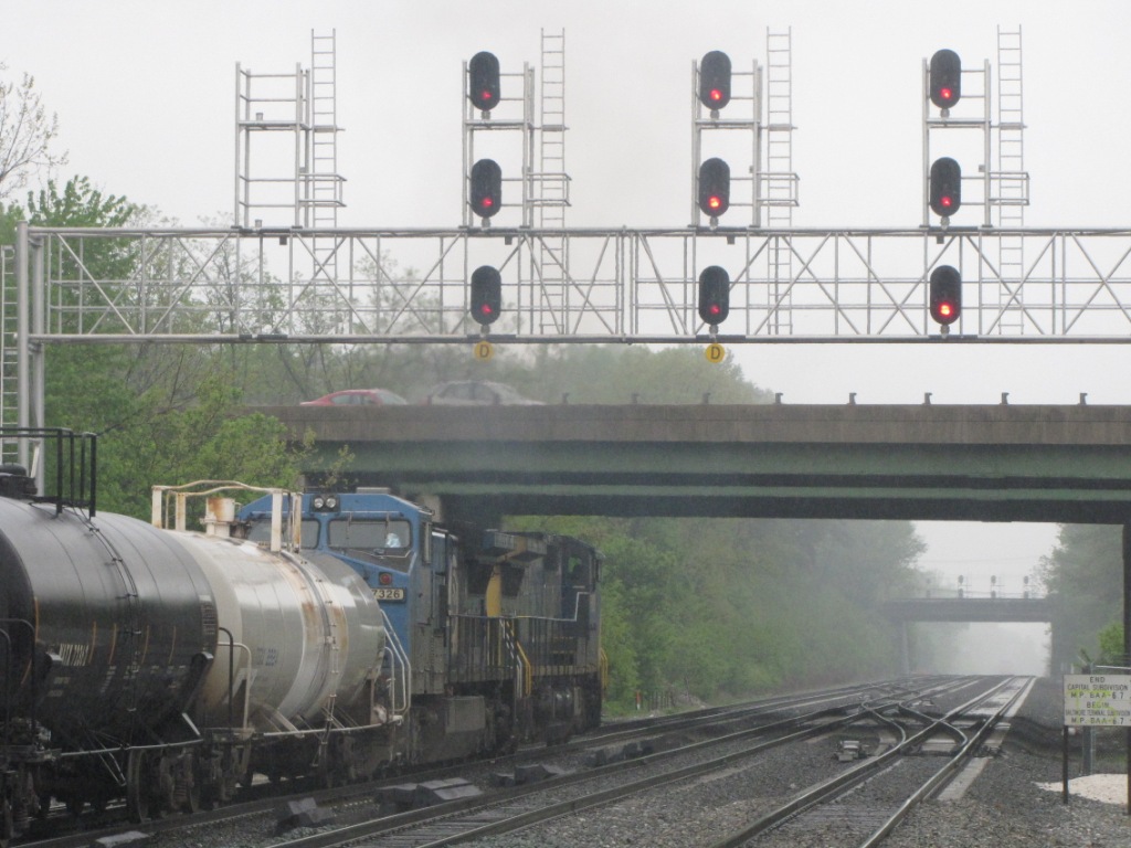
![]() CSX - Along Hammonds Ferry Road.
CSX - Along Hammonds Ferry Road.
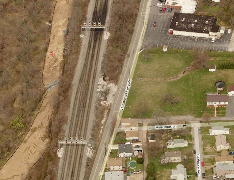
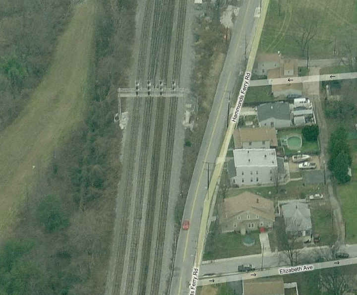
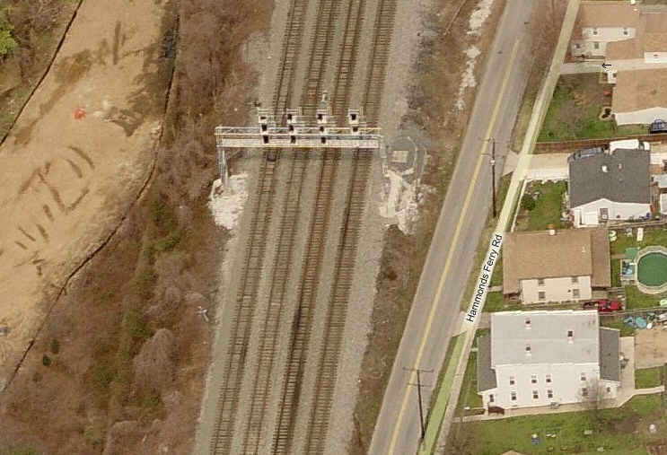
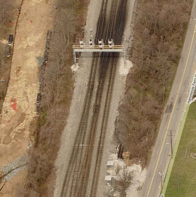
The shot on the right was taken from where the cabooses used
to be.


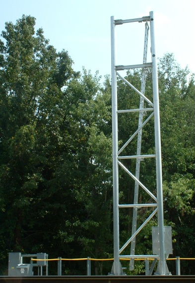
The unused signal bridge that was used up until the new
colorlights were installed.... I'm surprised they left this one standing.
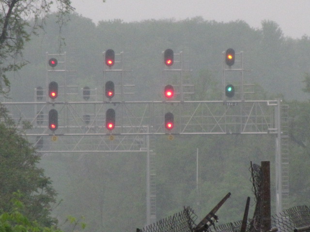
![]() CSX - Adjacent to HX Tower.
CSX - Adjacent to HX Tower.
The CPL signals that used to be here protected interlocking for a number of crossovers in front of the tower. Back in 2010 or so, CSX started a project to realign the crossovers, and moved them closer to St Denis. Once done, they activated the new color light signals by the MARC station, and turned out the CPL's forever, and removing them a short time later, including the bridges. These pictures are dupes of the ones up above in the HX Tower section, and are provided for historical reference only.
 Picture of the eastern signal bridge from HX tower.
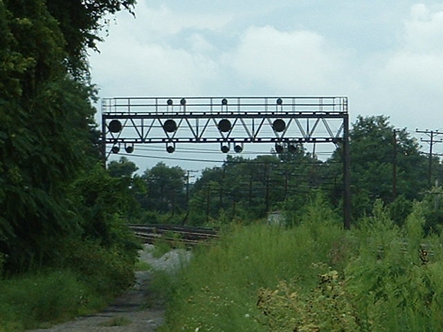
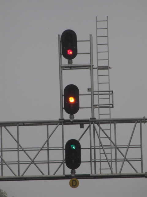
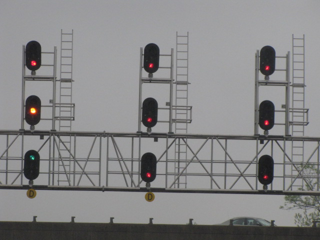
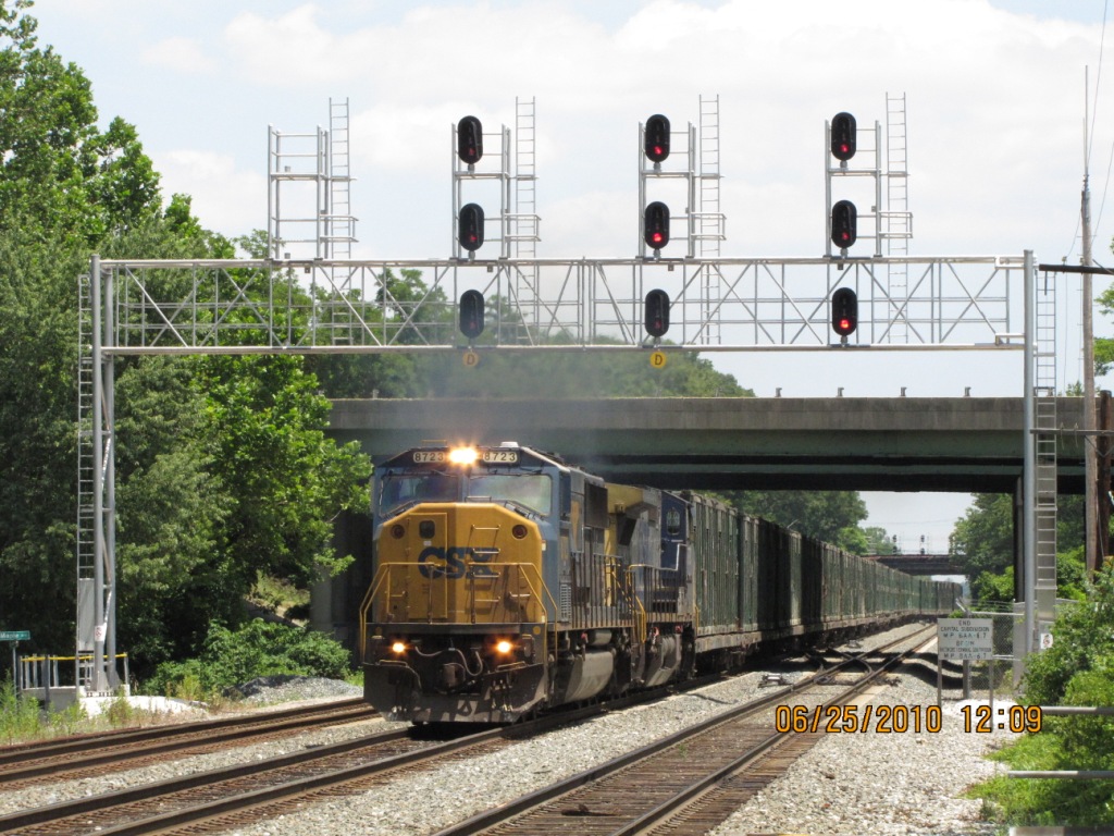
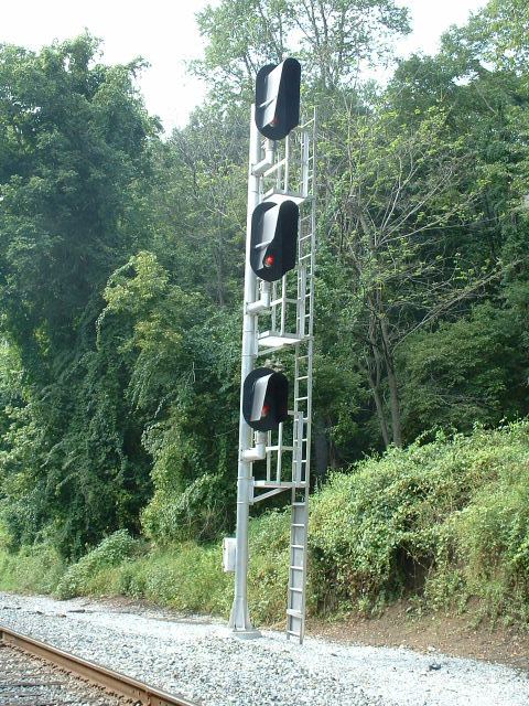
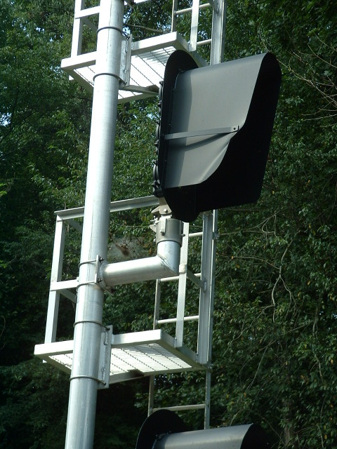
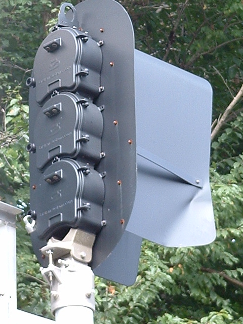
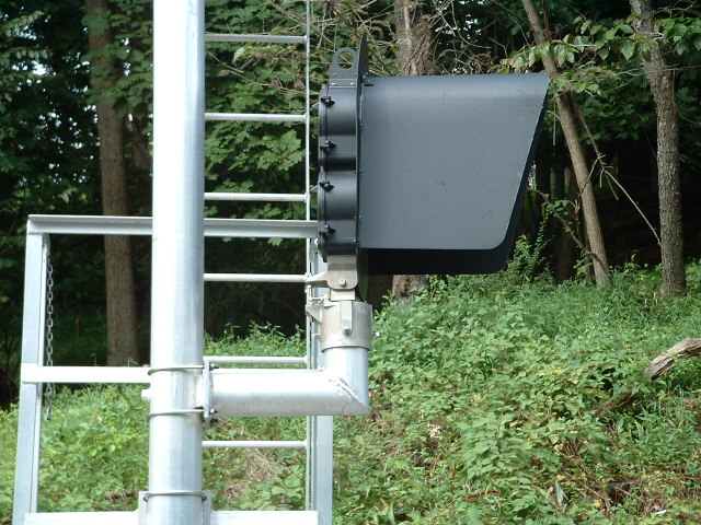
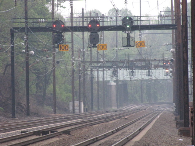
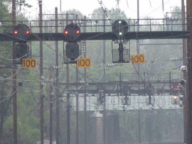
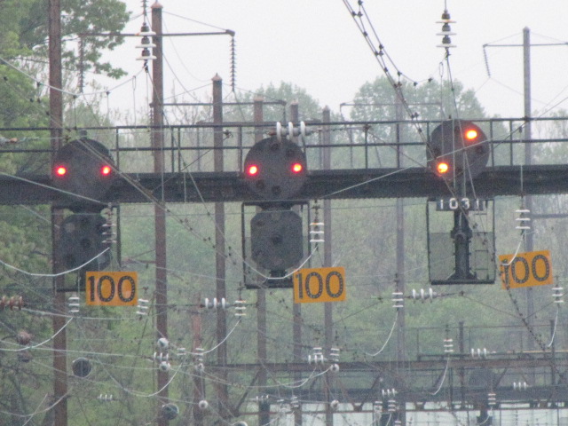
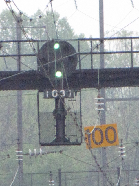
![]() CSX - New Color Lights by St
Denis Station.
CSX - New Color Lights by St
Denis Station.


 A few shots way before the signals were put into service
(2005)
A few shots way before the signals were put into service
(2005)
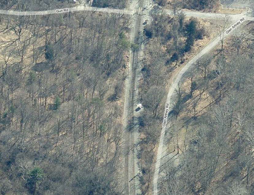
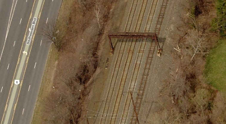
![]() CSX - Color Light Signals
and other stuff at
Gun Rd.
CSX - Color Light Signals
and other stuff at
Gun Rd.
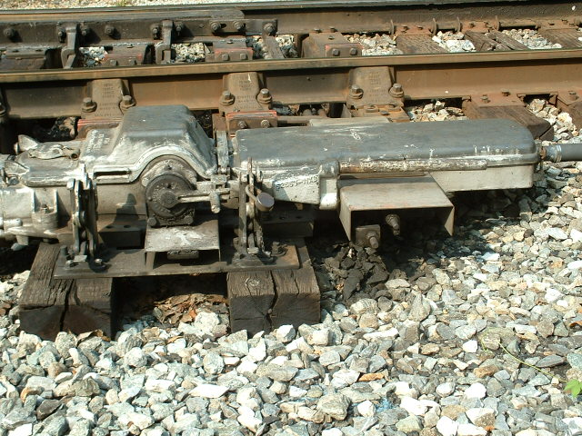
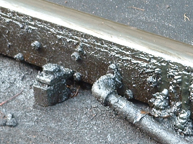
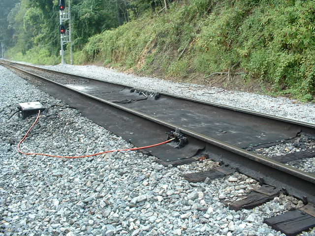
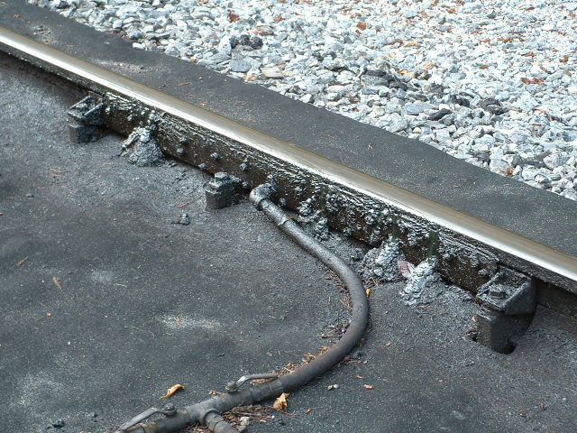
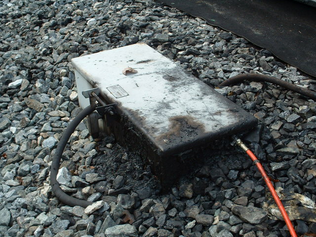
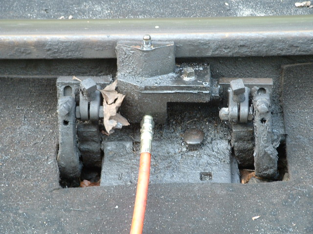
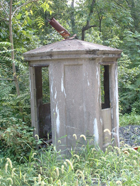
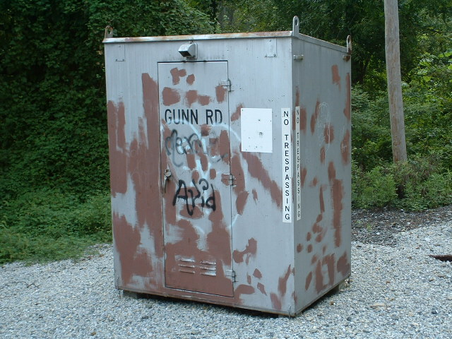
In this quiet little corner of the Patapsco Park, you have a closed grade crossing on the old main line, with interlocking signals, track lubricator, and old concrete telephone booth, a switch machine, and of course, grade crossing lights which no longer see any vehicular traffic. The signals are made by Safetran.


![]() Amtrak
NEC PCL's.
Amtrak
NEC PCL's.
This set of signals is just south of the Wilkens and Southwest Blvd split.
![]() Amtrak NEC - Unused signal bridge near the Arbutus Volunteer Fire
Co.
Amtrak NEC - Unused signal bridge near the Arbutus Volunteer Fire
Co.
![]() Amtrak NEC PCL's at the Halethorpe MARC
Station.
Amtrak NEC PCL's at the Halethorpe MARC
Station.
There are two sets of signal bridges, and one old bridge not used anymore in the middle of them.

Looking south from the platform, the signal on the far right
is on the southernmost signal bridge.
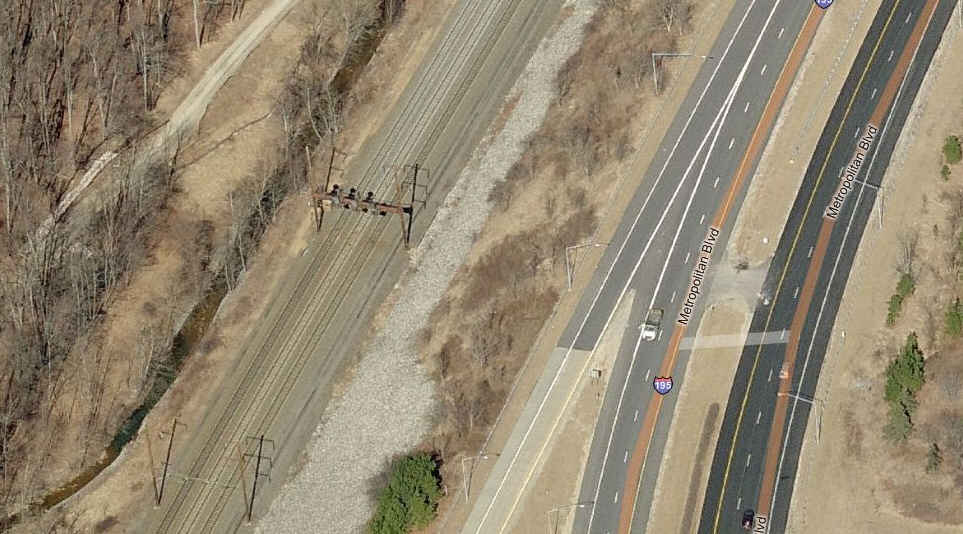
![]() Amtrak NEC PCL's along I195.
Amtrak NEC PCL's along I195.
All you can hope for is pictures from along the highway, if you're interested.
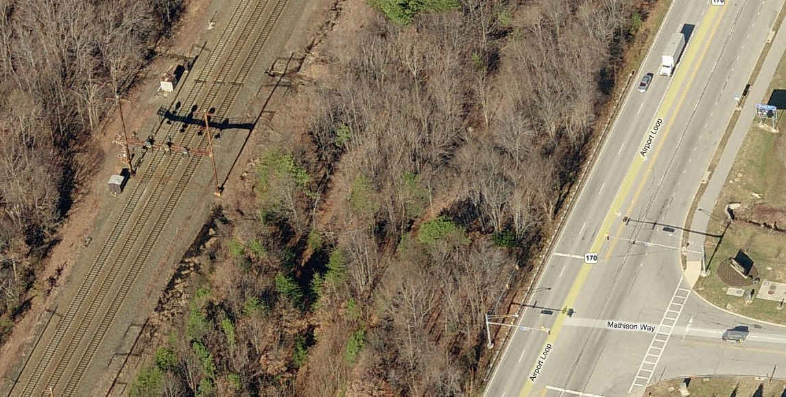
![]() Amtrak NEC PCL's along Ft Meade Road, just
south of Northrop Grumman.
Amtrak NEC PCL's along Ft Meade Road, just
south of Northrop Grumman.
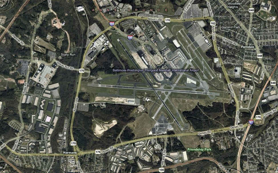
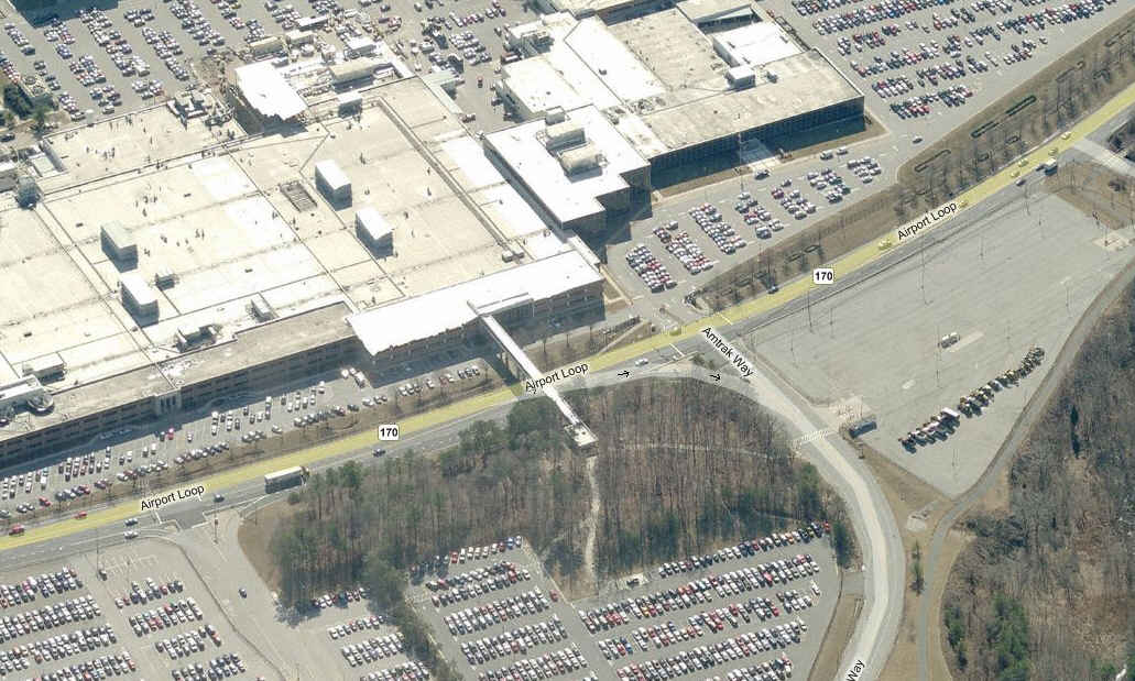
BWI Airport
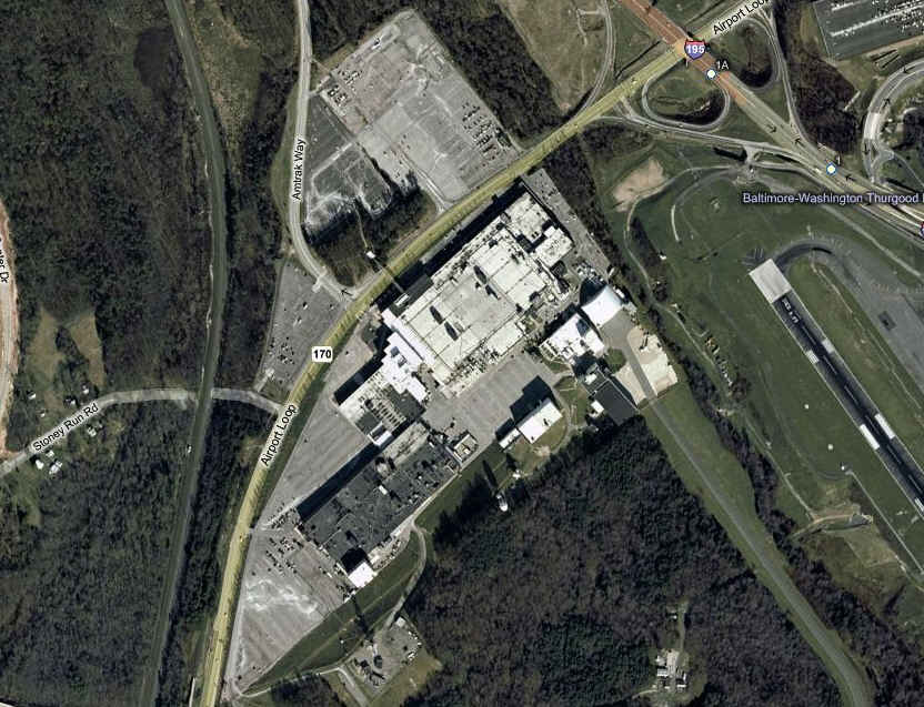
The proper name for this airport is the Baltimore/Washington International Thurgood Marshall Airport, but somehow, I just can't get used to using it, besides being way too long and complex. According to Wikipedia, it is the 24th busiest airport in the U.S., and 47th in the world. It is 10 miles south of downtown Baltimore, 30 miles north of DC.
Ground was broken for the construction of the airport in 1947, and opened on June 24th, 1950. It was owned by Baltimore City, who sold it to the state in 1972. The ID for the airport was BAL. Originally, the airport was named Friendship Airport, till it was renamed the Baltimore/Washington International Airport in 1973. The BWI ID for the airport did not become available till 1982.
The BWI Amtrak Station opened in 1980, and was the first airport to be served by a dedicated intercity rail station.

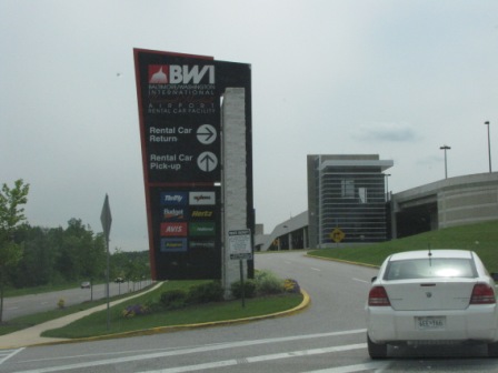


Returning a rental car with my daughter Tina, and the trip to
the airport proper, as the rental facility is located offsite.
Northrop Grumman
Northrop Grumman used to be Westinghouse prior to 1995, when they snapped up the good ole "Circle W Bar". Westinghouse was into radars bigtime, and is responsible for a few things you may be familiar with:
1) The cameras used on the moon in 1969, were built by their ATL (Advanced Technology Lab) along the BW Parkway.
2) The radar used in Hawaii back in 1941 and saw the Japanese coming to bomb Pearl Harbor... It was seen in the movie Tora, Tora, Tora.
3) The radars used on the E3A AWACS, the F16, the F22, many ground based radars for the military, an airborne radar jamming pod known as the AN/ALQ-31and all of the radars you see out on the field at airports, the ARSR-9.
Nowadays, NGC is still involved with those things, as well as number of things like boats and stuff for the USPS, including mail sorters and biohazard detection systems. But, despite the heritage of the names Northrop and Grumman, they no longer make airplanes except for a UAV. The way they are going, they may wind up being just a logistics and IT company, with no real product to sell. RIP.
The main plant is located between the approach ends of runways 15R and 22, and it has it's own taxiway into the plant, as can be seen in the right thumbnail.
The entrance into the MARC/Amtrak BWI Station is across from NGC.
The company is the largest private employer in the Baltimore area, with a current staff level of around 18,000 people (JUN2014). The next largest is the Social Security headquarters. (the ex Bethlehem Steel plant in Sparrows Point (home to the Patapsco and Back River RR) used to employ around 18,000 people, till "we" started buying steel from Japan and China, and then they sold it to a Russian company, and renigged on the retirement benefits for thousands of retirees... ooooops, that's political, and I'm supposed to stay away from that stuff on my website... sorry!)

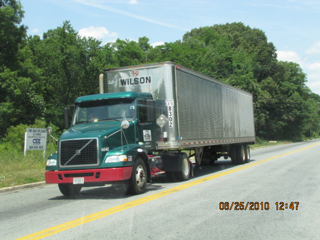
This map has several railroad competitors, one of which is the
main Baltimore terminal for UPS, off Joh Ave in Arbutus.
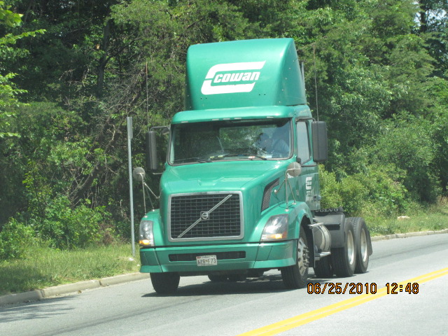


Cowen Trucking is the other RR competitor, and is right down
the street from the CSX HQ.
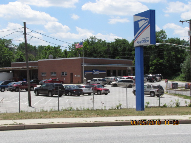
The Post Office by the traffic light at Benson Ave and Sulpher
Spring Road.
Social Security Headquarters
Located off the Baltimore Beltway at exit 17, Security Blvd, is the National headquarters for the Social Security Administration.

Disclaimers:
I love trains, and I love signals. I am not an expert. My webpages reflect what I find on the topic of the page. This is something I have fun with while trying to help others.
Please Note: Since the main focus of my two websites is railroad signals, the railfan guides are oriented towards the signal fan being able to locate them. For those of you into the modeling aspect of our hobby, my indexa page has a list of almost everything railroad oriented I can think of to provide you with at least a few pictures to help you detail your pike.
If this is a railfan page, every effort has been made to make sure that the information contained on this map and in this railfan guide is correct. Once in a while, an error may creep in :-)
My philosophy: Pictures and maps are worth a
thousand words, especially for railfanning. Text descriptions only
get you so far, especially if you get lost or disoriented. Take
along good maps.... a GPS is OK to get somewhere, but maps are still
better if you get lost! I belong to AAA, which allows you to get
local maps for free when you visit the local branches. ADC puts
out a nice series of county maps for the Washington DC area, but their
state maps do not have the railroads on them. If you can find em,
I like the National Geographic map book of the U.S..... good, clear, and
concise graphics, and they do a really good job of showing you where
tourist type attractions are, although they too lack the railroads.
Other notes about specific areas will show up on that page if known.
Pictures and additional information is always needed if anyone feels
inclined to take 'em, send 'em, and share 'em, or if you have
something to add or correct.... credit is always given! BE NICE!!! Contact info
is here
Beware: If used as a source, ANYTHING from Wikipedia must be treated as being possibly being inaccurate, wrong, or not true.
RAILFAN GUIDES HOME
RAILROAD SIGNALS HOME
2009-0511, 2009-0503, 2005-0828, 2005-0809, 2010-0625
New 4MAY2007....
Last Updated: 09/16/2021