RAILFAN GUIDES of the U.S.
Todd's Railfan
Guide to
BALTIMORE MD
North Central Baltimore City - south
RAILFAN GUIDES HOME
RAILROAD SIGNALS HOME
Guide Home Maps Hiways Hotels Intro Railroad Sights Links Photos Busses Bio's
The map below shows the north central part of Baltimore City.
This is a busy map, as there is plenty in this part of town to check out. Probably should have made two maps out of this area :-)
There is Amtrak's Penn Station, also home to MARC and light rail. Both the Light Rail and the Metro/Subway run thru the map.
The Light Rail North Ave shops and NS's Flexi-Flo terminal are across the Jones Falls from the Baltimore Streetcar Museum, and CSX's main line runs over all of this!
Although no-one has probably thought of it this way, when Howard St had trolley service, there was another triple level crossing (of sorts) in America besides the one in Richmond. The one in Richmond however was between three Class One's, and the Pennsy's track was in B&P tunnel, so you have never gotten the same kind of picture.... still......
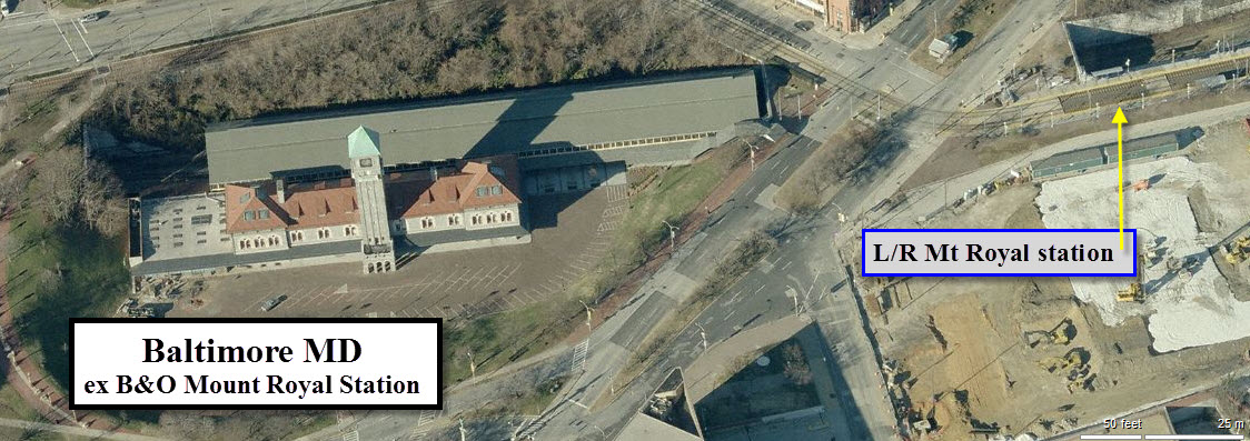
8 Mt Royal Station
Across Mt Royal Avenue from the Light Rail stop is the former B&O's Mt Royal Station... beautiful station, and it's easy to watch CSX freights come rambling thru.
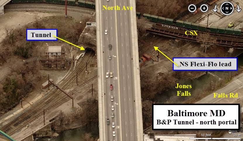
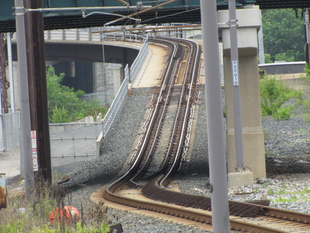
9 Amtrak's B&P Tunnel
Altho it's not something you can pix of, Amtrak's B&P tunnel is just south of Penn Station... shoot, you can't even see anything while in there cause it's so dark! You can get so-so shots of trains at the north end of the tunnel from Falls Road, just off Maryland Ave. Notice a CSX "trash train" is going by. You can get pictures of trains going in and out from the Howard Street overpass, just barely seen in the lower left hand corner. Parking however is not very convenient, so you will have to park several blocks to the north off Howard St.... Warning, Take along a friend!
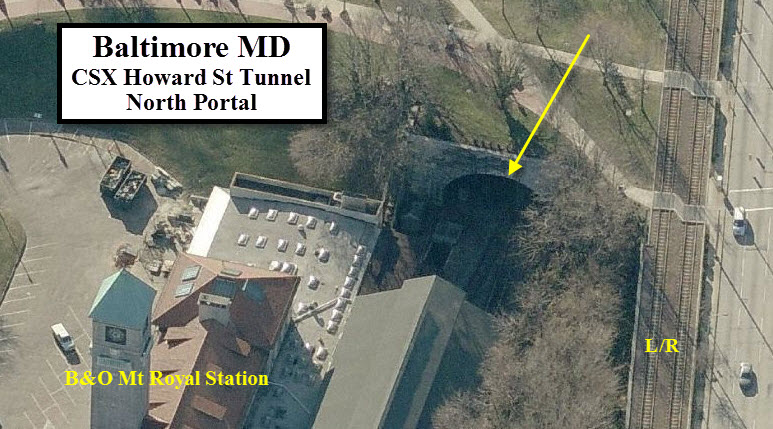
10 CSX Howard St Tunnel
The same thing goes for CSX's Howard Street Tunnel (10). However, you can get decent shots of freights at both ends at Mt Royal Station on the north and Camden Station at the south end. The tunnel was lengthened several hundred feet in the 80's when they put interstate 395 into downtown. There aren't any good vantage points on the south end any more since they built all the highways around here. Shooting at the north end will be difficult since there is little ambient light, but if you have a digital camera that does well in the dark, you might wind up with some nice pictures - you can shoot thru the fence they have up, and every now and then, the gate has been left unlocked (I didn't say that, did I?).

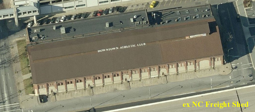
11 Ex NC Train Shed
Down off the "end" of I83, off to your right as you're going south, is the old Northern Central engine shed. It's hard to miss, especially with the roof line. Good shots can be taken from the street or I83.
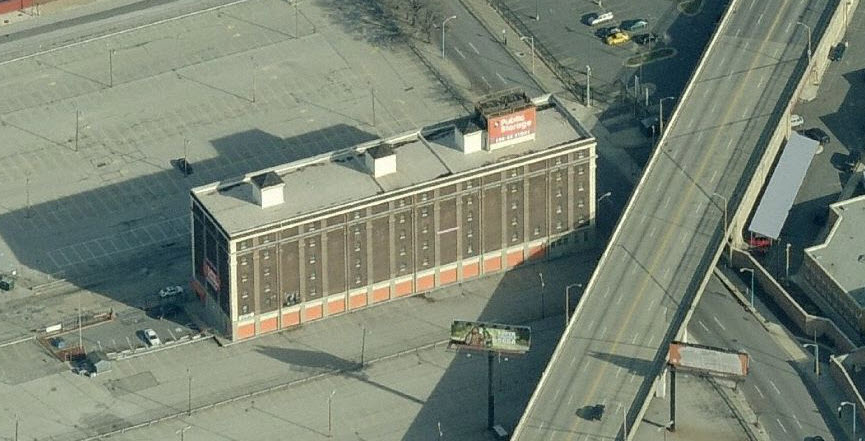
12 Ex WM Freight Shed
Just a little further down 83, on the other side of the highway, is an old Western Maryland freight building. It too is easy to spot, with orange paint all over it, and because it towers over the other buildings in the immediate area.
13 ex B&O HQ Building
Back in the real downtown area, on the corner of Baltimore and Charles Streets is the building that served as the headquarters for the B&O Railroad when it operated out of Baltimore.

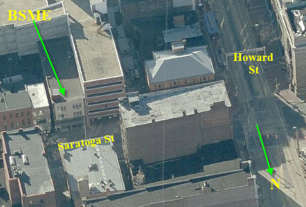
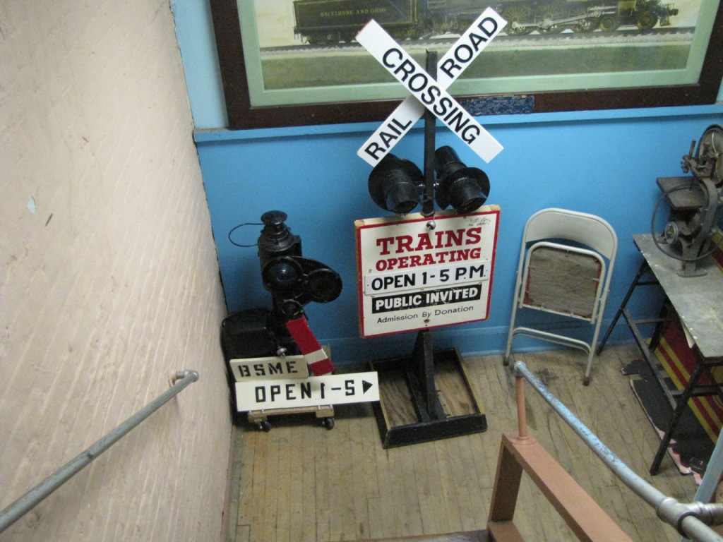
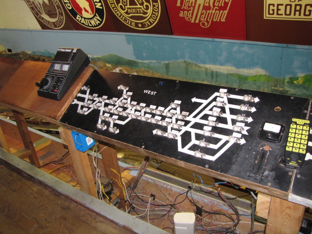
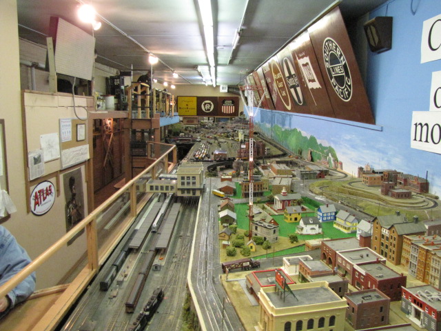
14 the BSME - Baltimore Society of Model Engineers
The BSME is one of the oldest model railroad clubs in America, and features both an HO and O gauge layout.


Light Rail Stations
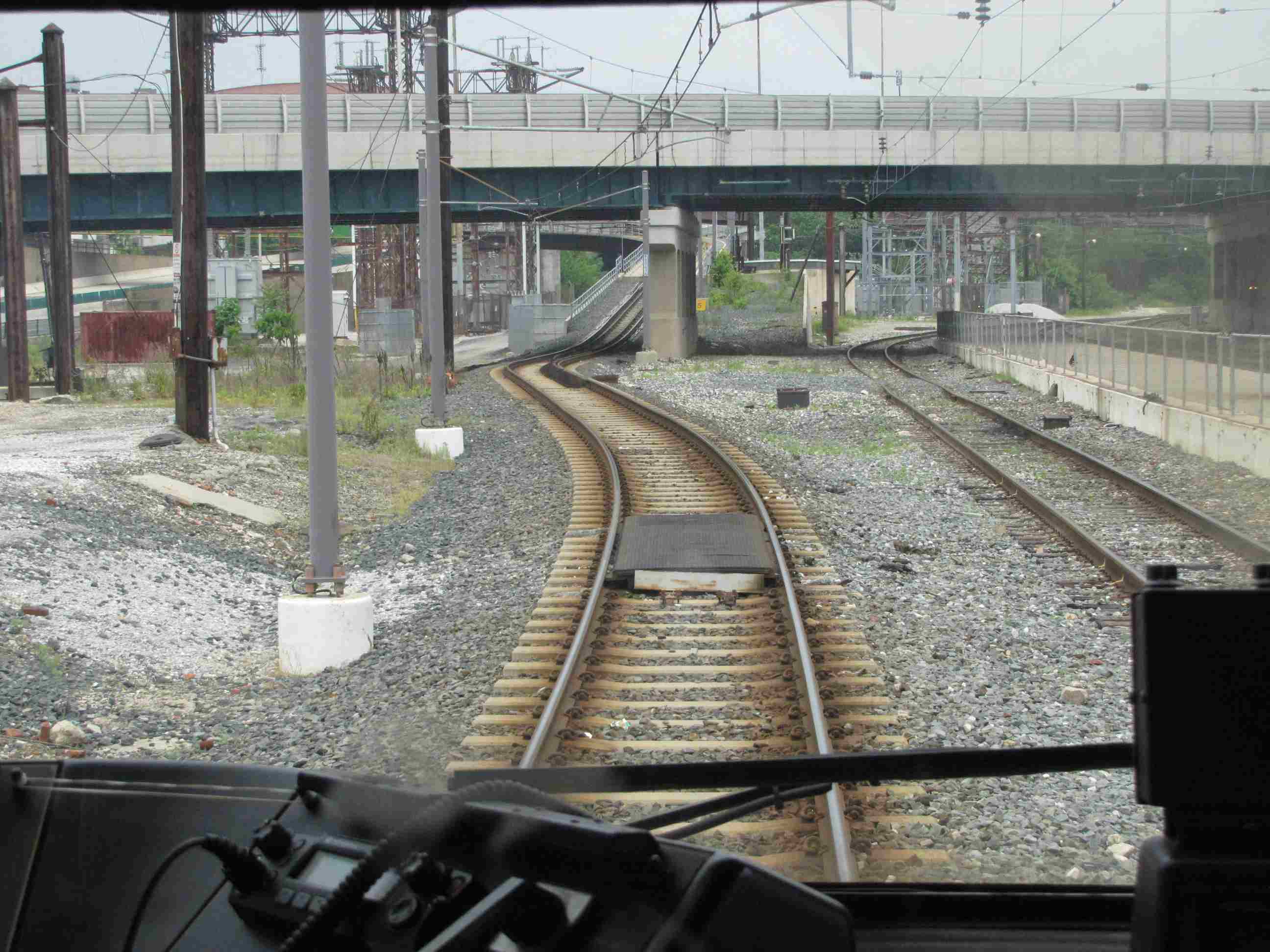
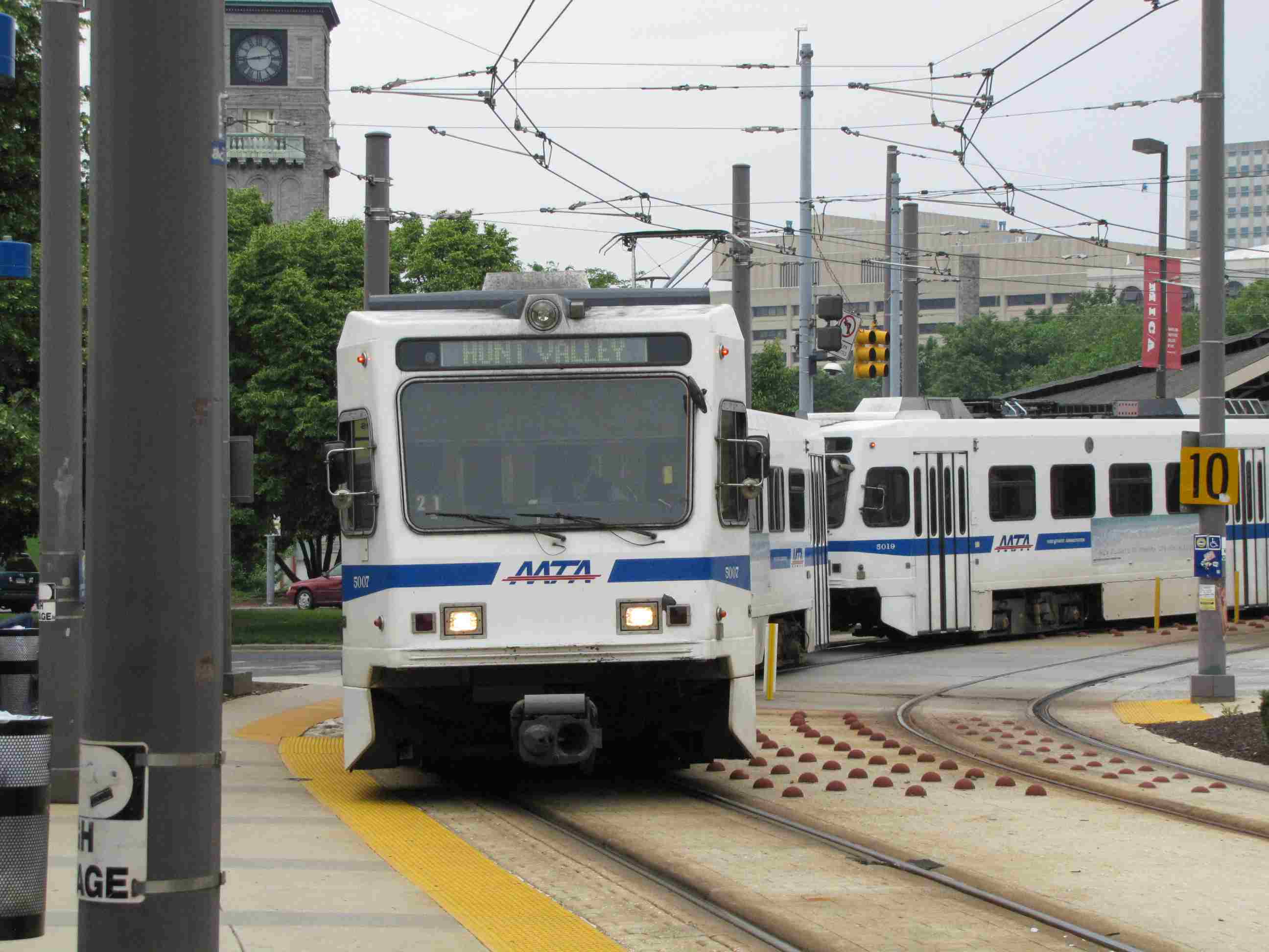
Penn Station
The light rail comes into Penn Station on what used to be track one.

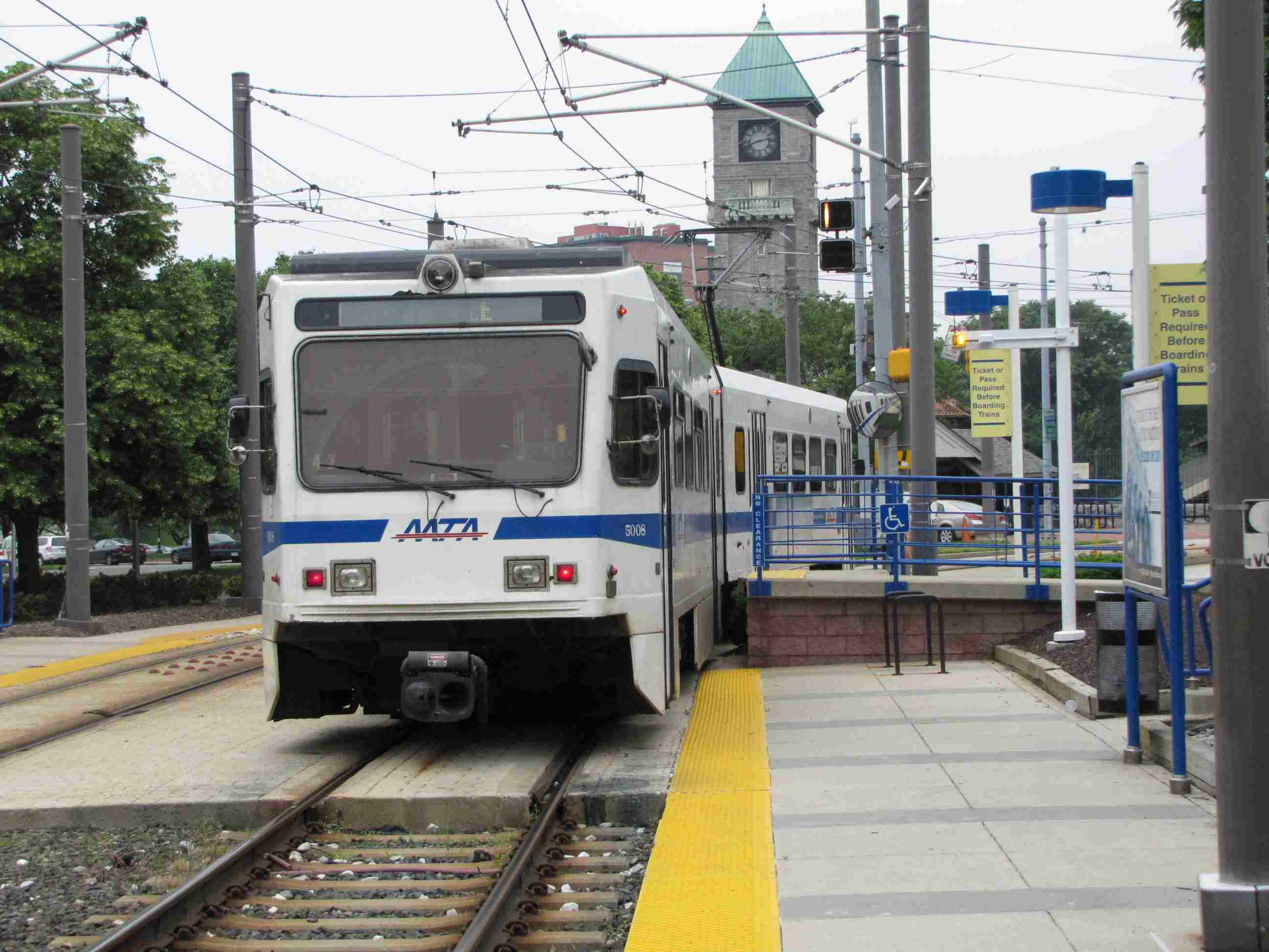
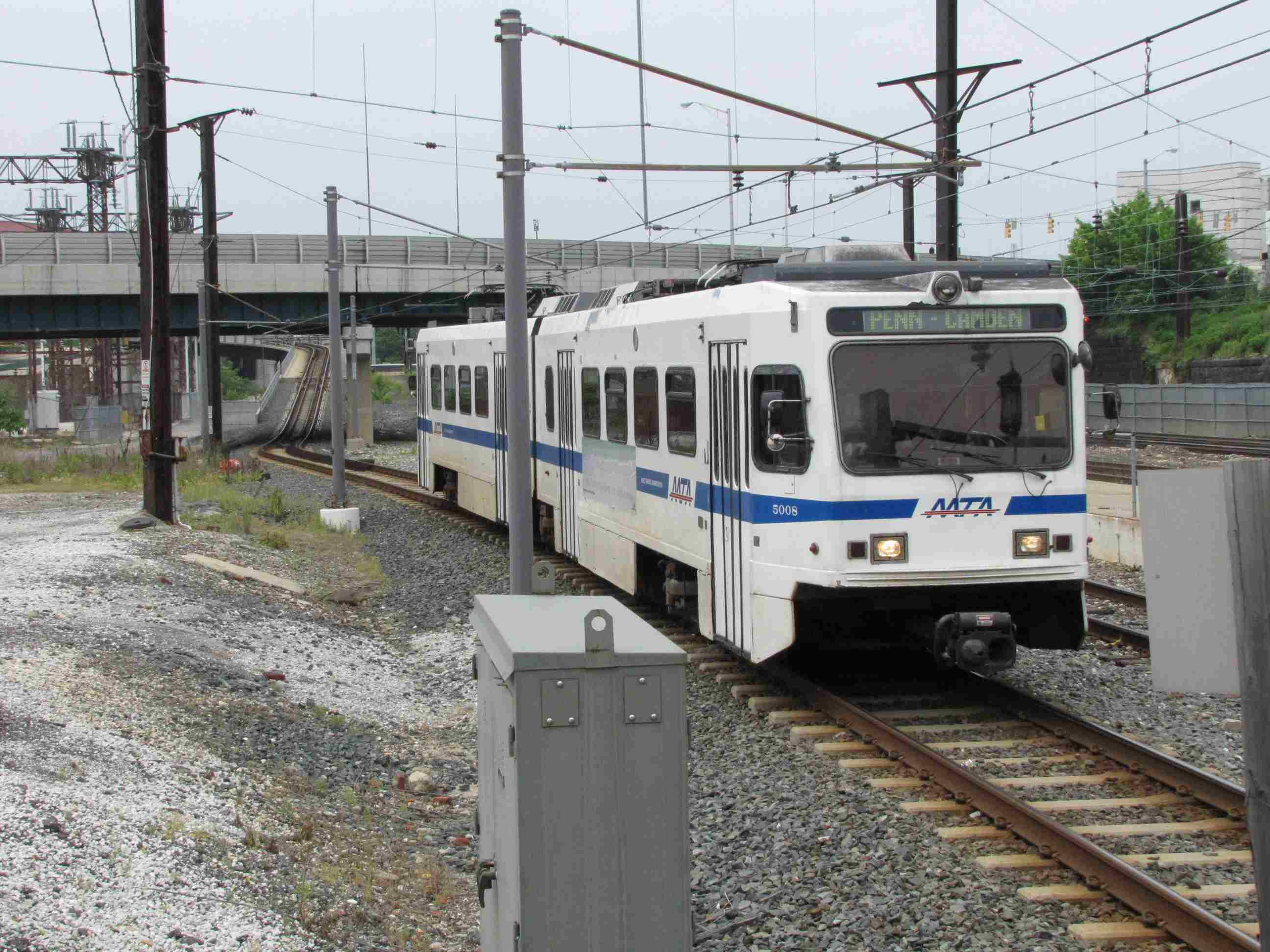 Train coming into the station.
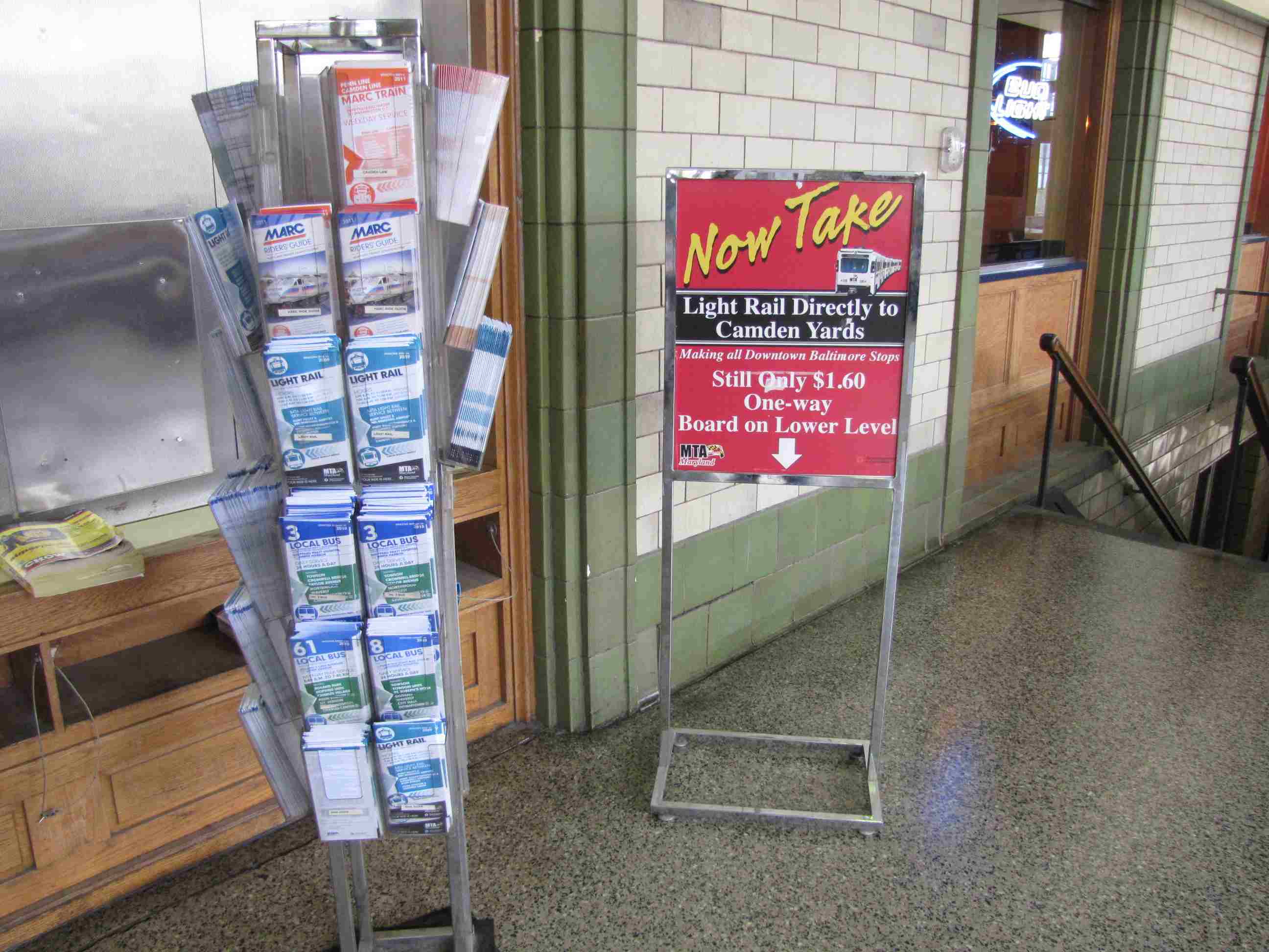
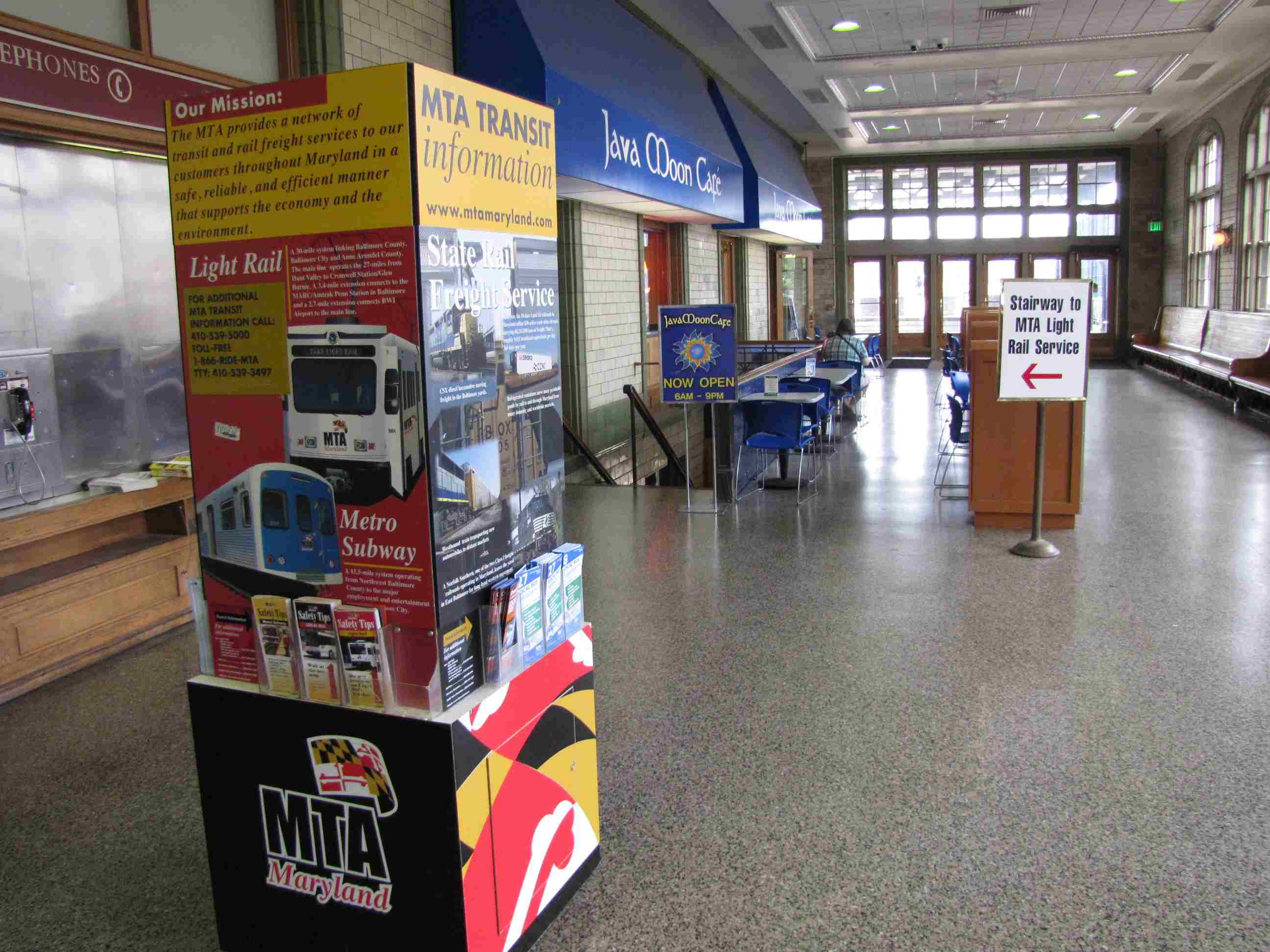 One of the better places around to get MTA schedules.
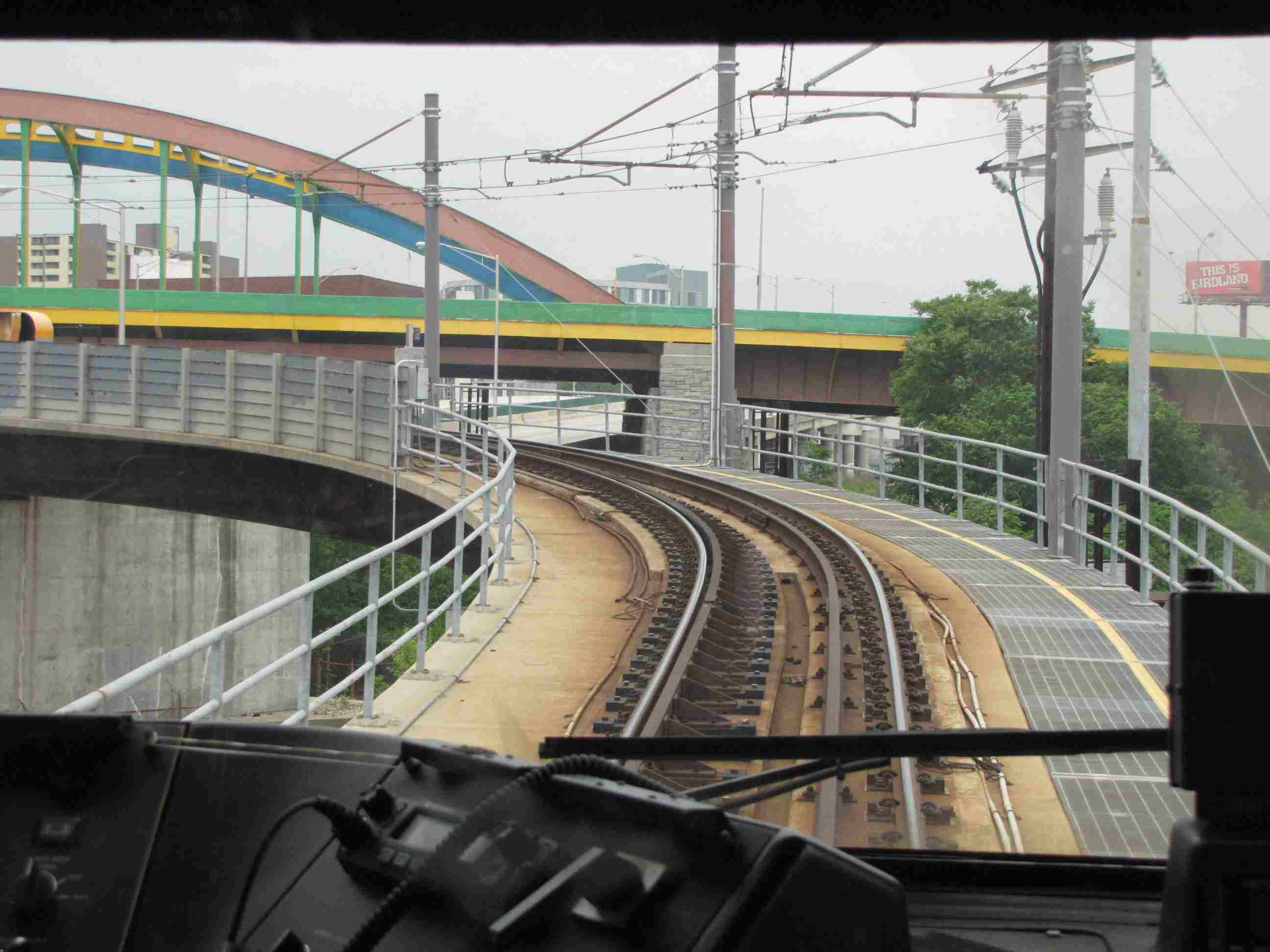
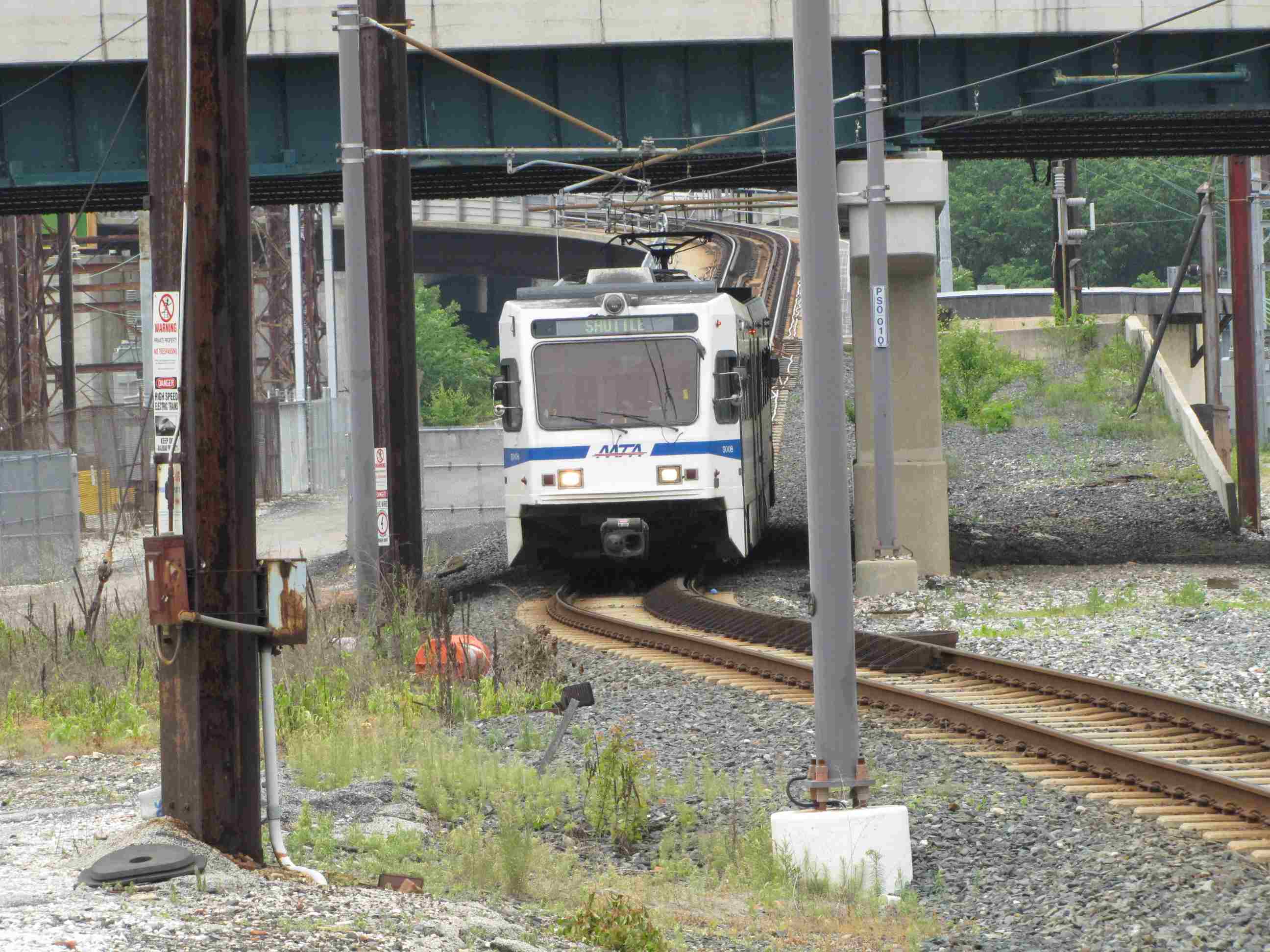
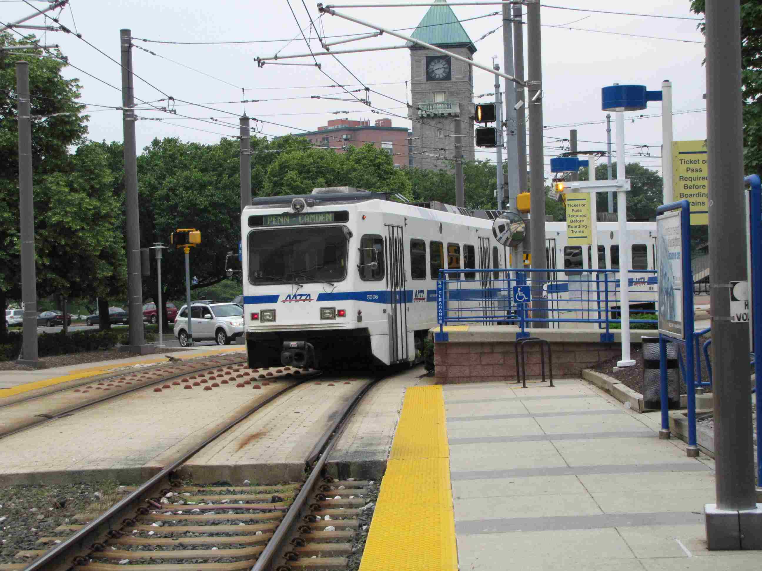
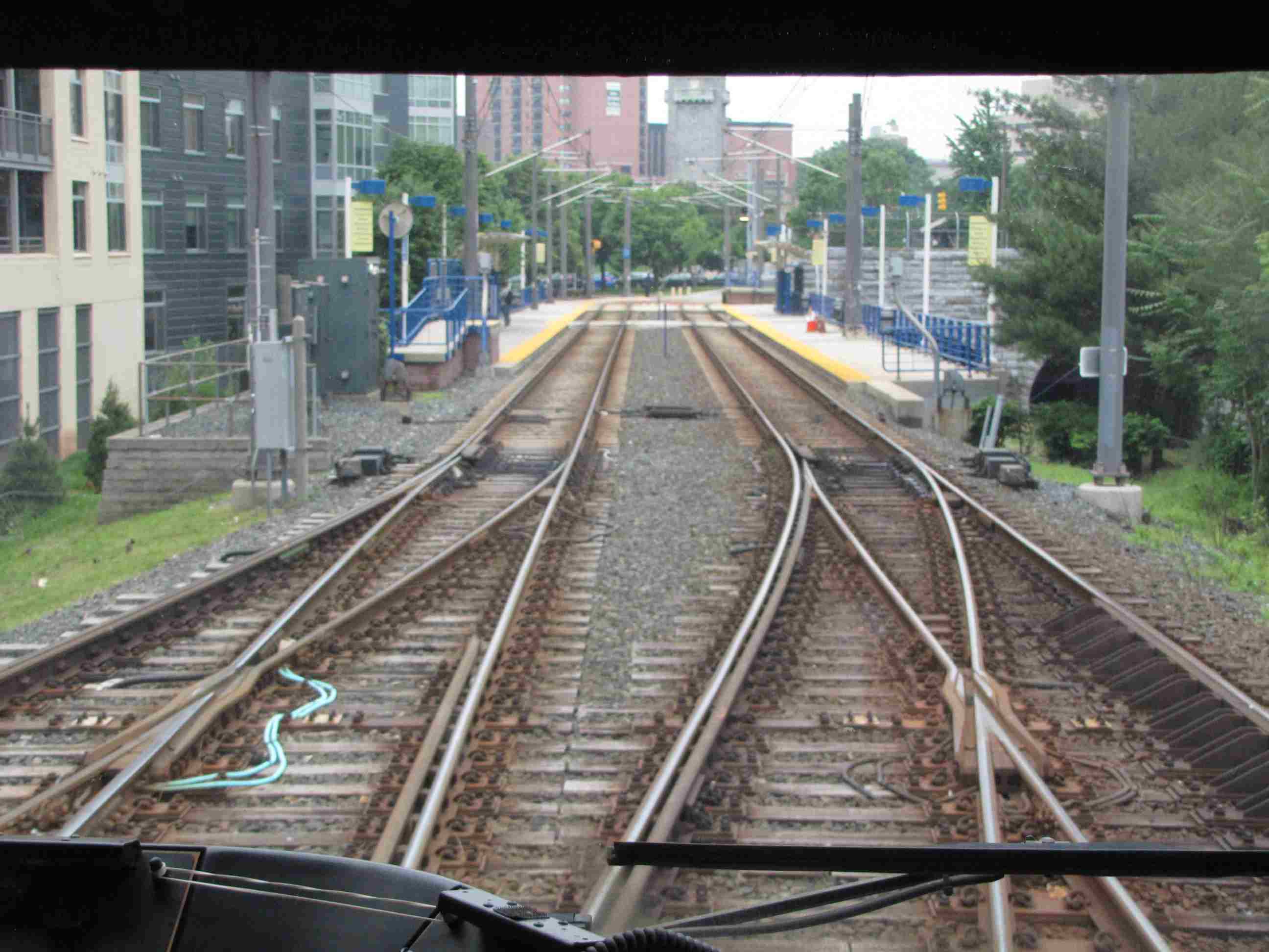
 We're leaving Penn Station and heading to Mt Royal.
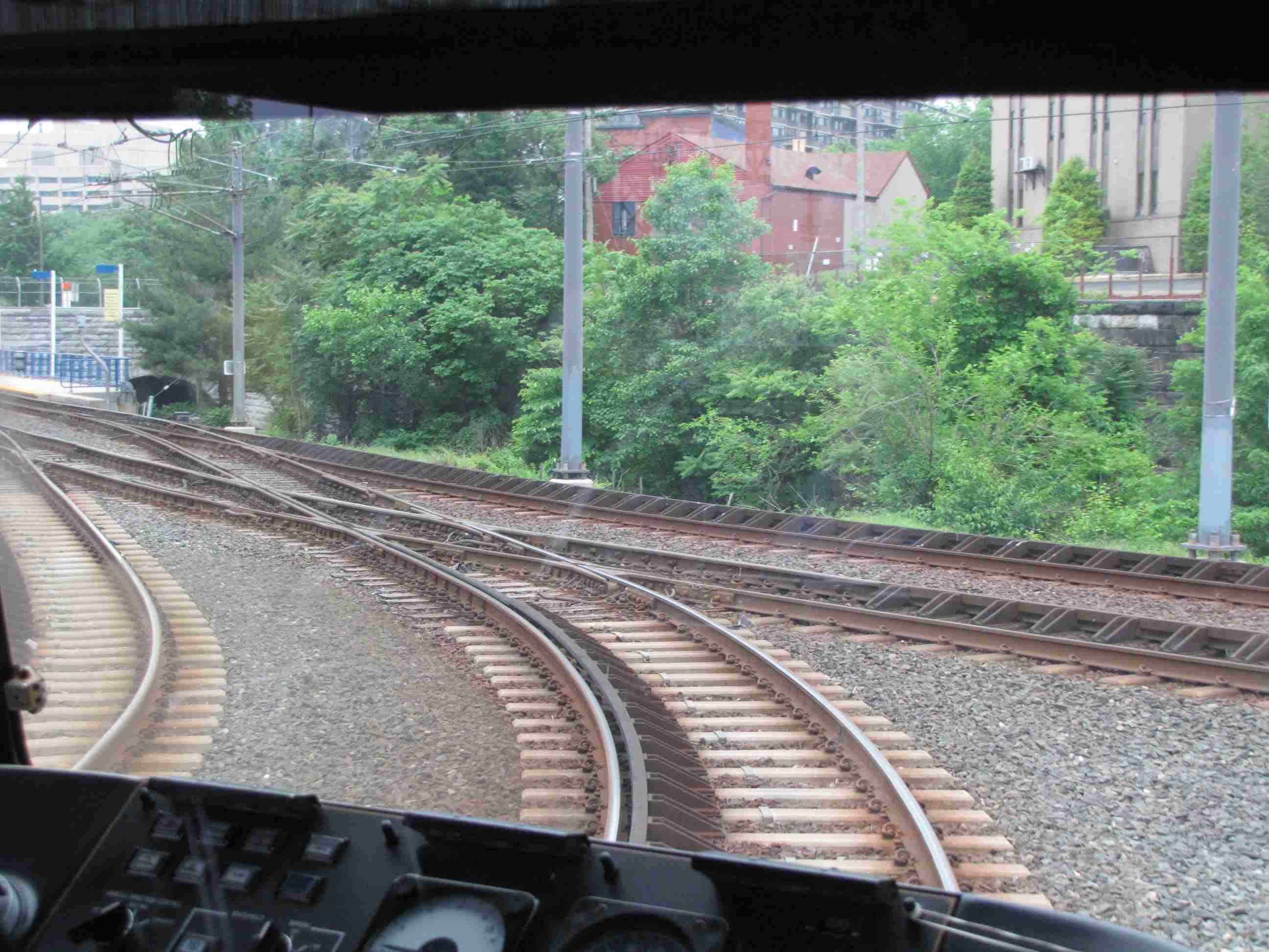
Notice the dwarf PL used as a route indicator.
We're leaving Penn Station and heading to Mt Royal.
Notice the dwarf PL used as a route indicator.
North Ave
North Avenue is one of two stations with a pocket track, because of it's location near the yard lead, and one of three places with a pocket track if you include the turn-around next to Lowes in Cockeysville (which is not used as a station). Trains coming in and out of the yard will often get put into the center track till they get into the queue for running that day, or when they get ready to go back into the yard (sometimes, not always).

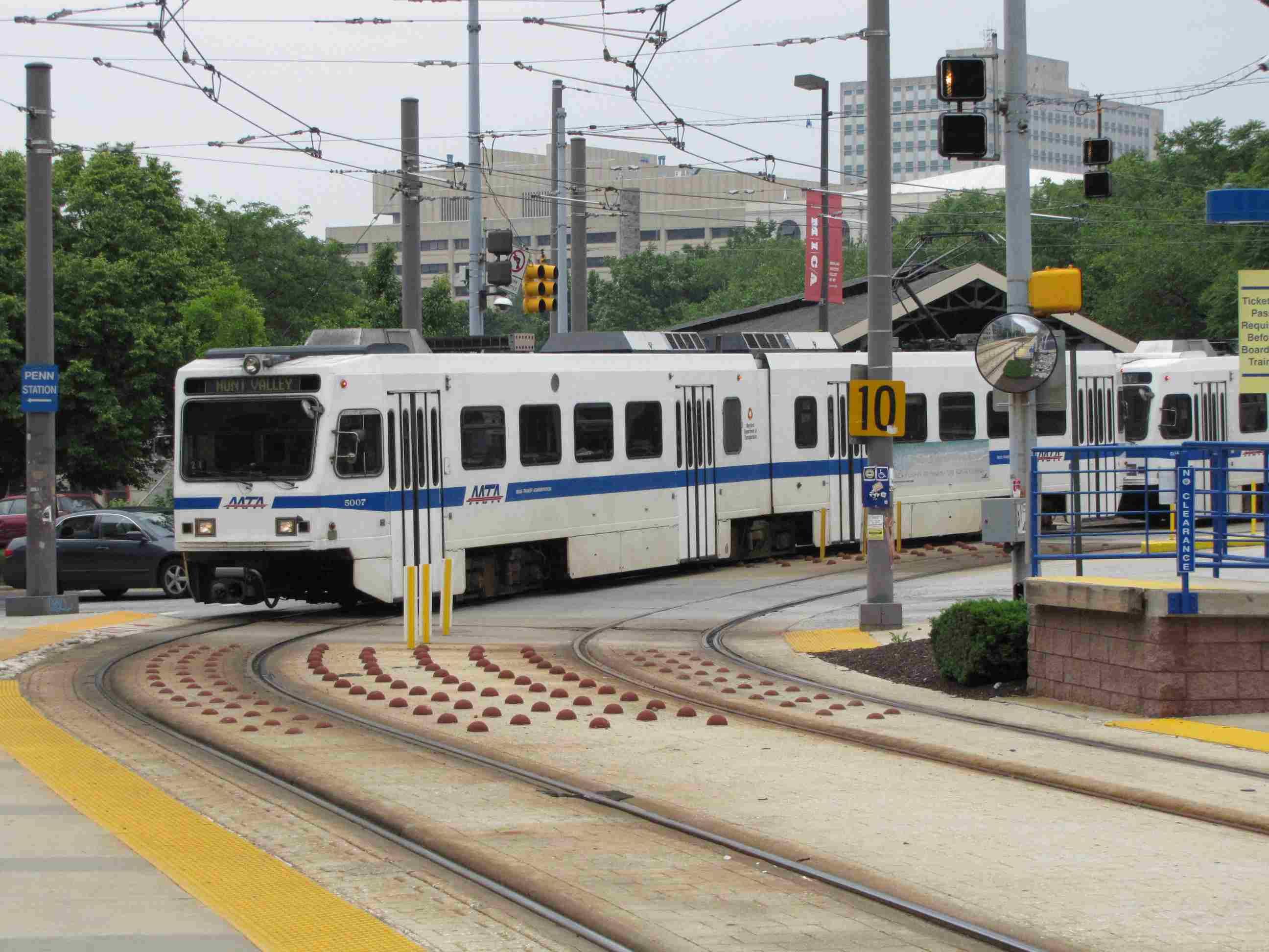
Mt Royal
Located at one of two division points for the system, going to either Penn Station, or heading north to Hunt Valley. The other division point in is Linthicum where the airport line branches off.

 NB (left) train entering and SB train leaving the
station.
NB (left) train entering and SB train leaving the
station.
 Entering Mt Royal from Penn Station.
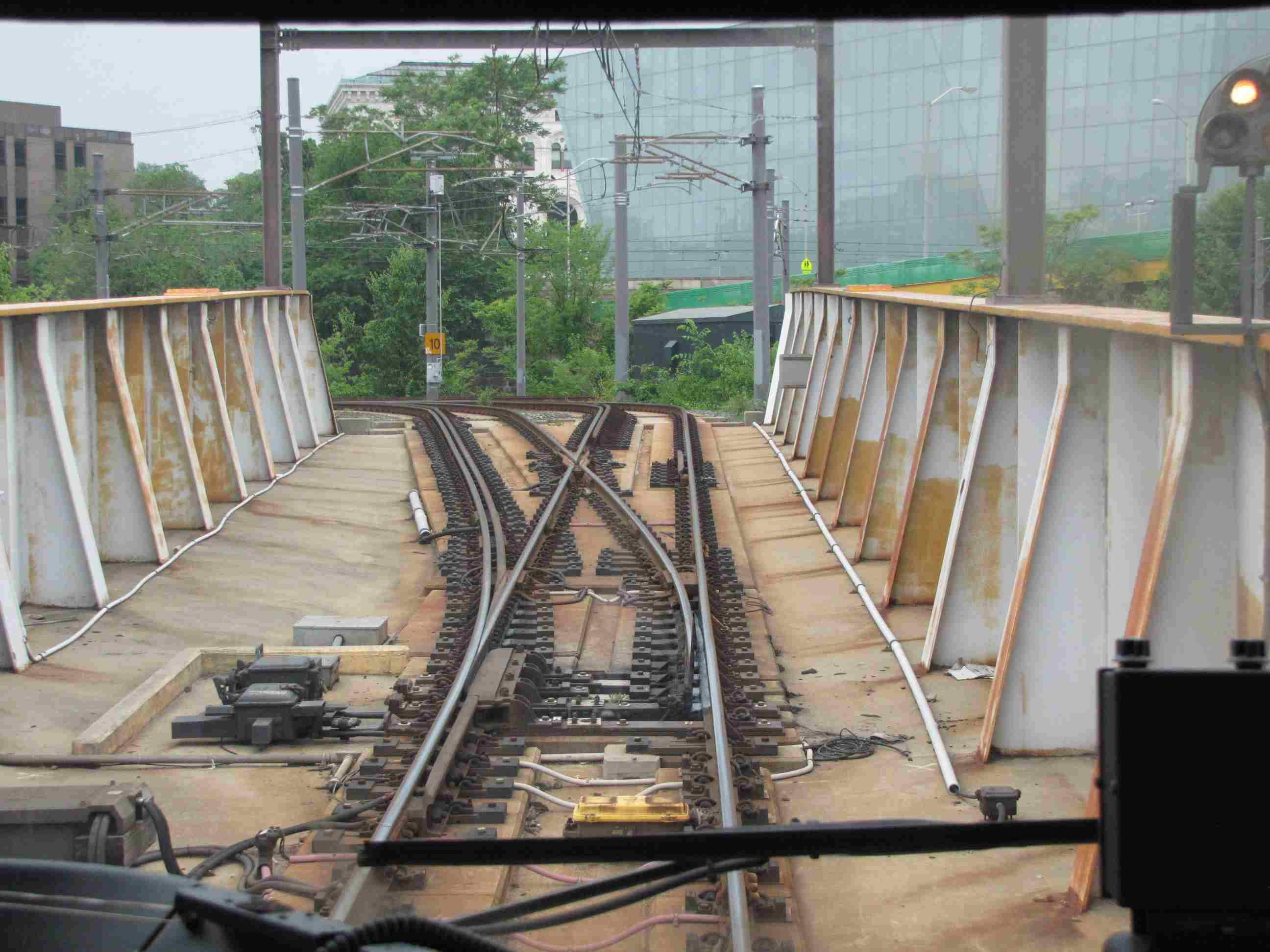
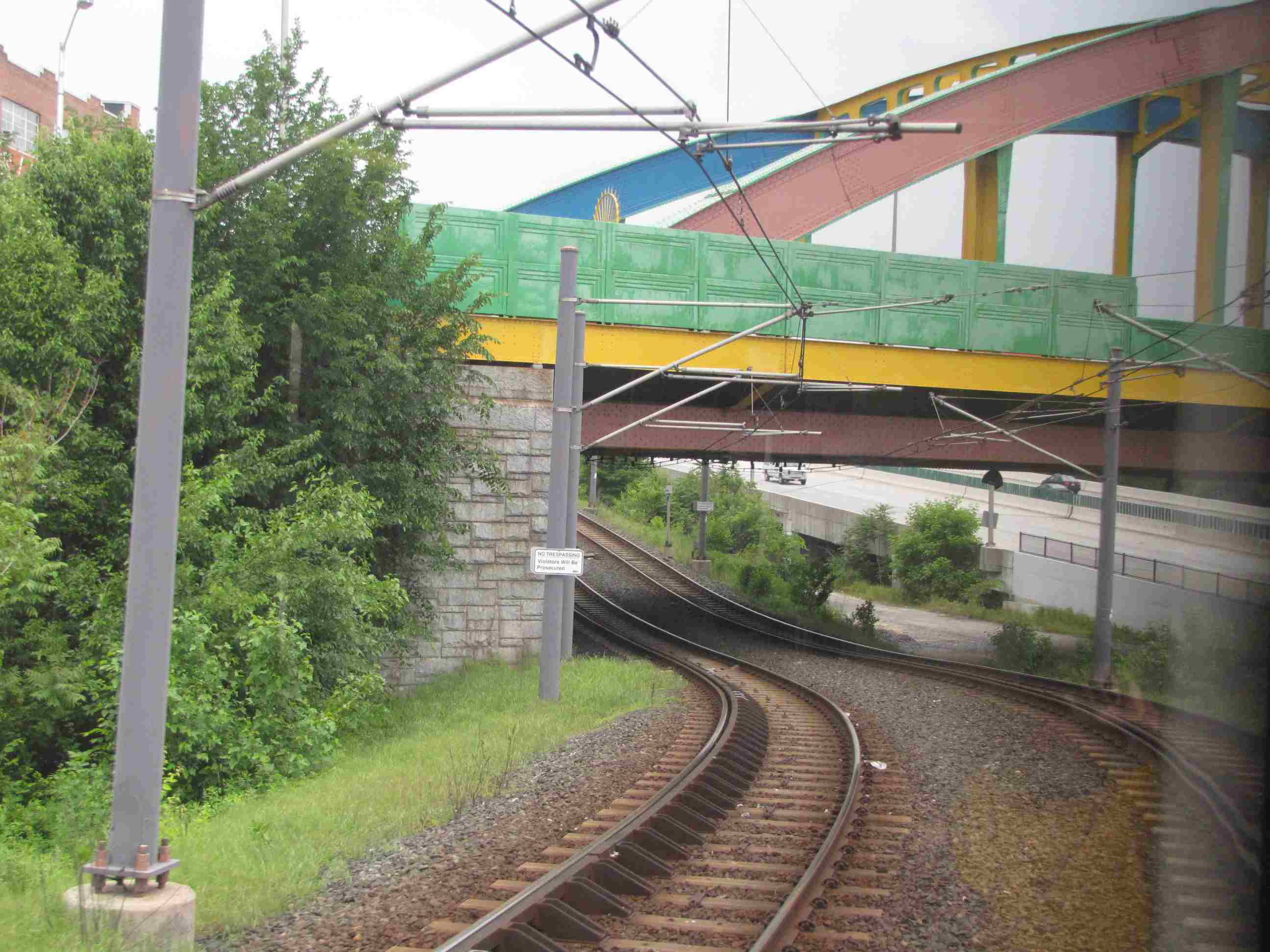 Getting ready to go under Howard St after leaving Mt Royal NB.
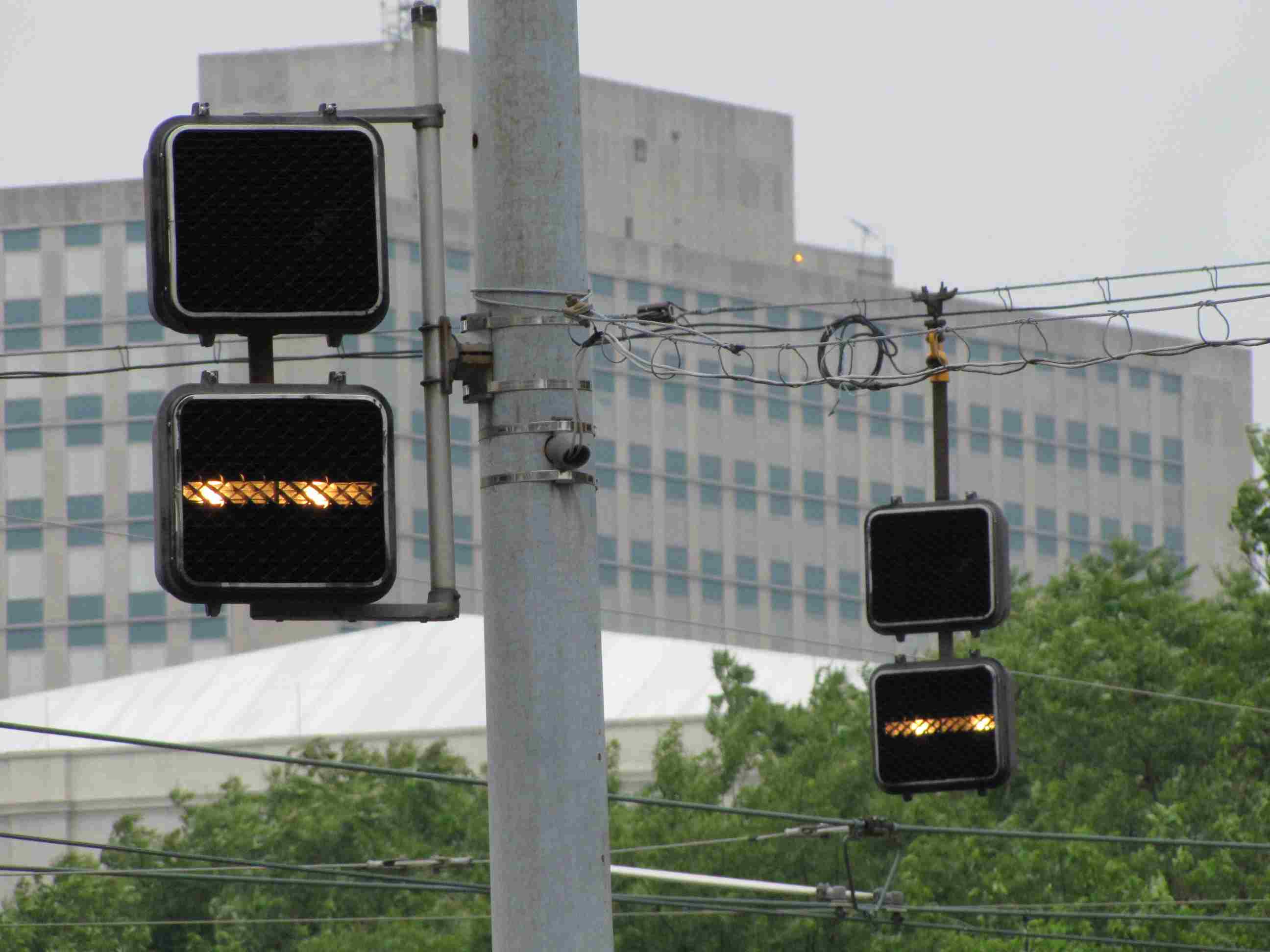 Bar signals for SB trains leaving Mt Royal.
Cultural Center

Into the Street
Between Centre St and the Cultural Center, the light rail tracks go from private right-of-way to street running.
![]()
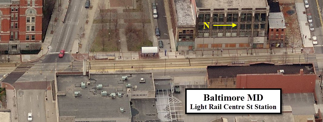
Centre St
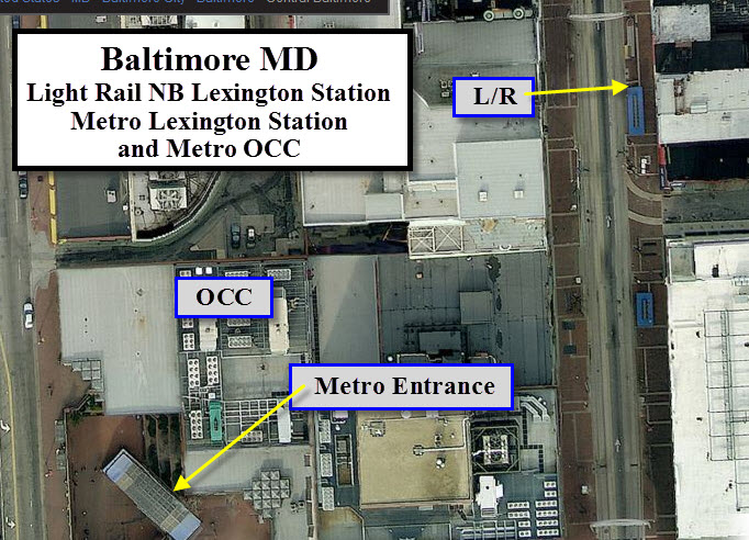
The stations along Howard Street are difficult to tell from one another (not that the ones on private right-of-way are much different), especially to out-of-towners because of all the buildings... there are not many differentiating landmarks to tell you where you are.
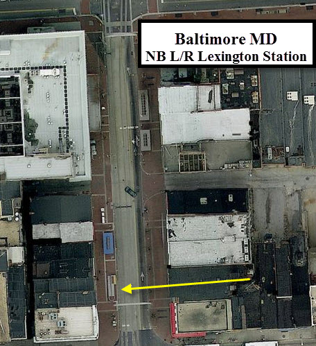
Lexington Mall
The Lexington Mall station is different from the rest because the northbound and southbound stations are in different blocks, with the NB station above Lexington St. Lexington St on either side of Howard St was turned into a shopping mall maybe 25 years ago, and is only open to delivery trucks.
The handicap islands are plain to see with the rounded end as pointed to, and give away the location of the stops.
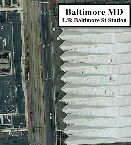
Baltimore St
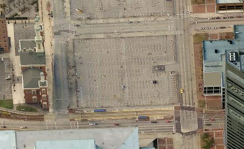
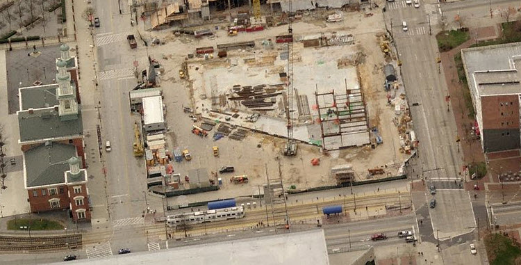
The above two thumbnails illustrate how Bing can have several generations of photos in their server, as they show the extension of the Convention center as an empty parking lot and under construction. Snagged 10APR2011.
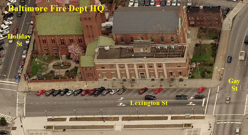
Fire and Police
1 the Baltimore City Fire Dept HQ
1 the Baltimore City Police HQ

Floobydust
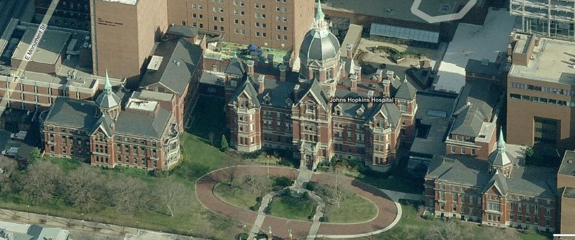
Johns Hopkins Hospital
The picture below shows the original part of Johns Hopkins Hospital. JHH is continuously rated in the top 3 hospitals of the U.S., if not number one.
Charles St
In 1904, Baltimore had its own "Great Fire". It burned xx blocks in the downtown area. When they started rebuilding the city, they decided to make the streets wider in many places. The most evident place you can see this is on Charles St at Lexington St. When you're driving north on Charles St, you will readily notice this because the buildings feel like they "are closing in on you".

NEW 09/11/2007.....split
7/24/2011
Last Modified:
01/08/2012