![]()
In General
Getting Here
Map
Pictures
Signals
RAILROAD SIGNALS HOME
Location / Name:
Baltimore MD
What's Here:
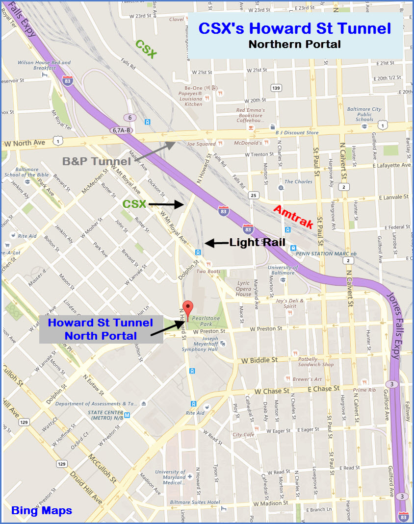
CSX's Howard Street Tunnel
Data:
GPS Coordinates: 39.304896, -76.620310 (north portal)
GPS Coordinates: 39.281051, -76.619279 (south portal)
Access by train/transit:
Camden Station -- Light Rail and MARC (south end)
Light Rail Mt Royal Station (north end)
Penn Station -- MARC and Amtrak (north end)(station is about 4-5 blocks away)
The Scoop:
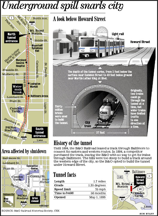
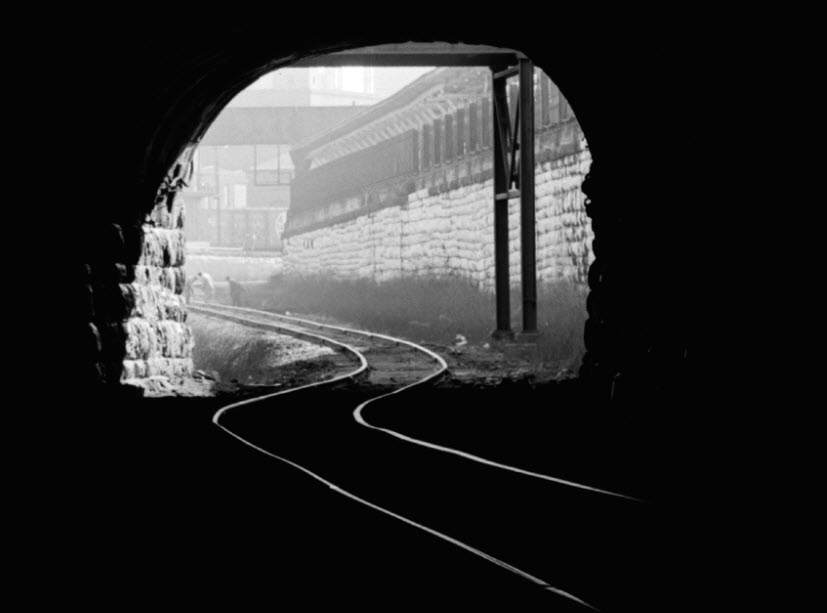
From Wikipedia: The Howard Street Tunnel, originally a 1.4-mile (2.3 km) long tunnel under Howard Street in downtown Baltimore, took four and a half years to build (1890–95) and was the longest tunnel on the B&O's system. The tunnel is brick-lined with iron-arched centerings. At the time of completion it was considered innovative for its use of electricity for illumination and powering of locomotives. Inside the tunnel, there was an underground platform for trains serving Camden Station. The tunnel is listed on the National Register of Historic Places.
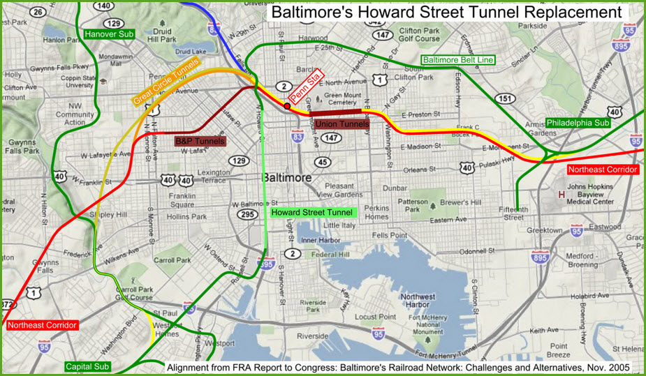
Connecting the new Philadelphia Branch to the rest of the B&O system was a considerable engineering challenge. A new surface line across the center of town was politically impossible and prohibitively expensive. Building around the outskirts of town would have required massive regrading and bridging, as the terrain is extremely hilly and the line would cut across every watershed flowing into the harbor. As a temporary expedient, traffic was handled through Baltimore on carfloats, but it was clear that a direct connection would have to be built.
The route the B&O chose started from the existing end of track at Camden station, at the west end of the Inner Harbor. A tunnel was constructed directly under Howard Street, heading north until just before it crossed the existing PRR line.
At the north portal of the tunnel, Mount Royal Station was constructed. The track then curved around to the east, passed through six other (much shorter) tunnels, continued across town, finally heading southeast to meet the already constructed line just north of the Canton neighborhood. The cost of construction drove the railroad into bankruptcy shortly after the line opened in 1895.
Initially there were plans to build three new stations, but concern for interference with freight haulage and expense reduced this to a single station at Mount Royal, which opened on September 1, 1896. Lower-level platforms were added at the east end of B&O's Camden Station in 1897.
Because of smoke in the tunnel, the line was electrified. The first train pulled by an electric locomotive operated through the Howard Street Tunnel on June 27, 1895. Electrification last until 1952, when diesels made things a whole lot cheaper. It was the first mainline electrification in the United States.
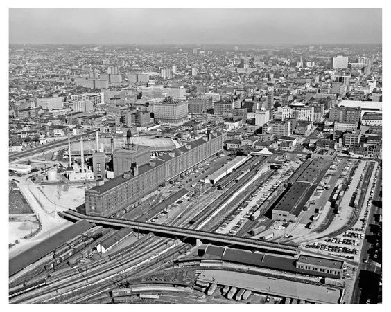
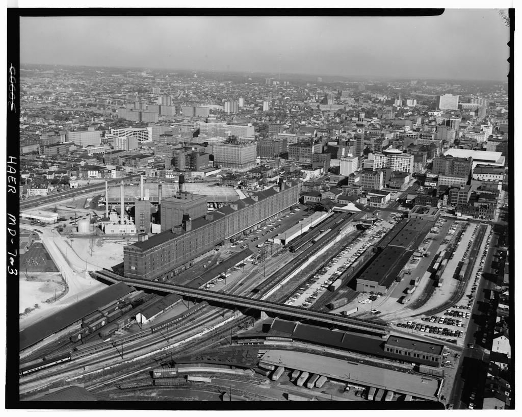
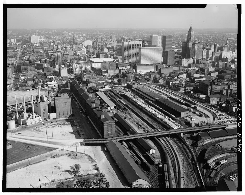
When I first started driving in 1969, I remember coming down to Camden Station, when it was still in service as a train station, and you could park anywhere in a huge parking lot that covered the area now taken up by I-395 and the convention center across the street. There was a covered walkway crossing the tracks which would take you from the parking lot to the station. You can see this in the pictures below.
Back in the early 80's, the tunnel was extended at the southern end to make room for the I-395 leg coming into downtown, and most of the adjoining yards were already gone. I-395 opened in 1981.
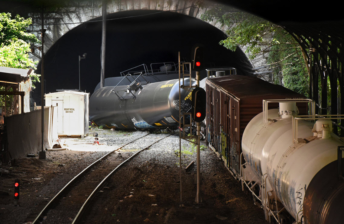
One of the worst accidents to happen in the tunnel was in 2001, where cars derailed and caught fire in the tunnel and had the city pretty much strangled and shut-down for 5 days.
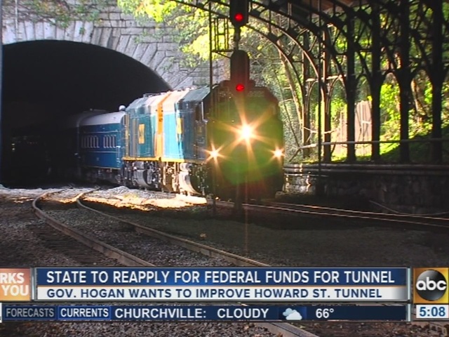
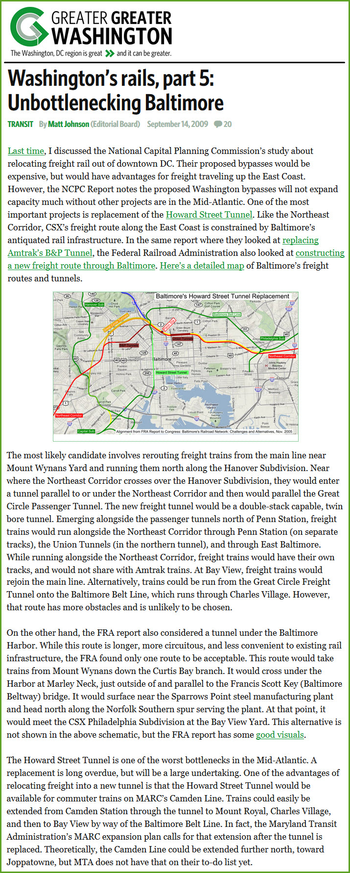
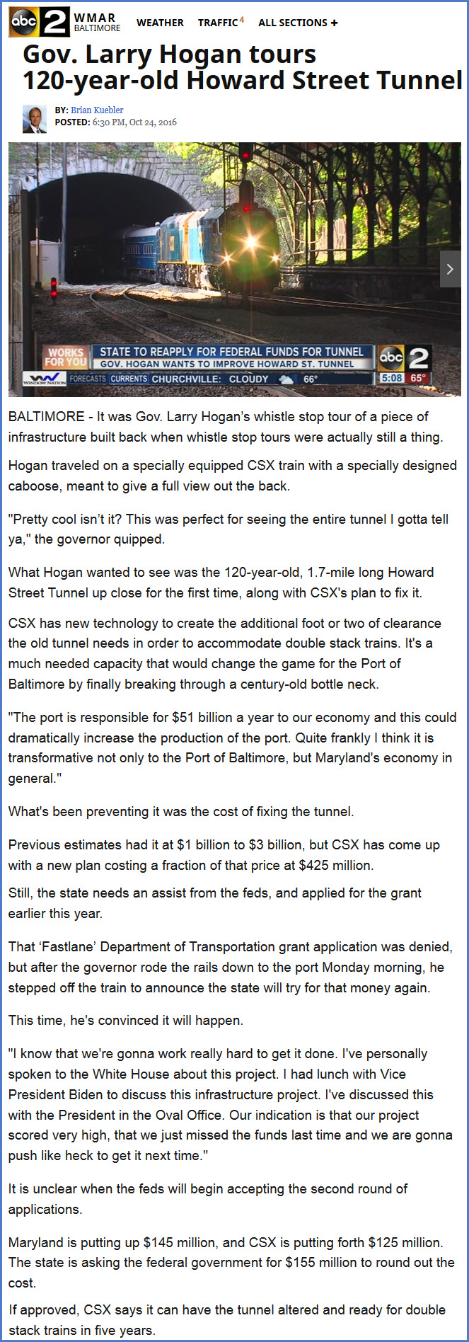
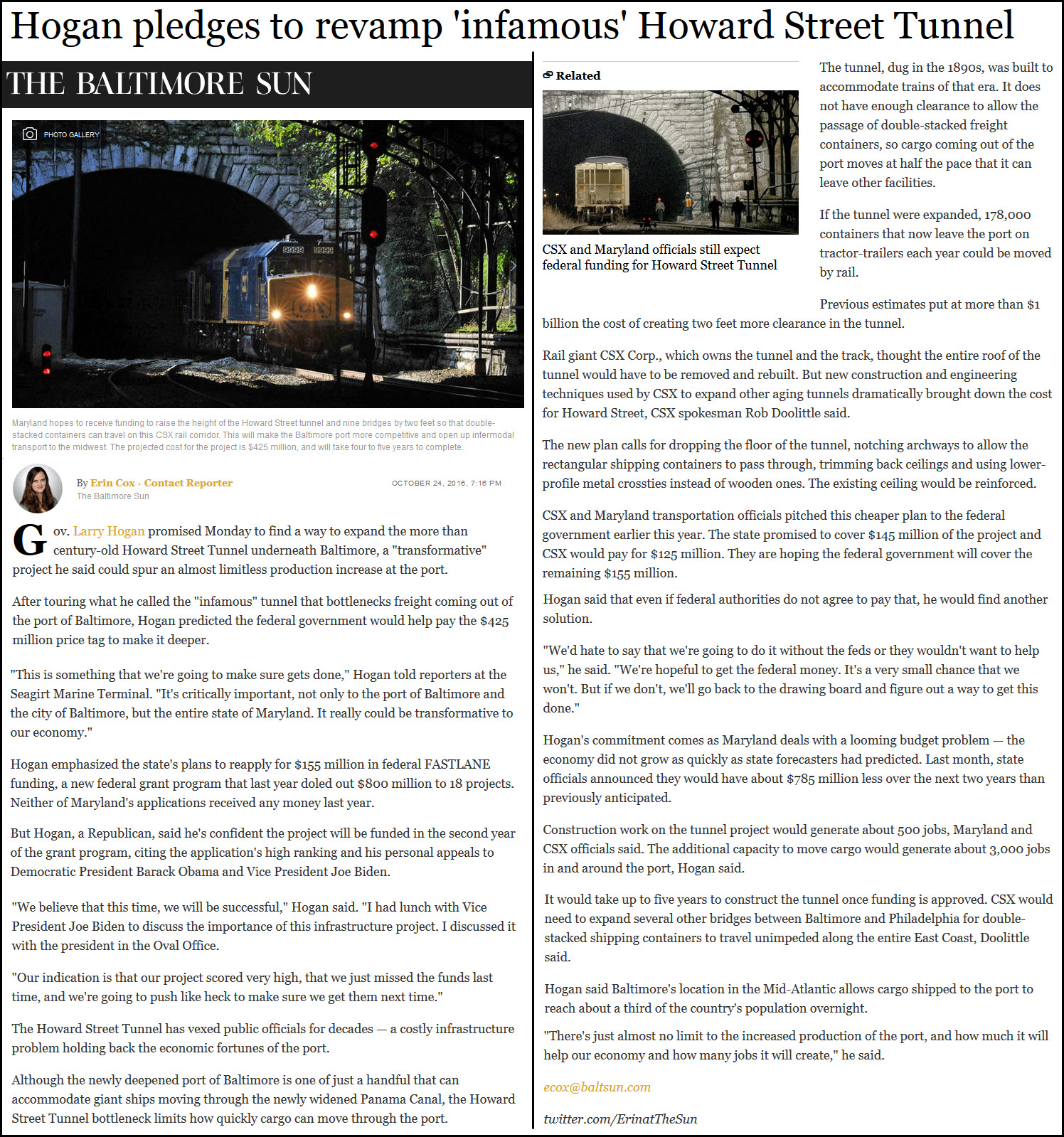
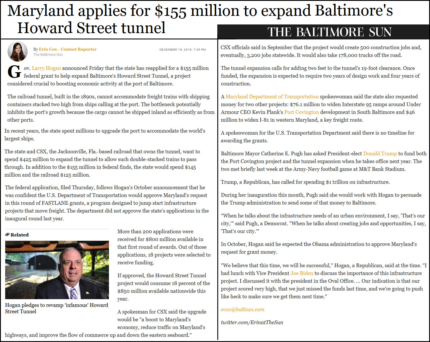
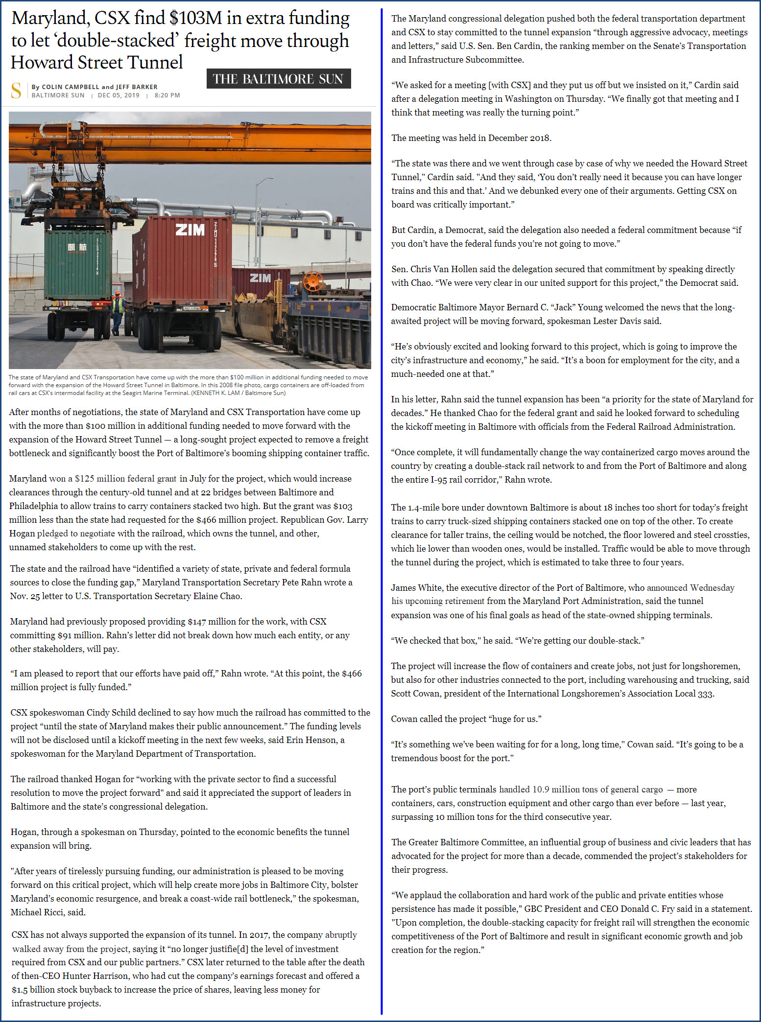
Over the past 10 years or so, there has been talk of either replacing or "fixing" the tunnel so that double-stack trains can cross Baltimore. As things stand now, the ports are on the eastside of Baltimore, and the way west is by way of going thru Baltimore, on either the CSX or the Northeast Corridor, both of which have to go thru a tunnel built at the turn of the 1900's before large loads were being carried by the railroads. Current thinking is to lower the floor in the tunnel to gain the needed two feet of clearance.
As of December 2019, it was announced that CSX and Maryland have secured a 100+ million shortfall for the estimated $466M project, so plans are underway to raise the ceiling by 18 inches (just in the area of the ceiling where the double stack trains will be), and lower the floor and use metal ties to help lower it a few more inches. See the article below.
Acknowledgements:
Library of Congress
Websites and other additional information sources of interest for the tunnel:
http://trn.trains.com/railroads/railroad-history/2009/09/the-stages-of-us-railroad-electrification
https://en.wikipedia.org/wiki/Baltimore_Belt_Line
https://en.wikipedia.org/wiki/Howard_Street_Tunnel_fire
http://www.baltimoresun.com/news/maryland/bs-md-hogan-howard-street-tunnel-20161024-story.html
http://www.baltimoresun.com/news/maryland/politics/bs-md-howard-street-tunnel-20161216-story.html
http://www.bizjournals.com/baltimore/news/2016/12/16/maryland-reapplies-for-federal-grants-for-howard.html
http://www.loc.gov/pictures/search/?q=Photograph:%20md0909&fi=number&op=PHRASE&va=exact&co%20=hh&st=gallery&sg%20=%20true
http://ethw.org/w/images/b/bc/Howard_Street_Tunnel.pdf very thorough history of the tunnel with details of the electrical systems
https://ggwash.org/view/2844/washingtons-rails-part-5-unbottlenecking-baltimore
The southern end is the easiest to get to via I-395 off of I-95 going thru Baltimore. When coming in on 395, stay to the left, and when you approach the first traffic light, stay to the right to take a right onto Conway St, but in the left of the two turn lanes. Get over to the left, and make a left turn at the second light, which is Charles St. Go two blocks and take a left onto Lombard St. Go another two blocks and take a left onto Howard St, where the light rail tracks are. Stay to your right, and take a right into the Camden Station parking lot, crossing the tracks Weekday parking will be really difficult.
For the north portal, stay on Charles St. and head north. Go to Mt Royal Ave, 1.5mi, and take a left. You will see Mt Royal Station on your left in a few blocks. The tunnel is behind the station.
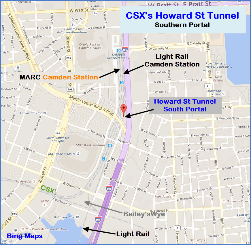
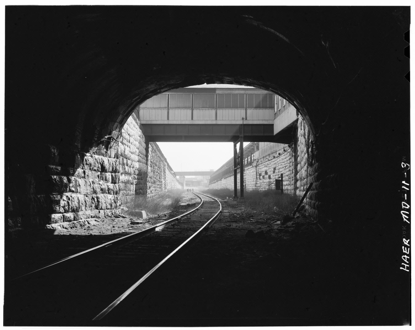
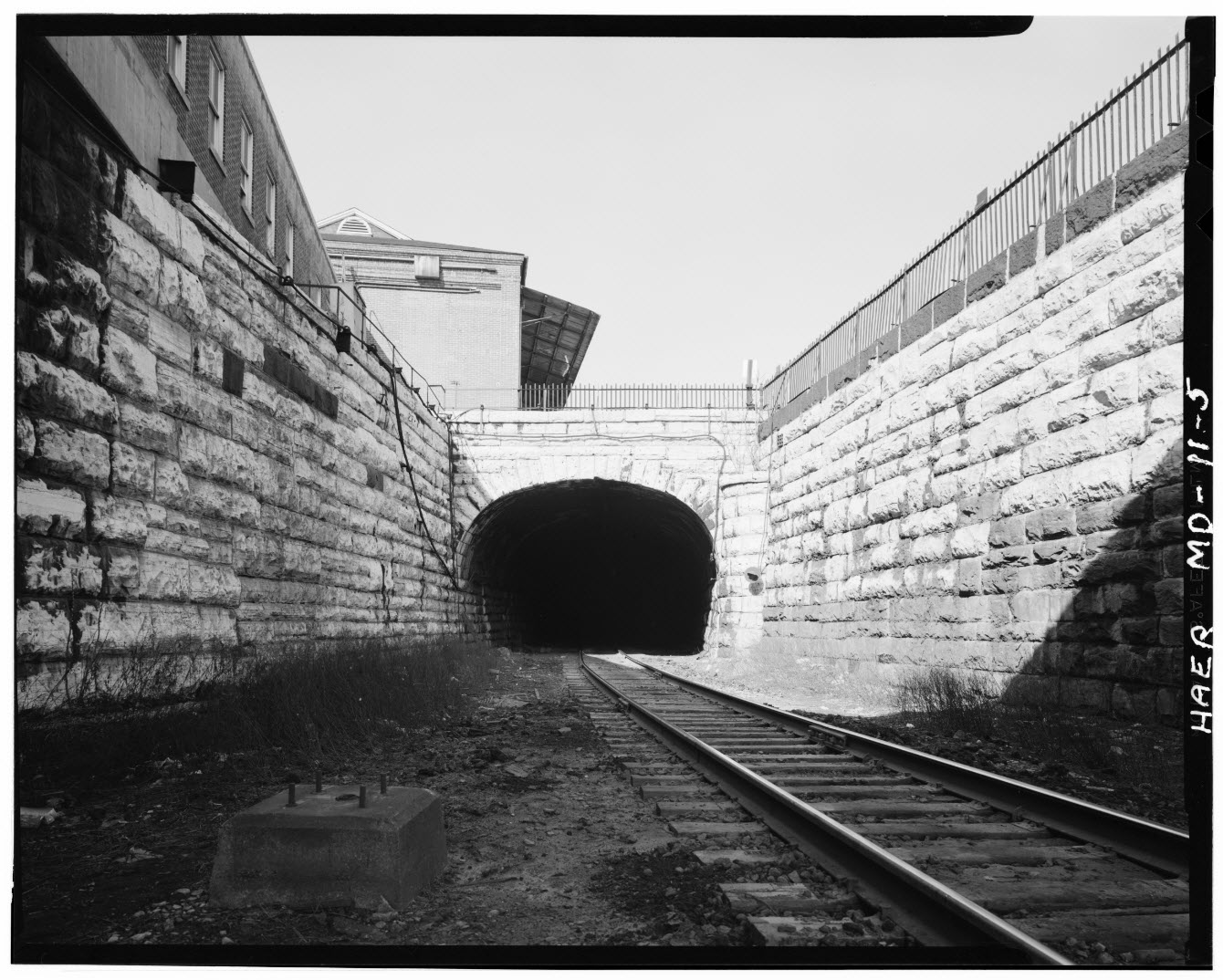
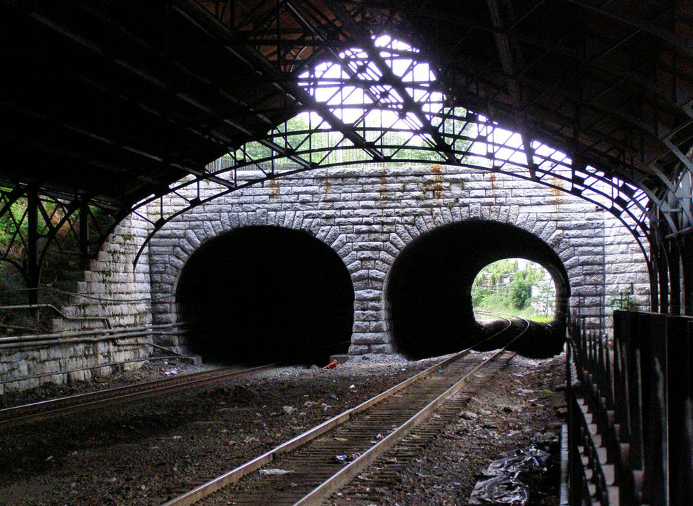
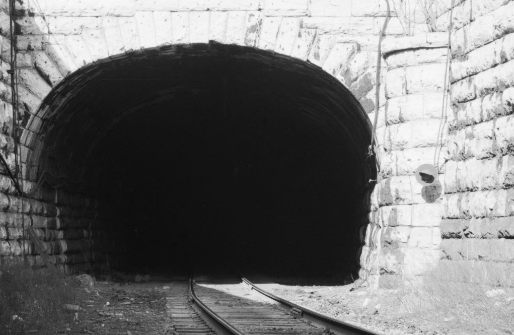
At the South End
The southern portal around the 1970 timeframe, before I-395 was built.
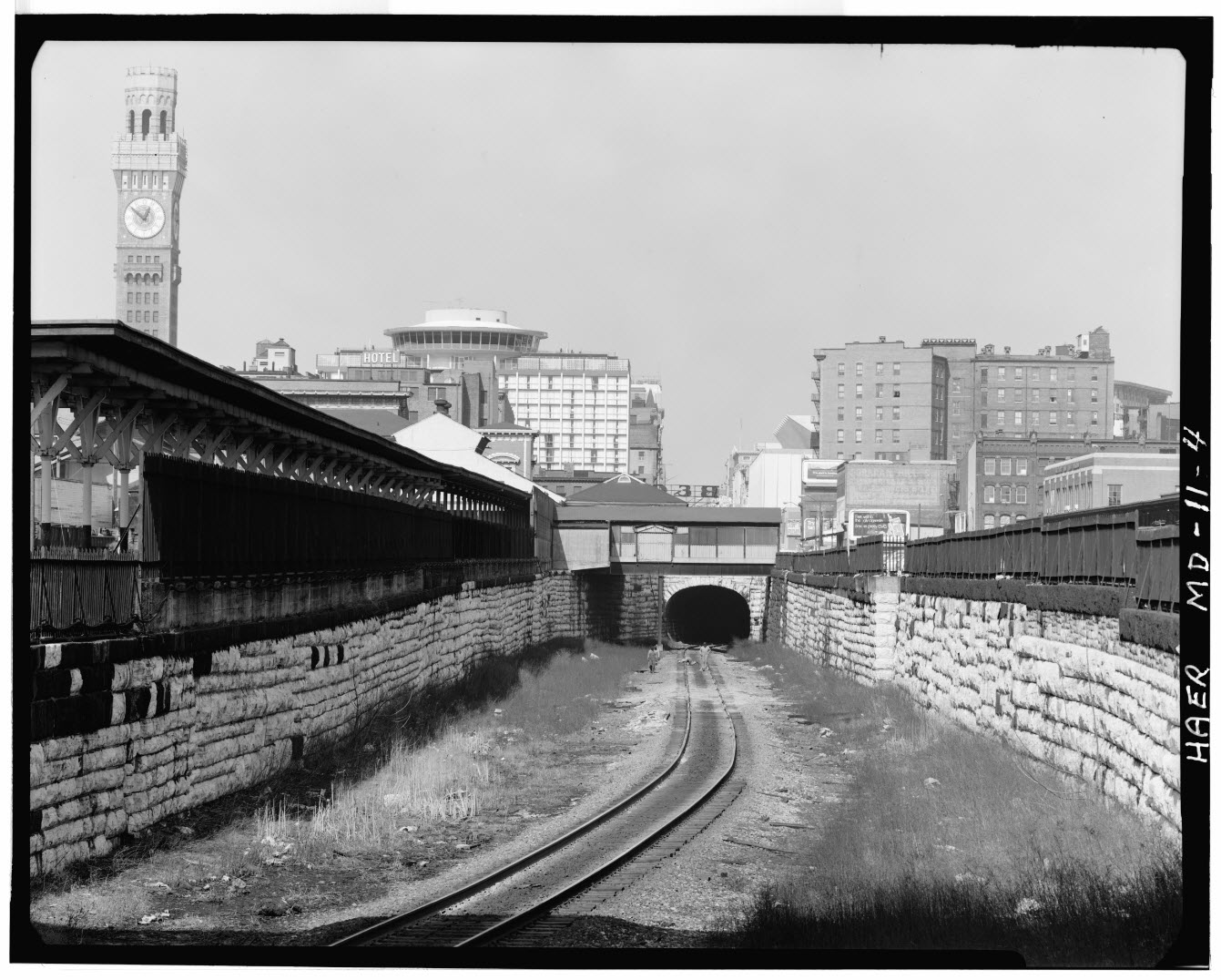
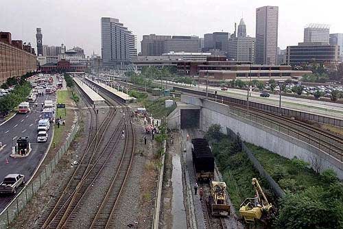 The southern portal after I-395 and Camden Yards was built.
A few views from 1968 or so.......
At the North End
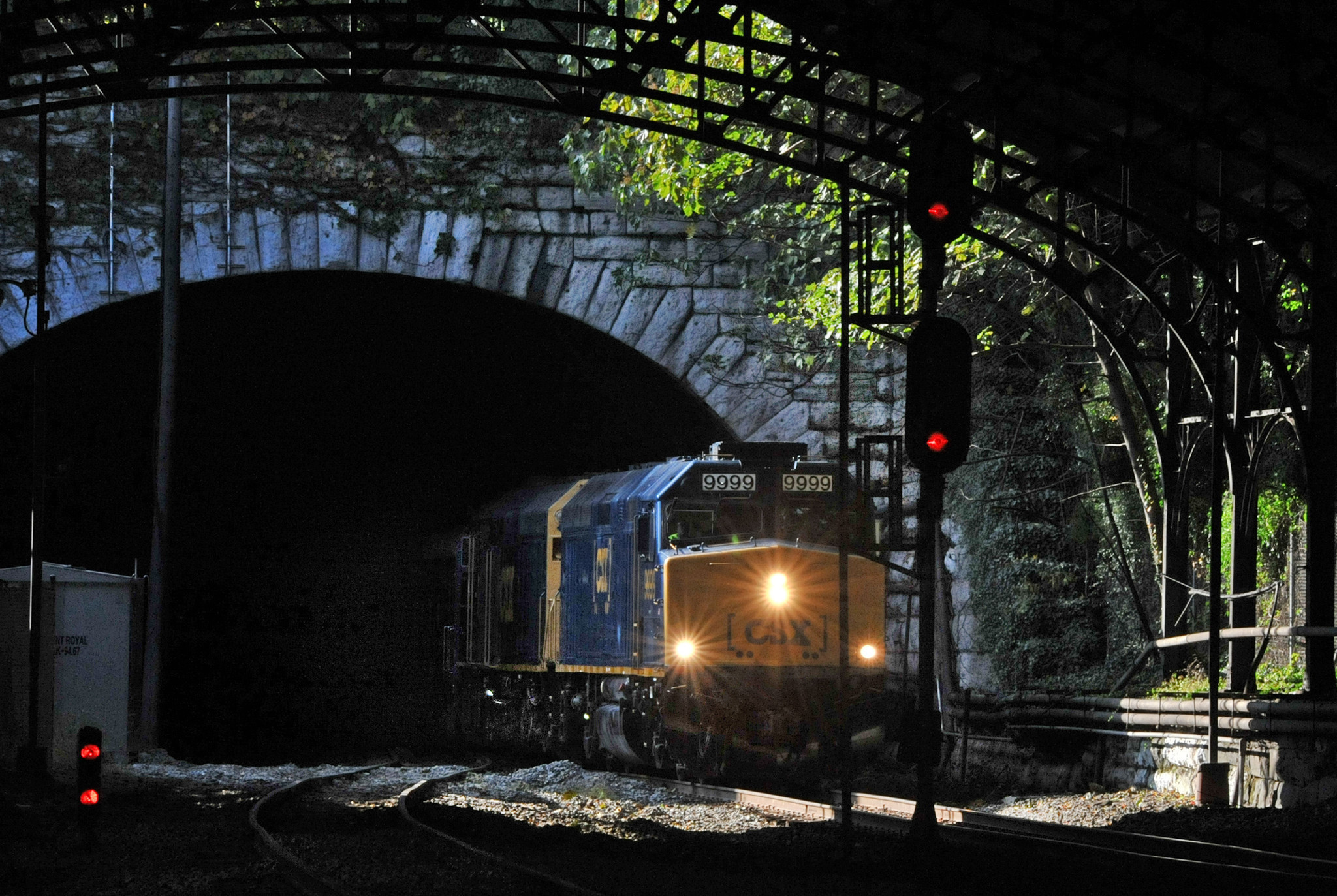
The northern portal, after the B&O style CPL signals were replaced, looks like the bottom head has 4 aspects in it.
The northern portal before the B&O signals were replaced.
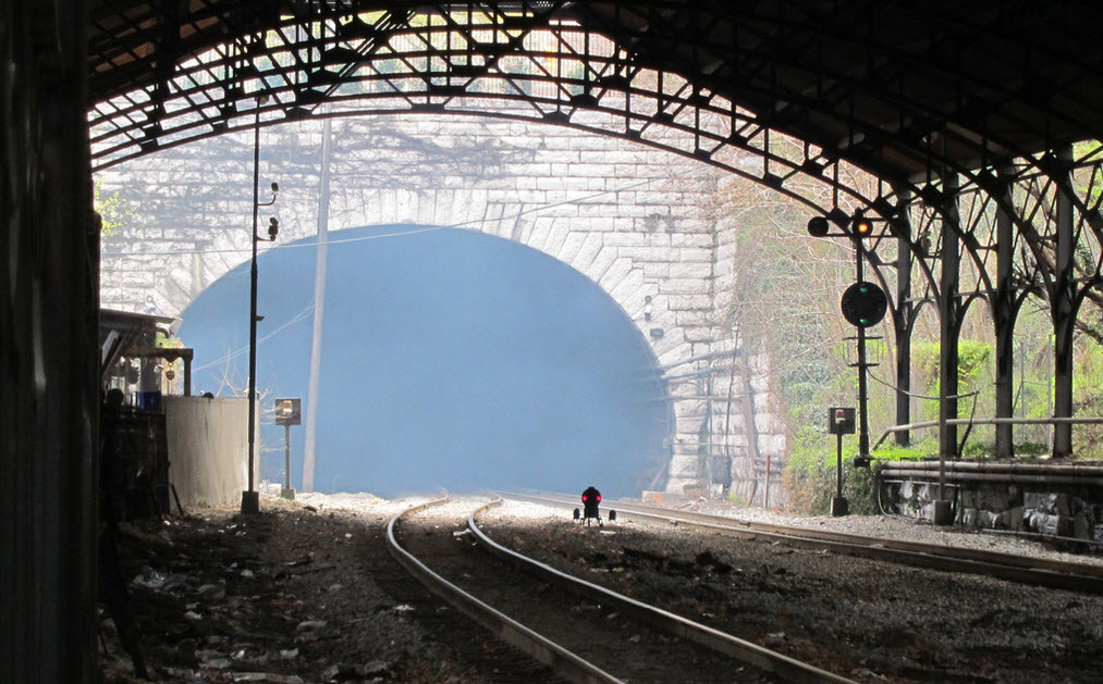
 Looking north, going under Mt Royal Ave
Since this CSX trackage is formerly a B&O line, CPL's ruled. Between 2008 and 2016, CSX has replaced almost every CPL signal in the Baltimore area.
 Before signal replacement.
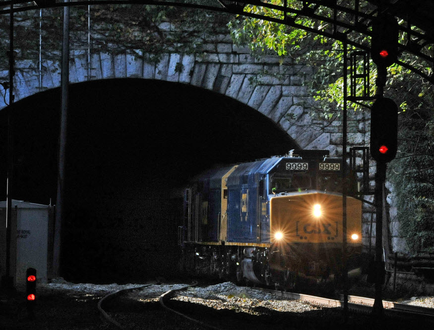 After signal replacement.
Not sure what the signal signified, but this was at the entrance to the southern portal.
Disclaimers:
I love trains, and I love signals. I am not an expert. I do these pages because I love spending my time doing them - although I do a reasonable amount of research to make sure the information presented is accurate! :-) :-)
Please Note: Since the main focus of my two websites is railroad signals, the railfan guides are oriented towards the signal fan being able to locate them. For those of you into the modeling aspect of our hobby, my indexa page has a list of almost everything railroad oriented I can think of to provide you with at least a few pictures to help you detail your pike.
If this is a railfan page, every effort has been made to make sure that the information contained on this map and in this railfan guide is correct. Once in a while, an error may creep in, oooooooops, oh well! :-)
My philosophy: Pictures and maps are worth a thousand words, especially for railfanning. Text descriptions only get you so far, especially if you get lost or disoriented. Take along good maps.... a GPS is OK to get somewhere, but maps are still better if you get lost! I belong to AAA, which allows you to get local maps for free when you visit the local branches. ADC puts out a nice series of county maps for the Washington DC area, but their state maps do not have the railroads on them. If you can find em, I like the National Geographic map book of the U.S..... good, clear, and concise graphics, and they do a really good job of showing you where tourist type attractions are, although they too lack the railroads. Other notes about specific areas will show up on that page if known.
BTW, floobydust is a term I picked up 30-40 years ago from a National Semiconductor data book, and means miscellaneous and/or other stuff.
Aerial shots were taken from either Google or Bing Maps as noted. Screen captures are made with Snagit, a Techsmith product... a great tool if you have never used it!
Pictures and additional information is always needed if anyone feels inclined to take 'em, send 'em, and share 'em, or if you have something to add or correct.... credit is always given! BE NICE!!! Contact info is here
Beware: If used as a source, ANYTHING from Wikipedia must be treated as being possibly being inaccurate, wrong, or not true.
RAILFAN GUIDES HOME
RAILROAD SIGNALS HOME
NEW FEB04/2017, FEB06/2017
Last Modified
06-Dec-2019