In General
Getting Here
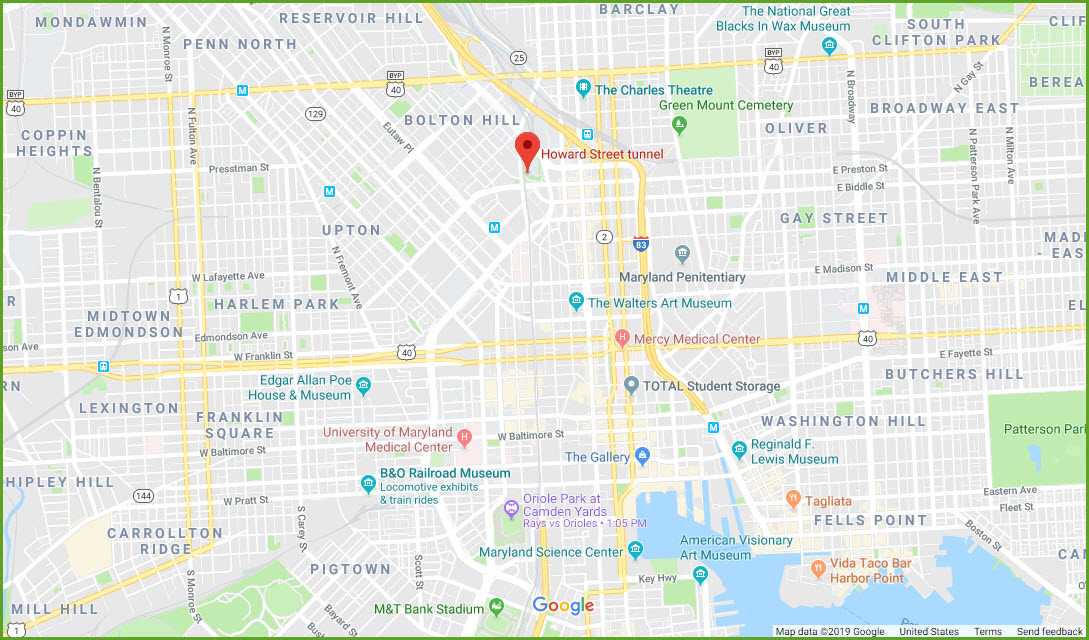
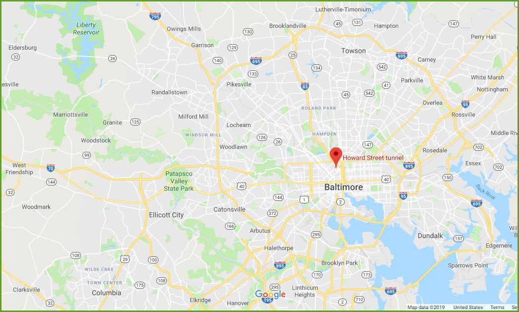
Map
Pictures
Bridges
RAILROAD SIGNALS HOME
Location / Name:
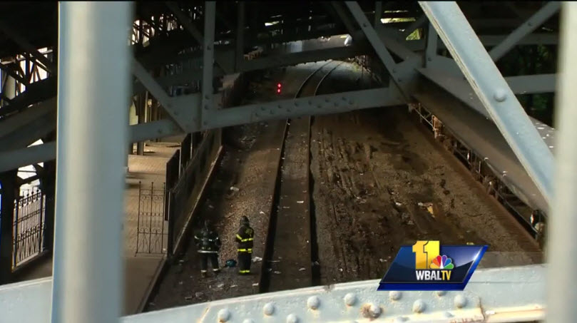
CSX Howard Street Tunnel -- Baltimore City, MD
What's Here:
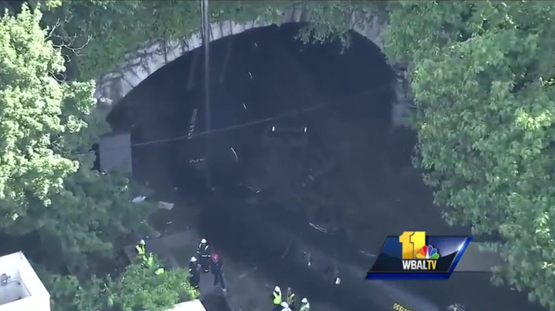
Derailment
Data:
GPS Coordinates: 39.304940, -76.620317
Phone A/C: 410 & 443
ZIP: 21202
Access by train/transit:
Light Rail Mt Royal Station
The Scoop:
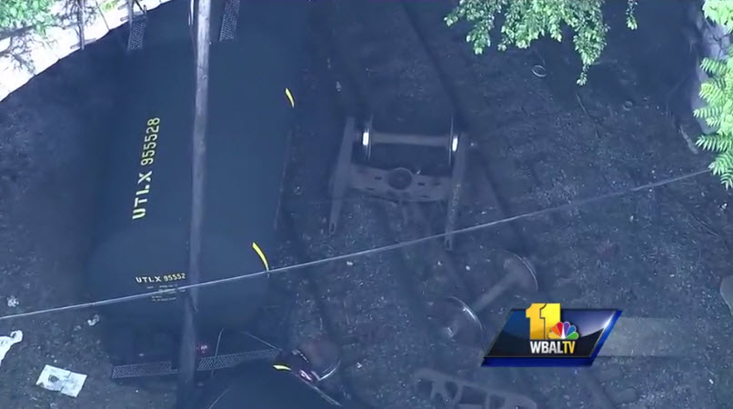
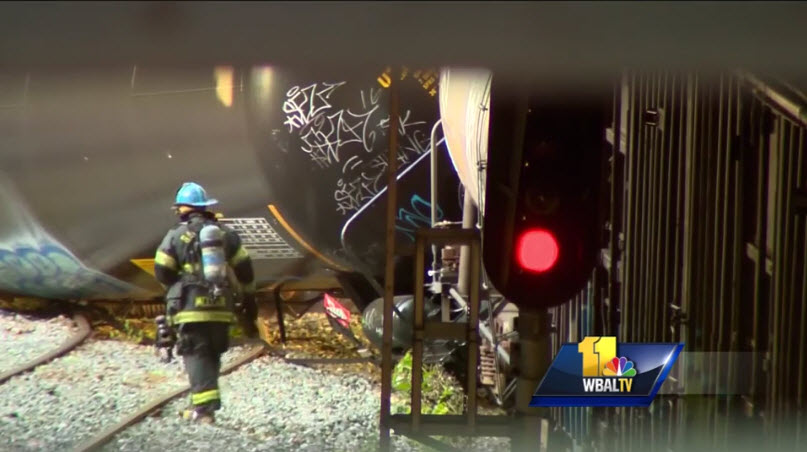
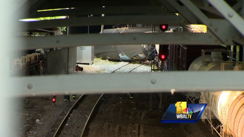
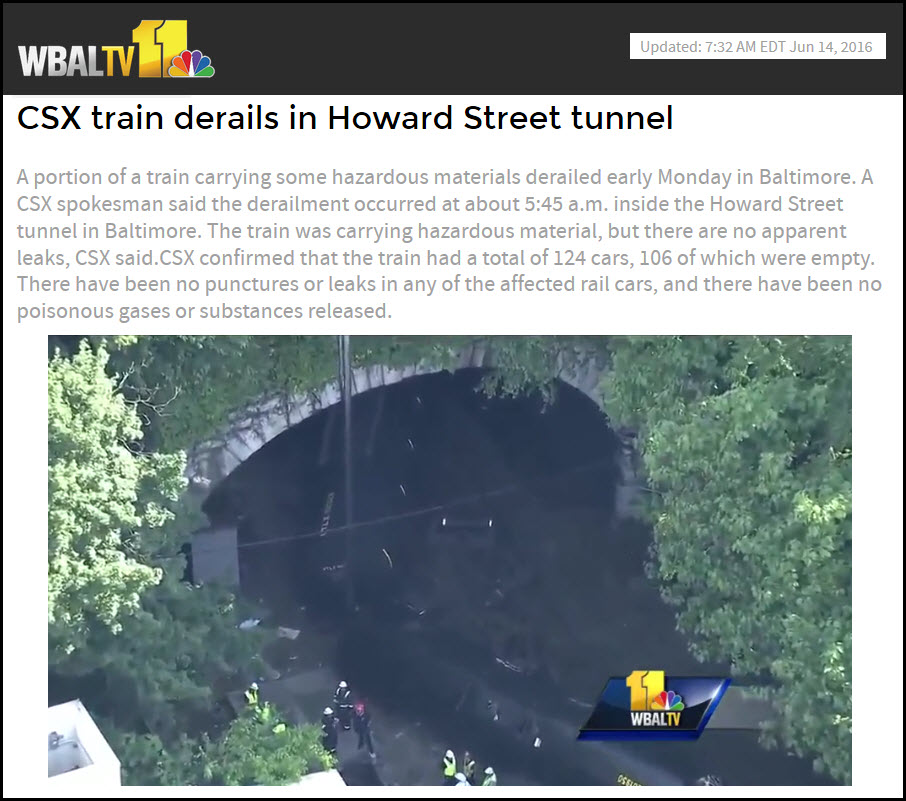
A 124 car southbound train was going thru the Howard Street tunnel and derailed at the northern portal around 5:45am. 13 cars overturned. A southbound train here is a westbound train on the railroad. Most of the cars were empty, but one of the overturned cars may have been carrying acetone - there were no leaks however. Speculation was that the derailment may have happened as far north of the tunnel as a mile, but since this was such a minor incident, there was never a follow-up story, at least not on local news. I have not searched for an FRA report.
The train originated in Philadelphia, and was heading to Cumberland, passing thru Baltimore and Washington DC.
Acknowledgements:
Channel 11 - WBAL TV
Websites and other additional information sources of interest for the area:
https://www.wbaltv.com/article/csx-train-derails-in-howard-street-tunnel/6950660
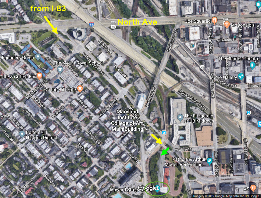
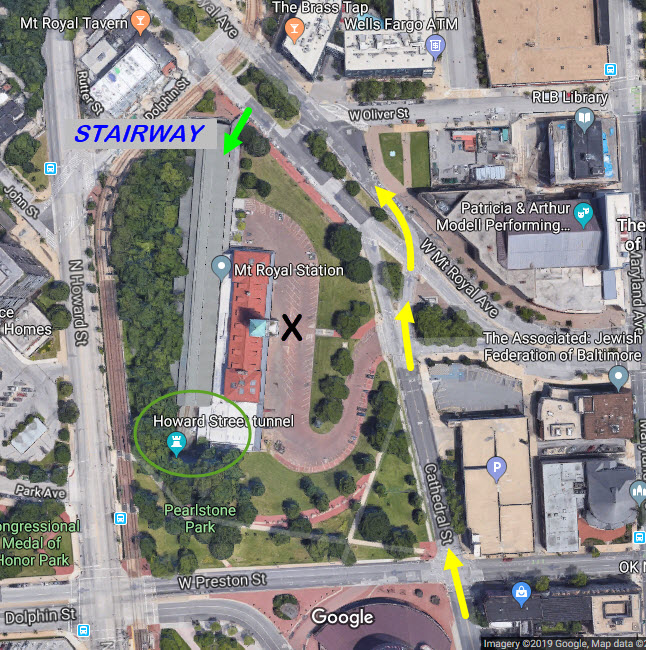
If you're coming down I-83 from the north side of Baltimore, get off at the North Avenue exit, exit 6. Go straight across the intersection at the first light, this will put you on West Mt Royal Avenue. Go about 2100 feet, and look for a place to park, A stairway down to the Mt Royal platform will be JUST on the other side of the light rail grade crossing.
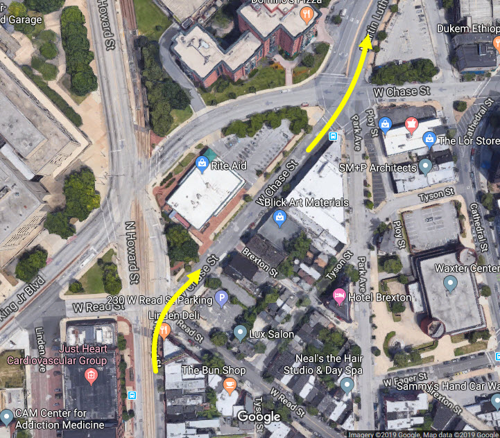
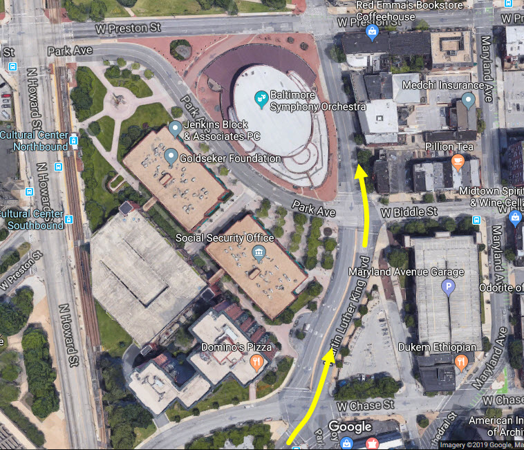
If you're coming "up" thru the city from say, I-95 and I-395, take Howard Street north. I-395 turns into Howard Street at Camden Station, and you will have the light rail next to you all the way up. Take a right at Chase Street, which is not a 90 degree turn, more like a 45. The next intersection is kind of an ugly one, with the MLK, which goes off slightly to your left, take that. At the next intersection with Biddle Street on your right, go straight, you will pass the BSO on your left (Baltimore Symphony Orchestra). Go straight thru the next intersection at Preston St, and this will take you to Mt Royal Ave, where you can take a left, or look for a parking spot now, or in the MICA parking lot at the Mt Royal Station/school (the black "X" below).
A stairway off Mt Royal Ave will take you down to the platform, or, as near as you can get to it.... (green arrow).

Disclaimers:
I love trains, and I love signals. I am not an expert. My webpages reflect what I find on the topic of the page. This is something I have fun with while trying to help others.
Please Note: Since the main focus of my two websites is railroad signals, the railfan guides are oriented towards the signal fan being able to locate them. For those of you into the modeling aspect of our hobby, my indexa page has a list of almost everything railroad oriented I can think of to provide you with at least a few pictures to help you detail your pike.
If this is a railfan page, every effort has been made to make sure that the information contained on this map and in this railfan guide is correct. Once in a while, an error may creep in :-)
My philosophy: Pictures and maps are worth a thousand words, especially for railfanning. Text descriptions only get you so far, especially if you get lost or disoriented. Take along good maps.... a GPS is OK to get somewhere, but maps are still better if you get lost! I belong to AAA, which allows you to get local maps for free when you visit the local branches. ADC puts out a nice series of county maps for the Washington DC area, but their state maps do not have the railroads on them. If you can find em, I like the National Geographic map book of the U.S..... good, clear, and concise graphics, and they do a really good job of showing you where tourist type attractions are, although they too lack the railroads. Other notes about specific areas will show up on that page if known.
Aerial shots were taken from either Google or Bing Maps as noted. Screen captures are made with Snagit, a Techsmith product... a great tool if you have never used it!
By the way, floobydust is a term I picked up 30-40 years ago from a National Semiconductor data book, and means miscellaneous and/or other stuff.
Pictures and additional information is always needed if anyone feels inclined to take 'em, send 'em, and share 'em, or if you have something to add or correct.... credit is always given! Please be NICE!!! Contact info is here
Beware: If used as a source, ANYTHING from Wikipedia must be treated as being possibly being inaccurate, wrong, or not true.
RAILFAN GUIDES HOME
RAILROAD SIGNALS HOME
Last Modified 14-Jul-2019