Access by train/transit:
MARC/Amtrak Penn Station (east side of the
tunnel - safety: 7 out of 10) MARC/Amtrak West
Baltimore station (west side of the tunnel - not all that close tho -
safety: 2 out of 10)
The Scoop:
From
Amtrak study
From
Amtrak study
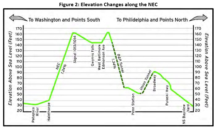
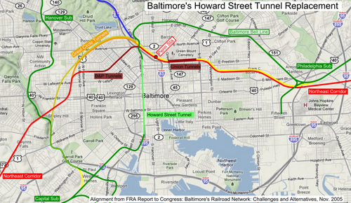
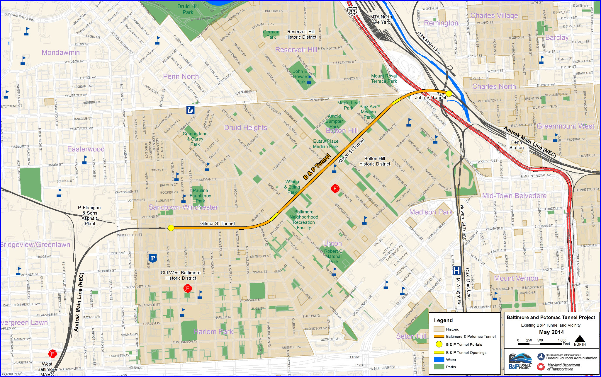
From Wikipedia: The Baltimore and Potomac Tunnel (or B&P Tunnel) is a double track, masonry arch railroad tunnel on
the Northeast Corridor in Baltimore MD, immediately to the south of
Pennsylvania Station. Approximately 140 Amtrak and MARC passenger trains, as well as two freight trains, use the tunnel daily.
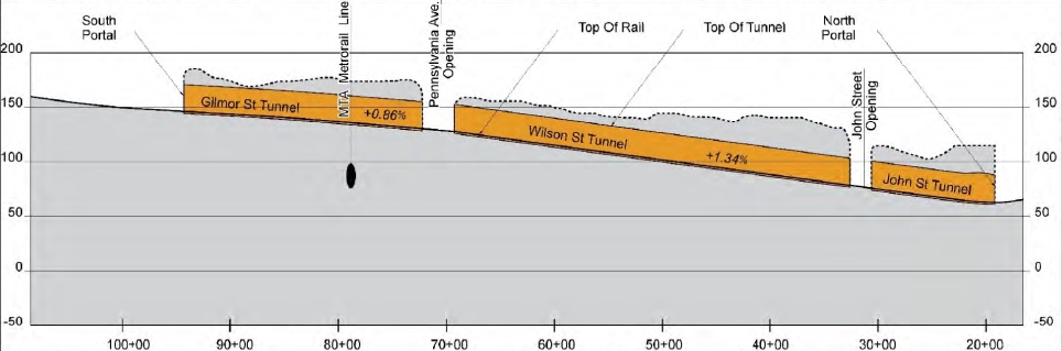
The 7,669-foot (2,338 m) tunnel facility, which passes under the Baltimore neighborhoods of Bolton Hill, Madison Park, and Upton, consists of
a series of three tunnel sections: the Gilmor Street Tunnel, the Wilson Street Tunnel, and
the John Street Tunnel, delineated by two open air cuts: the Pennsylvania
Avenue Opening and the John Street Opening.
Constructed by the Baltimore and Potomac Railroad under Winchester Street and Wilson Street in Baltimore, the
tunnel opened on June 29, 1873. The B&P tunnel allowed the Pennsylvania Railroad (PRR) direct
access to Washington, D.C. for the first time by connecting its Northern Central Railway affiliate (which arrived in Baltimore from the north) to the Baltimore
and Potomac's new spur, which ran to Washington. Between 1916 and 1917, the PRR lowered the floor of the tunnel approximately 2 1/2 feet to accommodate larger trains.
The work included the underpinning of the side walls, installation of a concrete
invert slab, and reconstruction of the track structure. The bases of the tunnel walls were chipped away to improve horizontal clearance. During the
reconstruction, trains were routed around the construction work by sending trains up the Northern Central to Hollins, then over the Greenspring Branch to
the Western Maryland Railway, and then back down into Baltimore!!!
The tunnel underwent rehabilitation as part of the Northeast Corridor Improvement Project in the early 1980s. The repairs included replacing the existing invert, repairing the tunnel lining,
upgrading the track structure, installing a new gauntlet track, and rehabilitating the tunnel drainage system. No fundamental change, however, was made in the tunnel’s difficult geometry. Eventually,
the gauntlet track was removed due to changes in freight traffic patterns.
Prior to the electrification of the PRR's New York City to Washington main line in 1935, the poorly-ventilated tunnel easily filled with smoke from the steam locomotives then in use.
The smoke also was a nuisance to the residential neighborhoods above the tunnel.
The tunnel was lined with gunite to waterproof the arch and prevent icicles from shorting out the catenary wires prior to the initiation of electrified
operation. However, financial considerations prevented the PRR from constructing a new passenger tunnel on the Presstman Street alignment, for which
it previously had acquired rights. The PRR’s plan had envisioned using the new Presstman Street tunnel and the original bores of the
Union Tunnel for passenger operations, while the old B&P Tunnel and the
newer bores of the Union Tunnel (completed in the 1930s) would have been used for freight operations.
In the late 1950s, the tunnel became a hindrance to the growth of PRR’s Trailer-on-Train service, which required additional vertical and horizontal
clearance to accommodate semi-trailers on top of railroad flatcars. The curve at Pennsylvania Avenue was the biggest constraint. The PRR modified
the tunnel walls and ceiling for a distance of 2,200 feet (670 m) to improve clearance and enable high cars and piggyback trailers to traverse the tunnel
without damaging their roofs. Additionally, a 928-foot (283 m) long gauntlet track was installed on southbound track 3 to route trains 17 inches
(430 mm) closer to the middle of the tunnel. However, trains could not operate on track 2 while track 3 and the gauntlet were being used. The
gauntlet track effectively created a single-track tunnel when in use; if a freight train broke down while using the gauntlet, the tunnel was closed to
traffic until the train was moved.
Even with the gauntlet, cars with a loading gauge in excess of Plate C (or in
excess of 16 feet 3 inches (4.95 m)) high were prevented from using the tunnel.
The tunnel underwent rehabilitation as part of the
Northeast Corridor Improvement Project in the early 1980s. The repairs included replacing the existing invert, repairing the tunnel lining, upgrading
the track structure, installing a new gauntlet track, and rehabilitating the tunnel drainage system.
No fundamental change, however, was made in the tunnel’s difficult geometry.
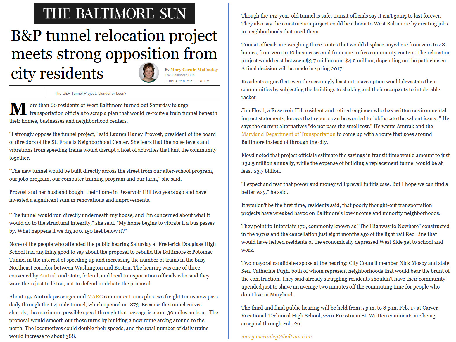
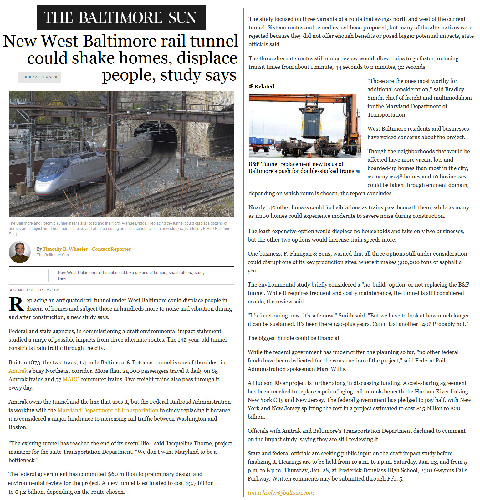
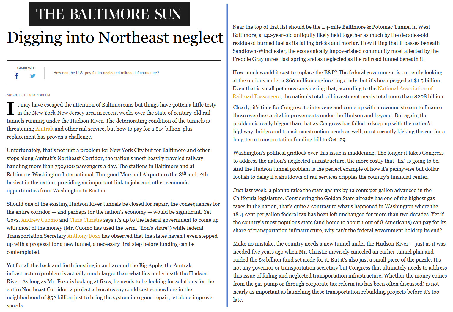
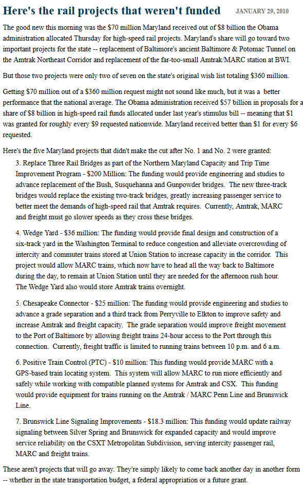
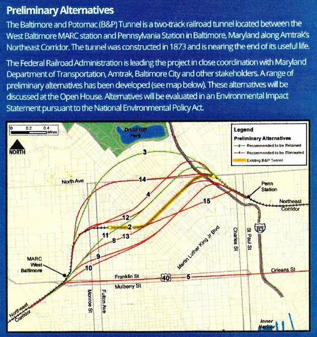
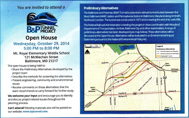
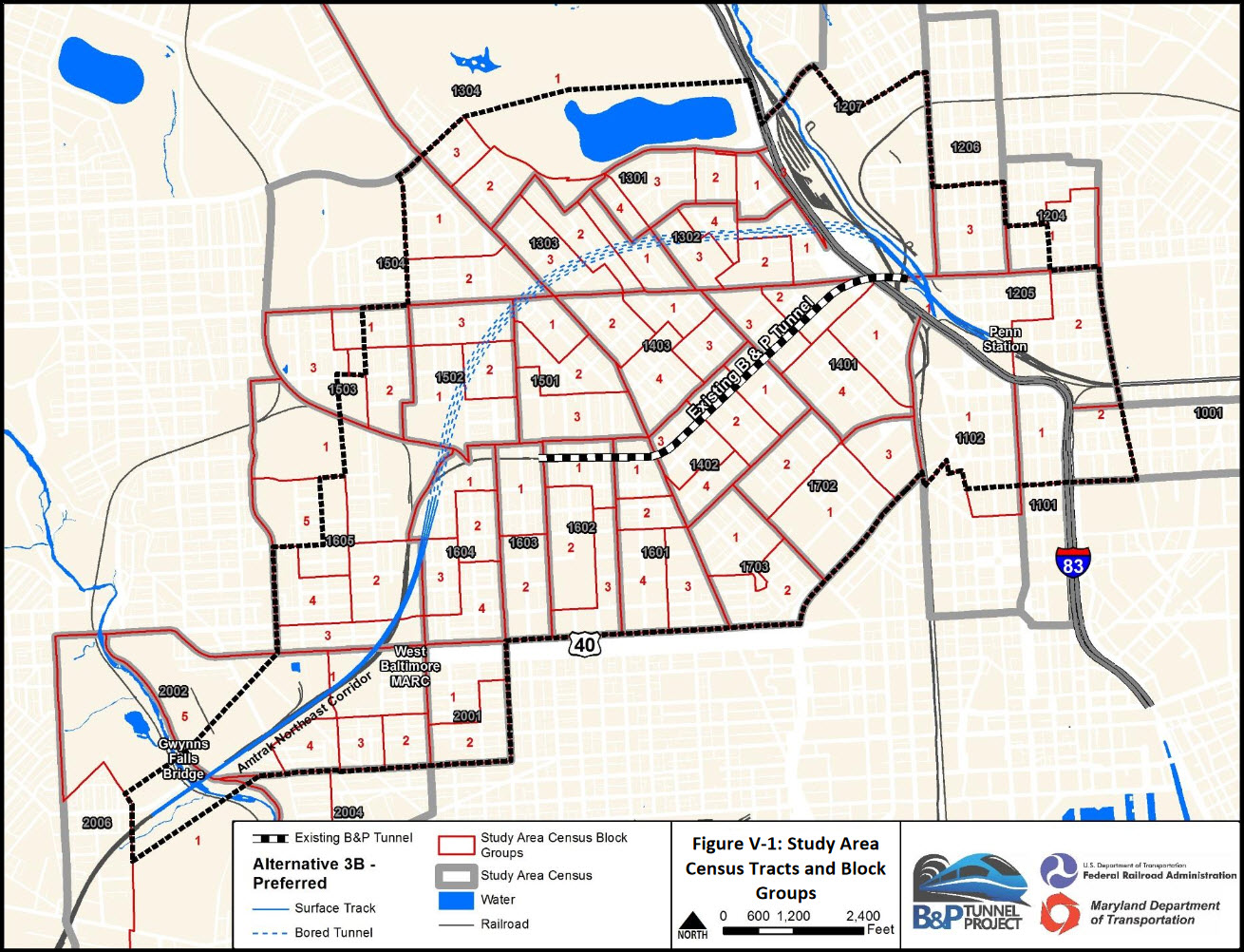
Proposals for Rehabilitating or Replacing B&P Tunnel
A series of public hearings has been held as far back as 2014 into early 2017 to inform the public of what Amtrak is considering for alternatives to the current tunnel.
After spending $60M on the study, the new Amtrak president and CEO (former
NS president), Charles "Wick" Moorman says he won't spend any more money on
studies that are going no-where. Obviously, the residents over any of
the proposed routes are against any and all plans.
Another issue, besides resistance from the neighborhood, is the CSX line
which is right above the entrance to the tunnel on the Penn Station side.
When the Pennsy bought the Washington, Baltimore & Annapolis, they nixed the
agreement the WB&A had with the B&O for trackage rights to Washington DC, so
the B&O now had to find their own route into DC. They built the
Baltimore Beltline, and it came through town, right over the B&P tunnel.
There was some sort of covenant or agreement, that said the two railroads
could not touch each other, so if one looks carefully at the northern B&P
Tunnel portal, you can see the ironwork for a bridge that supports the B&O
R-O-W over the Pennsy tracks. I'm sure in today's spirit of
cooperation, something could be figured out in order to work on the tunnel.
Personally, I think they should just daylight the tunnel, make it three
tracks, and upgrade the neighborhoods above so they won't complain.
Aerial shots were taken from either Google Maps or www.bing.com/maps as noted. Screen captures are made with Snagit, a
Techsmith product... a great tool if you have never used it!
All of the signals on the North East Corridor are of the Pennsy PL (position light) variety, colorized by Amtrak instead of being all yellow
as the Pennsy signals are (quickly becoming WERE).
Many people refer to them now as PCL's (position color light), as opposed to
CPL's (color position lights) which the B&O RR employed. At some
location, as for instance, when the trains exit the west portal, southbound
trains see a "small" form of a PL signal called a pedestal signal. One
would assume, because of limited visibilty, a full size PCL signal could not be
seen here.
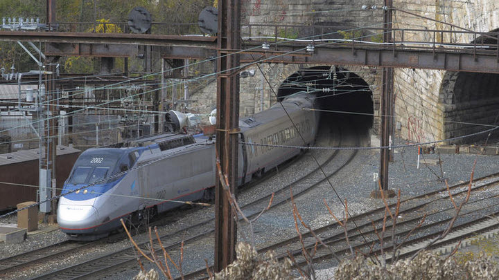
The picture below is of the eastern portal to the tunnel, showing the last set of Pennsy style PL signals before entering.
Picture by Jeffrey F. Bill/Baltimore Sunpapers
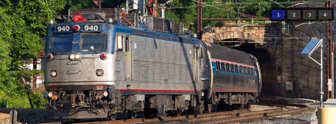
As usual, we have an excellent picture of the SB signals upon exiting the
tunnel on the west side, taken by Jersey Mike. Love those signal trips we
take!
For comparison, an EB CSX freight at the north end of the Howard St tunnel.
Early 70's
aerial view of the western portal.
FYI, this is a
piece of gauntlet track, where two trains can not be on the same stretch at the
same time. The tracks in the tunnel were like this at one time.
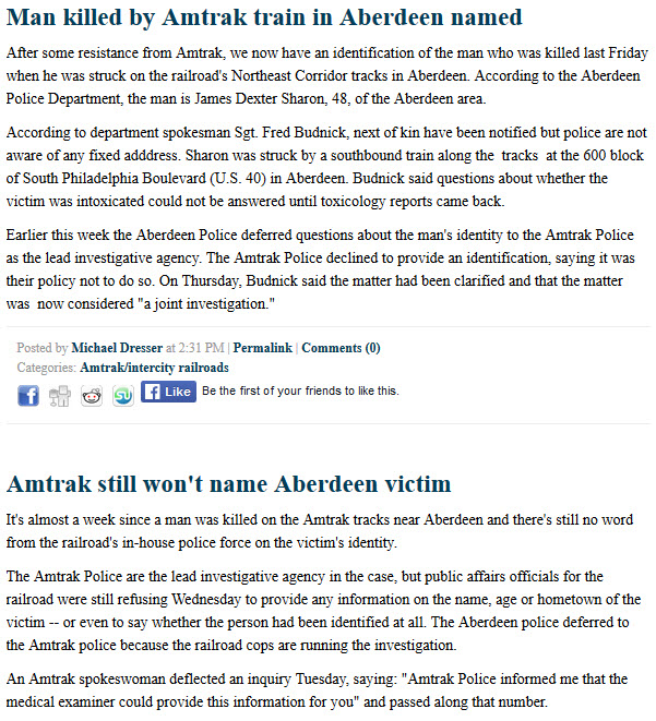
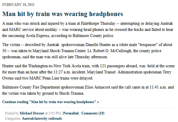
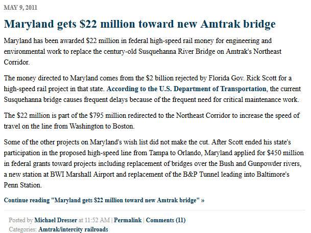
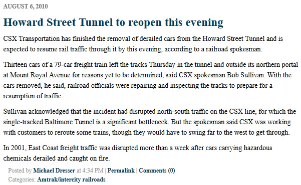
Newsblurbs from around. These can be found by
searching for "B&P Tunnel".
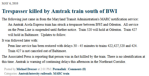
Stories about accidents were included to
illustrate that the NEC is no place to be walking around. One, you can
get killed very easily, and secondly, it is trespassing, and you can be
arrested if you survive.
Courtesy of the University of Texas Library, click
here for
their index page.
Disclaimers:
I love trains, and I love signals. I am not an
expert. My webpages reflect what I find on the topic of the page.
This is something I have fun with while trying to help others.
Please Note:
Since the main focus of my two websites is railroad signals, the railfan guides
are oriented towards the signal fan being able to locate them. For those
of you into the modeling aspect of our hobby, my
indexa page has a list of
almost everything railroad oriented I can think of to provide you with at least a few pictures to
help you detail your pike.
If this is a railfan page, every effort has
been made to make sure that the information contained on this map and in this
railfan guide is correct. Once in a while, an error may creep in
:-)
My philosophy: Pictures and maps are worth a
thousand words, especially for railfanning. Text descriptions only
get you so far, especially if you get lost or disoriented. Take
along good maps.... a GPS is OK to get somewhere, but maps are still
better if you get lost! I belong to AAA, which allows you to get
local maps for free when you visit the local branches. ADC puts
out a nice series of county maps for the Washington DC area, but their
state maps do not have the railroads on them. If you can find em,
I like the National Geographic map book of the U.S..... good, clear, and
concise graphics, and they do a really good job of showing you where
tourist type attractions are, although they too lack the railroads.
Other notes about specific areas will show up on that page if known.
By the way, floobydust is
a term I picked up 30-40 years ago from a National Semiconductor data
book, and means miscellaneous and/or other stuff.
Pictures and additional information is always needed if anyone feels
inclined to take 'em, send 'em, and share 'em, or if you have
something to add or correct.... credit is always given! BE NICE!!! Contact info
is here
Beware: If used as a source, ANYTHING from Wikipedia must be treated as
being possibly being inaccurate, wrong, or not true.
 From
Amtrak study
From
Amtrak study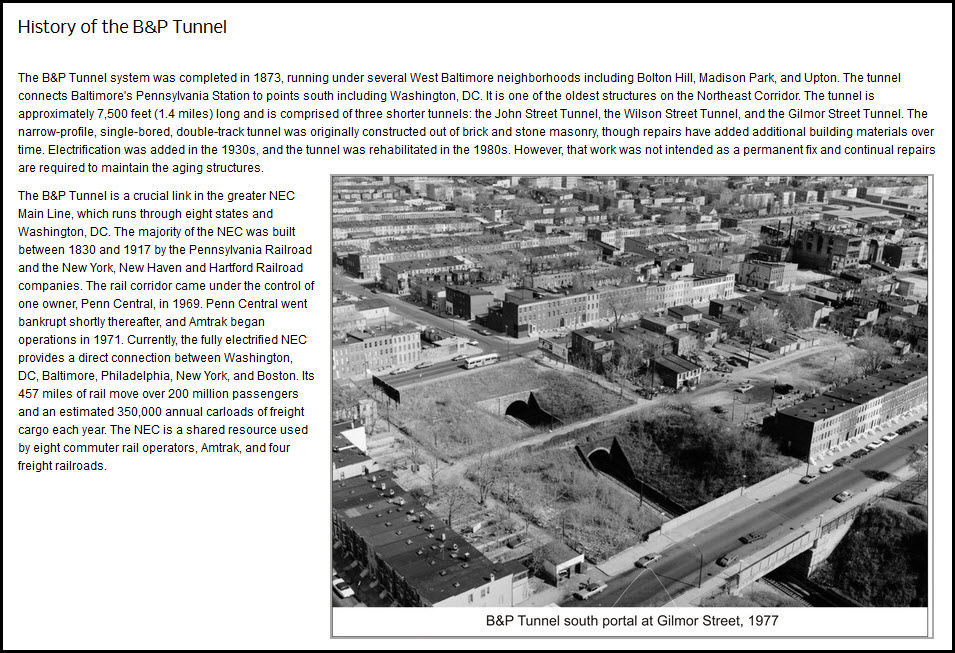 From
Amtrak study
From
Amtrak study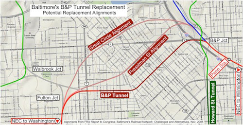
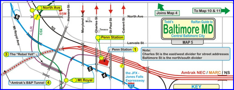 Part of my map 5 for the area of the east tunnel portal.
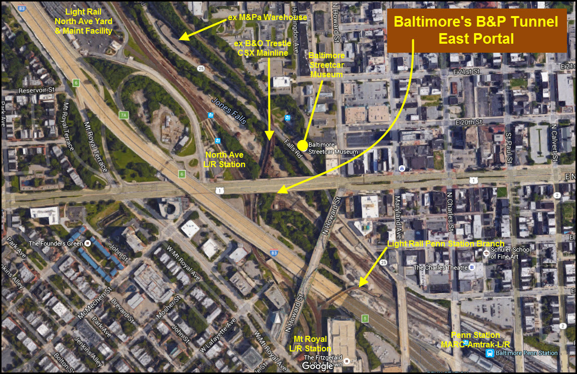
 Picture by Jeffrey F. Bill/Baltimore Sunpapers
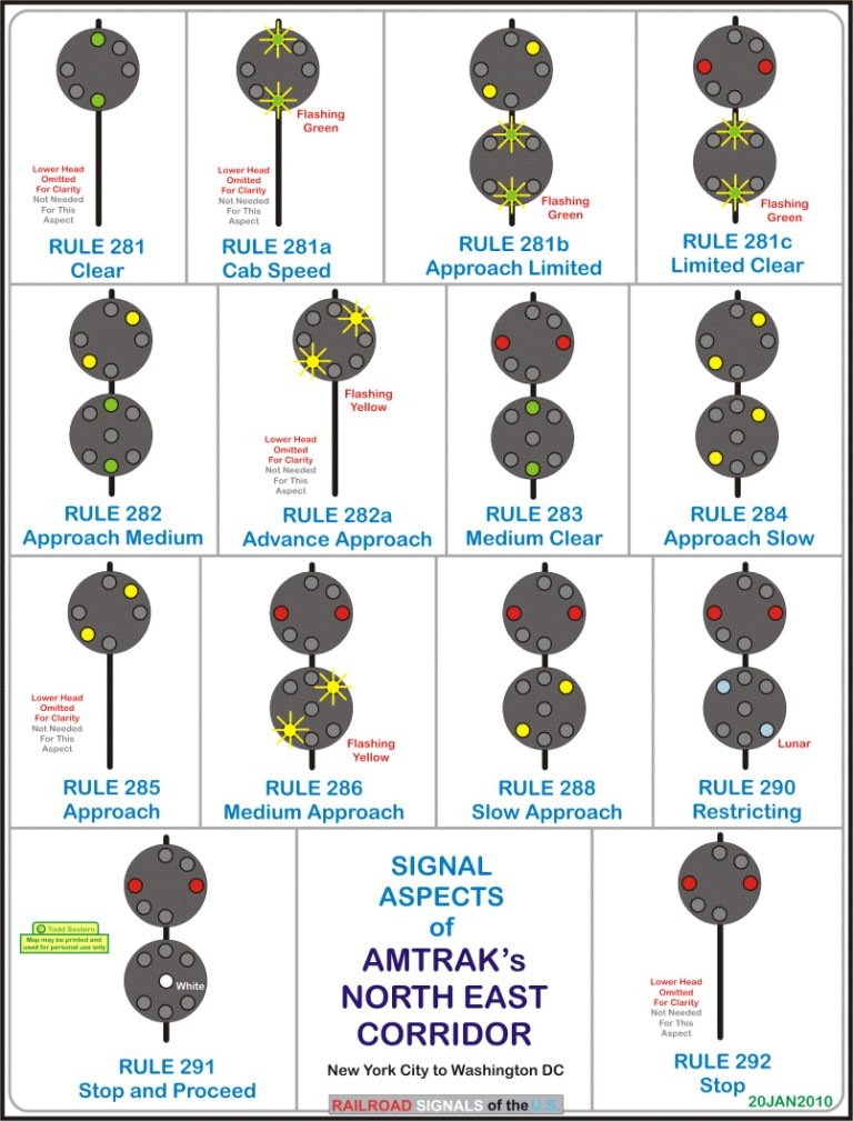

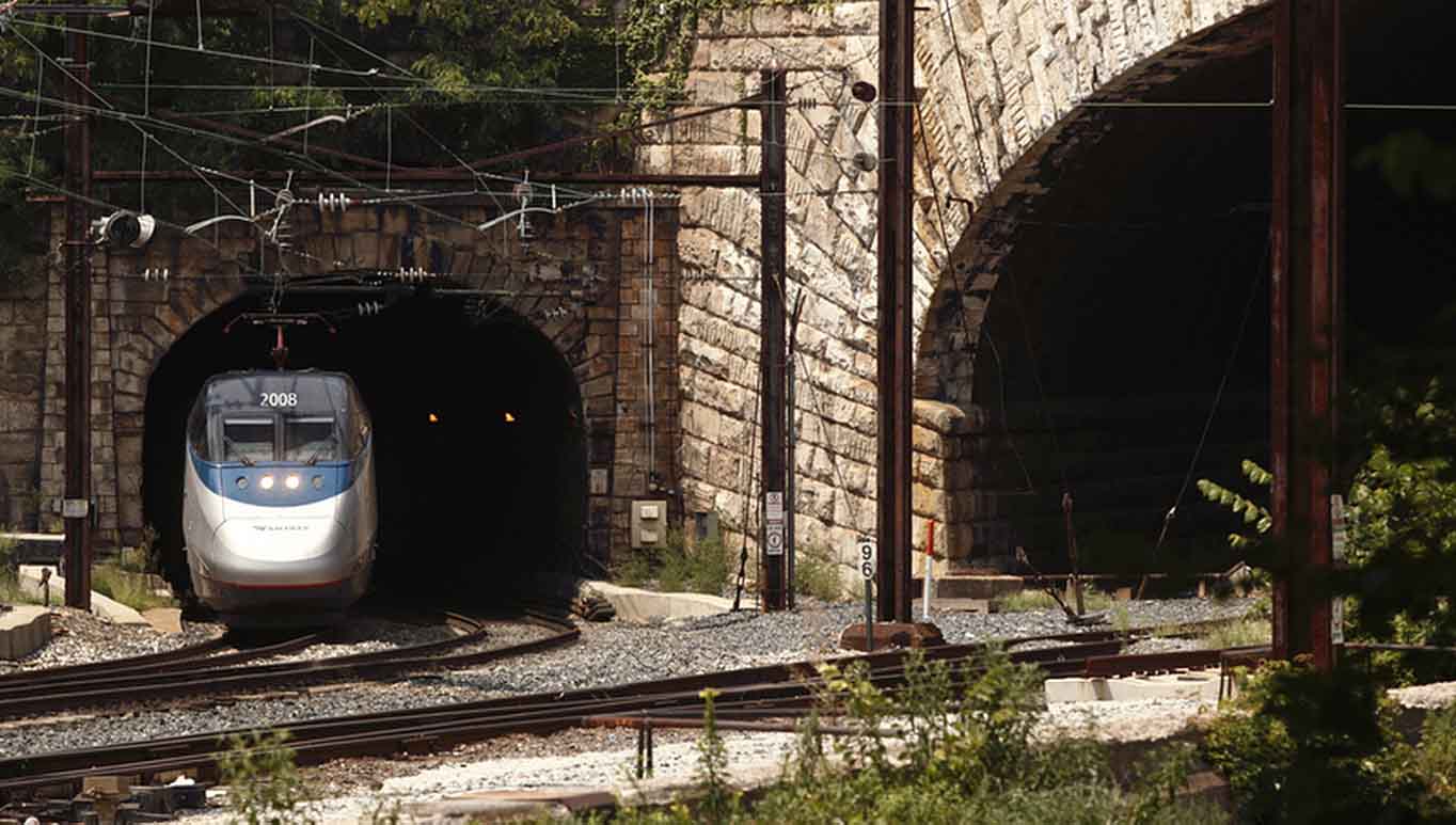 The eastern portal.
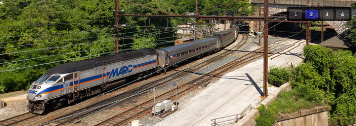
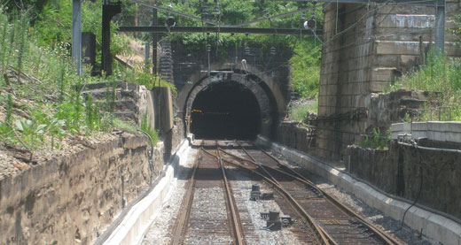 The western portal.
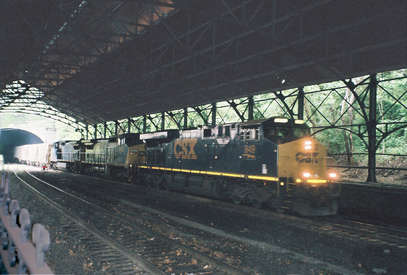 For comparison, an EB CSX freight at the north end of the Howard St tunnel.
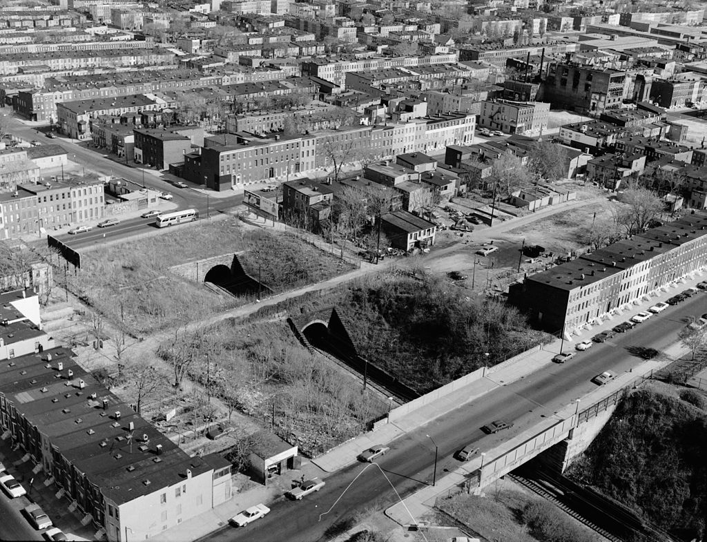 Early 70's
aerial view of the western portal.
Early 70's
aerial view of the western portal.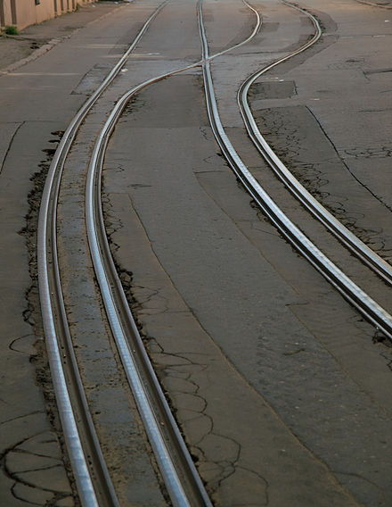 FYI, this is a
piece of gauntlet track, where two trains can not be on the same stretch at the
same time. The tracks in the tunnel were like this at one time.
FYI, this is a
piece of gauntlet track, where two trains can not be on the same stretch at the
same time. The tracks in the tunnel were like this at one time.