
In General
Getting Here
Map
Sights
Pictures
Signals
Fire & Police
Floobydust
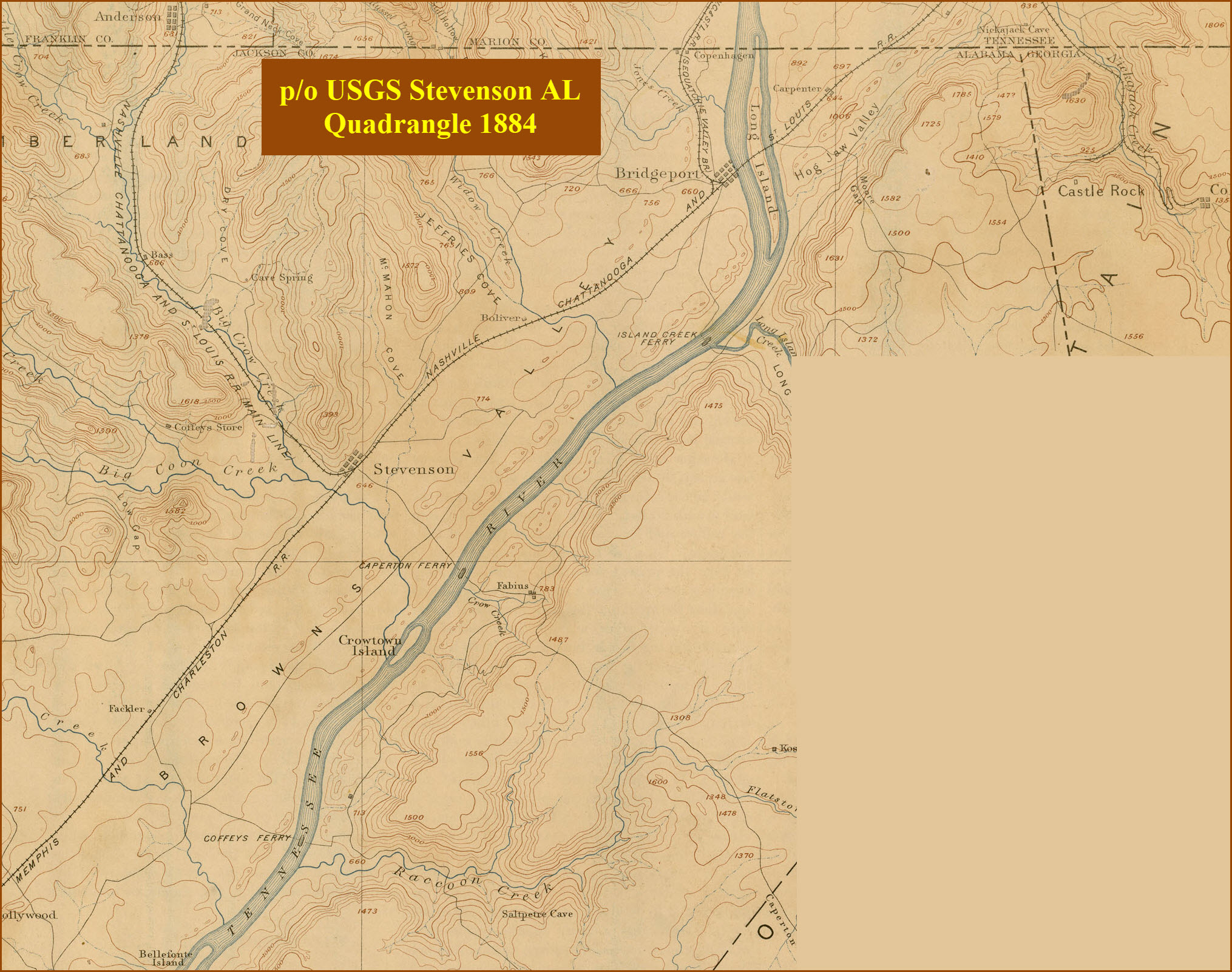
USGS Maps
RAILROAD SIGNALS HOME
Location / Name:
Stevenson AL, Jackson County
What's Here:
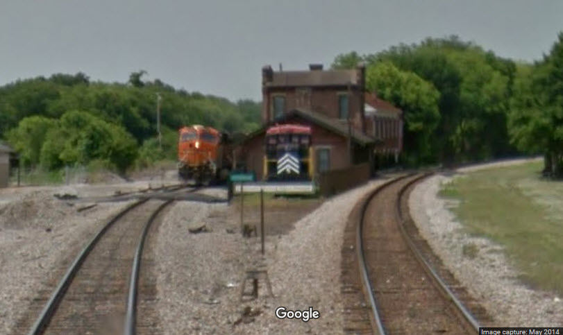
High traffic on both CSX and BNSF
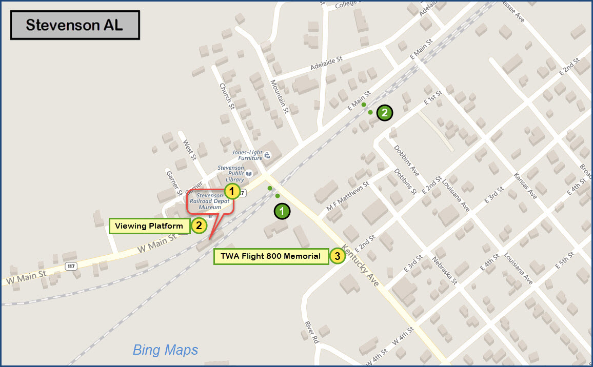
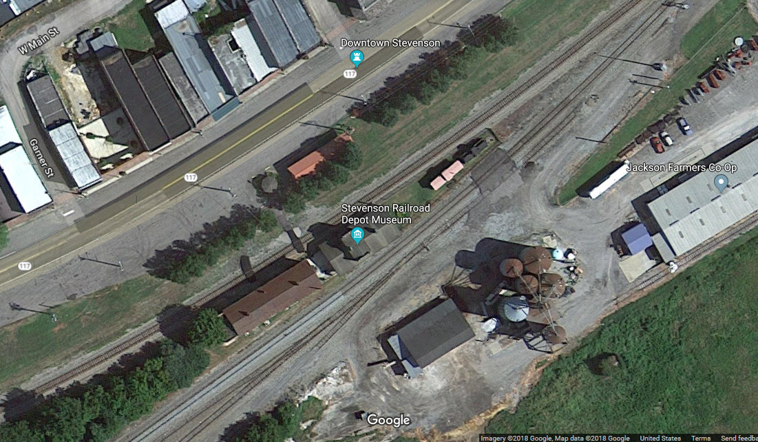
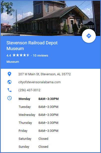
Stevenson RR Depot Museum
RR Viewing Platform
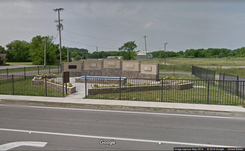
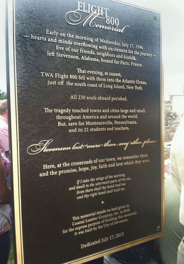
TWA Flight 800 Memorial
Data:
GPS Coordinates: 34.867654, -85.839718 (at the depot)
Phone A/C: 256
ZIP: 35772
Access by train/transit:
None
The Scoop:
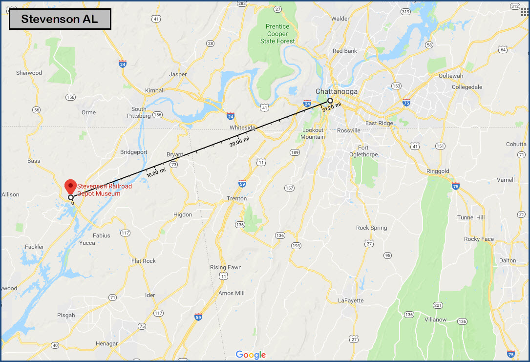
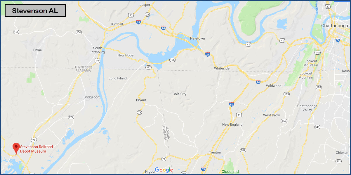
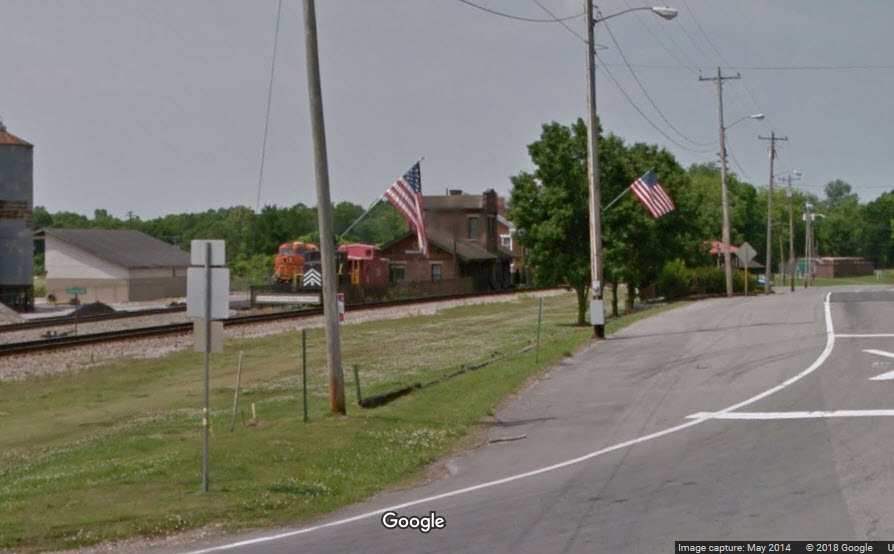
Stevenson Alabama is about 32 miles southwest of Chattanooga as the crow flies, in the northeastern part of Alabama, not too far from the border with Tennessee (about 10 miles). It is on the mainlines for both CSX and NS. As of August 2018, it is Trains latest hotspot, but it would seem that Trains Magazine is starting to have a tough time coming up with true hotspots (not to take anything away from Stevenson :-).
Between BNSF and CSX, there are approximately 60 trains a day.
There is a defect detector at MP116.7, in between the two sets of signals on the single track.
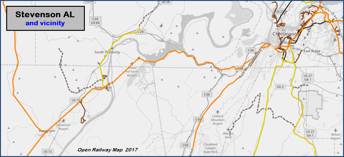
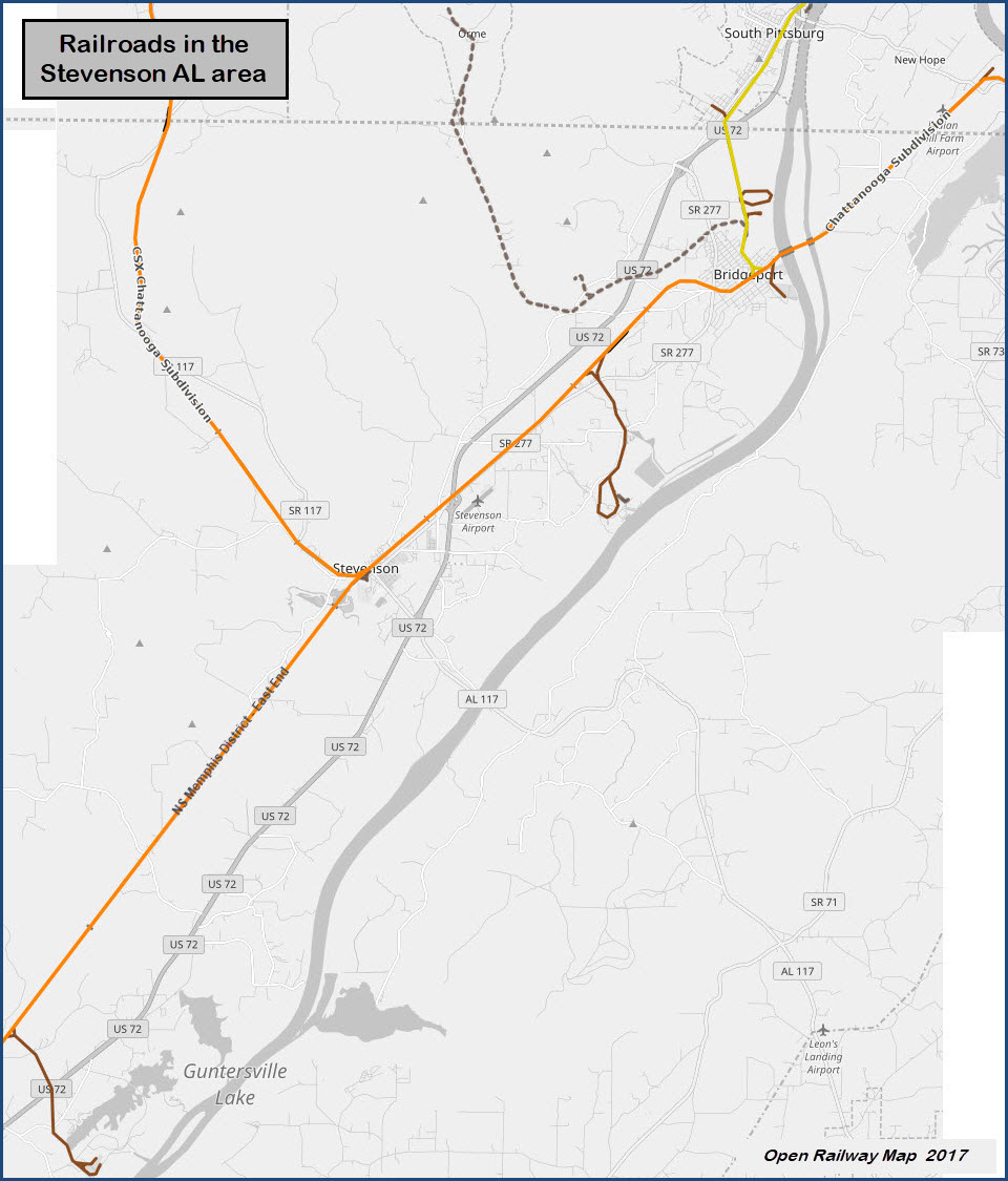
About 5.6 miles north, is a wye for the power and steam generating plant, and the north leg of the wye empties into a CSX yard at Widows Creek Station. The yard is about 4300 feet long, and has 12 tracks in it, not including the two mainline thru tracks. There is apparently no public access to the yard.
Up in Bridgeport, about 9 1/2 miles NE, we have another museum: the Bridgeport Depot Museum, another small seven (7) track yard, and a single track bridge heading out over the Tennessee River.
Acknowledgements:
Ron Kohlin, for letting me use his pictures as noted below
Denver Todd
Websites and other additional information sources of interest for the area:
http://gregariousrailfan.com/Stevenson_AL.html
http://kohlin.com/Chatt0606/page3.htm
https://en.wikipedia.org/wiki/Stevenson_Railroad_Depot_and_Hotel
https://www.youtube.com/watch?v=vCNUnrV51cw
https://www.openrailwaymap.org/
http://www.stevensonfire.com/
Stevenson is located in the northeast corner of Alabama, not really that near much of anything except for I-24, about 10 miles to the north via US72. 72 comes off of I-24 in Tennessee at exit 152. Exit 152 has plenty of services if you are hungry or need gas.
Stevenson is VERY convenient if you happen to be traveling from Chattanooga TN to Huntsville AL, as it is on the way (via US72)! I Passed by here oodles of times in the 1984 to 1990 timeframe, and wasn't aware of the stations existence! All I can say is darn.
Services at I-24 exit 152, there is also some stuff along 72 adjacent to Stevenson, and one restaurant, Friday's (not TGIF), in town:
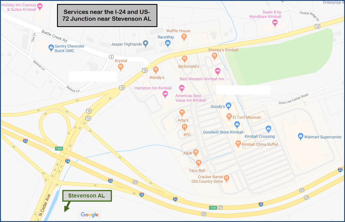
I had to include the following map, only because it is such an odd shape for a town to take, I guess they want the taxes from the businesses located along 72.
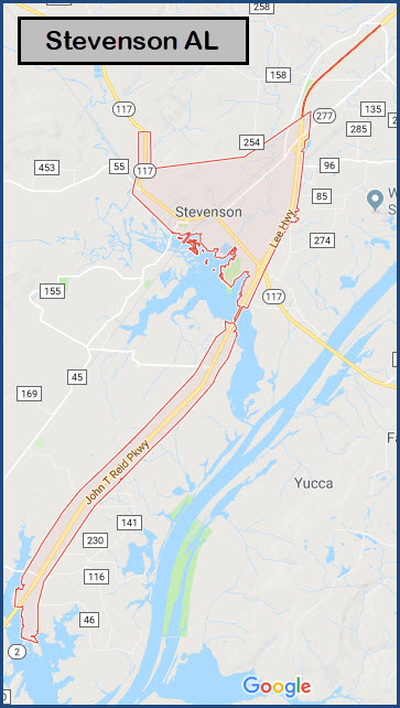
Note: if you look at the above map on Bing, you will notice that I added the double track going off to the right.... :-)
GPS Coordinates: 34.867654, -85.839718
207 W. Main St., Stevenson AL 35772
256-437-3012
http://www.cityofstevensonalabama.com/Depot-Museum.html
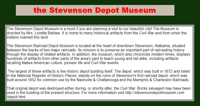
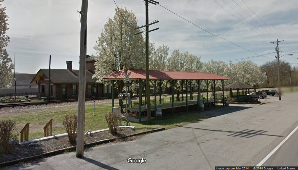
From Wikipedia: The Stevenson Railroad Depot and Hotel are a historic train station and hotel in Stevenson, Alabama. They were built circa 1872 as a joint project of the Memphis and Charleston RR and the Nashville and Chattanooga RR, whose lines converged in Stevenson. When the Memphis & Charleston was purchased by the Southern Railway in 1898, the Louisville and Nashville RR (who had taken over the N&C in 1880) took sole control of the depot and operated it until 1976. It was converted into a history museum in 1982. Both buildings are brick with gable roofs and Italianate details. The depot has a central, second-story tower that was added in 1887. The three-story hotel had a lobby, dining room, and kitchen on the first floor and eight large guest rooms on the upper floors. The buildings were listed on the Alabama Register of Landmarks and Heritage in 1975 and the National Register of Historic Places in 1976. The building is now operated as the Stevenson Railroad Depot Museum and features area railroad and Civil War artifacts.
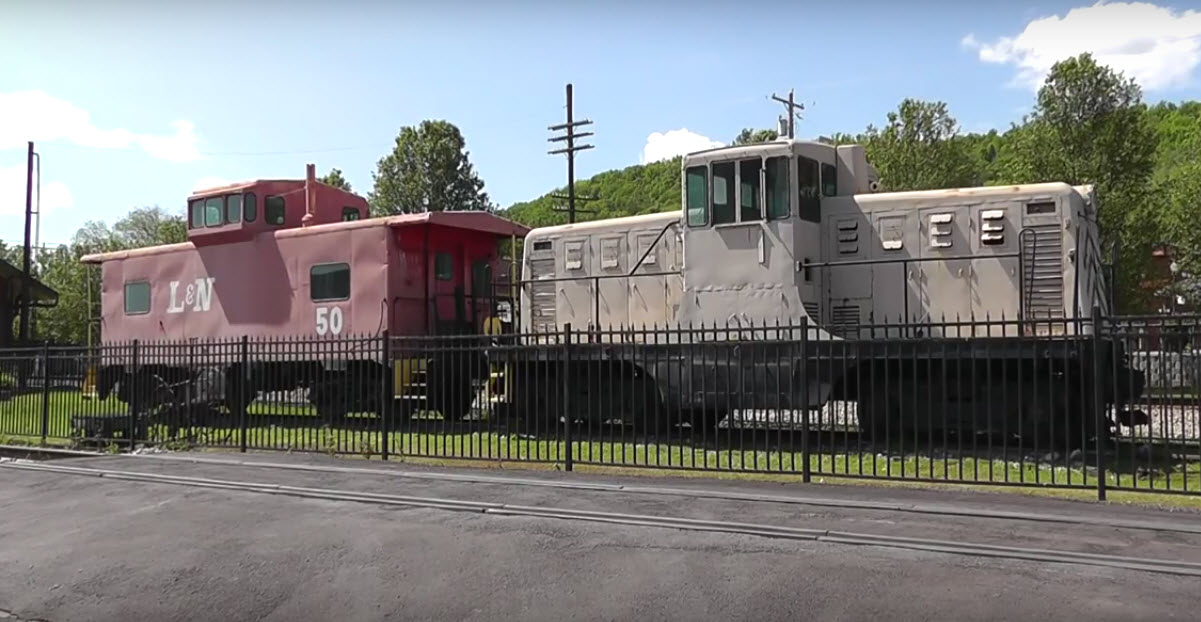
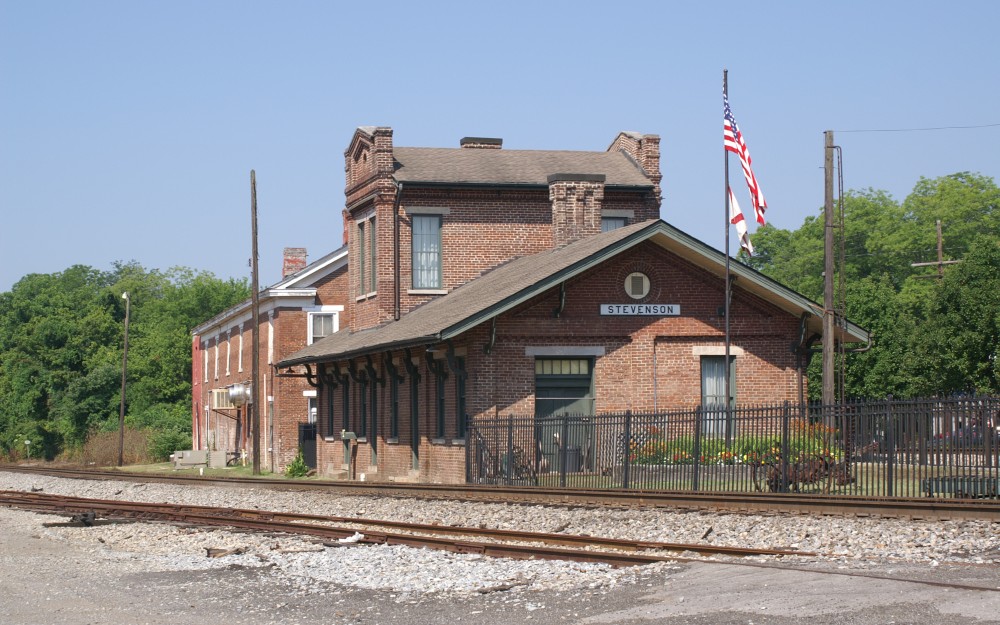 6/29/2006, Both photos by Ron Kohlin
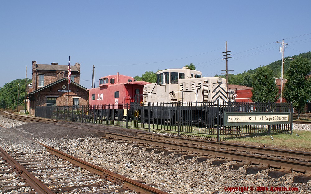
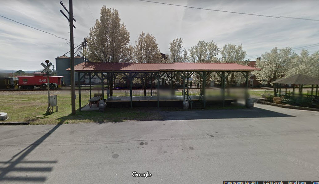
Located on Main Street, and across from the depot, it provides a sheltered place to watch the activity from.
Residents gathered on July 18, 2013 in downtown Stevenson, a Jackson County town of 2,000 souls, to honor five of their neighbors who died 22 (in 2018) years ago when TWA Flight 800 fell from the sky into the Atlantic Ocean. On the anniversary of the crash off Long Island, N.Y., on July 17, 1996, the city dedicated a memorial built to commemorate the lives of two young Boy Scouts, Tom Weatherby III and Joe Scott, as well as Tom's mother Brenda Privette and Joe's parents, Michael and Barbara Scott. The families were on their way to Paris, France, a trip they'd dreamed about, and were flying from JFK Airport in NYC. The plane went down shortly after take-off, killing all 230 passengers on board.
http://blog.al.com/breaking/2013/07/stevenson_dedicates_memorial_t.html
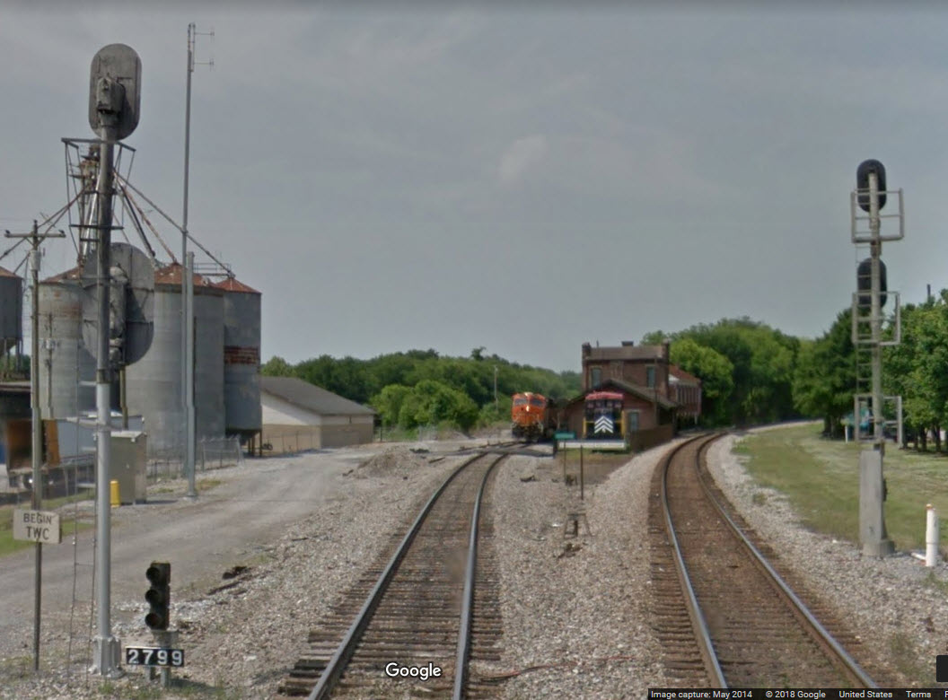
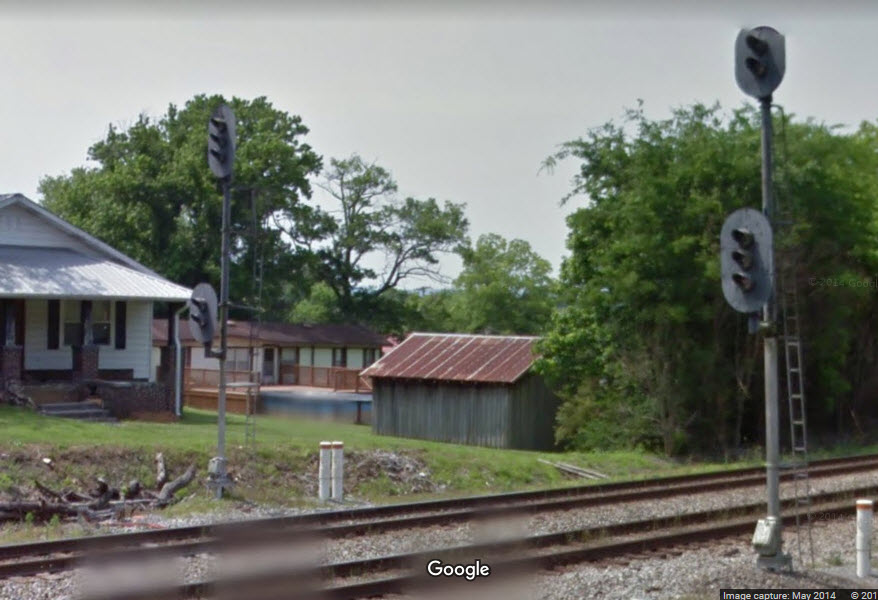
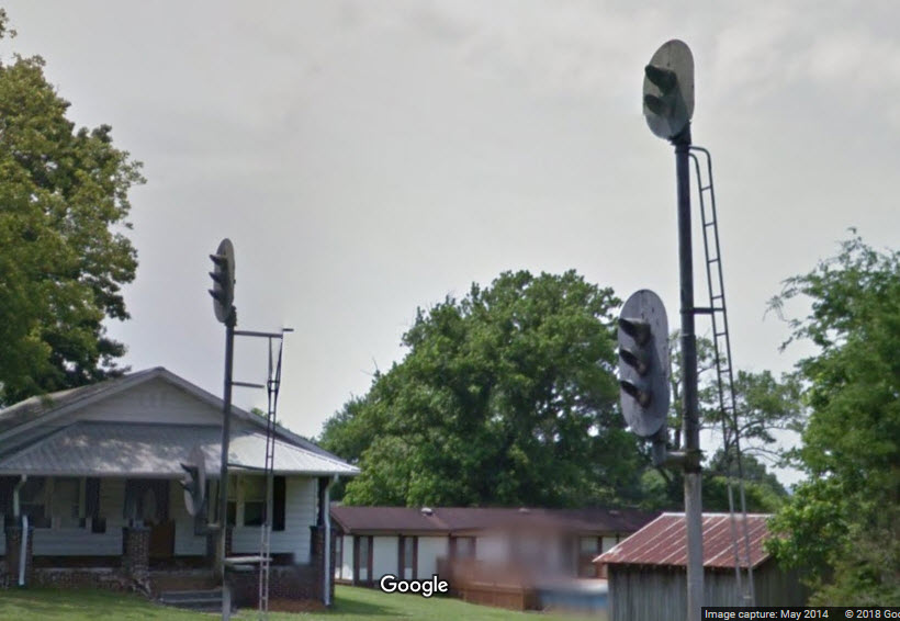
Notice on the line going off to the left, at least in 2014, that it still uses vintage signals, also notice the top signal is a searchlight!
In looking at the side photo, we can plainly see it is a GRS searchlight.
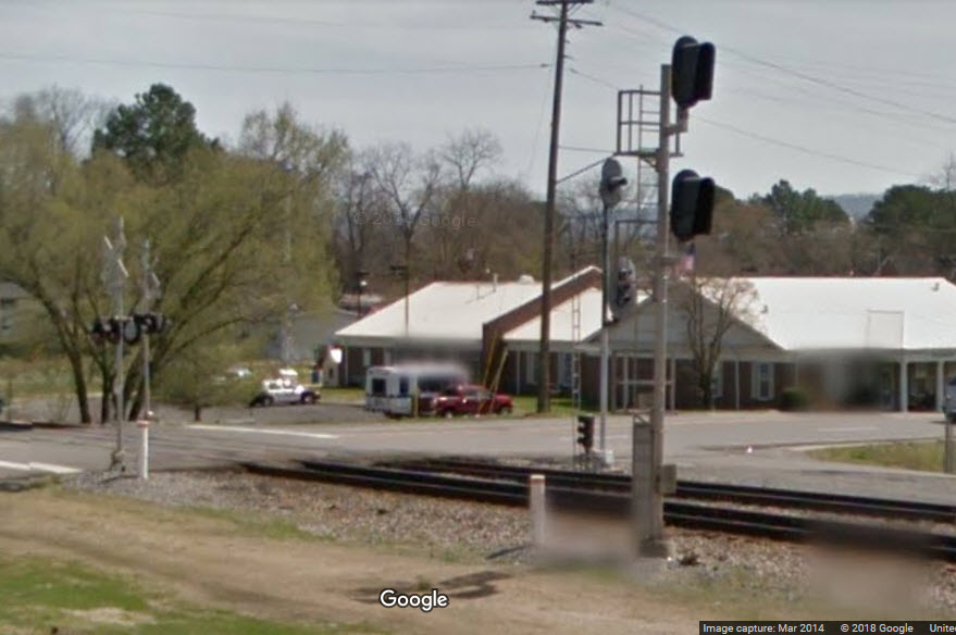
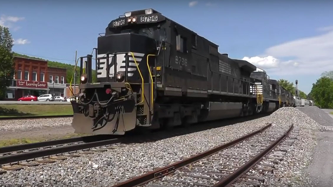
 from above video
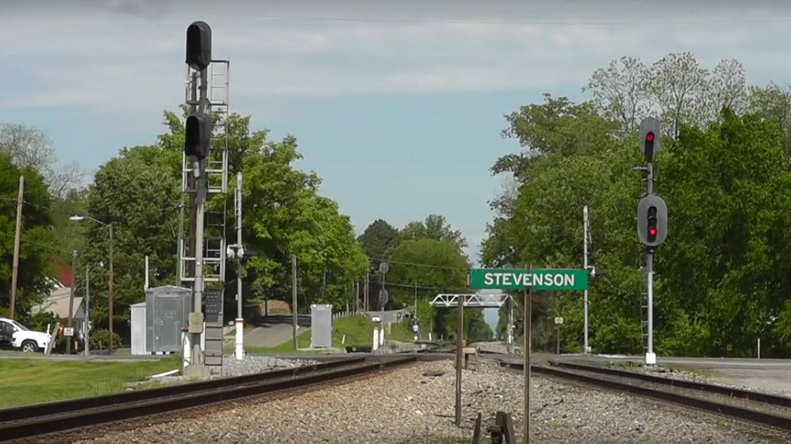 from video
Trains coming south from Chattanooga and Bridgeport have a dual track mainline until they get to the split in Stevenson. Prior to the split, the two tracks go down to one, and then do the split. This set of signals is where the tracks go from two down to one, with signals also indicating which way they will go at the split. I would think that maybe, with the signal replacement program going on, especially with CSX, that these may have been replaced by now....
 from video from video
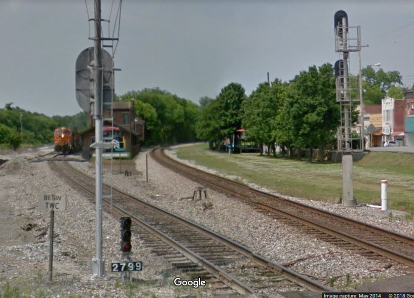
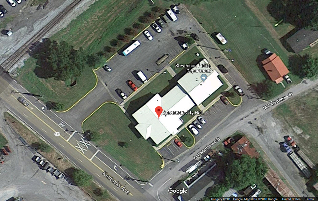
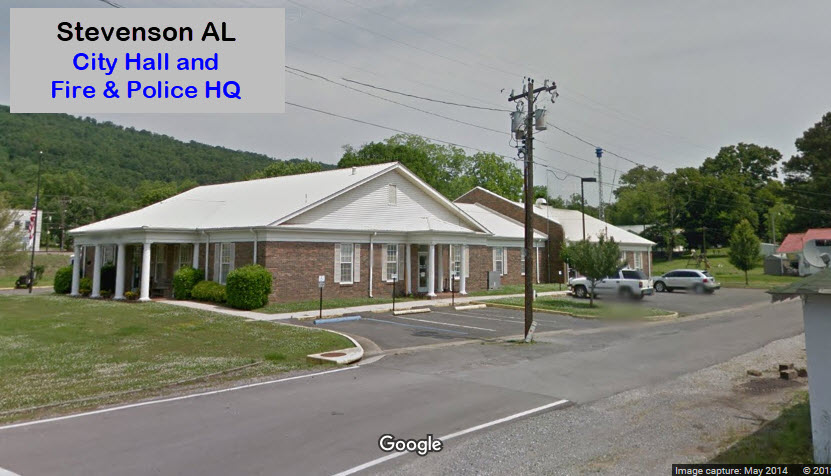
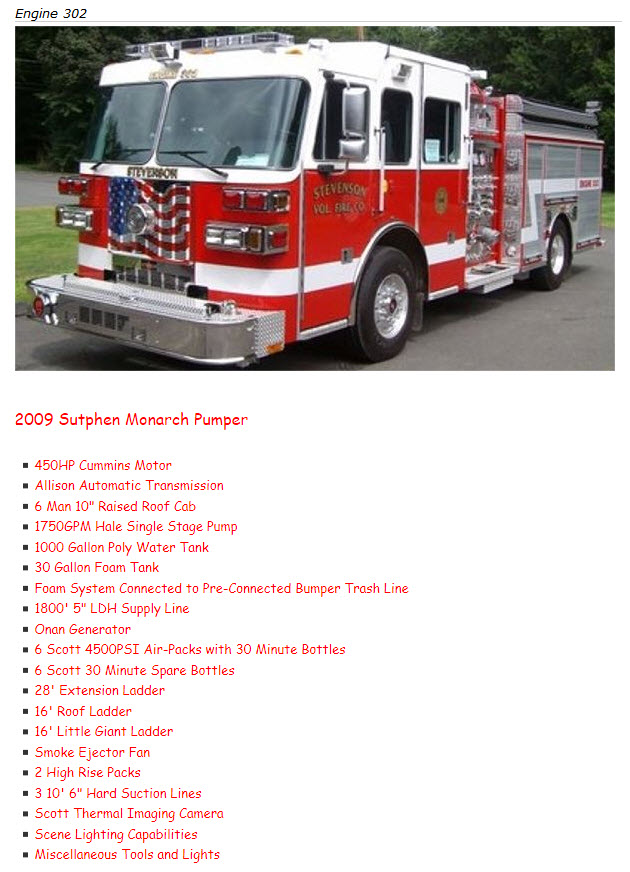
The headquarters for the Stevenson Police and Fire department is at the Stevenson City Hall building at 104 Kentucky Ave, corner of M.F. Matthews.
http://www.stevensonfire.com/
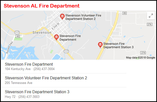
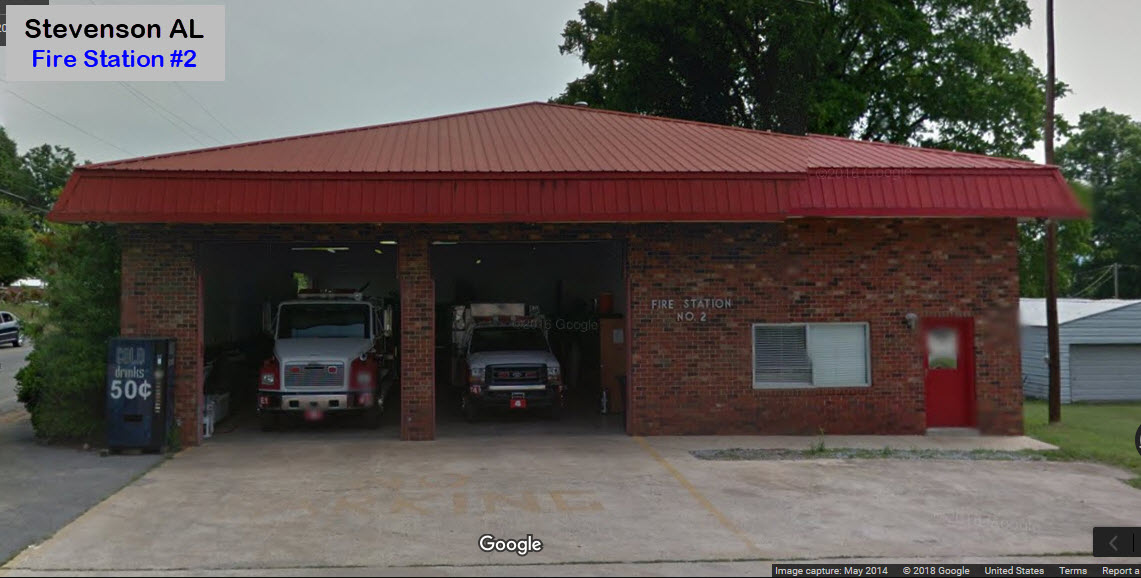
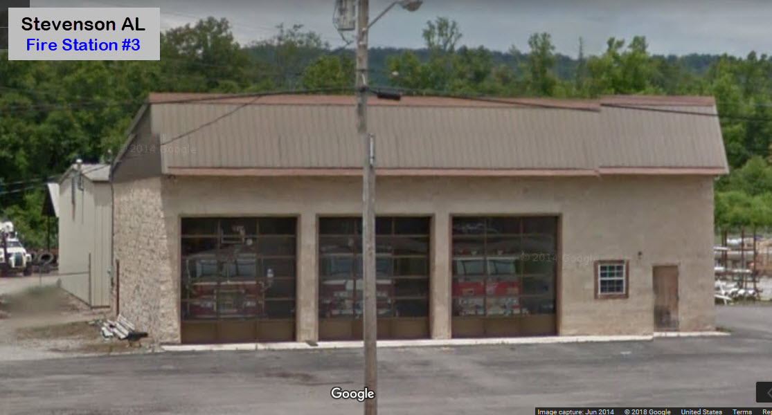
More pictures of their equipment is located at: http://www.stevensonfire.com/Apparatus.aspx
CSX's Widow Creek Station Yard
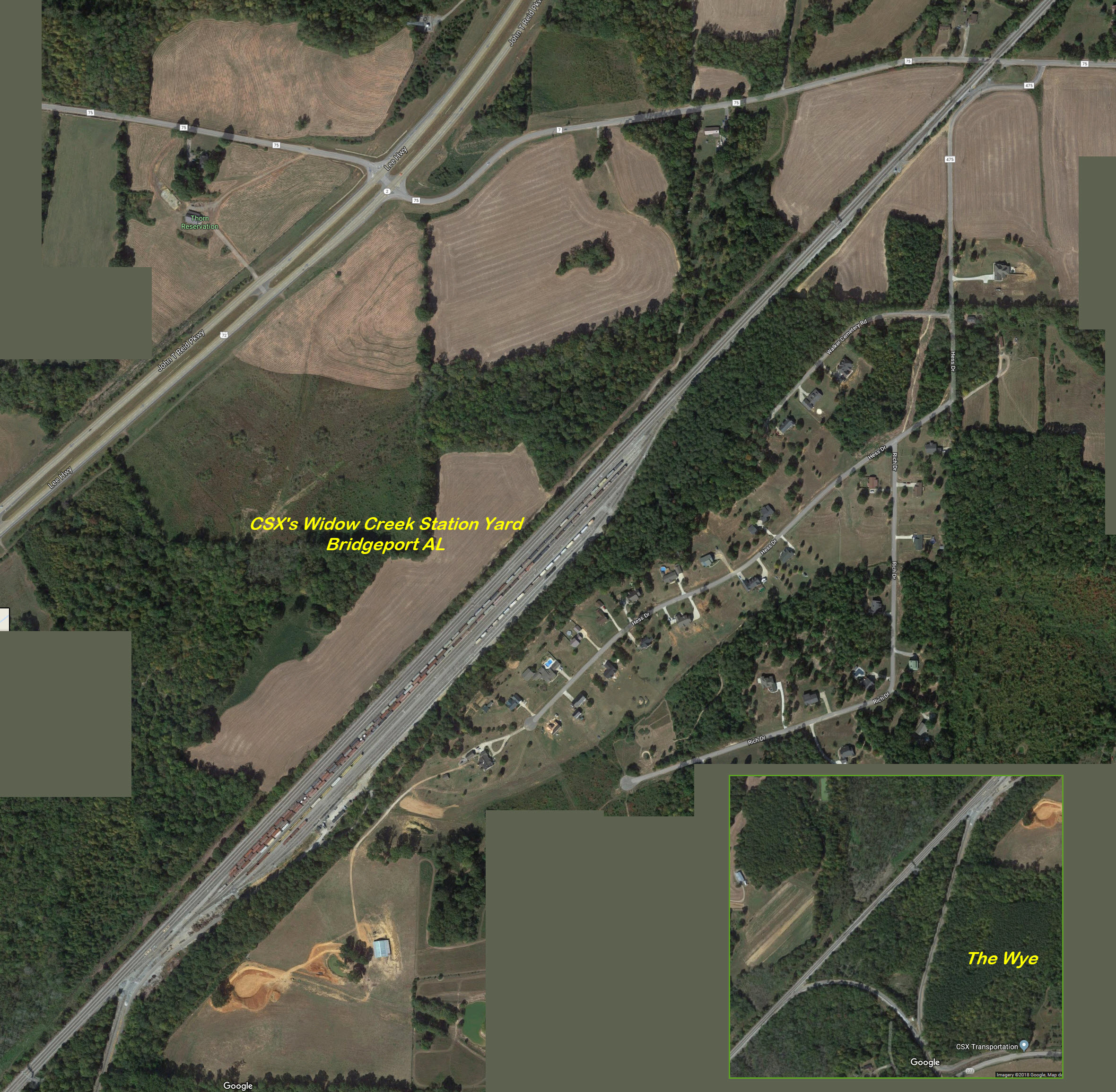
Courtesy of the University of Texas Library, click here for their index page.
Disclaimers:
I love trains, and I love signals. I am not an expert. My webpages reflect what I find on the topic of the page. This is something I have fun with while trying to help others.
Please Note: Since the main focus of my two websites is railroad signals, the railfan guides are oriented towards the signal fan being able to locate them. For those of you into the modeling aspect of our hobby, my indexa page has a list of almost everything railroad oriented I can think of to provide you with at least a few pictures to help you detail your pike.
If this is a railfan page, every effort has been made to make sure that the information contained on this map and in this railfan guide is correct. Once in a while, an error may creep in :-)
My philosophy: Pictures and maps are worth a thousand words, especially for railfanning. Text descriptions only get you so far, especially if you get lost or disoriented. Take along good maps.... a GPS is OK to get somewhere, but maps are still better if you get lost! I belong to AAA, which allows you to get local maps for free when you visit the local branches. ADC puts out a nice series of county maps for the Washington DC area, but their state maps do not have the railroads on them. If you can find em, I like the National Geographic map book of the U.S..... good, clear, and concise graphics, and they do a really good job of showing you where tourist type attractions are, although they too lack the railroads. Other notes about specific areas will show up on that page if known.
Aerial shots were taken from either Google or Bing Maps as noted. Screen captures are made with, a Techsmith product... a great tool if you have never used it!
By the way, floobydust is a term I picked up 30-40 years ago from a National Semiconductor data book, and means miscellaneous and/or other stuff.
Pictures and additional information is always needed if anyone feels inclined to take 'em, send 'em, and share 'em, or if you have something to add or correct.... credit is always given! Please be NICE!!! Contact info is here
Beware: If used as a source, ANYTHING from Wikipedia must be treated as being possibly being inaccurate, wrong, or not true.
RAILFAN GUIDES HOME
RAILROAD SIGNALS HOME
NEW 07/01/2017, AUG09/2018, SEP13/2019, OCT30/2022
Last Modified 30-Oct-2022