
In General
Getting Here
Map
Sights
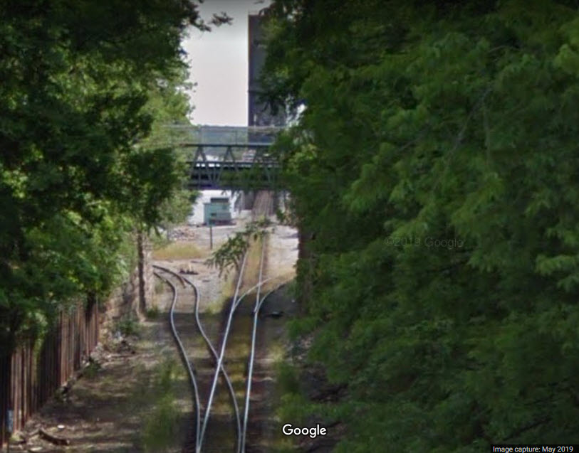
Bridges
Signals
Floobydust
USGS Maps
RAILROAD SIGNALS HOME
Location / Name:
Decatur AL, Morgan County, County Seat!
What's Here:
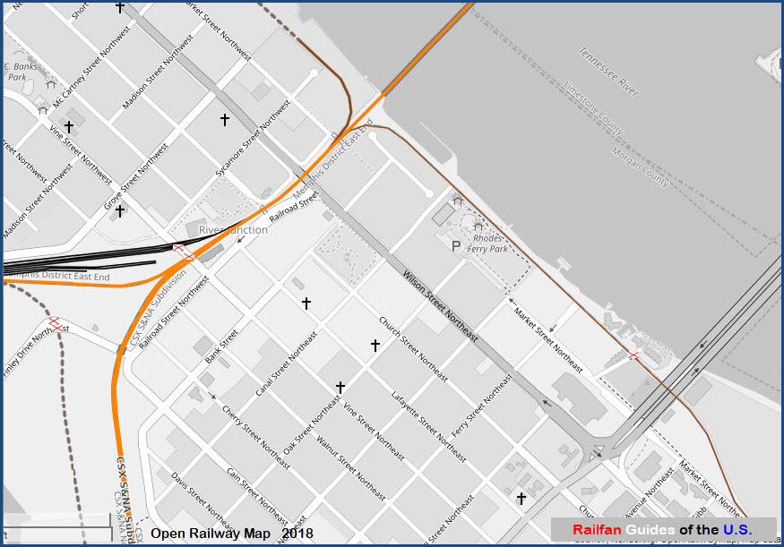
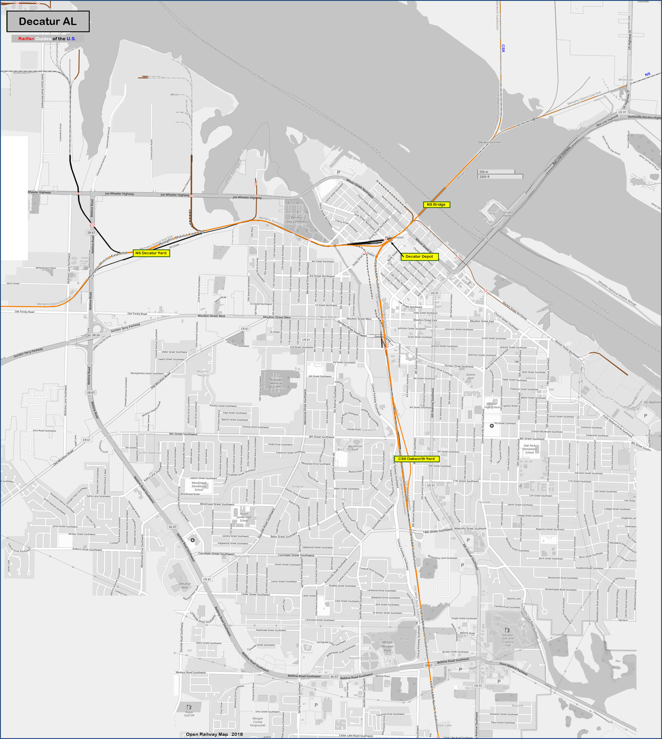
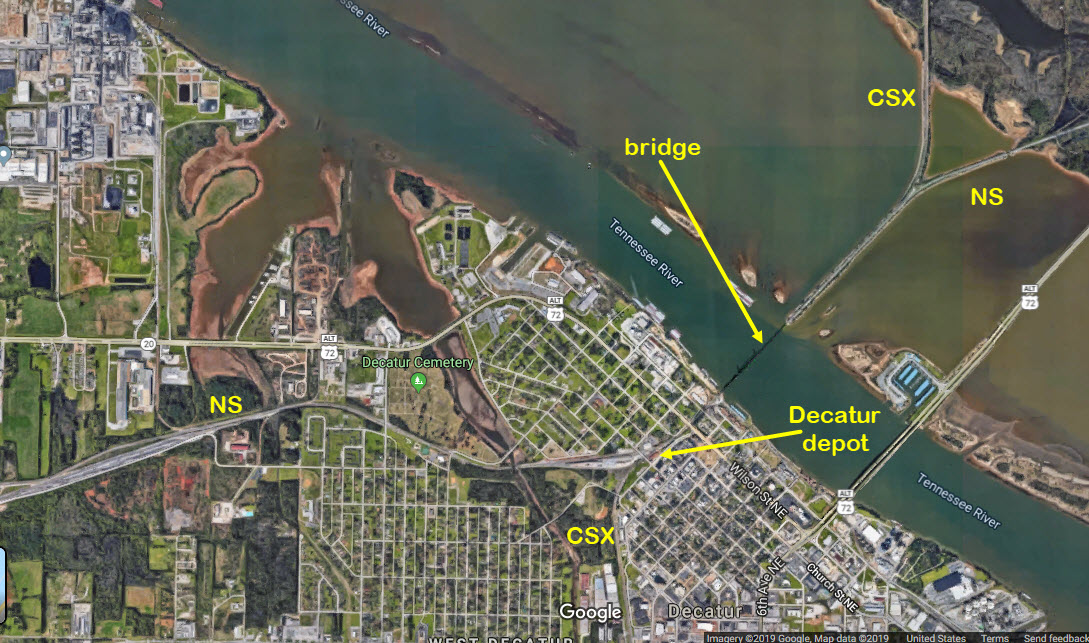
CSX Bridge Crossing the Tennessee River
Decatur Depot
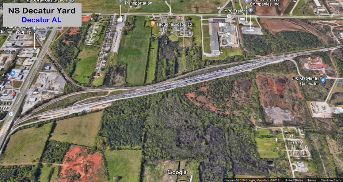
2 NS Yards
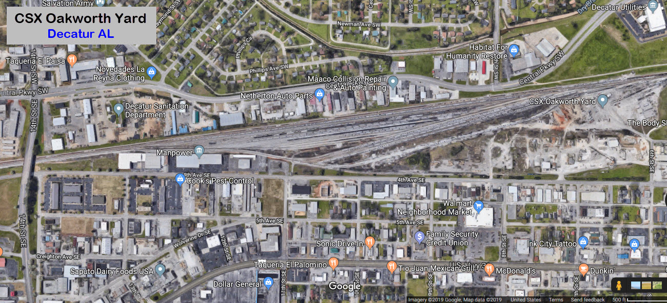
CSX Yard
Data:
GPS Coordinates: as needed
Phone A/C: 256
ZIP: 35601
Access by train/transit:
None
Scanner Freqs:
CSX 161.370 road [84]
CSX 160.410 dispatcher [20]
NS 160.950 road [56]
NS 160.845 road [49]
NS 160.290 dispatcher [12]
The Scoop:
Interesting town, in an interesting spot, with an interesting deal between CSX and Norfolk Southern so they can share the bridge to cross the Tennessee River. The bridge was built by the Southern Railway, it is AKA the Southern/Decatur Drawbridge.
Before CSX and NS, the Southern Railway and the Seaboard System (the old Louisville & Nashville) used to come thru here. Today, it is the CSX Nashville Division, the S&NA North Subdivision; and the Norfolk Southern Alabama Division, Memphis East Subdivision.
There are three yards located in the Decatur area. One is right at the CSX/NS split on the south side of the bridge. The main NS and CSX yards are a little further south.
Vine St NW slides by the side of the Depot, and crosses the small NS yard at the bridge at grade, and offers a good vantage point.
Approximately 55 trains a day come thru here.
There are 5 museums located a short distance from the Depot.
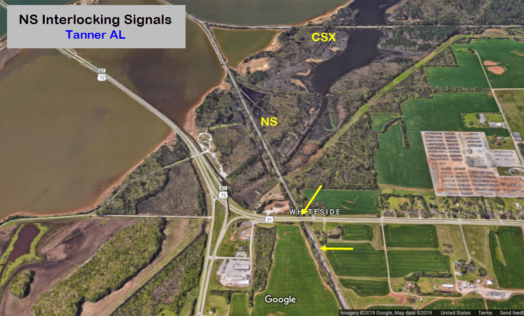
On the north side of the Tennessee River is Limestone County, where CSX runs pretty much straight-up north through Tanner and Athens, and on to Nashville TN on the S&NA North Sub. NS splits off while in the river, and heads northeast, passing through Huntsville AL on it's way to Chattanooga TN on the Memphis District East End.
Heading south from the bridge, CSX continues on the S&NA North Sub on it's way down to Birmingham AL, almost due south.
Norfolk Southern heads west to Memphis TN passing through Muscle Shoals AL and Corinth MS.
Acknowledgements:
Denver Todd
Brent Moore
Lee Boulineau
John D. Peterson
Bighorn Photography
alcheng1000
Carol M. Highsmith
Google Maps
Open Railway Maps
Websites and other additional information sources of interest for the area:
http://gregariousrailfan.com/DecaturAL.html
https://bridgehunter.com/al/limestone/bh38441/
https://www.youtube.com/watch?v=sTTg5todDJI video by alcheng1000
http://elevation.maplogs.com/poi/decatur_med_surg_clinic_us_31_decatur_al_usa.375170.html
https://en.wikipedia.org/wiki/Norfolk_Southern_Tennessee_River_Bridge
https://www.loc.gov/resource/highsm.07647/?r=0.102,0.37,0.694,0.298,0
http://www.decaturparks.com/account.php?accountid=315
The bridge is about 5 air miles off of I-65.
On the south side of the Tennessee River, take exit 334, go west 4.4mi on AL 67, to US 31 and take a right, this is 6th Ave SE.
Go about 3.4 mi north to Wilson Street NE, and take a left. You will pass by the CSX yard on your left.
You will pass over the tracks in 2900 feet.
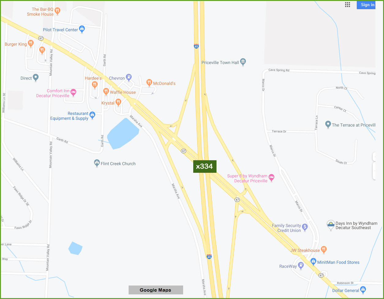
GPS Coordinates: 34.613549, -86.986472
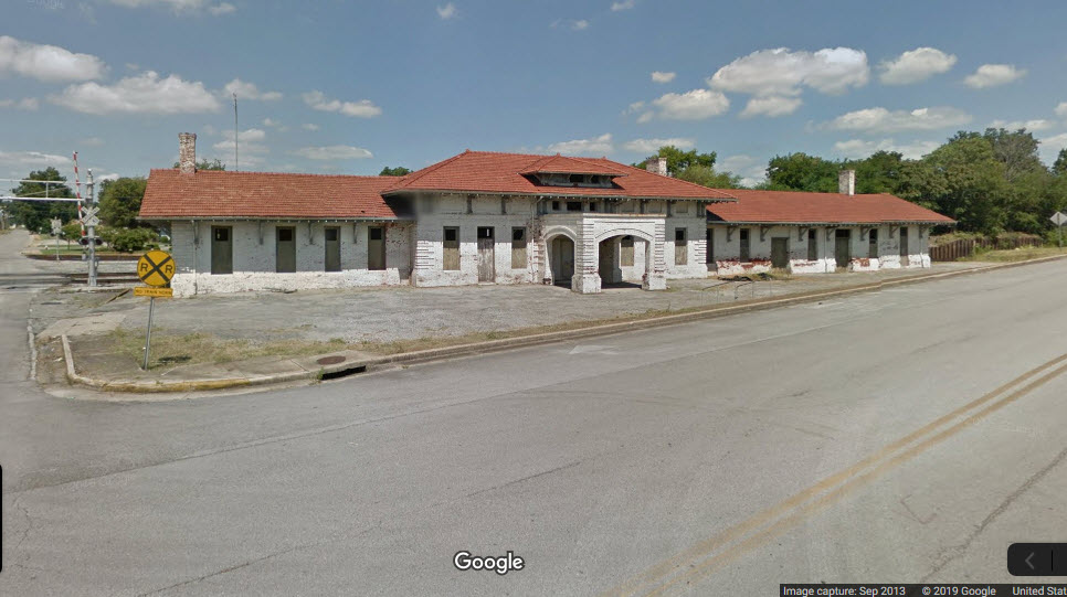
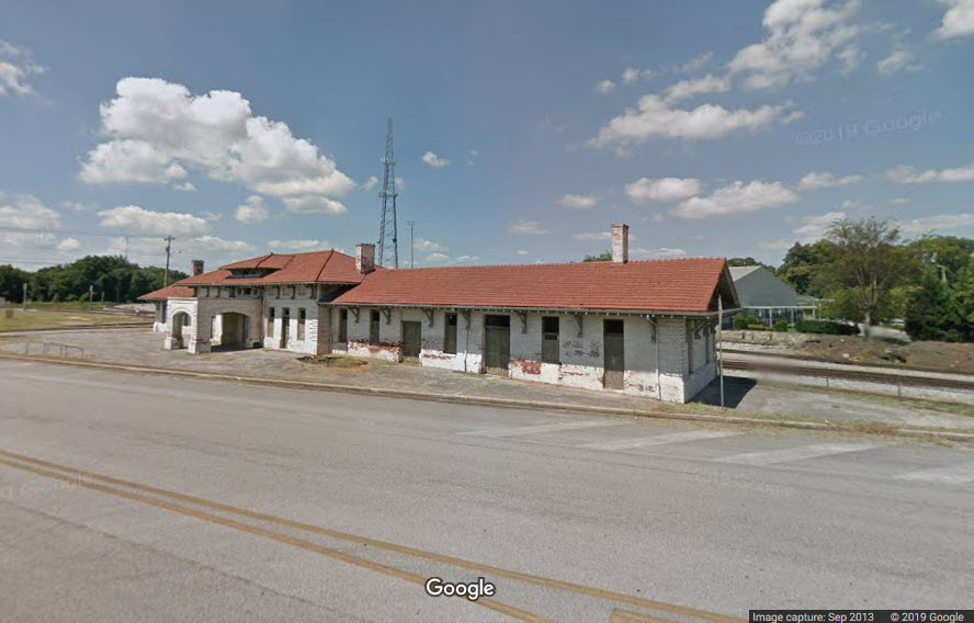
701 Railroad St, Decatur AL 35601
256-565-3788
Hours: Monday thru Friday, 10am to 12noon, and 1pm to 3pm
https://en.wikipedia.org/wiki/Southern_Railway_Depot_(Decatur,_Alabama)
https://www.northalabama.org/listing/decatur-historic-railroad-depot/1591/
https://www.decaturdowntown.org/work-inprogress/railroad-depot
http://www.encyclopediaofalabama.org/article/h-4055
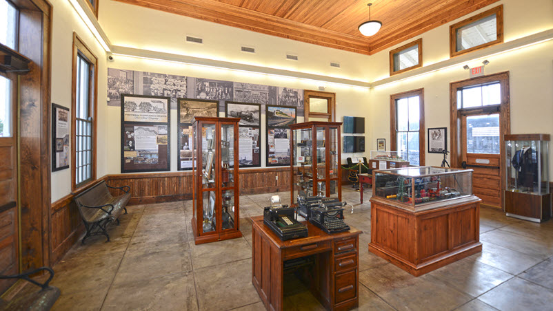
The depot was built by the Southern Railway in 1905. The depot now houses a museum. You can watch the train action from the track side of the depot, as it is was never moved back and is only feet from the tracks.
From Wikipedia: The Southern's last train through the city was the Tennessean (Memphis-Washington DC, discontinued, 1968). The last train by the L&N, and the train with the last route going south toward Alabama's largest cities, was the Pan-American, (Cincinnati-New Orleans) which ended in 1971. Other L&N trains passing through were the Azalean (Cincinnati-New Orleans) and the Humming Bird (Cincinnati-New Orleans). The depot last functioned as a passenger station in 1979, when Amtrak cancelled its (Chicago-St. Petersburg / Miami) Floridian service.
GPS Coordinates: 34.612705, -87.020648 (center of yard)
GPS Coordinates: 34.585790, -86.984528 (center of the yard)
GPS Coordinates: 34.618073, -86.980747 (center of left span)
https://bridgehunter.com/al/limestone/bh38441/
https://bridgehunter.com/al/limestone/bh69344/
https://www.youtube.com/watch?v=sTTg5todDJI video by alcheng1000
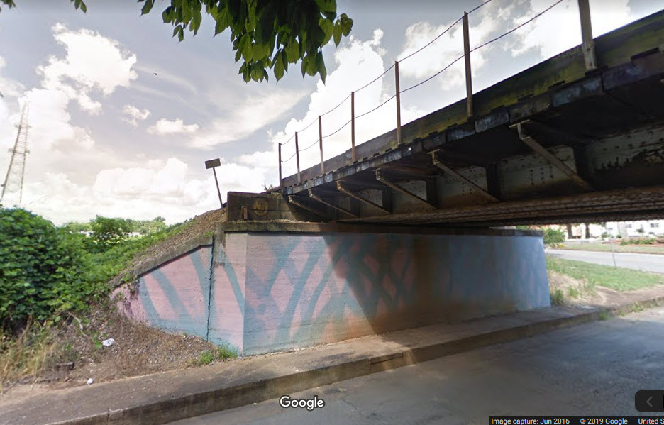
I believe NS owns the bridge, and CSX has trackage rights.
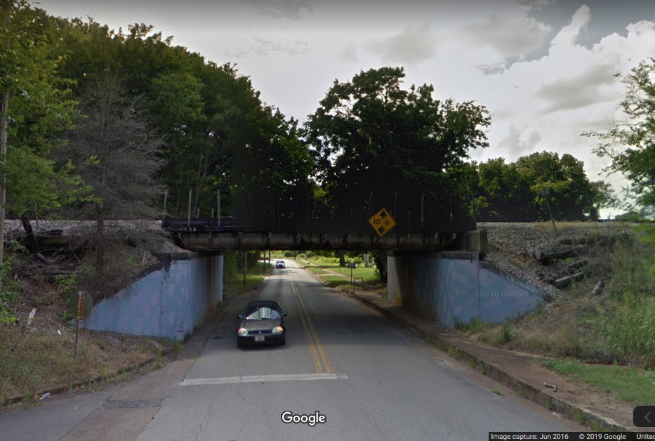
The longest span is 400 feet, and the entire bridge is 1200 feet long.
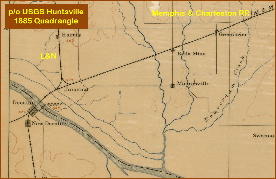
The Bridge Hunter page says: The first bridge built on this spot was burned during the Civil War, and replaced with a pontoon bridge. A swing bridge was built in 1885, and it was replaced by this modern drawbridge in 1978-79.
The tower on the southern shore, from what I can read, was the old control tower when there was a swing bridge here, and apparently, the bridge was located closer to the southern shore of the river. There's not that much on the second Bridge Hunter page listed.
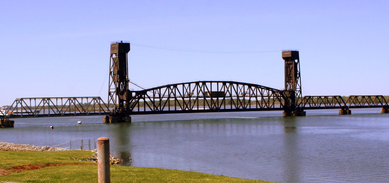 Photo by Brent Moore
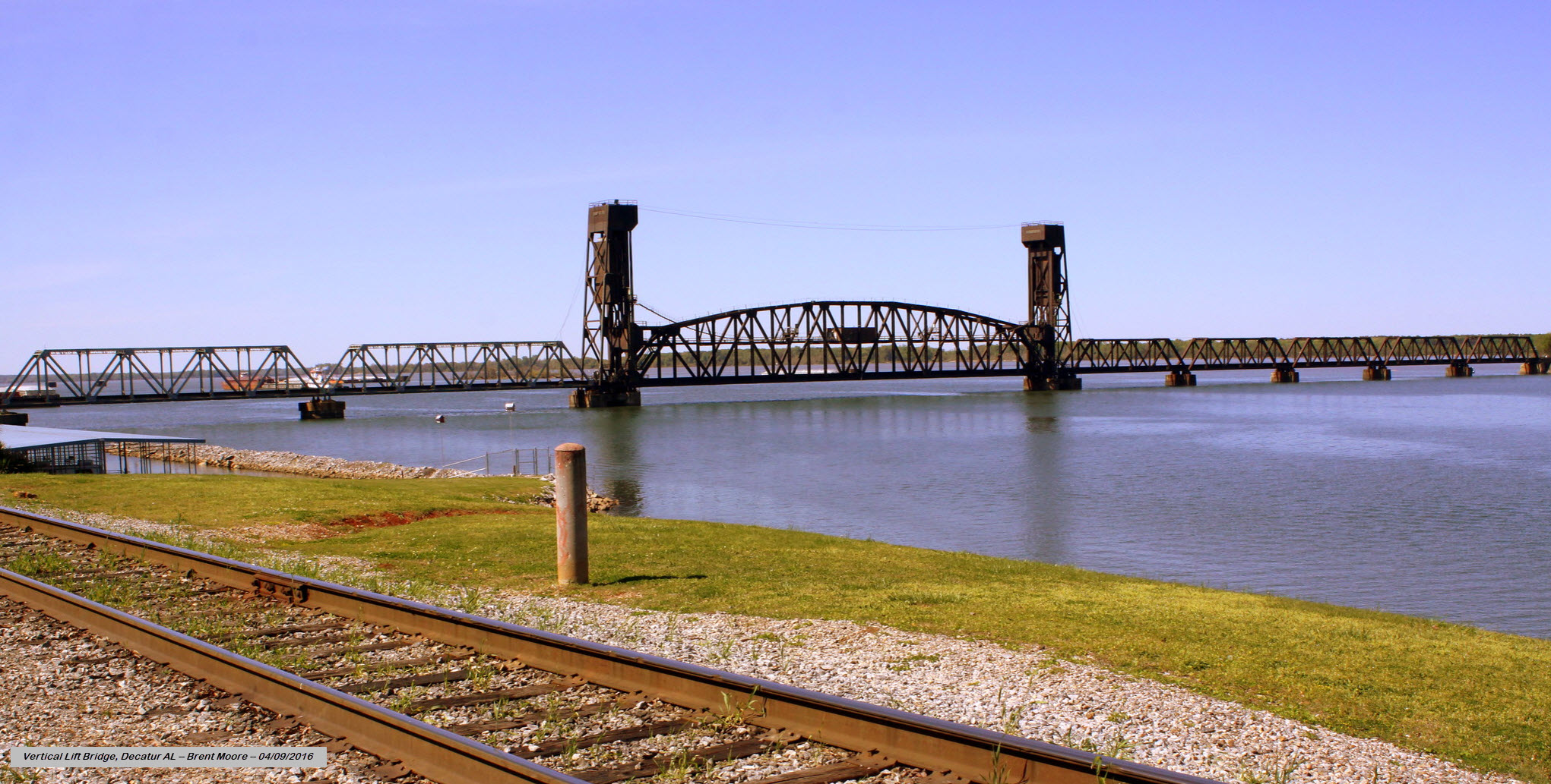 Photo by Brent Moore
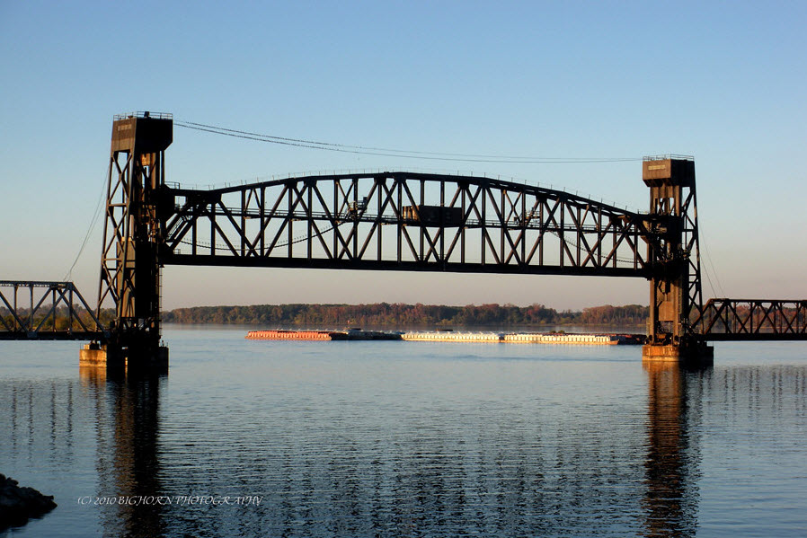
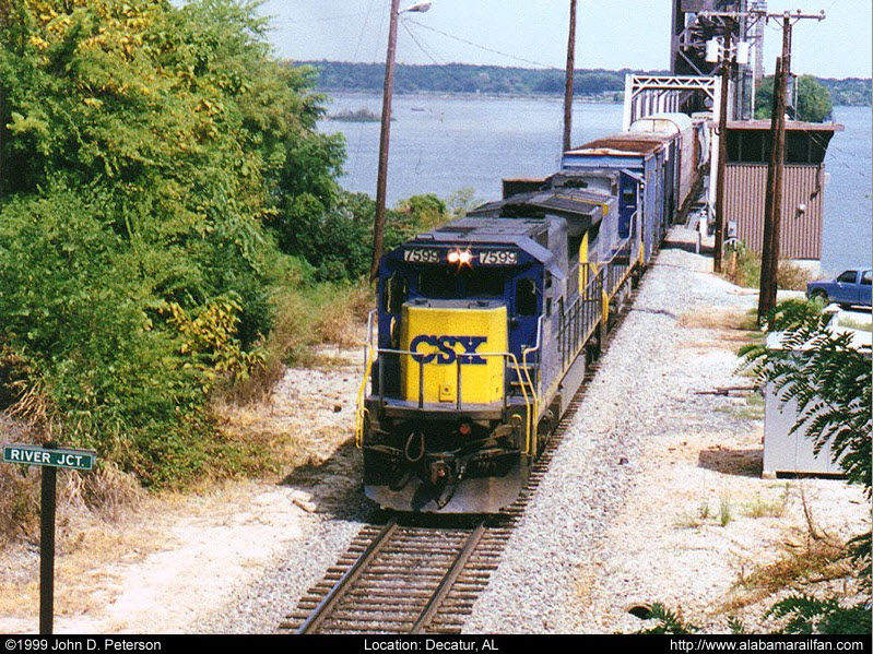
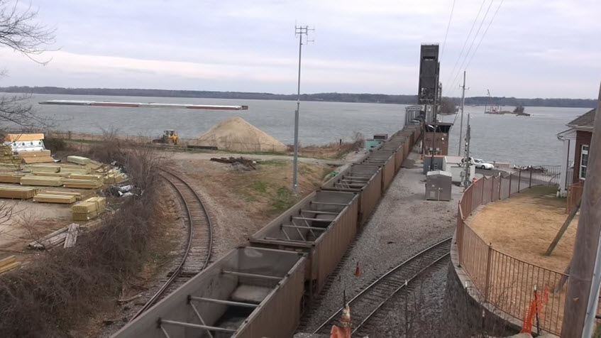 photo by alcheng1000, 12/27/2017
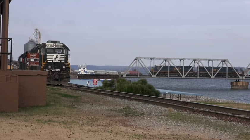 photo by alcheng1000, 12/27/2017
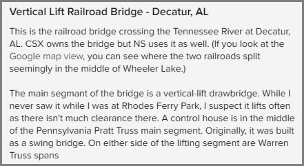
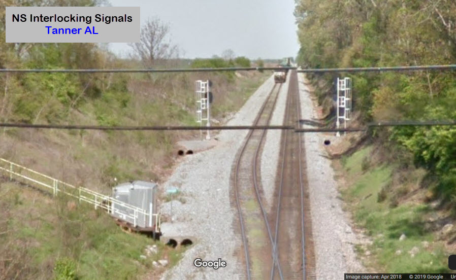
 from Wilson St NW/US Alt 72/AL 20
GPS Coordinates: 34.611640, -86.988612
These signals guard the NS/CSX split on the north shore of the bridge, wish I had better pictures for ya'll....
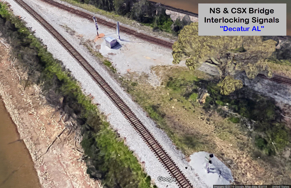
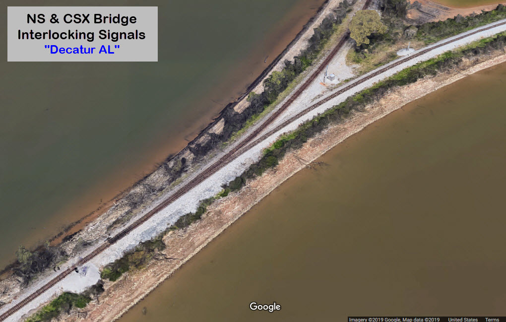
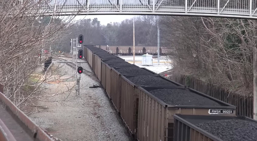 photo by alcheng1000, 12/27/2017
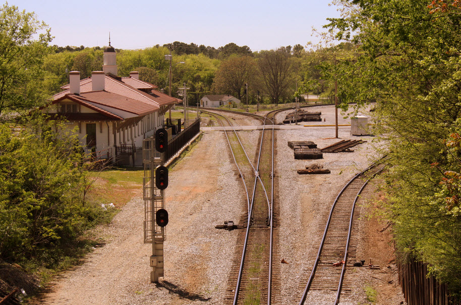
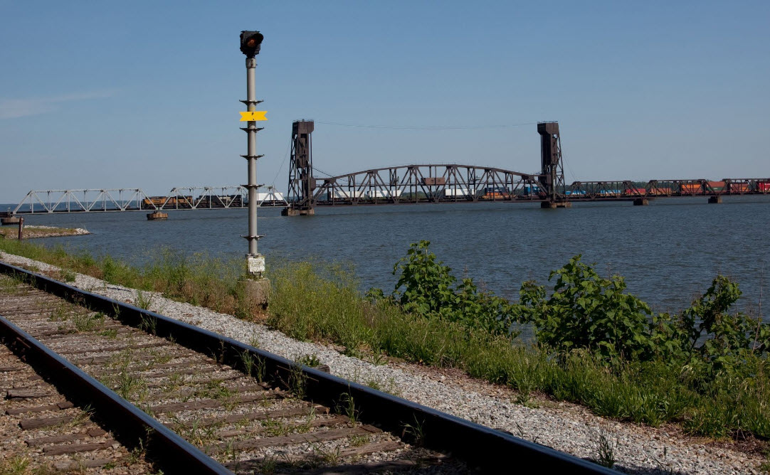 photo by Carol M. Highsmith, 05/09/2010
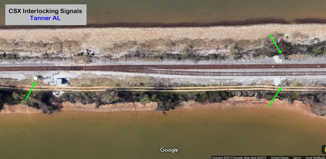
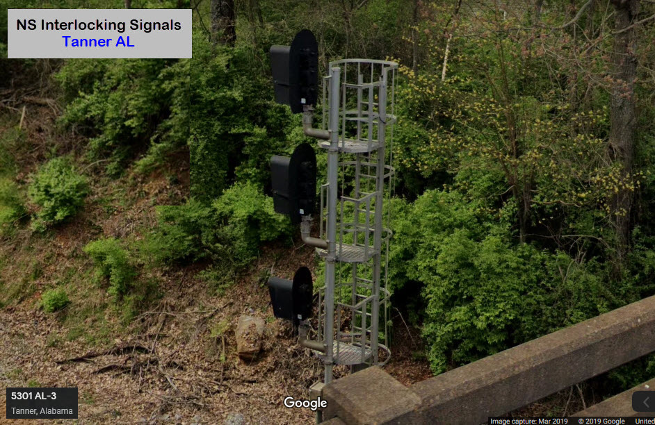
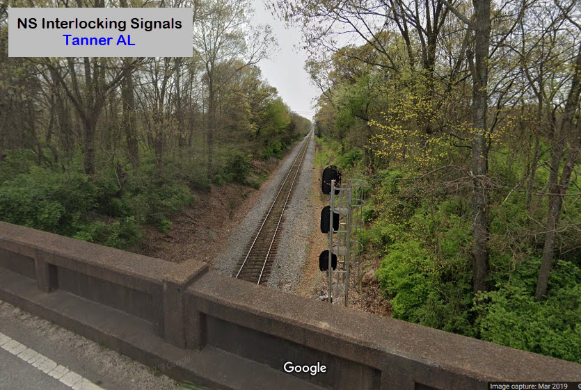
A little further north from where CSX and NS come together, the NS tracks go from two tracks to a single track to go over the bridge. Fairly good pictures can be had from the highway 31 overpass, however, looking north, there is a pair of telephone cables in the shot.... finding a way to get to the service stairs might be a way around this, but then, you would be trespassing....
Did U Know?
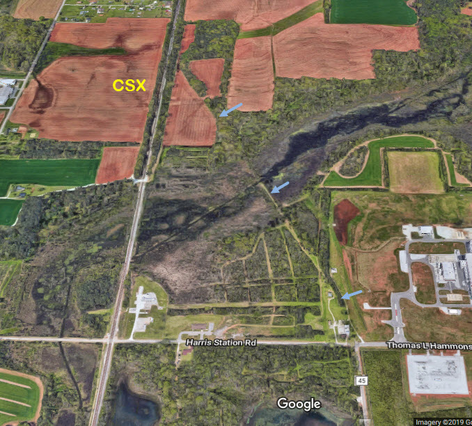
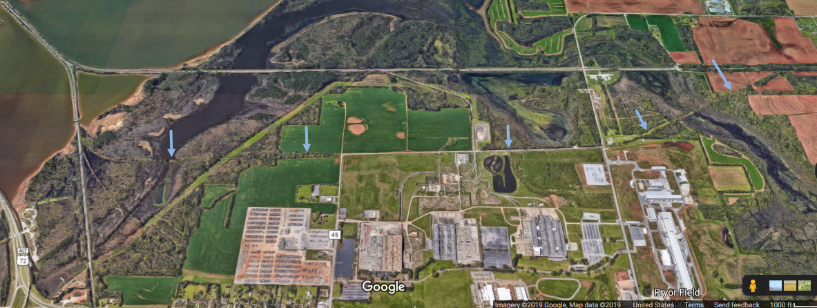
It appears from the aerial view, that the Southern had a wye (in the green circle), a siding or maybe another interchange to the Seaboard off that siding (the blue arrows), and one other siding coming off the mainline (the yellow arrows).
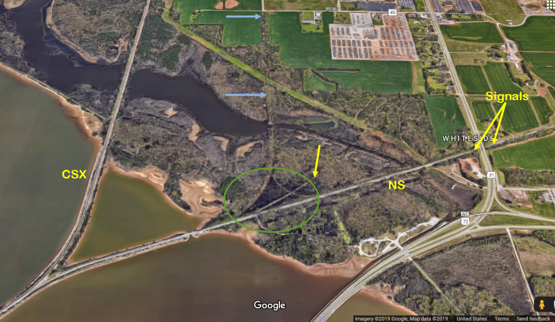
Courtesy of the University of Texas Library, click here for their index page.
Disclaimers:
I love trains, and I love signals. I am not an expert. My webpages reflect what I find on the topic of the page. This is something I have fun with while trying to help others.
Please Note: Since the main focus of my two websites is railroad signals, the railfan guides are oriented towards the signal fan being able to locate them. For those of you into the modeling aspect of our hobby, my indexa page has a list of almost everything railroad oriented I can think of to provide you with at least a few pictures to help you detail your pike.
If this is a railfan page, every effort has been made to make sure that the information contained on this map and in this railfan guide is correct. Once in a while, an error may creep in :-)
My philosophy: Pictures and maps are worth a thousand words, especially for railfanning. Text descriptions only get you so far, especially if you get lost or disoriented. Take along good maps.... a GPS is OK to get somewhere, but maps are still better if you get lost! I belong to AAA, which allows you to get local maps for free when you visit the local branches. ADC puts out a nice series of county maps for the Washington DC area, but their state maps do not have the railroads on them. If you can find em, I like the National Geographic map book of the U.S..... good, clear, and concise graphics, and they do a really good job of showing you where tourist type attractions are, although they too lack the railroads. Other notes about specific areas will show up on that page if known.
Aerial shots were taken from either Google or Bing Maps as noted. Screen captures are made with Snagit, a Techsmith product... a great tool if you have never used it!
By the way, floobydust is a term I picked up 30-40 years ago from a National Semiconductor data book, and means miscellaneous and/or other stuff.
Pictures and additional information is always needed if anyone feels inclined to take 'em, send 'em, and share 'em, or if you have something to add or correct.... credit is always given! Please be NICE!!! Contact info is here
Beware: If used as a source, ANYTHING from Wikipedia must be treated as being possibly being inaccurate, wrong, or not true.
RAILFAN GUIDES HOME
RAILROAD SIGNALS HOME
NEW JUL30/2019, AUG01/2019, JUN17/2020, DEC10/2022, MAR09/2023
Last Modified 09-Mar-2023