In General
Locations:
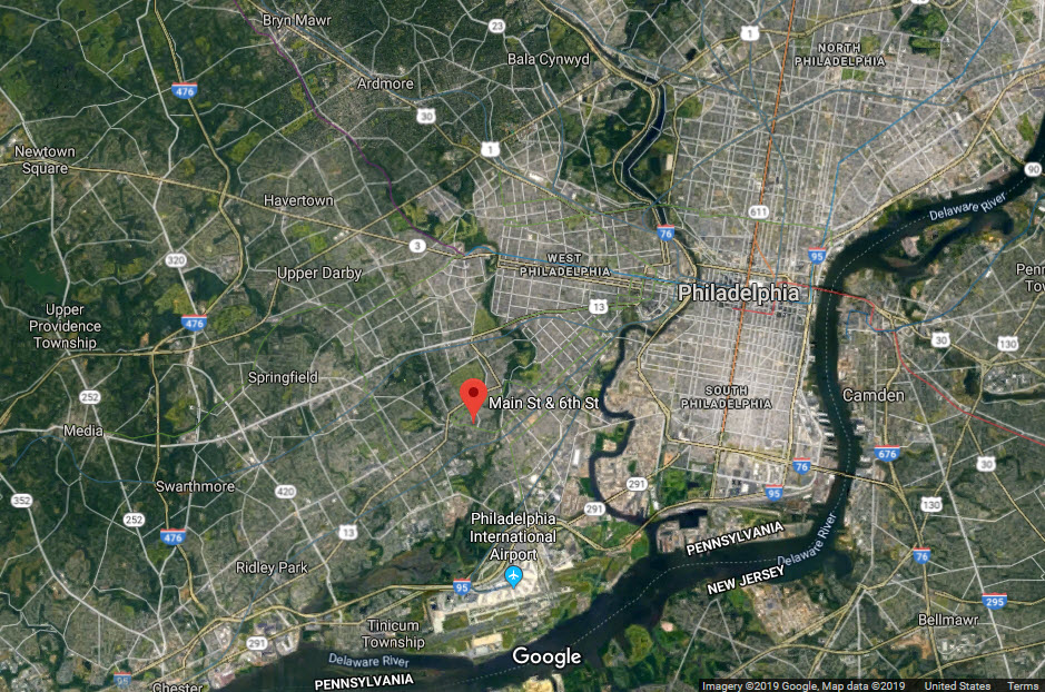
Darby
San Francisco
Tampa
Memphis
Scenes from the Past:
Baltimore MD/Dundalk Ave
RAILROAD SIGNALS HOME
Locations:
Darby PA
San Francisco CA
Tampa FL
Memphis TN
The Scoop:
This page covers a relatively unique "thing" in both the railroad and trolley worlds: a crossing between the two of them. As noted above, there are four of them known in the United States.
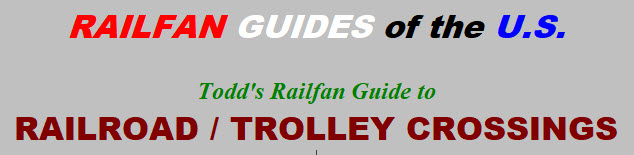
The one in Darby PA is between the CSX mainline that runs from Baltimore MD to Philadelphia PA, and the #11 Surface-Subway Streetcar line.
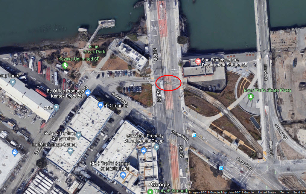
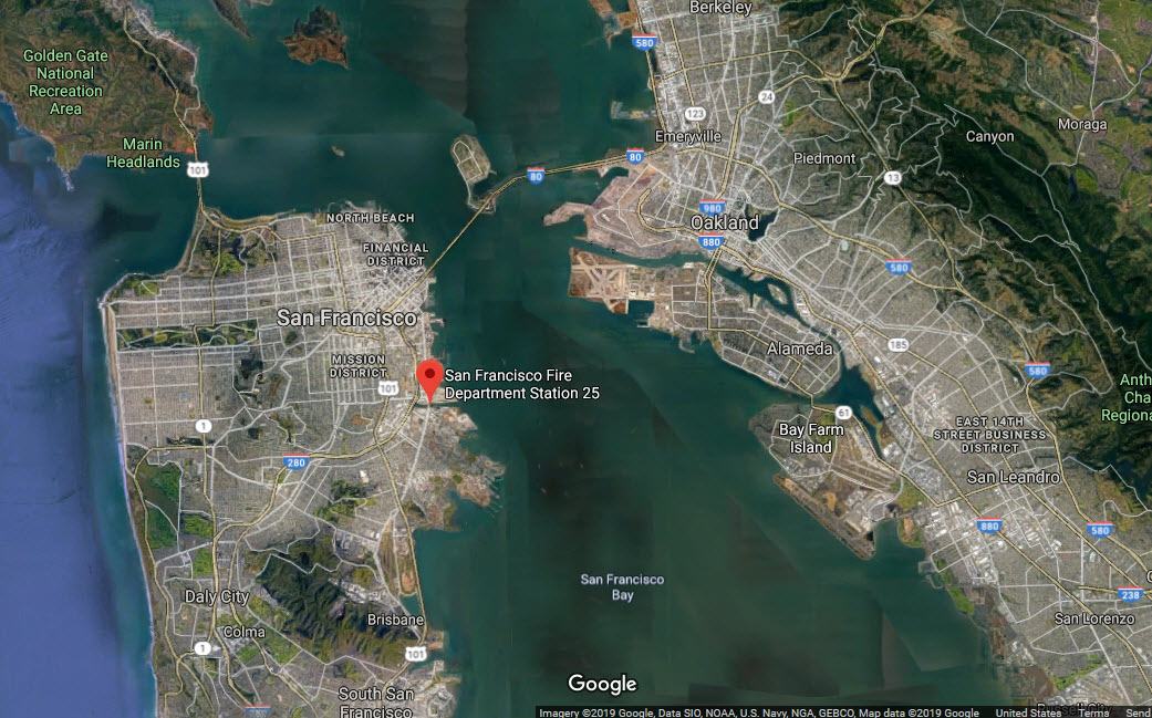
The one in San Francisco is between the UP and the San Francisco T at 3rd Street along the water.
The one in Memphis is between the MATA Streetcar system and the Canadian National.
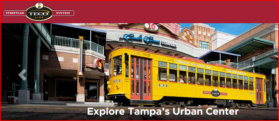
The newest one of them is in Tampa, being installed as a result of the construction of the TECO Streetcar System, and its crossing with CSX.
I have only been to the one in Darby, so that is the only one I can cover in detail.
Acknowledgements:
John Buxton
Rob Catlin
Denver Todd
Google Maps
Websites and other additional information sources of interest for the area:
https://railfanguides.us/septa/darby2/index.htm A whole page on the crossing in Darby PA
http://www.tecolinestreetcar.org/#/home
Pictures / Info
GPS Coordinates: 39.917784, -75.255658
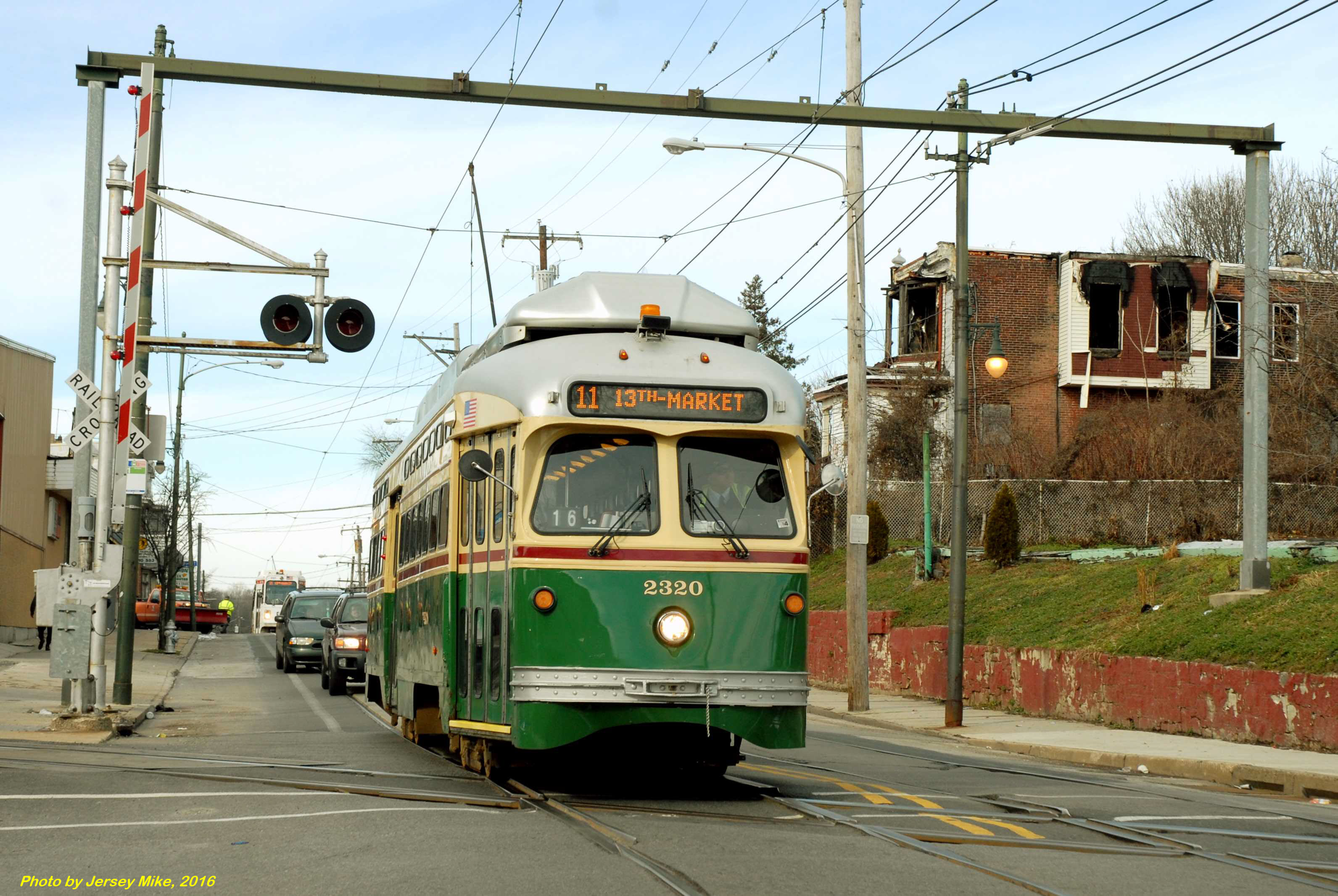
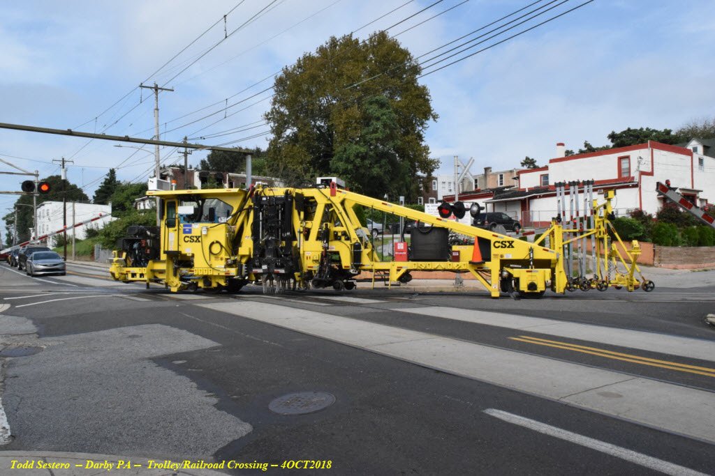
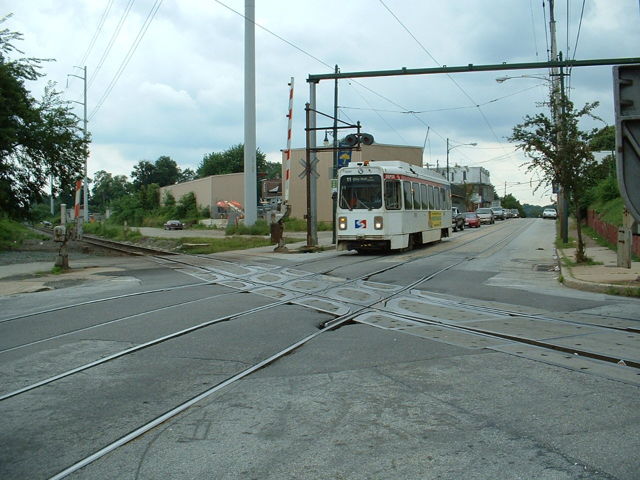
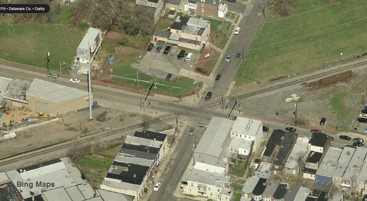
Crossing between SEPTA's #11 Subway Surface Line and CSX.
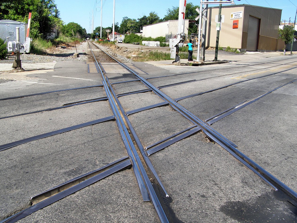
This crossing, out of the three, may be the busiest. A streetcar rambles by on the average of one every few minutes, and at certain times, there seems to be a parade of them one after another. On one of our visits to this crossing, detection electronics went nutsy, and kept the crossing gates down, and the streetcars were stacked up about 6 deep on each side before a CSX technician came along, which I have to say, once we called it in, he was there in five minutes! If you compare the crossing of the first two pictures with the other ones, you will notice that a massive amount of work has been done on the crossing. There are lots more detail photos on the DARBY2 page. This crossing, by nature, is not signaled other than the crossing gates protecting it, in comparison to the other two crossings.
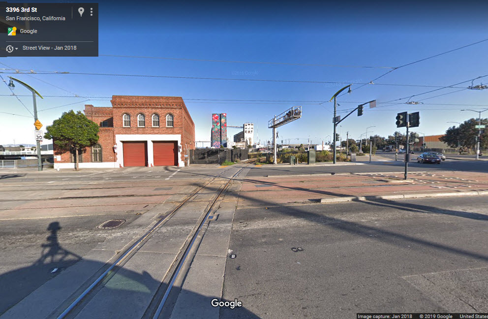
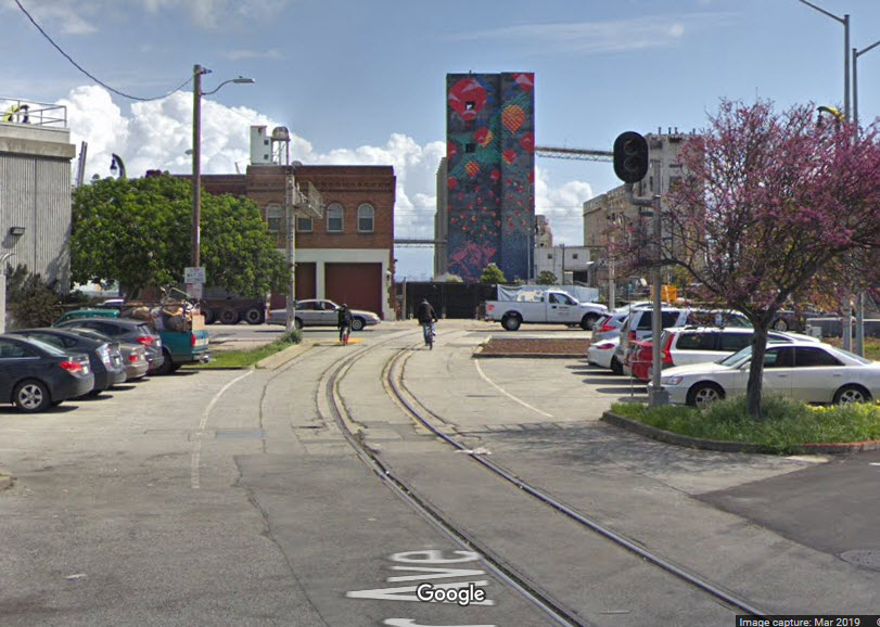
GPS Coordinates: 37.746518, -122.387243
Crossing between the San Francisco Muni and the UP: the Cargo Way Crossing.
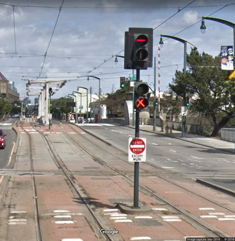
I don't know how busy the Union Pacific traffic is here, but I'm sure there are a whole lot more streetcars here than trains. This is an interesting area because of the UP servicing the docks. The UP tracks are signaled in both directions for the crossing, altho it looks like they are approach lit. The northbound streetcar signal has an extra head with an "X" on it, and I am not sure if it is for the grade crossing or not, for there is not a matching signal on the SB side.
Here is some additional information sent in by an anonymous contributor: For the Cargo Way crossing, it is signalized in both directions. The Southbound signal is north of the bridge that spans Islais Creek, right before the bridge starts. That area is set up so that if a freight train is on its track, the signals will go red. If the bridge is going up, same thing, all signals go red. There is a second crossing which is even more infrequently used at Carroll Ave. The signals are at Donner Ave going northbound, and Bancroft going southbound. The signaling system for both of these crossings requires a LRV to pass over a loop prior to the signal to "call" for a permissive aspect. Unlike the interlocking signals, to my memory, the Vetag console does not need to be used, if a train rolls over the loop then it gets its signal unless a freight train is approaching or a bridge lift is occurring.
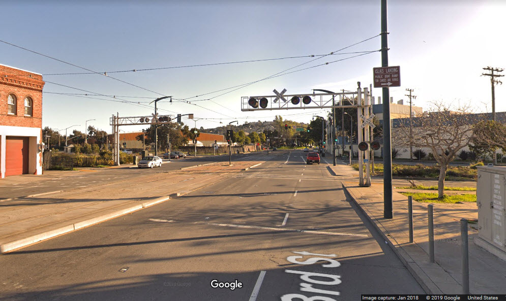
North Bound Signals before crossing the Islais Creek bridge, looking north.
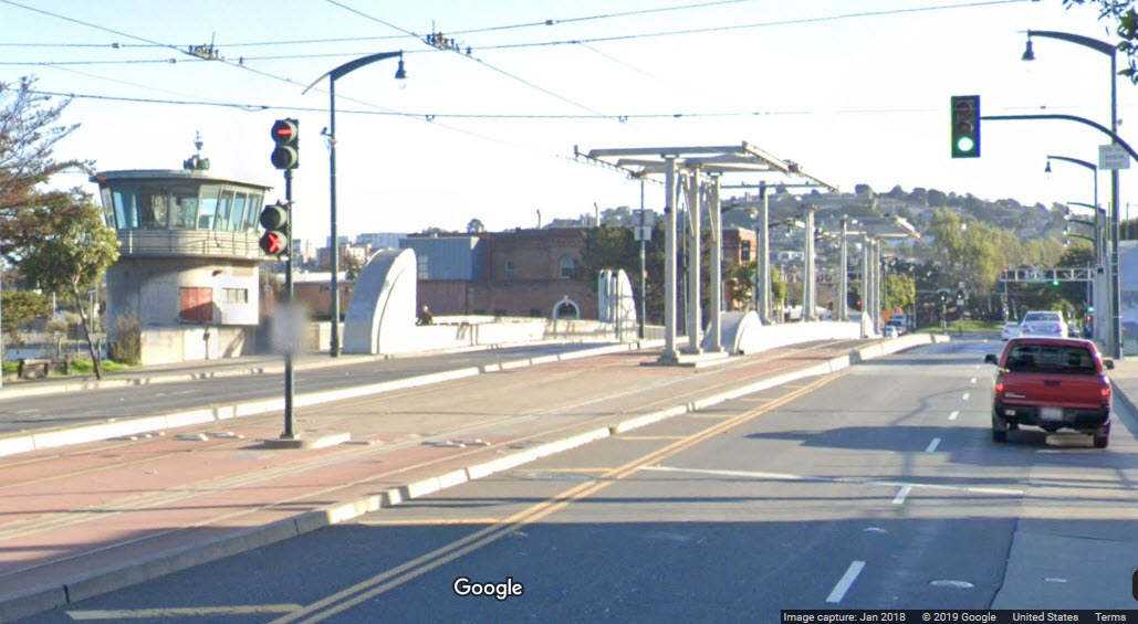
South Bound Signals before crossing the Islais Creek bridge, looking south - the Third St & Marin St station is directly behind me.
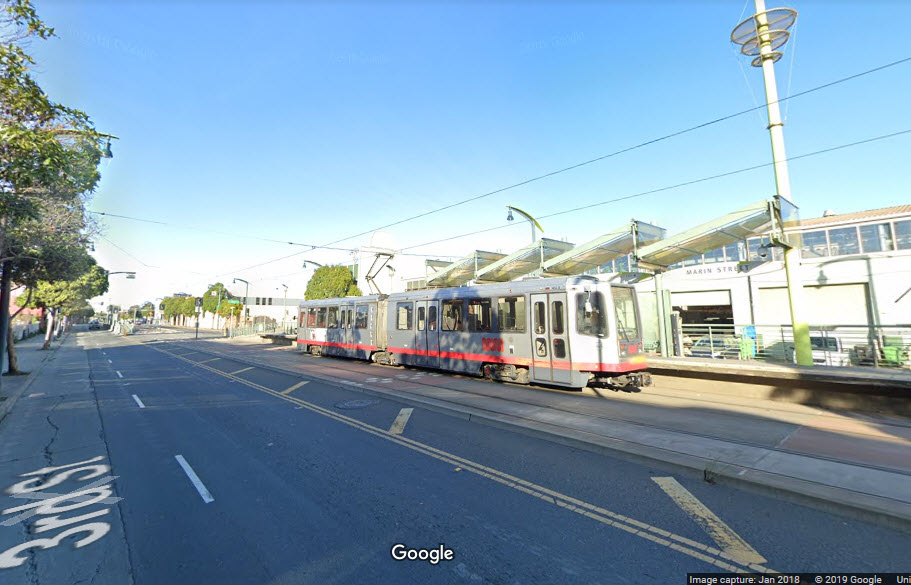
A train at the Third St & Marin St station, heading NB.
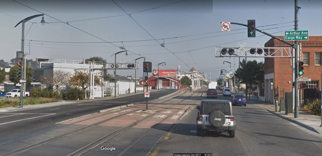
 From Arthur Ave
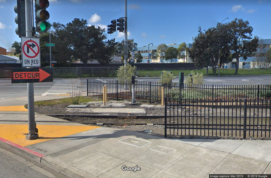 An outbound signal, not for the crossing
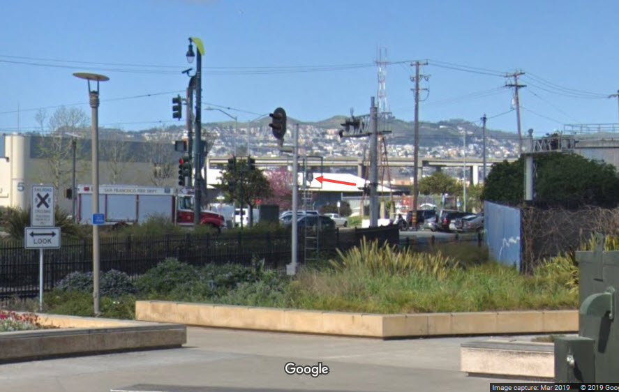 From Illinois St
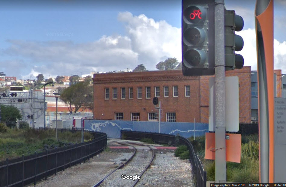
I've never seen an intersection with so many different lights - train, vehicular traffic, streetcars, and bicycles.....
 From Illinois St
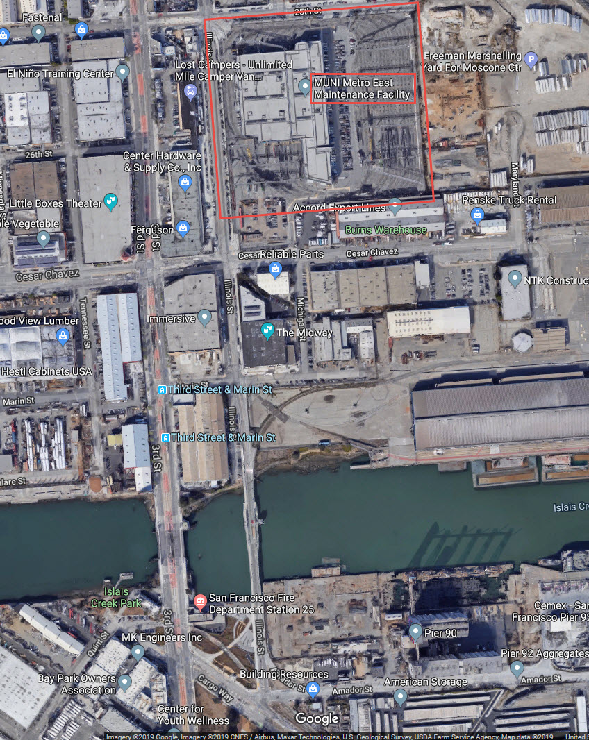
The Muni shops are one block off of Third St, and 3-4 blocks from the bridge.
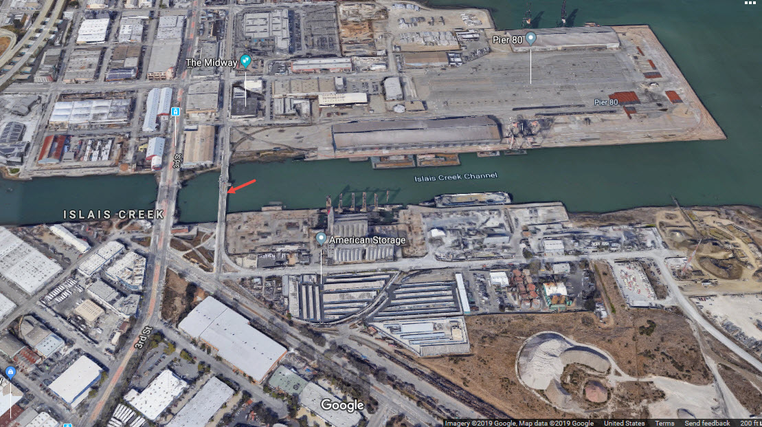
And if you're in the neighborhood taking pictures, you might try to catch a UP train crossing the Illinois Street bridge over to Pier 80, appers to be a lot of switching action if you can catch it.
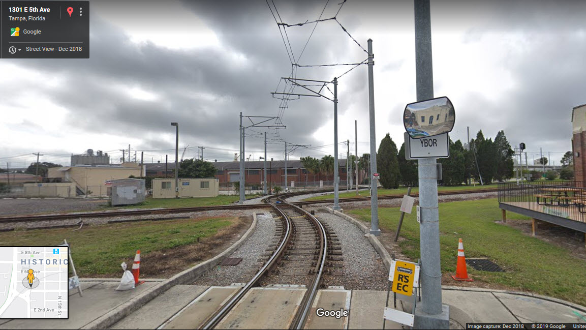
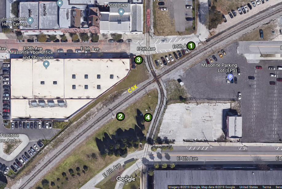
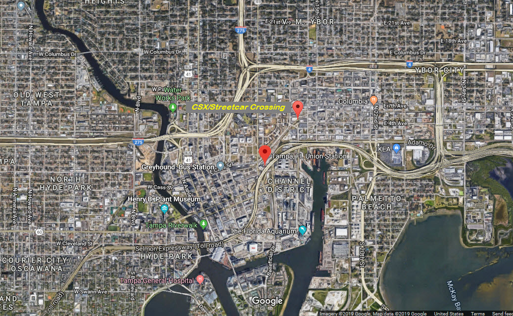
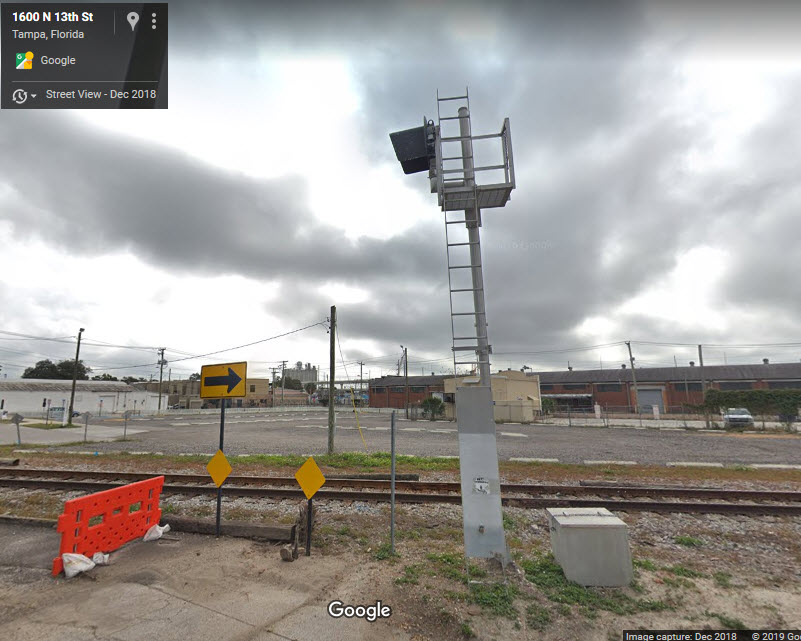
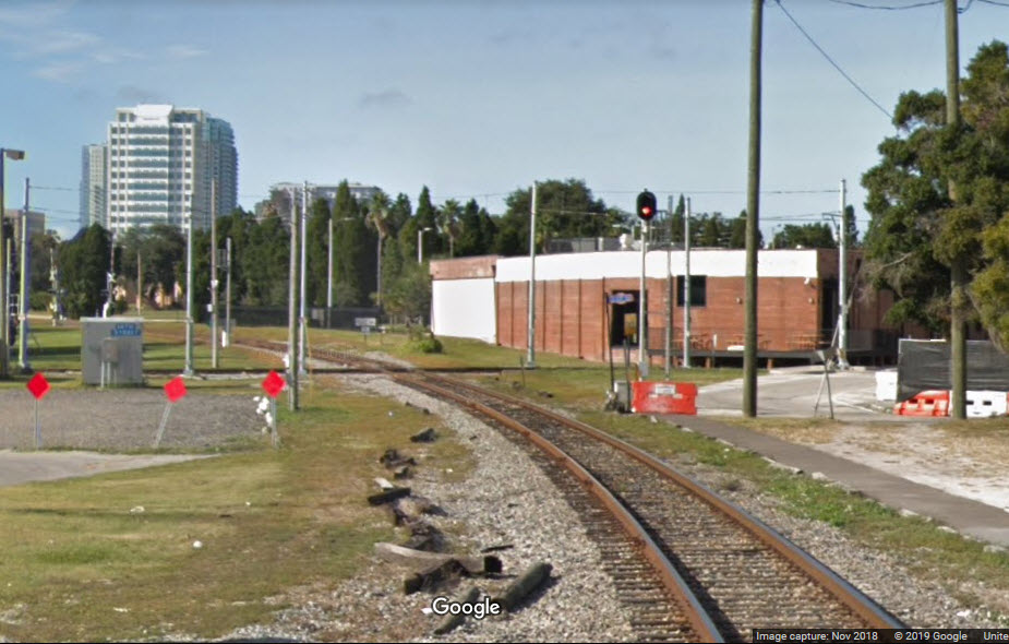
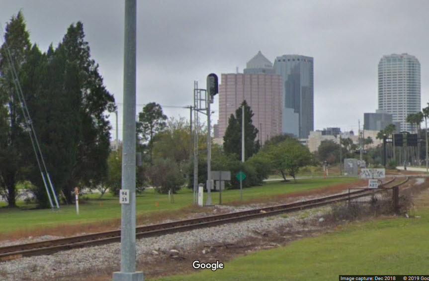
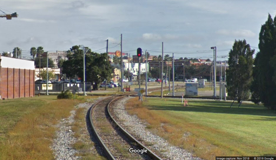
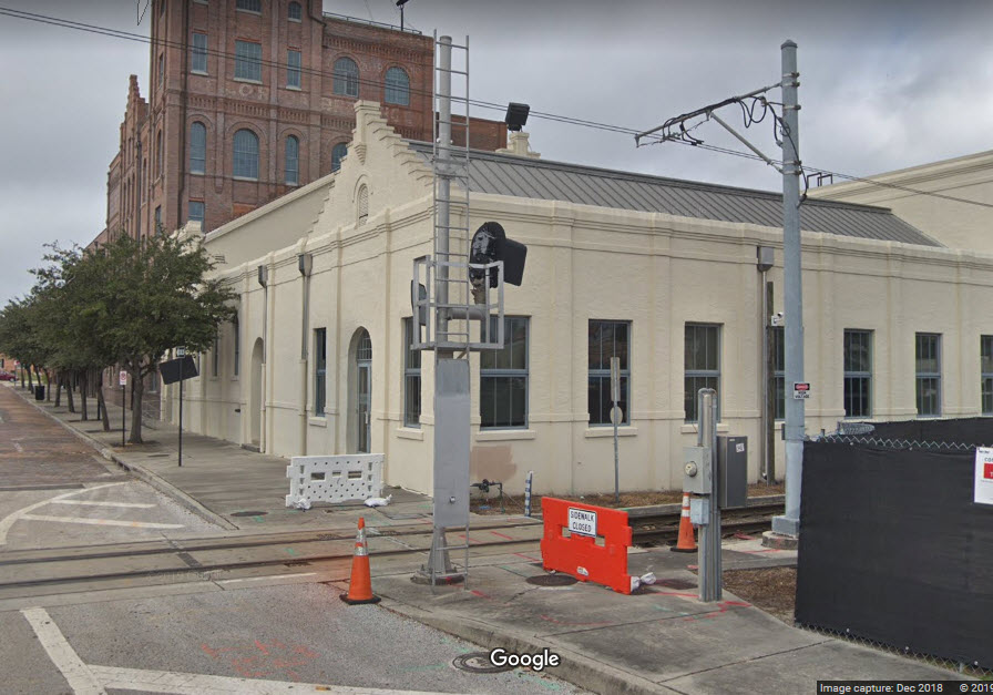
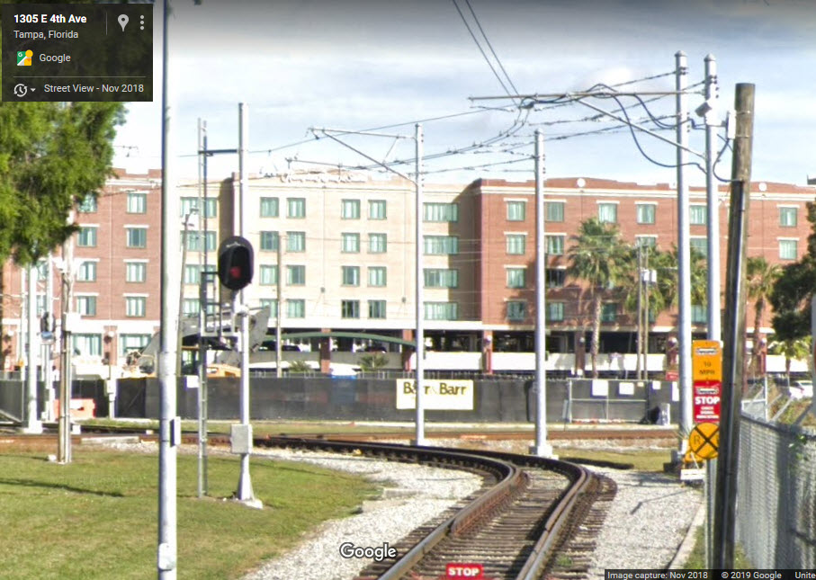
GPS Coordinates: 27.958650, -82.445382
Crossing between the TECO Streetcar System and CSX.
The TECO Streetcar System was completed in 2010, and consists of 11 streetcars, 10 of which are replica streetcars running on a 2.7 mile line.
Looks like they strived to make this crossing as close to a 90 degree angle as possible, looking at the aerial shots.
The crossing is fully signaled for both CSX and the streetcar system.
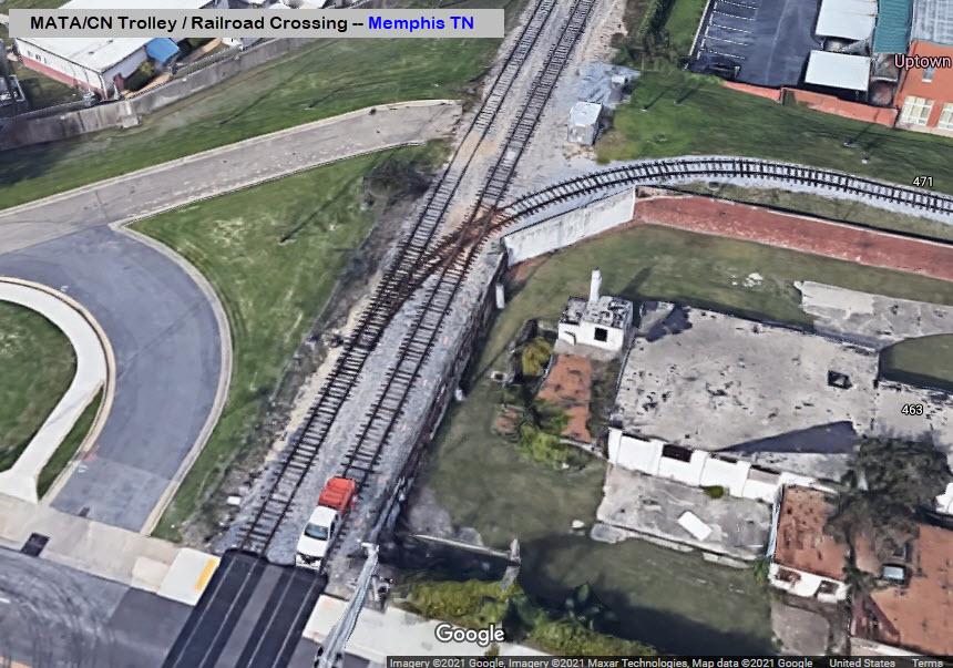
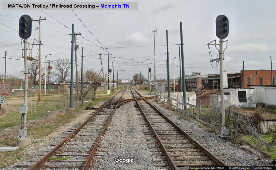
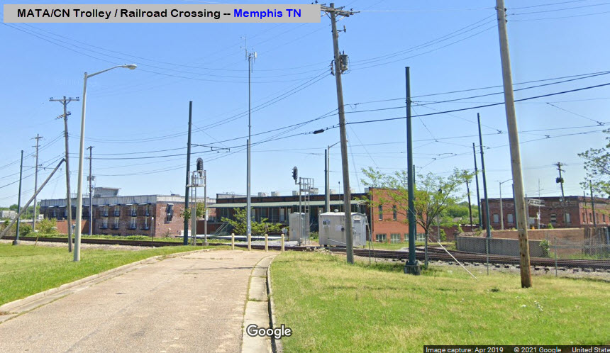
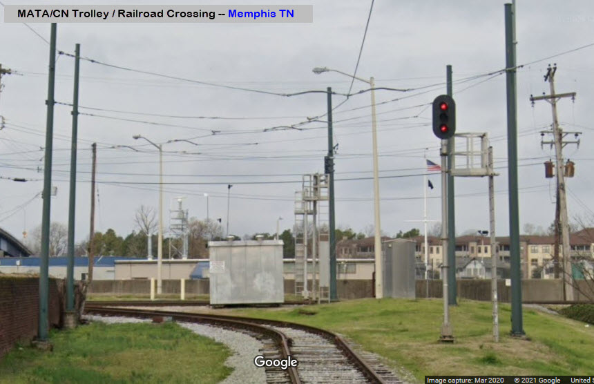
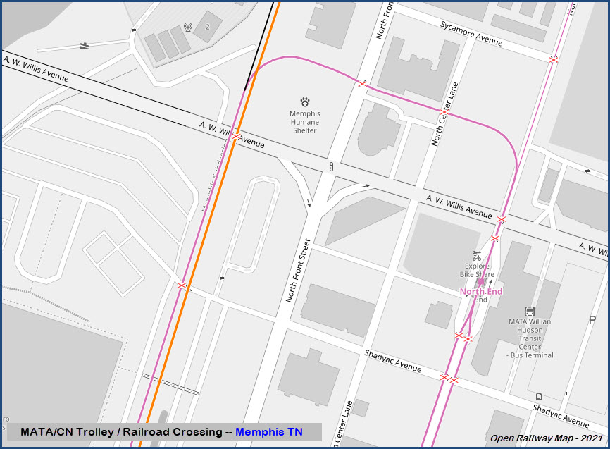
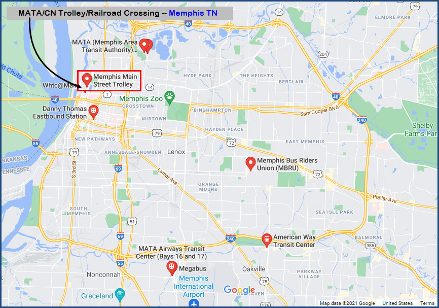
GPS Coordinates: 35.15807, -90.04990
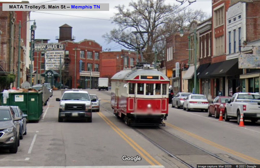
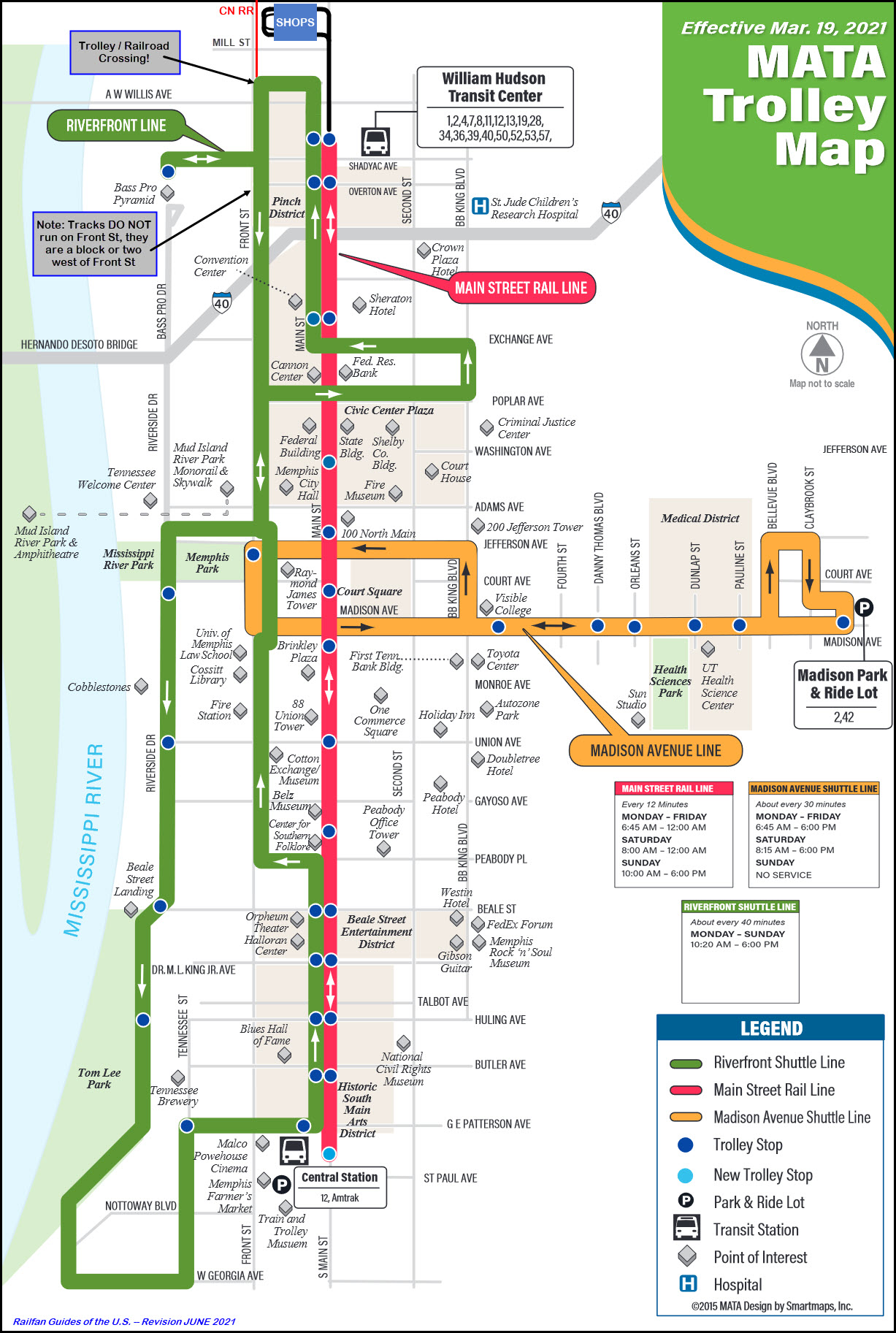
Crossing between the MATA Trolley and the CN.
The MATA Trolley is a heritage streetcar transit system operating in Memphis TN. It started operation on April 29, 1993.
At the bottom is a slightly modified map of the system to include the shops, and a note that the tracks shown on Front Street, do not actually run down Front - they are either a block or two west of Front St depending on where it is.
The crossing is fully signaled, although it looks like only the WB trolley signal approaching the diamond is lit all the time.
At least from what I can tell from the Google Streetview pictures, the CN signals are approach lit.
Scenes From The Past
Trolley/Train Crossings from the Days of Yore
Baltimore MD / Dundalk Ave
Sometime in the 1950's
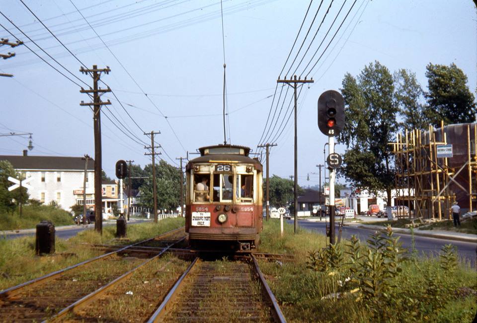 shared by Rob Catlin of the BSM
Disclaimers:
New format 10/26/23: Please check out my disclaimer page for my standard dribble and contact info here
RAILFAN GUIDES HOME
RAILROAD SIGNALS HOME
NEW 06/19/2019, DEC18/2019, MAY07/2021, JUL10/2025
Last Modified 10-Aug-2025