Access by train/transit:
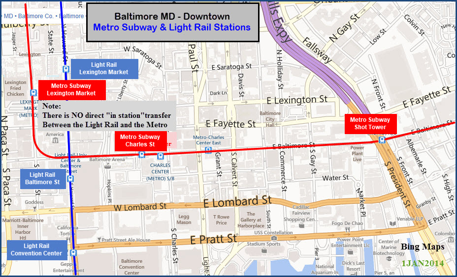
Light Rail at Lexington Market - altho it is a block away
MARC Camden Line is 6 blocks away from the Charles St station
Penn Station (MARC Penn Line/Amtrak/Light Rail) is a 9 block walk from the State St station
The Scoop:
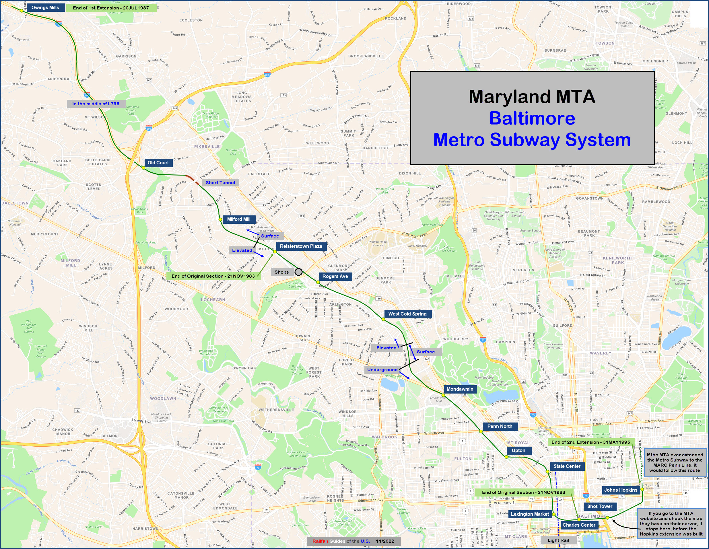
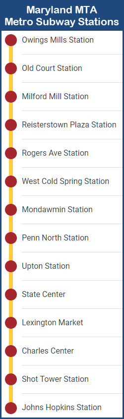
The Baltimore Metro Subway system, hereafter called the
Baltimore Metro system, is a simple system. It consists of a grand total
of 14 stations, nine of which were included when the system first opened
(Charles Center to Reisterstown Plaza).
The system opened for business in 1983. It was later
expanded northward to Owings Mills in 1987. The latest expansion, in 1994,
extended the downtown service to Johns Hopkins Hospital in East Baltimore.
It takes about a half an hour to traverse the route one way.
The system is 15.2 miles long, with 6.2 miles of it
underground. Of the remaining 9 miles, 2.2 miles of it are elevated, and
6.8 are at grade. Above Old Court Road and the Beltway, the line runs up
interstate 795, making it basically a commuter railroad, cause it certainly
isn't convenient to anything if you don't have a car. According to the
stats on Wikipedia, the cost of the total system ran 1.392 billion bucks.
One of the more interesting things I found out while
working at the MTA's Light Rail division is that above Reisterstown Road, for
some unknown reason, the gauge is a quarter inch less than the standard 4"-8
1/2". There is a 30 foot section where the two gauges "mesh".
Most people are unaware of this fact, including people that work at the Metro system.
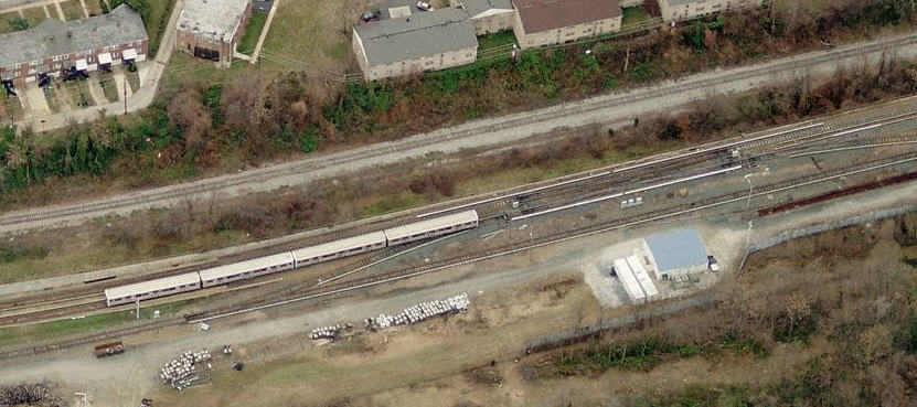
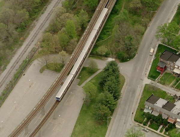
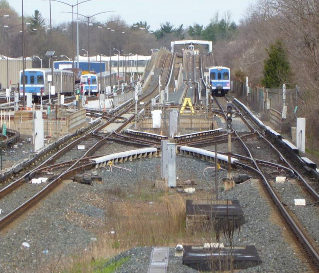
The heavy rail shops are located
between the Rogers Ave and W Cold Spring stations. Altho shots of the yard
itself aren't really possible, satisfactory pix can be had of some of the shop
and yard operations from the fence line along Wabash Ave. I've never been
bothered taking pix from there, even tho it is across the street from one of the
Baltimore City district courts, with plenty of police going by. Fairly
decent pictures can be had from a passing train, but this supposes you can find
a halfway good window. Also just down the street, is the Northwest bus depot.
The cars were built by Budd, in a (now closed) plant
northwest of Philadelphia. The cars are identical to those used on the
Miami system, in fact, they were ordered at the same time to lower the
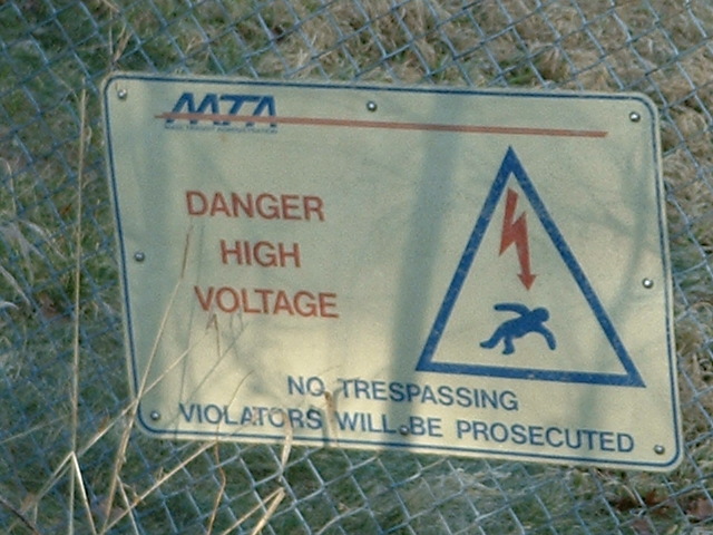
cost. They draw power from a typical heavy rail third rail system, which
operates at 600VDC. The cars consist of married pair, which never
get separated unless being serviced, because each individual car has different
systems needed for the two to operate as one. The cars are 72 feet long,
and 9.5 feet wide. They have a top speed of 70mph, altho the top speed is
kept to the speed limit of i795 so people won't race the trains! Trains
can have 1, 2, or 3 pairs of cars, depending on the time of day. Each pair
can handle 166 passengers, with 76 being seated, and 90 standing.
Because of cost, the only expansions to the line that have
been considered were to the Amtrak NEC going straight up Broadway, and/or
heading northeast to the Whitemarsh area, altho this expansion has been
protested by the local residents, not wanting to go thru what the CBD went thru
when they originally built the system, and when the expansion to Hopkins
happened (a dedicated busway was given as an alternative, but that hasn't
happened either due to the population density in the northeast area).
From Wikipedia: The line currently uses 100 cars manufactured by the Budd
Company at their Red Lion plant in Northeast Philadelphia. Most were delivered
in 1983 with a supplementary set of essentially identical cars being purchased
in 1986 for the line expansion. The cars, marketed by Budd as the Universal
Transit Vehicle, are identical to those formerly used on the Miami Metrorail
because the two agencies built their systems at the same time and saved
money by sharing a single order.
Trains draw power from a third rail, 600VDC.
The cars are 75 feet (22.86�m) long, 10 feet (3.05�m) wide, and have a top
speed of 70�mph (110�km/h). Cars are semi-permanently attached in married
pairs and joined up to form 4-car trains, which is the normal train length.
Each car can hold up to 166 passengers: 76 seated, 90 standing.
The fleet had a significant overhaul between 2002 and 2005. Seats were
reupholstered, and the floors were replaced. External destination
rollsigns were replaced with LED displays; internal systems that
display train destinations and upcoming stop announcements were also installed.
In July 2017, the MTA announced the purchase of 78 new
railcars to replace the entire subway fleet. The cars will be built in Florida
by Hitachi Rail Italy, formerly AnsaldoBreda, and will be similar in appearance
to those purchased for the Miami Metrorail. The railcars are set to be delivered
in 2023. End Wiki
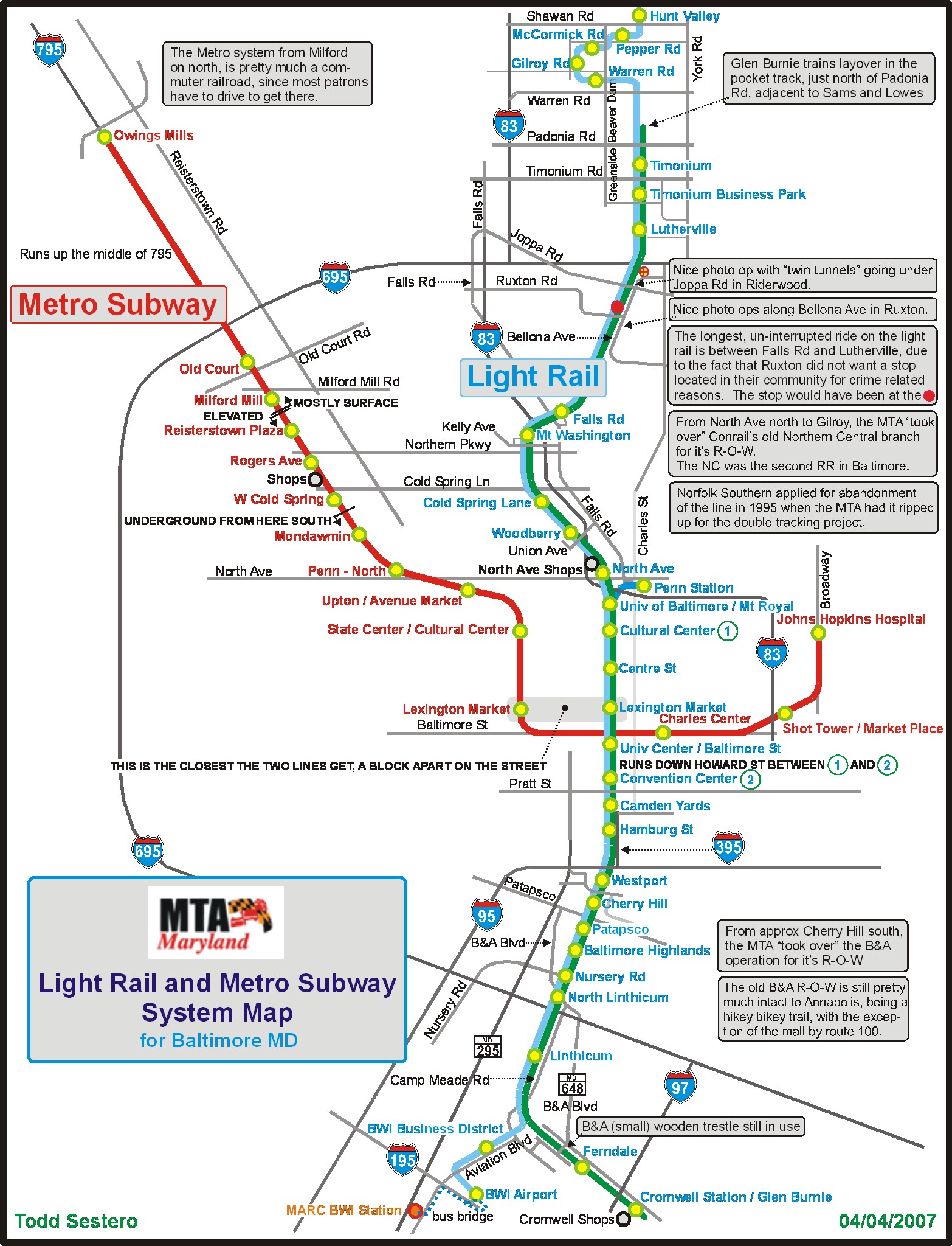
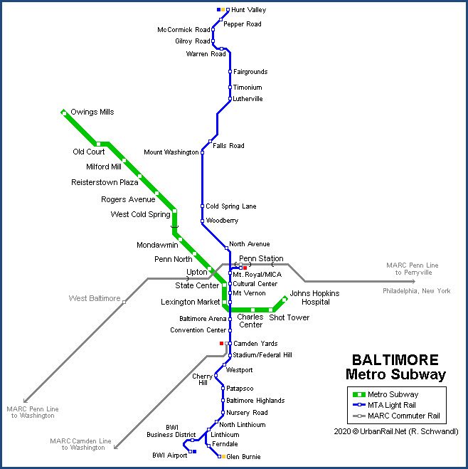
The map below is of both the Light and Heavy Rail systems
in Baltimore, and illustrates the lack of a common station for the two systems,
thereby making transfers between the two a royal pain in bad weather.
About 5 years ago (2017), I went on a tour of both the light rail and metro subway
shops. The MTA engineer leading the tour was part of a task force at 6 Saint
Paul Street (the MTA HQ) involved with specifying and ordering new cars and
signals. As of late summer 2022, the first of those cars has been
delivered.
Acknowledgements:
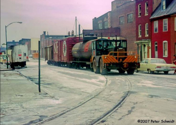
Peter Schmidt
Alancrh
Miami-Dade County Transit
Google Maps
Bing Maps
Wikipedia
The Metro System used to be run in the automatic mode,
where the operators only operate the doors, or in the case of an emergency,
the system could be put into the manual mode. Operators were required to make one trip a day manually
to stay in practice. This was called ATO,
or Automatic Train Operation. This
changed a number of years ago after several accidents happened on other
systems, while in the automatic mode, notably the one in DC where one train
ran into the back end of another one in the snow and sleet.
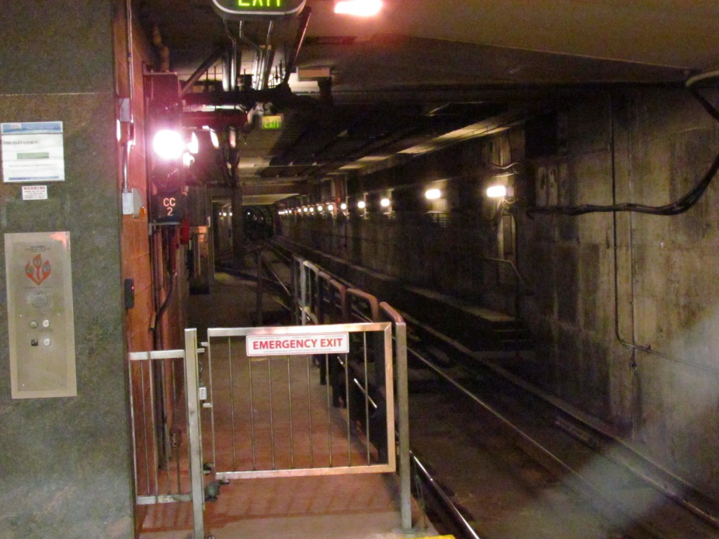
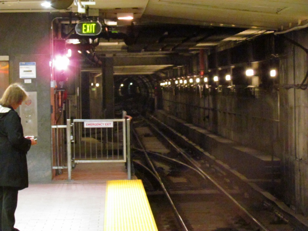
The signals were originally on the system as a means of back-up
when they had to operate in the manual mode. They appear mainly in
advance of crossovers, and in the yard all over the place.
The OCC, Operations Control Center, is located above
the Lexington Market station, and is the equivalent to Light Rail Control,
which was formerly located at the main shops north at North Avenue, but is
now in the same building as OCC. Everything for the
Metro system is controlled and monitored from here.
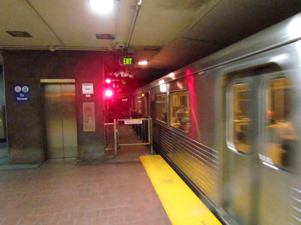
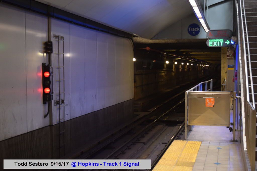
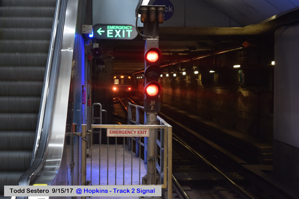
Trains headed towards Hopkins (Track 1) are considered eastbound,
while those to Owings Mills (Track 2) are westbound.
Trains run from 5am to midnight during the week, and 06:00
to 00:00 on the weekends. They run on 8 minute headways during the rush
hours, 11 minutes off peak, and 15 minutes on the weekends.
Fares are the same as on Light Rail, being $1.75 for a one
way fare, and $4.50 for an all day pass (all day pass for seniors is $2.10 as of
9/17). The fares are also good on the bus and light rail systems.
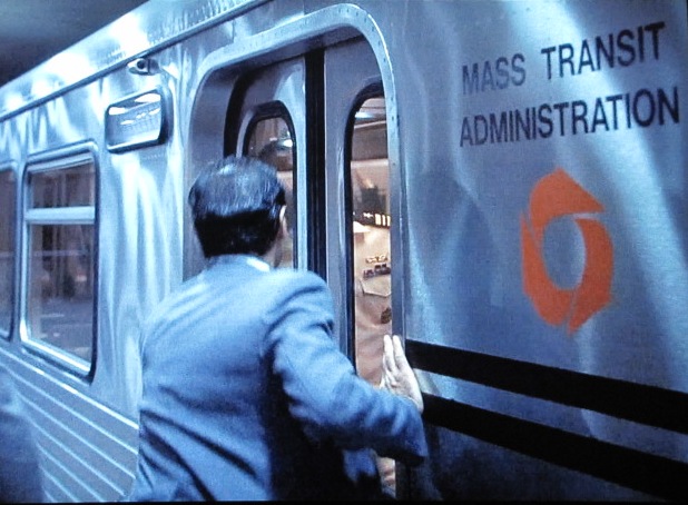
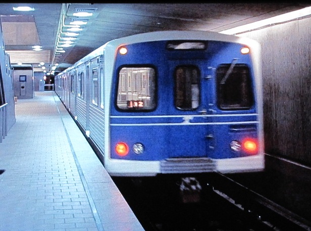
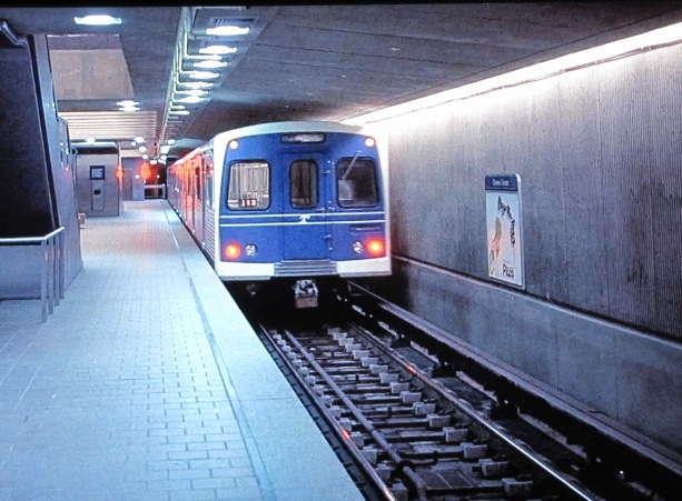
These three screen shots off my TV are from the movie No Way Out from 1987. The story takes place in Washington
DC, but I guess they couldn't work out a deal with the DC Metro system to shoot in their system. The scene was shot at Charles Center. In the scene following
this where Kevin Costner comes out of the subway, he's in Union Station. They made no effort to make the MTA cars look like WMATA cars.
Signals on the system are pretty simple. They are typical of the "newish" design philosophy, where they have departed from color light signals (for instance) of
the New York Subway system, and gone to basically a two aspect system with three indications. Why, who knows, someone (I guess) is always trying to re-invent things
because they think their way is better. Is this system really better? Can't say, don't know, and there is no definitive answer.
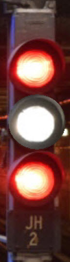
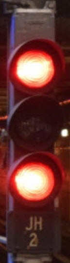
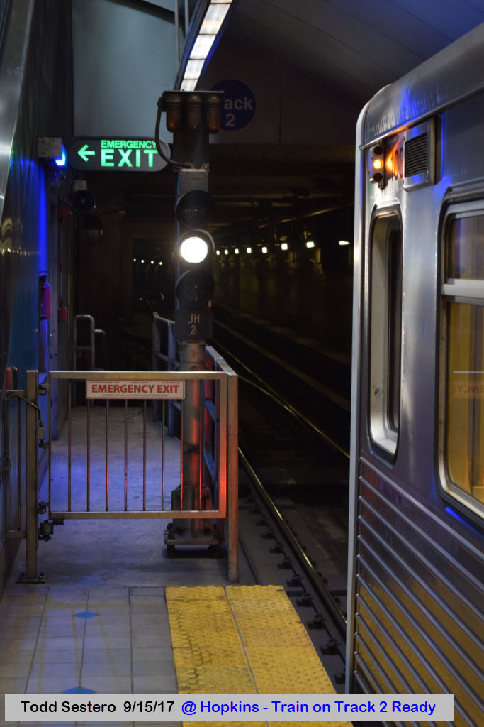
What the designers chose was to use a three aspect head, with lunar in the middle, and red lenses in the upper and lower positions, or,
red over lunar over red.
The two reds illuminate for stop.
The lunar illuminates for clear, and at interlockings, for a non-diverging movement.
The lunar flashes at interlockings when the route is aligned for a diverging movement.
If they had gone to a GRN-YEL-RED system, they could have been able to provide
their operators with a three block safety margin when operating in the manual mode, as opposed to just knowing if the block ahead was clear, and they could have used a flashing
yellow to note a diverging movement. And so it goes.
SB signal at the interlocking south of the Owings Mills station.
I have given the stations section of this page, a page of their own, therefore keeping this page down to a manageable size.
You will find the stations page here.
The new cars, are again being ordered from the manufacturer in cooperation
with the Maimi-Dade Transit purchase, and as such, will look very similar to them.
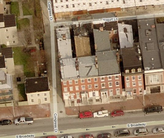
Todd's History and Nonsense Corner of Local Baltimore Trivia
I used to live at 7 S. Broadway, and when I re-roofed it, put a seven into the roof
using black colored shingles... made it
easier to find when I was flying around. For a rowhouse, it was big, being
24ft wide (most are like, 10-12-14 feet wide), and 80 feet deep, with 3 floors,
giving me a whopping 4800 square feet. 5, 7, and 9 were built by a guy for
him and his two sons, and 9, to the right, had a really nice carriage house on
the alley. I guess he didn't like his 2nd son as much as his first,
as #5 on the left is just a tad narrower! Both 7 and 9 were for sale
at the same time when I bought mine in 1985, but #9 had half the house
ripped out from vandals, and no bank I know would give you a loan on a house
in that condition, damn, if you look hard, you can see #9 had a two story
carriage house in the back -- nice!!!
As cool as this house was, there are some around the Reservoir Hill, Druid Hill Park, and Baltimore Zoo area (up off of 28
Street) that are absolutely fantastic and are almost mansions compared to this.
This area was the original Jewish neighborhood of Baltimore. Yogurt
Lane was named for the factory that used to be there years and years and years ago.
An old firehouse is on the very right of the picture, and it still has
the two poles in it!... Very cool for getting downstairs quick.
That's Ed's black truck on the street :-)
This aerial shot is after the city did a beautification project for the
street and took away all of the angle parking :-(
Many, many years ago on Fox (I think), they
had a show about a Black guy with a White wife, and the building all the way to
the left was used for the exterior shots of their house - it has New Orleans
style iron work around the exterior decks.
Down at the "bottom" of Broadway, where it
meets the Harbor, is a huge building built out over the water. When NBC
was filming Homicide, they had their studio located in this building. Also located in the
building, at an earlier time, was marine radio station WMH, and a customs house,
as Fells Point was one of the major ports in the Baltimore area.
Up until the mid 90's, when they started a
major waterfront renovation, there was a very cool three way RR switch in the
street, also located in the Fells Point on Albemarle Street. Somewhere I
have a pix of the thing. Penn Central used to run street freights back in
the 70's, until the business' closed, and used these weird trucks with couplers
mounted on them to move freight cars instead of locomotives.
Disclaimers:
I love trains, and I love signals. I am not an expert. My webpages reflect what I find on the topic of the page. This is something I have fun with while
trying to help others.
Please Note: Since the main focus of my two websites is railroad signals, the railfan guides are oriented towards the signal fan being able to locate them.
For those of you into the modeling aspect of our hobby, my
indexa page has a list of almost everything railroad oriented
I can think of to provide you with at least a few pictures to help you detail your pike.
If this is a railfan page, every effort has been made to make sure that the information contained on this map and in this railfan guide is correct. Once in a while,
an error may creep in :-)
My philosophy: Pictures and maps are worth a thousand words, especially for railfanning. Text descriptions only get you so far, especially if you get lost or
disoriented. Take along good maps.... a GPS is OK to get somewhere, but maps are still better if you get lost! I belong to AAA, which allows you to get
local maps for free when you visit the local branches. ADC puts out a nice series of county maps for the Washington DC area, but their state maps do not have the
railroads on them. If you can find em, I like the National Geographic map book of the U.S..... good, clear, and concise graphics, and they do a really good job
of showing you where tourist type attractions are, although they too lack the railroads. Other notes about specific areas will show up on that page if known.
Aerial shots were taken from either Google or Bing Maps as noted. Screen captures are made
with Snagit, a Techsmith product... a great tool if you have never used it!
By the way, floobydust is a term I picked up 30-40 years ago from a National Semiconductor data book, and means miscellaneous
and/or other stuff.
Pictures and additional information is always needed if anyone feels inclined to take 'em, send 'em, and share 'em, or if you have something to add or correct.... credit
is always given! Please be NICE!!! Contact info is here
Beware: If used as a source, ANYTHING from Wikipedia must be treated as being possibly inaccurate, wrong, or not true.
 The two reds illuminate for stop.
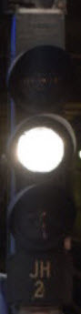 The lunar illuminates for clear, and at interlockings, for a non-diverging movement.
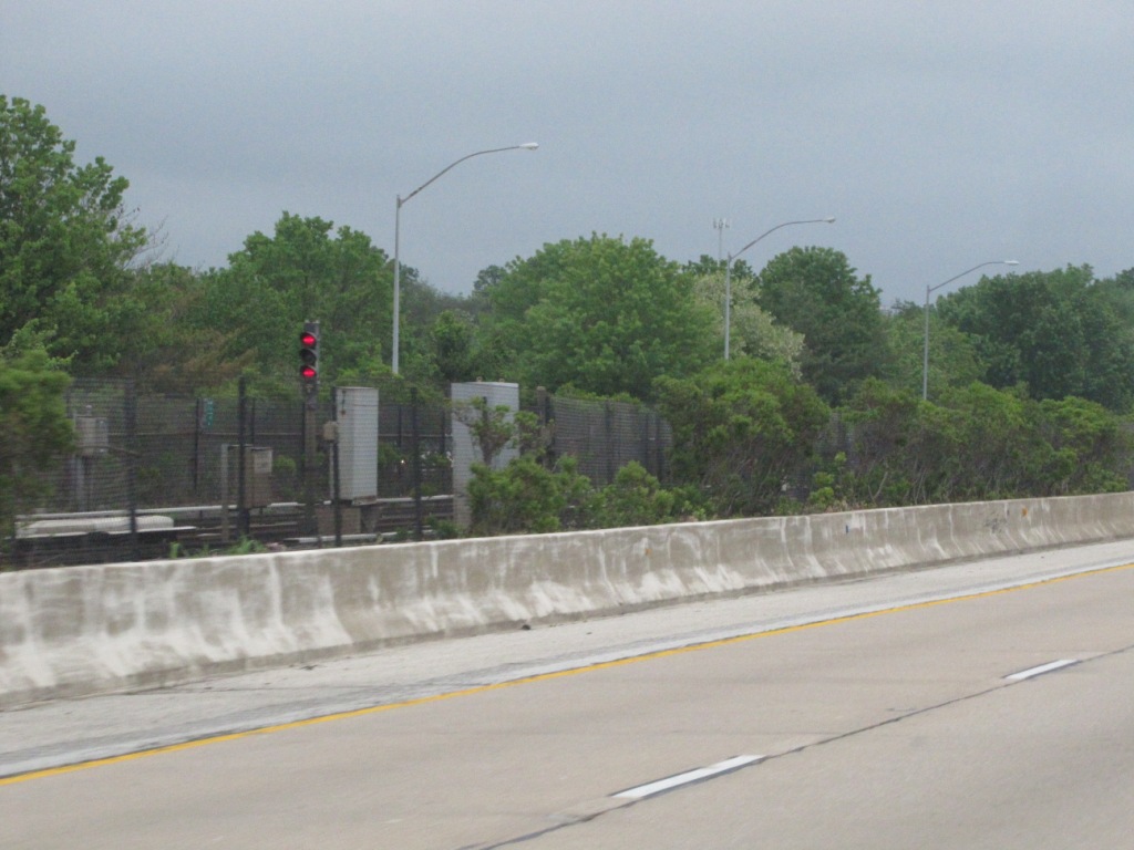
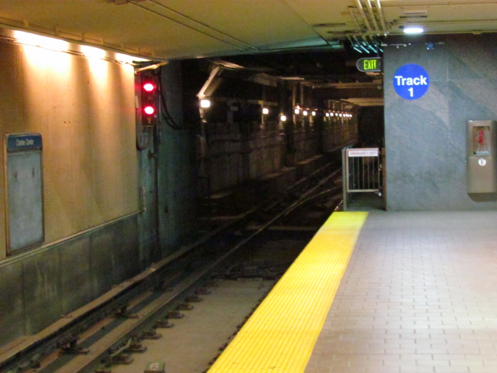
 Signals at the Charles Center station.
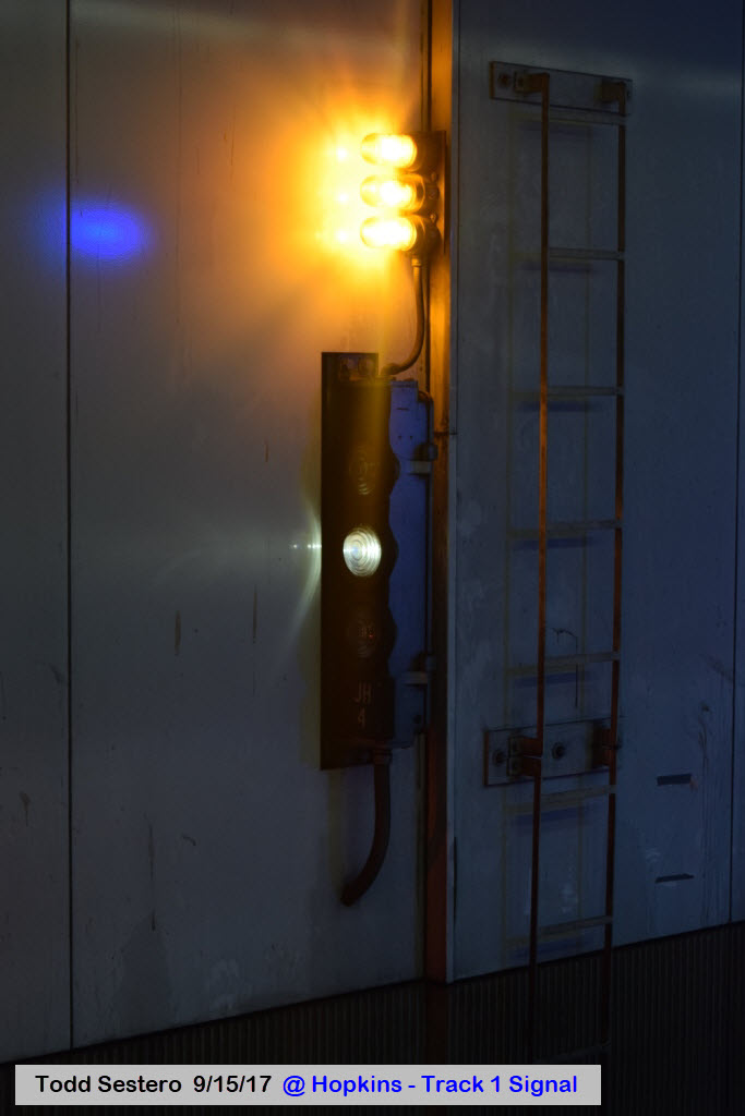
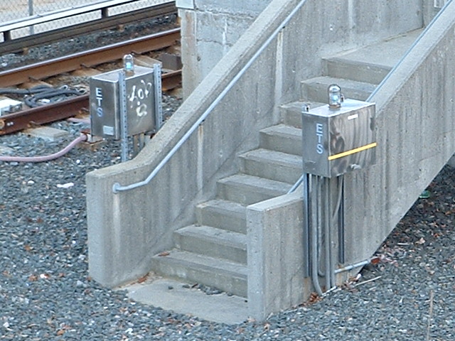
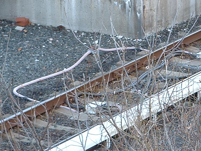 Stuff at Old Court Road.
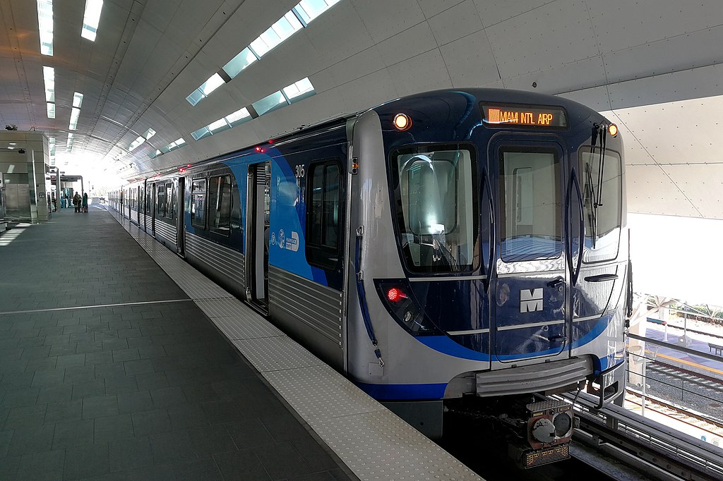 photo by
Alancrh/Wikipedia
photo by
Alancrh/Wikipedia