RAILFAN GUIDES HOME RAILROAD SIGNALS HOME
This page covers stuff related to the track on the Baltimore light rail
system - things such as the track itself, the ties, the switch machines,
interlockings, and junctions.
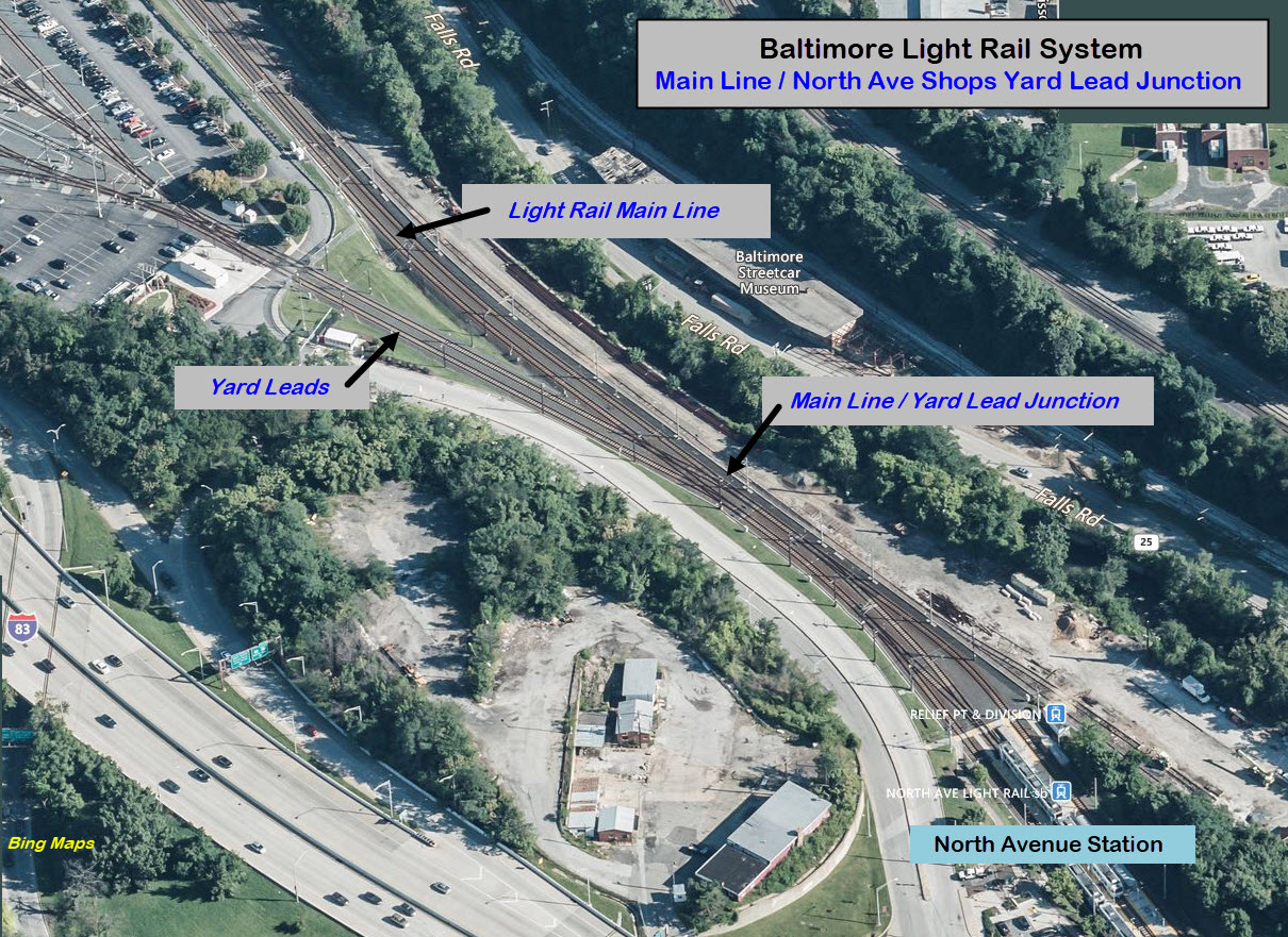
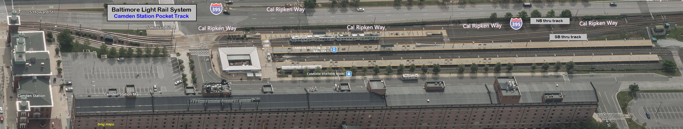
This is an easy one because there are really only two of them, three if you
count the yard leads at the North Avenue Shops, so I will cover "it" first.
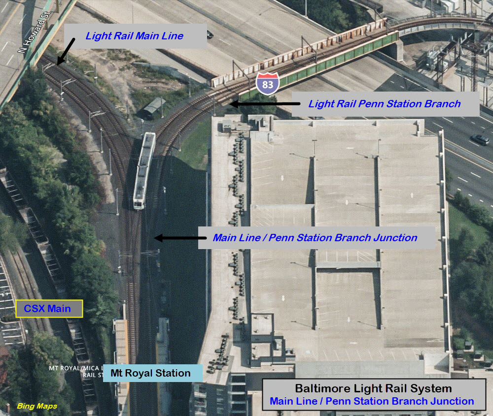
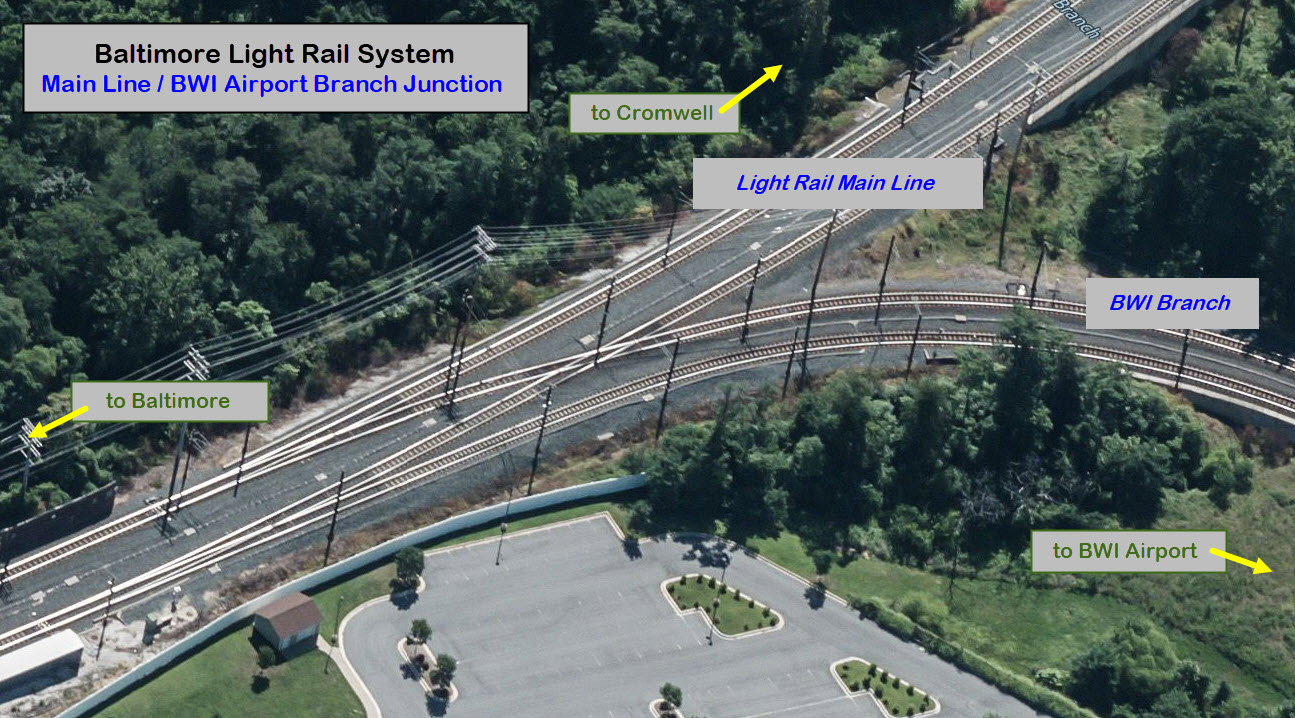
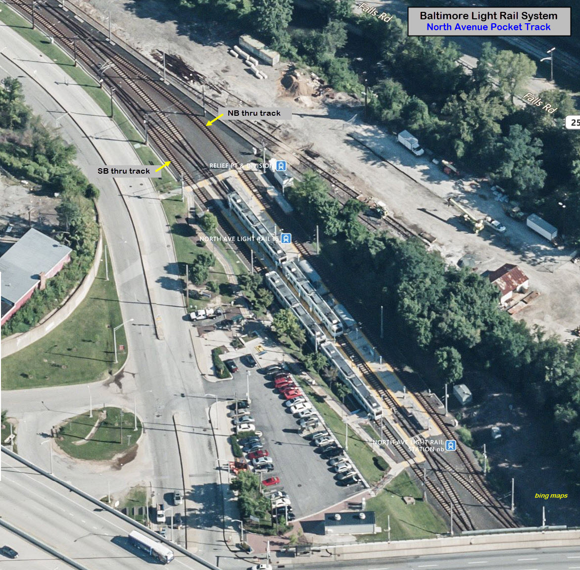
Going from north to south, we have the yard leads at the North Ave Shops, the
Penn Station branch, and the BWI Airport branch.
This is where the single track line that winds its way thru the industrial
park, splits into two tracks for the end-of-the-line station in Hunt Valley
by the mall.
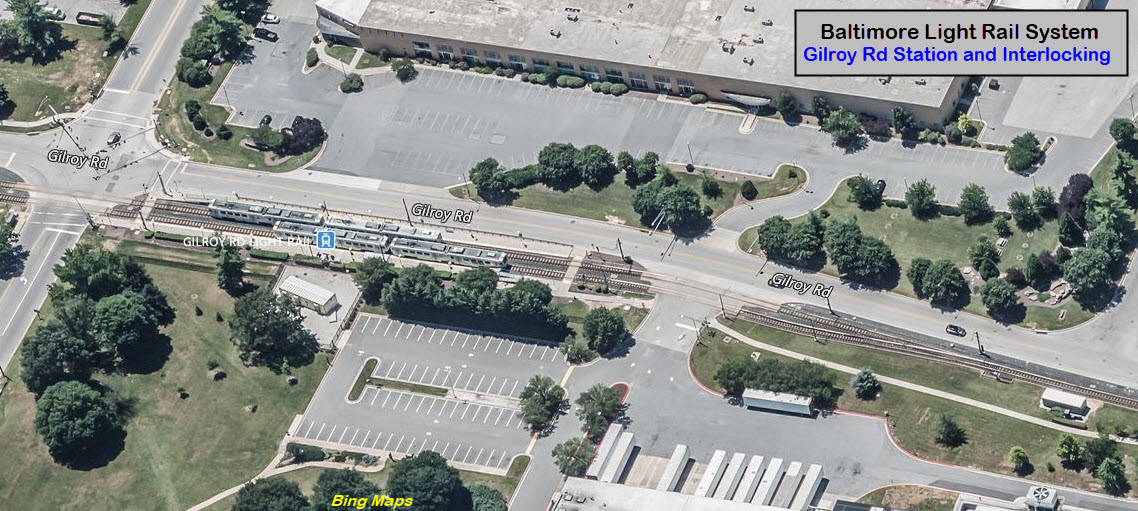
Gilroy
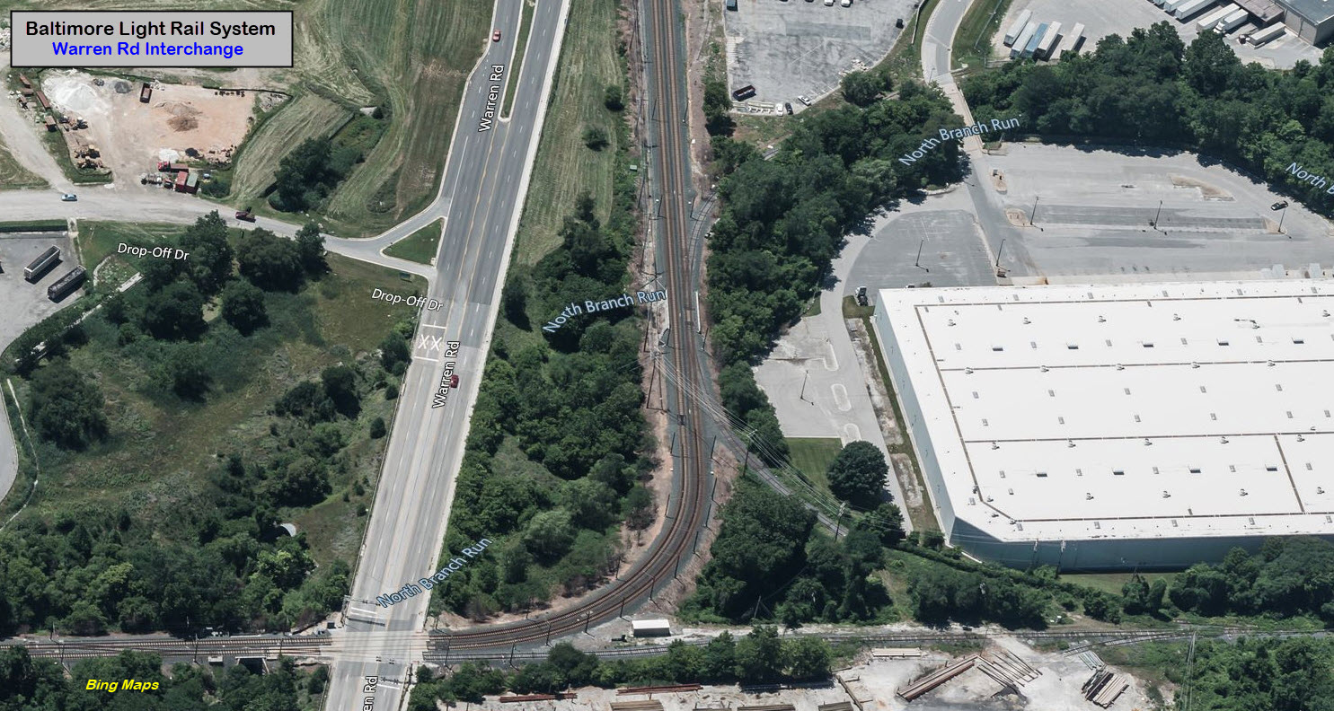
Warren Road
There is an interchange and a crossover here, but it is neither signaled or powered for the LRV's.
Once in a great while you will find MOW equipment parked on the siding.
The industrial spur into the park at the top of the photo has been unused
for many, many years, at least since 2005, and maybe earlier. The MTA
used to keep a speeder next to the Cockeysville freight shed years ago,
which is off to the right, but I Haven't seen the shed "up there" for at
least 10 years. The spur into the BG&E yard is also unused, so I guess
they truck in the new poles. I believe this is the only place on the
system where there is a wye, altho I don't know what kind of condition the
NW leg of the wye is in.
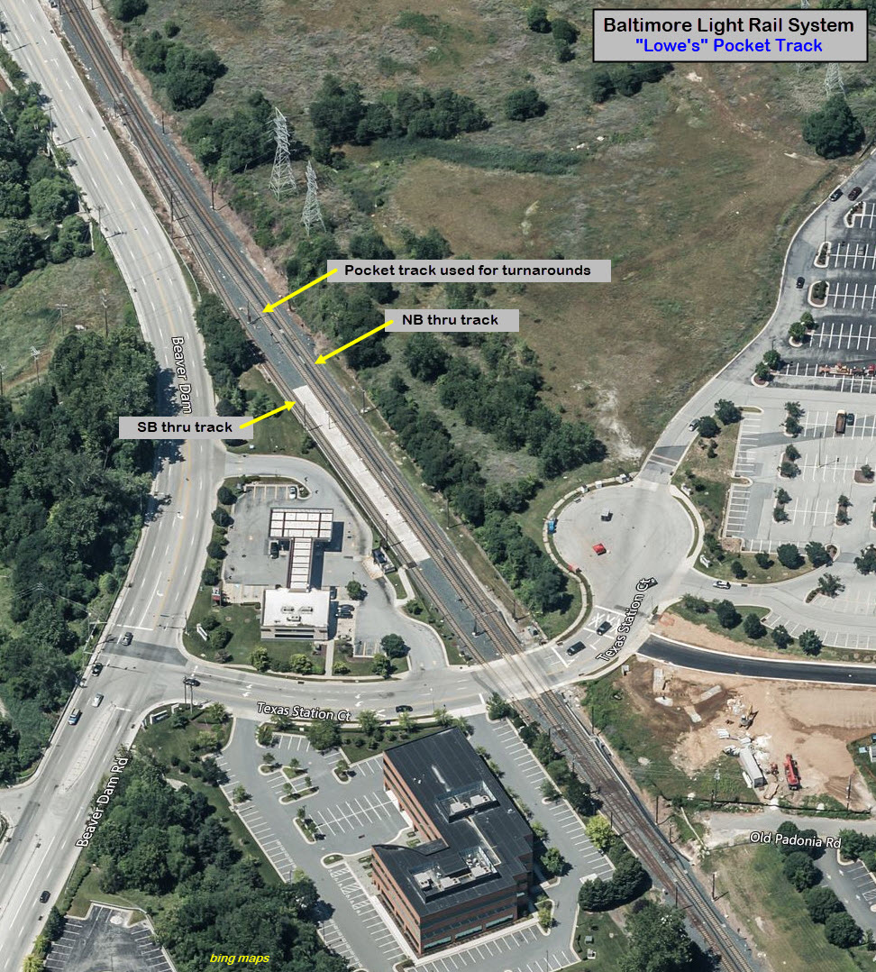
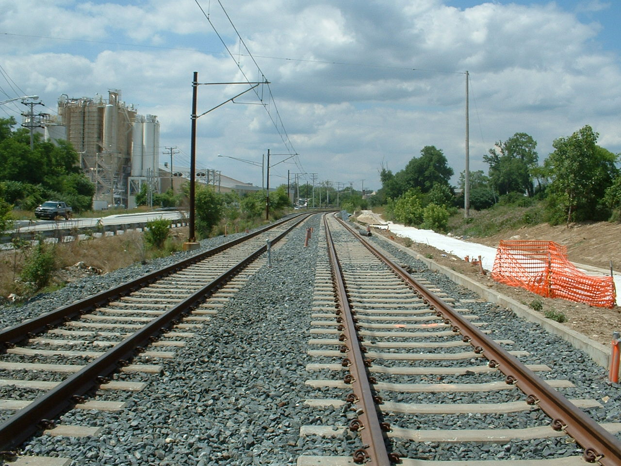
Here we are at "Lowe's" in Cockeysville, before this section was
double tracked with power, and the third track was installed for a possible
future station - now just used as a turnaround for the BWI trains.
Standard pre-stressed concrete ties are used except at switches.
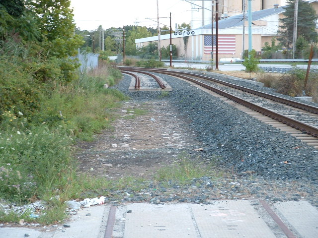
While the MTA was prepping the roadbed for the second track thru the Texas
and Padonia area, they uncovered the marble ties of the Baltimore &
Susquehanna RR, put down in 1832. I tried to get the state to take
some of them out and put them on display, but they didn't. The "white
stuff" between the two ends of track on the left are the marble sleepers
(as they used to call them). The marble was a convenient material to
use, as it came out of the quarry on the other side of Beaver Dam Road from
where this picture was taken (to the right), and is the same marble used in
the construction of THE Washington Monument in Washington DC. As far
as I know, the sleepers exist from Industrial Lane, to south of Padonia
Road, and now that they are covered up by the light rail, no-one alive now
will ever see them again!!! I wish I had taken more and better
pictures of them, and I wonder if the Maryland Historical Society did?
If you want to read more about the old ties, or sleepers, I have a page on
them here.
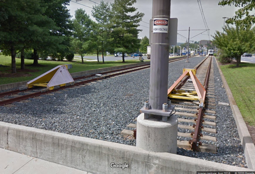
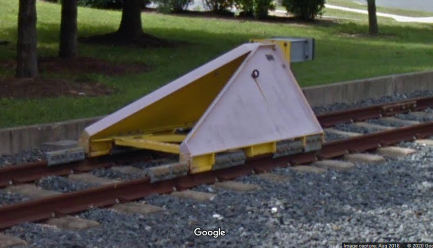
Bumpers are used at the end of the line where the trains can't go any
further... we all love the lit ones that are made for model railroads, I'm
not sure there are any like that out there in reality, but they look fun.
Hunt Valley - 2
Penn Station - 1
BWI Airport - 2
Cromwell - 2
Disclaimers:
I love trains, and I love signals. I am not an expert. My webpages reflect what I find on the topic of the page. This is something I have fun with while
trying to help others.
Please Note: Since the main focus of my two websites is railroad signals, the railfan guides are oriented towards the signal fan being able to locate them.
For those of you into the modeling aspect of our hobby, my
indexa page has a list of almost everything railroad oriented
I can think of to provide you with at least a few pictures to help you detail your pike.
If this is a railfan page, every effort has been made to make sure that the information contained on this map and in this railfan guide is correct. Once in a while,
an error may creep in :-)
My philosophy: Pictures and maps are worth a thousand words, especially for railfanning. Text descriptions only get you so far, especially if you get lost or
disoriented. Take along good maps.... a GPS is OK to get somewhere, but maps are still better if you get lost! I belong to AAA, which allows you to get
local maps for free when you visit the local branches. ADC puts out a nice series of county maps for the Washington DC area, but their state maps do not have the
railroads on them. If you can find em, I like the National Geographic map book of the U.S..... good, clear, and concise graphics, and they do a really good job
of showing you where tourist type attractions are, although they too lack the railroads. Other notes about specific areas will show up on that page if known.
Aerial shots were taken from either Google or Bing Maps as noted. Screen captures are made
with Snagit, a Techsmith product... a great tool if you have never used it!
By the way, floobydust is a term I picked up 30-40 years ago from a National Semiconductor data book, and means miscellaneous
and/or other stuff.
Pictures and additional information is always needed if anyone feels inclined to take 'em, send 'em, and share 'em, or if you have something to add or correct.... credit
is always given! Please be NICE!!! Contact info is here
Beware: If used as a source, ANYTHING from Wikipedia must be treated as being possibly inaccurate, wrong, or not true.
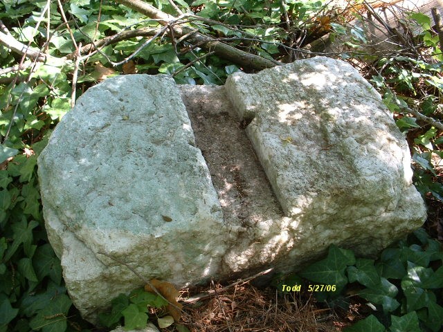 Close-up of one of the sleepers