Location / Name:
Upper Darby/Millbourne/Philadelphia PA, Delaware County
What's Here:
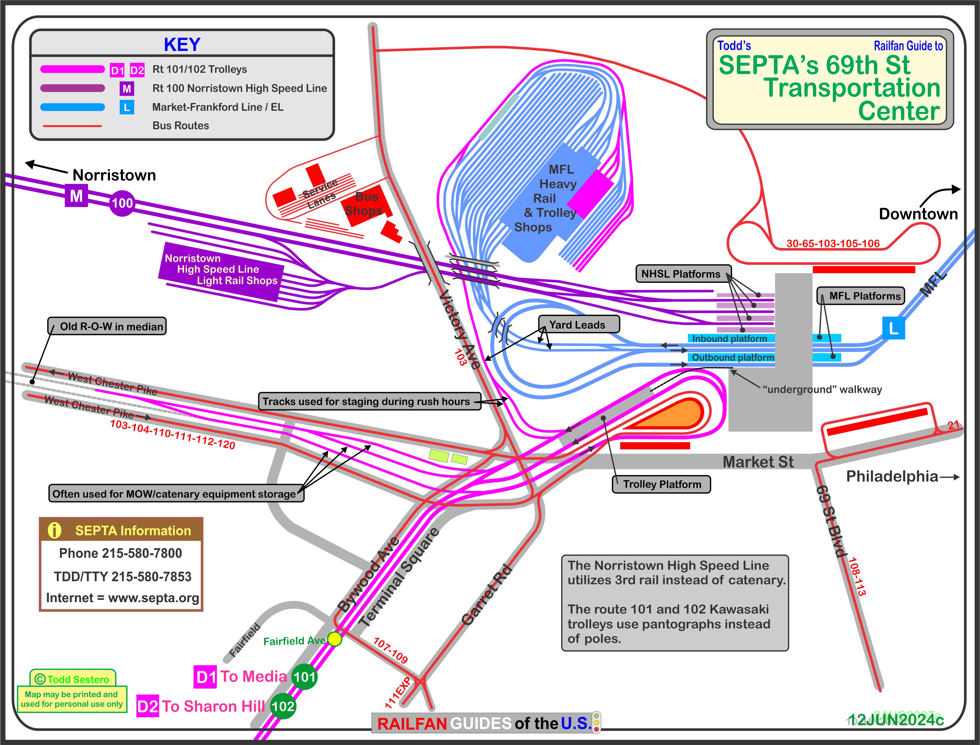
Major Transportation Center for Philadelphia
Market-Frankford Line (EL/Subway)
Routes 101/102 Trolley Lines
Norristown High Speed Line Light Rail
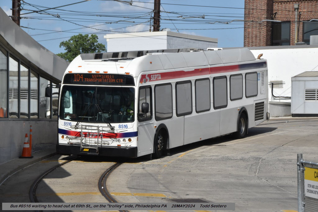
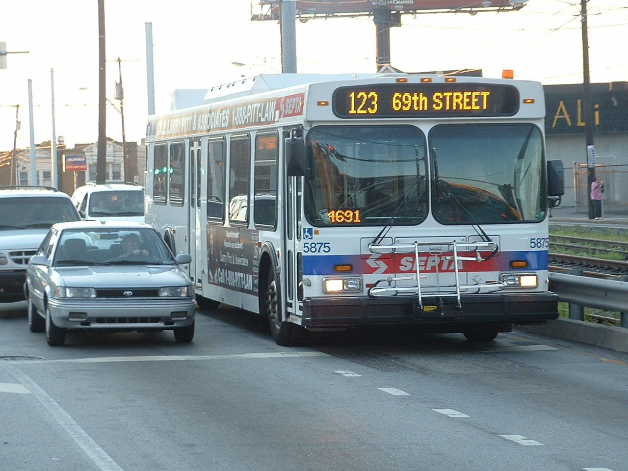
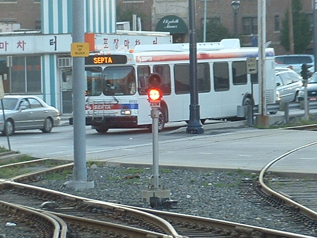
Bus Lines
Data:
GPS Coordinates: 39.96221, -75.26003 (center of trolley loop)
S 69th St &, Marshall Rd, Upper Darby, PA
Phone A/C: 610
ZIP: 19082
Access by train/transit:
EL/Subway
2 Trolley Lines
Norristown High Speed Light Rail Line
Plenty of Busses
Geography:
A few hills here and there in the immediate area
The Scoop:
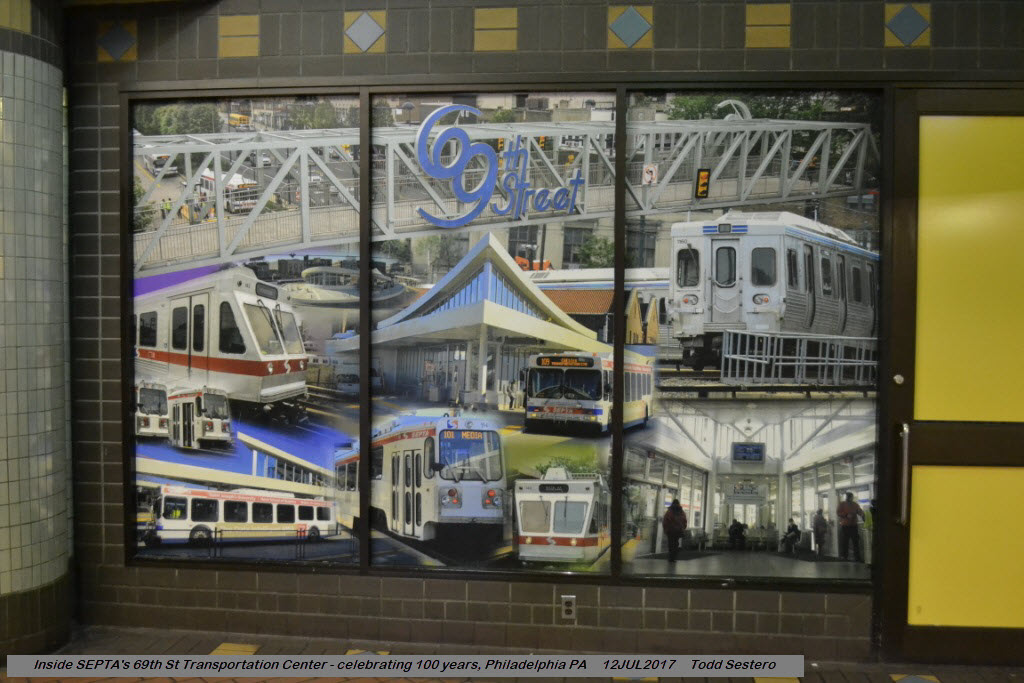
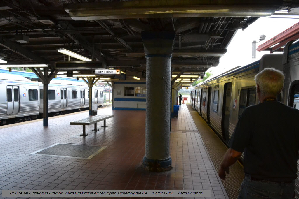
SEPTA's 69th Street Transportation Center is one of the best places to go for a transit fan!
If you've never been there before,
plan on spending a lot of time. Here in one place, you have subway, light
rail, and trolleys (and busses if you feel so inclined).
The Transportation Center, as mentioned above, offers the following services:
-- The Market-Frankford Line (MFL) AKA: EL. Can also be referred to as Subway or Heavy Rail.
-- The Media and Drexel Hill Trolley Lines.
-- The Norristown High Speed Light Rail Line.
-- And bus service in two separate areas.
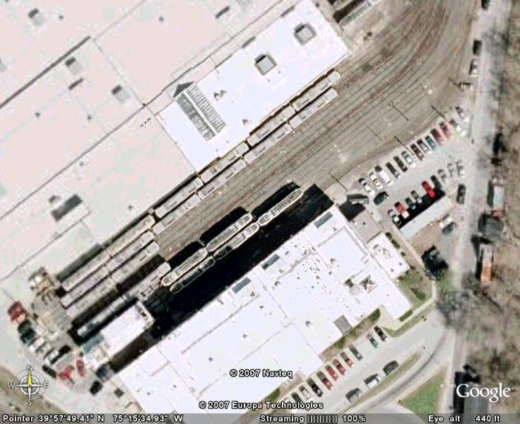
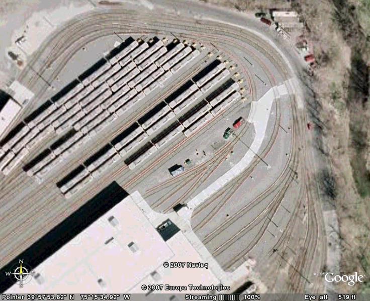
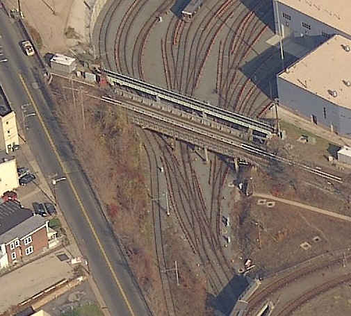
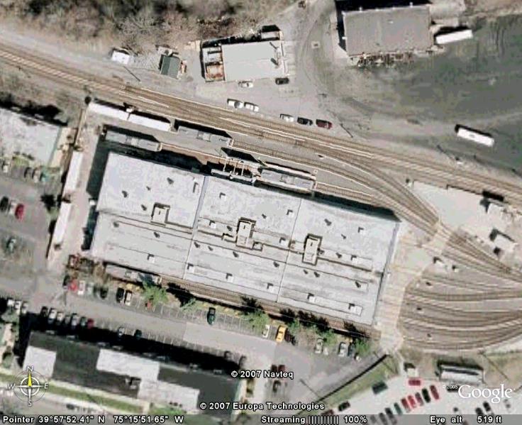
This area around the Transportation Center also contains the shops and
yards for all three lines, as shown below in the maps and serial photos.
From Moovit: The 69th Street Transportation Center is a SEPTA terminal in the
Terminal Square section of Upper Darby Township, Pennsylvania. It serves the
Market–Frankford Line, Norristown High Speed Line, and SEPTA Routes 101 and 102
trolleys, and multiple bus routes. It is located at the end of 69th Street, a
major retail corridor in Upper Darby Township across Market Street (Route 3)
from the Tower Theater. Until 2011, the station was primarily known as 69th
Street Terminal. 69th Street is the second-busiest SEPTA transfer point,
after its 15th Street/City Hall station, serving 35,000 passengers daily
during the week. It is also the only SEPTA facility to serve both City
Transit and Suburban Transit routes. end Moovit
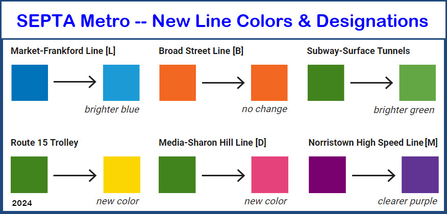
Note: Starting in 2024, SEPTA is in the process of converting all of
their rail systems into a "more unified" system approach to supposedly make
things easier. The 30th St/Drexel L & T station is the first to be
converted. My question is why then, did they give the Norristown
Line an "M" designation instead of "N"? Answer: because the line is
being named in favor of the county instead of the town that it has been
named after since, forever. I'm not sure that making
blue and green "brighter", and the purple a "clearer" color (whatever that
means) really accomplishes anything for 99.9% of us??? And none of
this is coming cheap, I read that it is costing 50 Mil to change everything
to the new naming system. Baltimore did a similar renaming thing about
10 years ago, and I'm not really sure it has accomplished much of anything.
I have pictures of the new 30th St station
here as part
of a recent trip I made to Philadelphia.
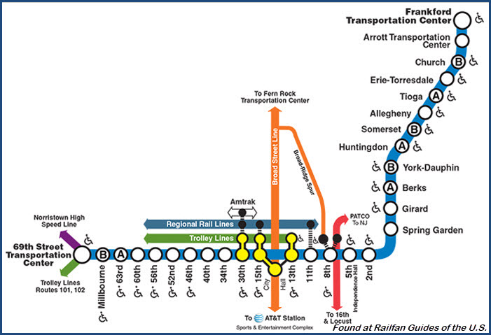
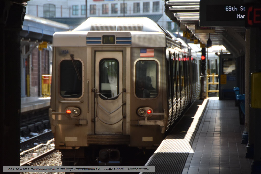
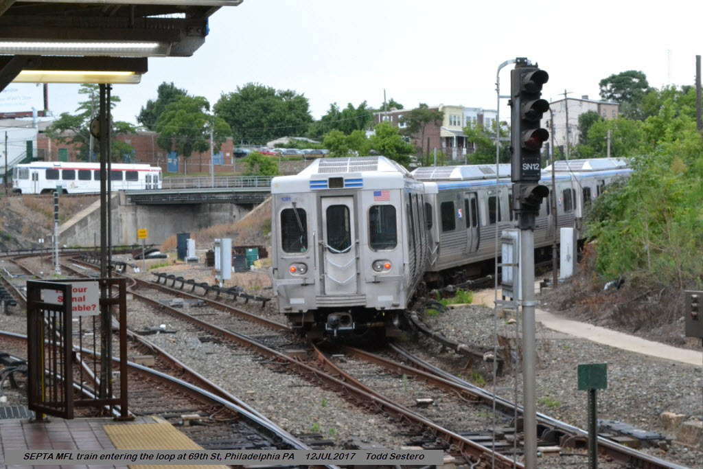
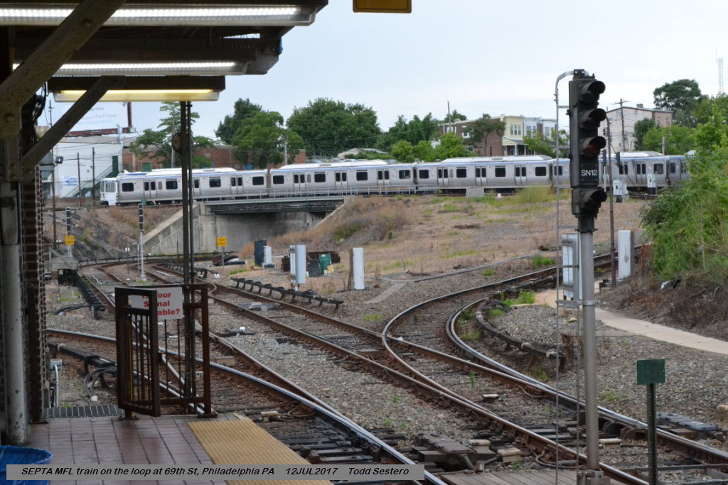
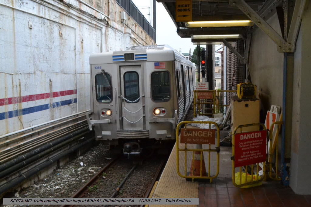
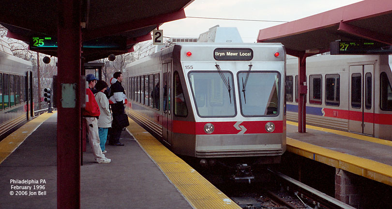
The Market-Frankford Line
The Transportation Center is the western terminus of the Market-Frankford line.
Through trains can loop around without going into the yard, but you need to get
off the train before it goes around the loop (I'm guessing mostly because
you don't know if the train is going into the yard, or looping around to
stay in service). There are two departing tracks, and one arrival track.
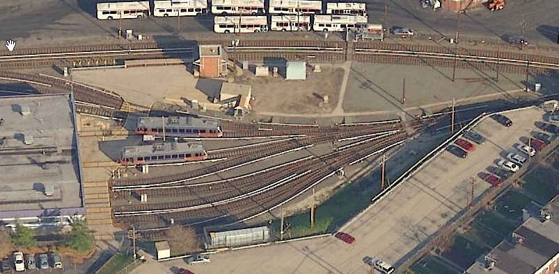
The Norristown High Speed Line
This is the southern terminus for the
Norristown Light Rail line. They started using the current ABB cars back
in the early 90's, just after Baltimore took delivery of it's first 36 cars.
Baltimore and Philadelphia are the only two systems in the U.S. with ABB
equipment. One of the "Bullet Cars" still runs at the streetcar museum in
Shade Dap / Orbisonia PA. Note: The Norristown High Speed Line LRV's
use third rail instead of the more common pantograph associated with most light
rail lines. The LRV's use the same electronics as the Baltimore LRV's,
since both cars are made by ABB. Prior to SEPTA taking control of this
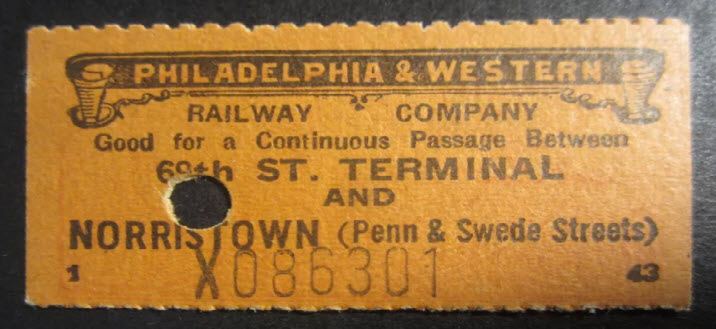
line, it was known as the Philadelphia & Western Rwy.
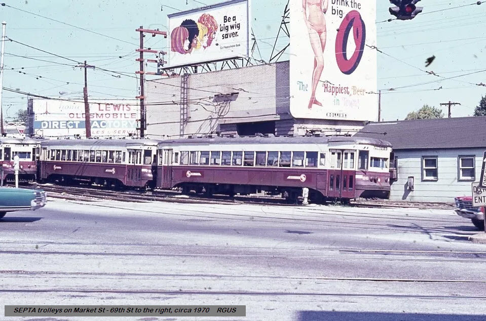
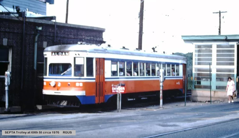
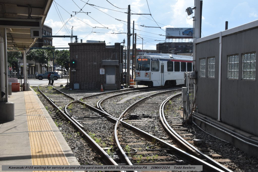
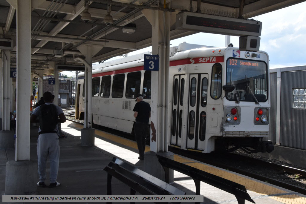
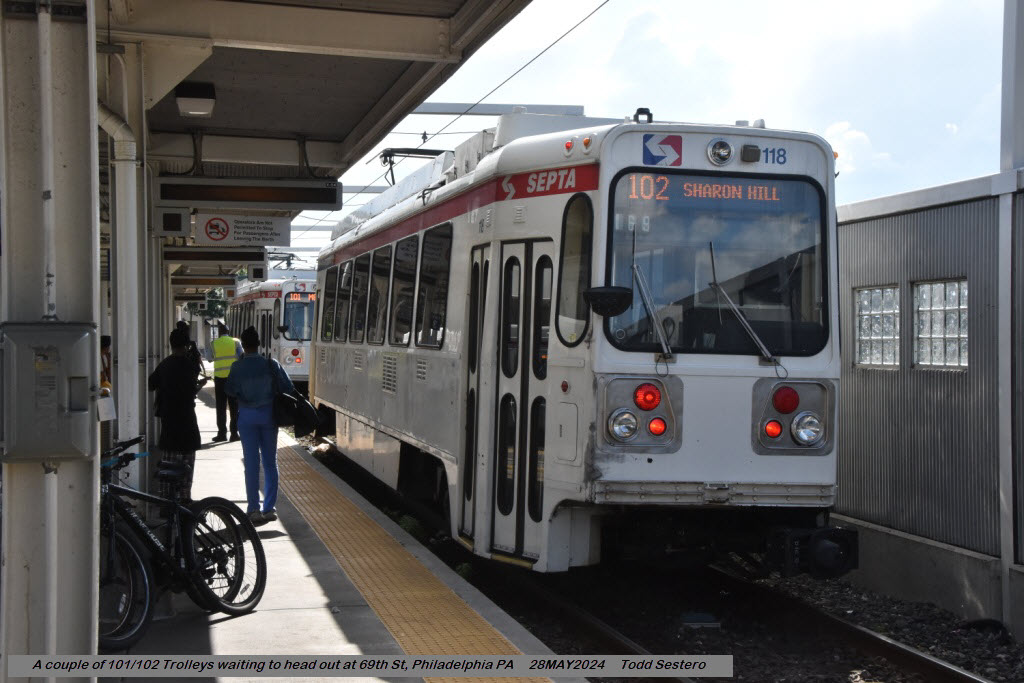
The 101 and 102 Trolley Lines
The 101 and 102 trolley lines make you feel like it is
still the 40's or 50's. The Kawasaki cars used on this line are
their version of the old standby PCC car dating back to the 30's. (BTW --
SEPTA updated a fleet of PCC cars, and is now running them on the number 15
/ Girard Ave line. Ride them if you get the chance.)
The Kawasaki's on the 101 and 102 routes use pantographs instead
of the common trolley pole (for the time being).
Bus Service
Bus route info came from SEPTA's own series of maps, which are
available for purchase inside the terminal for 9-10 bucks (at least
they used to be, I haven't checked lately). They have one for
the central area, and one that covers the suburban routes.
Both are necessary if you are going to railfan SEPTA. I believe
they are also available at the Franklin Map stores.
Acknowledgements:
Jon Bell
Google Maps
Bing Maps
Open Railway Map
Wikipedia


 courtesy Jon Bell
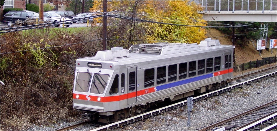
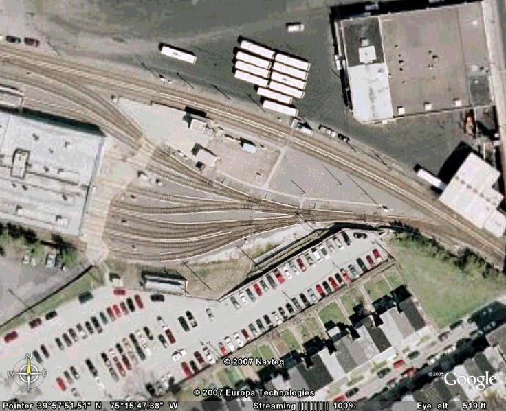
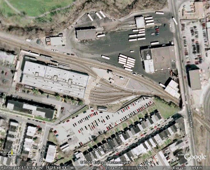

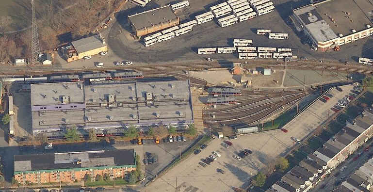
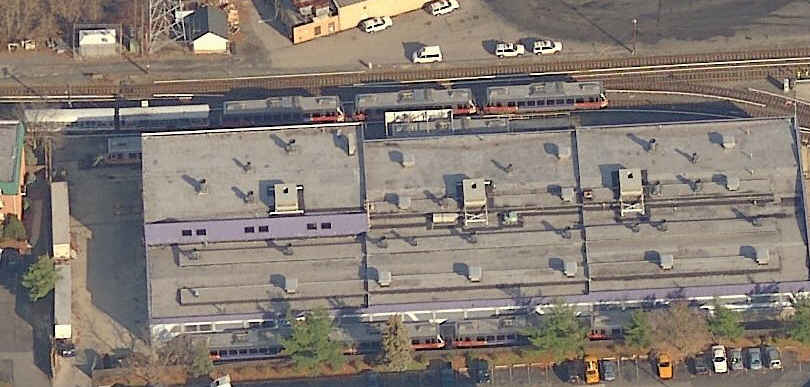 Aerials of the light rail facility.
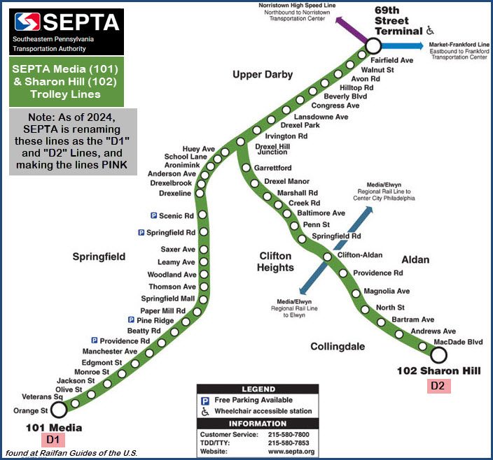

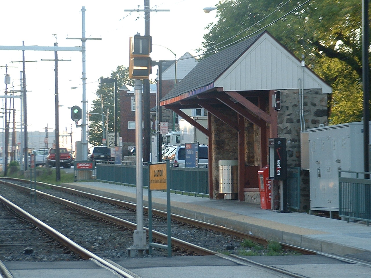 The Franklin Ave station, note the use of bar and color light signals.
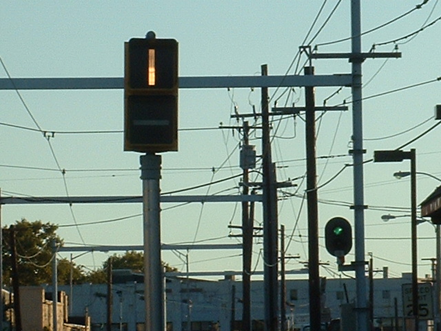
 The bar signals showing both aspects.
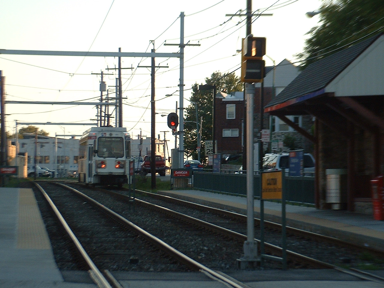
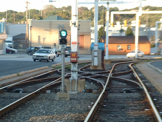 Looking towards the 69th St TC on the 101/102 line from the Franklin Ave station.
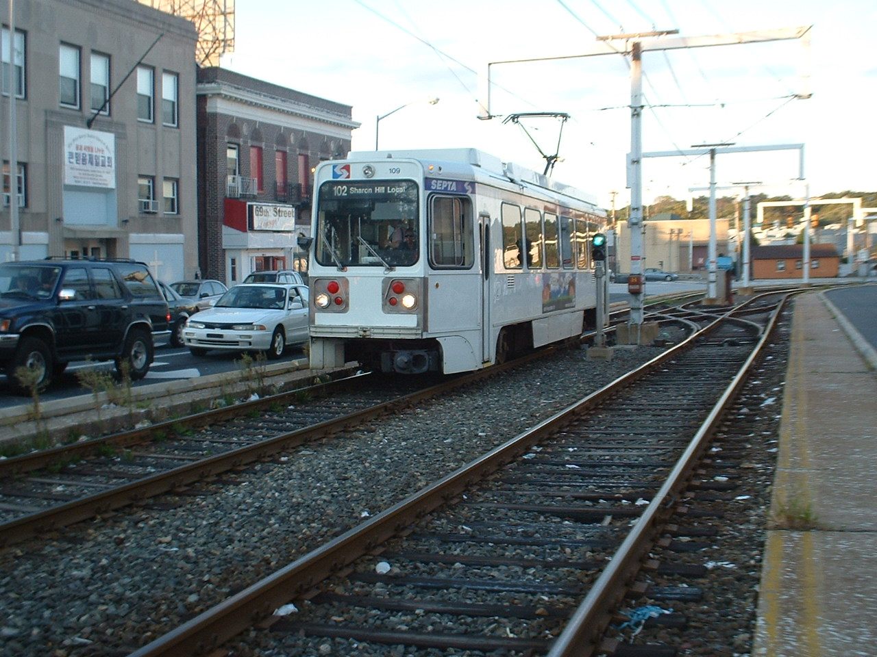
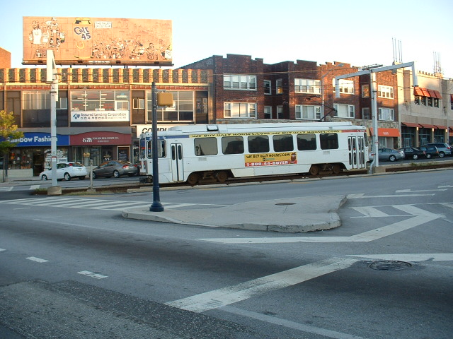
 Outbound Kawasaki #109 coming into and leaving Franklin St for Sharon Hill on the 102 line.
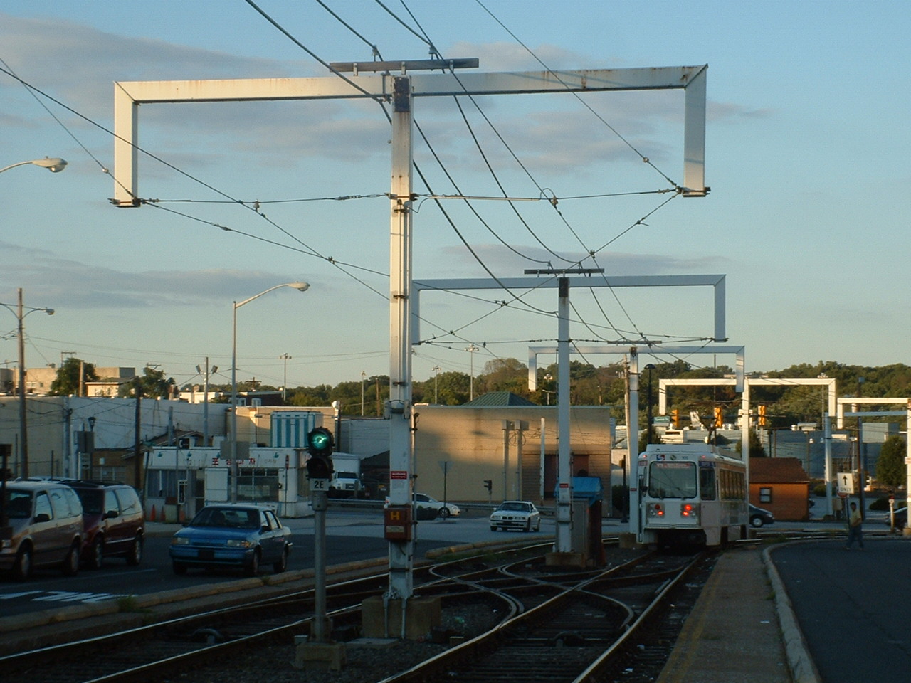 An inbound Kawasaki having just left Franklin St., nice shot of the poles.
 Trackwork at West Chester Pike before going into the terminal.
 Inbound #121 passing Franklin Ave.
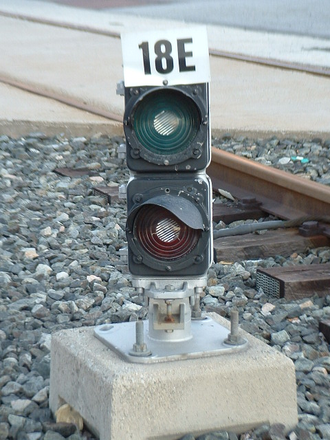
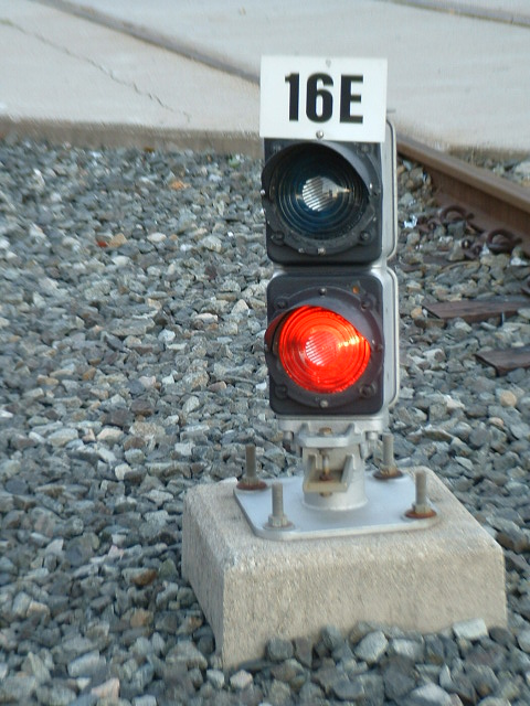
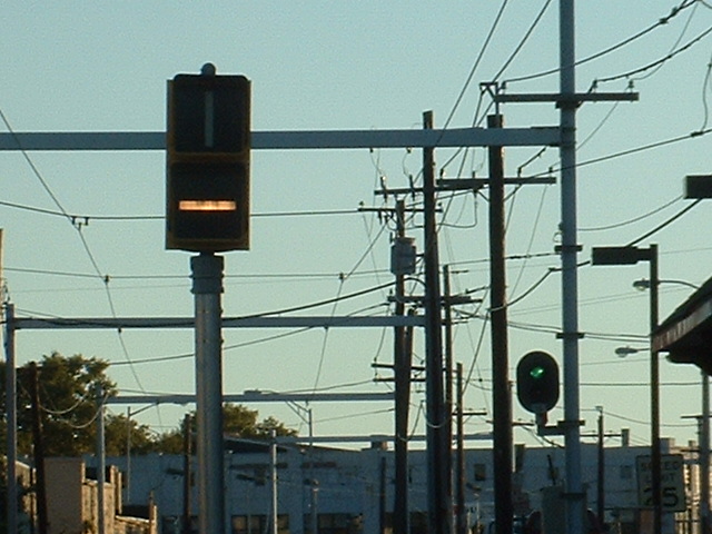
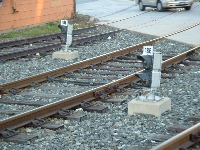 Close-ups of some of the signals.
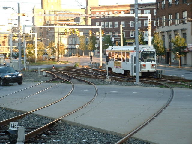
 Departing and inbound trolleys at West Chester Pike.
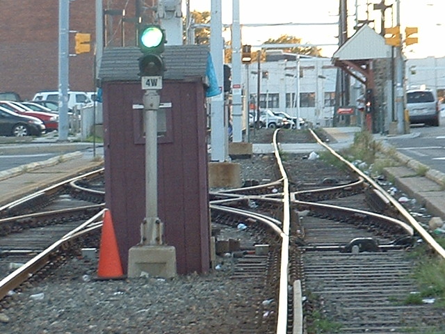 Looking up the tracks towards Franklin Ave, from West Chester Pike.
 Trolleys at the terminal, one coming in, one getting ready to be dispatched.